
Recommended
More Related Content
What's hot
What's hot (20)
Similar to Jijel ,Brief history
Similar to Jijel ,Brief history (20)
Recently uploaded
Recently uploaded (20)
Jijel ,Brief history
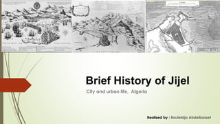
- 1. City and urban life, Algeria Brief History of Jijel Realised by : Bouteldja Abdelbasset
- 2. Coastal cities had always a relationship of domination towards their territories, they inspire this particularity from their natural environment first, and second from their proximity to trade routes. The city of Jijel stand between two vocations, the maritime and the rural world, which made it a favourite colonie to the powerful states through history, Phoenicians, romans vandals and ottomans focused on its quality of harbours and the capability of control the territories. The site chosen for Jijel in the heart of the Mediterranean sea was ideal, the city was built on an almost island covered with law hills and backed by fortifications, with this strategic location, the city was well protected and easily defensible. By the middle of the 19th century the city was moved to the south of the old one,
- 3. 1- Geographical location: - The wilaya of Jijel is located on the Algerian east coast, limited to the East by the wilaya of Skikda, to the West by Bejaïa, to the North by the Mediterranean Sea, to the South by Mila and Sétif Mila Skikda Séti f Bejaia The Wilaya of Jijel is characterized by a mountainous relief (82%) of the wilaya. Although the average altitude is from 600 to 1000, there are mainly two physical regions: The plains areas in the north and the mountains in the south of the state
- 4. Study area: Our air of study is limited to the north by the sea, to the south by the city of Selma, to the east by Oued el kbir, to the west by the city of Ziama Mensouria Study area map Ziama Oued el kbir - Cross-section on the territorie citysea
- 5. The Relief: The wilaya of Jijel is characterized by a mountainous relief, there are 2 main areas: The mountain area, located in the southern part of the wilaya, and the average altitude is 600 m The plains area: located in the northern part of the wilaya, whose average altitude is 100 m, it contains the most important cities of the wilaya such as the capital, El-Aouana, kaous, chekfa, Tahir The climate : The Jijel region is characterized by a Mediterranean climate, it is part of the sea coast (zone A), rainy and cold in winter, hot and humid in summer. Temperatures range from 20 ° C to 35 ° C in summer from 5 ° C to 15 ° C in winter.
- 6. The Toponymy : The Berbers called him Ighil Ighil, ( يغل يغل) ) which means from hill to hill, the Romans called him Igilgilis, and since that time, the name changes with each new outdoor occupation, we can cite: Zizeri, Zigel, Gigery, Gigel, Gigelli, Djidjelli, Djidjely, before arriving at our current spelling Jijel. يغل يغل Igilgilis Gigeri Djidjelli Jijel berbère Phéniciens romains Ottomans Français
- 7. To draw conclusions from this section, we based our researches on three main sources: the story of Djidjelli by A.Rétout, the story of the cities of the province of Constantine , Gigelli- by Féraud and Luis XIV in Algeria - Gigeri 1664 - by Bernard de Bachelot
- 8. - Jijel was frequented or occupied in turn by: Berbers before 6th century BC, Phoenicians in 6th century BC, Romans in 373, Vandals in 429, Byzantines in 533, Hammadites in 670, Normans, Pisans during the 12th century, Genoese in the 13th century, Ottomans in 1514, the French in 1839 and after independence the city which became the capital of Wilaya in 1974 A current photo of the Phoenician tombs of Rabta An ancient Roman wall in Ziama An engraving which shows the French flow in front of Jijel in 1664 Fort Duquesne The Algerian National Bank
- 9. -According to the historian A. Rétout, the first inhabitants of Jijel were the Berbers, before the 6th century AV-JC28, several prehistoric tools were discovered in a neolithic station in Jijel, prove a human installation since prehistoric times Berbers Fig. 28 various stones from the Neolithic station of Jijel, source : Ferton Ch. Station Néolithique à Djidjelli (Algérie). In: Bulletin de la Société préhistorique de France, tome 11, n°4, 1914. Pp. 242
- 10. Phoenicians : The Phoenicians roamed the Mediterranean to seek silver from Spain, and the Gold of the Sudan making a stopover every 30-40 km, Jijel was allowed their stopover place, it became afterwards, a Phoenician counter standing towards the 6th century BC. The tombs of the black point (Rabta) west of the city of Jijel, are the only witnesses that remain today Fig. the Phoenician tombs of Rabta (west of the city of Jijel) source : jijel.info.com
- 11. -The Romans: The Punic war between Numidia and the Roman empire, will end with the defeat of the 1st, the Romans seized Iol (Cherchel) and Icosium (Algiers) in 371 then Jijel in 373 under the command of the general Theodosius 29 The figure below (Fig. 31) of the region of Jijel in Roman times, shows the road network notices the colony of "Igilgilis" at the level of the peninsula (in the red circle), the town of Cavallo (El-Aouana), mansouria and the roads that connect them. Fig. 31, map of jijel during the Roman occupation Source: Jean-Baptiste d´Anville, 1732, www.bnf.fr
- 12. - The vandals: In 429 the Vandals signed a treaty with the Romans to take the three Mauritania (tingitane, caesarean,) (from the Atlantic in the west to wadi el-kebir in the east), Jijel was part of this territory, and was under the domination of vandals for 1 century -The Byzantines: After several battles, Jijel passes under the domination of the Byzantines in 53331, their domination lasted a little more than a century, today one does not find traces which correspond to this period. -The Arabs: In 670 the Muslim troops guided by Okba ibn nafa a, seized the Maghreb, and founded the city of Kairawan in Tunisia, they collided in the Aurès with kosaila, then the raine kahina, both, could not do anything against the strength of the Muslim army which took the side and north of Africa then Jijel passes under the domination of the khalifa aghlabide of the kairawan in 670.
- 13. -The Hamadites: At the beginning of the 11th century, the Berber tribe of blessed Hammad refused to control the sultana of the kairawane, and created their own kingdom, with the Qal'aa located in the massive hodna as capital, Jijel was part of this kingdom .32 the king Hamadite de Bejaia built a palace in the heights of Jijel, but the sources consulted do not show its exact place. 33 -The Normans: In 1143 the Norman king Roger II seized Jijel, his army destroyed it completely34, and returned to Sicily, they returned each spring to Jijel to trade there and buy figs, walnuts, barley, flax, bake, honey 36. -The Pisans: In the 12th century, the pisans signed an agreement with the Hammadites so that they could settle down on the Jijelian coast, and founded trading posts to take advantage of the unbleached leathers. 37 -The Genoese: In the XIII the Genoese obtained authorization from King Hammadite to found commercial establishments, they had built a tower located at the entrance to the peninsula which existed when the French arrived in 1838, they continued to control the city until the 16th century
- 14. -The Ottomans: In 1511 the Hafside king of Bougie, "Abou bakr" asked for the help of the Barbarossa brothers (Arouj and Khair-Eddine) to drive out the Spanish who seized his city, in 1510, the brothers accepted, they put a seat on the city, but the operation failed, and it is that in 1514 that the Barbarossa brothers, were able to seize Jijel, Baba Arouj landed in Ziama mensouria, the Genoese did not resist in front of their troops, the inhabitants happy, they granted Baba Arouj the title of Sultane de Djidjelli. The capture of Jijel by the Barbarossa brothers marks the beginning of Ottoman domination of Algeria. 39 Fig. the French fleet disembarks at Jijel; Source: Bachelot Bernard, Luis XIV in Algeria, Gigeri 1664, Edition du rochet, 1980
- 15. -The Douc De Beaufort expedition, 1664: -In 1663, the new French king Luis XIV, sent a fleet under the command of Duke De Beaufort, to drive out the pirates of the Mediterranean, followed by incursions on the coasts of Provence, the French administration wanted to occupy a strategic point for control their vessels in the Mediterranean basin During their expeditions, the French fleet landed near a marabout, currently the place du fort Duquesne, the inhabitants did not resist more than a day before the city fell in 23/07, under French domination; The troops settled on the site of the present city while the inhabitants of the medina took refuge in the mountains which are in the south of the city. -The inhabitants appealed to Turkish troops to save them, these funds settled in the heights of Jijel and did not stop bombing the French camps until the latter withdrew their troops on 31/10, the expedition ended with a haunting defeat of the army of Louis XIV Fig. the marabot of Jijel landing places of the French fleet in 1664 currently Fort Duquesne Source: www.jijelarchéo.com
- 16. The 1856 earthquake and tidal wave: On the night of August 22, 1856, an earthquake followed by a tidal wave struck Jijel, the medina completely destroyed, and the population escaped to the mountains. The colonial administration decided to build a new city between the defense line of five forts, and the peninsula, the project was entrusted to the French surveyor Scheslat is completed in 1861 - An octagonal triangle- shaped plan pierced by three main boulevards 43; The peninsula has turned into a naval military barracks including the port, and it still is. Fig. Jijel's medina in 1856 before the disaster, source: www.jijelarchéo.com
- 17. -In 05/07/1830 the French succeeded in seizing Algiers and fell three centuries from Ottoman domination, after this date, the French did not cease to seize the Algerian cities and Jijel fell under their domination after serious resistance on 05/13/1839. -The troops settled in the peninsula (the medina) and began to build Fort Saint Ferdinand on the ruins of a fort built during the expedition of 1664, and Fort Duquesne on the site of a marabout, three days later they completed two other forts (Galbois, Saint Eugénie), the result a defensive line which protects the medina from the attacks of the inhabitants who took refuge in the mountains. -After having ensured their domination of the city, the colonial administration began to renew the medina by cleaning the houses which they said was "hall", they reinforced the wall, transformed the Genoese tower into a powder keg, they installed a barrack Fig. , Map of the new plan of Jijel in 1887, showing the line of defense (five forts) surrounding the new town, and the picture of the church source: www.jijelarchéo.com -The French colonization :
- 18. -The components of the French city: The triangle shape and a plan characterized by regularity and Haussmannian town planning, and the layout with the rectilinear line, which created islands of regular shapes, oriented along the N-E / S-O axis. The new plan was composed of 3 main axes, the closest to the sea for administrative facilities, and 14 secondary axes, each boulevard leads to a monument or a square. The cross of the diagonals of the triangle is marked by the city church. Fig. , Map of the new plan of Jijel in 1887, showing the line of defense (five forts) surrounding the new town, and the picture of the town hall source: www.jijelarchéo.com
- 19. 7.13-The independence and the extension of the city: - Like all the cities of the Algerian territory, Jijel took its independence, on July 5, 1962, the Algerian population which took refuge in the mountains, returned to the colonial city center. After this date the population began to build houses in the west of the city, which created the Bon-Marché district, the extensions follow one another in the south and the southeast of the city. -The extensions of the city create a new fabric: the postcolonial, a tree-like fabric with no prior plan, has given birth to several districts such as: Village moussa, Village Mustapha, de Comolli, Lazouine, le Faubourg. Fig. the city of Jijel today, and the management of extensions since 1962, source: Google earth
- 20. Conclusion: The old ottoman city was taken by the Algerien marins, but much of its remains can be traced, including the outline of many fortifications, citadel, ancien mosque, and fortification wall Today the french city of Jijel is losing a very important part of its historic urban architectural heritage, indeed, almost a century since their realization, the old buildings have known various fates, the works of conservation and restoration have been insufficiently assuaged the colonial urban environment degrades continuously, and it is found in a state of advanced degradation