Historic Flooding in CO. Big Thompson Canyon - September 2013
•
2 likes•2,622 views

Historic flooding occurred in September 2013 along the Big Thompson River Canyon in northern Colorado, washing out sections of US Highway 34. Satellite imagery from September 14th shows damage to bridges, roads, and other infrastructure from Loveland to Drake along the highway, with entire stretches of roadbed washed away in some areas and debris piled on bridges in others.

Recommended
More Related Content
Viewers also liked
Viewers also liked (17)
Similar to Historic Flooding in CO. Big Thompson Canyon - September 2013
Similar to Historic Flooding in CO. Big Thompson Canyon - September 2013 (9)
More from DigitalGlobe
More from DigitalGlobe (12)
Recently uploaded
Recently uploaded (20)
Historic Flooding in CO. Big Thompson Canyon - September 2013
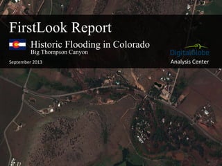
- 1. Analysis Center Historic Flooding in Colorado September 2013 FirstLook Report Big Thompson Canyon
- 2. Overview of the affected area. N Historic Flooding in Colorado - September 2013 Front Range, Colorado Big Thompson River Canyon – US Highway 34 Boulder Denver
- 3. US Highway 34Riverview RV Park and Campground DigitalGlobe Natural Color Imagery, September 14, 2013 Flooding near mouth of the Big Thompson Canyon Loveland, Colorado Loveland 3 miles
- 4. DigitalGlobe Natural Color Imagery, September 14, 2013 Bridge on US Highway 34 near mouth of Big Thompson Canyon Loveland, Colorado Debris on bridge
- 5. DigitalGlobe Natural Color Imagery, September 14, 2013 Loveland Water Treatment Plant Loveland, Colorado Water spills over control infrastructure
- 6. DigitalGlobe Natural Color Imagery, September 14, 2013 Damage to US Highway 34 near mile marker 83 Big Thompson Canyon, Colorado Road damage near Silvan Dale Ranch at the mouth of Big Thompson Canyon
- 7. DigitalGlobe Natural Color Imagery, September 14, 2013 Damage to US Highway 34 near mile marker 82 Big Thompson Canyon, Colorado Damage to concrete roadbed
- 8. DigitalGlobe Natural Color Imagery, September 14, 2013 Damage to US Highway 34 near mile marker 78 Big Thompson Canyon, Colorado Entire roadbed washed away Bridge appears to be standing
- 9. DigitalGlobe Natural Color Imagery, September 14, 2013 Damage to US Highway 34 near Mile Marker 76 Big Thompson Canyon, Colorado Town of Drake Significant damage along this stretch of road Riverbend Campground