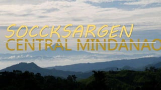
REGION 12: SOCCSKSARGEN
•Download as PPTX, PDF•
39 likes•42,313 views

CENTRAL MINDANAO'S HISTORY, GEOGRAPHY, CULTURE AND TOURISM *If you want the Ms Powerpoint Presentation of it just email me at gepfelaire@gmail.com

Recommended
More Related Content
What's hot
What's hot (20)
Similar to REGION 12: SOCCSKSARGEN
Similar to REGION 12: SOCCSKSARGEN (20)
More from Gheff Corpuz
More from Gheff Corpuz (8)
Recently uploaded
Recently uploaded (20)
REGION 12: SOCCSKSARGEN
- 2. SOCCSKSARGEN (SOX) REGION 12 • SOCCSKSARGEN is an administrative region the Philippines designated as Region 12. • It comprises of 4 provinces; 1. South Cotabato 2. Cotabato Province 3. Saranggani 4. Sultan Kudarat • and 2 chartered cities; 1. General Santos City (Highly Urbanized) 2. Cotabato City
- 3. SOCCSKSARGEN (SOX) REGION 12 • Regional Center: Koronadal • Population (2015): 4,545,276 • Land Area: 22, 513.30 sq.km • Municipalities: 45 • Barangays: 1,195 • Dialect: Maguindanao, Cebuano, Iranun, Blaan, Tururay, Ilianen • The region is the 2nd most populated with Muslims among the six regions in Mindanao.
- 4. SOCCSKSARGEN (SOX) REGION 12 • The region was formerly known as Cotabato or “Kuta-Wato” (meaning stone fort), became Central Mindanao and presently named as SOCCSKSARGEN which is acronym for its provinces. • The region was also branded as the “12th Paradise of the Philippines”.
- 5. SOCCSKSARGEN (SOX) REGION 12 • SOCCSKSARGEN encompasses Cotabato City situated within the borders of Maguindanao, province of the Autonomous Region in Mindanao (ARMM). • Also, Cotabato City is the seat of government of the Autonomous Region of Muslim Mindanao (ARMM).
- 6. HISTORY OF SOX • The region was created by the virtue of Presidential Decree No. 742 on July 7th 1975 and named as Central Mindanao. It comprised the following provinces: • Maguindanao • North Cotabato • Sultan Kudarat • Lanao Del Norte • Lanao Del Sur • And also cities of Iligan, Cotabato and Marawi.
- 7. HISTORY OF SOX • With the creation of ARMM, Lanao del Sur,and Maguindanao (excluding Cotabato City) were removed from the region, leaving Lanao del Norte, Cotabato and Sultan Kudarat, and Iligan, Marawi and Cotabato City as constituent provinces and cities. • Lanao del Norte and Iligan were later transferred to Northern Mindanao, while Marawi became part of the ARMM.
- 8. HISTORY OF SOX • September 19th 2001 – Executive Order No. 36 was signed by President Gloria Macapagal Arroyo creating the present Region 12 and renamed Central Mindanao to SOCCSKSARGEN which stands for South Cotabato, Cotabato Province, Sultan Kudarat, Saranggani plus General Santos City. • and cities of Cotabato City, Kidapawan City, Koronadal City and Tacurong City.
- 9. HISTORY OF SOX COTABATO CITY – LEAVING THE SOX • The January 21, 2019 Bangsamoro Autonomous Region creation plebiscite resulted in the surprise ratification of the Bangsamoro Organic Law. This means Cotabato City may now formally serve as the capital of the region and the offices of the current ARMM will be retained for use by the Bangsamoro Regional Government and now formally exited to the SOCCSKSARGEN Region.
- 10. ECONOMY OF SOX • The region is endowed with rich natural resources and it serves as the main source of hydroelectric power for Mindanao. • Palay and Corn are the leading crops of the region. Other major crops are Banana and Pineapple. • The region is also home of the high quality Tuna in the Philippines. (specifically in GenSan).
- 11. ECONOMY OF SOX • The following are the lists of the major industries in the region; • Coconut Industry Tourism Industry • Coffee Industry Banana Industry • Cassava Industry Aquamarine Industry • Fruit/Vegetable Industry Processing Industries
- 14. SOUTH COTABATO (Land of Dreamweavers) • Capital: Koronadal • Population(2015): 915, 289 • Land Area: 3,935.95 sq.km • Cities: Koronadal • Municipalities: 10 • Barangays: 199
- 15. SOUTH COTABATO (Land of Dreamweavers) • Land of dreamweavers • The patterns they use to weave are those that came from their dreams. • South Cotabato is home of the T’Bolis. • Roman Catholics predominate the province with 65% adherence, while Islam is a minority religion which is 6% of the population
- 16. SOUTH COTABATO (Land of Dreamweavers) • On July 2017, South Cotabato Police Chief Franklin Alvero sent a proposal to the Provincial Government changing the name the province to "Allah Valley Province" which Governor Daisy P. Avance Fuentes is open with.
- 17. HISTORY OF SOUTH COTABATO • The area of what now South Cotabato used to be part of the Davao Province until 1914. • February 27, 1939 - Pioneers mostly coming from Luzon led by the late General Paulino Santos arrived and laid the foundation for what was to become the progressive province it is today. • July 18, 1966 - South Cotabato was separated from Cotabato as an independent province • 1975 - With the creation of regions under Pres. Ferdinand Marcos, South Cotabato was grouped with Region XI, also known as Southern Mindanao.
- 18. HISTORY OF SOUTH COTABATO • 1992 - the province of Sarangani was formed out of South Cotabato. Seven towns in southern and coastal section of the province became of the new province. • September 19, 2001 – E.O no. 36 issued by President Gloria Macapagal Arroyo says South Cotabato is to be transferred from Southern Mindanao.
- 19. ECONOMY OF SOUTH COTABATO • Agriculture is the province’ pre-dominantly economic activity. • Major agricultural crops are; pineapple, papaya, asparagus, fruits, vegetables, corn, coffee, bananas, cut-flowers. • Commercial products include wood products and processed food. • The abaca – weaving imposes a big part for T’Boli people. • The province has 1st class income classification.
- 21. FESTIVALS OF SOUTH COTABATO FLOMLOK FESTIVAL HELOBUNG FESTIVAL
- 22. FESTIVALS OF SOUTH COTABATO KAMAYADAN FESTIVAL KULINTANG FESTIVAL
- 23. FESTIVALS OF SOUTH COTABATO LEMLUNAY FESTIVAL SESLONG FESTIVAL
- 24. FESTIVALS OF SOUTH COTABATO T’NALAK FESTIVAL
- 26. ATTRACTIONS OF SOUTH COTABATO LAKE SEBU
- 27. ATTRACTIONS OF SOUTH COTABATO MT. MATUTUM AND DOLE PLANTATION
- 28. ATTRACTIONS OF SOUTH COTABATO TARSIER SANCTUARY
- 29. ATTRACTIONS OF SOUTH COTABATO SURALLAH ROTONDA SOUTH COTABATO COMMUNITY MUSEUM
- 31. COTABATO (NORTH COTABATO) • Capital: Kidapawan • Population(2015): 1,379,747 • Land Area: 9,008.90 sq.km • Cities: Kidapawan • Municipalities: 17 • Barangays: 543
- 32. COTABATO (NORTH COTABATO) • Cotabato derives its name from the Maguindanao word kuta wato (from Malay - "Kota Batu"), meaning "stone fort", referring to the stone fort which served as the seat of Sultan Muhammad Kudarat. • Some of the barangay of the province have voted “Yes” from the plebiscite for the creation of B.A.R.M.M.
- 33. HISTORY OF COTABATO • 1596 – Christianity was introduced by the Spaniards in the Province, however they were unable to penetrate the area until the 2nd half of 19th century. • July 15, 1903 - through Act No. 787 of the Philippine Commission, Cotabato, covering what are now the provinces of Cotabato, Maguindanao, Sultan Kudarat, South Cotabato and Sarangani, became a district of the huge Moro province. • December 1941 - Japanese planes bombed and invaded in Cotabato.
- 34. HISTORY OF COTABATO • 1942 - Cotabato was occupied by the Japanese Imperial forces. • 1945 - Cotabato was recaptured from the Japanese Imperial forces by the combined Filipino and American troops together with the Moro guerrilla units. • November 22, 1973 - through Presidential Decree No. 341, what remained of the old Cotabato was further divided into the provinces of North Cotabato, Maguindanao, and Sultan Kudarat. • March 7, 1984 - North Cotabato was later named Cotabato through Batas Pambansa Blg. 660.
- 35. ECONOMY OF COTABATO • Cotabato is considered a major food basket in Mindanao. It is a top producer of cereals, tropical fruits, vegetables, sugarcane, coconut, coffee, freshwater fish and livestock. • Country’s leading producer of raw and semi – processed rubber and industrial trees. • The vast Liguasan Marsh which not only supplies a bounty of freshwater fish and organic fertilizer but considered as a possible source as well of natural gas. • They have a 1st class income classification.
- 36. ECONOMY OF COTABATO LIGUASAN MARSH
- 38. FESTIVALS OF COTABATO KALIVUNGAN FESTIVAL FRUIT FESTIVAL
- 39. FESTIVALS OF COTABATO SHARIFF KABUNGSUAN FESTIVAL
- 41. ATTRACTIONS OF COTABATO ASIK ASIK FALLS
- 42. ATTRACTIONS OF COTABATO GRAND MOSQUE
- 43. ATTRACTIONS OF COTABATO TAMONTAKA CHURCH
- 44. ATTRACTIONS OF COTABATO RIO GRANDE DE MINDANAO
- 45. ATTRACTIONS OF COTABATO PANIKI CAVE
- 46. ATTRACTIONS OF COTABATO BASAG FALLS
- 48. SULTAN KUDARAT • Capital: Isulan • Population(2015): 812, 095 • Land Area: 5,298.34 sq.km • Cities: Tacurong • Municipalities: 11 • Barangays: 249 • 59% of the population are Roman Catholics.
- 49. SULTAN KUDARAT • The name of the province was derived from a Muslim ruler, the late Sultan Mohammad Dipatuan Kudarat of the Sultanate of Maguindanao, who reigned from 1625 to 1671. • He was considered as one of the heroes of the Republic of the Philippines not only because of his virtues of leadership but also because of his patriotic exploit in repelling Spanish domination. For his honor, Sultan Kudarat province was named after him.
- 50. HISTORY OF SULTAN KUDARAT • Sultan Kudarat was part of the former province of Cotabato, until its creation as an independent province on November 22, 1973, through Presidential Decree No. 341 signed by President Ferdinand E. Marcos. • Sultan Kudarat was part of the former Empire Province of Cotabato presently covered by three provinces namely: Sultan Kudarat, Maguindanao and Cotabato. Being one of the largest and the richest provinces in the country. • Sultan Kudarat is now under the administrative supervision of Region per E.O. No. 36.
- 51. ECONOMY OF SULTAN KUDARAT • The economy of Sultan Kudarat is predominantly agricultural. • Leading crops produced are: rice, corn, coconuts, coffee, bananas, mangoes, durians and African palm. • The southern Philippines Grain Complex in Tacurong is the largest grains-processing complex in the country having more than 200 rice in the province. • Tuna caught along the coasts along the Celebes Sea are exported to Japan and Europe.
- 52. ECONOMY OF SULTAN KUDARAT • Cottage industries include crafts made of rattan and other types of • Metallic minerals, which include copper, gold and silver, are found within the mountainous areas. • Non-metallic minerals which include sand, gravel and marbleized limestone are also found in the province.
- 54. FESTIVALS OF SULTAN KUDARAT BANSADAYAW FESTIVAL HINABYOG FESTIVAL
- 55. FESTIVALS OF SULTAN KUDARAT HINUGYAW FESTIVAL KALIMUDAN FESTIVAL
- 56. FESTIVALS OF SULTAN KUDARAT KANDULAN FESTIVAL SALAGAAN FESTIVAL
- 57. FESTIVALS OF SULTAN KUDARAT TALAKUDONG FESTIVAL TIMPUYOG FESTIVAL
- 59. ATTRACTIONS OF SULTAN KUDARAT BARAS BIRD SANCTUARY LABAC WHITE SAND BEACH
- 60. ATTRACTIONS OF SULTAN KUDARAT PITOT KALABAW PITOT CAVE
- 61. ATTRACTIONS OF SULTAN KUDARAT SECRET ISLAND
- 63. SARANGGANI • Capital: Alabel • Population(2015): 544, 261 • Land Area: 3,601.25 sq.km • Cities: 0 • Municipalities: 7 • Barangays: 141 • 48% of the population are Roman Catholics.
- 64. SARANGGANI • Sarangani came from the legend of Saranganing, an adventurous son of a Sangil famlily from the coast of Celebes off Indonesia whose voyages often brought him to the Sultanate of (present day General Santos City).
- 65. SARANGGANI • The earliest civilization in the province can be found in Maitum, Sarangani, where the Maitum Anthropomorphic Pottery or Maitum Jars were found. The jars have been dated to approximately 5 BC to 370 one of the oldest in the entire Southeast Asian region and the Philippines. MAITUM JARS
- 66. HISTORY OF SARANGGANI • 1543 - Sarangani was named by Ruy López de Villalobos as Antonia in honor of Antonio de Mendoza y Pacheco who commissioned Villalobos expedition to the Philippines. • The first inhabitants were called “MunaTo”, a native term for “first people” • 1942 – Japanese troops occupied modern day Saranggani.
- 67. HISTORY OF SARANGGANI • 1945 - Filipino troops of the Philippine Commonwealth Army, Regiment of the Philippine Constabulary entered Saranggani to liberate it from Japanese invaders during the Battle of Cotabato. • The province is divided into two sections, separated by the Sarangani Bay and General Santos City, and it used to be part of South Cotabato until it was made an independent province in 1992 by the virtue of Republic Act No. 7228 on March 26th.
- 68. ECONOMY OF SARANGGANI • Coconut, corn, rice, banana, mango, durian, rubber, and sugarcane are major crops now being planted by the inhabitants. • The province has plantations (mango, banana, pineapple, asparagus), cattle ranches, and commercial fishponds that have been operating in area, • It has a 2nd class income classification.
- 70. FESTIVALS OF SARANGGANI BANGSI FESTIVAL BINUYUGAN FESTIVAL
- 71. FESTIVALS OF SARANGGANI KESTEBENG FESTIVAL LUBI – LUBI FESTIVAL
- 72. FESTIVALS OF SARANGGANI MUNATO FESTIVAL PAKARADYAN FESTIVAL
- 73. FESTIVALS OF SARANGGANI SARANGGANI BAY FESTIVAL S’LANG FESTIVAL
- 76. ATTRACTIONS OF SARANGGANI NALUS FALLS WHITE WATER TUBING
- 77. ATTRACTIONS OF SARANGGANI CAPITOL PARK
- 78. ATTRACTIONS OF SARANGGANI CENTURY OLD HOUSES
- 80. SARANGGANI PROVINCE IS THE HOME OF OUR “PAMBANSANG KAMAO” SEN. MANNY PACQUIAO
- 81. AND ALSO THE “FILIPINO FLASH” NONITO DONAIRE
- 83. GENERAL SANTOS CITY (Tuna Capital of the Philippines) • Founded: August 18, 1947 • Population(2015): 594, 446 • Land Area: 492.86 sq.km • Barangays: 26 • 90% of the population are Roman Catholics.
- 84. GENERAL SANTOS CITY (Tuna Capital of the Philippines) • Formerly called “Dadiangas” which is derived from thorny Ziziphus Spina- Christi tree tas was once abundant in the place and now a protected species under R.A 8371 or the Indigenous Peoples Right Act of 2007.
- 85. HISTORY OF GENSAN • February 27, 1939 - 62 Christian settlers from Luzon were relocated to the shores of Sarangani Bay aboard the steam “Basilan” of Compania Maritima led by General Paulino Santos. • The 62 Christian settlers who are mostly agricultural and trade graduates were the first big batch of settlers to land in GenSan with the mission to industriously cultivate the fertile expanse of land
- 86. HISTORY OF GENSAN • Thousands more from Luzon and Visayas migrated into GenSan which started the displacement of some native tribe to the mountains and lost their livelihood. • B’laan people were the original settlers of GenSan. B’laan people were called Dadiangas during those times.
- 87. HISTORY OF GENSAN • March 1939 - the first formal settlement in the city was established in Alagao, which is now known as Barangay Lagao. Lagao district was then as the "Municipal District of Buayan“ • Datu Sharif Zainal Abedin, an Arab mestizo who married a daughter of a very influential datu of lower Buayan, was appointed as the first district municipal mayor.
- 88. HISTORY OF GENSAN • During the WWII, the Municipal District of Buayan became the last frontiers of the Japanese Empire, retreating Imperial Japanese forces made Klaja Karsts Land their last ground for defense, constructing cement bunkers and tunnels.
- 89. HISTORY OF GENSAN • July 4, 1946 - the Municipality of Buayan became a 4th class regular municipality by virtue of the Executive Order Number dated August 18, 1947 by President Manuel Roxas. • June 1954 - the Municipality of Buayan was renamed General Santos as a tribute to the leading pioneer via Republic Act No. 1107
- 90. HISTORY OF GENSAN • July 8, 1968 - the Municipality of General Santos was converted into a city upon the approval of Republic Act No. 5412 • 5th of September in the year 1988 - a decade after its inauguration as a chartered city, GenSan was declared a highly urbanized city.
- 91. ECONOMY OF GENSAN • The city's major economic activity is primarily anchored in two sectors namely the agro-industry and fishing industry. • AGRO – INDUSTRY - General Santos City produces export quality high valued crops such as corn, coconut, pineapple, asparagus, banana and rice. The city is also a top producer and exporter of quality livestock such as poultry, hogs, and cattle.
- 92. ECONOMY OF GENSAN • FISHING – INDUSTRY - General Santos City is the largest producer of sashimi-grade tuna in the Philippines. Thus in as early as 1970, the title "Tuna Capital of the Philippines" has become a tag to it. GenSan also accounts for the second largest daily total catch of fish in the country after Navotas City in the National Capital Region. • The GenSan Fishport Complex is equipped with modern facilities that comply with international standards on fish catch handling.
- 94. FESTIVALS OF GENSAN TUNA FESTIVAL
- 95. FESTIVALS OF GENSAN KALILANGAN FESTIVAL
- 96. FESTIVALS OF GENSAN STO.NINO FLUVIAL PARADE
- 102. ATTRACTIONS OF GENSAN KALAJA ECO PARK
- 103. ATTRACTIONS OF GENSAN KALAJA CAVE
- 104. ATTRACTIONS OF GENSAN KALAJA FACE
- 105. ATTRACTIONS OF GENSAN CHRIST THE KING CATHEDRAL