The Regreening Africa App - A key innovation for monitoring of land restoration at scale
•Download as PPTX, PDF•
0 likes•238 views

Presented by Tor-Gunnar Vågen, Geoinformatics Senior Scientist (CIFOR/ICRAF) during Putting tools and technology into farmers hands session of Digital tree planting 29 September 2020

Recommended
Recommended
More Related Content
What's hot
What's hot (20)
Similar to The Regreening Africa App - A key innovation for monitoring of land restoration at scale
Similar to The Regreening Africa App - A key innovation for monitoring of land restoration at scale (20)
More from Global Landscapes Forum (GLF)
More from Global Landscapes Forum (GLF) (20)
Recently uploaded
Recently uploaded (20)
The Regreening Africa App - A key innovation for monitoring of land restoration at scale
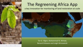
- 1. The Regreening Africa App a key innovation for monitoring of land restoration at scale Tor-G. Vågen, Muhammad N. Ahmad, Benard Onkware and Leigh Winowiecki
- 2. Citizen science data collection tool Used by (among others): • Implementing partners • Scientists • Extension agents • Lead farmers • Nursery managers
- 3. Farmer managed natural regeneration (FMNR) Senegal • Users walk the boundary of fields with tree planting or FMNR interventions and submit the geo-tagged field polygons. • These farm polygons can then overlaid onto maps of land cover and land health allowing us to assess the effectiveness of these interventions on multiple aspects of land health. • Potential applications of these assessments include soil carbon monitoring, relating directly to climate neutrality goals, etc. • Also, biodiversity within farming systems can be assessed and tracked.
- 4. Rwanda Tree planting interventions recorded across project intervention areas in Rwanda in 2020
- 5. Soil Organic Carbon (SOC) - a key indicator of land healthFractional vegetation cover The data collected using the Regreening Africa App is combined with analytical outputs to extract and assess land health information from farmers’ fields
- 6. Assessing interactions between multiple metrics of ecosystem health across intervention areas Map of soil organic carbon for Rwanda. Source: ICRAF GeoScience Lab