Ground water resources and problems
•
18 likes•6,214 views

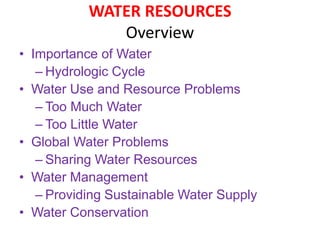
Importance of Water Hydrologic Cycle Water Use and Resource Problems Too Much Water Too Little Water Global Water Problems Sharing Water Resources Water Management Providing Sustainable Water Supply Water Conservation

Recommended
More Related Content
What's hot
What's hot (20)
Similar to Ground water resources and problems
Similar to Ground water resources and problems (20)
More from Jahangir Alam
More from Jahangir Alam (20)
Recently uploaded
Recently uploaded (20)
Ground water resources and problems
- 1. WATER RESOURCES Overview • Importance of Water – Hydrologic Cycle • Water Use and Resource Problems – Too Much Water – Too Little Water • Global Water Problems – Sharing Water Resources • Water Management – Providing Sustainable Water Supply • Water Conservation
- 2. Importance of Water • Cooking • Washing • Use large amounts for: – Agriculture – Manufacturing – Mining – Energy production – Waste disposal • Use of freshwater is increasing
- 3. Properties of Water • Composed of 2 Hydrogen and 1 oxygen • Exists as solid, liquid or gas • High heat capacity • Polar – One end has (+) charge, one end has (-) charge • Forms Hydrogen bond between 2 water molecules – H-bonds define water’s physical properties
- 4. Properties of Water • Water is never completely pure in nature • Content of seawater (left) • Many substances water dissolves cause water pollution
- 5. Distribution of Water • Only 2.5% of water on earth is freshwater • 2% is in the form of ice! • Only ~0.5% of water on earth is available freshwater
- 6. Freshwater Terminology • Surface water – Precipitation that remains on the surface and does not seep into soil • Runoff – Movement of surface water to lakes, rivers, etc. • Watershed (drainage basin) – Land area that delivers water into a stream or river system • Groundwater – Freshwater under the earth’s surface stored in aquifers • Aquifer – Underground caverns and porous layers of sand, gravel and rock in which groundwater is stored
- 8. Groundwater is the water located beneath the earth's surface in soil pore spaces and in the fractures of rock formations. A unit of rock or an unconsolidated deposit is called an aquifer when it can yield a usable quantity of water. The depth at which soil pore spaces or fractures and voids in rock become completely saturated with water is called the water table. Groundwater is recharged from, and eventually flows to, the surface naturally; natural discharge often occurs at springs and seeps, and can form oases or wetlands. Groundwater is also often withdrawn for agricultural, municipal, and industrial use by constructing and operating extraction wells. The study of the distribution and movement of groundwater is hydrogeology, also called groundwater hydrology. Typically, groundwater is thought of as liquid water flowing through shallow aquifers, but, in the technical sense, it can also include soil moisture, permafrost (frozen soil), immobile water in very low permeability bedrock, and deep geothermal or oil formation water. Groundwater is hypothesized to provide lubrication that can possibly influence the movement of faults. It is likely that much of the Earth's subsurface contains some water, which may be mixed with other fluids in some instances. Groundwater may not be confined only to the Earth. The formation of some of the landforms observed on Mars may have been influenced by groundwater. There is also evidence that liquid water may also exist in the subsurface of Jupiter's moon Europa. Groundwater
- 9. Aquiclude A geological stratum or formation that may be capable of storing water but is unable to transmit it in significant amounts. Aquifer A rock formation that is sufficiently porous and permeable to yield a significant quantity of water to a borehole, well or spring. The aquifer may be unconfined beneath a standing water table, or confined by an impermeable or weakly permeable horizon. Artesian Aquifer Groundwater that is under pressure so when tapped by a well it is able to rise above the level at which it is first encountered. It may or may not flow out at ground level. The pressure in such an aquifer commonly is called artesian pressure, and the formation is an artesian or confined aquifer. Artificial Recharge The deliberate replenishment of the groundwater by means of spreading basins, recharge wells, irrigation, or other means to induce infiltration of surface water. Ground Water Table The depth at which soil pore spaces or fractures and voids in rock become completely saturated with water is called the water table. Terms Used in Hydrogeology
- 10. Groundwater flow
- 11. Aquifer An aquifer is a layer of porous substrate that contains and transmits groundwater. When water can flow directly between the surface and the saturated zone of an aquifer, the aquifer is unconfined. The deeper parts of unconfined aquifers are usually more saturated since gravity causes water to flow downward. The upper level of this saturated layer of an unconfined aquifer is called the water table or phreatic surface. Below the water table, where in general all pore spaces are saturated with water, is the phreatic zone. Substrate with low porosity that permits limited transmission of groundwater is known as an aquitard. An aquiclude is a substrate with porosity that is so low it is virtually impermeable to groundwater. A confined aquifer is an aquifer that is overlain by a relatively impermeable layer of rock or substrate such as an aquiclude or aquitard. If a confined aquifer follows a downward grade from its recharge zone, groundwater can become pressurized as it flows. This can create artesian wells that flow freely without the need of a pump and rise to a higher elevation than the static water table at the above, unconfined, aquifer.
- 12. The characteristics of aquifers vary with the geology and structure of the substrate and topography in which they occur. In general, the more productive aquifers occur in sedimentary geologic formations. By comparison, weathered and fractured crystalline rocks yield smaller quantities of groundwater in many environments. Unconsolidated to poorly cemented alluvial materials that have accumulated as valley-filling sediments in major river valleys and geologically subsiding structural basins are included among the most productive sources of groundwater. The high specific heat capacity of water and the insulating effect of soil and rock can mitigate the effects of climate and maintain groundwater at a relatively steady temperature. In some places where groundwater temperatures are maintained by this effect at about 10°C (50°F), groundwater can be used for controlling the temperature inside structures at the surface. For example, during hot weather relatively cool groundwater can be pumped through radiators in a home and then returned to the ground in another well. During cold seasons, because it is relatively warm, the water can be used in the same way as a source of heat for heat pumps that is much more efficient than using air.
- 13. Groundwater is often cheaper, more convenient and less vulnerable to pollution than surface water. Therefore, it is commonly used for public water supplies. Groundwater provides the largest source of usable water storage in many countries. Underground reservoirs contain far more water than the capacity of all surface reservoirs and lakes, including the Great Lakes. Many municipal water supplies are derived solely from groundwater The volume of groundwater in an aquifer can be estimated by measuring water levels in local wells and by examining geologic records from well-drilling to determine the extent, depth and thickness of water-bearing sediments and rocks. Before an investment is made in production wells, test wells may be drilled to measure the depths at which water is encountered and collect samples of soils, rock and water for laboratory analyses. Pumping tests can be performed in test wells to determine flow characteristics of the aquifer. Polluted ground water is less visible, but more difficult to clean up, than pollution in rivers and lakes. Ground water pollution most often results from improper disposal of wastes on land. Major sources include industrial and household chemicals and garbage landfills, industrial waste lagoons, tailings and process wastewater from mines, oil field brine pits, leaking underground oil storage tanks and pipelines, sewage sludge and septic systems.
- 14. Polluted groundwater is mapped by sampling soils and groundwater near suspected or known sources of pollution, to determine the extent of the pollution, and to aid in the design of groundwater remediation systems. Preventing groundwater pollution near potential sources such as landfills requires lining the bottom of a landfill with watertight materials, collecting any leachate with drains, and keeping rainwater off any potential contaminants, along with regular monitoring of nearby groundwater to verify that contaminants have not leaked into the groundwater. The danger of pollution of municipal supplies is minimized by locating wells in areas of deep ground water and impermeable soils, and careful testing and monitoring of the aquifer and nearby potential pollution sources.
- 15. Groundwater makes up about twenty percent of the world's fresh water supply, which is about 0.61% of the entire world's water, including oceans and permanent ice. Global groundwater storage is roughly equal to the total amount of freshwater stored in the snow and ice pack, including the north and south poles. This makes it an important resource that can act as a natural storage that can buffer against shortages of surface water, as in during times of drought. Groundwater is naturally replenished by surface water from precipitation, streams, and rivers when this recharge reaches the water table. Groundwater can be a long-term 'reservoir' of the natural water cycle (with residence times from days to millennia), as opposed to short-term water reservoirs like the atmosphere and fresh surface water (which have residence times from minutes to years). The figure in the next slide shows how deep groundwater (which is quite distant from the surface recharge) can take a very long time to complete its natural cycle. The Great Artesian Basin in central and eastern Australia is one of the largest confined aquifer systems in the world, extending for almost 2 million km2. By analysing the trace elements in water sourced from deep underground,hydrogeologists have been able to determine that water extracted from these aquifers can be more than 1 million years old. Water cycle
- 16. Hydrologic Cycle
- 17. Certain problems have beset the use of groundwater around the world. Just as river waters have been over-used and polluted in many parts of the world, so too have aquifers. The big difference is that aquifers are out of sight. The other major problem is that water management agencies, when calculating the "sustainable yield" of aquifer and river water, have often counted the same water twice, once in the aquifer, and once in its connected river. This problem, although understood for centuries, has persisted, partly through inertia within government agencies. Four important effects are worthy of brief mention. First, flood mitigation schemes, intended to protect infrastructure built on floodplains, have had the unintended consequence of reducing aquifer recharge associated with natural flooding. Second, prolonged depletion of groundwater in extensive aquifers can result in land subsidence, with associated infrastructure damage – as well as, third, saline intrusion. Fourth, draining acid sulphate soils, often found in low-lying coastal plains, can result in acidification and pollution of formerly freshwater and estuarinestreams.[11] Another cause for concern is that groundwater drawdown from over-allocated aquifers has the potential to cause severe damage to both terrestrial and aquatic ecosystems – in some cases very conspicuously but in others quite imperceptibly because of the extended period over which the damage occurs. PROBLEMS RELATED TO GROUNDWATER USE
- 18. Groundwater is a highly useful and often abundant resource. However, over-use, or overdraft, can cause major problems to human users and to the environment. The most evident problem (as far as human groundwater use is concerned) is a lowering of the water table beyond the reach of existing wells. As a consequence, wells must be drilled deeper to reach the groundwater; in some places (e.g., California, Texas, and India) the water table has dropped hundreds of feet because of extensive well pumping. In the Punjab region of India, for example, groundwater levels have dropped 10 meters since 1979, and the rate of depletion is accelerating.[13] A lowered water table may, in turn, cause other problems such as groundwater-related subsidence and saltwater intrusion. Groundwater is also ecologically important. The importance of groundwater to ecosystems is often overlooked, even by freshwater biologists and ecologists. Groundwaters sustain rivers, wetlands, and lakes, as well as subterranean ecosystems within karst or alluvial aquifers. OVERDRAFT
- 19. Subsidence occurs when too much water is pumped out from underground, deflating the space below the above-surface, and thus causing the ground to collapse. The result can look like craters on plots of land. This occurs because, in its natural equilibrium state, the hydraulic pressure of groundwater in the pore spaces of the aquifer and the aquitard supports some of the weight of the overlying sediments. When groundwater is removed from aquifers by excessive pumping, pore pressures in the aquifer drop and compression of the aquifer may occur. This compression may be partially recoverable if pressures rebound, but much of it is not. When the aquifer gets compressed, it may cause land subsidence, a drop in the ground surface. The city of New Orleans, Louisiana is actually below sea level today, and its subsidence is partly caused by removal of groundwater from the various aquifer/aquitard systems beneath it. In the first half of the 20th century, the city of San Jose, California dropped 13 feet from land subsidence caused by overpumping; this subsidence has been halted with improved groundwater management. Dhaka city may face the same problem. Subsidence
- 20. Seawater intrusion In general, in very humid or undeveloped regions, the shape of the water table reflects the slope of the surface. The recharge zone of an aquifer near the seacoast is likely to be inland, often at considerable distance. In these coastal areas, a lowered water table may induce sea water to reverse the flow toward the land. Sea water moving inland is called a saltwater intrusion. In alternative fashion, salt from mineral beds may leach into the groundwater of its own accord. Pollution Water pollution of groundwater, from pollutants released to the ground that can work their way down into groundwater, can create a contaminant plume within an aquifer. Movement of water and dispersion within the aquifer spreads the pollutant over a wider area, its advancing boundary often called a plume edge, which can then intersect with groundwater wells or daylight into surface water such as seeps and springs, making the water supplies unsafe for humans and wildlife. The stratigraphy of the area plays an important role in the transport of these pollutants. An area can have layers of sandy soil, fractured bedrock, clay, or hardpan. Areas of karst topography on limestone bedrock are sometimes vulnerable to surface pollution from groundwater. Earthquake faults can also be entry routes for downward contaminant entry.
- 21. Water table conditions are of great importance for drinking water supplies, agricultural irrigation, waste disposal (including nuclear waste), wildlife habitat, and other ecological issues. An example of widespread groundwater pollution is in the Ganges Plain of northern India and Bangladesh where severe contamination of groundwater by naturally occurring arsenic affects 25% of water wells in the shallower of two regional aquifers. The pollution occurs because aquifer sediments contain organic matter that generates anaerobic conditions in the aquifer. These conditions result in the microbial dissolution of iron oxides in the sediment and, thus, the release of the arsenic, normally strongly bound to iron oxides, into the water. As a consequence, arsenic-rich groundwater is often iron-rich, although secondary processes often obscure the association of dissolved arsenic and dissolved iron.
- 22. THANK YOU ALL
- 23. THANKS