2019 tg lithosphere4 landforms
•
1 like•892 views

Main Landforms in bilingual subject of geography

Recommended
More Related Content
What's hot
What's hot (20)
Similar to 2019 tg lithosphere4 landforms
Similar to 2019 tg lithosphere4 landforms (20)
More from Juan Antonio García González
More from Juan Antonio García González (20)
Recently uploaded
Recently uploaded (20)
2019 tg lithosphere4 landforms
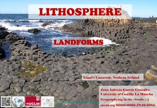
- 1. LITHOSPHERE LANDFORMS Juan Antonio García González University of Castilla La Mancha Geographying in the clouds ; -) orcid.org/0000-0001-7049-1085 Giant's Causeway, Nothern Ireland https://en.wikipedia.org/wiki/Giant%27s_Cause way
- 2. Small to medium tracts or parcels of the earth’s surface are called landforms. Each landform has its own physical shape, size, materials and is a result of the action of certain geomorphic processes and agent(s) Landforms once formed may change in their shape, size and nature slowly or fast due to continued action of geomorphic processes and agents https://www.disfrutalasvegas.com/gran-canon Grand Canyon Colorado, USA
- 3. Each and every landform has a history of development and changes through time. Most of the geomorphic processes are imperceptible functions and can only be seen and measured through their results Zhangye Danxia Landform Geological Park in Gansu Province, China
- 6. SHIELDS Solid Granite Rock Surfaces They are homogeneous from their morphology Tectonic stability Soft and smooth shapes
- 7. SEDIMENTARY BASINS Topographically depressed areas Sometimes they find themselves submerged Tectonic stability https://geographyoral.weebly.com/mississippi-drainage-basin.html
- 8. ÁREAS MONTAÑOSAS lugares más jóvenes Importantes variaciones de relieve Rocas sedimentarias con corazón granítico https://xn--rutaspormontaa-2nb.es/actividades/parque-nacional-de-los-pirineos-francia/ Parque Nacional de los Pirineos (Francia)
- 9. LITHOLOGICAL MODELING Sedimentary rocks Limestone rocks Granite rocks LANDFORMS TYPOLOGY STRUCTURAL MODELLING Horizontal Folding Failed CLIMATE MODELING Glacial and periglacial Arid regions Tropical regions https://en.wikipe dia.org/wiki/Gre at_Blue_Hole Great Blue Hole, Belize
- 10. LITHOLOGICAL MODELING Sedimentary rocks Limestone rocks Granite rocks https://en.wikipedia.org/wiki/Naica_Mine Selenite crystals in Naica Mine Chihuahua MEXICO. lead, zinc and silver mine
- 11. SEDIMENTARY ROCKS https://es.wikipedia.org/wiki/Roraima_(tepuy) tepuy Roraima. Venezuela, Guyana, Brazil • Rocks from the dissolution of crystalline and calcareous rocks (clays and loams). • Little cohesive rocks with strong mechanical wear, especially rain (gullies). • Sometimes they are more cemented and have a greater fight against erosion (sandstones). • If they metamorphose, they become much harder rocks (quartzite). • They hydrate easily and can suffer significant landslides. (Solifluxion flows).
- 12. Marls, Clays, Sands, Conglomerates,…
- 13. Sandstone
- 14. KARST FEATURES Any limestone or dolomitic region showing typical landforms produced by the action of groundwater through the processes of solution and deposition is called Karst. The surface water percolates well when the rocks are permeable, thinly bedded and highly jointed and cracked Rocks like limestones or dolomites rich in calcium carbonate, the surface water as well as groundwater through the chemical process of solution and precipitation deposition develop varieties of landforms LIMESTONE ROCKS https://en.wikipedia.org/wiki/Stone_ForestThe Stone Forest or Shilin, China
- 16. • Swallow holes form: Small to medium sized round to sub-rounded shallow depressions • Pools: Swallow holes with water • Sinkholes. A sinkhole is an opening more or less circular at the top and funnel-shapped towards the bottom with sizes varying in area from a few sq. m to a hectare and with depth from a less than half a metre to thirty metres or more EROSIONAL LANDFORMS CENOTE, MEXICOhttp://www.neuriwoman.com/2010/06/skinhole-de-ik-kil-cenote-mexico-3.html
- 17. Uvala: When sink holes and dolines join together because of slumping of materials along their margins or due to roof collapse of caves, long, narrow to wide trenches called valley sinks or Uvalas form Polje. Sierra de la Tramontana, Mallorcahttps://previa.uclm.es/profesorado/egcardenas/doli.htm
- 18. Lapies and Limestone Pavements these ridges or lapies form due to differential solution activity along parallel to sub-parallel joints. The lapie field may eventually turn into somewhat smooth limestone pavements Doline: Sinkholes colapses
- 19. Caves: reas where there are alternating beds of rocks (shales, sandstones, quartzites) with limestones or dolomites The Murmuring Cave. The Škocjan Caves Regional Park. Republic of Slovenia https://www.naravniparkislovenije.si/en/nature-parks/skocjan-caves-regional-park
- 20. DEPOSITIONAL LANDFORMS • Stalactites: hang as icicles of different diameters. Normally they are broad at their bases and taper towards the free ends showing up in a variety of forms • Stalagmites: rise up from the floor of the caves http://estalactitasyestalagmitas.blogspot.com/
- 21. DEPOSITIONAL LANDFORMS Pillars: The stalagmite and stalactites eventually fuse to give rise to columns and pillars of different diameters https://en.wikipedia.org/wiki/Avshalom_Cave
- 22. DEPOSITIONAL LANDFORMS Travertinos: Organic limestone's barriers https://es.wikipedia.org/wiki/Pamukkale
- 23. Sugarloaf Mountain Rio de janeiro Brasil GRANITE ROCKS It is a rock heterogeneous by composition and type of grain. Granite is not very massive, with diaclases, originated in the formation of a magmatic rock. Certain components of the rock behave differently Its modeling varies depending on where it is located on the planet (humidity and temperature).
- 26. HORIZONTAL LANDFORMS The West and East Mitten Buttes (also known as the Mittens) are two buttes in the Monument Valley Navajo Tribal Park in northeast Navajo County, Arizona https://en.wikipedia.org/wiki/West_and_East_Mitten_Buttes
- 27. The Wave, Vermillion Cliffs National Monument Arizona USA FOLDING LANDFORMS https://es.wikipedia.org/wiki/The_Wave
- 30. https://www3.nd.edu/~cneal/PlanetEarth/Lab-Deserts/Erosional.html Plateaus: comparatively flat upland areas formed in regions of horizontal rock layers. The plateau becomes dissected by rivers and distinctive landforms are produced. Mesa: a generally flat-topped area, bounded by cliffs, that is quite a bit wider (usually) than it is high. Buttes: smaller, flat-topped landforms isolated by erosion. They are more or less as wide as they are high. Monuments (or spires): slender features that are much higher than they are wide.
- 32. http://sageography.co.za/wiki/grade-11-caps/grade-11-caps- geomorphology/inclinedtilted-rock-strata/
- 42. Parts of a FaultFAILED STRUCTURES https://www.researchg ate.net/publication/33 4508149_Fault_core_ and_its_geostatistical _analysis_Insight_into _the_fault_core_thick ness_and_fault_displa cement/figures?lo=1
- 45. CLIMATE MODELING ICE WIND WATER Hoodoos in Utah's Goblin Valley. USA https://www.mnn.com/earth-matters/wilderness-resources/blogs/the-oddly- expressive-hoodoos-of-goblin-valley-state-park
- 46. GLACIERS Masses of ice moving as sheets over the land or as linear flows down the slopes of mountains in broad trough-like valleys (mountain and valley glaciers) are called glaciers The movement could be a few centimetres to a few metres a day or even less or more because of the force of gravity https://www.nationalgeographic.org/encyclopedia/glacier/ • Islandsides: powerful and continuous mass of ice • Alpine zones (Altitude) • Valley Glacier Perito Moreno, Argentina
- 47. Flattened sections Glacial thresholds Buckets or glacial lakes Longitudinal profile Transversal profile U-shaped valley (lateral erosion) Glacial Circus (reception basin) Moraines (transport and sedimentation)
- 50. GLACIERS Erosion by glaciers is tremendous because of friction caused by sheer weight of the ice. Glaciers can cause significant damage to even un-weathered rocks and can reduce high mountains into low hills and plains. http://www.geography.hunter.cuny.edu/tbw/Iceland.Field.Trip/Lectures/18.Glaciers.Ice.Ages/glaciers__ice_ages.htm Gelifraction Glacier unrolling Rubbing Speed Adherence Thickness
- 53. EROSIONAL LANDFORMS Glacial Micromodeling: Smoothed and grooved areas
- 54. EROSIONAL LANDFORMS https://www.biodiversidadvirtual.org/geolog ia/Valle-glaciar-de-Ordesa-img2601.html Ordesa y Monte Perdido National Park Glacial Valleys/Troughs Glaciated valleys are trough-like and U-shaped with broad floors and relatively smooth, and steep sides The faces of divides or spurs of such hanging valleys opening into main glacial valleys are quite often truncated to give them an appearance like triangular facets
- 56. http://www.geography.hunter.cuny.edu/tbw/Icelan d.Field.Trip/Lectures/18.Glaciers.Ice.Ages/glacier s__ice_ages.htm Very deep U-shaped glacial troughs filled with sea water and making up shorelines (in high latitudes) are called fjords/fiords Fjords Preikestolen Stavanger (Norway)
- 57. EROSIONAL LANDFORMS Horns and Serrated Ridges He divides between cirque side walls or head walls get narrow because of progressive erosion and turn into serrated or saw-toothed ridges sometimes referred to as arêtes with very sharp crest and a zig-zag outline
- 58. EROSIONAL LANDFORMS Cirque Cirques are the most common of landforms in glaciated mountains. The cirques quite often are found at the heads of glacial valleys They are deep, long and wide troughs or basins with very steep concave to vertically dropping high walls at its head as well as sides http://www.antarcticglaciers.org/glacial-geology/glacial-landforms/glacial-erosional-landforms/cirques/ Snowdonia National Park, Wales
- 60. DEPOSITIONAL LANDFORMS Moraines: They are long ridges of deposits of glacial till. Such deposits varying greatly in thickness and in surface topography are called ground moraines http://www.geography.hunter.cuny.edu/tbw/Iceland.Field.Trip/L ectures/18.Glaciers.Ice.Ages/glaciers__ice_ages.htm
- 61. DEPOSITIONAL LANDFORMS Eskers: very coarse materials like boulders and blocks along with some minor fractions of rock debris carried into this stream settle in the valley of ice beneath the glacier and after the ice melts can be found as a sinuous ridge called esker http://www.geography.hunter.cuny.edu/tbw/Iceland.Field.Trip/ Lectures/18.Glaciers.Ice.Ages/glaciers__ice_ages.htm
- 62. DEPOSITIONAL LANDFORMS Outwash Plains: The plains at the foot of the glacial mountains or beyond the limits of continental ice sheets are covered with glacio-fluvial deposits in the form of broad flat alluvial fans which may join to form outwash plains of gravel, silt, sand and clay. https://landformsmi.weebly.com/outwash-plains.html http://www.geo.mtu.edu/KeweenawGeoheritage/Glaciers/Outwash.html
- 63. DEPOSITIONAL LANDFORMS Drumlins: Drumlins are smooth oval shaped ridge-like features composed mainly of glacial till with some masses of gravel and sand. The long axes of drumlins are parallel to the direction of ice movement. Drumlins give an indication of direction of glacier movement.
- 64. Frost weathering Gelifraction cryoturbation Solifluction PERIGLACIAL MODELING Areas of high latitudes High Altitude Areas Lower altitude in continental zones Temporal and spatial variation in ice occupation Landforms Valleys dissymmetry Permafrost and polygonal soils https://frontierscientists.com/2016/07/lines-polygons-permafrost-thaw-ecosystem-changes/
- 65. Agents Circulating waters (Badlands and sedimentation glaciers) Temperature (thermoclasty) Wind deflection (REG, ERG) Wind Corrosion MODELING ARID REGIONS Is it the same arid region as desert? https://www.microsoft.com/es-es/p/in-the-desert/9ngxfqkqjkf2?activetab=pivot:overviewtab
- 67. WIND EROSION there are storm winds which are very destructive. Winds cause deflation, abrasion and impact. Deflation includes lifting and removal of dust and smaller particles from the surface of rocks. In the transportation process sand and silt act as effective tools to abrade the land surface. The wind action creates a number of interesting erosional and depositional features in the deserts. Though rain is scarce in deserts, it comes down torrentially in a short period of time. https://www.agri c.wa.gov.au/fire/ wind-erosion- control-after-fire
- 68. EROSIONAL LANDFORMS Pediments and Pediplains Gently inclined rocky floors close to the mountains at their foot Once, pediments are formed with a steep wash slope followed by cliff or free face above it, This method of erosion is termed as parallel retreat of slopes through backwasting. So, through parallel retreat of slopes, the pediments extend backwards at the expense of mountain front, and gradually, the mountain gets reduced leaving an inselberg which is a remnant of the mountain.
- 69. Plains Plains are by far the most prominent landforms in the deserts Such types of shallow lakes are called as playas where water is retained only for short duration due to evaporation and quite often the playas contain good deposition of salts. The playa plain covered up by salts is called alkali flats EROSIONAL LANDFORMS https://worldbuilding.stacke xchange.com/questions/803 59/can-deserts-and- plainslands-be- geographically-close Nile flood plain
- 70. Deflation Hollows and Caves Deflation also creates numerous small pits or cavities over rock surfaces. EROSIONAL LANDFORMS https://revision.co.zw/deflation-hollows/ https://earthscience.stackexchange .com/questions/16988/is-there-a- widely-accepted-reason-for-the- formation-of-tafoni
- 71. Mushroom, Table and Pedestal Rocks Sometimes, the top surface is broad like a table top and quite often, the remnants stand out like pedestals EROSIONAL LANDFORMS https://www.pmfias.com/arid- landforms-erosional- depositional-wind-eroded- water-eroded-arid-landforms/ https://revisionworld.com/a2- level-level- revision/geography/arid-and- semi-arid-environments- 0/features-produced-water- deserts
- 75. In humid regions, which receive heavy rainfall running water is considered the most important of the geomorphic agents in bringing about the degradation of the land surface RUNNING WATER https://en.wikipedia.org/wiki/Iguazu_Falls Iguazu Falls
- 78. Thanks for your attention, you can follow us in “Geografiando en las nubes ;-)” @JGARCIAGONZALEZ garciagonzalez.juanantonio@gmail.com http://www.youtube.com/user/garciotum1?feature=mhee “Geographying in the clouds ;-)” http://www.linkedin.com/profile/view?id=139061635&trk=tab_pro http://es.slideshare.net/JuanAntonioGarciaGonzlez http://pinterest.com/geografiando/boards/ http://geografiandoenlasnubes.blogspot.com.es/ http://www.scoop.it/u/dr-juan-antonio-garcia-gonzalez https://plus.google.com/u/0/105941284089211583758/posts http://www.facebook.com/juanantonio.garciagonzalez.37