Pseudoranges from your Android smartphone
•
2 likes•11,713 views

The latest version of Android, Nougat (v7.x), was released in late 2016, and offers access to raw GNSS measurements. Google demonstrated functionality to obtain Pseudoranges, Dopplers and Carrier Phase from a phone or tablet last September at the Institute of Navigation’s conference. This seminar will explain the current API, hardware limitations and possible future advantages of this exciting new development. We will discuss data collection, raw measurements and demo processing example in Matlab and Python.

Recommended
Recommended
More Related Content
What's hot
What's hot (20)
Similar to Pseudoranges from your Android smartphone
Similar to Pseudoranges from your Android smartphone (20)
Pseudoranges from your Android smartphone
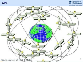
- 1. GPS Figure courtesy of Prof T Moore 1
- 3. Pseudoranges from your Android smartphone Dr. Lukasz Bonenberg 1st Feb 2017 NGI 3
- 4. Introduction
- 5. GPS Navigation Concept Figure courtesy of Prof T Moore 5
- 7. Looking under the hood
- 12. Sum it up • Most devs focus on highly abstracted com.google.android.gms.location • android.hardware provides Sensors API • android.location provides raw GNSS • Last two are difficult to use • check Google Matlab code • check my notes and python code • Google... 12
- 13. GNSS Observables
- 14. GNSS raw data • Pseudorange/Pseudorange Rate (code) • HW clock • Navigation data • Accumulated Delta Range (Carrier) • additional information (Doppler, observation uncertainty ,SNR ect) Availability varies and might not be enabled on supported chipsets1. Currently, only Nexus 9 provides most of the raw measurements. Nexus 5x, Nexus 6, Pixel and Pixel XL only provide code and clocks, sometimes only if fix. 1Qualcomm Snapdragon 650 or 820, Broadcom BCM4774 or Intel WCS2x00 14
- 15. Carrier phase Figure courtesy of Prof T Moore 15
- 16. Carrier phase • In order to save battery a lot of phones will use duty cycle which will affect both carrier phase reading and clocks • Currently only Nexus 9 provides carrier phase • Read T. Humphrey et al (2016) On the Feasibility of cm-Accurate Positioning via a Smartphone’s Antenna and GNSS Chip 16
- 17. Making it real - live demo
- 19. GNSS accuracy Figure courtesy of Prof T Moore 19
- 20. We are not yet replacing CORS networks ©Google 20
- 21. or use it for civil engineering... Figure courtesy of Prof Gethin Roberts and Dr Xiaolin Meng 21
- 24. Using it
- 25. Where should we start ? • Pseudorange and Doppler in urban canyons • Teaching • Mobile hardware differences • Conversion to other formats RTCM3, RINEX logger • NMEA logger for messages not already supported 25
- 26. Some suggestions • GIS, asset management • Augmentation and integrity monitoring • Space weather • Differential GNSS/RTK using NTRIP and CORS and OS tools like RTKLib • Crowdsourced jammer detector • Crowdsorced earthquake detection • sensor fusion • improve position in urban areas (GNSS shadowing) 26
- 27. Summary
- 28. What we covered today 1 Introduction 2 Looking under the hood 3 GNSS Observables 4 Making it real - live demo 5 Opportunity and Challenge 6 Using it 7 Summary 28
- 29. Take away • RAW GNSS will only work with Android 7.x; • A limited hardware is supported2; • Open source code is available; • Commercial companies are interested; • More creative use of GNSS in mass market applications? • Privacy concerns. 2Hardware allegedly forced to comply from mid 2017 29
- 31. Useful links • my edits to Google code - https://github.com/DfAC/gps-measurement-tools • ranges intro in python - https://github.com/DfAC/AndroidGNSS • Simon Banville blog - http://www.blackdotgnss.com/ 2016/09/20/ppp-with-smartphones-are-we-there-yet/ • Rokybun blog - http://rokubun.cat/2016/06/30/ android-n-preview-gnss-measurements/ • My previous presentations - http://www.slideshare.net/LukaszKosmaBonenberg 31