
Recommended
Recommended
More Related Content
Recently uploaded
Recently uploaded (20)
Featured
Featured (20)
MineExcellence Drones Platform for mining Industry
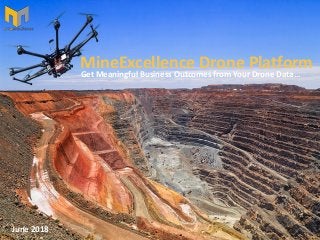
- 1. June 2018 MineExcellence Drone Platform Get Meaningful Business Outcomes from Your Drone Data…
- 2. IntroductiontoMineExcellenceDronePlatform In Mining industry UAV/Drone survey provide aerial images delivering high accurate Topography data, 3D Digital Elevation Models and Digital Surface Models (DSM). MineExcellence provide a web based drone data analysis platform that enables you to get more from your drone data. MineExcellence Drone Platform provides 2D/3D visualization with various tools helping in scoping, assessment, planning, surveying, design and inspection which would be very useful to the mining industry.
- 4. WhereMineExcellenceDronePlatformcanhelp MineExcellence Provides a Web based module where you can upload your drone data files and do a variety of business functions what will let you get more value out of your drone data – Some Areas below where drone data can help. Exploration & Planning • Feature Extraction & Environmental Assessment Elevation & Contours • Digital Terrain Modelling (DTM) for height and elevation data of the site • Digital Elevation Modelling (DEM) for height and depth of the entire site • Mine Survey • Design of Haul Roads Operations & Maintenance • Mine Growth Mapping • Stock Pile Calculations • Pre & Post blast assessment & calculations • Development analysis • Documentations • Blast video in slow motion resolution including critical zones
- 5. MineExcellenceDroneModules S.No. Drone Module Business Benefits 1 Measurement Tools Any specific distance, area , volume, angle, height can be calculated in a mine using a drone 3D image. 2 Slope Analysis The slopes can be shown as per the angles in specific colors to get a better understanding for planning of mines. 3 Contour Mapping Contours can be marked throughout the mines at any specific unit. From 10m to 0.1m to any other unit, contour lines can be generated for a depth analysis. 4 Boundaries The boundaries can be generated to view the breakpoints more easily to plan its recovery. 5 Hydrology Drainage and water management •Watershed, drainage basin & water flow mapping •Tailings dam management 6 Stock Pile Calculations Calculate accurate stock volumes in much lesser time compared to other traditional methods 7 Pre Blast Assessment /Burden Analysis Design drill patterns, calculate burden analysis, apply blasting parameters, and tie in the shot. 8 Post Blast Assessment Analysis of post blast factors like Fragmentation , Flyrock etc. What are the business Benefits ?
- 6. MineExcellenceDroneApplications WhataretheBusinessBenefits? S.No. Drone Module Business Benefits 9 Digital Mine Mapping Create a digital map of the mine site , defining routs , mine zones , infrastructure etc. 10 Blast Video in Slow Motion Resolution The video data can be used to analyze the firing order, as well as detect imperfections in the detonation. 11 Haul road analytics overlaid The load and haul process in mining is improved through aerial surveying techniques. Applications include: 1. Measuring volumes excavated at the shovel /excavator face 2. Monitoring bench elevations 3. Creating digital terrain models of haul road networks. 12 Environmental By acquiring regular aerial survey data the mining operation can ensure environmental compliance to local regulations. Land use can be monitored and any encroachment on company property quickly detected. 13 Mine Growth Mapping Volume Difference of an Area Surveyed over different Time Periods
- 8. Contourlines Contours can be marked throughout the mines at any specific unit. From 10m to 0.1m to any other unit, contour lines can be generated for a depth analysis.
- 9. FaceProfile
- 10. Quarry&Blasting Design drill patterns, calculate burden analysis, apply blasting parameters, and tie in the shot.
- 13. DigitalMineMapping Create a digital map of the mine site , defining routs , mine zones , infrastructure etc.
- 14. BlastVideoinSlowMotionResolution The video data can be used to analyze the firing order, as well as detect imperfections in the detonation. This includes critical blast zones
- 16. SurveyviaTraditionalvsDronemethods Using traditional ground methods, a 60-acre site could easily take two or even three weeks to survey.
- 18. CollaborationviaCloud Share data to all the stakeholders to increase collaboration. Digital drone data, hosted in a secure online cloud environment, makes collaboration with stakeholders simple. Whether taking decisions to improve operational planning, depletion accounting, monitoring environmental factors or identifying and agreeing on required maintenance work.
- 19. YourBenefits Safety • Personnel safety improvement • Operational safety enhancement • Safety enhancement – Reduction of personnel working at heights • Risk minimization Resources • Optimization of crew deployment – Shorter notification time for ground crew • Short term adjustment on resources – Efficient material procurement • Faster inspection intervals – Shorter inspection time for equipment set-up • Resource planning optimization – More efficient allocation of highly skilled labor Cost • Replacement of conventional methods – Low cost UAV surveying Solutions • Reduction of opportunity cost – Less operation shutdown • Reduction of expensive conventional methods – Less teams & platforms • Lower opportunity cost – Reduced asset downtime Reporting • Up-to-date reporting to better track progress– Speed-up decision making • Digitalized workable data – Stakeholders interaction through a single platform • Accurate and precise data sets – Ensuring 100% inspection coverage • Evidence on every identified irregularities – Workable digital data
- 20. • Don’t have drone data? • Have drone data but don’t know what to do with it? • Give us a call! support@mineexcellence.com (0291) 2624063 (+61) 03 9444 7454 www.mineexcellence.com