SlideShare a Scribd company logo
1 of 155
Download to read offline
NISQUALLY WATERSHED
STEWARDSHIP PLAN
2018 STATUS REPORT
PREPARED FOR THE NISQUALLY RIVER COUNCIL
Recommended citation: McCartan, Emily. Nisqually Watershed Stewardship Plan: 2018 Status Report.
Olympia, WA: Nisqually River Council, 2019.
Nisqually Watershed Stewardship Plan: 2018 Status Report 2
Nisqually Watershed Stewardship Plan: 2018 Status Report 3
TABLE OF CONTENTS
Introduction.....................................................................................................................8
Watershed Background ....................................................................................................... 10
Nisqually Watershed Map.................................................................................................... 11
Nisqually River Council Members and Representatives, 2018............................................ 11
Environmental Sustainability: A Viable, Healthy Natural Resource Base ..............12
Goal I: Protect, restore, and enhance ecosystem function............................................... 14
Indicators: ............................................................................................................................ 14
I.1 Prairie lands with a predominance of native species and minimal populations of invasive species.. 14
I.2 Forest lands with a diversity of species and age classes; complexity within stands, and complexity
inter- and intra-stand.................................................................................................................................. 16
I.3 Snow and ice lands with sufficient amounts to support healthy hydrologic cycles. ........................... 20
I.4 Alpine lands continue to support diverse biological communities...................................................... 24
I.4 River and stream systems are fully functioning – healthy riparian zones, intact channel migration
zones, connected and intact floodplains and wetlands, good water quality, flow regimes that support
biological diversity...................................................................................................................................... 25
I.6 **Proposed new indicator: Estuary and delta lands support robust and sustainable habitat for native
and recovering species.............................................................................................................................. 37
Goal II: Protect and enhance biological diversity .............................................................. 40
Indicators: ............................................................................................................................ 40
II.1 Harvestable amounts of culturally-important species are present.................................................... 40
II.2 Invasive species are eradicated or managed................................................................................... 46
II.3 Diverse communities of native fish, wildlife, and plants are thriving................................................. 49
II.4 Recovery plans for species listed under the Endangered Species Act are fully implemented......... 50
Goal III: Promote sustainable resource use ....................................................................... 52
Indicators: ............................................................................................................................ 52
III.1 Forests are harvested in a sustainable manner. ............................................................................. 52
III.2 Water usage protects in-stream flows, groundwater recharge areas, surface filtration systems. ... 55
III.3 Sustainable agricultural practices protect soils, water quality, and sensitive habitats..................... 57
III.4 Mineral extraction and associated industries are conducted in a manner that protects water
quantity and quality, and air quality, and keeps the ecosystem intact. ...................................................... 62
III.5 Animal densities are within the carrying capacity of the land.......................................................... 64
Goal IV: Facilitate the appreciation, protection, and enhancement of the watershed
through education and participation................................................................................... 65
Indicators: ............................................................................................................................ 65
IV.1 Students engaged in actively exploring, monitoring and restoring their watershed. ....................... 65
IV.2 Local landowners and community members are active stewards of their lands and watersheds. .. 68
IV.3 Watershed-based education programs are present in schools throughout the watershed. ........... 70
IV.4 Organizations and businesses throughout the watershed provide visitors and residents access to
educational programs and resources. ....................................................................................................... 72
IV.5 Opportunities are provided by various organizations for volunteers to learn and contribute to
watershed sustainability............................................................................................................................. 74
Social Sustainability: A community that is healthy, wealthy, resilient, and wise ..78
Goal V: Promote health and wellness in the community .................................................. 80
Indicators: ............................................................................................................................ 80
V.1 Locally grown and produced foods are available and affordable. .................................................... 80
V.3 Disaster Response Plans and Community Emergency Response Teams are developed............... 85
Goal VI: Protect and enhance the network of trails and recreational opportunities for all
ages and abilities .................................................................................................................. 87
Nisqually Watershed Stewardship Plan: 2018 Status Report 4
Indicators: ............................................................................................................................ 87
VI.1 Individual communities are linked by a network of multi-use trails; trails are sustainable/compatible
within the environment............................................................................................................................... 87
VI.2 A diverse assortment of recreational opportunities exists in the watershed.................................... 90
VI.3 The public is aware of, and uses, regional recreational opportunities............................................. 95
Goal VII: Promote local community identities, cultures, arts, and heritage.................... 98
Indicators: ............................................................................................................................ 98
VII.1 Farmers markets, co-ops, and alternative economies exist throughout the watershed. ............... 98
VII.2 Natural and built heritage facilities are protected. .......................................................................... 99
VII.4 Celebrations of watershed events occur throughout the watershed. ........................................... 106
VII.4 Community members are informed, engaged, involved, and interconnected with a sense of local
identity. .................................................................................................................................................... 107
Goal VIII: Support fully functioning, integrated communities with the full complement
of services ........................................................................................................................... 111
Indicators: .......................................................................................................................... 111
VIII.1 Transportation infrastructure supports public transportation, ride sharing, and alternative fuel
vehicles.................................................................................................................................................... 111
VIII.2 Increase access to quality health care. ...................................................................................... 113
VIII.3 Opportunities for formal and informal education exist throughout the watershed....................... 114
VIII.4 **Proposed new indicator: Watershed residents have access to affordable housing and adequate
services exist to minimize the environmental, health, and social impacts of homelessness. .................. 116
Economic Sustainability: Increased economic productivity in a sustainable
manner.........................................................................................................................118
Goal IX: Promote development of sustainable businesses and built communities..... 120
Indicators: .......................................................................................................................... 120
IX.1 An increase in sustainable manufacturing within the watershed................................................... 120
IX.2 Goods and services are produced within regenerative and/or zero-waste systems. .................... 121
IX.3 Increased investment in natural capital by small and large business owners. .............................. 122
IX.4 Developed areas of the watershed support ecosystem services. ................................................. 123
Goal X: Support sustainable tourism and recreation ...................................................... 125
Indicators: .......................................................................................................................... 125
X.1 An abundance of sustainable recreation opportunities exist within the watershed......................... 125
X.2 A vital agriculture tourism industry exists........................................................................................ 130
X.3 Scenic vistas and viewpoints are protected.................................................................................... 131
X.4 Non-traditional experiential tourism is supported............................................................................ 133
Goal XI: Enhance economic viability of sustainable agriculture, forestry, & fisheries 135
Indicators: .......................................................................................................................... 135
XI.1 Increased opportunities to add value to products in order to maximize economic return for
sustainable natural resource industries. .................................................................................................. 135
XI.2 Expansion of economic opportunities for sustainable non-traditional natural resource uses........ 136
XI.3 Infrastructure exists with which to process products locally. ........................................................ 137
Goal XII: Increase market access for watershed-based businesses ............................. 139
Indicators: .......................................................................................................................... 139
XII.1 Watershed marketing program is expanded to include all watershed businesses....................... 139
XII.2 Regional and national recognition of the Nisqually brand. ........................................................... 139
XII.3 Significant value resulting from use of Nisqually brand................................................................ 139
Bibliography................................................................................................................139
Nisqually Watershed Stewardship Plan: 2018 Status Report 5
MAPS AND FIGURES
MAP I.2.1: Nisqually Watershed Land Use, 2010 ................................................................... 18
MAP I.2.2: Nisqually watershed zoning, 2018......................................................................... 19
MAP I.3.1: Nisqually Glacier, 2015 .......................................................................................... 20
TABLE I.3.1: Change in Extent of Nisqually-Wilson Glaciers, 1896-2015 ............................ 21
MAP I.3.3: Nisqually-Wilson Glaciers, 1896-2015 .................................................................. 21
FIGURE I.3.1: Nisqually Glacier Variation and Retreat .......................................................... 22
FIGURE I.3.2: Snowfall at Paradise (inches) .......................................................................... 22
TABLE I.5.1: Salmon Recovery Program Habitat Initiatives .................................................. 25
MAP I.5.1: Habitat Restoration and Protection Initiatives through 2016 ............................... 29
MAP I.5.2: Assessed Waterbodies in Nisqually Watershed ................................................... 30
TABLE I.5.1: Water Quality Listings in Nisqually Watershed................................................. 30
TABLE I.5.2: Pierce County Water Quality Assessment by Stream ...................................... 34
TABLE I.5.3: Thurston County Water Quality Assessment by Stream.................................. 34
MAP I.5.3: Nisqually Watershed Closures and Instream Flow Rules .................................... 36
TABLE I.6.1: Salmon Recovery Program Habitat Initiatives .................................................. 38
FIGURE I.6.1: Nisqually Delta Restoration Aerial Images ..................................................... 38
TABLE I.6.1: Delta Restoration Monitoring and Research ..................................................... 39
FIGURE II.1.1: Average Annual Runsize for Nisqually Salmonids, 1966-2017 .................... 40
TABLE II.1.1: Anadromous Fish Harvest, Historical*.............................................................. 41
TABLE II.1.2: Nisqually Indian Tribe Salmon Harvest, 2011-2017 ........................................ 41
TABLE II.1.3: Estimated Big Game Population, Historical ..................................................... 42
TABLE II.1.4: Small Game Harvest Totals, Historical ............................................................ 42
FIGURE II.1.1: District 11 Elk Harvest, 2008-2016................................................................. 42
FIGURE II.1.2: District 11 Deer Harvest, 2008-2016.............................................................. 42
FIGURE II.1.3: District 11 Bear Harvest, 2008-2016 .............................................................. 43
FIGURE II.1.4: District 11 Cougar Harvest, 2008-2016.......................................................... 44
FIGURE II.1.5: District 11 Duck Harvest, 2008-2016 ............................................................. 44
MAP II.2.1: Nisqually Knotweed Infestations, 2013 ................................................................ 47
MAP II.2.2: Nisqually Knotweed Treatment Zones, 2007-2012 ............................................. 48
MAP II.2.3: Upper Nisqually Knotweed Control Area, 2019 ................................................... 48
TABLE II.4.1: Status of Listed Plant Species .......................................................................... 50
TABLE III.1.1: Timber harvest by county (Thousand Board Feet, Scribner)......................... 53
Nisqually Watershed Stewardship Plan: 2018 Status Report 6
FIGURE III.1.1: Timber harvest by county (Thousand Board Feet, Scribner) ...................... 53
TABLE III.3.1: Farmland Acreage by County .......................................................................... 57
MAP III.3.1: Habitat and Land Use, 1987 ................................................................................ 58
MAP III.3.2: Agricultural Land Zoning, 2006............................................................................ 59
MAP III.3.2: Agricultural Land Zoning, 2016............................................................................ 60
TABLE III.4.1: Surface mining And reclamation sites in Nisqually Watershed ..................... 62
TABLE IV.1.1: NREP Activities, 2017-18................................................................................. 66
TABLE IV.3.1: Eligible and Active Schools in NREP Service Area ....................................... 71
TABLE IV.5.1: Nisqually Stream Stewards Volunteers........................................................... 75
TABLE IV.5.2: Nisqually Land Trust Volunteers ..................................................................... 75
TABLE IV.5.3: Nisqually Reach Nature Center Volunteers.................................................... 75
TABLE IV.5.3: BFJNNWR Volunteers...................................................................................... 76
TABLE IV.5.4: Mount Rainier National Park Volunteers......................................................... 77
FIGURE IV.5.4: Mount Rainier National Park Hours .............................................................. 77
TABLE V.1.1: Food Environment Index by County, 2015 ...................................................... 80
TABLE V.1.2: Local Food Distribution By County, 2007 vs. 2012 ......................................... 81
TABLE V.1.3: Nisqually Indian Tribe Traditional Food Survey .............................................. 82
TABLE V.2.1: Community Health Indicators by County.......................................................... 83
TABLE V.2.2: Human Health Vital Signs ................................................................................. 84
MAP VI.1.1: Trails in Nisqually Watershed.............................................................................. 88
MAP VI.2.1: Recreational Opportunities in the Nisqually Watershed .................................... 91
MAP VI.2.2: Outdoor Recreation and Conservation LandS ................................................... 92
Table VI.2.1: Fishing and boating access sites....................................................................... 93
TABLE VI.3.1: Mount Rainier Annual Visitation ...................................................................... 96
FIGURE VI.3.1: Mount Rainier Annual Visitation.................................................................... 96
TABLE VI.3.2: Billy Frank Jr. Nisqually NWR Annual Visitation (FY Oct. 1-Sept. 30) ......... 97
TABLE VII.2.1: National Register and Washington Heritage Register Sites......................... 99
TABLE VII.2.1: National Register and Washington Heritage Register Sites....................... 101
MAP VII.2.1: Historic and Heritage Register Sites................................................................ 102
MAP VII.5.1: Nisqually Subarea ............................................................................................. 108
MAP VII.5.2: Upper Nisqually Valley...................................................................................... 109
TABLE VIII.2.1: Providers and Access to Care by County................................................... 113
TABLE VIII.2.2: Percent of population facing cost barriers to health care.......................... 113
Nisqually Watershed Stewardship Plan: 2018 Status Report 7
TABLE VIII.3.1: Public School District Demographic Data................................................... 114
TABLE VIII.3.2: Educational Attainment By County.............................................................. 115
TABLE VIII.4.1: Housing Insecurity by County...................................................................... 116
FIGURE VIII.4.1: Homeless Students Enrolled in Major Watershed Districts..................... 117
MAP X.1.1: Recreational Destinations in the Nisqually Watershed..................................... 125
TABLE X.1.1: Recreation Access Sites Along Nisqually River Mainstem, 1987-2018....... 126
TABLE X.1.2: Nisqually Land Trust Protected Areas ........................................................... 127
TABLE X.1.3: Alder Lake Campground Use.......................................................................... 128
Nisqually Watershed Stewardship Plan: 2018 Status Report 8
INTRODUCTION
The Nisqually River Council (NRC) was formed in 1987 to implement the Nisqually Watershed
Management Plan, a document drafted by an interagency task force by legislative request to
provide guidance for stewardship of the Nisqually River. The 1987 Watershed Management
Plan focused on the river itself and land within 300 feet of the banks. It outlined management
principles intended to balance the rights of private landholders, statewide public interests, public
access to the river, and fish and wildlife protection. Today, with 24 member agencies
representing federal, state, local, and tribal governments and a Citizens Advisory Committee,
the NRC has evolved to adopt a whole-watershed approach, recognizing the interconnected
impacts that regional development, population growth, and community health and economic
stability have on the long-term sustainability of the watershed’s habitat, water, and natural
resources. The Council’s mission is to create sustainability in the Nisqually Watershed for
current and future generations by developing a common culture of environmental, social, and
economic balance.
In 2011, the NRC produced an update to the 1987 Management Plan titled the Nisqually
Watershed Stewardship Plan (NWSP). The NWSP created the NRC’s current mission, guiding
principles, and organizational structure. It also established 12 long-term goals for watershed
sustainability, including social, economic, and environmental measures. As the NRC enters into
its fourth decade, this Status Report documents the watershed’s health on measures for each of
the 12 NWSP goals. It celebrates the remarkable successes in restoration, recreation planning,
and innovative resource management achieved under NRC leadership over the last 30 years.
Where necessary, it also identifies challenges, concerns, and gaps in existing data to help guide
future study. This Report establishes a baseline of data about the watershed and its
communities to inform future strategic planning for long-term sustainability projects.
This Report was developed by the NWSP Report Work Group: Matt Curtis (Washington State
Department of Fish & Wildlife), Chris Ellings (Nisqually Indian Tribe), Scott Groce (Pierce
County), Justin Hall (Nisqually River Foundation), Ed Kenney (NRC Citizens’ Advisory
Committee), Emily McCartan (Nisqually River Foundation), and George Walter (Nisqually Indian
Tribe). The Nisqually River Council and Citizens Advisory Committee reviewed a draft and
offered additional contributions in July 2018. Over the next year, the NRC is charged with
identifying priorities for further study, discussion, and implementation, and laying out an
actionable plan to move those priorities forward. Several key findings emerged in the writing of
this Report, which should frame NRC’s next steps:
1. The Nisqually Watershed is a unique site of collaboration and recovery. Projects
undertaken here in the last decade have taken innovative steps to improve water quality
and quantity, protect existing habitat, recover damaged habitat, and plan for future
progress:
a. 76% of the mainstem Nisqually River in permanently protected status;
b. Estuary restoration reconnecting 762 acres of critical tidal habitat to endangered
salmon and other species;
c. Nisqually Community Forest initiative, managing timberland with sustainable
harvest practices to improve stream and forest health;
Nisqually Watershed Stewardship Plan: 2018 Status Report 9
d. Ohop Valley Restoration, remeandering over two miles of Ohop Creek and
restoring 475 acres of riparian forest and floodplain to provide high-quality
spawning habitat for salmon;
e. Nisqually River Education Project, involving at least 1,000 students and
community members in citizen science, conservation work, and stewardship
education every year.
These projects are all products of collaborative partnerships between local, state, tribal,
federal, and community stakeholders. In addition to sustaining one of the most protected
watersheds in Washington State, they have regional significance in expanding the
scientific research base, providing planning and implementation models, and delivering
real-time ecological benefits for Puget Sound.
2. Relationships and communication are key. The Nisqually River Council is the oldest
watershed council in the American West, and has provided a forum for education,
discussion, and problem-solving for watershed leaders and community stakeholders for
over 30 years. The relationships and trust between NRC members are at the foundation
of the watershed’s accomplishments: in conservation and restoration; in pursuing
voluntary rather than regulatory strategies for sustainable resource management; and in
responding to emergent issues whether they come from community concerns or external
mandates. The clear lesson of the Nisqually Watershed model is that investing in
relationships, both institutional and interpersonal, pays tremendous dividends in meeting
long-term goals and adapting to new challenges.
3. Further study, focusing especially on geospatial data analysis, can yield important
big-picture information but requires significantly more investment. While
collaboration between NRC members and other community stakeholders has been
consistently strong, a lack of reliable and sufficient funding has been an ongoing
challenge in addressing long-term data collection and planning for big-picture watershed
management projects. This report notes knowledge gaps on many NWSP indicators. In
some cases, these gaps reflect a lack of publicly available data, and a need for baseline,
ground-level studies. In many other cases, however, data is available from a variety of
unconsolidated sources, but making it relevant for watershed-level planning will require
significant original mapping and analysis. Because of the investment needed to do this
work, the NRC will need prioritize information needs and how best to fulfill them.
4. The future will be different, demanding both adaptive metrics and strategies and
affirmation of our underlying values. This report offers a snapshot in time, reflecting
the goals and indicators laid out in the 2011 NWSP. The results point towards important
across-the-board trends, particularly the accelerating pressures of climate change and
increasing population, which will significantly impact progress towards the NWSP’s goals
in coming years. The interconnections of these trends and impacts, however, are not the
primary focus of this report. Focusing on the individual indicators may miss connections
or conflicts among them as the watershed’s environmental, social, and economic pillars
respond differently to these emerging challenges. The report does propose adding
several new indicators and removing or combining others, in an effort to keep the values
of the twelve underlying goals aligned with current research and conditions. This kind of
adaptation will be helpful to consider in future status reports, as well as indicating how
NWSP goals should help guide reporting, planning, and action around specific climate,
development, and conservation issues.
Nisqually Watershed Stewardship Plan: 2018 Status Report 10
WATERSHED BACKGROUND
The Nisqually Watershed (USGS Hydrologic Unit [HCU] 17110015, Washington State Water
Resource Inventory Area [WRIA] 11) is located in western Washington State, encompassing
parts of Thurston, Lewis, and Pierce Counties approximately 10 miles east of Olympia, WA. The
watershed includes the communities of Ashford, Elbe, Mineral, Eatonville, McKenna, Roy, Yelm,
Fort Lewis, and portions of Graham, Lacey, DuPont, and Rainier. Flowing 78 miles from its
source at the Nisqually Glacier on Mount Rainier to its delta at the Billy Frank Jr. Nisqually
National Wildlife Refuge, the Nisqually is a direct link between the summit snows of Mount
Rainier and the marine waters of Puget Sound.
The Nisqually Watershed drains an area of 768 square miles in the southern Puget Sound
basin. The River is supplied by glacial outflow and snowmelt from the Nisqually, Kautz, and
Wilson Glaciers and surrounding snowfields on Mount Rainier. The watershed encompasses a
broad range of land uses and jurisdictions: rural communities; national and state parks and
forests; public and private timberlands; municipal hydropower dams and reservoirs; farmlands;
the Nisqually Indian Reservation; Joint Base Lewis-McChord, and the Billy Frank Jr. Nisqually
National Wildlife Refuge (BFJNNWR). 58% of the watershed is in Pierce County, 25% in
Thurston County, and 17% in Lewis County. It is the only Puget Sound watershed with its
headwaters in a national park and its estuary in a national wildlife refuge. The Nisqually River is
the major tributary to southern Puget Sound, providing fifty percent of the freshwater flowing into
the Sound below the Tacoma Narrows. Most tributaries to the Upper Nisqually River are typical
mountain streams producing falls, cascades, and rapids with large rock or boulder stream
bottoms. Most tributaries are surrounded with dense cover, usually deciduous trees and
underbrush with some conifers. Streams in the upper reaches of the watershed tend to be
lower-order tributaries (non-fish bearing and seasonal). The primary salmon-bearing streams in
the Nisqually watershed are the mainstem Nisqually River, the Mashel River, Ohop Creek, and
Muck Creek. The tributary streams flow across the glacial outwash plains and sometimes lose
flow to the underlying aquifer.
The Nisqually River basin is one of the least developed watersheds in south Puget Sound. In
the last 10 years, however, the central watershed has experienced significant population growth
in communities around Joint Base Lewis-McChord. Significant development has largely
occurred in the lower reaches and elevations of the watershed. Habitat degradation, stemming
from hydroelectric dams, forest practices, agricultural development and urbanization was
identified as one of the primary reasons for the sharp decline of Nisqually Chinook salmon and
steelhead trout, which are listed as threatened under the federal Endangered Species Act.
Salmon recovery is a central concern for both water quality and quantity in the watershed, as a
cultural and economic resource critical to the Nisqually Indian Tribe and as a keystone species
essential to the ecosystem functions of the watershed.
Nisqually Watershed Stewardship Plan: 2018 Status Report 11
NISQUALLY WATERSHED MAP
NISQUALLY RIVER COUNCIL MEMBERS AND REPRESENTATIVES, 2018
Nisqually Indian Tribe
City of Roy
City of Yelm
Town of Eatonville
Lewis County
Pierce County
Thurston County
Puget Sound Partnership
Tacoma Public Utilities
University of Washington Pack Forest
U.S. Department of Defense, Joint Base Lewis-McChord
U.S. Fish and Wildlife Service, Billy Frank Jr. Nisqually National Wildlife Refuge
U.S. Forest Service, Gifford Pinchot National Forest
Pierce Conservation District
Thurston Conservation District
Lewis Conservation District
Washington State Secretary of State
Washington State Department of Commerce
Washington State Department of Agriculture
Washington State Department of Ecology
Washington State Department of Fish & Wildlife
Washington State Department of Natural Resources
Washington State Department of Transportation
Washington State Parks and Recreation
Nisqually Watershed Stewardship Plan: 2018 Status Report 12
Nisqually Watershed Stewardship Plan: 2018 Status Report 13
ENVIRONMENTAL SUSTAINABILITY: A VIABLE, HEALTHY
NATURAL RESOURCE BASE
The natural resources of the Nisqually watershed – the forests, the fish and wildlife, the water,
and the agricultural lands – co-exist with the community and economy it supports. The natural
resources of the watershed are finite and can easily be spoiled. With the looming pressures of
population growth, we must redouble our efforts to leave a legacy of one of the healthiest and
unspoiled watersheds in the region.
Goals:
I. Protect, restore, and enhance ecosystem function.
II. Protect and enhance biological diversity.
III. Promote sustainable resource use.
IV. Facilitate the appreciation, protection, and enhancement of the watershed
through education and participation.
Nisqually Watershed Stewardship Plan: 2018 Status Report 14
GOAL I: PROTECT, RESTORE, AND ENHANCE ECOSYSTEM FUNCTION
Viable, resilient amounts of all watershed ecosystems are present and providing ecosystem
services.
INDICATORS:
I.1 Prairie lands with a predominance of native species and minimal
populations of invasive species.
The extent of native prairie lands was not mapped
precisely in the 1987 Nisqually River Management Plan.
Throughout the South Sound region, over 97% of
historic native prairie habitat has been lost to
development and land use practices.1
14,000 acres of
remaining South Sound prairie are within Joint Base
Lewis-McChord (JBLM). The artillery impact area, part of
the Nisqually Watershed, is one of the largest prairie
habitats remaining in the region, and is managed under
the JBLM Sustainability Plan to maintain habitat,
encourage older oak and ponderosa forest growth, and
preserve endangered species while accomplishing
military readiness objectives.2
The Bald Hills Natural
Area Preserve, managed by Washington’s Department
of Natural Resources (DNR), is a 314-acre area
including prairielands and white oak woodlands.3
Prairie
lands in the Yelm area have been significantly impacted
by the effects of development and fire suppression,
including habitat fragmentation, impervious surface
cover, and forest encroachment.4
Prairies are dependent on active management, including
regular burning, to control invasive species, Douglas fir
encroachment, and rejuvenate native grassland species.
Recovering native grasslands where invasives have
taken hold is often a slow process requiring years of
ongoing maintenance (burns, manual removal, and
herbicide application).5
Invasive plant species of major
concern in Nisqually prairielands include non-native grasses (tall oat grass, colonial bentgrass,
sweet vernal grass, quackgrass), Scots broom, ox-eye daisy, hairy cats ear, English plantain,
peppergrass, and introduced annuals. Protections are also needed for state and federally listed
species of concern in prairie habitats, including Western gray squirrels, Taylor’s Checkerspot
1
Nisqually River Task Force 1987, 76.
2
Gordon 2008.
3
Washington Department of Natural Resources 2018.
4
U.S. Fish & Wildlife Service 2018.
5
Rook 2011.
AT A GLANCE: PRAIRIE
LANDS
DATA AVAILABILITY
Grasslands geodata available
from DNR. Ground-level surveys
from JBLM and other partners.
PARTNERS AND INITIATIVES
Joint-Base Lewis McChord
South Sound Prairies and
Cascadia Prairie-Oak Partnership
Mazama Pocket Gopher Habitat
Conservation Plans
CHALLENGES
Invasive species
Habitat loss and fragmentation for
endangered species
High-impact maintenance needs
(controlled burns
Nisqually Watershed Stewardship Plan: 2018 Status Report 15
butterflies, streaked horn larks, and Mazama pocket gophers. A Habitat Conservation Plan for
the Yelm subspecies of Mazama Pocket Gopher is under review by the U.S. Fish & Wildlife
Service as of August 2018.6
Funding and collaboration between agencies and private landowners for prairie recovery and
maintenance is essential to achieving this goal. The Center for Natural Lands Management
(CNLM), a prairie conservation organization, works with private landowners to adopt prairie-
friendly practices on their property.7
CNLM also partners extensively with JBLM on prairie
habitat and species maintenance.
GOAL I.1: NRC ACTION OPTIONS
• Work with partners to identify needs, challenges, and opportunities to protect, recover,
and/or invest in prairie habitat.
• Continue to monitor status.
• Further study current status of prairie lands.
6
U.S. Fish and Wildlife Service 2018.
7
Center for Natural Lands Management 2017.
Nisqually Watershed Stewardship Plan: 2018 Status Report 16
I.2 Forest lands with a diversity of species and age classes; complexity within
stands, and complexity inter- and intra-stand.
The Nisqually Watershed remains abundantly forested
compared to more-developed neighboring basins.
Approximately 196,000 acres are zoned as forestland
and managed either as private commercial, state, or
federal timberlands. Up to an additional 100,000 acres of
the watershed are forested, including numerous small
private commercial or non-commercial forestlands as
well as parks and protected areas. A comprehensive
survey of forest lands has not been conducted yet, but
would offer clearer details about land use patterns and
changes over time. Map I.2.1 shows land use
classifications in the Nisqually Watershed based on
2010 data from the Department of Ecology at a relatively
fine resolution, indicating forest cover in areas of mixed
use. Map I.2.2 shows land use based on several
different agency data sets from 2018 at a more general
scale, capturing zoned forestlands in commercial or
public forests (the difference between maps reflects this
alternate data presentation rather than significant loss of
forestland in the central watershed).
The largest private timberland holders in the watershed
are Weyerhaeuser and Hancock Timber. Average parcel
size is decreasing for small privately owned forestland,
as family-owned forests undergoing generational
ownership transitions are more likely to be converted or
subdivided.8
Clear-cutting, which continues to be the
primary method of timber harvest in the watershed,
results in habitat fragmentation and monoculture as
forests reemerge, both of which diminish ecosystem
function and biodiversity (see Goal II.3).9
Likewise,
climate change presents a number of vulnerabilities for
the watershed’s forests, including potential loss of all subalpine habitat, reduced range for
Douglas fir in the lowlands, insect and invasive species infestations, and wildfire.10
In 2014, the Nisqually River Council published a Forest and Water Climate Adaptation Plan
identifying vulnerabilities and strategies for Nisqually forest lands as climate change
accelerates. The plan identified a need for a holistic mapping and technical analysis effort to
survey the status of all commercial, public, and protected forestlands in the watershed. It also
recommended initiating workshops with major forestry landowners and other stakeholders to
discuss cooperative management practices to promote climate resilience. The Nisqually
Community Forest (see Goal III.1) has conducted some of these studies and developed detailed
8
Campbell Waddell and Gray 2010, 16.
9
Greene 2014, 23.
10
Greene 2014, 28.
AT A GLANCE: FOREST
LANDS
DATA AVAILABILITY
Comprehensive analysis would
require compilation of many data
sources. Approximately 300,000
acres total in 2018.
PARTNERS AND INITIATIVES
Nisqually Community Forest
Nisqually Land Trust
Nisqually Forest and Water
Climate Adaptation Plan
CHALLENGES
Resources to conduct thorough
GIS analysis
Decreasing parcel size for small
private timber holdings
Commercial clear-cutting and
harvest rotation patterns
Climate change
Nisqually Watershed Stewardship Plan: 2018 Status Report 17
hydrologic models based on its first target areas in the upper Mashel basin, but a major effort to
survey and analyze all forest lands in the Nisqually watershed has not been undertaken.11
GOAL I.2: NRC ACTION OPTIONS
• Implement recommended strategies to improve forest resiliency from 2014 Nisqually
Climate Adaptation Plan.
• Identify actions supporting Nisqually Land Trust and Nisqually Community Forest
initiatives.
• Continue to monitor status.
• Further study status of forest lands, including detailed mapping.
11
Hall 2018.
Nisqually Watershed Stewardship Plan: 2018 Status Report 18
MAP I.2.1: NISQUALLY WATERSHED LAND USE, 2010
Source: WA Department of Ecology12
12
Greene 2014, 25.
Nisqually Watershed Stewardship Plan: 2018 Status Report 19
MAP I.2.2: NISQUALLY WATERSHED ZONING, 2018
Source: Nisqually Planning Unit13
13
Nisqually Watershed Planning Unit 2019.
ZoningDesignation
Area
(acres)ZoningDesignation
Area
(acres)
ActiveOpenSpace/Recreation41195.3MineralResourceArea617.5
AgriculturalArea15286.9NaturalPreservation/Conservation5288.5
ForestLands196134.0PublicRightofWay147.8
Industrial406.7RightofWay5404.3
IntensiveRural3420.3RuralCharacterResidential147725.0
IntensiveUrban1468.1Undesignated560.9
Military60031.2UrbanCharacterResidential6439.3
Water7239.2
Nisqually Watershed Stewardship Plan: 2018 Status Report 20
I.3 Snow and ice lands with sufficient amounts to support healthy hydrologic
cycles.
The Nisqually drainage basin on Mount Rainier includes
the Nisqually, Wilson, and Van Trump Glaciers and the
permanent Muir Snowfield, a total of approximately 3
square miles.14
The Nisqually-Wilson Glacier complex
has been extensively monitored since the establishment
of the Park, with studies of glacier mass balance
conducted by the NPS North Coast and Cascades
Network of the National Park Service since 2003.
Climate change is rapidly causing loss of snow and ice
lands. The Nisqually Glacier lost a cumulative net 58.2
million cubic meters in ice mass between 2002 and
2011.15
MAP I.3.1: NISQUALLY GLACIER, 2015
Source: Mount Rainier Geology & Weather16
14
S. R. Beason Stream stage stream temperature and air temperature for the Nisqually River at
Longmire: Water year 2014 2017, 3.
15
Riedel 2015, 13.
16
S. R. Beason Change in glacial extent at Mount Rainier National Park from 1896-2015 2017,
A-14.
AT A GLANCE: SNOW AND
ICE LANDS
DATA AVAILABILITY
Tracking done for all of Mount
Rainier by National Park Service.
Approximately 3.02 square miles
(1,933 acres) in 2018.
morageology.com
PARTNERS AND INITIATIVES
National Park Service Glacial
Monitoring Program
CHALLENGES
Climate change:
• Glacial ice loss and
stagnation
• Precipitation shift
• Declining snowpack
• Increased likelihood of glacial
outburst floods, debris flows,
and higher peak flows
Nisqually Watershed Stewardship Plan: 2018 Status Report 21
TABLE I.3.1: CHANGE IN EXTENT OF NISQUALLY-WILSON GLACIERS, 1896-2015
Source: Mount Rainier Geology & Weather17
1896 1913 1971 1994 2009 2015
Area, mi2
3.87 2.54 2.34 2.41 2.32 1.62
Area, km2
10.03 6.59 6.07 6.25 6.00 4.19
MAP I.3.3: NISQUALLY-WILSON GLACIERS, 1896-2015
Source: Mount Rainier Geology & Weather17
17
S. R. Beason Change in glacial extent at Mount Rainier National Park from 1896-2015 2017.
Nisqually Watershed Stewardship Plan: 2018 Status Report 22
FIGURE I.3.1: NISQUALLY GLACIER VARIATION AND RETREAT
Source: Mount Rainier National Park18
Over the same period, the glacier contributed between 12-33% of total runoff for summer
streamflow in the Nisqually River.19
Winter snowpack at Paradise is also a major source of
snowmelt runoff in the upper watershed, with snowpack water equivalent totaling 78.9 in a 2016
analysis by the Washington State Department of Health – the highest of any watershed in the
state.20
Mean average annual precipitation throughout the watershed was 103 inches in 2011.21
FIGURE I.3.2: SNOWFALL AT PARADISE (INCHES)
Source: National Park Service22
18
Lofgren 2015.
19
Riedel 2015 14.
20
Washington State Department of Health 2016.
21
S. R. Beason Change in glacial extent at Mount Rainier National Park from 1896-2015 2017,
3.
22
Mount Rainier National Park 2018.
1840 terminus
1905 terminus
1936 terminus
1951 terminus (stagnant)
1956 terminus
1961 terminus
1974 terminus
1997 terminus
The Nisqually retreated 700 feet since 2003, S. Lofgren, NPS.
Glacier Variation and Retreat
National Park Service
US Department of the Interior
Mount Rainier National Park
0
200
400
600
800
1000
1200
1954-55
1956-57
1958-59
1960-61
1962-63
1964-65
1966-67
1968-69
1970-71
1972-73
1974-75
1976-77
1978-79
1980-81
1982-83
1984-85
1986-87
1988-89
1990-91
1992-93
1994-95
1996-97
1998-99
2000-01
2002-03
2004-05
2006-07
2008-09
2010-11
2012-13
2014-15
2016-17
Nisqually Watershed Stewardship Plan: 2018 Status Report 23
Climate change is rapidly impacting glacial and hydrologic processes, with accelerating glacial
ice loss and signs of stagnation on the Nisqually Glacier. Peak flows on the upper Nisqually
River have also increased substantially since the 1970s, from 387 m³/s in 1972 to 626 m³/s in
2009. Glacier loss, stagnation, and precipitation shifts are associated with increased glacial
outburst floods and debris flows, as well as greater sediment production.23
Seasonal
precipitation shifts are likely to ultimately shift the hydrologic calendar of the Nisqually, with peak
snowmelts predicted to occur 4-9 weeks earlier by the 2080s, causing higher winter flows and
lower summer flows.24
Research is just beginning on data collection and modeling to predict the
effects of these changes on hydrologic processes in the Nisqually.
GOAL I.3: NRC ACTION OPTIONS
• Continue to monitor status.
• Further study the long-term implications of changing hydrologic input from snow and ice
lands.
• Develop water storage, flood protection, or other hazard mitigation strategies to address
long-term implications of climate change for glacial runoff in the watershed.
23
Beason et al. 2017.
24
Greene 2014, 26.
Nisqually Watershed Stewardship Plan: 2018 Status Report 24
I.4 Alpine lands continue to support diverse biological communities.
Alpine and subalpine lands in the watershed encompass
just under 10 square miles (4.27 alpine and 4.89
subalpine), all within Mount Rainier National Park.25
Human activities at Paradise, which remains the Park’s
most highly trafficked area, caused significant
degradation to subalpine meadowlands over much of the
20th
century. In 1986, the Park Service began a major
long-term restoration initiative to vegetate 913 sites
(516,709 square feet) on 12 acres in Paradise Meadows
and conduct visitor education to discourage off-trail
hiking in sensitive areas.26
By 1996, 90 sites (71,461
square feet, 13%) had begun restoration work and 15
(6,681 square feet, 1.3%) were determined fully
restored.27
The Park’s onsite greenhouse produced
around 85,000 plants in 2011, of which 30,000 were
planted at Paradise by volunteers and NPS staff.28
Alpine zones are among the most vulnerable to climate
change effects, including encroaching tree
establishment and grass cover permitted by decreased
winter snowpack and warmer, drier summers. In 2012,
the NPS’s North Coast and Cascades Network adopted
a monitoring protocol to follow long-term climate-driven
changes in alpine and sub-alpine vegetation at Mt. Rainier.29
Further reporting has not been
published, but this will supply a longitudinal dataset to assess the watershed’s alpine region
going forward. In its 2016 Exotic Plant Inventory at Mt. Rainier, the National Park Service found
lower exotic plant cover compared to North Cascades and Olympic National Parks, likely due
partially to the higher elevations where native plants are better adapted to survive, and in part to
Mount Rainier’s active management program to control exotics.30
GOAL I.4: NRC ACTION OPTIONS
• Continue to monitor status.
• Work with partners to produce additional study of alpine and subalpine lands in the
watershed.
25
S. R. Beason Change in glacial extent at Mount Rainier National Park from 1896-2015 2017
3.
26
Rochefort & Gibbons 1992.
27
Society for Ecological Restoration.
28
Arnsen 2017.
29
Rochefort Bivin Boetsch Acker & Whiteaker 2015.
30
Rochefort Bivin Conquest Acker & Kurth 2016.
AT A GLANCE: ALPINE
LANDS
DATA AVAILABILITY
2017 Extent: 9.16 square miles;
5,862 acres (3,129 sub-alpine
and 2,733 alpine)
PARTNERS AND INITIATIVES
National Park Service Climate
Monitoring
Paradise Meadow restoration
(1986-ongoing)
CHALLENGES
Invasive species
Climate change
Nisqually Watershed Stewardship Plan: 2018 Status Report 25
I.4 River and stream systems are fully functioning – healthy riparian zones,
intact channel migration zones, connected and intact floodplains and
wetlands, good water quality, flow regimes that support biological
diversity.
Riparian Habitat Protection and Restoration
The watershed has benefitted from significant
restoration work over the three decades since the
initial 1987 plan. Between conservation easements,
publicly held lands, and Nisqually Land Trust and
Community Forest acquisitions, nearly 76% of the
Nisqually mainstem shoreline is now permanently
protected from further development.31
Since 1994,
the Nisqually Salmon Recovery Lead Entity program
at the Nisqually Indian Tribe has worked with the
state Salmon Recovery Office, the NRC and many
partners to implement 134 planning, acquisition,
restoration, and monitoring projects in key riparian
zones targeting the estuary, mainstem, Mashel and
Ohop basins, and numerous small tributaries. 91
projects have been completed as of 2018, with 43
currently active and an additional 58 proposed,
conceptual, or dormant (project totals are listed in
Table I.5.1, with estuary-related projects in Table
I.6.1 below). The NRC approves the Lead Entity’s
Four-Year Work Plan each year, providing input and
oversight for habitat recovery. The Lead Entity is
currently developing a habitat ranking system to
track and prioritize projects based on their impact on
restoring ecosystem functions that will support long-
term viable salmon populations. The implementation
metrics for the Habitat Ranking Initiative offer
benchmarks for tracking this NWSP indicator.
TABLE I.5.1: SALMON RECOVERY PROGRAM HABITAT INITIATIVES
Source: Washington State Recreation and Conservation Office, 201832
Name Status Cost Start End
Mainstem Nisqually Restoration and Protection Active $6,955,000 1996 2020
Nisqually River Riparian Project Completed $129,223 1998 2001
Browder Property Acquisition Completed $120,000 1999 1999
North Powell Complex Riparian Restoration Completed $179,753 2000 2014
Mosman Shoreline Acquisition Completed $142,843 2000 2000
31
Greene 2014.
32
Washington State Recreation and Conservation Office 2018.
AT A GLANCE: RIPARIAN
SYSTEMS
DATA AVAILABILITY
Extensive documentation of ESA-
bearing streams with ongoing
restoration work
Understudied prairie basins
PARTNERS AND INITIATIVES
Salmon Recovery Habitat
Restoration Initiatives
Water quality monitoring (Ecology,
Thurston, and Pierce Counties)
CHALLENGES
• Self-sustaining ESA salmonid
habitat
• Water quality (McAllister, Lynch,
Ohop, Midway, and Twenty-Five
Mile creeks)
• Summer instream flows and
temperatures
Nisqually Watershed Stewardship Plan: 2018 Status Report 26
Wilcox Flats - Phase 1 Completed $206,544 2000 2004
Browder Property Restoration Completed $10,000 2000 2000
Collins/Bartlett Shoreline Acquisition Completed $178,385 2001 2005
Nisqually R@ Old Pacific Hwy Off-Channel Completed $55,280 2001 2001
Green Crow Shoreline Acquisition Completed $200,912 2002 2002
Thomsen Fencing/Riparian Planting Completed $73,196 2002 2006
Nisqually River Shoreline Protection Completed $500,000 2003 2007
Miller Shoreline Protection Completed $248,731 2005 2006
Wilcox Flats Mainstem & Off-Channel Restoration Completed $200,000 2006 2015
Kist Shoreline Acquisition Completed $327,190 2006 2008
Elledge Shoreline Protection Completed $411,745 2007 2007
South Wilcox Flats Riparian Restoration - Phase I Completed $15,000 2008 2008
Nisqually Pines Culvert Replacement Completed $25,000 2008 2009
Mainstem Nisq LWD Assess. & Restoration Plan Dormant $135,000 2008 2014
Yelm-McKenna Riparian Restoration Completed $75,000 2008 2015
Manke Shoreline Acquisition Completed $0 2008 2009
Tatrimima Shoreline Protection Completed $372,577 2009 2010
Wilcox Farm Floodplain Restoration Design Active $6,000,000 2010 2020
Thurston Ridge Boundary Protection Completed $20,000 2010 2015
South Wilcox Flats Riparian Restoration - Phase II Completed $85,000 2010 2015
Peissner Upland Forest Restoration Completed $20,000 2010 2015
Yelm Shoreline Protection Completed $180,000 2010 2011
Lower Nisqually Side-channel project Conceptual $4,000,000 2010 2020
Riverbend Logjam Project Conceptual $1,500,000 2010 2014
Tanwax Nisqually Confluence Acquisition Completed $183,754 2010 2011
Yelm - Lower Reach Restoration Completed $30,000 2011 2015
North Yelm Riparian Restoration Active $35,000 2011 2016
McKenna 94th Ave Riparian Restoration Completed $8,000 2011 2015
Thurston Ridge Riparian Restoration Completed $60,000 2011 2015
Nisqually Whitewater Reach Protection - East Shoreline Conceptual $360,000 2011 2015
Middle Nisq Floodplain Protection & Restoration - S
Shoreline
Conceptual $420,000 2011 2015
McKenna Reach Protection and Rest’n - RM 24 Proposed $622,189 2012 2019
Middle Nisqually Riparian Enhancement Completed $47,474 2012 2017
LOTT Acquisition Completed $87,000 2012 2014
Mainstem Nisqually Riparian Enhancement Conceptual $500,000 2014 2020
Whitewater JBLM Riparian Restoration Conceptual $0 2014 2017
Whitewater North Yelm Riparian Restoration Dormant $0 2014 2016
Salmon Escapement/Comp above Centralia Dam Active $480,000 2015 2020
McKenna Area Small Lot Acquisition Proposed $279,250 2015 2020
Whitewater Reach Protection Project Active $397,200 2016 2020
Wilcox Reach - North Shoreline Protection Active $1,430,900 2016 2021
Nisqually River Protection Planning Completed $52,000 2016 2017
Wilcox Reach - Small Lots Acquisition Active $322,394 2017 2020
Nisqually River Protection - Lower Reach Conceptual $60,000 2018 2021
Nisqually Watershed Stewardship Plan: 2018 Status Report 27
Lower Nisqually Mainstem, McAllister Creek Acquisition Conceptual $3,000,000
Nisqually Mainstem Off-Channel Restoration - Feasibility Conceptual $93,000
M Nisq Floodplain Protect. & Rest’n - E Shoreline Conceptual $680,000
Wilcox Reach Riparian Restoration Conceptual $152,000
Mashel River Restoration and Protection Active $3,079,510 2000 2020
Nisqually Mashel - Phase 6 Completed $1,215,994 2001 2004
Mashel Eatonville Restoration Assessment Phase I Completed $106,221 2002 2006
Lower Mashel Enhancement Project Completed $128,586 2002 2006
Weyco Mashel Shoreline Acquisition Completed $632,502 2003 2004
Mashel Restoration Project Completed $434,687 2004 2008
Boxcar Canyon Acquisition Completed $700,000 2004 2006
Mashel Eatonville Restoration Assess. Phase II Completed $72,657 2007 2009
Coburg Tree Farm - Kronis Creek - R3 Completed $46,010 2007 2008
Mashel Shoreline Protection - Phase 1 Completed $663,114 2008 2011
Mashel Monitoring Plan Conceptual $190,000 2008 2018
Mashel Riparian Habitat Acq & Protect Completed $1,689,510 2009 2011
Mashel Eatonville Restoration Project Phase 2 Completed $1,381,289 2009 2011
Mashel Eatonville Restoration Phase III Active $1,400,000 2009 2019
Middle Mashel Protection Project Completed $295,000 2010 2012
Mashel Shoreline Protection Phase II Completed $470,508 2011 2013
Lower Mashel River Riparian Enhancement Dormant $10,000 2012 2014
Mashel Eatonville Shoreline Riparian Enhancement Completed $110,000 2013 2015
Mashel Shoreline Protection-3 Active $125,275 2014 2017
Busy Wild Creek Protection Active $6,989,000 2014 2020
Busy Wild Creek Protection Planning Completed $23,000 2014 2016
Mashel Shoreline Protection Phase IV Active $873,500 2016 2020
Mashel Eatonville Phase III Cons. Easement Dormant $152,200 2016 2020
Middle Mashel Protection Phase II Conceptual $6,500,000 2017 2021
Busy Wild Protection Phase II Active $1,300,000 2017 2021
Ohop Creek Restoration and Protection Active $10,740,000 2000 2020
Grauwen Ohop Creek Acquisition Completed $214,500 2001 2002
Ohop Creek Salmon Habitat Acquisition Completed $100,555 2002 2002
Ohop Restoration Assessment Phase II Completed $328,000 2002 2006
Middle Ohop Litzenberger Revegetation Project Completed $68,890 2004 2006
Lower Ohop Creek Restoration, Phase 1 Completed $1,206,261 2006 2011
Lower Ohop Creek Restoration Phase II Completed $2,700,000 2007 2011
Ohop Monitoring Plan Dev. & Implementation Conceptual $191,000 2008 2021
Lower Ohop Upland Restoration Active $120,000 2010 2020
Eatonville Stormwater Reduction Project Conceptual $5,000,000 2010 2012
Burwash Ohop Acquisition Completed $1,010,000 2011 2016
Eatonville Stormwater Planning Completed $140,000 2011 2014
Lower Ohop Creek Acquisition and Restoration Completed $235,000 2012 2015
Lower Ohop Restoration Ph III Completed $1,392,029 2013 2017
Nisqually Watershed Stewardship Plan: 2018 Status Report 28
Upper Ohop Valley Protection Completed $295,800 2014 2017
Middle Ohop Protection Phase 1 Active $480,000 2014 2017
Lower Ohop "Acquisition for Restoration" Planning Active $22,000 2016 2020
Middle Ohop Protection Ph II Proposed $257,988 2017 2021
Middle Ohop Protection Phase III Active $233,153 2017 2020
Upper Ohop Phase II - Protection and Restoration Proposed $219,162 2017 2021
Lower Ohop Protection and Stewardship Proposed $553,169 2018 2022
Lower/Middle Ohop Revegetation Project Conceptual $150,000
Lower Ohop Valley Restoration - Phase IV Conceptual $0
Small Tributary Restoration and Protection Active $1,668,000 1996 2020
Independent Projects on small tributaries Active $1,046,000 1996 2020
Horn Creek Restoration Projects Proposed $426,000 2000 2020
Muck Lake Salmon Habitat Restoration Completed $120,000 2000 2003
Powell Creek Restoration and Protection Proposed $100,000 2000 2020
Muck Creek Enhancement at Exeter Springs Completed $0 2001 2011
Muck Creek Spawning Chanel Construction Completed $0 2001 2001
Muck Creek Riparian Assessment Completed $0 2002 2002
Lower Yelm Restoration Project Completed $115,480 2002 2006
Muck Creek Restoration: Last Piece of the Puzzle Completed $38,200 2003 2004
Lower Tanwax Creek Restoration Proposed $96,000 2004 2020
Horn Creek Riparian Planting Completed $7,415 2005 2007
Red Salmon/Washburn Creek Protect. & Rest’n Active $340,000 2006 2016
Red Salmon Creek Watershed Restoration Completed $110,000 2006 2010
Elledge- McKenna Cr - R3 Completed $58,312 2006 2007
Youngblood- Powell Creek R6 Completed $78,700 2008 2010
Nisqually/Powell Protection &Restoration Completed $1,296,566 2008 2011
Powell Creek Watershed Restoration Dormant $300,000 2009 2011
Chaffee- Lackamas Creek R6 Completed $119,384 2009 2009
Lower Lacamas Creek Riparian Restoration Dormant $0 2010 2020
North Fork Muck Creek Restoration Dormant $0 2010 2020
South Muck Creek Restoration Dormant $0 2010 2020
Red Salmon Creek Headwaters Completed $60,000 2010 2016
Upper McKenna Creek culvert project Dormant $0 2010 2012
Powell Wetland Protection Completed $73,584 2012 2015
Muck Ck Reed Canary Grass Strategies Study Completed $100,000 2014 2016
Lower Powell Riparian Restoration Conceptual $71,850 2014 2018
Horn Creek Fish Passage Design Conceptual $40,000 2017 2020
South Creek Riparian Planting Conceptual $68,500 2017 2020
Ward Site Fish Passage Conceptual $93,000 2017 2021
Lower Murray Creek Protection Conceptual $2,350,000 2017 2021
Powell Creek Protection Conceptual $2,600,000 2018 2021
Protection of Red Salmon and Washburn Creeks Conceptual $200,000 2018 2021
Brighton Creek Culvert Replacement Project Conceptual $820,000
Harts Lake Horn Creek Culvert Replacement Conceptual $294,000
Nisqually Watershed Stewardship Plan: 2018 Status Report 29
Muck Creek Hydrology Study Conceptual $200,000
Powell Creek Community Conservation Easement Dormant $0
Tanwax Creek Riparian Restoration Dormant $96,000
Yelm Creek Protection and Restoration Projects Conceptual $0
Murray Creek Restoration and Protection Conceptual $0
Toboton @ Peissner Rd culvert replacement Conceptual $0
MAP I.5.1: HABITAT RESTORATION AND PROTECTION INITIATIVES THROUGH 2016
Source: Nisqually Indian Tribe
Water Quality
As of 2014, the Department of Ecology lists over 40 waterbodies with water quality data
available in the Nisqually watershed (including the Nisqually Reach/Drayton Passage, lakes,
and unnamed tributaries to several creek systems). Of those, 10 met water quality standards on
at least one parameter. 19 bodies are 303(d)-listed/Category 5 impaired waters on at least one
parameter, requiring a water quality improvement project. An additional 24 listings have an
EPA-approved Total Maximum Daily Load (TMDL) plan already implemented (Category 4A). 41
are Of Concern (Category 2). State listings are mapped and summarized below, with more
detailed results collected by Thurston and Pierce Counties following. In addition to these
existing water quality indicators, there are increasing concerns about the levels of plastics,
Nisqually Watershed Stewardship Plan: 2018 Status Report 30
pharmaceuticals, and other pollutants in Nisqually surfacewater systems. These pollutants are
currently understudied, but with increasing research should be included in our understanding of
Nisqually water quality.
MAP I.5.2: ASSESSED WATERBODIES IN NISQUALLY WATERSHED
Source: Washington State Department of Ecology33
TABLE I.5.1: WATER QUALITY LISTINGS IN NISQUALLY WATERSHED
Source: Department of Ecology (2016)34
Listing
ID 2014 2012 2008 2004 1998 1996 Waterbody Parameter
48529 5 5 5 3 N N Berry Creek Temperature
7528 2 2 2 2 Y N Catt Creek Temperature
22171 5 5 5 1 N N Catt Creek Temperature
52873 2 2 2 3 N N Clear Lake Total Phosphorus
6329 5 5 5 5 Y Y Clear Lake Total Phosphorus
22174 5 5 5 5 N N East Creek Temperature
33
Washington State Department of Ecology 2016
34
Washington State Department of Ecology 2016
Nisqually Watershed Stewardship Plan: 2018 Status Report 31
22365 2 2 2 2 N N Eaton Creek
Dissolved
Oxygen
74416 5 3 3 3 N N Eaton Creek Bacteria
45846 2 2 2 3 N N Fields Pond Bacteria
8680 5 5 5 5 Y Y Harts Lake Total Phosphorus
22175 2 2 2 2 N N Hiawatha Creek Temperature
22366 2 2 2 2 N N Lacamas Creek
Dissolved
Oxygen
73657 2 3 3 3 N N Lacamas Creek Temperature
22176 1 1 1 1 N N Lake Creek Temperature
22177 5 5 5 5 N N Little Nisqually River Temperature
22180 5 5 5 5 N N Little Nisqually River, W.F. Temperature
22181 5 5 5 5 N N Little Nisqually River, W.F. Temperature
74454 4A 3 3 3 N N Lynch Creek Bacteria
34851 1 1 1 1 N N Mashel River Temperature
34853 1 1 1 1 N N Mashel River Temperature
34852 2 2 2 2 N N Mashel River Temperature
34847 5 5 5 5 N N Mashel River Temperature
34848 5 5 5 5 N N Mashel River Temperature
9878 1 1 1 1 N N McAllister Creek Bacteria
22369 1 1 1 2 N N McAllister Creek
Dissolved
Oxygen
71789 1 3 3 3 N N McAllister Creek Ammonia-N
7529 2 2 2 5 Y N McAllister Creek
Dissolved
Oxygen
7532 2 2 2 5 Y N McAllister Creek
Dissolved
Oxygen
9873 2 3 3 1 N N McAllister Creek Bacteria
73661 2 3 3 3 N N McAllister Creek Temperature
73669 2 3 3 3 N N McAllister Creek Temperature
74412 2 3 3 3 N N McAllister Creek Bacteria
74456 2 3 3 3 N N McAllister Creek Bacteria
77790 2 3 3 3 N N McAllister Creek
Dissolved
Oxygen
77791 2 3 3 3 N N McAllister Creek
Dissolved
Oxygen
9395 5 3 3 1 N N McAllister Creek pH
73660 5 3 3 3 N N McAllister Creek Temperature
7530 4A 4A 4A 5 Y N McAllister Creek Bacteria
7531 4A 4A 4A 5 Y N McAllister Creek Bacteria
9874 4A 1 1 1 N N McAllister Creek Bacteria
72268 4A 3 3 3 N N McAllister Creek Bacteria
78055 4A 3 3 3 N N McAllister Creek
Dissolved
Oxygen
78057 4A 3 3 3 N N McAllister Creek
Dissolved
Oxygen
Nisqually Watershed Stewardship Plan: 2018 Status Report 32
78059 4A 3 3 3 N N McAllister Creek
Dissolved
Oxygen
78060 4A 3 3 3 N N McAllister Creek
Dissolved
Oxygen
9880 1 4A 4A 2 N N Medicine Creek Bacteria
73667 5 3 3 3 N N Medicine Creek Temperature
78058 4A 3 3 3 N N Medicine Creek
Dissolved
Oxygen
18898 2 2 2 1 N N Mineral Lake Total Phosphorus
22370 2 2 2 2 N N Muck Creek
Dissolved
Oxygen
22411 2 2 2 2 N N Muck Creek Bacteria
45840 5 4A 4A 3 N N Muck Creek Bacteria
10183 1 1 1 1 N N Nisqually Reach Temperature
39751 1 1 2 2 Y Y Nisqually Reach Bacteria
65016 1 1 3 3 N N Nisqually Reach Temperature
65038 1 1 3 3 N N Nisqually Reach Temperature
65040 1 1 3 3 N N Nisqually Reach Temperature
13928 2 2 3 1 N Y Nisqually Reach Bacteria
66300 2 2 3 3 N N Nisqually Reach
Dissolved
Oxygen
66308 2 2 3 3 N N Nisqually Reach
Dissolved
Oxygen
39746 4A 4A 4A 5 N Y Nisqually Reach Bacteria
39748 4A 4A 4A 5 N Y Nisqually Reach Bacteria
39749 4A 4A 4A 5 N Y Nisqually Reach Bacteria
39750 4A 4A 4A 5 N Y Nisqually Reach Bacteria
39752 4A 4A 4A 5 N Y Nisqually Reach Bacteria
8238 1 1 1 1 N N Nisqually River Ammonia-N
16719 1 1 1 1 N Y Nisqually River Bacteria
8682 2 2 2 2 N N Nisqually River Chromium
16718 2 2 2 2 N Y Nisqually River Bacteria
6575 5 1 1 1 N N Nisqually River Temperature
22400 2 2 2 1 N N Ohop Creek pH
74453 2 3 3 3 N N Ohop Creek Bacteria
7533 4A 4A 4A 5 Y Y Ohop Creek Bacteria
11486 4A 5 5 1 N N Ohop Creek
Dissolved
Oxygen
22379 4A 5 5 1 N N Ohop Creek
Dissolved
Oxygen
47619 4A 5 5 3 N N Ohop Creek
Dissolved
Oxygen
6360 5 5 5 5 Y Y Ohop Lake Total Phosphorus
22712 2 2 2 2 N N Rapjohn Lake Total Phosphorus
74452 2 3 3 3 N N Red Salmon Creek, E.F. Bacteria
52869 2 2 2 3 N N Silver Lake Total Phosphorus
Nisqually Watershed Stewardship Plan: 2018 Status Report 33
22179 1 1 1 1 N N Spencer Creek Temperature
70680 5 3 3 3 N N St. Clair Lake Total Phosphorus
18903 2 2 2 2 N N Tanwax Lake Total Phosphorus
74429 1 3 3 3 N N Thompson Creek Bacteria
72626 5 3 3 3 N N Trib To Mashel River, S.F. Temperature
72627 5 3 3 3 N N Trib To Mashel River, S.F. Temperature
72628 5 3 3 3 N N Trib To Mashel River Temperature
45542 2 2 2 3 N N Trib To McAllister Creek Bacteria
46178 2 2 2 3 N N Trib To McAllister Creek Bacteria
73664 2 3 3 3 N N Trib To McAllister Creek Temperature
73665 2 3 3 3 N N Trib To McAllister Creek Temperature
74413 2 3 3 3 N N Trib To McAllister Creek Bacteria
74420 2 3 3 3 N N Trib To McAllister Creek Bacteria
74444 2 3 3 3 N N Trib To McAllister Creek Bacteria
77792 2 3 3 3 N N Trib To McAllister Creek
Dissolved
Oxygen
46177 4A 2 2 3 N N Trib To McAllister Creek Bacteria
46187 4A 4A 4A 3 N N Trib To McAllister Creek Bacteria
78056 4A 3 3 3 N N Trib To McAllister Creek
Dissolved
Oxygen
74850 5 3 3 3 N N Trib To Nisqually Reach Bacteria
74337 2 3 3 3 N N Trib To Red Salmon Creek Bacteria
73659 5 3 3 3 N N Trib To Red Salmon Creek Temperature
72629 5 3 3 3 N N Trib To Summit Creek Temperature
72630 5 3 3 3 N N Trib To Summit Creek Temperature
46480 4A 4A 4A 3 N N Unnamed Drain To Reach Bacteria
74455 2 3 3 3 N N Unnamed Drain To Ohop Bacteria
48018 4A 5 5 3 N N Unnamed Drain To Ohop
Dissolved
Oxygen
74451 5 3 3 3 N N Wash Creek Bacteria
22182 5 5 5 1 N N Wildcat Creek Temperature
22183 1 1 1 1 N N Winston Creek Temperature
22423 1 3 3 2 N N Yelm Creek Bacteria
6807 5 3 3 1 N N Yelm Creek Temperature
6808 5 3 3 1 N N Yelm Creek
Dissolved
Oxygen
22422 5 3 3 1 N N Yelm Creek Bacteria
Pierce County
The Water Quality Index (WQI) score is calculated using monthly sampling data for fecal
coliform bacteria, dissolved oxygen, pH, temperature, turbidity, total suspended solids, total
nitrogen, and total phosphorus. Benthic Index of Biotic Integrity (BIBI) scores are calculated
based on benthic macroinvertebrate samples at least once every five years. It should be noted,
however, that rocky and gravelly streambeds, which make ideal salmon habitat, tend to score
lower on BIBI. BIBI scores may negatively skew stream grades in some salmon streams; further
Nisqually Watershed Stewardship Plan: 2018 Status Report 34
calibration of the index is needed. Fecal coliform bacterial contamination is the main concern in
low-scoring Pierce County tributaries, likely from manure runoff and septic leaching.
TABLE I.5.2: PIERCE COUNTY WATER QUALITY ASSESSMENT BY STREAM
Source: Pierce County Water Quality Report (2016)35
Creek BIBI WQI Final Score Grade
2016 2017 2016 2017 2016 2017 2016 2017
Copper Creek 69 90 54 90 61 90 C+ A-
Goat Creek 73 73 62 71 67 72 C+ B-
Horn Creek 82 82 56 34 69 58 B- C
Lacamas Creek 56 56 45 60 50 58 C- C
Lynch Creek 63 63 23 27 43 45 D+ D+
Midway Creek 81 81 13 24 47 53 D+ C-
Ohop Creek 61 61 31 45 46 53 C- C-
Ohop Lake Outlet 77 77 34 8 56 43 D D+
Twenty-five Mile Creek 82 82 80 36 81 59 C C
Tanwax Creek n/a n/a
Thurston County
General Water Quality score is assessed based on monthly sampling data for fecal coliform
bacteria, dissolved oxygen, pH, temperature, turbidity, total suspended solids, total nitrogen,
and total phosphorus. High levels of fecal coliform bacteria in McAllister Creek are the main
concern in Thurston County.
TABLE I.5.3: THURSTON COUNTY WATER QUALITY ASSESSMENT BY STREAM
Thurston County Annual Monitoring Report (2014-2016)36
Creek General Water Quality Areas of Concern
McAllister Creek Fair Fecal coliform (routinely fails)
Thompson Creek Good High nitrate concentrations
Yelm Creek Good High nitrate and total phosphorus;
low dissolved oxygen on one test
Flow Regimes
Minimum instream flow regulations are established in the Nisqually watershed (WRIA 11) by
Washington’s Department of Ecology under the Instream Resource Protection Program (IRPP)
and are described in Chapter 173-511 of the Washington Administrative Code (WAC). Instream
Flows and closures in the Nisqually Watershed have a priority date of February 1981 (revised in
1988). WAC 173-511 sets instream flow levels for four segments of the Nisqually River, each
with a specific flow control or measuring site (above Alder reservoir, below the LaGrande
Powerhouse, the bypass reach and below the Centralia Powerhouse) and for the Mashel River,
measured at the USGS gauge on the Mashel River (Figure 2). Additional minimum instream
flow requirements are in place year-round for the bypass reach, the reach below LaGrande
35
Pierce County Planning and Public Works Surface Water Management Division 2016.
36
Thurston County Public Health and Social Services Department Environmental Health
Division and Thurston County Resource Stewardship Department Water Resources Division
2017.
Nisqually Watershed Stewardship Plan: 2018 Status Report 35
Powerhouse, and the reach below the LaGrande Dam, established by the Federal Energy
Regulatory Commission (FERC) as license requirements for the Tacoma Public Utilities
Nisqually Hydroelectric Project and the City of Centralia’s Yelm Hydroelectric Project.
In addition to these minimum flows, 20 tributaries and lakes and two segments of the Nisqually
mainstem have been closed to further allocation either seasonally or year-round. These
instream flow rules provide a water right for each subject stream or river segment with an
associated date that is senior to any permit-exempt well use initiated subsequent to that date.
Much of the Nisqually Watershed is administratively closed to new water appropriation due to
the establishment of instream flows under WAC 173-511-030 and closures established under
WAC 173-511-040. The Nisqually River segment above Tacoma’s hydroelectric project and
tributaries to that segment were not closed to further appropriation by the IRPP. Map I.5.3
shows water bodies impacted by closures or instream flow rules.
The Nisqually Watershed Management Plan, adopted in 2004, establishes principles and
strategies for managing water use in the basin.37
In 2018, following the Supreme Court’s 2016
Hirst decision, the Legislature passed the Streamflow Restoration Act (Chapter 90.94 RCW)
requiring 15 watersheds to develop plans to offset the projected impacts of new domestic permit
exempt-wells on protected rivers and streams.38
The law placed the Nisqually Watershed under
an early deadline to deliver a completed addendum to the existing Nisqually Watershed
Management Plan, which the interagency Nisqually Planning Unit completed in 2018. Ecology
adopted the addendum in February of 2019. The plan recommends a number of offset actions
aligned with county and salmon recovery goals to permit continued rural development and water
use while securing flow and ecological benefits for the watershed.39
Implementation studies and
project work is ongoing.
GOAL I.5: NRC ACTION OPTIONS
• Adopt Salmon Recovery Habitat Initiative goals as benchmarks for this indicator.
• Identify alternative or additional benchmarks for river and stream ecosystems.
• Identify and implement projects to improve water quality in listed waterbodies.
• Implement projects under the 2003 Nisqually Watershed Management Plan and 2019
Streamflow Restoration Addendum to improve streamflows.
• Continue to monitor status.
37
Golder Associates 2003.
38
Washington Department of Ecology 2019.
39
Nisqually Watershed Planning Unit 2019.
Nisqually Watershed Stewardship Plan: 2018 Status Report 36
MAP I.5.3: NISQUALLY WATERSHED CLOSURES AND INSTREAM FLOW RULES
Source: Nisqually Watershed Planning Unit, 2019
Nisqually Watershed Stewardship Plan: 2018 Status Report 37
I.6 **Proposed new indicator: Estuary and delta lands support robust
and sustainable habitat for native and recovering species.
In 2009, after over a decade of planning, pilot projects,
and public input, the Nisqually National Wildlife Refuge,
Nisqually Indian Tribe, and Ducks Unlimited undertook
the Puget Sound’s largest estuary restoration, removing
the 1904 Brown Farm Dike to restore 762 acres of tidal
estuary.40 The delta restoration represents a landmark
interagency partnership, with major shared investments
in collaborative funding and research highlighting the
significance of this habitat to South Sound salmon
recovery and ecosystem functions. Combined with
restoration projects on the Tribe’s land, 902 acres of
estuary habitat and over 21 miles of historic tidal sloughs
and channels have been restored, increasing the
amount of estuary habitat in South Puget Sound by
55%.41
Restoration and monitoring projects undertaken
through the Washington Recreation and Conservation
Office are listed in Table I.6.1.
The restoration and how it affects and is affected by
watershed-wide ecosystem processes are still being
studied, with monitoring and research conducted by
numerous agency partners. Wildlife and fisheries
surveys document an increased diversity of waterfowl
and the presence of juvenile salmon from other
watersheds in Puget Sound, indicating that the Nisqually
Delta is providing critical habitat supporting regional
biodiversity. Studies of biomass production and carbon sequestration, sediment accumulation
and channel geomorphology are establishing an understanding of the ecosystem functions
needed to ensure the estuary can be resilient and self-sustaining through sea level rise and
other climate change phenomena. A Delta Data report, compiling current data and analysis from
ongoing research, is in progress as of 2018.
GOAL I.6: NRC ACTION OPTIONS
• Do not adopt indicator.
• Adopt indicator and work with partners to complete Delta Data and ongoing reporting on
restoration effects.
• Adopt indicator and continue to monitor status.
• Adopt indicator and support further study of estuary and delta functions.
40
Nisqually Delta Restoration Partnership 2011.
41
Ellings et al. 2016.
AT A GLANCE: ESTUARY
LANDS
DATA AVAILABILITY
Numerous studies conducted
since 2009 restoration; Delta
Data compilation in production
PARTNERS AND INITIATIVES
Salmon Recovery Habitat
Restoration Initiatives
UWFWS and USGS studies
(bioenergetics, sedimentation,
blue carbon sequestration, and
more)
CHALLENGES
Sediment recruitment
Climate change and sea level rise
(I-5 elevation)
Nisqually Watershed Stewardship Plan: 2018 Status Report 38
TABLE I.6.1: SALMON RECOVERY PROGRAM HABITAT INITIATIVES
Source: Washington State Recreation and Conservation Office, 201842
Name Status Cost Start End
Estuary Restoration and Protection Active $13,325,000 1996 2020
Red Salmon Slough Estuary Restoration Pilot Completed $0 1994 1996
Nisqually Estuary Restoration Completed $0 2001 2003
Nisqually Estuary/Red Salmon Slough Rest Completed $0 2003 2007
Red Salmon Slough Estuary Restoration Phase 2 Completed $336,960 2003 2017
Nisqually Refuge Estuary Restoration 760 acres Completed $2,667,652 2008 2011
Red Salmon Slough Levee Removal Completed $321,000 2008 2011
Nisqually Estuary Restoration Project Monitoring Active $2,000,000 2008 2020
Monitoring Estuary Restoration at Red Salmon Slough Completed $174,000 2008 2009
I-5 Fill Removal Feasibility Analysis Conceptual $400,000
FIGURE I.6.1: NISQUALLY DELTA RESTORATION AERIAL IMAGES


42
Washington State Recreation and Conservation Office 2018.
Nisqually Watershed Stewardship Plan: 2018 Status Report 39
	
TABLE I.6.1: DELTA RESTORATION MONITORING AND RESEARCH
Topic Entities
Fisheries monitoring (focusing on juvenile out-
migrating salmon)43
Nisqually Indian Tribe
USGS Western Fisheries Research Center
BFJNNWR (pre-restoration)
Ducks Unlimited (pre-restoration)
Juvenile Chinook bioenergetics modeling University of Washington
Nisqually Indian Tribe
Insects and invertebrates food web USGS Western Ecological Research Center (lead)
Nisqually Indian Tribe
BFJNNWR
Birds and waterfowl USGS Western Ecological Research Center
BFJNNWR
Vegetation44 USGS Western Ecological Research Center
Sedimentation and elevation monitoring USGS Western Ecological Research Center
Sediment transport and modeling USGS Coastal and Marine Geology and Washington
Water Science Center
Channel development and geomorphology USGS Western Ecological Research Center and
Coastal and Marine Geology
Eelgrass USGS Coastal and Marine Geology
Carbon Sequestration
45
USGS
Sea Level Rise46 USGS
43
David et al. 2016.
44
Belleveau et al. 2015.
45
U.S. Geological Survey 2018.
46
Thorne et al. 2018.
Nisqually Watershed Stewardship Plan: 2018 Status Report 40
GOAL II: PROTECT AND ENHANCE BIOLOGICAL DIVERSITY
Local populations of native species are self-sustaining.
INDICATORS:
II.1 Harvestable amounts of culturally-important species are present.
Salmonids
The Nisqually Indian Tribe sets harvest goals for
Chinook and coho salmon, supplemented by hatchery
production. Chinook goals are driven by ESA recovery
objectives for wild (unmarked) Chinook and dependent
on preterminal fisheries (total exploitation cannot exceed
47%). Tribal coho harvest rates are determined annually
after forecasts are generated and preterminal fisheries
are complete. Sustainable traditional harvest is permitted
in the river on chum from Thanksgiving through January,
and there are no management goals for pink salmon.
Runsizes that support the Tribe’s goals also support
non-tribal recreational and commercial fisheries.
Because runsizes for threatened steelhead remain
below recovery objectives, only incidental catch is
permitted.
FIGURE II.1.1: AVERAGE ANNUAL RUNSIZE FOR
NISQUALLY SALMONIDS, 1966-2017
Source: Nisqually Indian Tribe
AT A GLANCE: HARVEST
DATA AVAILABILITY
Watershed-specific tracking
available for salmonids.
Management units for game
overlap with watershed
boundaries.
PARTNERS AND INITIATIVES
Nisqually Indian Tribe hatchery
program and harvest goals
Nisqually Indian Tribe food
sovereignty project and harvest
agreements with partners
WDFW harvest management
CHALLENGES
Harvest limitations for tribal and
non-tribal fisheries
Limited access to hunting on
private forestlands
Limited access for tribal members
to traditional plant gathering
locations
0
100,000
200,000
300,000
400,000
500,000
600,000
1966-1971
1981-1984
2011-2017
Nisqually Watershed Stewardship Plan: 2018 Status Report 41
TABLE II.1.1: ANADROMOUS FISH HARVEST, HISTORICAL*
Source: Nisqually River Management Plan47
Chinook Pink Coho Chum Steelhead
Year Catch
Total
Runsize Catch
Total
Runsize Catch
Total
Runsize Catch
Total
Runsize Catch
Total
Runsize
1966-
1971 4,500 6,000
12,25
0 18,375 16,800 21,000
No
data
No data
(escapement
est: 16,500)
No
data No data
1981-
1984 1,480* 1,680 110* 1,985 4,090* 12,890 21,200* 44,500 3,714* 6,064
*estimated average annual catch and runsize for the period listed. 1966-1971 is total catch and
1981-1984 is Nisqually Tribal catch only.
TABLE II.1.2: NISQUALLY INDIAN TRIBE SALMON HARVEST, 2011-2017
Source: Nisqually Indian Tribe48
Chinook* Pink Coho* Chum Steelhead
Year Catch
Total
Runsize Catch
Total
Runsize Catch
Total
Runsize Catch
Total
Runsize Catch
Total
Runsize
2011 11,255 32,219 370 853,433 2,583 4,628 45,361 94,288 4 272
2012 11,553 32,828 8,347 21,540 7,427 23,149 3 707
2013 10,782 36,639 1,713 917,573 3,553 11,760 14,034 31,263 2 601
2014 4,572 14,575 2,654 7,424 14,152 53,716 1 1,135
2015 4,461 15,608 10,171 204,200 878 4,295 6,212 26,514 0 2,035
2016 4,858 23,023 1,002 11,846 161 14,328 0 616
2017 16,357 36,683 350 7151 4,188 17,473 6,388 61,436 2 TBD
*Chinook and coho total catch includes hatchery and wild fish; all others are wild.
Game
The Nisqually Watershed falls within WDFW’s District 11, containing portions of Game
Management Units (GMUs) 510, 652, 654, 665, 666, and 667.49
Harvest data reported are for
District 11 as a whole, which includes areas outside the watershed. While not specifically
connected to harvest, wildlife surveys conducted in the Ohop Valley following Lower Ohop
Restoration Project Phases I and II, in 2014-15, found use typical for early successional riparian
areas, with predicted elk, deer, beaver, and avian species present.50
Ongoing studies are
recommended to build the dataset about species use as restored habitats mature.
47
Nisqually River Task Force 1987.
48
Data provided by Nisqually Indian Tribe Natural Resources.
49
Washington State Department of Fish & Wildlife 2019.
50
ICF International 2015 18.
Nisqually Watershed Stewardship Plan: 2018 Status Report 42
TABLE II.1.3: ESTIMATED BIG GAME POPULATION, HISTORICAL
Source: Nisqually River Management Plan EIS (1987)51
Year Deer Elk Black Bear Cougar Mountain
Goat
1970 11,400 850 600 10 100
1894 13,401 538 242 20 100
TABLE II.1.4: SMALL GAME HARVEST TOTALS, HISTORICAL
Source: Nisqually River Management Plan EIS (1987)52
Year Waterfowl Pheasant Grouse Beaver Otter Raccoon
1975 70,240 23,750 58,350 863 62 571
1980 68,730 17,980 40,270 1,632 141 521
1984 32,258 9,999 17,054 1,474 113 694
Elk – North Rainier and South Rainier elk herds migrate within areas of the watershed and have
met recovery goals over the last 15 years, allowing increasing harvest (over 400 elk harvests
reported to WDFW from District 11 in 2016, up from 200 in 2008).53
Several possible incidences
of elk with treponeme-associated hoof disease (hoof rot), a contagious bacterial infection, have
been reported in the watershed on the Pierce County side since 2012.54
Deer – Black-tailed deer populations remain robust throughout District 11, with between 1,500
and 2,000 harvested annually since 2009.
FIGURE II.1.1: DISTRICT 11 ELK HARVEST,
2008-2016
Source: WDFW55
FIGURE II.1.2: DISTRICT 11 DEER HARVEST,
2008-2016
Source: WDFW56
51
Nisqually River Task Force 1987, 55.
52
Nisqually River Task Force 1987, 55.
53
Tihri & Butler 2017, 3.
54
Washington State Department of Fish & Wildlife 2018.
55
Tihri & Butler 2017, 3.
56
Tihri & Butler 2017, 12.
Nisqually Watershed Stewardship Plan: 2018 Status Report 43
Bear – Bear harvest trends have declined since 2008, but relatively stable (20-35 bears
harvested per year) since 2012.
FIGURE II.1.3: DISTRICT 11 BEAR HARVEST, 2008-2016
Source: WDFW 57
57
Tihri & Butler 2017, 17.
Nisqually Watershed Stewardship Plan: 2018 Status Report 44
Cougar – WDFW places quotas on cougar harvesting for GMUs 654 and 667. Throughout
District 11, up to 9 cougars have been harvested annually since 2008.
FIGURE II.1.4: DISTRICT 11 COUGAR HARVEST, 2008-2016
Source: WDFW 58
Waterfowl – Migratory waterfowl populations are estimated by survey at the state level. In 2016,
while duck populations were high across North America, Washington State estimates were 30%
lower than the previous 5-year average, likely due to a less productive breeding season during
the 2015 drought. Duck harvest was not significantly impacted.
FIGURE II.1.5: DISTRICT 11 DUCK HARVEST, 2008-2016
Source: WDFW 59
58
Tihri & Butler 2017, 19.
59
Tihri & Butler 2017, 23.
Nisqually Watershed Stewardship Plan: 2018 Status Report 45
Small Game – Small game harvests licensed and tracked by WDFW within the watershed
include mourning dove, forest grouse, pheasant, quail, band-tailed pigeons, and cottontail
rabbit. (Hooper 2015) Dove, quail, and grouse populations have experienced slight declines in
recent years. WDFW releases pheasants on JBLM (and in other nearby habitats outside the
watershed) because the western Washington population is not self-sustaining. Pigeon and
rabbit populations and harvests are fairly robust.60
Traditional Plants
Nisqually Tribal members have used native plants found throughout the watershed for traditional
food, medicinal, and cultural purposes since time immemorial. In 1998, the Nisqually Indian
Tribe entered into a Memorandum of Understanding with Mount Rainier National Park to allow
tribal members to collect 11 plant species, using traditional methods, where they occur at high
elevations on park lands. The list has since been expanded to include 17 species: yellow cedar,
spruce, western white pine, western yew, western redcedar, pipsissewa, devil’s club, cascara,
tiger lily, maidenhair fern, huckleberry, highbush cranberry, wild gooseberry, salmonberry,
serviceberry, and strawberry. Only a small number of Tribal members gather plants from Mount
Rainier, and a 2015 ethnographic and biological study found that negative ecological impacts
from harvesting were unlikely.61
Tribal members also have arrangements allowing gathering of
camas and other prairie plants on JBLM. Again, a small number of people participate in plant
gathering. The 2017 Nisqually Food Sovereignty Assessment found that 75% of Tribal survey
respondents never get food from plant gathering, citing lack of access to source locations and
lack of knowledge about where and how to gather and prepare them.62
GOAL II.1 NRC ACTION OPTIONS
• Continue to monitor status.
• Further study occurrence and harvest of one or more culturally significant species.
60
Tihri & Butler 2017, 26.
61
Hooper 2015, 138.
62
Krenn Serpa Caughman LaCroix & Arndt 2017, 22.
Nisqually Watershed Stewardship Plan: 2018 Status Report 46
II.2 Invasive species are eradicated or managed.
Statewide, a 2017 report estimated that, across
Washington State, invasive species cost over $500 million
per year in impacts on crops, livestock, timber, and
recreation. Of the 12 plant species of listed as of greatest
concern in the report, 11 are documented in at least one of
the counties of the watershed. Scots broom, Himalayan
blackberry, Eurasian watermilfoil, and invasive knotweed
are the most prevalent and aggressive plant species in the
watershed.63
Invasive plant control remains a major
challenge for restoration and preservation of critical
habitat, with multiple interagency partnerships working on
initiatives to detect and eradicate. In 2018, the Nisqually
Indian Tribe and Nisqually Land Trust are developing an
Early Detection and Rapid Response (EDRR) plan
targeting 15 plants in riparian habitats key for salmon
populations. The Cascadia Prairie-Oak Partnership is in
the process of forming a Cooperative Weed Management
Area (CWMA) throughout western Washington and
Oregon to coordinate invasives action throughout prairie
and oaklands in the region, an effort that could involve
several NRC member agencies.64
A Nisqually CWMA was
formed in 2007 and meets annually, with multiple NRC
organizations participating (see below).
Mount Rainier National Park has 145 documented exotic
plant species. Species of greatest concern are herb
Robert, Ox-eye Daisy, Bohemian knotweed, Canada
thistle, foxglove, butter and eggs, and hawkweeds.
Relatively low distributions of exotic plants at Mt. Rainier
may be attributable to the Park’s active management
program to control non-native species.65
The Refuge
manages at least 27 invasive plants with the assistance of volunteers, as program funding and
support is available. In 2006-2007, volunteers working under a Washington Conservation Corps
intern surveyed, monitored, and removed invasive plants at the Nisqually and Grays Harbor
Refuges, a project covering over 350 acres and 620 hours of volunteer time.66
The estuary
restoration at the Refuge significantly reduced the presence of reed canary grass and other
non-native non-tidal plants in the Nisqually Delta, beginning in 2009.
63
Community Attributes Inc. 2017.
64
Cascadia Prairie-Oak Partnership 2018.
65
Rochefort, Biven, Conquest, Acker & Kurth 2016, 21.
66
Takekawa 2006.
AT A GLANCE: INVASIVE
SPECIES
DATA AVAILABILITY
Numerous coordinated and
organizational monitoring
programs, variously integrated
PARTNERS AND INITIATIVES
Nisqually Knotweed Control
Project (Pierce Conservation
District)
Cascadia Prairie-Oak Partnership
CWMA (in development)
Nisqually Land Trust/Nisqually
Indian Tribe EDRR Plan (in
development)
Management programs at Mount
Rainier National Park and
BFJNNWR
CHALLENGES
Funding and resources to survey,
monitor, and control invasives
Nisqually Watershed Stewardship Plan: 2018 Status Report 47
Knotweed
In 2007, the NRC joined with other organizations to form the Nisqually River CWMA to survey
and manage knotweed infestations throughout the Nisqually Watershed. The project, led by the
Pierce Conservation District since 2010, has been successful in treating knotweed infestations
in numerous locations on the river, with ongoing monitoring and maintenance.67
Access to
properties in the upper watershed remains a concern, along with new infestations noted at Alder
Lake and in the tidally influenced zone at the BFJNNWR. Ongoing funding for long-term
monitoring and eradication of knotweed is a significant priority by watershed partners.
GOAL II.2: NRC ACTION OPTIONS
• Partner with local state-level entities documenting and managing invasive species.
• Work with partners to provide sustained programmatic funding for eradication and
management strategies.
• Continue to monitor status.
• Conduct further field study to map where invasive species currently occur in the
watershed.
MAP II.2.1: NISQUALLY KNOTWEED INFESTATIONS, 2013
Source: Pierce Conservation District
67
Pierce Conservation District 2012.
Nisqually Watershed Stewardship Plan: 2018 Status Report 48
MAP II.2.2: NISQUALLY KNOTWEED TREATMENT ZONES, 2007-2012
Source: Pierce Conservation District
MAP II.2.3: UPPER NISQUALLY KNOTWEED CONTROL AREA, 2019
Source: Nisqually Indian Tribe
Nisqually Watershed Stewardship Plan: 2018 Status Report 49
II.3 Diverse communities of native fish, wildlife, and plants are thriving.
Increasingly, agencies addressing biodiversity are
adopting metrics and management goals focused at the
level of ecosystem functions, covered in Goal I of the
NWSP. Biodiversity concerns in the watershed center
around ecosystem-level factors, including habitat
fragmentation, climate change, and invasive species
control, which inhibit environmental processes that
native plant and wildlife communities rely on. Ecosystem
functions perform best where biodiversity remains
robust, and biodiversity is in turn reliant on intact
ecosystem processes. As climate change and
population growth in particular impact biological
communities in the Nisqually watershed, biological
resilience will depend on holistic and adaptive
management that preserves ecosystem functions.68
In 2013, several NRC stakeholders, including Mount
Rainier National Park, Pack Forest, JBLM, and the
BFJNNWR, provided input on ecosystem functions and
indicator species being monitored in various habitat
zones throughout the watershed. In addition to
threatened and endangered species, non-listed species
can be monitored as an indicator of the overall health of
a given habitat due to their interrelationships with other
species.69
While community structures among species in
an ecosystem are too dynamic to fully capture, selecting
species with key relationships to other components of the habitat’s functions can give an
ongoing point of reference for the overall health of the community. No formal efforts have been
undertaken at the watershed level to identify or monitor biodiversity based on indicator species,
although larger public landowners and endangered species recovery plans provide some
groundwork. Where key species are already being monitored (such as salmonids in
estuarine/riparian zones, spotted owls and fishers in forested areas, and eelgrass in tidelands),
they could provide a reporting framework for overall biodiversity in the watershed to which
additional species could be added.
GOAL II.3: NRC ACTION OPTIONS
• Identify key indicator species to monitor in various habitat zones of the watershed and
work with partner agencies to establish baseline and ongoing data collection on them.
• Identify key areas where habitat fragmentation can be mitigated or prevented to
preserve biodiversity.
• Continue to monitor status.
• Further study and/or map habitat extents and biodiversity in specific regions of the
watershed.
68
Greene 2014.
69
Nisqually River Council 2013.
AT A GLANCE:
BIODIVERSITY
DATA AVAILABILITY
Overlapping with ecosystem and
other monitoring programs
PARTNERS AND INITIATIVES
ESA Recovery Plans
Ecosystem Functions planning
Delta restoration
CHALLENGES
Complex species interactions
Cost of monitoring
Habitat fragmentation
Climate change
Nisqually Watershed Stewardship Plan: 2018 Status Report 50
II.4 Recovery plans for species listed under the Endangered Species Act are
fully implemented.
There are 13 state or federally listed plant species and
18 wildlife species occurring within the watershed.
Most plants do not have recovery plans or designated
lead entities. Three wildlife species do not have
recovery plans and four have draft or in progress
plans awaiting final approval.
GOAL II.4: NRC ACTION OPTIONS
• Encourage adoption of recovery plans where
final plans are not approved.
• Create and maintain a central resource for
endangered species status in the Nisqually
Watershed.
• Continue to monitor status.
TABLE II.4.1: STATUS OF LISTED PLANT SPECIES70
Plants Federal Status State Status Recovery Plan Lead
Golden Paintbrush Endangered (1997) Threatened USFWS - 1990
71
White-topped Aster Sensitive USFWS - 2010
72
Rush Aster Sensitive Threatened None
Grape Fern Sensitive None
Green-fruited Sedge Sensitive None
Bristly Sedge Sensitive Threatened None
Tall Bugbane Sensitive Sensitive None
Bog Clubmoss Sensitive Sensitive None
Mt. Rainier Lousewort Sensitive Sensitive None
California Sword Fern Sensitive Threatened None
Giant Trillium Threatened Not listed None
Water Howellia Threatened (1994) Threatened None – delisting proposed
73
Marsh Sandwort Endangered (1993) Possibly extirpated USFWS - 1998
74
70
Washington State Department of Natural Resources 2018.
71
U.S. Fish & Wildlife Service 2000.
72
U.S. Fish and Wildlife Service 2010.
73
U.S. Fish and Wildlife Service 2013.
74
U.S. Fish and Wildlife Service 1998.
AT A GLANCE:
ENDANGERED SPECIES
DATA AVAILABILITY
Listed species vary in study and
recovery plans
PARTNERS AND INITIATIVES
13 listed plant species (3 adopted
recovery plans)
18 listed animal species (11
adopted plans, 4 draft plans)
CHALLENGES
Lack of adopted plans
Nisqually Watershed Stewardship Plan: 2018 Status Report 51
TABLE II.4.2: STATUS OF LISTED ANIMAL SPECIES75
Animals
Federal
Status
Date
Listed
(F) State Status
Date
Listed
(S) Recovery Plan Lead
Bald Eagle Concern 2007 Not listed - Delisted
Oregon Vesper Sparrow Concern - Candidate 1998 None
Pileated Woodpecker Not listed - Candidate ? None
Northern Spotted Owl Threatened 1990 Endangered 1988 USFWS - 2011
76
Streaked Horned Lark Threatened 2013 Endangered 2006 USFWS – in progress
77
Western Gray Squirrel Not listed - Threatened 1993 WDFW - 2007
78
Olympia, Roy, Yelm,
Tenino Pocket Gopher Threatened 2014 Threatened 2006
WDFW – draft, 2013
79
USFWS – in progress
Western Pond Turtle Not listed - Endangered 1992? WDFW - 1999
80
Gray Wolf Endangered 1973 Endangered 1980 WDFW - 2011
81
Taylor's Checkerspot
Butterfly Endangered 2013 Endangered 2006
USFWS - Prairie
Species Recovery Plan,
2010
82
Oregon Spotted Frog Threatened 2014 Endangered 1997 WDFW – draft, 2013
83
Mardon Skipper Butterfly Concern Endangered 1999 None
84
Marbled Murrelet Threatened 1992 Endangered 1993 USFWS - 1997
85
Puget Sound Chinook
Salmon Threatened 1999 Candidate -
NIT – 2005, update
2018
86
Puget Sound Steelhead Threatened 2007 Not listed - NIT – draft, 2014
87
Bull Trout Threatened 1998 Candidate - USFWS - 2015
88
Southern Resident Killer
Whale Endangered 2006 Endangered 2004
NOAA National Marine
Fisheries Service -
2008
89
Canada Lynx Threatened 2000 Endangered 2001 USFWS – in progress
90
Fisher Candidate 2004 Endangered 1998 WDFW - 2006
91
75
Washington State Department of Fish & Wildlife 2018.
76
U.S. Fish and Wildlife Service 2011.
77
U.S. Fish and Wildlife Service 2016.
78
Linders & Stinson 2007.
79
Stinson 2013.
80
Hays, McAllister, Richardson, & Stinson 1999.
81
Wilse Allen & Hayes 2011.
82
U.S. Fish and Wildlife Service 2010.
83
Hallock 2013.
84
Potter, Fleckenstein, Richardson & Hays 1999.
85
U.S. Fish and Wildlife Service 1997.
86
Shared Strategy for Puget Sound 2007.
87
Nisqually Steelhead Recovery Team 2014.
88
U.S. Fish and Wildlife Service 2015.
89
National Marine Fisheries Service 2008.
90
U.S. Fish and Wildlife Service 2014.
91
Hayes & Lewis 2006; Rochefort & Gibbons 1992.
Nisqually Watershed Stewardship Plan: 2018 Status Report 52
GOAL III: PROMOTE SUSTAINABLE RESOURCE USE
All resource extraction is conducted in a manner consistent with the long-term viability of
watershed ecosystems.
INDICATORS:
III.1 Forests are harvested in a sustainable manner.
This indicator focuses on ecological metrics of
sustainable forestry, including stand age, habitat
connectivity and, hydrological and other ecosystem
functions. (Economic strategies for sustainable forestry
are addressed under Goal XI.) Timber practices in
Washington are regulated under the 1999 Washington
State Forests and Fish Law (ESHB 2091). Regulations
under Forests and Fish established enlarged stream
buffers, slope stability protections, road and culvert
improvement plans, and ongoing adaptive
management guidelines.92
In 2006, the federal
government approved the Forest Practices Habitat
Conservation Plan, making the state Forests and Fish
law the standard for endangered species habitat
conservation on private timberlands (allowing
exemptions from certain ESA provisions where
landowners follow the state regulations).93
Additional
conservation policies governing timber harvest on
public lands with ESA-protected habitat are
established in the federal Northwest Forest Plan
(1994)94
and State Trust Lands Habitat Conservation
Plan (1997).95
In a presentation to the NRC in 2015, the NIT Natural
Resources Division reported increasing timber harvest,
but generally good compliance with riparian buffers in
the watershed, with room for closer partnerships with
timber companies on on-site adaptive management
strategies in specific areas.96
As discussed in Goal I.2,
forestland ownership patterns in the Nisqually
Watershed have not been fully mapped. Although
additional research is needed to develop a complete
picture of stand age, harvest rotations, connectivity,
and other timberland data, forestry practices continue to have a significant impact on Nisqually
92
Washington Forest Protection Association 2013.
93
Washington Forest Protection Association 2013.
94
U.S. Forest Service.
95
Washington Department of Natural Resources.
96
Miniken 2015.
AT A GLANCE: FORESTRY
DATA AVAILABILITY
Limited for watershed-scale
analysis
PARTNERS AND INITIATIVES
Northwest Forest Plan (federal
lands, 1994)
Habitat Conservation Plan (state
lands, 1997)
Forest & Fish Law (Private lands,
1999) and Forest Practices HCP
(2006)
Nisqually Community Forest
JBLM Sustainable Forestry
CHALLENGES
Clear-cutting
Harvest rotations
Habitat fragmentation
Gaps between current modeling
and regulatory backstops
Nisqually Watershed Stewardship Report 8.16.19

More Related Content

Similar to Nisqually Watershed Stewardship Report 8.16.19

Towards A Healthy Community Food System
Towards A Healthy Community Food SystemTowards A Healthy Community Food System
Towards A Healthy Community Food SystemBenBeckers
 
Lasbela - Integrated Development Vision
Lasbela - Integrated Development VisionLasbela - Integrated Development Vision
Lasbela - Integrated Development Visionzubeditufail
 
Healthy Families Healthy Forests_CI's PHE end of project report article
Healthy Families Healthy Forests_CI's PHE end of project report articleHealthy Families Healthy Forests_CI's PHE end of project report article
Healthy Families Healthy Forests_CI's PHE end of project report articleMarcelino Jr. Viernes
 
OFAH + Conservation Halton_urban-creeks-2008
OFAH + Conservation Halton_urban-creeks-2008OFAH + Conservation Halton_urban-creeks-2008
OFAH + Conservation Halton_urban-creeks-2008Mhat Briehl
 
Ziarat - Integrated Development Vision
Ziarat - Integrated Development VisionZiarat - Integrated Development Vision
Ziarat - Integrated Development Visionzubeditufail
 
Acuicultura en europa
Acuicultura en europaAcuicultura en europa
Acuicultura en europaPancho Pou
 
Pishin - Integrated Development Vision
Pishin - Integrated Development VisionPishin - Integrated Development Vision
Pishin - Integrated Development Visionzubeditufail
 
NCAT's Organic Livestock Workbook: A Guide to Sustainable and Allowed Practices
NCAT's Organic Livestock Workbook: A Guide to Sustainable and Allowed PracticesNCAT's Organic Livestock Workbook: A Guide to Sustainable and Allowed Practices
NCAT's Organic Livestock Workbook: A Guide to Sustainable and Allowed PracticesElisaMendelsohn
 
Malaysia initial national communication
Malaysia initial national communicationMalaysia initial national communication
Malaysia initial national communicationSazalina85
 
final report consultancies trifinio(en)
final report consultancies trifinio(en)final report consultancies trifinio(en)
final report consultancies trifinio(en)groundwatercop
 
Canadian Intermountain Joint Venture Prospectus
Canadian Intermountain Joint Venture ProspectusCanadian Intermountain Joint Venture Prospectus
Canadian Intermountain Joint Venture ProspectusBarbara Robinson
 
A Water Handbook
A Water HandbookA Water Handbook
A Water HandbookD4Z
 
Quetta - Integrated Development Vision
Quetta - Integrated Development VisionQuetta - Integrated Development Vision
Quetta - Integrated Development Visionzubeditufail
 
Mastung - Integrated Development Vision
Mastung - Integrated Development VisionMastung - Integrated Development Vision
Mastung - Integrated Development Visionzubeditufail
 

Similar to Nisqually Watershed Stewardship Report 8.16.19 (20)

Towards A Healthy Community Food System
Towards A Healthy Community Food SystemTowards A Healthy Community Food System
Towards A Healthy Community Food System
 
Water & sanitation handbook
Water & sanitation handbookWater & sanitation handbook
Water & sanitation handbook
 
Lasbela - Integrated Development Vision
Lasbela - Integrated Development VisionLasbela - Integrated Development Vision
Lasbela - Integrated Development Vision
 
Healthy Families Healthy Forests_CI's PHE end of project report article
Healthy Families Healthy Forests_CI's PHE end of project report articleHealthy Families Healthy Forests_CI's PHE end of project report article
Healthy Families Healthy Forests_CI's PHE end of project report article
 
OFAH + Conservation Halton_urban-creeks-2008
OFAH + Conservation Halton_urban-creeks-2008OFAH + Conservation Halton_urban-creeks-2008
OFAH + Conservation Halton_urban-creeks-2008
 
Ziarat - Integrated Development Vision
Ziarat - Integrated Development VisionZiarat - Integrated Development Vision
Ziarat - Integrated Development Vision
 
Acuicultura en europa
Acuicultura en europaAcuicultura en europa
Acuicultura en europa
 
Water Handbook
Water HandbookWater Handbook
Water Handbook
 
Pishin - Integrated Development Vision
Pishin - Integrated Development VisionPishin - Integrated Development Vision
Pishin - Integrated Development Vision
 
NCAT's Organic Livestock Workbook: A Guide to Sustainable and Allowed Practices
NCAT's Organic Livestock Workbook: A Guide to Sustainable and Allowed PracticesNCAT's Organic Livestock Workbook: A Guide to Sustainable and Allowed Practices
NCAT's Organic Livestock Workbook: A Guide to Sustainable and Allowed Practices
 
NCAT's Organic Livestock Workbook: A Guide to Sustainable and Allowed Practices
NCAT's Organic Livestock Workbook: A Guide to Sustainable and Allowed PracticesNCAT's Organic Livestock Workbook: A Guide to Sustainable and Allowed Practices
NCAT's Organic Livestock Workbook: A Guide to Sustainable and Allowed Practices
 
Malaysia initial national communication
Malaysia initial national communicationMalaysia initial national communication
Malaysia initial national communication
 
final report consultancies trifinio(en)
final report consultancies trifinio(en)final report consultancies trifinio(en)
final report consultancies trifinio(en)
 
Canadian Intermountain Joint Venture Prospectus
Canadian Intermountain Joint Venture ProspectusCanadian Intermountain Joint Venture Prospectus
Canadian Intermountain Joint Venture Prospectus
 
A Water Handbook
A Water HandbookA Water Handbook
A Water Handbook
 
etd
etdetd
etd
 
2.0 agriculture
2.0 agriculture2.0 agriculture
2.0 agriculture
 
Quetta - Integrated Development Vision
Quetta - Integrated Development VisionQuetta - Integrated Development Vision
Quetta - Integrated Development Vision
 
Mastung - Integrated Development Vision
Mastung - Integrated Development VisionMastung - Integrated Development Vision
Mastung - Integrated Development Vision
 

More from Nisqually River Council

Nisqually River Education Project - NOAA ELG Presentation 2019
Nisqually River Education Project - NOAA ELG Presentation 2019Nisqually River Education Project - NOAA ELG Presentation 2019
Nisqually River Education Project - NOAA ELG Presentation 2019Nisqually River Council
 
Dynamic Habitat Models for Estuary-Dependent Species
Dynamic Habitat Models for Estuary-Dependent SpeciesDynamic Habitat Models for Estuary-Dependent Species
Dynamic Habitat Models for Estuary-Dependent SpeciesNisqually River Council
 
Nisqually Watershed Management Plan 2019 Addendum - Appendices
Nisqually Watershed Management Plan 2019 Addendum - AppendicesNisqually Watershed Management Plan 2019 Addendum - Appendices
Nisqually Watershed Management Plan 2019 Addendum - AppendicesNisqually River Council
 
Nisqually Watershed Management Plan 2019 Addendum - Figures
Nisqually Watershed Management Plan 2019 Addendum - FiguresNisqually Watershed Management Plan 2019 Addendum - Figures
Nisqually Watershed Management Plan 2019 Addendum - FiguresNisqually River Council
 
Nisqually Watershed Management Plan 2019 Addendum
Nisqually Watershed Management Plan 2019 Addendum Nisqually Watershed Management Plan 2019 Addendum
Nisqually Watershed Management Plan 2019 Addendum Nisqually River Council
 
2018 Nisqually Water Planning Unit Working Agreement
2018 Nisqually Water Planning Unit Working Agreement2018 Nisqually Water Planning Unit Working Agreement
2018 Nisqually Water Planning Unit Working AgreementNisqually River Council
 
Evaluating Biodiversity in the Salish Sea at Two Levels
Evaluating Biodiversity in the Salish Sea at Two LevelsEvaluating Biodiversity in the Salish Sea at Two Levels
Evaluating Biodiversity in the Salish Sea at Two LevelsNisqually River Council
 
Nisqually Watershed Stewardship Plan: Status Report 2018 Draft Presentation
Nisqually Watershed Stewardship Plan: Status Report 2018 Draft PresentationNisqually Watershed Stewardship Plan: Status Report 2018 Draft Presentation
Nisqually Watershed Stewardship Plan: Status Report 2018 Draft PresentationNisqually River Council
 
Nisqually Indian Tribe Food Sovereignty Assessment
Nisqually Indian Tribe Food Sovereignty AssessmentNisqually Indian Tribe Food Sovereignty Assessment
Nisqually Indian Tribe Food Sovereignty AssessmentNisqually River Council
 
Thurston County Nisqually Subarea Plan Update
Thurston County Nisqually Subarea Plan UpdateThurston County Nisqually Subarea Plan Update
Thurston County Nisqually Subarea Plan UpdateNisqually River Council
 

More from Nisqually River Council (20)

Yil Me Hu Summer 2022
Yil Me Hu Summer 2022Yil Me Hu Summer 2022
Yil Me Hu Summer 2022
 
Yil Me Hu Winter 2021
Yil Me Hu Winter 2021Yil Me Hu Winter 2021
Yil Me Hu Winter 2021
 
I-5 Study Report 2020
I-5 Study Report 2020I-5 Study Report 2020
I-5 Study Report 2020
 
Nisqually River Education Project - NOAA ELG Presentation 2019
Nisqually River Education Project - NOAA ELG Presentation 2019Nisqually River Education Project - NOAA ELG Presentation 2019
Nisqually River Education Project - NOAA ELG Presentation 2019
 
Kayak Nisqually
Kayak Nisqually Kayak Nisqually
Kayak Nisqually
 
Dynamic Habitat Models for Estuary-Dependent Species
Dynamic Habitat Models for Estuary-Dependent SpeciesDynamic Habitat Models for Estuary-Dependent Species
Dynamic Habitat Models for Estuary-Dependent Species
 
Tacoma Metro Parks Public Engagement
Tacoma Metro Parks Public EngagementTacoma Metro Parks Public Engagement
Tacoma Metro Parks Public Engagement
 
Nisqually Watershed Management Plan 2019 Addendum - Appendices
Nisqually Watershed Management Plan 2019 Addendum - AppendicesNisqually Watershed Management Plan 2019 Addendum - Appendices
Nisqually Watershed Management Plan 2019 Addendum - Appendices
 
Nisqually Watershed Management Plan 2019 Addendum - Figures
Nisqually Watershed Management Plan 2019 Addendum - FiguresNisqually Watershed Management Plan 2019 Addendum - Figures
Nisqually Watershed Management Plan 2019 Addendum - Figures
 
Nisqually Watershed Management Plan 2019 Addendum
Nisqually Watershed Management Plan 2019 Addendum Nisqually Watershed Management Plan 2019 Addendum
Nisqually Watershed Management Plan 2019 Addendum
 
2018 Nisqually Water Planning Unit Working Agreement
2018 Nisqually Water Planning Unit Working Agreement2018 Nisqually Water Planning Unit Working Agreement
2018 Nisqually Water Planning Unit Working Agreement
 
Yil Me Hu Winter 2018-19
Yil Me Hu Winter 2018-19Yil Me Hu Winter 2018-19
Yil Me Hu Winter 2018-19
 
Remembering Medicine Creek
Remembering Medicine CreekRemembering Medicine Creek
Remembering Medicine Creek
 
Evaluating Biodiversity in the Salish Sea at Two Levels
Evaluating Biodiversity in the Salish Sea at Two LevelsEvaluating Biodiversity in the Salish Sea at Two Levels
Evaluating Biodiversity in the Salish Sea at Two Levels
 
Nisqually Stream Stewards Map 2018
Nisqually Stream Stewards Map 2018Nisqually Stream Stewards Map 2018
Nisqually Stream Stewards Map 2018
 
2018 SRFB PSAR Project Ranked List
2018 SRFB PSAR Project Ranked List2018 SRFB PSAR Project Ranked List
2018 SRFB PSAR Project Ranked List
 
Nisqually Watershed Stewardship Plan: Status Report 2018 Draft Presentation
Nisqually Watershed Stewardship Plan: Status Report 2018 Draft PresentationNisqually Watershed Stewardship Plan: Status Report 2018 Draft Presentation
Nisqually Watershed Stewardship Plan: Status Report 2018 Draft Presentation
 
2018 SRFB PSAR Project List for
2018 SRFB PSAR Project List for2018 SRFB PSAR Project List for
2018 SRFB PSAR Project List for
 
Nisqually Indian Tribe Food Sovereignty Assessment
Nisqually Indian Tribe Food Sovereignty AssessmentNisqually Indian Tribe Food Sovereignty Assessment
Nisqually Indian Tribe Food Sovereignty Assessment
 
Thurston County Nisqually Subarea Plan Update
Thurston County Nisqually Subarea Plan UpdateThurston County Nisqually Subarea Plan Update
Thurston County Nisqually Subarea Plan Update
 

Recently uploaded

Water Conservation.pptxfgggggggggggggggggggggggggggggggggggggg
Water Conservation.pptxfggggggggggggggggggggggggggggggggggggggWater Conservation.pptxfgggggggggggggggggggggggggggggggggggggg
Water Conservation.pptxfggggggggggggggggggggggggggggggggggggggkhulekanimkhize2
 
Call Girls Sarovar Portico Naraina Hotel, New Delhi 9873777170
Call Girls Sarovar Portico Naraina Hotel, New Delhi 9873777170Call Girls Sarovar Portico Naraina Hotel, New Delhi 9873777170
Call Girls Sarovar Portico Naraina Hotel, New Delhi 9873777170simranguptaxx69
 
EARTH DAY Slide show EARTHDAY.ORG is unwavering in our commitment to end plas...
EARTH DAY Slide show EARTHDAY.ORG is unwavering in our commitment to end plas...EARTH DAY Slide show EARTHDAY.ORG is unwavering in our commitment to end plas...
EARTH DAY Slide show EARTHDAY.ORG is unwavering in our commitment to end plas...Aqsa Yasmin
 
办理(Victoria毕业证书)维多利亚大学毕业证成绩单原版一比一
办理(Victoria毕业证书)维多利亚大学毕业证成绩单原版一比一办理(Victoria毕业证书)维多利亚大学毕业证成绩单原版一比一
办理(Victoria毕业证书)维多利亚大学毕业证成绩单原版一比一z xss
 
Call Girls Ahmedabad 7397865700 Ridhima Hire Me Full Night
Call Girls Ahmedabad 7397865700 Ridhima Hire Me Full NightCall Girls Ahmedabad 7397865700 Ridhima Hire Me Full Night
Call Girls Ahmedabad 7397865700 Ridhima Hire Me Full Nightssuser7cb4ff
 
5 Wondrous Places You Should Visit at Least Once in Your Lifetime (1).pdf
5 Wondrous Places You Should Visit at Least Once in Your Lifetime (1).pdf5 Wondrous Places You Should Visit at Least Once in Your Lifetime (1).pdf
5 Wondrous Places You Should Visit at Least Once in Your Lifetime (1).pdfsrivastavaakshat51
 
原版1:1复刻塔夫斯大学毕业证Tufts毕业证留信学历认证
原版1:1复刻塔夫斯大学毕业证Tufts毕业证留信学历认证原版1:1复刻塔夫斯大学毕业证Tufts毕业证留信学历认证
原版1:1复刻塔夫斯大学毕业证Tufts毕业证留信学历认证jdkhjh
 
Making a Difference: Understanding the Upcycling and Recycling Difference
Making a Difference: Understanding the Upcycling and Recycling DifferenceMaking a Difference: Understanding the Upcycling and Recycling Difference
Making a Difference: Understanding the Upcycling and Recycling DifferenceSwag Cycle
 
9873940964 High Profile Call Girls Delhi |Defence Colony ( MAYA CHOPRA ) DE...
9873940964 High Profile  Call Girls  Delhi |Defence Colony ( MAYA CHOPRA ) DE...9873940964 High Profile  Call Girls  Delhi |Defence Colony ( MAYA CHOPRA ) DE...
9873940964 High Profile Call Girls Delhi |Defence Colony ( MAYA CHOPRA ) DE...Delhi Escorts
 
885MTAMount DMU University Bachelor's Diploma in Education
885MTAMount DMU University Bachelor's Diploma in Education885MTAMount DMU University Bachelor's Diploma in Education
885MTAMount DMU University Bachelor's Diploma in Educationz xss
 
Dwarka Call Girls 9643097474 Phone Number 24x7 Best Services
Dwarka Call Girls 9643097474 Phone Number 24x7 Best ServicesDwarka Call Girls 9643097474 Phone Number 24x7 Best Services
Dwarka Call Girls 9643097474 Phone Number 24x7 Best Servicesnajka9823
 
EMP (Environment Management Plan . .pptx
EMP (Environment Management Plan . .pptxEMP (Environment Management Plan . .pptx
EMP (Environment Management Plan . .pptxSarmad Naeem
 
Determination of antibacterial activity of various broad spectrum antibiotics...
Determination of antibacterial activity of various broad spectrum antibiotics...Determination of antibacterial activity of various broad spectrum antibiotics...
Determination of antibacterial activity of various broad spectrum antibiotics...Open Access Research Paper
 
9873940964 Full Enjoy 24/7 Call Girls Near Shangri La’s Eros Hotel, New Delhi
9873940964 Full Enjoy 24/7 Call Girls Near Shangri La’s Eros Hotel, New Delhi9873940964 Full Enjoy 24/7 Call Girls Near Shangri La’s Eros Hotel, New Delhi
9873940964 Full Enjoy 24/7 Call Girls Near Shangri La’s Eros Hotel, New Delhidelih Escorts
 
Slide deck for the IPCC Briefing to Latvian Parliamentarians
Slide deck for the IPCC Briefing to Latvian ParliamentariansSlide deck for the IPCC Briefing to Latvian Parliamentarians
Slide deck for the IPCC Briefing to Latvian Parliamentariansipcc-media
 
Call In girls Connaught Place (DELHI)⇛9711147426🔝Delhi NCR
Call In girls Connaught Place (DELHI)⇛9711147426🔝Delhi NCRCall In girls Connaught Place (DELHI)⇛9711147426🔝Delhi NCR
Call In girls Connaught Place (DELHI)⇛9711147426🔝Delhi NCRjennyeacort
 

Recently uploaded (20)

Call Girls In R.K. Puram 9953056974 Escorts ServiCe In Delhi Ncr
Call Girls In R.K. Puram 9953056974 Escorts ServiCe In Delhi NcrCall Girls In R.K. Puram 9953056974 Escorts ServiCe In Delhi Ncr
Call Girls In R.K. Puram 9953056974 Escorts ServiCe In Delhi Ncr
 
Call Girls In { Delhi } South Extension Whatsup 9873940964 Enjoy Unlimited Pl...
Call Girls In { Delhi } South Extension Whatsup 9873940964 Enjoy Unlimited Pl...Call Girls In { Delhi } South Extension Whatsup 9873940964 Enjoy Unlimited Pl...
Call Girls In { Delhi } South Extension Whatsup 9873940964 Enjoy Unlimited Pl...
 
Water Conservation.pptxfgggggggggggggggggggggggggggggggggggggg
Water Conservation.pptxfggggggggggggggggggggggggggggggggggggggWater Conservation.pptxfgggggggggggggggggggggggggggggggggggggg
Water Conservation.pptxfgggggggggggggggggggggggggggggggggggggg
 
Call Girls Sarovar Portico Naraina Hotel, New Delhi 9873777170
Call Girls Sarovar Portico Naraina Hotel, New Delhi 9873777170Call Girls Sarovar Portico Naraina Hotel, New Delhi 9873777170
Call Girls Sarovar Portico Naraina Hotel, New Delhi 9873777170
 
EARTH DAY Slide show EARTHDAY.ORG is unwavering in our commitment to end plas...
EARTH DAY Slide show EARTHDAY.ORG is unwavering in our commitment to end plas...EARTH DAY Slide show EARTHDAY.ORG is unwavering in our commitment to end plas...
EARTH DAY Slide show EARTHDAY.ORG is unwavering in our commitment to end plas...
 
办理(Victoria毕业证书)维多利亚大学毕业证成绩单原版一比一
办理(Victoria毕业证书)维多利亚大学毕业证成绩单原版一比一办理(Victoria毕业证书)维多利亚大学毕业证成绩单原版一比一
办理(Victoria毕业证书)维多利亚大学毕业证成绩单原版一比一
 
Call Girls Ahmedabad 7397865700 Ridhima Hire Me Full Night
Call Girls Ahmedabad 7397865700 Ridhima Hire Me Full NightCall Girls Ahmedabad 7397865700 Ridhima Hire Me Full Night
Call Girls Ahmedabad 7397865700 Ridhima Hire Me Full Night
 
5 Wondrous Places You Should Visit at Least Once in Your Lifetime (1).pdf
5 Wondrous Places You Should Visit at Least Once in Your Lifetime (1).pdf5 Wondrous Places You Should Visit at Least Once in Your Lifetime (1).pdf
5 Wondrous Places You Should Visit at Least Once in Your Lifetime (1).pdf
 
原版1:1复刻塔夫斯大学毕业证Tufts毕业证留信学历认证
原版1:1复刻塔夫斯大学毕业证Tufts毕业证留信学历认证原版1:1复刻塔夫斯大学毕业证Tufts毕业证留信学历认证
原版1:1复刻塔夫斯大学毕业证Tufts毕业证留信学历认证
 
Making a Difference: Understanding the Upcycling and Recycling Difference
Making a Difference: Understanding the Upcycling and Recycling DifferenceMaking a Difference: Understanding the Upcycling and Recycling Difference
Making a Difference: Understanding the Upcycling and Recycling Difference
 
9873940964 High Profile Call Girls Delhi |Defence Colony ( MAYA CHOPRA ) DE...
9873940964 High Profile  Call Girls  Delhi |Defence Colony ( MAYA CHOPRA ) DE...9873940964 High Profile  Call Girls  Delhi |Defence Colony ( MAYA CHOPRA ) DE...
9873940964 High Profile Call Girls Delhi |Defence Colony ( MAYA CHOPRA ) DE...
 
885MTAMount DMU University Bachelor's Diploma in Education
885MTAMount DMU University Bachelor's Diploma in Education885MTAMount DMU University Bachelor's Diploma in Education
885MTAMount DMU University Bachelor's Diploma in Education
 
Dwarka Call Girls 9643097474 Phone Number 24x7 Best Services
Dwarka Call Girls 9643097474 Phone Number 24x7 Best ServicesDwarka Call Girls 9643097474 Phone Number 24x7 Best Services
Dwarka Call Girls 9643097474 Phone Number 24x7 Best Services
 
Hot Sexy call girls in Nehru Place, 🔝 9953056974 🔝 escort Service
Hot Sexy call girls in Nehru Place, 🔝 9953056974 🔝 escort ServiceHot Sexy call girls in Nehru Place, 🔝 9953056974 🔝 escort Service
Hot Sexy call girls in Nehru Place, 🔝 9953056974 🔝 escort Service
 
EMP (Environment Management Plan . .pptx
EMP (Environment Management Plan . .pptxEMP (Environment Management Plan . .pptx
EMP (Environment Management Plan . .pptx
 
Determination of antibacterial activity of various broad spectrum antibiotics...
Determination of antibacterial activity of various broad spectrum antibiotics...Determination of antibacterial activity of various broad spectrum antibiotics...
Determination of antibacterial activity of various broad spectrum antibiotics...
 
9873940964 Full Enjoy 24/7 Call Girls Near Shangri La’s Eros Hotel, New Delhi
9873940964 Full Enjoy 24/7 Call Girls Near Shangri La’s Eros Hotel, New Delhi9873940964 Full Enjoy 24/7 Call Girls Near Shangri La’s Eros Hotel, New Delhi
9873940964 Full Enjoy 24/7 Call Girls Near Shangri La’s Eros Hotel, New Delhi
 
Slide deck for the IPCC Briefing to Latvian Parliamentarians
Slide deck for the IPCC Briefing to Latvian ParliamentariansSlide deck for the IPCC Briefing to Latvian Parliamentarians
Slide deck for the IPCC Briefing to Latvian Parliamentarians
 
Call In girls Connaught Place (DELHI)⇛9711147426🔝Delhi NCR
Call In girls Connaught Place (DELHI)⇛9711147426🔝Delhi NCRCall In girls Connaught Place (DELHI)⇛9711147426🔝Delhi NCR
Call In girls Connaught Place (DELHI)⇛9711147426🔝Delhi NCR
 
Escort Service Call Girls In Shakti Nagar, 99530°56974 Delhi NCR
Escort Service Call Girls In Shakti Nagar, 99530°56974 Delhi NCREscort Service Call Girls In Shakti Nagar, 99530°56974 Delhi NCR
Escort Service Call Girls In Shakti Nagar, 99530°56974 Delhi NCR
 

Nisqually Watershed Stewardship Report 8.16.19

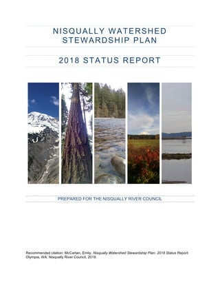
  • 1. NISQUALLY WATERSHED STEWARDSHIP PLAN 2018 STATUS REPORT PREPARED FOR THE NISQUALLY RIVER COUNCIL Recommended citation: McCartan, Emily. Nisqually Watershed Stewardship Plan: 2018 Status Report. Olympia, WA: Nisqually River Council, 2019.
  • 2. Nisqually Watershed Stewardship Plan: 2018 Status Report 2
  • 3. Nisqually Watershed Stewardship Plan: 2018 Status Report 3 TABLE OF CONTENTS Introduction.....................................................................................................................8 Watershed Background ....................................................................................................... 10 Nisqually Watershed Map.................................................................................................... 11 Nisqually River Council Members and Representatives, 2018............................................ 11 Environmental Sustainability: A Viable, Healthy Natural Resource Base ..............12 Goal I: Protect, restore, and enhance ecosystem function............................................... 14 Indicators: ............................................................................................................................ 14 I.1 Prairie lands with a predominance of native species and minimal populations of invasive species.. 14 I.2 Forest lands with a diversity of species and age classes; complexity within stands, and complexity inter- and intra-stand.................................................................................................................................. 16 I.3 Snow and ice lands with sufficient amounts to support healthy hydrologic cycles. ........................... 20 I.4 Alpine lands continue to support diverse biological communities...................................................... 24 I.4 River and stream systems are fully functioning – healthy riparian zones, intact channel migration zones, connected and intact floodplains and wetlands, good water quality, flow regimes that support biological diversity...................................................................................................................................... 25 I.6 **Proposed new indicator: Estuary and delta lands support robust and sustainable habitat for native and recovering species.............................................................................................................................. 37 Goal II: Protect and enhance biological diversity .............................................................. 40 Indicators: ............................................................................................................................ 40 II.1 Harvestable amounts of culturally-important species are present.................................................... 40 II.2 Invasive species are eradicated or managed................................................................................... 46 II.3 Diverse communities of native fish, wildlife, and plants are thriving................................................. 49 II.4 Recovery plans for species listed under the Endangered Species Act are fully implemented......... 50 Goal III: Promote sustainable resource use ....................................................................... 52 Indicators: ............................................................................................................................ 52 III.1 Forests are harvested in a sustainable manner. ............................................................................. 52 III.2 Water usage protects in-stream flows, groundwater recharge areas, surface filtration systems. ... 55 III.3 Sustainable agricultural practices protect soils, water quality, and sensitive habitats..................... 57 III.4 Mineral extraction and associated industries are conducted in a manner that protects water quantity and quality, and air quality, and keeps the ecosystem intact. ...................................................... 62 III.5 Animal densities are within the carrying capacity of the land.......................................................... 64 Goal IV: Facilitate the appreciation, protection, and enhancement of the watershed through education and participation................................................................................... 65 Indicators: ............................................................................................................................ 65 IV.1 Students engaged in actively exploring, monitoring and restoring their watershed. ....................... 65 IV.2 Local landowners and community members are active stewards of their lands and watersheds. .. 68 IV.3 Watershed-based education programs are present in schools throughout the watershed. ........... 70 IV.4 Organizations and businesses throughout the watershed provide visitors and residents access to educational programs and resources. ....................................................................................................... 72 IV.5 Opportunities are provided by various organizations for volunteers to learn and contribute to watershed sustainability............................................................................................................................. 74 Social Sustainability: A community that is healthy, wealthy, resilient, and wise ..78 Goal V: Promote health and wellness in the community .................................................. 80 Indicators: ............................................................................................................................ 80 V.1 Locally grown and produced foods are available and affordable. .................................................... 80 V.3 Disaster Response Plans and Community Emergency Response Teams are developed............... 85 Goal VI: Protect and enhance the network of trails and recreational opportunities for all ages and abilities .................................................................................................................. 87
  • 4. Nisqually Watershed Stewardship Plan: 2018 Status Report 4 Indicators: ............................................................................................................................ 87 VI.1 Individual communities are linked by a network of multi-use trails; trails are sustainable/compatible within the environment............................................................................................................................... 87 VI.2 A diverse assortment of recreational opportunities exists in the watershed.................................... 90 VI.3 The public is aware of, and uses, regional recreational opportunities............................................. 95 Goal VII: Promote local community identities, cultures, arts, and heritage.................... 98 Indicators: ............................................................................................................................ 98 VII.1 Farmers markets, co-ops, and alternative economies exist throughout the watershed. ............... 98 VII.2 Natural and built heritage facilities are protected. .......................................................................... 99 VII.4 Celebrations of watershed events occur throughout the watershed. ........................................... 106 VII.4 Community members are informed, engaged, involved, and interconnected with a sense of local identity. .................................................................................................................................................... 107 Goal VIII: Support fully functioning, integrated communities with the full complement of services ........................................................................................................................... 111 Indicators: .......................................................................................................................... 111 VIII.1 Transportation infrastructure supports public transportation, ride sharing, and alternative fuel vehicles.................................................................................................................................................... 111 VIII.2 Increase access to quality health care. ...................................................................................... 113 VIII.3 Opportunities for formal and informal education exist throughout the watershed....................... 114 VIII.4 **Proposed new indicator: Watershed residents have access to affordable housing and adequate services exist to minimize the environmental, health, and social impacts of homelessness. .................. 116 Economic Sustainability: Increased economic productivity in a sustainable manner.........................................................................................................................118 Goal IX: Promote development of sustainable businesses and built communities..... 120 Indicators: .......................................................................................................................... 120 IX.1 An increase in sustainable manufacturing within the watershed................................................... 120 IX.2 Goods and services are produced within regenerative and/or zero-waste systems. .................... 121 IX.3 Increased investment in natural capital by small and large business owners. .............................. 122 IX.4 Developed areas of the watershed support ecosystem services. ................................................. 123 Goal X: Support sustainable tourism and recreation ...................................................... 125 Indicators: .......................................................................................................................... 125 X.1 An abundance of sustainable recreation opportunities exist within the watershed......................... 125 X.2 A vital agriculture tourism industry exists........................................................................................ 130 X.3 Scenic vistas and viewpoints are protected.................................................................................... 131 X.4 Non-traditional experiential tourism is supported............................................................................ 133 Goal XI: Enhance economic viability of sustainable agriculture, forestry, & fisheries 135 Indicators: .......................................................................................................................... 135 XI.1 Increased opportunities to add value to products in order to maximize economic return for sustainable natural resource industries. .................................................................................................. 135 XI.2 Expansion of economic opportunities for sustainable non-traditional natural resource uses........ 136 XI.3 Infrastructure exists with which to process products locally. ........................................................ 137 Goal XII: Increase market access for watershed-based businesses ............................. 139 Indicators: .......................................................................................................................... 139 XII.1 Watershed marketing program is expanded to include all watershed businesses....................... 139 XII.2 Regional and national recognition of the Nisqually brand. ........................................................... 139 XII.3 Significant value resulting from use of Nisqually brand................................................................ 139 Bibliography................................................................................................................139
  • 5. Nisqually Watershed Stewardship Plan: 2018 Status Report 5 MAPS AND FIGURES MAP I.2.1: Nisqually Watershed Land Use, 2010 ................................................................... 18 MAP I.2.2: Nisqually watershed zoning, 2018......................................................................... 19 MAP I.3.1: Nisqually Glacier, 2015 .......................................................................................... 20 TABLE I.3.1: Change in Extent of Nisqually-Wilson Glaciers, 1896-2015 ............................ 21 MAP I.3.3: Nisqually-Wilson Glaciers, 1896-2015 .................................................................. 21 FIGURE I.3.1: Nisqually Glacier Variation and Retreat .......................................................... 22 FIGURE I.3.2: Snowfall at Paradise (inches) .......................................................................... 22 TABLE I.5.1: Salmon Recovery Program Habitat Initiatives .................................................. 25 MAP I.5.1: Habitat Restoration and Protection Initiatives through 2016 ............................... 29 MAP I.5.2: Assessed Waterbodies in Nisqually Watershed ................................................... 30 TABLE I.5.1: Water Quality Listings in Nisqually Watershed................................................. 30 TABLE I.5.2: Pierce County Water Quality Assessment by Stream ...................................... 34 TABLE I.5.3: Thurston County Water Quality Assessment by Stream.................................. 34 MAP I.5.3: Nisqually Watershed Closures and Instream Flow Rules .................................... 36 TABLE I.6.1: Salmon Recovery Program Habitat Initiatives .................................................. 38 FIGURE I.6.1: Nisqually Delta Restoration Aerial Images ..................................................... 38 TABLE I.6.1: Delta Restoration Monitoring and Research ..................................................... 39 FIGURE II.1.1: Average Annual Runsize for Nisqually Salmonids, 1966-2017 .................... 40 TABLE II.1.1: Anadromous Fish Harvest, Historical*.............................................................. 41 TABLE II.1.2: Nisqually Indian Tribe Salmon Harvest, 2011-2017 ........................................ 41 TABLE II.1.3: Estimated Big Game Population, Historical ..................................................... 42 TABLE II.1.4: Small Game Harvest Totals, Historical ............................................................ 42 FIGURE II.1.1: District 11 Elk Harvest, 2008-2016................................................................. 42 FIGURE II.1.2: District 11 Deer Harvest, 2008-2016.............................................................. 42 FIGURE II.1.3: District 11 Bear Harvest, 2008-2016 .............................................................. 43 FIGURE II.1.4: District 11 Cougar Harvest, 2008-2016.......................................................... 44 FIGURE II.1.5: District 11 Duck Harvest, 2008-2016 ............................................................. 44 MAP II.2.1: Nisqually Knotweed Infestations, 2013 ................................................................ 47 MAP II.2.2: Nisqually Knotweed Treatment Zones, 2007-2012 ............................................. 48 MAP II.2.3: Upper Nisqually Knotweed Control Area, 2019 ................................................... 48 TABLE II.4.1: Status of Listed Plant Species .......................................................................... 50 TABLE III.1.1: Timber harvest by county (Thousand Board Feet, Scribner)......................... 53
  • 6. Nisqually Watershed Stewardship Plan: 2018 Status Report 6 FIGURE III.1.1: Timber harvest by county (Thousand Board Feet, Scribner) ...................... 53 TABLE III.3.1: Farmland Acreage by County .......................................................................... 57 MAP III.3.1: Habitat and Land Use, 1987 ................................................................................ 58 MAP III.3.2: Agricultural Land Zoning, 2006............................................................................ 59 MAP III.3.2: Agricultural Land Zoning, 2016............................................................................ 60 TABLE III.4.1: Surface mining And reclamation sites in Nisqually Watershed ..................... 62 TABLE IV.1.1: NREP Activities, 2017-18................................................................................. 66 TABLE IV.3.1: Eligible and Active Schools in NREP Service Area ....................................... 71 TABLE IV.5.1: Nisqually Stream Stewards Volunteers........................................................... 75 TABLE IV.5.2: Nisqually Land Trust Volunteers ..................................................................... 75 TABLE IV.5.3: Nisqually Reach Nature Center Volunteers.................................................... 75 TABLE IV.5.3: BFJNNWR Volunteers...................................................................................... 76 TABLE IV.5.4: Mount Rainier National Park Volunteers......................................................... 77 FIGURE IV.5.4: Mount Rainier National Park Hours .............................................................. 77 TABLE V.1.1: Food Environment Index by County, 2015 ...................................................... 80 TABLE V.1.2: Local Food Distribution By County, 2007 vs. 2012 ......................................... 81 TABLE V.1.3: Nisqually Indian Tribe Traditional Food Survey .............................................. 82 TABLE V.2.1: Community Health Indicators by County.......................................................... 83 TABLE V.2.2: Human Health Vital Signs ................................................................................. 84 MAP VI.1.1: Trails in Nisqually Watershed.............................................................................. 88 MAP VI.2.1: Recreational Opportunities in the Nisqually Watershed .................................... 91 MAP VI.2.2: Outdoor Recreation and Conservation LandS ................................................... 92 Table VI.2.1: Fishing and boating access sites....................................................................... 93 TABLE VI.3.1: Mount Rainier Annual Visitation ...................................................................... 96 FIGURE VI.3.1: Mount Rainier Annual Visitation.................................................................... 96 TABLE VI.3.2: Billy Frank Jr. Nisqually NWR Annual Visitation (FY Oct. 1-Sept. 30) ......... 97 TABLE VII.2.1: National Register and Washington Heritage Register Sites......................... 99 TABLE VII.2.1: National Register and Washington Heritage Register Sites....................... 101 MAP VII.2.1: Historic and Heritage Register Sites................................................................ 102 MAP VII.5.1: Nisqually Subarea ............................................................................................. 108 MAP VII.5.2: Upper Nisqually Valley...................................................................................... 109 TABLE VIII.2.1: Providers and Access to Care by County................................................... 113 TABLE VIII.2.2: Percent of population facing cost barriers to health care.......................... 113
  • 7. Nisqually Watershed Stewardship Plan: 2018 Status Report 7 TABLE VIII.3.1: Public School District Demographic Data................................................... 114 TABLE VIII.3.2: Educational Attainment By County.............................................................. 115 TABLE VIII.4.1: Housing Insecurity by County...................................................................... 116 FIGURE VIII.4.1: Homeless Students Enrolled in Major Watershed Districts..................... 117 MAP X.1.1: Recreational Destinations in the Nisqually Watershed..................................... 125 TABLE X.1.1: Recreation Access Sites Along Nisqually River Mainstem, 1987-2018....... 126 TABLE X.1.2: Nisqually Land Trust Protected Areas ........................................................... 127 TABLE X.1.3: Alder Lake Campground Use.......................................................................... 128
  • 8. Nisqually Watershed Stewardship Plan: 2018 Status Report 8 INTRODUCTION The Nisqually River Council (NRC) was formed in 1987 to implement the Nisqually Watershed Management Plan, a document drafted by an interagency task force by legislative request to provide guidance for stewardship of the Nisqually River. The 1987 Watershed Management Plan focused on the river itself and land within 300 feet of the banks. It outlined management principles intended to balance the rights of private landholders, statewide public interests, public access to the river, and fish and wildlife protection. Today, with 24 member agencies representing federal, state, local, and tribal governments and a Citizens Advisory Committee, the NRC has evolved to adopt a whole-watershed approach, recognizing the interconnected impacts that regional development, population growth, and community health and economic stability have on the long-term sustainability of the watershed’s habitat, water, and natural resources. The Council’s mission is to create sustainability in the Nisqually Watershed for current and future generations by developing a common culture of environmental, social, and economic balance. In 2011, the NRC produced an update to the 1987 Management Plan titled the Nisqually Watershed Stewardship Plan (NWSP). The NWSP created the NRC’s current mission, guiding principles, and organizational structure. It also established 12 long-term goals for watershed sustainability, including social, economic, and environmental measures. As the NRC enters into its fourth decade, this Status Report documents the watershed’s health on measures for each of the 12 NWSP goals. It celebrates the remarkable successes in restoration, recreation planning, and innovative resource management achieved under NRC leadership over the last 30 years. Where necessary, it also identifies challenges, concerns, and gaps in existing data to help guide future study. This Report establishes a baseline of data about the watershed and its communities to inform future strategic planning for long-term sustainability projects. This Report was developed by the NWSP Report Work Group: Matt Curtis (Washington State Department of Fish & Wildlife), Chris Ellings (Nisqually Indian Tribe), Scott Groce (Pierce County), Justin Hall (Nisqually River Foundation), Ed Kenney (NRC Citizens’ Advisory Committee), Emily McCartan (Nisqually River Foundation), and George Walter (Nisqually Indian Tribe). The Nisqually River Council and Citizens Advisory Committee reviewed a draft and offered additional contributions in July 2018. Over the next year, the NRC is charged with identifying priorities for further study, discussion, and implementation, and laying out an actionable plan to move those priorities forward. Several key findings emerged in the writing of this Report, which should frame NRC’s next steps: 1. The Nisqually Watershed is a unique site of collaboration and recovery. Projects undertaken here in the last decade have taken innovative steps to improve water quality and quantity, protect existing habitat, recover damaged habitat, and plan for future progress: a. 76% of the mainstem Nisqually River in permanently protected status; b. Estuary restoration reconnecting 762 acres of critical tidal habitat to endangered salmon and other species; c. Nisqually Community Forest initiative, managing timberland with sustainable harvest practices to improve stream and forest health;
  • 9. Nisqually Watershed Stewardship Plan: 2018 Status Report 9 d. Ohop Valley Restoration, remeandering over two miles of Ohop Creek and restoring 475 acres of riparian forest and floodplain to provide high-quality spawning habitat for salmon; e. Nisqually River Education Project, involving at least 1,000 students and community members in citizen science, conservation work, and stewardship education every year. These projects are all products of collaborative partnerships between local, state, tribal, federal, and community stakeholders. In addition to sustaining one of the most protected watersheds in Washington State, they have regional significance in expanding the scientific research base, providing planning and implementation models, and delivering real-time ecological benefits for Puget Sound. 2. Relationships and communication are key. The Nisqually River Council is the oldest watershed council in the American West, and has provided a forum for education, discussion, and problem-solving for watershed leaders and community stakeholders for over 30 years. The relationships and trust between NRC members are at the foundation of the watershed’s accomplishments: in conservation and restoration; in pursuing voluntary rather than regulatory strategies for sustainable resource management; and in responding to emergent issues whether they come from community concerns or external mandates. The clear lesson of the Nisqually Watershed model is that investing in relationships, both institutional and interpersonal, pays tremendous dividends in meeting long-term goals and adapting to new challenges. 3. Further study, focusing especially on geospatial data analysis, can yield important big-picture information but requires significantly more investment. While collaboration between NRC members and other community stakeholders has been consistently strong, a lack of reliable and sufficient funding has been an ongoing challenge in addressing long-term data collection and planning for big-picture watershed management projects. This report notes knowledge gaps on many NWSP indicators. In some cases, these gaps reflect a lack of publicly available data, and a need for baseline, ground-level studies. In many other cases, however, data is available from a variety of unconsolidated sources, but making it relevant for watershed-level planning will require significant original mapping and analysis. Because of the investment needed to do this work, the NRC will need prioritize information needs and how best to fulfill them. 4. The future will be different, demanding both adaptive metrics and strategies and affirmation of our underlying values. This report offers a snapshot in time, reflecting the goals and indicators laid out in the 2011 NWSP. The results point towards important across-the-board trends, particularly the accelerating pressures of climate change and increasing population, which will significantly impact progress towards the NWSP’s goals in coming years. The interconnections of these trends and impacts, however, are not the primary focus of this report. Focusing on the individual indicators may miss connections or conflicts among them as the watershed’s environmental, social, and economic pillars respond differently to these emerging challenges. The report does propose adding several new indicators and removing or combining others, in an effort to keep the values of the twelve underlying goals aligned with current research and conditions. This kind of adaptation will be helpful to consider in future status reports, as well as indicating how NWSP goals should help guide reporting, planning, and action around specific climate, development, and conservation issues.
  • 10. Nisqually Watershed Stewardship Plan: 2018 Status Report 10 WATERSHED BACKGROUND The Nisqually Watershed (USGS Hydrologic Unit [HCU] 17110015, Washington State Water Resource Inventory Area [WRIA] 11) is located in western Washington State, encompassing parts of Thurston, Lewis, and Pierce Counties approximately 10 miles east of Olympia, WA. The watershed includes the communities of Ashford, Elbe, Mineral, Eatonville, McKenna, Roy, Yelm, Fort Lewis, and portions of Graham, Lacey, DuPont, and Rainier. Flowing 78 miles from its source at the Nisqually Glacier on Mount Rainier to its delta at the Billy Frank Jr. Nisqually National Wildlife Refuge, the Nisqually is a direct link between the summit snows of Mount Rainier and the marine waters of Puget Sound. The Nisqually Watershed drains an area of 768 square miles in the southern Puget Sound basin. The River is supplied by glacial outflow and snowmelt from the Nisqually, Kautz, and Wilson Glaciers and surrounding snowfields on Mount Rainier. The watershed encompasses a broad range of land uses and jurisdictions: rural communities; national and state parks and forests; public and private timberlands; municipal hydropower dams and reservoirs; farmlands; the Nisqually Indian Reservation; Joint Base Lewis-McChord, and the Billy Frank Jr. Nisqually National Wildlife Refuge (BFJNNWR). 58% of the watershed is in Pierce County, 25% in Thurston County, and 17% in Lewis County. It is the only Puget Sound watershed with its headwaters in a national park and its estuary in a national wildlife refuge. The Nisqually River is the major tributary to southern Puget Sound, providing fifty percent of the freshwater flowing into the Sound below the Tacoma Narrows. Most tributaries to the Upper Nisqually River are typical mountain streams producing falls, cascades, and rapids with large rock or boulder stream bottoms. Most tributaries are surrounded with dense cover, usually deciduous trees and underbrush with some conifers. Streams in the upper reaches of the watershed tend to be lower-order tributaries (non-fish bearing and seasonal). The primary salmon-bearing streams in the Nisqually watershed are the mainstem Nisqually River, the Mashel River, Ohop Creek, and Muck Creek. The tributary streams flow across the glacial outwash plains and sometimes lose flow to the underlying aquifer. The Nisqually River basin is one of the least developed watersheds in south Puget Sound. In the last 10 years, however, the central watershed has experienced significant population growth in communities around Joint Base Lewis-McChord. Significant development has largely occurred in the lower reaches and elevations of the watershed. Habitat degradation, stemming from hydroelectric dams, forest practices, agricultural development and urbanization was identified as one of the primary reasons for the sharp decline of Nisqually Chinook salmon and steelhead trout, which are listed as threatened under the federal Endangered Species Act. Salmon recovery is a central concern for both water quality and quantity in the watershed, as a cultural and economic resource critical to the Nisqually Indian Tribe and as a keystone species essential to the ecosystem functions of the watershed.
  • 11. Nisqually Watershed Stewardship Plan: 2018 Status Report 11 NISQUALLY WATERSHED MAP NISQUALLY RIVER COUNCIL MEMBERS AND REPRESENTATIVES, 2018 Nisqually Indian Tribe City of Roy City of Yelm Town of Eatonville Lewis County Pierce County Thurston County Puget Sound Partnership Tacoma Public Utilities University of Washington Pack Forest U.S. Department of Defense, Joint Base Lewis-McChord U.S. Fish and Wildlife Service, Billy Frank Jr. Nisqually National Wildlife Refuge U.S. Forest Service, Gifford Pinchot National Forest Pierce Conservation District Thurston Conservation District Lewis Conservation District Washington State Secretary of State Washington State Department of Commerce Washington State Department of Agriculture Washington State Department of Ecology Washington State Department of Fish & Wildlife Washington State Department of Natural Resources Washington State Department of Transportation Washington State Parks and Recreation
  • 12. Nisqually Watershed Stewardship Plan: 2018 Status Report 12
  • 13. Nisqually Watershed Stewardship Plan: 2018 Status Report 13 ENVIRONMENTAL SUSTAINABILITY: A VIABLE, HEALTHY NATURAL RESOURCE BASE The natural resources of the Nisqually watershed – the forests, the fish and wildlife, the water, and the agricultural lands – co-exist with the community and economy it supports. The natural resources of the watershed are finite and can easily be spoiled. With the looming pressures of population growth, we must redouble our efforts to leave a legacy of one of the healthiest and unspoiled watersheds in the region. Goals: I. Protect, restore, and enhance ecosystem function. II. Protect and enhance biological diversity. III. Promote sustainable resource use. IV. Facilitate the appreciation, protection, and enhancement of the watershed through education and participation.
  • 14. Nisqually Watershed Stewardship Plan: 2018 Status Report 14 GOAL I: PROTECT, RESTORE, AND ENHANCE ECOSYSTEM FUNCTION Viable, resilient amounts of all watershed ecosystems are present and providing ecosystem services. INDICATORS: I.1 Prairie lands with a predominance of native species and minimal populations of invasive species. The extent of native prairie lands was not mapped precisely in the 1987 Nisqually River Management Plan. Throughout the South Sound region, over 97% of historic native prairie habitat has been lost to development and land use practices.1 14,000 acres of remaining South Sound prairie are within Joint Base Lewis-McChord (JBLM). The artillery impact area, part of the Nisqually Watershed, is one of the largest prairie habitats remaining in the region, and is managed under the JBLM Sustainability Plan to maintain habitat, encourage older oak and ponderosa forest growth, and preserve endangered species while accomplishing military readiness objectives.2 The Bald Hills Natural Area Preserve, managed by Washington’s Department of Natural Resources (DNR), is a 314-acre area including prairielands and white oak woodlands.3 Prairie lands in the Yelm area have been significantly impacted by the effects of development and fire suppression, including habitat fragmentation, impervious surface cover, and forest encroachment.4 Prairies are dependent on active management, including regular burning, to control invasive species, Douglas fir encroachment, and rejuvenate native grassland species. Recovering native grasslands where invasives have taken hold is often a slow process requiring years of ongoing maintenance (burns, manual removal, and herbicide application).5 Invasive plant species of major concern in Nisqually prairielands include non-native grasses (tall oat grass, colonial bentgrass, sweet vernal grass, quackgrass), Scots broom, ox-eye daisy, hairy cats ear, English plantain, peppergrass, and introduced annuals. Protections are also needed for state and federally listed species of concern in prairie habitats, including Western gray squirrels, Taylor’s Checkerspot 1 Nisqually River Task Force 1987, 76. 2 Gordon 2008. 3 Washington Department of Natural Resources 2018. 4 U.S. Fish & Wildlife Service 2018. 5 Rook 2011. AT A GLANCE: PRAIRIE LANDS DATA AVAILABILITY Grasslands geodata available from DNR. Ground-level surveys from JBLM and other partners. PARTNERS AND INITIATIVES Joint-Base Lewis McChord South Sound Prairies and Cascadia Prairie-Oak Partnership Mazama Pocket Gopher Habitat Conservation Plans CHALLENGES Invasive species Habitat loss and fragmentation for endangered species High-impact maintenance needs (controlled burns
  • 15. Nisqually Watershed Stewardship Plan: 2018 Status Report 15 butterflies, streaked horn larks, and Mazama pocket gophers. A Habitat Conservation Plan for the Yelm subspecies of Mazama Pocket Gopher is under review by the U.S. Fish & Wildlife Service as of August 2018.6 Funding and collaboration between agencies and private landowners for prairie recovery and maintenance is essential to achieving this goal. The Center for Natural Lands Management (CNLM), a prairie conservation organization, works with private landowners to adopt prairie- friendly practices on their property.7 CNLM also partners extensively with JBLM on prairie habitat and species maintenance. GOAL I.1: NRC ACTION OPTIONS • Work with partners to identify needs, challenges, and opportunities to protect, recover, and/or invest in prairie habitat. • Continue to monitor status. • Further study current status of prairie lands. 6 U.S. Fish and Wildlife Service 2018. 7 Center for Natural Lands Management 2017.
  • 16. Nisqually Watershed Stewardship Plan: 2018 Status Report 16 I.2 Forest lands with a diversity of species and age classes; complexity within stands, and complexity inter- and intra-stand. The Nisqually Watershed remains abundantly forested compared to more-developed neighboring basins. Approximately 196,000 acres are zoned as forestland and managed either as private commercial, state, or federal timberlands. Up to an additional 100,000 acres of the watershed are forested, including numerous small private commercial or non-commercial forestlands as well as parks and protected areas. A comprehensive survey of forest lands has not been conducted yet, but would offer clearer details about land use patterns and changes over time. Map I.2.1 shows land use classifications in the Nisqually Watershed based on 2010 data from the Department of Ecology at a relatively fine resolution, indicating forest cover in areas of mixed use. Map I.2.2 shows land use based on several different agency data sets from 2018 at a more general scale, capturing zoned forestlands in commercial or public forests (the difference between maps reflects this alternate data presentation rather than significant loss of forestland in the central watershed). The largest private timberland holders in the watershed are Weyerhaeuser and Hancock Timber. Average parcel size is decreasing for small privately owned forestland, as family-owned forests undergoing generational ownership transitions are more likely to be converted or subdivided.8 Clear-cutting, which continues to be the primary method of timber harvest in the watershed, results in habitat fragmentation and monoculture as forests reemerge, both of which diminish ecosystem function and biodiversity (see Goal II.3).9 Likewise, climate change presents a number of vulnerabilities for the watershed’s forests, including potential loss of all subalpine habitat, reduced range for Douglas fir in the lowlands, insect and invasive species infestations, and wildfire.10 In 2014, the Nisqually River Council published a Forest and Water Climate Adaptation Plan identifying vulnerabilities and strategies for Nisqually forest lands as climate change accelerates. The plan identified a need for a holistic mapping and technical analysis effort to survey the status of all commercial, public, and protected forestlands in the watershed. It also recommended initiating workshops with major forestry landowners and other stakeholders to discuss cooperative management practices to promote climate resilience. The Nisqually Community Forest (see Goal III.1) has conducted some of these studies and developed detailed 8 Campbell Waddell and Gray 2010, 16. 9 Greene 2014, 23. 10 Greene 2014, 28. AT A GLANCE: FOREST LANDS DATA AVAILABILITY Comprehensive analysis would require compilation of many data sources. Approximately 300,000 acres total in 2018. PARTNERS AND INITIATIVES Nisqually Community Forest Nisqually Land Trust Nisqually Forest and Water Climate Adaptation Plan CHALLENGES Resources to conduct thorough GIS analysis Decreasing parcel size for small private timber holdings Commercial clear-cutting and harvest rotation patterns Climate change
  • 17. Nisqually Watershed Stewardship Plan: 2018 Status Report 17 hydrologic models based on its first target areas in the upper Mashel basin, but a major effort to survey and analyze all forest lands in the Nisqually watershed has not been undertaken.11 GOAL I.2: NRC ACTION OPTIONS • Implement recommended strategies to improve forest resiliency from 2014 Nisqually Climate Adaptation Plan. • Identify actions supporting Nisqually Land Trust and Nisqually Community Forest initiatives. • Continue to monitor status. • Further study status of forest lands, including detailed mapping. 11 Hall 2018.
  • 18. Nisqually Watershed Stewardship Plan: 2018 Status Report 18 MAP I.2.1: NISQUALLY WATERSHED LAND USE, 2010 Source: WA Department of Ecology12 12 Greene 2014, 25.
  • 19. Nisqually Watershed Stewardship Plan: 2018 Status Report 19 MAP I.2.2: NISQUALLY WATERSHED ZONING, 2018 Source: Nisqually Planning Unit13 13 Nisqually Watershed Planning Unit 2019. ZoningDesignation Area (acres)ZoningDesignation Area (acres) ActiveOpenSpace/Recreation41195.3MineralResourceArea617.5 AgriculturalArea15286.9NaturalPreservation/Conservation5288.5 ForestLands196134.0PublicRightofWay147.8 Industrial406.7RightofWay5404.3 IntensiveRural3420.3RuralCharacterResidential147725.0 IntensiveUrban1468.1Undesignated560.9 Military60031.2UrbanCharacterResidential6439.3 Water7239.2
  • 20. Nisqually Watershed Stewardship Plan: 2018 Status Report 20 I.3 Snow and ice lands with sufficient amounts to support healthy hydrologic cycles. The Nisqually drainage basin on Mount Rainier includes the Nisqually, Wilson, and Van Trump Glaciers and the permanent Muir Snowfield, a total of approximately 3 square miles.14 The Nisqually-Wilson Glacier complex has been extensively monitored since the establishment of the Park, with studies of glacier mass balance conducted by the NPS North Coast and Cascades Network of the National Park Service since 2003. Climate change is rapidly causing loss of snow and ice lands. The Nisqually Glacier lost a cumulative net 58.2 million cubic meters in ice mass between 2002 and 2011.15 MAP I.3.1: NISQUALLY GLACIER, 2015 Source: Mount Rainier Geology & Weather16 14 S. R. Beason Stream stage stream temperature and air temperature for the Nisqually River at Longmire: Water year 2014 2017, 3. 15 Riedel 2015, 13. 16 S. R. Beason Change in glacial extent at Mount Rainier National Park from 1896-2015 2017, A-14. AT A GLANCE: SNOW AND ICE LANDS DATA AVAILABILITY Tracking done for all of Mount Rainier by National Park Service. Approximately 3.02 square miles (1,933 acres) in 2018. morageology.com PARTNERS AND INITIATIVES National Park Service Glacial Monitoring Program CHALLENGES Climate change: • Glacial ice loss and stagnation • Precipitation shift • Declining snowpack • Increased likelihood of glacial outburst floods, debris flows, and higher peak flows
  • 21. Nisqually Watershed Stewardship Plan: 2018 Status Report 21 TABLE I.3.1: CHANGE IN EXTENT OF NISQUALLY-WILSON GLACIERS, 1896-2015 Source: Mount Rainier Geology & Weather17 1896 1913 1971 1994 2009 2015 Area, mi2 3.87 2.54 2.34 2.41 2.32 1.62 Area, km2 10.03 6.59 6.07 6.25 6.00 4.19 MAP I.3.3: NISQUALLY-WILSON GLACIERS, 1896-2015 Source: Mount Rainier Geology & Weather17 17 S. R. Beason Change in glacial extent at Mount Rainier National Park from 1896-2015 2017.
  • 22. Nisqually Watershed Stewardship Plan: 2018 Status Report 22 FIGURE I.3.1: NISQUALLY GLACIER VARIATION AND RETREAT Source: Mount Rainier National Park18 Over the same period, the glacier contributed between 12-33% of total runoff for summer streamflow in the Nisqually River.19 Winter snowpack at Paradise is also a major source of snowmelt runoff in the upper watershed, with snowpack water equivalent totaling 78.9 in a 2016 analysis by the Washington State Department of Health – the highest of any watershed in the state.20 Mean average annual precipitation throughout the watershed was 103 inches in 2011.21 FIGURE I.3.2: SNOWFALL AT PARADISE (INCHES) Source: National Park Service22 18 Lofgren 2015. 19 Riedel 2015 14. 20 Washington State Department of Health 2016. 21 S. R. Beason Change in glacial extent at Mount Rainier National Park from 1896-2015 2017, 3. 22 Mount Rainier National Park 2018. 1840 terminus 1905 terminus 1936 terminus 1951 terminus (stagnant) 1956 terminus 1961 terminus 1974 terminus 1997 terminus The Nisqually retreated 700 feet since 2003, S. Lofgren, NPS. Glacier Variation and Retreat National Park Service US Department of the Interior Mount Rainier National Park 0 200 400 600 800 1000 1200 1954-55 1956-57 1958-59 1960-61 1962-63 1964-65 1966-67 1968-69 1970-71 1972-73 1974-75 1976-77 1978-79 1980-81 1982-83 1984-85 1986-87 1988-89 1990-91 1992-93 1994-95 1996-97 1998-99 2000-01 2002-03 2004-05 2006-07 2008-09 2010-11 2012-13 2014-15 2016-17
  • 23. Nisqually Watershed Stewardship Plan: 2018 Status Report 23 Climate change is rapidly impacting glacial and hydrologic processes, with accelerating glacial ice loss and signs of stagnation on the Nisqually Glacier. Peak flows on the upper Nisqually River have also increased substantially since the 1970s, from 387 m³/s in 1972 to 626 m³/s in 2009. Glacier loss, stagnation, and precipitation shifts are associated with increased glacial outburst floods and debris flows, as well as greater sediment production.23 Seasonal precipitation shifts are likely to ultimately shift the hydrologic calendar of the Nisqually, with peak snowmelts predicted to occur 4-9 weeks earlier by the 2080s, causing higher winter flows and lower summer flows.24 Research is just beginning on data collection and modeling to predict the effects of these changes on hydrologic processes in the Nisqually. GOAL I.3: NRC ACTION OPTIONS • Continue to monitor status. • Further study the long-term implications of changing hydrologic input from snow and ice lands. • Develop water storage, flood protection, or other hazard mitigation strategies to address long-term implications of climate change for glacial runoff in the watershed. 23 Beason et al. 2017. 24 Greene 2014, 26.
  • 24. Nisqually Watershed Stewardship Plan: 2018 Status Report 24 I.4 Alpine lands continue to support diverse biological communities. Alpine and subalpine lands in the watershed encompass just under 10 square miles (4.27 alpine and 4.89 subalpine), all within Mount Rainier National Park.25 Human activities at Paradise, which remains the Park’s most highly trafficked area, caused significant degradation to subalpine meadowlands over much of the 20th century. In 1986, the Park Service began a major long-term restoration initiative to vegetate 913 sites (516,709 square feet) on 12 acres in Paradise Meadows and conduct visitor education to discourage off-trail hiking in sensitive areas.26 By 1996, 90 sites (71,461 square feet, 13%) had begun restoration work and 15 (6,681 square feet, 1.3%) were determined fully restored.27 The Park’s onsite greenhouse produced around 85,000 plants in 2011, of which 30,000 were planted at Paradise by volunteers and NPS staff.28 Alpine zones are among the most vulnerable to climate change effects, including encroaching tree establishment and grass cover permitted by decreased winter snowpack and warmer, drier summers. In 2012, the NPS’s North Coast and Cascades Network adopted a monitoring protocol to follow long-term climate-driven changes in alpine and sub-alpine vegetation at Mt. Rainier.29 Further reporting has not been published, but this will supply a longitudinal dataset to assess the watershed’s alpine region going forward. In its 2016 Exotic Plant Inventory at Mt. Rainier, the National Park Service found lower exotic plant cover compared to North Cascades and Olympic National Parks, likely due partially to the higher elevations where native plants are better adapted to survive, and in part to Mount Rainier’s active management program to control exotics.30 GOAL I.4: NRC ACTION OPTIONS • Continue to monitor status. • Work with partners to produce additional study of alpine and subalpine lands in the watershed. 25 S. R. Beason Change in glacial extent at Mount Rainier National Park from 1896-2015 2017 3. 26 Rochefort & Gibbons 1992. 27 Society for Ecological Restoration. 28 Arnsen 2017. 29 Rochefort Bivin Boetsch Acker & Whiteaker 2015. 30 Rochefort Bivin Conquest Acker & Kurth 2016. AT A GLANCE: ALPINE LANDS DATA AVAILABILITY 2017 Extent: 9.16 square miles; 5,862 acres (3,129 sub-alpine and 2,733 alpine) PARTNERS AND INITIATIVES National Park Service Climate Monitoring Paradise Meadow restoration (1986-ongoing) CHALLENGES Invasive species Climate change
  • 25. Nisqually Watershed Stewardship Plan: 2018 Status Report 25 I.4 River and stream systems are fully functioning – healthy riparian zones, intact channel migration zones, connected and intact floodplains and wetlands, good water quality, flow regimes that support biological diversity. Riparian Habitat Protection and Restoration The watershed has benefitted from significant restoration work over the three decades since the initial 1987 plan. Between conservation easements, publicly held lands, and Nisqually Land Trust and Community Forest acquisitions, nearly 76% of the Nisqually mainstem shoreline is now permanently protected from further development.31 Since 1994, the Nisqually Salmon Recovery Lead Entity program at the Nisqually Indian Tribe has worked with the state Salmon Recovery Office, the NRC and many partners to implement 134 planning, acquisition, restoration, and monitoring projects in key riparian zones targeting the estuary, mainstem, Mashel and Ohop basins, and numerous small tributaries. 91 projects have been completed as of 2018, with 43 currently active and an additional 58 proposed, conceptual, or dormant (project totals are listed in Table I.5.1, with estuary-related projects in Table I.6.1 below). The NRC approves the Lead Entity’s Four-Year Work Plan each year, providing input and oversight for habitat recovery. The Lead Entity is currently developing a habitat ranking system to track and prioritize projects based on their impact on restoring ecosystem functions that will support long- term viable salmon populations. The implementation metrics for the Habitat Ranking Initiative offer benchmarks for tracking this NWSP indicator. TABLE I.5.1: SALMON RECOVERY PROGRAM HABITAT INITIATIVES Source: Washington State Recreation and Conservation Office, 201832 Name Status Cost Start End Mainstem Nisqually Restoration and Protection Active $6,955,000 1996 2020 Nisqually River Riparian Project Completed $129,223 1998 2001 Browder Property Acquisition Completed $120,000 1999 1999 North Powell Complex Riparian Restoration Completed $179,753 2000 2014 Mosman Shoreline Acquisition Completed $142,843 2000 2000 31 Greene 2014. 32 Washington State Recreation and Conservation Office 2018. AT A GLANCE: RIPARIAN SYSTEMS DATA AVAILABILITY Extensive documentation of ESA- bearing streams with ongoing restoration work Understudied prairie basins PARTNERS AND INITIATIVES Salmon Recovery Habitat Restoration Initiatives Water quality monitoring (Ecology, Thurston, and Pierce Counties) CHALLENGES • Self-sustaining ESA salmonid habitat • Water quality (McAllister, Lynch, Ohop, Midway, and Twenty-Five Mile creeks) • Summer instream flows and temperatures
  • 26. Nisqually Watershed Stewardship Plan: 2018 Status Report 26 Wilcox Flats - Phase 1 Completed $206,544 2000 2004 Browder Property Restoration Completed $10,000 2000 2000 Collins/Bartlett Shoreline Acquisition Completed $178,385 2001 2005 Nisqually R@ Old Pacific Hwy Off-Channel Completed $55,280 2001 2001 Green Crow Shoreline Acquisition Completed $200,912 2002 2002 Thomsen Fencing/Riparian Planting Completed $73,196 2002 2006 Nisqually River Shoreline Protection Completed $500,000 2003 2007 Miller Shoreline Protection Completed $248,731 2005 2006 Wilcox Flats Mainstem & Off-Channel Restoration Completed $200,000 2006 2015 Kist Shoreline Acquisition Completed $327,190 2006 2008 Elledge Shoreline Protection Completed $411,745 2007 2007 South Wilcox Flats Riparian Restoration - Phase I Completed $15,000 2008 2008 Nisqually Pines Culvert Replacement Completed $25,000 2008 2009 Mainstem Nisq LWD Assess. & Restoration Plan Dormant $135,000 2008 2014 Yelm-McKenna Riparian Restoration Completed $75,000 2008 2015 Manke Shoreline Acquisition Completed $0 2008 2009 Tatrimima Shoreline Protection Completed $372,577 2009 2010 Wilcox Farm Floodplain Restoration Design Active $6,000,000 2010 2020 Thurston Ridge Boundary Protection Completed $20,000 2010 2015 South Wilcox Flats Riparian Restoration - Phase II Completed $85,000 2010 2015 Peissner Upland Forest Restoration Completed $20,000 2010 2015 Yelm Shoreline Protection Completed $180,000 2010 2011 Lower Nisqually Side-channel project Conceptual $4,000,000 2010 2020 Riverbend Logjam Project Conceptual $1,500,000 2010 2014 Tanwax Nisqually Confluence Acquisition Completed $183,754 2010 2011 Yelm - Lower Reach Restoration Completed $30,000 2011 2015 North Yelm Riparian Restoration Active $35,000 2011 2016 McKenna 94th Ave Riparian Restoration Completed $8,000 2011 2015 Thurston Ridge Riparian Restoration Completed $60,000 2011 2015 Nisqually Whitewater Reach Protection - East Shoreline Conceptual $360,000 2011 2015 Middle Nisq Floodplain Protection & Restoration - S Shoreline Conceptual $420,000 2011 2015 McKenna Reach Protection and Rest’n - RM 24 Proposed $622,189 2012 2019 Middle Nisqually Riparian Enhancement Completed $47,474 2012 2017 LOTT Acquisition Completed $87,000 2012 2014 Mainstem Nisqually Riparian Enhancement Conceptual $500,000 2014 2020 Whitewater JBLM Riparian Restoration Conceptual $0 2014 2017 Whitewater North Yelm Riparian Restoration Dormant $0 2014 2016 Salmon Escapement/Comp above Centralia Dam Active $480,000 2015 2020 McKenna Area Small Lot Acquisition Proposed $279,250 2015 2020 Whitewater Reach Protection Project Active $397,200 2016 2020 Wilcox Reach - North Shoreline Protection Active $1,430,900 2016 2021 Nisqually River Protection Planning Completed $52,000 2016 2017 Wilcox Reach - Small Lots Acquisition Active $322,394 2017 2020 Nisqually River Protection - Lower Reach Conceptual $60,000 2018 2021
  • 27. Nisqually Watershed Stewardship Plan: 2018 Status Report 27 Lower Nisqually Mainstem, McAllister Creek Acquisition Conceptual $3,000,000 Nisqually Mainstem Off-Channel Restoration - Feasibility Conceptual $93,000 M Nisq Floodplain Protect. & Rest’n - E Shoreline Conceptual $680,000 Wilcox Reach Riparian Restoration Conceptual $152,000 Mashel River Restoration and Protection Active $3,079,510 2000 2020 Nisqually Mashel - Phase 6 Completed $1,215,994 2001 2004 Mashel Eatonville Restoration Assessment Phase I Completed $106,221 2002 2006 Lower Mashel Enhancement Project Completed $128,586 2002 2006 Weyco Mashel Shoreline Acquisition Completed $632,502 2003 2004 Mashel Restoration Project Completed $434,687 2004 2008 Boxcar Canyon Acquisition Completed $700,000 2004 2006 Mashel Eatonville Restoration Assess. Phase II Completed $72,657 2007 2009 Coburg Tree Farm - Kronis Creek - R3 Completed $46,010 2007 2008 Mashel Shoreline Protection - Phase 1 Completed $663,114 2008 2011 Mashel Monitoring Plan Conceptual $190,000 2008 2018 Mashel Riparian Habitat Acq & Protect Completed $1,689,510 2009 2011 Mashel Eatonville Restoration Project Phase 2 Completed $1,381,289 2009 2011 Mashel Eatonville Restoration Phase III Active $1,400,000 2009 2019 Middle Mashel Protection Project Completed $295,000 2010 2012 Mashel Shoreline Protection Phase II Completed $470,508 2011 2013 Lower Mashel River Riparian Enhancement Dormant $10,000 2012 2014 Mashel Eatonville Shoreline Riparian Enhancement Completed $110,000 2013 2015 Mashel Shoreline Protection-3 Active $125,275 2014 2017 Busy Wild Creek Protection Active $6,989,000 2014 2020 Busy Wild Creek Protection Planning Completed $23,000 2014 2016 Mashel Shoreline Protection Phase IV Active $873,500 2016 2020 Mashel Eatonville Phase III Cons. Easement Dormant $152,200 2016 2020 Middle Mashel Protection Phase II Conceptual $6,500,000 2017 2021 Busy Wild Protection Phase II Active $1,300,000 2017 2021 Ohop Creek Restoration and Protection Active $10,740,000 2000 2020 Grauwen Ohop Creek Acquisition Completed $214,500 2001 2002 Ohop Creek Salmon Habitat Acquisition Completed $100,555 2002 2002 Ohop Restoration Assessment Phase II Completed $328,000 2002 2006 Middle Ohop Litzenberger Revegetation Project Completed $68,890 2004 2006 Lower Ohop Creek Restoration, Phase 1 Completed $1,206,261 2006 2011 Lower Ohop Creek Restoration Phase II Completed $2,700,000 2007 2011 Ohop Monitoring Plan Dev. & Implementation Conceptual $191,000 2008 2021 Lower Ohop Upland Restoration Active $120,000 2010 2020 Eatonville Stormwater Reduction Project Conceptual $5,000,000 2010 2012 Burwash Ohop Acquisition Completed $1,010,000 2011 2016 Eatonville Stormwater Planning Completed $140,000 2011 2014 Lower Ohop Creek Acquisition and Restoration Completed $235,000 2012 2015 Lower Ohop Restoration Ph III Completed $1,392,029 2013 2017
  • 28. Nisqually Watershed Stewardship Plan: 2018 Status Report 28 Upper Ohop Valley Protection Completed $295,800 2014 2017 Middle Ohop Protection Phase 1 Active $480,000 2014 2017 Lower Ohop "Acquisition for Restoration" Planning Active $22,000 2016 2020 Middle Ohop Protection Ph II Proposed $257,988 2017 2021 Middle Ohop Protection Phase III Active $233,153 2017 2020 Upper Ohop Phase II - Protection and Restoration Proposed $219,162 2017 2021 Lower Ohop Protection and Stewardship Proposed $553,169 2018 2022 Lower/Middle Ohop Revegetation Project Conceptual $150,000 Lower Ohop Valley Restoration - Phase IV Conceptual $0 Small Tributary Restoration and Protection Active $1,668,000 1996 2020 Independent Projects on small tributaries Active $1,046,000 1996 2020 Horn Creek Restoration Projects Proposed $426,000 2000 2020 Muck Lake Salmon Habitat Restoration Completed $120,000 2000 2003 Powell Creek Restoration and Protection Proposed $100,000 2000 2020 Muck Creek Enhancement at Exeter Springs Completed $0 2001 2011 Muck Creek Spawning Chanel Construction Completed $0 2001 2001 Muck Creek Riparian Assessment Completed $0 2002 2002 Lower Yelm Restoration Project Completed $115,480 2002 2006 Muck Creek Restoration: Last Piece of the Puzzle Completed $38,200 2003 2004 Lower Tanwax Creek Restoration Proposed $96,000 2004 2020 Horn Creek Riparian Planting Completed $7,415 2005 2007 Red Salmon/Washburn Creek Protect. & Rest’n Active $340,000 2006 2016 Red Salmon Creek Watershed Restoration Completed $110,000 2006 2010 Elledge- McKenna Cr - R3 Completed $58,312 2006 2007 Youngblood- Powell Creek R6 Completed $78,700 2008 2010 Nisqually/Powell Protection &Restoration Completed $1,296,566 2008 2011 Powell Creek Watershed Restoration Dormant $300,000 2009 2011 Chaffee- Lackamas Creek R6 Completed $119,384 2009 2009 Lower Lacamas Creek Riparian Restoration Dormant $0 2010 2020 North Fork Muck Creek Restoration Dormant $0 2010 2020 South Muck Creek Restoration Dormant $0 2010 2020 Red Salmon Creek Headwaters Completed $60,000 2010 2016 Upper McKenna Creek culvert project Dormant $0 2010 2012 Powell Wetland Protection Completed $73,584 2012 2015 Muck Ck Reed Canary Grass Strategies Study Completed $100,000 2014 2016 Lower Powell Riparian Restoration Conceptual $71,850 2014 2018 Horn Creek Fish Passage Design Conceptual $40,000 2017 2020 South Creek Riparian Planting Conceptual $68,500 2017 2020 Ward Site Fish Passage Conceptual $93,000 2017 2021 Lower Murray Creek Protection Conceptual $2,350,000 2017 2021 Powell Creek Protection Conceptual $2,600,000 2018 2021 Protection of Red Salmon and Washburn Creeks Conceptual $200,000 2018 2021 Brighton Creek Culvert Replacement Project Conceptual $820,000 Harts Lake Horn Creek Culvert Replacement Conceptual $294,000
  • 29. Nisqually Watershed Stewardship Plan: 2018 Status Report 29 Muck Creek Hydrology Study Conceptual $200,000 Powell Creek Community Conservation Easement Dormant $0 Tanwax Creek Riparian Restoration Dormant $96,000 Yelm Creek Protection and Restoration Projects Conceptual $0 Murray Creek Restoration and Protection Conceptual $0 Toboton @ Peissner Rd culvert replacement Conceptual $0 MAP I.5.1: HABITAT RESTORATION AND PROTECTION INITIATIVES THROUGH 2016 Source: Nisqually Indian Tribe Water Quality As of 2014, the Department of Ecology lists over 40 waterbodies with water quality data available in the Nisqually watershed (including the Nisqually Reach/Drayton Passage, lakes, and unnamed tributaries to several creek systems). Of those, 10 met water quality standards on at least one parameter. 19 bodies are 303(d)-listed/Category 5 impaired waters on at least one parameter, requiring a water quality improvement project. An additional 24 listings have an EPA-approved Total Maximum Daily Load (TMDL) plan already implemented (Category 4A). 41 are Of Concern (Category 2). State listings are mapped and summarized below, with more detailed results collected by Thurston and Pierce Counties following. In addition to these existing water quality indicators, there are increasing concerns about the levels of plastics,
  • 30. Nisqually Watershed Stewardship Plan: 2018 Status Report 30 pharmaceuticals, and other pollutants in Nisqually surfacewater systems. These pollutants are currently understudied, but with increasing research should be included in our understanding of Nisqually water quality. MAP I.5.2: ASSESSED WATERBODIES IN NISQUALLY WATERSHED Source: Washington State Department of Ecology33 TABLE I.5.1: WATER QUALITY LISTINGS IN NISQUALLY WATERSHED Source: Department of Ecology (2016)34 Listing ID 2014 2012 2008 2004 1998 1996 Waterbody Parameter 48529 5 5 5 3 N N Berry Creek Temperature 7528 2 2 2 2 Y N Catt Creek Temperature 22171 5 5 5 1 N N Catt Creek Temperature 52873 2 2 2 3 N N Clear Lake Total Phosphorus 6329 5 5 5 5 Y Y Clear Lake Total Phosphorus 22174 5 5 5 5 N N East Creek Temperature 33 Washington State Department of Ecology 2016 34 Washington State Department of Ecology 2016
  • 31. Nisqually Watershed Stewardship Plan: 2018 Status Report 31 22365 2 2 2 2 N N Eaton Creek Dissolved Oxygen 74416 5 3 3 3 N N Eaton Creek Bacteria 45846 2 2 2 3 N N Fields Pond Bacteria 8680 5 5 5 5 Y Y Harts Lake Total Phosphorus 22175 2 2 2 2 N N Hiawatha Creek Temperature 22366 2 2 2 2 N N Lacamas Creek Dissolved Oxygen 73657 2 3 3 3 N N Lacamas Creek Temperature 22176 1 1 1 1 N N Lake Creek Temperature 22177 5 5 5 5 N N Little Nisqually River Temperature 22180 5 5 5 5 N N Little Nisqually River, W.F. Temperature 22181 5 5 5 5 N N Little Nisqually River, W.F. Temperature 74454 4A 3 3 3 N N Lynch Creek Bacteria 34851 1 1 1 1 N N Mashel River Temperature 34853 1 1 1 1 N N Mashel River Temperature 34852 2 2 2 2 N N Mashel River Temperature 34847 5 5 5 5 N N Mashel River Temperature 34848 5 5 5 5 N N Mashel River Temperature 9878 1 1 1 1 N N McAllister Creek Bacteria 22369 1 1 1 2 N N McAllister Creek Dissolved Oxygen 71789 1 3 3 3 N N McAllister Creek Ammonia-N 7529 2 2 2 5 Y N McAllister Creek Dissolved Oxygen 7532 2 2 2 5 Y N McAllister Creek Dissolved Oxygen 9873 2 3 3 1 N N McAllister Creek Bacteria 73661 2 3 3 3 N N McAllister Creek Temperature 73669 2 3 3 3 N N McAllister Creek Temperature 74412 2 3 3 3 N N McAllister Creek Bacteria 74456 2 3 3 3 N N McAllister Creek Bacteria 77790 2 3 3 3 N N McAllister Creek Dissolved Oxygen 77791 2 3 3 3 N N McAllister Creek Dissolved Oxygen 9395 5 3 3 1 N N McAllister Creek pH 73660 5 3 3 3 N N McAllister Creek Temperature 7530 4A 4A 4A 5 Y N McAllister Creek Bacteria 7531 4A 4A 4A 5 Y N McAllister Creek Bacteria 9874 4A 1 1 1 N N McAllister Creek Bacteria 72268 4A 3 3 3 N N McAllister Creek Bacteria 78055 4A 3 3 3 N N McAllister Creek Dissolved Oxygen 78057 4A 3 3 3 N N McAllister Creek Dissolved Oxygen
  • 32. Nisqually Watershed Stewardship Plan: 2018 Status Report 32 78059 4A 3 3 3 N N McAllister Creek Dissolved Oxygen 78060 4A 3 3 3 N N McAllister Creek Dissolved Oxygen 9880 1 4A 4A 2 N N Medicine Creek Bacteria 73667 5 3 3 3 N N Medicine Creek Temperature 78058 4A 3 3 3 N N Medicine Creek Dissolved Oxygen 18898 2 2 2 1 N N Mineral Lake Total Phosphorus 22370 2 2 2 2 N N Muck Creek Dissolved Oxygen 22411 2 2 2 2 N N Muck Creek Bacteria 45840 5 4A 4A 3 N N Muck Creek Bacteria 10183 1 1 1 1 N N Nisqually Reach Temperature 39751 1 1 2 2 Y Y Nisqually Reach Bacteria 65016 1 1 3 3 N N Nisqually Reach Temperature 65038 1 1 3 3 N N Nisqually Reach Temperature 65040 1 1 3 3 N N Nisqually Reach Temperature 13928 2 2 3 1 N Y Nisqually Reach Bacteria 66300 2 2 3 3 N N Nisqually Reach Dissolved Oxygen 66308 2 2 3 3 N N Nisqually Reach Dissolved Oxygen 39746 4A 4A 4A 5 N Y Nisqually Reach Bacteria 39748 4A 4A 4A 5 N Y Nisqually Reach Bacteria 39749 4A 4A 4A 5 N Y Nisqually Reach Bacteria 39750 4A 4A 4A 5 N Y Nisqually Reach Bacteria 39752 4A 4A 4A 5 N Y Nisqually Reach Bacteria 8238 1 1 1 1 N N Nisqually River Ammonia-N 16719 1 1 1 1 N Y Nisqually River Bacteria 8682 2 2 2 2 N N Nisqually River Chromium 16718 2 2 2 2 N Y Nisqually River Bacteria 6575 5 1 1 1 N N Nisqually River Temperature 22400 2 2 2 1 N N Ohop Creek pH 74453 2 3 3 3 N N Ohop Creek Bacteria 7533 4A 4A 4A 5 Y Y Ohop Creek Bacteria 11486 4A 5 5 1 N N Ohop Creek Dissolved Oxygen 22379 4A 5 5 1 N N Ohop Creek Dissolved Oxygen 47619 4A 5 5 3 N N Ohop Creek Dissolved Oxygen 6360 5 5 5 5 Y Y Ohop Lake Total Phosphorus 22712 2 2 2 2 N N Rapjohn Lake Total Phosphorus 74452 2 3 3 3 N N Red Salmon Creek, E.F. Bacteria 52869 2 2 2 3 N N Silver Lake Total Phosphorus
  • 33. Nisqually Watershed Stewardship Plan: 2018 Status Report 33 22179 1 1 1 1 N N Spencer Creek Temperature 70680 5 3 3 3 N N St. Clair Lake Total Phosphorus 18903 2 2 2 2 N N Tanwax Lake Total Phosphorus 74429 1 3 3 3 N N Thompson Creek Bacteria 72626 5 3 3 3 N N Trib To Mashel River, S.F. Temperature 72627 5 3 3 3 N N Trib To Mashel River, S.F. Temperature 72628 5 3 3 3 N N Trib To Mashel River Temperature 45542 2 2 2 3 N N Trib To McAllister Creek Bacteria 46178 2 2 2 3 N N Trib To McAllister Creek Bacteria 73664 2 3 3 3 N N Trib To McAllister Creek Temperature 73665 2 3 3 3 N N Trib To McAllister Creek Temperature 74413 2 3 3 3 N N Trib To McAllister Creek Bacteria 74420 2 3 3 3 N N Trib To McAllister Creek Bacteria 74444 2 3 3 3 N N Trib To McAllister Creek Bacteria 77792 2 3 3 3 N N Trib To McAllister Creek Dissolved Oxygen 46177 4A 2 2 3 N N Trib To McAllister Creek Bacteria 46187 4A 4A 4A 3 N N Trib To McAllister Creek Bacteria 78056 4A 3 3 3 N N Trib To McAllister Creek Dissolved Oxygen 74850 5 3 3 3 N N Trib To Nisqually Reach Bacteria 74337 2 3 3 3 N N Trib To Red Salmon Creek Bacteria 73659 5 3 3 3 N N Trib To Red Salmon Creek Temperature 72629 5 3 3 3 N N Trib To Summit Creek Temperature 72630 5 3 3 3 N N Trib To Summit Creek Temperature 46480 4A 4A 4A 3 N N Unnamed Drain To Reach Bacteria 74455 2 3 3 3 N N Unnamed Drain To Ohop Bacteria 48018 4A 5 5 3 N N Unnamed Drain To Ohop Dissolved Oxygen 74451 5 3 3 3 N N Wash Creek Bacteria 22182 5 5 5 1 N N Wildcat Creek Temperature 22183 1 1 1 1 N N Winston Creek Temperature 22423 1 3 3 2 N N Yelm Creek Bacteria 6807 5 3 3 1 N N Yelm Creek Temperature 6808 5 3 3 1 N N Yelm Creek Dissolved Oxygen 22422 5 3 3 1 N N Yelm Creek Bacteria Pierce County The Water Quality Index (WQI) score is calculated using monthly sampling data for fecal coliform bacteria, dissolved oxygen, pH, temperature, turbidity, total suspended solids, total nitrogen, and total phosphorus. Benthic Index of Biotic Integrity (BIBI) scores are calculated based on benthic macroinvertebrate samples at least once every five years. It should be noted, however, that rocky and gravelly streambeds, which make ideal salmon habitat, tend to score lower on BIBI. BIBI scores may negatively skew stream grades in some salmon streams; further
  • 34. Nisqually Watershed Stewardship Plan: 2018 Status Report 34 calibration of the index is needed. Fecal coliform bacterial contamination is the main concern in low-scoring Pierce County tributaries, likely from manure runoff and septic leaching. TABLE I.5.2: PIERCE COUNTY WATER QUALITY ASSESSMENT BY STREAM Source: Pierce County Water Quality Report (2016)35 Creek BIBI WQI Final Score Grade 2016 2017 2016 2017 2016 2017 2016 2017 Copper Creek 69 90 54 90 61 90 C+ A- Goat Creek 73 73 62 71 67 72 C+ B- Horn Creek 82 82 56 34 69 58 B- C Lacamas Creek 56 56 45 60 50 58 C- C Lynch Creek 63 63 23 27 43 45 D+ D+ Midway Creek 81 81 13 24 47 53 D+ C- Ohop Creek 61 61 31 45 46 53 C- C- Ohop Lake Outlet 77 77 34 8 56 43 D D+ Twenty-five Mile Creek 82 82 80 36 81 59 C C Tanwax Creek n/a n/a Thurston County General Water Quality score is assessed based on monthly sampling data for fecal coliform bacteria, dissolved oxygen, pH, temperature, turbidity, total suspended solids, total nitrogen, and total phosphorus. High levels of fecal coliform bacteria in McAllister Creek are the main concern in Thurston County. TABLE I.5.3: THURSTON COUNTY WATER QUALITY ASSESSMENT BY STREAM Thurston County Annual Monitoring Report (2014-2016)36 Creek General Water Quality Areas of Concern McAllister Creek Fair Fecal coliform (routinely fails) Thompson Creek Good High nitrate concentrations Yelm Creek Good High nitrate and total phosphorus; low dissolved oxygen on one test Flow Regimes Minimum instream flow regulations are established in the Nisqually watershed (WRIA 11) by Washington’s Department of Ecology under the Instream Resource Protection Program (IRPP) and are described in Chapter 173-511 of the Washington Administrative Code (WAC). Instream Flows and closures in the Nisqually Watershed have a priority date of February 1981 (revised in 1988). WAC 173-511 sets instream flow levels for four segments of the Nisqually River, each with a specific flow control or measuring site (above Alder reservoir, below the LaGrande Powerhouse, the bypass reach and below the Centralia Powerhouse) and for the Mashel River, measured at the USGS gauge on the Mashel River (Figure 2). Additional minimum instream flow requirements are in place year-round for the bypass reach, the reach below LaGrande 35 Pierce County Planning and Public Works Surface Water Management Division 2016. 36 Thurston County Public Health and Social Services Department Environmental Health Division and Thurston County Resource Stewardship Department Water Resources Division 2017.
  • 35. Nisqually Watershed Stewardship Plan: 2018 Status Report 35 Powerhouse, and the reach below the LaGrande Dam, established by the Federal Energy Regulatory Commission (FERC) as license requirements for the Tacoma Public Utilities Nisqually Hydroelectric Project and the City of Centralia’s Yelm Hydroelectric Project. In addition to these minimum flows, 20 tributaries and lakes and two segments of the Nisqually mainstem have been closed to further allocation either seasonally or year-round. These instream flow rules provide a water right for each subject stream or river segment with an associated date that is senior to any permit-exempt well use initiated subsequent to that date. Much of the Nisqually Watershed is administratively closed to new water appropriation due to the establishment of instream flows under WAC 173-511-030 and closures established under WAC 173-511-040. The Nisqually River segment above Tacoma’s hydroelectric project and tributaries to that segment were not closed to further appropriation by the IRPP. Map I.5.3 shows water bodies impacted by closures or instream flow rules. The Nisqually Watershed Management Plan, adopted in 2004, establishes principles and strategies for managing water use in the basin.37 In 2018, following the Supreme Court’s 2016 Hirst decision, the Legislature passed the Streamflow Restoration Act (Chapter 90.94 RCW) requiring 15 watersheds to develop plans to offset the projected impacts of new domestic permit exempt-wells on protected rivers and streams.38 The law placed the Nisqually Watershed under an early deadline to deliver a completed addendum to the existing Nisqually Watershed Management Plan, which the interagency Nisqually Planning Unit completed in 2018. Ecology adopted the addendum in February of 2019. The plan recommends a number of offset actions aligned with county and salmon recovery goals to permit continued rural development and water use while securing flow and ecological benefits for the watershed.39 Implementation studies and project work is ongoing. GOAL I.5: NRC ACTION OPTIONS • Adopt Salmon Recovery Habitat Initiative goals as benchmarks for this indicator. • Identify alternative or additional benchmarks for river and stream ecosystems. • Identify and implement projects to improve water quality in listed waterbodies. • Implement projects under the 2003 Nisqually Watershed Management Plan and 2019 Streamflow Restoration Addendum to improve streamflows. • Continue to monitor status. 37 Golder Associates 2003. 38 Washington Department of Ecology 2019. 39 Nisqually Watershed Planning Unit 2019.
  • 36. Nisqually Watershed Stewardship Plan: 2018 Status Report 36 MAP I.5.3: NISQUALLY WATERSHED CLOSURES AND INSTREAM FLOW RULES Source: Nisqually Watershed Planning Unit, 2019
  • 37. Nisqually Watershed Stewardship Plan: 2018 Status Report 37 I.6 **Proposed new indicator: Estuary and delta lands support robust and sustainable habitat for native and recovering species. In 2009, after over a decade of planning, pilot projects, and public input, the Nisqually National Wildlife Refuge, Nisqually Indian Tribe, and Ducks Unlimited undertook the Puget Sound’s largest estuary restoration, removing the 1904 Brown Farm Dike to restore 762 acres of tidal estuary.40 The delta restoration represents a landmark interagency partnership, with major shared investments in collaborative funding and research highlighting the significance of this habitat to South Sound salmon recovery and ecosystem functions. Combined with restoration projects on the Tribe’s land, 902 acres of estuary habitat and over 21 miles of historic tidal sloughs and channels have been restored, increasing the amount of estuary habitat in South Puget Sound by 55%.41 Restoration and monitoring projects undertaken through the Washington Recreation and Conservation Office are listed in Table I.6.1. The restoration and how it affects and is affected by watershed-wide ecosystem processes are still being studied, with monitoring and research conducted by numerous agency partners. Wildlife and fisheries surveys document an increased diversity of waterfowl and the presence of juvenile salmon from other watersheds in Puget Sound, indicating that the Nisqually Delta is providing critical habitat supporting regional biodiversity. Studies of biomass production and carbon sequestration, sediment accumulation and channel geomorphology are establishing an understanding of the ecosystem functions needed to ensure the estuary can be resilient and self-sustaining through sea level rise and other climate change phenomena. A Delta Data report, compiling current data and analysis from ongoing research, is in progress as of 2018. GOAL I.6: NRC ACTION OPTIONS • Do not adopt indicator. • Adopt indicator and work with partners to complete Delta Data and ongoing reporting on restoration effects. • Adopt indicator and continue to monitor status. • Adopt indicator and support further study of estuary and delta functions. 40 Nisqually Delta Restoration Partnership 2011. 41 Ellings et al. 2016. AT A GLANCE: ESTUARY LANDS DATA AVAILABILITY Numerous studies conducted since 2009 restoration; Delta Data compilation in production PARTNERS AND INITIATIVES Salmon Recovery Habitat Restoration Initiatives UWFWS and USGS studies (bioenergetics, sedimentation, blue carbon sequestration, and more) CHALLENGES Sediment recruitment Climate change and sea level rise (I-5 elevation)
  • 38. Nisqually Watershed Stewardship Plan: 2018 Status Report 38 TABLE I.6.1: SALMON RECOVERY PROGRAM HABITAT INITIATIVES Source: Washington State Recreation and Conservation Office, 201842 Name Status Cost Start End Estuary Restoration and Protection Active $13,325,000 1996 2020 Red Salmon Slough Estuary Restoration Pilot Completed $0 1994 1996 Nisqually Estuary Restoration Completed $0 2001 2003 Nisqually Estuary/Red Salmon Slough Rest Completed $0 2003 2007 Red Salmon Slough Estuary Restoration Phase 2 Completed $336,960 2003 2017 Nisqually Refuge Estuary Restoration 760 acres Completed $2,667,652 2008 2011 Red Salmon Slough Levee Removal Completed $321,000 2008 2011 Nisqually Estuary Restoration Project Monitoring Active $2,000,000 2008 2020 Monitoring Estuary Restoration at Red Salmon Slough Completed $174,000 2008 2009 I-5 Fill Removal Feasibility Analysis Conceptual $400,000 FIGURE I.6.1: NISQUALLY DELTA RESTORATION AERIAL IMAGES 42 Washington State Recreation and Conservation Office 2018.
  • 39. Nisqually Watershed Stewardship Plan: 2018 Status Report 39 TABLE I.6.1: DELTA RESTORATION MONITORING AND RESEARCH Topic Entities Fisheries monitoring (focusing on juvenile out- migrating salmon)43 Nisqually Indian Tribe USGS Western Fisheries Research Center BFJNNWR (pre-restoration) Ducks Unlimited (pre-restoration) Juvenile Chinook bioenergetics modeling University of Washington Nisqually Indian Tribe Insects and invertebrates food web USGS Western Ecological Research Center (lead) Nisqually Indian Tribe BFJNNWR Birds and waterfowl USGS Western Ecological Research Center BFJNNWR Vegetation44 USGS Western Ecological Research Center Sedimentation and elevation monitoring USGS Western Ecological Research Center Sediment transport and modeling USGS Coastal and Marine Geology and Washington Water Science Center Channel development and geomorphology USGS Western Ecological Research Center and Coastal and Marine Geology Eelgrass USGS Coastal and Marine Geology Carbon Sequestration 45 USGS Sea Level Rise46 USGS 43 David et al. 2016. 44 Belleveau et al. 2015. 45 U.S. Geological Survey 2018. 46 Thorne et al. 2018.
  • 40. Nisqually Watershed Stewardship Plan: 2018 Status Report 40 GOAL II: PROTECT AND ENHANCE BIOLOGICAL DIVERSITY Local populations of native species are self-sustaining. INDICATORS: II.1 Harvestable amounts of culturally-important species are present. Salmonids The Nisqually Indian Tribe sets harvest goals for Chinook and coho salmon, supplemented by hatchery production. Chinook goals are driven by ESA recovery objectives for wild (unmarked) Chinook and dependent on preterminal fisheries (total exploitation cannot exceed 47%). Tribal coho harvest rates are determined annually after forecasts are generated and preterminal fisheries are complete. Sustainable traditional harvest is permitted in the river on chum from Thanksgiving through January, and there are no management goals for pink salmon. Runsizes that support the Tribe’s goals also support non-tribal recreational and commercial fisheries. Because runsizes for threatened steelhead remain below recovery objectives, only incidental catch is permitted. FIGURE II.1.1: AVERAGE ANNUAL RUNSIZE FOR NISQUALLY SALMONIDS, 1966-2017 Source: Nisqually Indian Tribe AT A GLANCE: HARVEST DATA AVAILABILITY Watershed-specific tracking available for salmonids. Management units for game overlap with watershed boundaries. PARTNERS AND INITIATIVES Nisqually Indian Tribe hatchery program and harvest goals Nisqually Indian Tribe food sovereignty project and harvest agreements with partners WDFW harvest management CHALLENGES Harvest limitations for tribal and non-tribal fisheries Limited access to hunting on private forestlands Limited access for tribal members to traditional plant gathering locations 0 100,000 200,000 300,000 400,000 500,000 600,000 1966-1971 1981-1984 2011-2017
  • 41. Nisqually Watershed Stewardship Plan: 2018 Status Report 41 TABLE II.1.1: ANADROMOUS FISH HARVEST, HISTORICAL* Source: Nisqually River Management Plan47 Chinook Pink Coho Chum Steelhead Year Catch Total Runsize Catch Total Runsize Catch Total Runsize Catch Total Runsize Catch Total Runsize 1966- 1971 4,500 6,000 12,25 0 18,375 16,800 21,000 No data No data (escapement est: 16,500) No data No data 1981- 1984 1,480* 1,680 110* 1,985 4,090* 12,890 21,200* 44,500 3,714* 6,064 *estimated average annual catch and runsize for the period listed. 1966-1971 is total catch and 1981-1984 is Nisqually Tribal catch only. TABLE II.1.2: NISQUALLY INDIAN TRIBE SALMON HARVEST, 2011-2017 Source: Nisqually Indian Tribe48 Chinook* Pink Coho* Chum Steelhead Year Catch Total Runsize Catch Total Runsize Catch Total Runsize Catch Total Runsize Catch Total Runsize 2011 11,255 32,219 370 853,433 2,583 4,628 45,361 94,288 4 272 2012 11,553 32,828 8,347 21,540 7,427 23,149 3 707 2013 10,782 36,639 1,713 917,573 3,553 11,760 14,034 31,263 2 601 2014 4,572 14,575 2,654 7,424 14,152 53,716 1 1,135 2015 4,461 15,608 10,171 204,200 878 4,295 6,212 26,514 0 2,035 2016 4,858 23,023 1,002 11,846 161 14,328 0 616 2017 16,357 36,683 350 7151 4,188 17,473 6,388 61,436 2 TBD *Chinook and coho total catch includes hatchery and wild fish; all others are wild. Game The Nisqually Watershed falls within WDFW’s District 11, containing portions of Game Management Units (GMUs) 510, 652, 654, 665, 666, and 667.49 Harvest data reported are for District 11 as a whole, which includes areas outside the watershed. While not specifically connected to harvest, wildlife surveys conducted in the Ohop Valley following Lower Ohop Restoration Project Phases I and II, in 2014-15, found use typical for early successional riparian areas, with predicted elk, deer, beaver, and avian species present.50 Ongoing studies are recommended to build the dataset about species use as restored habitats mature. 47 Nisqually River Task Force 1987. 48 Data provided by Nisqually Indian Tribe Natural Resources. 49 Washington State Department of Fish & Wildlife 2019. 50 ICF International 2015 18.
  • 42. Nisqually Watershed Stewardship Plan: 2018 Status Report 42 TABLE II.1.3: ESTIMATED BIG GAME POPULATION, HISTORICAL Source: Nisqually River Management Plan EIS (1987)51 Year Deer Elk Black Bear Cougar Mountain Goat 1970 11,400 850 600 10 100 1894 13,401 538 242 20 100 TABLE II.1.4: SMALL GAME HARVEST TOTALS, HISTORICAL Source: Nisqually River Management Plan EIS (1987)52 Year Waterfowl Pheasant Grouse Beaver Otter Raccoon 1975 70,240 23,750 58,350 863 62 571 1980 68,730 17,980 40,270 1,632 141 521 1984 32,258 9,999 17,054 1,474 113 694 Elk – North Rainier and South Rainier elk herds migrate within areas of the watershed and have met recovery goals over the last 15 years, allowing increasing harvest (over 400 elk harvests reported to WDFW from District 11 in 2016, up from 200 in 2008).53 Several possible incidences of elk with treponeme-associated hoof disease (hoof rot), a contagious bacterial infection, have been reported in the watershed on the Pierce County side since 2012.54 Deer – Black-tailed deer populations remain robust throughout District 11, with between 1,500 and 2,000 harvested annually since 2009. FIGURE II.1.1: DISTRICT 11 ELK HARVEST, 2008-2016 Source: WDFW55 FIGURE II.1.2: DISTRICT 11 DEER HARVEST, 2008-2016 Source: WDFW56 51 Nisqually River Task Force 1987, 55. 52 Nisqually River Task Force 1987, 55. 53 Tihri & Butler 2017, 3. 54 Washington State Department of Fish & Wildlife 2018. 55 Tihri & Butler 2017, 3. 56 Tihri & Butler 2017, 12.
  • 43. Nisqually Watershed Stewardship Plan: 2018 Status Report 43 Bear – Bear harvest trends have declined since 2008, but relatively stable (20-35 bears harvested per year) since 2012. FIGURE II.1.3: DISTRICT 11 BEAR HARVEST, 2008-2016 Source: WDFW 57 57 Tihri & Butler 2017, 17.
  • 44. Nisqually Watershed Stewardship Plan: 2018 Status Report 44 Cougar – WDFW places quotas on cougar harvesting for GMUs 654 and 667. Throughout District 11, up to 9 cougars have been harvested annually since 2008. FIGURE II.1.4: DISTRICT 11 COUGAR HARVEST, 2008-2016 Source: WDFW 58 Waterfowl – Migratory waterfowl populations are estimated by survey at the state level. In 2016, while duck populations were high across North America, Washington State estimates were 30% lower than the previous 5-year average, likely due to a less productive breeding season during the 2015 drought. Duck harvest was not significantly impacted. FIGURE II.1.5: DISTRICT 11 DUCK HARVEST, 2008-2016 Source: WDFW 59 58 Tihri & Butler 2017, 19. 59 Tihri & Butler 2017, 23.
  • 45. Nisqually Watershed Stewardship Plan: 2018 Status Report 45 Small Game – Small game harvests licensed and tracked by WDFW within the watershed include mourning dove, forest grouse, pheasant, quail, band-tailed pigeons, and cottontail rabbit. (Hooper 2015) Dove, quail, and grouse populations have experienced slight declines in recent years. WDFW releases pheasants on JBLM (and in other nearby habitats outside the watershed) because the western Washington population is not self-sustaining. Pigeon and rabbit populations and harvests are fairly robust.60 Traditional Plants Nisqually Tribal members have used native plants found throughout the watershed for traditional food, medicinal, and cultural purposes since time immemorial. In 1998, the Nisqually Indian Tribe entered into a Memorandum of Understanding with Mount Rainier National Park to allow tribal members to collect 11 plant species, using traditional methods, where they occur at high elevations on park lands. The list has since been expanded to include 17 species: yellow cedar, spruce, western white pine, western yew, western redcedar, pipsissewa, devil’s club, cascara, tiger lily, maidenhair fern, huckleberry, highbush cranberry, wild gooseberry, salmonberry, serviceberry, and strawberry. Only a small number of Tribal members gather plants from Mount Rainier, and a 2015 ethnographic and biological study found that negative ecological impacts from harvesting were unlikely.61 Tribal members also have arrangements allowing gathering of camas and other prairie plants on JBLM. Again, a small number of people participate in plant gathering. The 2017 Nisqually Food Sovereignty Assessment found that 75% of Tribal survey respondents never get food from plant gathering, citing lack of access to source locations and lack of knowledge about where and how to gather and prepare them.62 GOAL II.1 NRC ACTION OPTIONS • Continue to monitor status. • Further study occurrence and harvest of one or more culturally significant species. 60 Tihri & Butler 2017, 26. 61 Hooper 2015, 138. 62 Krenn Serpa Caughman LaCroix & Arndt 2017, 22.
  • 46. Nisqually Watershed Stewardship Plan: 2018 Status Report 46 II.2 Invasive species are eradicated or managed. Statewide, a 2017 report estimated that, across Washington State, invasive species cost over $500 million per year in impacts on crops, livestock, timber, and recreation. Of the 12 plant species of listed as of greatest concern in the report, 11 are documented in at least one of the counties of the watershed. Scots broom, Himalayan blackberry, Eurasian watermilfoil, and invasive knotweed are the most prevalent and aggressive plant species in the watershed.63 Invasive plant control remains a major challenge for restoration and preservation of critical habitat, with multiple interagency partnerships working on initiatives to detect and eradicate. In 2018, the Nisqually Indian Tribe and Nisqually Land Trust are developing an Early Detection and Rapid Response (EDRR) plan targeting 15 plants in riparian habitats key for salmon populations. The Cascadia Prairie-Oak Partnership is in the process of forming a Cooperative Weed Management Area (CWMA) throughout western Washington and Oregon to coordinate invasives action throughout prairie and oaklands in the region, an effort that could involve several NRC member agencies.64 A Nisqually CWMA was formed in 2007 and meets annually, with multiple NRC organizations participating (see below). Mount Rainier National Park has 145 documented exotic plant species. Species of greatest concern are herb Robert, Ox-eye Daisy, Bohemian knotweed, Canada thistle, foxglove, butter and eggs, and hawkweeds. Relatively low distributions of exotic plants at Mt. Rainier may be attributable to the Park’s active management program to control non-native species.65 The Refuge manages at least 27 invasive plants with the assistance of volunteers, as program funding and support is available. In 2006-2007, volunteers working under a Washington Conservation Corps intern surveyed, monitored, and removed invasive plants at the Nisqually and Grays Harbor Refuges, a project covering over 350 acres and 620 hours of volunteer time.66 The estuary restoration at the Refuge significantly reduced the presence of reed canary grass and other non-native non-tidal plants in the Nisqually Delta, beginning in 2009. 63 Community Attributes Inc. 2017. 64 Cascadia Prairie-Oak Partnership 2018. 65 Rochefort, Biven, Conquest, Acker & Kurth 2016, 21. 66 Takekawa 2006. AT A GLANCE: INVASIVE SPECIES DATA AVAILABILITY Numerous coordinated and organizational monitoring programs, variously integrated PARTNERS AND INITIATIVES Nisqually Knotweed Control Project (Pierce Conservation District) Cascadia Prairie-Oak Partnership CWMA (in development) Nisqually Land Trust/Nisqually Indian Tribe EDRR Plan (in development) Management programs at Mount Rainier National Park and BFJNNWR CHALLENGES Funding and resources to survey, monitor, and control invasives
  • 47. Nisqually Watershed Stewardship Plan: 2018 Status Report 47 Knotweed In 2007, the NRC joined with other organizations to form the Nisqually River CWMA to survey and manage knotweed infestations throughout the Nisqually Watershed. The project, led by the Pierce Conservation District since 2010, has been successful in treating knotweed infestations in numerous locations on the river, with ongoing monitoring and maintenance.67 Access to properties in the upper watershed remains a concern, along with new infestations noted at Alder Lake and in the tidally influenced zone at the BFJNNWR. Ongoing funding for long-term monitoring and eradication of knotweed is a significant priority by watershed partners. GOAL II.2: NRC ACTION OPTIONS • Partner with local state-level entities documenting and managing invasive species. • Work with partners to provide sustained programmatic funding for eradication and management strategies. • Continue to monitor status. • Conduct further field study to map where invasive species currently occur in the watershed. MAP II.2.1: NISQUALLY KNOTWEED INFESTATIONS, 2013 Source: Pierce Conservation District 67 Pierce Conservation District 2012.
  • 48. Nisqually Watershed Stewardship Plan: 2018 Status Report 48 MAP II.2.2: NISQUALLY KNOTWEED TREATMENT ZONES, 2007-2012 Source: Pierce Conservation District MAP II.2.3: UPPER NISQUALLY KNOTWEED CONTROL AREA, 2019 Source: Nisqually Indian Tribe
  • 49. Nisqually Watershed Stewardship Plan: 2018 Status Report 49 II.3 Diverse communities of native fish, wildlife, and plants are thriving. Increasingly, agencies addressing biodiversity are adopting metrics and management goals focused at the level of ecosystem functions, covered in Goal I of the NWSP. Biodiversity concerns in the watershed center around ecosystem-level factors, including habitat fragmentation, climate change, and invasive species control, which inhibit environmental processes that native plant and wildlife communities rely on. Ecosystem functions perform best where biodiversity remains robust, and biodiversity is in turn reliant on intact ecosystem processes. As climate change and population growth in particular impact biological communities in the Nisqually watershed, biological resilience will depend on holistic and adaptive management that preserves ecosystem functions.68 In 2013, several NRC stakeholders, including Mount Rainier National Park, Pack Forest, JBLM, and the BFJNNWR, provided input on ecosystem functions and indicator species being monitored in various habitat zones throughout the watershed. In addition to threatened and endangered species, non-listed species can be monitored as an indicator of the overall health of a given habitat due to their interrelationships with other species.69 While community structures among species in an ecosystem are too dynamic to fully capture, selecting species with key relationships to other components of the habitat’s functions can give an ongoing point of reference for the overall health of the community. No formal efforts have been undertaken at the watershed level to identify or monitor biodiversity based on indicator species, although larger public landowners and endangered species recovery plans provide some groundwork. Where key species are already being monitored (such as salmonids in estuarine/riparian zones, spotted owls and fishers in forested areas, and eelgrass in tidelands), they could provide a reporting framework for overall biodiversity in the watershed to which additional species could be added. GOAL II.3: NRC ACTION OPTIONS • Identify key indicator species to monitor in various habitat zones of the watershed and work with partner agencies to establish baseline and ongoing data collection on them. • Identify key areas where habitat fragmentation can be mitigated or prevented to preserve biodiversity. • Continue to monitor status. • Further study and/or map habitat extents and biodiversity in specific regions of the watershed. 68 Greene 2014. 69 Nisqually River Council 2013. AT A GLANCE: BIODIVERSITY DATA AVAILABILITY Overlapping with ecosystem and other monitoring programs PARTNERS AND INITIATIVES ESA Recovery Plans Ecosystem Functions planning Delta restoration CHALLENGES Complex species interactions Cost of monitoring Habitat fragmentation Climate change
  • 50. Nisqually Watershed Stewardship Plan: 2018 Status Report 50 II.4 Recovery plans for species listed under the Endangered Species Act are fully implemented. There are 13 state or federally listed plant species and 18 wildlife species occurring within the watershed. Most plants do not have recovery plans or designated lead entities. Three wildlife species do not have recovery plans and four have draft or in progress plans awaiting final approval. GOAL II.4: NRC ACTION OPTIONS • Encourage adoption of recovery plans where final plans are not approved. • Create and maintain a central resource for endangered species status in the Nisqually Watershed. • Continue to monitor status. TABLE II.4.1: STATUS OF LISTED PLANT SPECIES70 Plants Federal Status State Status Recovery Plan Lead Golden Paintbrush Endangered (1997) Threatened USFWS - 1990 71 White-topped Aster Sensitive USFWS - 2010 72 Rush Aster Sensitive Threatened None Grape Fern Sensitive None Green-fruited Sedge Sensitive None Bristly Sedge Sensitive Threatened None Tall Bugbane Sensitive Sensitive None Bog Clubmoss Sensitive Sensitive None Mt. Rainier Lousewort Sensitive Sensitive None California Sword Fern Sensitive Threatened None Giant Trillium Threatened Not listed None Water Howellia Threatened (1994) Threatened None – delisting proposed 73 Marsh Sandwort Endangered (1993) Possibly extirpated USFWS - 1998 74 70 Washington State Department of Natural Resources 2018. 71 U.S. Fish & Wildlife Service 2000. 72 U.S. Fish and Wildlife Service 2010. 73 U.S. Fish and Wildlife Service 2013. 74 U.S. Fish and Wildlife Service 1998. AT A GLANCE: ENDANGERED SPECIES DATA AVAILABILITY Listed species vary in study and recovery plans PARTNERS AND INITIATIVES 13 listed plant species (3 adopted recovery plans) 18 listed animal species (11 adopted plans, 4 draft plans) CHALLENGES Lack of adopted plans
  • 51. Nisqually Watershed Stewardship Plan: 2018 Status Report 51 TABLE II.4.2: STATUS OF LISTED ANIMAL SPECIES75 Animals Federal Status Date Listed (F) State Status Date Listed (S) Recovery Plan Lead Bald Eagle Concern 2007 Not listed - Delisted Oregon Vesper Sparrow Concern - Candidate 1998 None Pileated Woodpecker Not listed - Candidate ? None Northern Spotted Owl Threatened 1990 Endangered 1988 USFWS - 2011 76 Streaked Horned Lark Threatened 2013 Endangered 2006 USFWS – in progress 77 Western Gray Squirrel Not listed - Threatened 1993 WDFW - 2007 78 Olympia, Roy, Yelm, Tenino Pocket Gopher Threatened 2014 Threatened 2006 WDFW – draft, 2013 79 USFWS – in progress Western Pond Turtle Not listed - Endangered 1992? WDFW - 1999 80 Gray Wolf Endangered 1973 Endangered 1980 WDFW - 2011 81 Taylor's Checkerspot Butterfly Endangered 2013 Endangered 2006 USFWS - Prairie Species Recovery Plan, 2010 82 Oregon Spotted Frog Threatened 2014 Endangered 1997 WDFW – draft, 2013 83 Mardon Skipper Butterfly Concern Endangered 1999 None 84 Marbled Murrelet Threatened 1992 Endangered 1993 USFWS - 1997 85 Puget Sound Chinook Salmon Threatened 1999 Candidate - NIT – 2005, update 2018 86 Puget Sound Steelhead Threatened 2007 Not listed - NIT – draft, 2014 87 Bull Trout Threatened 1998 Candidate - USFWS - 2015 88 Southern Resident Killer Whale Endangered 2006 Endangered 2004 NOAA National Marine Fisheries Service - 2008 89 Canada Lynx Threatened 2000 Endangered 2001 USFWS – in progress 90 Fisher Candidate 2004 Endangered 1998 WDFW - 2006 91 75 Washington State Department of Fish & Wildlife 2018. 76 U.S. Fish and Wildlife Service 2011. 77 U.S. Fish and Wildlife Service 2016. 78 Linders & Stinson 2007. 79 Stinson 2013. 80 Hays, McAllister, Richardson, & Stinson 1999. 81 Wilse Allen & Hayes 2011. 82 U.S. Fish and Wildlife Service 2010. 83 Hallock 2013. 84 Potter, Fleckenstein, Richardson & Hays 1999. 85 U.S. Fish and Wildlife Service 1997. 86 Shared Strategy for Puget Sound 2007. 87 Nisqually Steelhead Recovery Team 2014. 88 U.S. Fish and Wildlife Service 2015. 89 National Marine Fisheries Service 2008. 90 U.S. Fish and Wildlife Service 2014. 91 Hayes & Lewis 2006; Rochefort & Gibbons 1992.
  • 52. Nisqually Watershed Stewardship Plan: 2018 Status Report 52 GOAL III: PROMOTE SUSTAINABLE RESOURCE USE All resource extraction is conducted in a manner consistent with the long-term viability of watershed ecosystems. INDICATORS: III.1 Forests are harvested in a sustainable manner. This indicator focuses on ecological metrics of sustainable forestry, including stand age, habitat connectivity and, hydrological and other ecosystem functions. (Economic strategies for sustainable forestry are addressed under Goal XI.) Timber practices in Washington are regulated under the 1999 Washington State Forests and Fish Law (ESHB 2091). Regulations under Forests and Fish established enlarged stream buffers, slope stability protections, road and culvert improvement plans, and ongoing adaptive management guidelines.92 In 2006, the federal government approved the Forest Practices Habitat Conservation Plan, making the state Forests and Fish law the standard for endangered species habitat conservation on private timberlands (allowing exemptions from certain ESA provisions where landowners follow the state regulations).93 Additional conservation policies governing timber harvest on public lands with ESA-protected habitat are established in the federal Northwest Forest Plan (1994)94 and State Trust Lands Habitat Conservation Plan (1997).95 In a presentation to the NRC in 2015, the NIT Natural Resources Division reported increasing timber harvest, but generally good compliance with riparian buffers in the watershed, with room for closer partnerships with timber companies on on-site adaptive management strategies in specific areas.96 As discussed in Goal I.2, forestland ownership patterns in the Nisqually Watershed have not been fully mapped. Although additional research is needed to develop a complete picture of stand age, harvest rotations, connectivity, and other timberland data, forestry practices continue to have a significant impact on Nisqually 92 Washington Forest Protection Association 2013. 93 Washington Forest Protection Association 2013. 94 U.S. Forest Service. 95 Washington Department of Natural Resources. 96 Miniken 2015. AT A GLANCE: FORESTRY DATA AVAILABILITY Limited for watershed-scale analysis PARTNERS AND INITIATIVES Northwest Forest Plan (federal lands, 1994) Habitat Conservation Plan (state lands, 1997) Forest & Fish Law (Private lands, 1999) and Forest Practices HCP (2006) Nisqually Community Forest JBLM Sustainable Forestry CHALLENGES Clear-cutting Harvest rotations Habitat fragmentation Gaps between current modeling and regulatory backstops