SlideShare a Scribd company logo
1 of 21
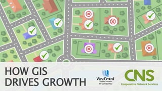
HOW GIS
DRIVES GROWTH
PURPOSE:
HelpYou Bring
More Broadband
to More Rural Places
COOPERATIVE
SPIRIT
DO MORE.
TOGETHER.
WE CONNECT YOU
WHAT IS GIS?
LET’S CLEAR THIS UP
ESRI APPS
ARCGIS ONLINE
So simple a manager could use it
SURVEY123
SURVEY 123
Mobile ready
Create surveys in web browser
or via a Microsoft Excel
Surveys are simple to setup and
change
Add pictures, signatures,
locations in real-time
WCTA PROJECT AREA
SURVEY123 IN REAL LIFE
Establish interest in potential buildout area
Customer verification after survey is complete
Entering addresses saves having to canvas an
area
Real-time data allows multiple surveyors to be
in the field without visiting same house twice
Assignments can be given different priorities
OPPORTUNITY FOR GROWTH
Maps of WCTA areas Survey123 was used for?
Managers can assign projects based on area, priority, and worker
Managers can view where their workforce is at
Updates are live and the app ties in with other AGO apps
RESULTS IN REAL-TIME
WCTA AGO screenshot of app.
WORKFORCE
APP
DISCUSSION
Clayton Burns, GISP
Geospatial Engineer
Clayton.Burns@Cooperative-
Networks.com
Jodi Sjolie
Sales Consultant
JodiS@WCTA.net
• https://survey123.arcgis.com/share/c88e0f160daa472db64c1c4ba853
4950

More Related Content

What's hot

IMGS Location Publisher Update - IMGS CTO Simon McCabe
IMGS Location Publisher Update -  IMGS CTO Simon McCabeIMGS Location Publisher Update -  IMGS CTO Simon McCabe
IMGS Location Publisher Update - IMGS CTO Simon McCabeIMGS
 
ArcGIS for Server on Microsoft Azure Jumpstart
ArcGIS for Server on Microsoft Azure JumpstartArcGIS for Server on Microsoft Azure Jumpstart
ArcGIS for Server on Microsoft Azure JumpstartEsri
 
YouVR [Make site survey easy]
YouVR [Make site survey easy]YouVR [Make site survey easy]
YouVR [Make site survey easy]HaehyeonPark
 
Augmented Reality Using Mobile Mapping
Augmented Reality Using Mobile MappingAugmented Reality Using Mobile Mapping
Augmented Reality Using Mobile MappingEsri
 
City run lite final presentation
City run lite final presentationCity run lite final presentation
City run lite final presentationLok Yee Li
 
GIS as a Platform by Sam Viana (Esri Inc)
GIS as a Platform by Sam Viana (Esri Inc)GIS as a Platform by Sam Viana (Esri Inc)
GIS as a Platform by Sam Viana (Esri Inc)Esri South Africa
 
Oculus presentation
Oculus presentationOculus presentation
Oculus presentationZx MYS
 
3D Geospatial Visualization Using Power Map
3D Geospatial Visualization Using Power Map3D Geospatial Visualization Using Power Map
3D Geospatial Visualization Using Power Mapkristinferrier
 
ArcGIS Enterprise Tips and Tricks - Esri Ireland 'Do One Thing Well' Webinar #5
ArcGIS Enterprise Tips and Tricks - Esri Ireland 'Do One Thing Well' Webinar #5ArcGIS Enterprise Tips and Tricks - Esri Ireland 'Do One Thing Well' Webinar #5
ArcGIS Enterprise Tips and Tricks - Esri Ireland 'Do One Thing Well' Webinar #5Esri Ireland
 
Apps & web solutions with OpenSource - Mani Singh - IMIA Asia Pacific Conference
Apps & web solutions with OpenSource - Mani Singh - IMIA Asia Pacific ConferenceApps & web solutions with OpenSource - Mani Singh - IMIA Asia Pacific Conference
Apps & web solutions with OpenSource - Mani Singh - IMIA Asia Pacific ConferenceInternational Map Industry Association
 
Mapping for Advanced Business Analytics - ArcGIS Business Analyst
Mapping for Advanced Business Analytics - ArcGIS Business AnalystMapping for Advanced Business Analytics - ArcGIS Business Analyst
Mapping for Advanced Business Analytics - ArcGIS Business AnalystEsri Ireland
 
Portal for ArcGIS
Portal for ArcGISPortal for ArcGIS
Portal for ArcGISEsri
 
From producers to consumers: democratizing the access to reference data
From producers to consumers: democratizing the access to reference dataFrom producers to consumers: democratizing the access to reference data
From producers to consumers: democratizing the access to reference dataJorge Sanz
 
Location Intelligence for Everyone
Location Intelligence for EveryoneLocation Intelligence for Everyone
Location Intelligence for EveryoneJorge Sanz
 
Geo spatial analytics using Microsoft BI
Geo spatial analytics using Microsoft BIGeo spatial analytics using Microsoft BI
Geo spatial analytics using Microsoft BIJason Thomas
 
Google maps & earth platinum
Google maps & earth platinumGoogle maps & earth platinum
Google maps & earth platinumLeptonmaps
 
IMGS Location Publisher Update_Simon McCabe - IMGS Government User Group 2013
IMGS Location Publisher Update_Simon McCabe - IMGS Government User Group 2013IMGS Location Publisher Update_Simon McCabe - IMGS Government User Group 2013
IMGS Location Publisher Update_Simon McCabe - IMGS Government User Group 2013IMGS
 

What's hot (20)

Avt Drones for The Construction Environment
Avt Drones for The Construction EnvironmentAvt Drones for The Construction Environment
Avt Drones for The Construction Environment
 
IMGS Location Publisher Update - IMGS CTO Simon McCabe
IMGS Location Publisher Update -  IMGS CTO Simon McCabeIMGS Location Publisher Update -  IMGS CTO Simon McCabe
IMGS Location Publisher Update - IMGS CTO Simon McCabe
 
ArcGIS for Server on Microsoft Azure Jumpstart
ArcGIS for Server on Microsoft Azure JumpstartArcGIS for Server on Microsoft Azure Jumpstart
ArcGIS for Server on Microsoft Azure Jumpstart
 
YouVR [Make site survey easy]
YouVR [Make site survey easy]YouVR [Make site survey easy]
YouVR [Make site survey easy]
 
Augmented Reality Using Mobile Mapping
Augmented Reality Using Mobile MappingAugmented Reality Using Mobile Mapping
Augmented Reality Using Mobile Mapping
 
Scanning with drones
Scanning with dronesScanning with drones
Scanning with drones
 
City run lite final presentation
City run lite final presentationCity run lite final presentation
City run lite final presentation
 
SupSlide
SupSlideSupSlide
SupSlide
 
GIS as a Platform by Sam Viana (Esri Inc)
GIS as a Platform by Sam Viana (Esri Inc)GIS as a Platform by Sam Viana (Esri Inc)
GIS as a Platform by Sam Viana (Esri Inc)
 
Oculus presentation
Oculus presentationOculus presentation
Oculus presentation
 
3D Geospatial Visualization Using Power Map
3D Geospatial Visualization Using Power Map3D Geospatial Visualization Using Power Map
3D Geospatial Visualization Using Power Map
 
ArcGIS Enterprise Tips and Tricks - Esri Ireland 'Do One Thing Well' Webinar #5
ArcGIS Enterprise Tips and Tricks - Esri Ireland 'Do One Thing Well' Webinar #5ArcGIS Enterprise Tips and Tricks - Esri Ireland 'Do One Thing Well' Webinar #5
ArcGIS Enterprise Tips and Tricks - Esri Ireland 'Do One Thing Well' Webinar #5
 
Apps & web solutions with OpenSource - Mani Singh - IMIA Asia Pacific Conference
Apps & web solutions with OpenSource - Mani Singh - IMIA Asia Pacific ConferenceApps & web solutions with OpenSource - Mani Singh - IMIA Asia Pacific Conference
Apps & web solutions with OpenSource - Mani Singh - IMIA Asia Pacific Conference
 
Mapping for Advanced Business Analytics - ArcGIS Business Analyst
Mapping for Advanced Business Analytics - ArcGIS Business AnalystMapping for Advanced Business Analytics - ArcGIS Business Analyst
Mapping for Advanced Business Analytics - ArcGIS Business Analyst
 
Portal for ArcGIS
Portal for ArcGISPortal for ArcGIS
Portal for ArcGIS
 
From producers to consumers: democratizing the access to reference data
From producers to consumers: democratizing the access to reference dataFrom producers to consumers: democratizing the access to reference data
From producers to consumers: democratizing the access to reference data
 
Location Intelligence for Everyone
Location Intelligence for EveryoneLocation Intelligence for Everyone
Location Intelligence for Everyone
 
Geo spatial analytics using Microsoft BI
Geo spatial analytics using Microsoft BIGeo spatial analytics using Microsoft BI
Geo spatial analytics using Microsoft BI
 
Google maps & earth platinum
Google maps & earth platinumGoogle maps & earth platinum
Google maps & earth platinum
 
IMGS Location Publisher Update_Simon McCabe - IMGS Government User Group 2013
IMGS Location Publisher Update_Simon McCabe - IMGS Government User Group 2013IMGS Location Publisher Update_Simon McCabe - IMGS Government User Group 2013
IMGS Location Publisher Update_Simon McCabe - IMGS Government User Group 2013
 

Similar to How GIS Drives Growth in Rural Broadband

React’s suitability to develop Geospatial solutions.pdf
React’s suitability to develop Geospatial solutions.pdfReact’s suitability to develop Geospatial solutions.pdf
React’s suitability to develop Geospatial solutions.pdfMindfire LLC
 
Leveraging Google Maps with Business Intellilgence
Leveraging Google Maps with Business IntellilgenceLeveraging Google Maps with Business Intellilgence
Leveraging Google Maps with Business IntellilgenceMISNet - Integeo SE Asia
 
GIS Based Project Planning and Management
GIS Based Project Planning and ManagementGIS Based Project Planning and Management
GIS Based Project Planning and ManagementSaurabhChobe
 
Geo location based augmented reality application
Geo location based augmented reality applicationGeo location based augmented reality application
Geo location based augmented reality applicationeSAT Journals
 
Esri ArcGIS Integration for Enterprise Asset Management | KloudGin
Esri ArcGIS Integration for Enterprise Asset Management | KloudGinEsri ArcGIS Integration for Enterprise Asset Management | KloudGin
Esri ArcGIS Integration for Enterprise Asset Management | KloudGinKloudGin
 
Arcgis for Server
Arcgis for ServerArcgis for Server
Arcgis for ServerEsri
 
MODERN trends of GIS
MODERN trends of GISMODERN trends of GIS
MODERN trends of GISVAISHALI JAIN
 
FYP Presentation On Android based Google Map Application
FYP Presentation On Android based Google Map ApplicationFYP Presentation On Android based Google Map Application
FYP Presentation On Android based Google Map ApplicationMuzamil Hussain
 
Web Mapping 101: What Is It and Making It Work For You
Web Mapping 101: What Is It and Making It Work For YouWeb Mapping 101: What Is It and Making It Work For You
Web Mapping 101: What Is It and Making It Work For YouSafe Software
 
Effective Data Collection and Management through Mobile Phone Applications
Effective Data Collection and Management through Mobile Phone ApplicationsEffective Data Collection and Management through Mobile Phone Applications
Effective Data Collection and Management through Mobile Phone ApplicationsMichael Baker Jr., Inc.
 
Azlina5 road ahead
Azlina5 road aheadAzlina5 road ahead
Azlina5 road aheadAzlina Mahad
 
Design at Scale: An ExactTarget Case Study
Design at Scale: An ExactTarget Case StudyDesign at Scale: An ExactTarget Case Study
Design at Scale: An ExactTarget Case StudyDesignMap
 
Putting Asset Management Tools on the web and mobile devices with Cartegraph ...
Putting Asset Management Tools on the web and mobile devices with Cartegraph ...Putting Asset Management Tools on the web and mobile devices with Cartegraph ...
Putting Asset Management Tools on the web and mobile devices with Cartegraph ...GeCo in the Rockies
 

Similar to How GIS Drives Growth in Rural Broadband (20)

Geospatial Product Watch 2015
Geospatial Product Watch 2015Geospatial Product Watch 2015
Geospatial Product Watch 2015
 
HighAccuracyDataCollection
HighAccuracyDataCollectionHighAccuracyDataCollection
HighAccuracyDataCollection
 
React’s suitability to develop Geospatial solutions.pdf
React’s suitability to develop Geospatial solutions.pdfReact’s suitability to develop Geospatial solutions.pdf
React’s suitability to develop Geospatial solutions.pdf
 
Wisconsin SCO Virtual Data Integration
Wisconsin SCO Virtual Data IntegrationWisconsin SCO Virtual Data Integration
Wisconsin SCO Virtual Data Integration
 
Leveraging Google Maps with Business Intellilgence
Leveraging Google Maps with Business IntellilgenceLeveraging Google Maps with Business Intellilgence
Leveraging Google Maps with Business Intellilgence
 
GIS Based Project Planning and Management
GIS Based Project Planning and ManagementGIS Based Project Planning and Management
GIS Based Project Planning and Management
 
Geo location based augmented reality application
Geo location based augmented reality applicationGeo location based augmented reality application
Geo location based augmented reality application
 
Esri ArcGIS Integration for Enterprise Asset Management | KloudGin
Esri ArcGIS Integration for Enterprise Asset Management | KloudGinEsri ArcGIS Integration for Enterprise Asset Management | KloudGin
Esri ArcGIS Integration for Enterprise Asset Management | KloudGin
 
Mapping application
Mapping applicationMapping application
Mapping application
 
Arcgis for Server
Arcgis for ServerArcgis for Server
Arcgis for Server
 
Microsoft Virtuele Earth
Microsoft Virtuele EarthMicrosoft Virtuele Earth
Microsoft Virtuele Earth
 
Company Overview
Company OverviewCompany Overview
Company Overview
 
cc.ppt.pptx
cc.ppt.pptxcc.ppt.pptx
cc.ppt.pptx
 
MODERN trends of GIS
MODERN trends of GISMODERN trends of GIS
MODERN trends of GIS
 
FYP Presentation On Android based Google Map Application
FYP Presentation On Android based Google Map ApplicationFYP Presentation On Android based Google Map Application
FYP Presentation On Android based Google Map Application
 
Web Mapping 101: What Is It and Making It Work For You
Web Mapping 101: What Is It and Making It Work For YouWeb Mapping 101: What Is It and Making It Work For You
Web Mapping 101: What Is It and Making It Work For You
 
Effective Data Collection and Management through Mobile Phone Applications
Effective Data Collection and Management through Mobile Phone ApplicationsEffective Data Collection and Management through Mobile Phone Applications
Effective Data Collection and Management through Mobile Phone Applications
 
Azlina5 road ahead
Azlina5 road aheadAzlina5 road ahead
Azlina5 road ahead
 
Design at Scale: An ExactTarget Case Study
Design at Scale: An ExactTarget Case StudyDesign at Scale: An ExactTarget Case Study
Design at Scale: An ExactTarget Case Study
 
Putting Asset Management Tools on the web and mobile devices with Cartegraph ...
Putting Asset Management Tools on the web and mobile devices with Cartegraph ...Putting Asset Management Tools on the web and mobile devices with Cartegraph ...
Putting Asset Management Tools on the web and mobile devices with Cartegraph ...
 

How GIS Drives Growth in Rural Broadband

Editor's Notes

  1. All presentations should start with a story… In 1969 Jack Dangermond and his wife created ESRI to analyze data as it relates to places. He had a vision to…. And has created some incredibly powerful tools, and a platform for developers to expand the possibilities. It’s popularity lead to the explosion of it’s use with over 50% market share today. He’s now a low-key Billionairre.
  2. Online mapping solution Allows users to access their data from any computer Grants access to multiple out of the box app solutions Should be purchased as an organizational account so users can be added/changed as needed easily Access is user based Level 2 user = Editor User = $42/month Level 1 user = Viewing User = $9/month
  3. Pictures of ONT locations Customer signatures Geo-coded locations for regulatory reporting
  4. When a potential customer calls in months later, I can pull up their address and verify if they are in the build out area. When we are working on build outs in two different areas, we will mark one high priority and the second area medium priority. This way we can separate them in on the spread sheets. This makes it so much easier to find address, I can canvas areas with out zig zagging around the country Easy access I have the app on my smart phone and my IPAD When having two reps out canvasing the area, we are able to see what areas the other has finished not going to same house twice. I have easy access to the customers information, name and phone number etc. all in one place.