

Recommended
More Related Content
What's hot
What's hot (20)
Viewers also liked
Viewers also liked (20)
Similar to baluchistan basin
Similar to baluchistan basin (20)
Recently uploaded
Recently uploaded (20)
baluchistan basin
- 3. BALUCHISTAN BASIN • There are three main ranges in Balochistan: • The Makran Coastal Range (up to about 1500 m), • The Central Makran Range (2000 m to 3000 m) • The Siahan Range (1000 m to 2000 m).
- 4. • In this eastward view across northern Makran to Chaman fault (C) to Suleiman foldbelt (S), the forearc basin (F) of Makran is in left foreground. The letter 'C' is placed where the Chaman fault changes from a thrust fault (right) to a plate boundary transform fault (left) as seen in the near-vertical view of the preceding photo. The next photo shows the region north (to left) of this frame.
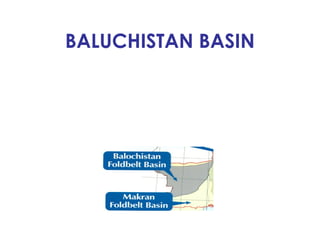
- 5. BALUCHISTAN BASIN • This onshore—0ffshore basin, covers an area of about 300,000 sq. km, is the least explored in Pakistan. Only six wells have been drilled in the region to date. • What is more, these were abandoned either due to operational difficulties or geological complexities. • N 0 commercial hydrocarbons have so far been proven in the basin.
- 6. • This view is to the east across the Helmand block to the Chaman fault. Kuh-e-Sultan (S), part of the volcano linefacing the incoming Indian Ocean floor, is nearly 250 miles (406 km) north of the subducting plate margin, testimony to the very shallow dip of the subducting plate. At lower left is one of the lakes that marks the end of the Helmand River system, headwaters of which are in the Pamirs (under clouds at top). An isolated recent volcano (V) lies along a riverbend.
- 7. • In this southwesterly view across the Suleiman Ranges, the Chaman fault forms the sharp northwestern boundary of the sweeping Suleiman folds. Across the Helmand block are the Sistan Lakes, the end of the Helmand River system that flows across the Helmand block. The volcano line (V) can also be seen in the distance.
- 8. • Looking south along the Chaman fault (left edge) and across the eastern half of the Helmand block, Qandahar (Q) can be seen at the southern end of the mountain ranges. Note that the Helmand River stays north of the huge sand dune field that occupies much of the flat country. The river is the supplier of sand to the dune field. Note the sharp bends in river courses where they intersect the Chaman fault.
- 9. BALUCHISTAN BASIN • In the east it is seperated by Chaman Transform Zone whereas the western part extends into Iran. This basin presents a different geological history compared to the Indus Basin; that of an arc-trench system from north to south where Arabian Oceanic Plate is subducting beneath the continental margin of Eurasian Plate (Lut and Afghan blocks).
- 10. BALUCHISTAN BASIN • From south to north this arc-trench system is divided into Makran Trench, Coastal Makran Depression, Makran (Panjgur) Accretionary Prism,Harnun-i-Mashkel (Kharan) Fore-Arc Basin, Ras Koh Arc, Mirjawa—Dalbandin Trough (Inter Arc region) and Chagai Arc .
- 12. BALUCHISTAN BASIN • Makran Coast is a great festoon of folded and faulted Tertiary sediments extending 800 km from Las Bela axial fold belt on the east to the Oman line on the west. • The subduction of oceanic crust under the Makran region of eastern Iran and western Pakistan started in Late Cretaceous and is continuing through modern times.
- 13. BALUCHISTAN BASIN • This led to the generation of Arc-Trench system which is known to be widest in the world. The Arc-Trench gap is of the order of 500 km, far wider than most systems. • The examples with unusually large arc- trench gaps are found in northern New Zealand and the Gulf of Alaska.
- 14. BALUCHISTAN BASIN • One school of thought suggests that shoreline has migrated 250 km southward since Oligocene and the present day trench represents an incipient subduction. • The Chagai Arc may be the remnant of the volcanic activity related with the initial subduction of the oceanic lithosphere which might have been interrupted by the huge influx of terrigenous sediments from the Axial Belt formed by collision of Indian Plate with Eurasian Plate, both being continental land masses.
- 15. BALUCHISTAN BASIN • This Arc-Trench system is unique in a number of ways: • (i) Fore-Arc Basin and most of the Accretionary Prism are emergent, thus making surface geological investigation possible, • (ii) Even intense deformation has not created structural incoherence in the exposed strata.
- 16. STRATIGRAPHY • The sedimentary rocks exposed in Balochistan Basin range in age from Cretaceous to Recent with older rocks exposed in the north and younger to the south. • The deposition of younger sedimentary rocks is controlled by the subduction of Arabian Oceanic Plate under the Makran Continental Plate.
- 17. Geological section across B.B
- 18. STRATIGRAPHY • The stratigraphy of this basin is complex and shows a great deal of variation from one end to the other. • Fig in next slide represents isopachs of total sedimentary thickness in Balochistan Basin.
- 19. Geological map with tectonic zones
- 20. CRETACEOUS Sinjrani Formation • This formation is exposed in Chagai and Ras Koh area, the northern most part of the Balochistan Basin. The formation consists of volcanic rocks and thin beds of shale, sandstone and limestone. Grey,green and black agglomerates and volcanic conglomerates are the dominant rock types • The maximum thickness measured in the field is 1,200 meters as the lower contact is not exposed.
- 21. Humai Formation • The formation consists of fossiliferous limestone, shale, siltstone and some volcanics. Near its type locality, at Koh-I-Humai in northwest Balochistan, it is composed of greenish grey and purplish shales,calcareous sandstones, siltstones, ’thin-bedded limestones and volcanic conglomerates • This formation is also restricted to the northern part (Eruptive Zone) of Balochistan Basin.
- 22. Hummai formation • Thickness of up to 300 meters is reported from Mazenen Rud. Its contact with Sinjrani Formation is unconformable along the southen margin of Chagai Hills, while it is conformable in other areas.
- 23. RAKHSHANI FORMATION • This formation is also restricted to northern part and comprises sandstone and limestone with volcanic agglomerates. Beds of conglomerates, basaltic and andesitic lava flows, tuff are also common. Thickness varies considerably from 150 meters to a maximum of 2,400 meters south of Robat.
- 24. RAKHSHANI FORMATION • lt represents the shallow marine environment near the volcanic centre of the Chagai area. • The formation is conformably underlain by the Humai Formation in the Chagai and Dalbandin areas and by the Sinjrani Formation in the Ras Koh Range.
- 25. ISPEKAN CONGLOMERATE • This formation consists of conglomerates comprising unbedded and unsorted masses of boulder-sized grey limestone,igneous rocks and quartz pebbles. • Boulders of granite and andesite seem to have been derived from Chagai. intrusives, • The formation is unconformably underlain by Cretaceous marls and is restricted to only one locality i.e. Ispikan in North Makran.
- 26. EOCENE • Eocene rocks are exposed in Eruptive Zone and western part of Makran.
- 27. SAINDAK FORMATION(EOCENE) • The formation has been divided into Kharan and Wakai Members. • Kharan Limestone Member consists of medium to dark grey,thin to thick bedded, finegrained, argillaceous limestones. • The limestones are locally highly fossiliferous, and have a petroliferous odour when broken. Grey to brown calcareous shale is also intercalated with alternations of grey to greenish brown, fine to medium grained calcareous sandstones. • This member attains a maximum thickness of 600 meters in the north-western corner of Eruptive Zone. it is conformably underlain by Rakhshani Formation.
- 28. SAINDAK FORMATION • Wakai Member consists of limestone, marls and shales with subordinate sandstones and conglomerates. • Limestones have petroliferous smell. Wakai Member is restricted to the central part of the basin (Kech Bund area) • It was deposited along the flanks of regional highs. Its lower contact is unconformable. • Limestones of this formation have reservoir charzicteristics.
- 29. Regional Stratigraphy Of B.B
- 30. OLIGIOCENE • The sedimentation during and post Oligocene was controlled by the volcanic activity in the north and the coalescence of Indian and Eurasian Plates which gave rise to the formation of Axial Belt and much of the tectonic shed was depositing in the depression areas of Balochistan Basin.
- 31. AMALAF FORMATION • This formation is exposed in the northern areas of the basin and consists of volcanic rocks and occasional beds of red shales and sandstone. The volcanics comprise beds of fine to coarse ash and conglomerate with subordinate andesitic lava flows. • The formation is restricted to the western part of Mirjawa —Dalbandin Trough of the Eruptive Zone where it attains the thickness of 300 meters. Sandstones of this formation have Fair to good reservoir potential. • This formation is unconformably overlain by the Saindak formtion.
- 32. Hoshab Formation • This formation is exposed in the central part of the basin. It is a basin or slope facies consisting of deep water shales with subordinate sandstone. The formation extends into Miocene in the south. The sandstones of Siahan have reservoir potential.
- 34. MIOCENE • This period is predominantly represented in the Central and the southern part of basin with younger rocks units in south
- 35. Panjgur Formation • The type locality of the formation is near panjgur in the North Makran area. The formation consists of interbedded marine shale and sandstone. Thick bedded sandstones with small proportion of shale beds were deposited by turbidity currents. This formation is as much as 400 meters thick. • Sandstones are micaceous, quartzose, fine- medium grained and occasionally coarse grained with thin shale interbeds.
- 36. PANJGUR FORMATION • Sandstone beds form prominent ridges along anticlinal cores. This formation depicts fair to good res- ervoir characteristics. Middle Miocene age is given to this formation.
- 37. PARKINI FORMATION • The type locality of this formation is Parkini Kaur, a tributary of Hingol River.The formation consists of mainly grey,slightly clacareous mudstone. • It is commonly massive or thick-bedded, with discernible lamination and bedding. Thin siltstone or very fine grained sandstone beds are present in some zones.
- 38. PARKINI FORMATION • The formation was deposited on slopes in upper to lower bathyal depths (more than 200 meters). • The formation is exposed in two major belts: – i) Across the central section on the south flank of Gokh Prush Band, – ii) In the vicinity of Kappar and along the coast to Ras Shamal Bandar, where thickness is about 1,600 meters • The formation bears source rock characteristics.
- 39. PLIOCENE • This period is represented by Talar Formation restricted to the southern part of the basin.
- 40. Talar Formation • The formation was named after good exposures in Talar Gorge in Western Makran. • It is composed mainly of regularly interbedded marine sandstone, shale and mudstone. The sandstone is medium to coarse grained, soft and crumbly, generally l—2 meters thick beds with maximum of 3 meters thickness. • However, the middle part of the formation is predominantly massive sandstone.
- 41. Talar Formation • Some layers are cross—bedded and some are ripple marked.Thickness of the formation is estimated at 5,000 meters • The formation represents the depositional environment ranging from mainly slope to outer shelf, inner shelf and nearshore. • Sandstone beds of this formation may • be prospective reservoirs.
- 42. PLEISTOCENE • This period was largely influenced by the main phase of the Himalayan orogeny which began in early Pleistocene.
- 43. Chatti Formation • This formation was named after Chatti,about 30km northwest of Gwadar. • The formation is similar to Parkini For- mation and contains interbedded mud- stone/siltstone and thin impure limestonebeds.
- 44. PLEISTOCENE • The siltstone beds, a few centimeter to 0.5 meters thick and widely interspersed in the thick units of mudstone, are greenish brown. The resistant layers of siltstone and fine sandstone form low ridges. • The thickness of this formation is reported to be more than 1,300 meters. • The formation represents mainly shelf • deposit with less dominant slope facies.
- 45. Ormara Formation • This formation was named after Ormara headlands on the coast of Arabian Sea. It consists of shale, sandstone, and conglomerate with shell-bearing beds in the upper part. The lower part of the formation is mainly soft, poorly consolidated, sandy clay. • The sandstone is light brown, medium to coarse grained and poorly consolidated. • Maximum thickness of more than 1,000 meters is reported for this formation at Astola Island, (the island came into existence after earthquake of 1945)
- 46. Ormara Formation • This formation has angular unconformable relationship with underlying formation‘ • In terms of depositional environment,it represents a regressive cycle from inner • shelf to nearshore marine.
- 47. Jiwani Formation • This formation was named after the coastal village of Jiwani. It consists of limestone, conglomerate and sandstone. • The limestone is coquina of small shell fragments in a sandy,hard, calcareous matrix forming porous beds 0.3-2 meters thick. • Conglomerate contains the pebbles of Wakai Limestone. • Jiwani Formation is restricted to coastal area and its thickness is about 30 meters at Jiwani headland. It represents the shoreline facies.
- 48. MAJOR TECTONIC ELEMENTS AND THEIR HYDROCARBON POTENTIAL • In view of the hydrocarbon potential of this arc-trench setting, following main features from north to south are discussed indetails: • 1. Volcanic Arc with associated depression • 2. Hamun-i-Masl1kel Fore-Arc Basin& Kharan Desert • 3. Makran Accretionary Prism.
- 49. VOLCANIC ARC • This is the characteristic feature of the convergent plate boundaries associated with subduction of oceanic lithosphere. • Balochistan volcanic arc is associated with continental plate 0verriding oceanic lithosphere. • A zone of Quaternary volcanism stretches from north of Chagai Hills at the Pakistan/ Afghanistan border region, across the Pakistan/ Iran boarder, and into SE Iran marking Koh-I- Sultan, Taftan, and Bazman volcanic centres respectively.
- 50. VOLCANIC ARC • The general geologic setting appears to involve an Andean-type andesitic arc in the Chagai Hills, Ras Koh and Saindak areas which was most active from the Middle Cretaceous to the Early Paleocene. • Chagai Arc was subjected to recurrent uplift through the Paleogene, accompanied by the corresponding formation of the Mirjawa-Dalbandin Trough between the Chagai igneous belt and the Ras Koh Range. • It is postulated that this region accumulated about 10,000 meters of Cretaceous(Cenomanian) Sinjrani volcanic groups, in Mashki Chah area.
- 51. VOLCANIC ARC • This is conformably overlain by Humai Formation of Cretaceous(Mastrichtian) age. The upper part of this formation is thick-bedded to massive, biohermal limestone up to 300 meters thick in the outlier of Sorkoh. • The lower part, upto 1,700 meters thick at Amir Chah, is composed mainly of thin-bedded, fine-grained limestone and mudstone. At places, it also contains tuff and agglomerates and conglomerates composed of limestone and volcanic debris. • Humai Formation is overlain by Rakhshani and ]uzzak formations which in turn underlie Saindak Formation.
- 52. VOLCANIC ARC • Thes two formations are about 2,500 meters thick and are of Paleocene-Oligocene age. Juzzak Formation consists of flysch like facies with layers of limestone and volcanic conglomerates. • Saindak Formation is composed mainly of mudstones with beds of numulitic limestone apparently formed in shallow water conditions. • Overlying gypsiferous silts and conglomerates of the Kamerod Formation of Miocene age have an angular unconformable relationship with Juzzak and Saindak formations.
- 53. VOLCANIC ARC • Final phase was dominated by erosion and peneplanation, followed by accumulation of the Quaternary and older Alluvium. This was accompanied by a resumption of Volcanism—the eruption of andesitic pyroclastics and lavas. Another important feature of this area is stock-like bodies of igneous rocks, i.e. diorite, grano- diorite, granite and quartz diorite intrudingSinjrani, Humai and Iuzzak rocks.
- 54. VOLCANIC ARC • From structural geological point of view Chagai Hills are generally horizontal to gently dipping. Small scale structures are dominated by two sets of faults at approximately right angle to one another. Reverse faults are less common. • Mirjawa — Dalbandin synclinoriurn,south of Chagai uplift, represents trough into which large amounts of sediments were shed down during Paleogene.
- 55. VOLCANIC ARC • More common structures in Mirjawa synclinorium are folds and reverse faults which are aligned mainly east-west. In the Dalbandin area,broad and doubly plunging synclines are common fold type. Anticlines are commonly faulted. This area is characterised by greater thickness of sediments and greater depth of the original synclinal depression as compared to Mirjawa synclinorium.
- 56. VOLCANIC ARC • Chagai Hills, Ras Koh Range and the intervening Mirjawa—Dalbandin depression, being part of the Paleogene volcanic arc and subduction complex, are considered to have low petroleum potential. • However, arc trench phenomenon have given rise to a geologically complex scenario that has excellent mineral potential.
- 57. HAMUN-I-MASHKEL FORE-ARC BASIN • Two large depressions, ]az Murian in Iran and Hamun-i-Mashkel in Pakistan immediately south of Volcanic arc, are termed as Fore—Arc Basins. • Hamun-i-Mashkel Basin constitutes a flat area of Harnun-i-Mashkel and Kharan Desert which are covered by Quaternary sands. • The basin is believecl to contain huge thickness of sedimentary rocks of possible Paleocene age.
- 58. HAMUN-I-MASHKEL FORE-ARC BASIN • Structures in fore-arc basins are typically complex with both normal and reverse block faulting and thrust faulted blocks. • In a trench-arc system as that of Balochistan Basin, forearc basins are considered to bear the best petroleum prospects such as Cook Inlet basin of Alaska, with total oil and gas recoverable reserves of more than 1 billion bbls of oil equivalent.
- 59. STRATIGRAPHY • Since this area is covered by Quaternary sediments, its straligraphy is vaguely known from the outcrops at the periphery. • Stratigraphic sequences would probably be same as found in Volcanic Arc region.
- 60. SOURCE ROCKS • Fore-arc basin is usually characterised by young and less mature source rocks. • However, it appears from the surrounding exposures that deposition has probably occurred more or less continuously since Paleocene and may have begun in Cretaceous. • If a thick sedimentary succession is present as confirmed by Aeromagnetic surveys then conditions are ideal for hydrocarbon generation.
- 61. SOURCE ROCKS • Back reef facies associated with Kharan Formation of Eocene age consists of limestones that have petroliferous odour. It is also likely that hydrocarbon might have generated in adjacent shales. • Kwash oil seep of Siahan Range is reported to be in rocks of Eocene age. This indicates that oil has been generated in the area.
- 62. RESERVOlR ROCKS • ln terms of reservoir characteristics petroleum potential of fore-arc basin area is regarded as moderate. Provenance is usually located in the back-area where the rocks are predominantly volcanic which shed a lot of dirty sand into the basin with various types of clays. Deposition foci are also frequently shifted due to tectonic instability. • In this case the only reservoir rock type is limestone deposited as carbonate build-ups along the basin margin.
- 63. RESERVOIR ROCKS • In Hamun-i-Mashkel Fore—Arc Basin, there are indications that Kharan Limestone was deposited. This limestone bears reservoir qualities • ln addition, this basin is bounded in the north by crystalline rocks of Afghan block and intrusives of Chagai area which provide the sediments that are likely to be clean, quartzose and feldspatliic, free from clay and lithic fragments. Such sandstones have all the potential for good quality reservoir at depth. • Entrapment mechanism in such basin is both structural and stratigrapliic. Traps are associated with deltaic, nearshore and submarine fan and car-bonate built-up settings.
- 64. RESERVOlR ROCKS • ln order to assess the potential of this fore- arc basin and unveil the buried structural/stratigraphic configuration, good quality seismic survey and its stratigraphic processing is highly required.
- 65. MAKRAN ACCRETIONARY PRISM • This is the only area of Balochistaii Basin where all past drilling activity has been undertaken .In a trench-arc system the accretionary prism forms the most proximal part to the trench. Accretionary prisms are formed by scraping of the sedimentary cover off the subducting plate and its stacking and deformation into ridges at the frontal fold. • These are explained in terms of simple imbricate thrust model.
- 66. MAKRAN ACCRETIONARY PRISM • Makran Accretionary Prism, one of the widest (170 km.) in the world, starts at the Northern Makran (Siahan Range) and ex- tends south through Central Makran coastal ranges.
- 68. MAKRAN ACCRETIONARY PRISM • These ranges predominantly comprise deformed flysch (Panjgur Sandstone) of Miocene age in the south and probable Paleogene age in the north. • The strata becomes younger southward where accretion is still going on near the trench.
- 69. STRATIGRAPHY • The peripheral outcrops of the region are highly imbricated and severely deformed turbidites of the Middle to Late Oligocene Panjgur Formation, underlain by the abyssal Hoshab and Siahan Shales of Late Eocene to Early Oligocene age. • In the north, the older stratigraphy is represented by Ispikan Conglomerate (Paleocene), Nisai Formation (Eocene) and Khojak Formation (Late Eocene-Olig0cene) which in turn is overlain by Talar and Chatti formations west of Pasni and Hinglaj Formation east of it.
- 70. STRATIGRAPHY • ln the Makran Coast Range, Panjgur Formation (Flysch) appears to be overlain by Parkini Formation. • The sediments of Hoshab Shale and Panjgur/ Parkini Formations were deposited on the ocean floor of the Gulf of Oman and were incorporated into the accretionary complex during Neogene, thus shortening and thickening them from an initial 4-5 km. to l5—20 km.
- 71. SEDIMENTOLOGY AND GEOLOGICAL HISTORY • The oldest rocks reported are Cretaceous Marls which were deposited on deep ocean floor. These are overlain by lspikan Conglomerates (Paleocene) reported from only one locality in northern Makran, and were derived from erosion of basement and Cretaceous volcanic rocks. • During Eocene massive, reefoid limestones of Nisai Formation, associated with shales, were deposited along regional highs.
- 72. SEDIMENTOLOGY AND GEOLOGICAL HISTORY • This was followed by the deposition of flysch (Khojak Formation) during Late Eo- cene to Oligocene. • This continental setting which was established in Oligocene, has continued through to the present day and has been regressing southward.
- 73. SEDIMENTOLOGY AND GEOLOGICAL HISTORY • Sandstones and shales of Khojak Formation were deposited in a shallow marine environment and were pushed down by the turbidity currents to the base of the continental slope where they became part of the Accretionary Prism. • The Oligocene shore line was consistent with the present day Siahan Range. This was followed by a major episode of uplift during Late Oligocene probably because of the collision of Lut and Afghan Block and emergence of Axial Belt as a result of collision between Indian and Eurasian Continental Plates in the east.
- 74. SEDIMENTOLOGY AND GEOLOGICAL HISTORY • Uplifting of these surrounding land masses became the major provinces for the deposition of huge thicknesses of terrigenous sediments from Miocene onward. • Miocene — Paleocene sedimentation was mostly restricted to the South Makran and Makran Coast Ranges. • Deposition of Hoshab Shale in Early Miocene occurred in basin or slope enviromnents.
- 75. SEDIMENTOLOGY AND GEOLOGICAL HISTORY • During Middle Miocene, thick-bedded sandstone and conglomerate with small proportions of thin shale beds of Panjgur Formation were deposited by turbidity currents in South Makran. • This formation depicts all of the features, both sedimentary and paleontological in a turbidity current deposit. • Depositional region was probably a Middle Miocene deep-sea fan .
- 76. SEDIMENTOLOGY AND GEOLOGICAL HISTORY • Since Late Miocene, the Makran Coast area has received deposits of shale-slope shoreline representing progradational or regressive episodes / cycles. This has given rise to the deposition of almost 7,000 meters thick sediments. • Each phase ranges in thickness from 1,000 to 3,000 meters and has bathyal massive mudstone deposited on slopes overlain by coarsening upward sequence of sandstone of outer to inner shelf deposit. • Near-shore deposits are mostly represented in Late Pleistocene or Holocene sequences.
- 77. SOURCE ROCKS • The most encouraging features, which substantiate the evidence of hydrocarbons generation in the Makran region, are presence of numerous gas seeps occurring as spectacular mud volcanoes or subdued pools onshore and as bubbling gas and turbid water offshore. • The Kawash oil seepage described earlier, has an important bearing on source rock maturity in Makran Accretionary Prism.
- 78. SOURCE ROCKS • The source rock evaluation of any area is carried out on the basis of organic rich ness of the source beds and there thermal maturity. • Unfortunately the Pre-Miocene stratigraphy of the Makran region is not exposed, although they are expected to be finer grained since they provided the de- tachment zone for folding.
- 79. SOURCE ROCKS • The total organic carbon content of the rocks vary from lean to moderate. There is a very large volume of mudstone deposited in slope and outer shelf environments incorporating significant amount of organic matter. • As a principle, sediments are first deposited in a shelf environment and later incorporated in accretionary prism complex by the action of turbidity currents.
- 80. SOURCE ROCKS • In terms of thermal maturity the region appears to be cool with an average geothermal gradient of 1.82 oC/100 meters. For hydrocarbon generation in relatively younger rocks this gradient has to be compensated with rapid burial which has been the case. • However thermal modeling and prediction of hydrocarbon evolution is difficult due to complex structural history of the region.
- 81. SOURCE ROCKS • However, the isotopic composition of the gas from mud volcanoes is heavier which suggests that the gas is generated from a thermally mature source. It can be summarized that present maturity level has been attained because Makran Zone is mostly underlain by oceanic crust and would be subject to higher heat flow than basins underlain by continental crust.
- 82. Reservoir Rocks • The sedimentological evidences suggest that this region has received huge amount of sand which is of poor to good reservoir quality. The Middle Eocene Panjgur Formation is an ideal candidate for reservoir. • This was deposited by turbidity currents. It is fine to medium grained, free of clays and bioturbation. The porosity in outcrops ranges from 10% to 25%.
- 83. Reservoir Rocks • Late Miocene to Pleistocene deposits represent outer to inner shelf and shoreline sandstone sequence, of which inner shelf and shoreline sandstone is coarser and better sorted. • However, these facies are not expected to be represented at depth.
- 84. SEISMIC CHARACTERISTICS • Seismic data was mainly shot in the offshore with some onshore coverage forboth academic and exploratory purposes during 1961 and 1982. • The data has resulted in the delineation of many fascinating features which would have otherwise been impossible to be deciphered
- 85. SEISMIC CHARACTERISTICS • Some profiles shot to delineate the subsea accretionary prism and subducting oceanic plate have also led to the resolution of the arc-trench system . • Quality of data spreads from patches of good to patches of poor in shelf/ slope facies whereas data of abyssal plain shows relatively better reflection continuity in the first 5 seconds of depth. The deep water data at places is plagued with water bottom multiples.
- 86. SEISMIC CHARACTERISTICS • The interpretation of data requires thorough knowledge of seismic stratigraphy,marine tectonics and the geology of conti-nental margins. • T0 say the least it is the offshore seismic which has unveiled yet another fasci— nating discipline of Earth Sciences i.e. ArcTrench System and Marine Tectonics.
- 87. DRILLING CHARECTERISTIC • Following wells have been drilled in Balochistan Basin:- – Chandragup- BOC- 1916-810m – Dhak-1- Hunt- 1956- 2562m – Dhak- 2- Hunt- 1956-4455m – Kech Band-1- Tidewater- 1962-3349 – Garrh Koh- 1- Marathon- 1975- 3624 – Jalpari ( Offshore) Marathon – 1977- 2088
- 88. DRILLING CHARECTERISTIC • The main operational problem in coastal region has been abnormally high pressures in younger sand/ shale sequences. • These pressures are the result of rapid sedimentation and non-expulsion of formation water. This has also resulted in the intrusion of shale diapirs.
- 89. DRILLING CHARECTERISTIC • Modern high resolution seismic may now be able to correctly distinguish the repeated stratigraphic succession from the normal. Also, the operational problems could be handled with the state-of-the-art drilling technology available today.
- 90. EXPLORATION POTENTIAL • Generally Balochistan Basin is regarded as high risk high cost exploration area mainly because of lack of full geological understanding, sparse drilling, and non- availability of infra structure. • However, this basin is considered to bear all the necessary characteristics that qualify it as a possible hydrocarbon province.
- 91. • Hamun-i-Mashkel Fore-Arc Basin has the best petroleum potential as petroleum has been found in its analogues in the world. • The sedimentologi cal evidences suggest that both source and reservoir rocks have been deposited in the basin with source thrown in the oil window. • Because of the pattern of deposition the basin has the possibility for the develop- ment of both stratigraphic and structural traps.
- 92. • However, the Makran Accretionary Prism is characterised by severely reverse faulted structures. Traces of these faults are consistent with the axes of folds. • This severity must have transmitted its effects to the north to give rise to the formation of buried structures in the Fore- Arc Basin.
- 93. Pasni