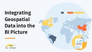
Integrating Geospatial Data into the BI Picture

It’s a well-known mantra, location, location, location. We feel the same way when it comes to data, and many businesses do too! Organizations are increasingly interested in bringing geospatial (location) data into business intelligence tools to gain valuable insights and make better decisions. Find out how it’s done in this webinar by Safe Software, the makers of FME, the data integration platform with the best support for geospatial data worldwide. We’ll start off with some basics and then jump into an example so you can see first-hand how you can bring geospatial data into your business intelligence tools. FME enables you to harness the power of data integration by combining data from databases, static files, big data, and data feeds – including location data. Whether you’re using PowerBI, Qlik, SAP HANA, Tableau, or any other tool, FME was designed to solve integration and geospatial data challenges.

Recommended
Recommended
More Related Content
More from Safe Software
More from Safe Software (20)
Recently uploaded
Recently uploaded (20)
Integrating Geospatial Data into the BI Picture
- 1. Integrating Geospatial Data into the BI Picture
- 2. Nick Sartore Channel Account Manager Nathan Hildebrand FME Technology Expert Meet the experts Erin Lemky Senior Product Marketing Manager Use the GoToWebinar Control Panel to chat in questions
- 3. “The world’s most valuable resource is no longer oil, but data.” THE ECONOMIST
- 4. ● 66% of enterprises rank Location Intelligence as either critical or very important to ongoing revenue growth strategies (Forbes) ● Gain insight into your key business assets ● Integrate geospatial into your business intelligence platform Importance of Location
- 5. ● Service areas ● Catchment areas ● IoT/GPS ● Indoor mapping Location Data Use Cases
- 6. Agenda 1. Location, location, location 2. Intro to Safe Software 3. FME® Platform 4. Geospatial Data Use Cases 5. Demos 6. Resources & Support 7. Q&A
- 7. Years of solving data challenges 25 Safe So ware COMPANY PROFILE 10,000 Organizations trusting us worldwide www.safe.com Partners supporting our network 150 128 Countries with FME customers
- 8. CONNECT CAD GIS FME release by year NumberofsupportedformatsinFME 1995 10500100300 20192015201020052000 TABULAR DATABASE RASTER POINT CLOUD BIM 3D WEB XML CLOUD BIG DATA IOT BI AR / VR AI / ML INDOOR MAPPING GAMING
- 9. OUR MISSION To help you maximize the value of your data.
- 10. Connect Your Data Sources Transform Your Data Automate Your Workflows
- 11. Service Areas
- 12. CUSTOMER STORY “We love FME. We’ve been using it for about 20 years.” - Piet Nooij, Fortis BC PROJECT Assess the current wildfire threat to assets. SOLUTION Integrate active wildfire data from provincial government with their GIS. RESULTS ● Workflow automatically runs at same interval as source dataset updates. ● Notifications & reports are immediately sent to Operations Managers who can coordinate with Emergency Services. FORTIS BC >
- 13. CUSTOMER STORY “FME Cloud may not run all year long if there are no earthquakes, or if there are a lot it could run o en… but it’s always available, checking the feed.” -- Stephanie Halpin, CEA - Piet Nooij, Fortis BC PROJECT Identify an earthquake significant enough to cause property damage to policyholders. SOLUTION Watch the USGS Shakemap dataset and send notifications and reports within minutes of detection. RESULTS FME workflow extracts shaking intensity data, creates a report, and emails stakeholders, including the Claims department. CEA CALIFORNIA EARTHQUAKE AUTHORITY >
- 14. Catchment Areas
- 15. IoT, GPS, and Indoor Mapping
- 16. CUSTOMER STORY “FME is the cherry on top the ice cream sundae that helps bring data together and customize it for your needs.” - David Runneals, Iowa DOT PROJECT Provide road conditions and plow information to the public. SOLUTION Use FME to integrate plow locations, plow cams, and road conditions. RESULTS ● Data is retrieved 1x/min from AWS to populate Oracle database. ● FME automatically delivers a KML file to Windows Azure for AGOL. ● API delivers the data to local TV stations for their on-air software. IOWA DOT >
- 17. CUSTOMER STORY Improving operations and passenger experience to become a top airport in Europe. PROJECT Unify data across departments into a central GIS database. SOLUTION Integrated asset and infrastructure data, enhanced it, validated it, and distributed it across teams. RESULTS ● Synchronized GIS database. ● Open APIs available to developers. ● Foundation for building digital twin. ● Indoor mapping in Apple Maps and a custom augmented reality app. AMS Amsterdam Airport Schiphol >
- 19. CONNECT YOUR DATA SOURCES FME supports location data, structured and unstructured data, linked data, and time series. Share Connect data between 400+ sources Extend Extend FME’s capabilities with custom connections Enable Power business decisions by removing data silos
- 20. DEMOS
- 21. Validate Validate to ensure high quality data Adjust Adjust workflows to meet changing requirements TRANSFORM YOUR DATA Use any combination of transformers to address all levels of complexity. Modify Restructure, filter, calculate & more
- 22. Eliminate Eliminate the manual effort of complex and repetitive tasks AUTOMATE YOUR WORKFLOWS Automatically provide integrated data to stakeholders on a real-time or scheduled basis. Trigger Automate data integration using event-based workflows Assemble Easily build automations using a visual interface
- 23. FME® Integration Platform FME Desktop FME Server FME Cloud Connect. Transform. Automate. FME is the data integration solution with the best support for location data worldwide. Build & Run Workflows Automate Workflows (on-premises) Automate Workflows (cloud)
- 24. FREE RESOURCES WE’RE ALL ABOUT safe.com Getting Started Online Courses On Demand Live chat > Tutorials and webinars > Instructor led > Live and hands-on > Video courses & demos > Knowledge Base > "FME sets the standard for support and is the leader by far". - Brad Very helpful and went above and beyond to help find a solution to my request! A+" - Justin "Thank you! Answered all my questions - AGAIN. You folks always seem to have a way of doing that." - Ray
- 26. Thank you! Get a free trial of FME at safe.com