
Recommended
More Related Content
What's hot
What's hot (20)
Viewers also liked
Viewers also liked (20)
Similar to Africa
Similar to Africa (20)
More from Sandy Anthony
More from Sandy Anthony (20)
Recently uploaded
Recently uploaded (20)
Africa
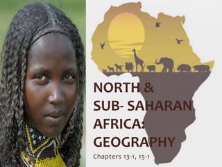
- 1. Chapters 13-1, 15-1 NORTH & SUB- SAHARAN AFRICA: GEOGRAPHY
- 2. Section Objectives •Identify and recognize key elements in each of Africa’s geographic regions •Identify the nations in each African region •Discuss the environmental impact of desertification and deforestation
- 3. Africa’s Geography •Africa is the second largest continent on the planet! •It has an extremely diverse geography
- 4. Africa’s Geography • Africa is divided into four sections: • North: Mostly the Sahara Desert, along with the Nile River Valley • West: Much of the Sahel, a semiarid grassland that separates the Sahara from the savannas, or tropical grasslands • Central: Mostly rainforest, especially in the Congo Basin • East: Rift valleys–deep valleys that formed when Earth’s crust separated and broke apart • South: Great plateaus and the Kalahari Desert
- 5. North Africa: Life in the Sahara
- 6. North Africa: Life in the Sahara •Much of North Africa is made up of arid, or very dry, deserts • Much of the Sahara Desert receives less than 4 inches per year! • It stretches 3,500 miles from the Red Sea to the Atlantic Ocean • Daytime temperatures can climb to 130°F • 10,000 years ago, the Sahara was a tropical grassland • A process called desertification—the gradual transition from fertile to less productive land– forced people to move from northern Africa into other areas • However, a semi-nomadic people known as the Tuareg still regularly cross the Sahara to trade goods such as salt
- 7. North Africa: Life in the Sahara •The Atlas Mountains stretch along the Mediterranean coast from Morocco to Tunisia •Water is scarce, but the Nile River provides Egypt with an important water supply •Countries: Morocco, Algeria, Tunisia, Libya, Egypt Tuareg Traders
- 8. The Nile River Valley •The Nile is the longest river in the world •4,132 miles, 1,300 miles longer than the U.S. at its widest point! •Unlike most rivers, the Nile flows north from • Lake Tana in Ethiopia (Elevation: 6,000 feet) • Lake Victoria in Tanzania, Uganda, and Kenya (Elevation: 3,720 feet) •Each spring, flooding leaves rich soil on the floodplain, a low-lying land next to rivers formed by flood sediment deposits •Good soil and plentiful water made this one of the places humans first developed a civilization
- 9. The Nile River Valley at Night!
- 10. The Nile River Valley •In 1970, the Aswan High Dam was built to regulate, or control flooding •The dam generates hydroelectric power, a form of energy created using flowing water •This dam generates 15% of Egypt’s electricity! •Today, 95% of Egypt’s population live along the Nile; the rest of the nation is mostly desert
- 11. Aswan High Dam (Looking South)
- 12. Traveling to North Africa (5:07)
- 14. East Africa & the Rift Valley
- 15. East Africa & the Rift Valley •The most important feature in East Africa is the Great Rift Valley •Formed when tectonic plates separated and created deep cracks, or rifts, in the earth’s crust •Have been forming for about 20 million years •Low spots that filled with rainwater became lakes like Lake Tanganyika •Second deepest freshwater lake in the world!
- 16. Lake Tanganyika 4,823 feet deep!
- 17. East Africa & the Rift Valley •The rest of East Africa sits mostly on plateaus •Kenya and Tanzania have vast savannas where wildlife can graze freely or in reserves •Plate movements also created volcanoes like Mount Kilimanjaro (19,304 feet) and Mount Kenya (17,058 feet) •These are dormant, or inactive, volcanoes •Countries: Sudan, South Sudan, Eritrea, Ethiopia, Somalia, Uganda, Kenya, Rwanda, Burundi, Tanzania
- 18. Traveling to East Africa (6:24)
- 20. West African Steppes • West Africa runs from the Atlantic coast south of the Sahara to the interior, or inner part, of the continent • Near the coast, the climate is tropical and these countries can receive up to 10 FEET of rain each year • In the interior countries, however, desert may get as little as 10 INCHES per year. • Landforms in West Africa include the Sahel, semiarid steppes, rainforests, and highlands, which are areas of higher mountainous land • To create more farmland for a growing population, some West Africans have cut down forests, a process called deforestation
- 21. West African Steppes •The majority of the population in West Africa lives along the Atlantic coast • Lagos, Nigeria – the largest city in West Africa – one of the largest in the world! •Deserts in West Africa make the countries there poorer, and some people struggle to stay alive • In Chad, 80% of people practice subsistence farming •Countries: Western Sahara, Mauritania, Senegal, Gambia, Guinea-Bissau, Guinea, Sierra Leone, Liberia, Cote D’Ivoire, Ghana, Burkina Faso, Mali Niger, Togo, Benin, Nigeria, Chad
- 23. Central Africa: Rainforests & Resources •The Congo Basin—a region dominated by a river system—is the main feature of Central Africa • Second largest in the world (Amazon is first!) •The basin holds a rain forest, a forest with warm temperatures, plentiful rain, high humidity, and thick vegetation •Central Africa has many resources, including copper, forests, diamonds, and the river itself, which provides hydroelectric power •Countries: Central African Republic, Congo, Cameroon, São Tomé and PrÍncipe, Equatorial Guinea, and Gabon
- 24. Traveling to West and Central Africa (5:40)
- 26. Southern Plateaus & Basins •Southern Africa has fertile farmland, valuable natural resources, and abundant wildlife •A large plateau covers most of southern Africa and ends with the Great Escarpment, a steep slope that drops from the plateau to the coastal plains •The Zambezi River collects water from south central Africa and carries it to the Indian Ocean
- 27. Southern Plateaus & Basins •Copper, gold, and diamonds are all mined in Zambia, Zimbabwe, and South Africa •South Africa has many vineyards; Zimbabwe grows tea on the eastern escarpment slopes, and Angola grows coffee •Fruits, corn, wheat, and other grains are grown across the region •Countries: Angola, Zambia, Malawi, Comoros, Mozambique, Zimbabwe, Namibia, Botswana, Swaziland, Lesotho, South Africa, Madagascar
- 28. Traveling to Southern Africa (5:10)
- 29. Chapters 13-2, 15-2 NORTH & SUB- SAHARAN AFRICA: HISTORY
- 30. Section Objectives •Recognize the contributions of Egyptian civilization to the world •Understand the impact of Bantu migration on African culture •Examine the impact of the slave trade and European imperialism on Africa’s present-day struggles
- 31. Egypt’s Ancient Civilization •Egypt is one of the oldest civilizations on earth •They developed a system of record-keeping known as hieroglyphics, and a paper-like material called papyrus •Pharaohs, or Egyptian kings, ruled with absolute authority for almost 3,000 years •Egypt was eventually made a part of the Roman Empire
- 32. African Migration & Empires •About 10,000 years ago, an agricultural revolution began when people started growing crops instead of gather plants •A people called the Bantu moved south and east across Central and Southern Africa • Had knowledge of iron working other tribes lacked • Absorbed other groups into their culture •Nearly 85 million people now trace their ancestry to the Bantu • Original Bantu language has morphed into 450! • Swahili – born out of trade with Arab travelers – is one of the most common languages • It is a lingua franca, or common language between multiple groups of people
- 34. African Migration & Empires •Trade by caravans—groups of merchants traveling together for safety—spread languages like Swahili and the religion of Islam •Many empires ruled by African kings thrived on trading gold and salt •In 1390, the kingdom of Kongo (different from the Republic of Congo) in Central Africa became known for its highly-organized government—until the Portuguese got involved
- 35. The Slave Trade •Slavery existed in Africa for many years before Europeans arrived •In the 700s, some Muslims began to sell Africans to North Africa and Southwest Asia as slaves
- 36. The Slave Trade •Around 1500, the Portuguese, Spanish, Dutch, French and English all began trading slaves •Purchased in African coastal cities •Shipped across the Atlantic via the Middle Passage, a voyage of several months • Many died from disease and malnutrition, or inadequate food or nourishment •Slaves in the Americas were sold at auction to work on plantations, or large farms, for sugar, tobacco, and cotton
- 38. The Slave Trade •From 1500 to the mid-1800s, over 12 million Africans were enslaved •The majority were sent to Brazil and the Caribbean •Africa was robbed of its young people, particularly males, leaving communities without leaders and families without fathers •The loss of these young people weakened some communities and totally destroyed others
- 39. Atlantic Slave Trade - Middle Passage (5:38)
- 40. • By the 1500s, several European countries wanted to control large chunks of Africa • Many Europeans believed Africa’s cultures and religions were inferior, or less valuable, than those of Europe, and did not respect them • Imperialism is the practice of extending a nation’s influence by controlling other territories • It leads to colonialism, or the practice of directly controlling and settling foreign territories Colonization & Independence
- 41. Colonization to Independence •In 1884, Europeans held the Berlin Conference to settle disagreements about who was in charge of what part of Africa •They divided up Africa between France, Germany, Belgium, Portugal, Italy, Spain, and Great Britain •NO Africans were invited to attend!
- 42. Scramble for Africa - Berlin Conference (3:42)
- 43. Colonization to Independence •In the early 1900s, Pan- Africanism, a movement to unite African people, began to grow. •In the 1950s and 1960s, the European powers, under pressure from African leaders, finally began to give their African colonies independence
- 44. History of the Pan-African Movement (3:00)
- 45. ANY QUESTIONS?