SlideShare a Scribd company logo
1 of 20
Rene Forsberg
Geodynamics Dept, DTU-Space
rf@space.dtu.dk
UAVs and the Arctic
Lidar mapping of sea ice and ice cap changes
from fixed-wing drones (and aircraft)
DTU Space / COWI, KNS glacier, Aug 2013
Drone use in Greenland …
• Urban and settlement mapping/ASIAQ (E-bees)
• Emergency services
• Mining and tailings mapping
• Sciences – archeology, biology, glaciology
(mapping/imagery)
Upcoming / future:
• Defense – surveilance, sovereignity, situational
awareness …
• Search and Rescue
• Communications relays …
• Environent /landslide/cryosphere monitoring …
• ??
Nuuk
Uummaanaq
Monitoring the Arctic cryosphere changes ..
Space missions give the overview … space agency focus (ESA, NASA, …)
Details and validation by aircraft, drones and in-situ campaings
Drones have the potential for frequent, year-round monitoring
CryoSat GRACE GOCE
Greenland ice sheet elevations
from CryoSat (DTU-Space)
Greenland ice sheet changes ..
Rapid melt of the ice sheet margins and outlet glaciers (ESA CryoSat, Sentinel-3)
Increasing ice velocity for outlet glaciers .. especially in summer (ESA Sentinel-1)
Global concern: sea level rise .. (p.t. 0.7 mm/year)
Height changes (DTU) Ice Velocities (Enveo)
Cryosphere
changes …
Land ice: global
Sea ice:
- local fishery
and hunting
- ship navigation
- climate feedbacks
Jakobshavn glacier front
Arctic Ocean sea ice
north of Greenland
Qaanaaq
Changing ice cover in the Arctic Ocean
1979 2007
The satellite measurements since 1979 shows a gradual decrease with acceleration
in recent years … 2007 onwards new records year by year…
Sea ice thickness …
Sea ice thickness a special problem for
space and sub-orbital flight:
Principle: measurement of freeboard ..
Lead
Example of laserscanning of sea ice
Arctic Ocean north of Greenland
300 m wide swath
Ice thickness 2-3 m
Ice Ridges
UAV’s for research/climate
- Testing small and medium UAV’s:
Glacier mapping, sea ice, icebergs, urban mapping
High-techonology fund project – ”smart UAV”
- Sensor development:
Lightweight GPS, miniature IMU, geodetic GPS,
scanning lidar, magnetometer …
- Polar deployments (Villum Station Nord)
- Other cooperations:
NASA/Danish Defense (GlobalHawk tests in Greenland)
MonMap/Mongolia (glacier surveys) ..
Villum Station Nord lidar droneHawkeye UAV / MonMap, Mongolia
Snow mapping in Svalbard
Drones for measuring cryosphere elevation changes…
Challenges: down-sizing of sensors (GPS, lidar, radar ..)
Off-the-shelf: Camera solutions – dense flight pattern… static
objects (i.e. drifting sea ice not working)
Single-profile measurements – laser scanning / BVLOS drones
Elevation change KNS–glacier near Nuuk
2013-2009 (skale 0-80 m)
Drone fotomosaic KNS 2013
KNS glacier
front
Short-term
Glacier changes
DTU Space DroneCenter 2014-
Research
o Development of Smart UAV (fixed-wing VTOL)
o Close cooperation with Sky-Watch and InteGra
o UAV landing on moving platforms (AutoDescent)
o Mini Aerial Vehicle (MAV)
o Development of sensors for use on unmanned platforms
(gravimeter, magnetometer, LiDAR)
o Formationflying and “swarming” using high precision-navigation
and antikollision-teknology for “proximity operations”
SmartUAV Hugin-X1
Cumulus-1
Cooperation with NASA Armstrong Flight
Research Facility, Northrop Grumman
Corporation og NOAA to use NASA
Global Hawk in the Arctic.
US cooperation: large drones
Airborne remote sensing / geophysics
CryoVex 2017
Blå: Marts (POF)
Green: April (FAZ)
- GPS/INS, Positioning @ cm level
- Scanning lidar
- Radar (Ku-band, VHF, P-band)
- Gravimeter, magnetometers
CryoSat validation campaigns ..
Sea-ice freeboard by lidar
Mow-the-lawn
flight over R/V Lance
April 24, 2015
Villum: UAV – Penguin B (payload 10 kg – BVLOS ops)
Velodyne Puck and
Riegl VUX-1 lidar
Stn
Nord
Villum Penguin B
lidar setup ..
(gasoline engine, skis under
construction, servicing ….)
Lidar
GPS/IMU
Iridium
Autopilot controller
GoPro camera below
Science computer
Villum Station Nord, Greenland
New science station – 10 million Euro
Private foundation funding – open 2015
Århus University lead ..
Fleet of drones:
E-bees, Penguin B/C, Prion Mk3
Flights from DK via Svalbard
Close to ice cap, sea ice, tundra ..
www.villumresearchstation.dk
Drones in the Arctic
Numerous applications … society, military, research …
Scanning lidar to supplement airborne and satellite
data acquisitions for cryosphere changes and
satellite data cal/val ..
Penguin-B campaigns:
Ice cap (Kangerlussuaq) Oct 2017, sea ice (St Nord) Apr 2017

More Related Content

What's hot

Geological mapping using satellite images.
Geological mapping using satellite images.Geological mapping using satellite images.
Geological mapping using satellite images.Diego Bedoya Gonzalez
 
Sakkas.ppt
Sakkas.pptSakkas.ppt
Sakkas.pptgrssieee
 
2019-10-07 Small-scale deformation of active volcanoes measured by Synthetic ...
2019-10-07 Small-scale deformation of active volcanoes measured by Synthetic ...2019-10-07 Small-scale deformation of active volcanoes measured by Synthetic ...
2019-10-07 Small-scale deformation of active volcanoes measured by Synthetic ...Yosuke Aoki
 
Solaro_IGARSS_2011.ppt
Solaro_IGARSS_2011.pptSolaro_IGARSS_2011.ppt
Solaro_IGARSS_2011.pptgrssieee
 
Disaster monitoring by multi-temporal images of the 2011 Tohoku Earthquake an...
Disaster monitoring by multi-temporal images of the 2011 Tohoku Earthquake an...Disaster monitoring by multi-temporal images of the 2011 Tohoku Earthquake an...
Disaster monitoring by multi-temporal images of the 2011 Tohoku Earthquake an...grssieee
 
Best projects in University of Khartoum, Faculty of Engineering 2016
Best projects in University of Khartoum, Faculty of  Engineering 2016Best projects in University of Khartoum, Faculty of  Engineering 2016
Best projects in University of Khartoum, Faculty of Engineering 2016Mohamed Yousif
 
Haiti Earthquake.ppt
Haiti Earthquake.pptHaiti Earthquake.ppt
Haiti Earthquake.pptgrssieee
 
Introdution to Landsat and Google Earth Engine
Introdution to Landsat and Google Earth EngineIntrodution to Landsat and Google Earth Engine
Introdution to Landsat and Google Earth EngineVeerachai Tanpipat
 
Estimation of hydraulic parameters with multi-scale parameterization method
Estimation of hydraulic parameters with multi-scale parameterization methodEstimation of hydraulic parameters with multi-scale parameterization method
Estimation of hydraulic parameters with multi-scale parameterization methodKatsutoshi Seki
 
Measuring water from Sky: Basin-wide ET monitoring and application
Measuring water from Sky: Basin-wide ET monitoring and applicationMeasuring water from Sky: Basin-wide ET monitoring and application
Measuring water from Sky: Basin-wide ET monitoring and applicationIwl Pcu
 
FR1.T03.1 Meeting Slides of MHS_TB over Antarctica_7_29_11.pptx
FR1.T03.1 Meeting Slides of MHS_TB over Antarctica_7_29_11.pptxFR1.T03.1 Meeting Slides of MHS_TB over Antarctica_7_29_11.pptx
FR1.T03.1 Meeting Slides of MHS_TB over Antarctica_7_29_11.pptxgrssieee
 
GSAT 18 SATTELITE, GSLV & INSAT 3DR AND ROSETTA MISSION
GSAT 18 SATTELITE, GSLV & INSAT 3DR AND ROSETTA MISSIONGSAT 18 SATTELITE, GSLV & INSAT 3DR AND ROSETTA MISSION
GSAT 18 SATTELITE, GSLV & INSAT 3DR AND ROSETTA MISSIONCompetitive Exam Forum
 
A Study on the Development of High Accuracy Solar Tracking Systems
A Study on the Development of High Accuracy Solar Tracking SystemsA Study on the Development of High Accuracy Solar Tracking Systems
A Study on the Development of High Accuracy Solar Tracking Systemsiskandaruz
 
MAGIA satellite. Experimental Astronomy (8 December 2010), pp. 1-20
MAGIA satellite. Experimental Astronomy (8 December 2010), pp. 1-20MAGIA satellite. Experimental Astronomy (8 December 2010), pp. 1-20
MAGIA satellite. Experimental Astronomy (8 December 2010), pp. 1-20Stefano Coltellacci
 
Presentation: Volcanic Monitoring with GPS--An Alaskan Example
Presentation: Volcanic Monitoring with GPS--An Alaskan ExamplePresentation: Volcanic Monitoring with GPS--An Alaskan Example
Presentation: Volcanic Monitoring with GPS--An Alaskan ExampleSERC at Carleton College
 
IGARSS_2011_ScanSAR_new.pptx
IGARSS_2011_ScanSAR_new.pptxIGARSS_2011_ScanSAR_new.pptx
IGARSS_2011_ScanSAR_new.pptxgrssieee
 

What's hot (18)

Geological mapping using satellite images.
Geological mapping using satellite images.Geological mapping using satellite images.
Geological mapping using satellite images.
 
Sakkas.ppt
Sakkas.pptSakkas.ppt
Sakkas.ppt
 
2019-10-07 Small-scale deformation of active volcanoes measured by Synthetic ...
2019-10-07 Small-scale deformation of active volcanoes measured by Synthetic ...2019-10-07 Small-scale deformation of active volcanoes measured by Synthetic ...
2019-10-07 Small-scale deformation of active volcanoes measured by Synthetic ...
 
Thesis Presentation
Thesis PresentationThesis Presentation
Thesis Presentation
 
Solaro_IGARSS_2011.ppt
Solaro_IGARSS_2011.pptSolaro_IGARSS_2011.ppt
Solaro_IGARSS_2011.ppt
 
Disaster monitoring by multi-temporal images of the 2011 Tohoku Earthquake an...
Disaster monitoring by multi-temporal images of the 2011 Tohoku Earthquake an...Disaster monitoring by multi-temporal images of the 2011 Tohoku Earthquake an...
Disaster monitoring by multi-temporal images of the 2011 Tohoku Earthquake an...
 
Best projects in University of Khartoum, Faculty of Engineering 2016
Best projects in University of Khartoum, Faculty of  Engineering 2016Best projects in University of Khartoum, Faculty of  Engineering 2016
Best projects in University of Khartoum, Faculty of Engineering 2016
 
Haiti Earthquake.ppt
Haiti Earthquake.pptHaiti Earthquake.ppt
Haiti Earthquake.ppt
 
Introdution to Landsat and Google Earth Engine
Introdution to Landsat and Google Earth EngineIntrodution to Landsat and Google Earth Engine
Introdution to Landsat and Google Earth Engine
 
Estimation of hydraulic parameters with multi-scale parameterization method
Estimation of hydraulic parameters with multi-scale parameterization methodEstimation of hydraulic parameters with multi-scale parameterization method
Estimation of hydraulic parameters with multi-scale parameterization method
 
Measuring water from Sky: Basin-wide ET monitoring and application
Measuring water from Sky: Basin-wide ET monitoring and applicationMeasuring water from Sky: Basin-wide ET monitoring and application
Measuring water from Sky: Basin-wide ET monitoring and application
 
FR1.T03.1 Meeting Slides of MHS_TB over Antarctica_7_29_11.pptx
FR1.T03.1 Meeting Slides of MHS_TB over Antarctica_7_29_11.pptxFR1.T03.1 Meeting Slides of MHS_TB over Antarctica_7_29_11.pptx
FR1.T03.1 Meeting Slides of MHS_TB over Antarctica_7_29_11.pptx
 
GSAT 18 SATTELITE, GSLV & INSAT 3DR AND ROSETTA MISSION
GSAT 18 SATTELITE, GSLV & INSAT 3DR AND ROSETTA MISSIONGSAT 18 SATTELITE, GSLV & INSAT 3DR AND ROSETTA MISSION
GSAT 18 SATTELITE, GSLV & INSAT 3DR AND ROSETTA MISSION
 
A Study on the Development of High Accuracy Solar Tracking Systems
A Study on the Development of High Accuracy Solar Tracking SystemsA Study on the Development of High Accuracy Solar Tracking Systems
A Study on the Development of High Accuracy Solar Tracking Systems
 
MAGIA satellite. Experimental Astronomy (8 December 2010), pp. 1-20
MAGIA satellite. Experimental Astronomy (8 December 2010), pp. 1-20MAGIA satellite. Experimental Astronomy (8 December 2010), pp. 1-20
MAGIA satellite. Experimental Astronomy (8 December 2010), pp. 1-20
 
Presentation: Volcanic Monitoring with GPS--An Alaskan Example
Presentation: Volcanic Monitoring with GPS--An Alaskan ExamplePresentation: Volcanic Monitoring with GPS--An Alaskan Example
Presentation: Volcanic Monitoring with GPS--An Alaskan Example
 
IGARSS_2011_ScanSAR_new.pptx
IGARSS_2011_ScanSAR_new.pptxIGARSS_2011_ScanSAR_new.pptx
IGARSS_2011_ScanSAR_new.pptx
 
AAS National Conference 2008: Diana Blaney
AAS National Conference 2008: Diana BlaneyAAS National Conference 2008: Diana Blaney
AAS National Conference 2008: Diana Blaney
 

Similar to Monitoring Arctic Cryosphere Changes with UAV Lidar Scanning

Drinkwater ice sheet symposium - tu delft climate inst., 17 oct 2013(1)
Drinkwater  ice sheet symposium - tu delft climate inst., 17 oct 2013(1)Drinkwater  ice sheet symposium - tu delft climate inst., 17 oct 2013(1)
Drinkwater ice sheet symposium - tu delft climate inst., 17 oct 2013(1)TU Delft Climate Institute
 
Computer Vision in Geosciences
Computer Vision in GeosciencesComputer Vision in Geosciences
Computer Vision in GeosciencesPavel Golubev
 
Overview of using InSAR to measure ice velocity
Overview of using InSAR to measure ice velocityOverview of using InSAR to measure ice velocity
Overview of using InSAR to measure ice velocitySERC at Carleton College
 
WE2.L10.4: OPERATION ICEBRIDGE: USING INSTRUMENTED AIRCRAFT TO BRIDGE THE OBS...
WE2.L10.4: OPERATION ICEBRIDGE: USING INSTRUMENTED AIRCRAFT TO BRIDGE THE OBS...WE2.L10.4: OPERATION ICEBRIDGE: USING INSTRUMENTED AIRCRAFT TO BRIDGE THE OBS...
WE2.L10.4: OPERATION ICEBRIDGE: USING INSTRUMENTED AIRCRAFT TO BRIDGE THE OBS...grssieee
 
TU2.L10 - THE AQUARIUS/SAC-D MISSION OVERVIEW
TU2.L10 - THE AQUARIUS/SAC-D MISSION OVERVIEWTU2.L10 - THE AQUARIUS/SAC-D MISSION OVERVIEW
TU2.L10 - THE AQUARIUS/SAC-D MISSION OVERVIEWgrssieee
 
Earth Observation Systems Evolution- Thales Alenia Space at Paris Air Show 2013
Earth Observation Systems Evolution- Thales Alenia Space at Paris Air Show 2013Earth Observation Systems Evolution- Thales Alenia Space at Paris Air Show 2013
Earth Observation Systems Evolution- Thales Alenia Space at Paris Air Show 2013Leonardo
 
WE3.L10.4: KIYO TOMIYASU, CO-SEISMIC SLIP AND THE KRAFLA VOLCANO: REFLECTIONS...
WE3.L10.4: KIYO TOMIYASU, CO-SEISMIC SLIP AND THE KRAFLA VOLCANO: REFLECTIONS...WE3.L10.4: KIYO TOMIYASU, CO-SEISMIC SLIP AND THE KRAFLA VOLCANO: REFLECTIONS...
WE3.L10.4: KIYO TOMIYASU, CO-SEISMIC SLIP AND THE KRAFLA VOLCANO: REFLECTIONS...grssieee
 
TH4.TO4.2.ppt
TH4.TO4.2.pptTH4.TO4.2.ppt
TH4.TO4.2.pptgrssieee
 
MEASUREMENT OF SURFACE TEMPERATURE OF A GLACIER USING AN UNMANNED AERIAL VEHI...
MEASUREMENT OF SURFACE TEMPERATURE OF A GLACIER USING AN UNMANNED AERIAL VEHI...MEASUREMENT OF SURFACE TEMPERATURE OF A GLACIER USING AN UNMANNED AERIAL VEHI...
MEASUREMENT OF SURFACE TEMPERATURE OF A GLACIER USING AN UNMANNED AERIAL VEHI...Nepal Flying Labs
 
Spaceborne Imagery For Environmental & Disaster Monitoring
Spaceborne Imagery For Environmental & Disaster MonitoringSpaceborne Imagery For Environmental & Disaster Monitoring
Spaceborne Imagery For Environmental & Disaster Monitoringgpetrie
 
The use of geoinformatics in mineral exploration and exploitation
The use of geoinformatics in mineral exploration and exploitationThe use of geoinformatics in mineral exploration and exploitation
The use of geoinformatics in mineral exploration and exploitationMarguerite Walsh
 
Monitoring surface deformation combining optical and radar sentinel data gsg ...
Monitoring surface deformation combining optical and radar sentinel data gsg ...Monitoring surface deformation combining optical and radar sentinel data gsg ...
Monitoring surface deformation combining optical and radar sentinel data gsg ...Pavlos Krassakis
 
Grace satellite technology
Grace satellite technologyGrace satellite technology
Grace satellite technologydzbsjk
 
WE4.L10.5: ADVANCES IN NIGHTTIME SATELLITE REMOTE SENSING CAPABILITIES VIA TH...
WE4.L10.5: ADVANCES IN NIGHTTIME SATELLITE REMOTE SENSING CAPABILITIES VIA TH...WE4.L10.5: ADVANCES IN NIGHTTIME SATELLITE REMOTE SENSING CAPABILITIES VIA TH...
WE4.L10.5: ADVANCES IN NIGHTTIME SATELLITE REMOTE SENSING CAPABILITIES VIA TH...grssieee
 

Similar to Monitoring Arctic Cryosphere Changes with UAV Lidar Scanning (20)

Drinkwater ice sheet symposium - tu delft climate inst., 17 oct 2013(1)
Drinkwater  ice sheet symposium - tu delft climate inst., 17 oct 2013(1)Drinkwater  ice sheet symposium - tu delft climate inst., 17 oct 2013(1)
Drinkwater ice sheet symposium - tu delft climate inst., 17 oct 2013(1)
 
2013.10.17 ice sheet-symposium_ditmar
2013.10.17 ice sheet-symposium_ditmar2013.10.17 ice sheet-symposium_ditmar
2013.10.17 ice sheet-symposium_ditmar
 
Computer Vision in Geosciences
Computer Vision in GeosciencesComputer Vision in Geosciences
Computer Vision in Geosciences
 
Overview of using InSAR to measure ice velocity
Overview of using InSAR to measure ice velocityOverview of using InSAR to measure ice velocity
Overview of using InSAR to measure ice velocity
 
WE2.L10.4: OPERATION ICEBRIDGE: USING INSTRUMENTED AIRCRAFT TO BRIDGE THE OBS...
WE2.L10.4: OPERATION ICEBRIDGE: USING INSTRUMENTED AIRCRAFT TO BRIDGE THE OBS...WE2.L10.4: OPERATION ICEBRIDGE: USING INSTRUMENTED AIRCRAFT TO BRIDGE THE OBS...
WE2.L10.4: OPERATION ICEBRIDGE: USING INSTRUMENTED AIRCRAFT TO BRIDGE THE OBS...
 
Microwave remote sensing
Microwave remote sensingMicrowave remote sensing
Microwave remote sensing
 
AAS National Conference 2008: Graham Gibbs
AAS National Conference 2008: Graham GibbsAAS National Conference 2008: Graham Gibbs
AAS National Conference 2008: Graham Gibbs
 
TU2.L10 - THE AQUARIUS/SAC-D MISSION OVERVIEW
TU2.L10 - THE AQUARIUS/SAC-D MISSION OVERVIEWTU2.L10 - THE AQUARIUS/SAC-D MISSION OVERVIEW
TU2.L10 - THE AQUARIUS/SAC-D MISSION OVERVIEW
 
Earth Observation Systems Evolution- Thales Alenia Space at Paris Air Show 2013
Earth Observation Systems Evolution- Thales Alenia Space at Paris Air Show 2013Earth Observation Systems Evolution- Thales Alenia Space at Paris Air Show 2013
Earth Observation Systems Evolution- Thales Alenia Space at Paris Air Show 2013
 
WE3.L10.4: KIYO TOMIYASU, CO-SEISMIC SLIP AND THE KRAFLA VOLCANO: REFLECTIONS...
WE3.L10.4: KIYO TOMIYASU, CO-SEISMIC SLIP AND THE KRAFLA VOLCANO: REFLECTIONS...WE3.L10.4: KIYO TOMIYASU, CO-SEISMIC SLIP AND THE KRAFLA VOLCANO: REFLECTIONS...
WE3.L10.4: KIYO TOMIYASU, CO-SEISMIC SLIP AND THE KRAFLA VOLCANO: REFLECTIONS...
 
GAIA @SpaceUpParis
GAIA @SpaceUpParisGAIA @SpaceUpParis
GAIA @SpaceUpParis
 
Rs
RsRs
Rs
 
TH4.TO4.2.ppt
TH4.TO4.2.pptTH4.TO4.2.ppt
TH4.TO4.2.ppt
 
MEASUREMENT OF SURFACE TEMPERATURE OF A GLACIER USING AN UNMANNED AERIAL VEHI...
MEASUREMENT OF SURFACE TEMPERATURE OF A GLACIER USING AN UNMANNED AERIAL VEHI...MEASUREMENT OF SURFACE TEMPERATURE OF A GLACIER USING AN UNMANNED AERIAL VEHI...
MEASUREMENT OF SURFACE TEMPERATURE OF A GLACIER USING AN UNMANNED AERIAL VEHI...
 
Spaceborne Imagery For Environmental & Disaster Monitoring
Spaceborne Imagery For Environmental & Disaster MonitoringSpaceborne Imagery For Environmental & Disaster Monitoring
Spaceborne Imagery For Environmental & Disaster Monitoring
 
915 pankine[1]
915 pankine[1]915 pankine[1]
915 pankine[1]
 
The use of geoinformatics in mineral exploration and exploitation
The use of geoinformatics in mineral exploration and exploitationThe use of geoinformatics in mineral exploration and exploitation
The use of geoinformatics in mineral exploration and exploitation
 
Monitoring surface deformation combining optical and radar sentinel data gsg ...
Monitoring surface deformation combining optical and radar sentinel data gsg ...Monitoring surface deformation combining optical and radar sentinel data gsg ...
Monitoring surface deformation combining optical and radar sentinel data gsg ...
 
Grace satellite technology
Grace satellite technologyGrace satellite technology
Grace satellite technology
 
WE4.L10.5: ADVANCES IN NIGHTTIME SATELLITE REMOTE SENSING CAPABILITIES VIA TH...
WE4.L10.5: ADVANCES IN NIGHTTIME SATELLITE REMOTE SENSING CAPABILITIES VIA TH...WE4.L10.5: ADVANCES IN NIGHTTIME SATELLITE REMOTE SENSING CAPABILITIES VIA TH...
WE4.L10.5: ADVANCES IN NIGHTTIME SATELLITE REMOTE SENSING CAPABILITIES VIA TH...
 

More from TUS Expo

Are you likely to be hit by a drone? (by Anders La Cour-Harbo)
Are you likely to be hit by a drone? (by Anders La Cour-Harbo)Are you likely to be hit by a drone? (by Anders La Cour-Harbo)
Are you likely to be hit by a drone? (by Anders La Cour-Harbo)TUS Expo
 
The cloud based maritime emission monitoring (by Matti Irjala)
The cloud based maritime emission monitoring (by Matti Irjala)The cloud based maritime emission monitoring (by Matti Irjala)
The cloud based maritime emission monitoring (by Matti Irjala)TUS Expo
 
Internet of Civil Unmanned Aerial Systems: Challenges and Opportunities (by J...
Internet of Civil Unmanned Aerial Systems: Challenges and Opportunities (by J...Internet of Civil Unmanned Aerial Systems: Challenges and Opportunities (by J...
Internet of Civil Unmanned Aerial Systems: Challenges and Opportunities (by J...TUS Expo
 
Drones-as-a-Service for agricultural applications (by Philipp Trénel)
Drones-as-a-Service for agricultural applications (by Philipp Trénel)Drones-as-a-Service for agricultural applications (by Philipp Trénel)
Drones-as-a-Service for agricultural applications (by Philipp Trénel)TUS Expo
 
The future of drone traffice management, applied today (by Ronni Winkler Øste...
The future of drone traffice management, applied today (by Ronni Winkler Øste...The future of drone traffice management, applied today (by Ronni Winkler Øste...
The future of drone traffice management, applied today (by Ronni Winkler Øste...TUS Expo
 
Downstream Business Applications (by Norbert Hübner)
Downstream Business Applications (by Norbert Hübner)Downstream Business Applications (by Norbert Hübner)
Downstream Business Applications (by Norbert Hübner)TUS Expo
 
Artificial Intelligence (by Oldrich Svec)
Artificial Intelligence (by Oldrich Svec)Artificial Intelligence (by Oldrich Svec)
Artificial Intelligence (by Oldrich Svec)TUS Expo
 
Visual Detection Technology in Siemens Gamesa (by Allan Moeller Larsen)
Visual Detection Technology in Siemens Gamesa (by Allan Moeller Larsen)Visual Detection Technology in Siemens Gamesa (by Allan Moeller Larsen)
Visual Detection Technology in Siemens Gamesa (by Allan Moeller Larsen)TUS Expo
 
To boldly go where no man has gone before (by Gareth R Knowles)
To boldly go where no man has gone before (by Gareth R Knowles)To boldly go where no man has gone before (by Gareth R Knowles)
To boldly go where no man has gone before (by Gareth R Knowles)TUS Expo
 

More from TUS Expo (9)

Are you likely to be hit by a drone? (by Anders La Cour-Harbo)
Are you likely to be hit by a drone? (by Anders La Cour-Harbo)Are you likely to be hit by a drone? (by Anders La Cour-Harbo)
Are you likely to be hit by a drone? (by Anders La Cour-Harbo)
 
The cloud based maritime emission monitoring (by Matti Irjala)
The cloud based maritime emission monitoring (by Matti Irjala)The cloud based maritime emission monitoring (by Matti Irjala)
The cloud based maritime emission monitoring (by Matti Irjala)
 
Internet of Civil Unmanned Aerial Systems: Challenges and Opportunities (by J...
Internet of Civil Unmanned Aerial Systems: Challenges and Opportunities (by J...Internet of Civil Unmanned Aerial Systems: Challenges and Opportunities (by J...
Internet of Civil Unmanned Aerial Systems: Challenges and Opportunities (by J...
 
Drones-as-a-Service for agricultural applications (by Philipp Trénel)
Drones-as-a-Service for agricultural applications (by Philipp Trénel)Drones-as-a-Service for agricultural applications (by Philipp Trénel)
Drones-as-a-Service for agricultural applications (by Philipp Trénel)
 
The future of drone traffice management, applied today (by Ronni Winkler Øste...
The future of drone traffice management, applied today (by Ronni Winkler Øste...The future of drone traffice management, applied today (by Ronni Winkler Øste...
The future of drone traffice management, applied today (by Ronni Winkler Øste...
 
Downstream Business Applications (by Norbert Hübner)
Downstream Business Applications (by Norbert Hübner)Downstream Business Applications (by Norbert Hübner)
Downstream Business Applications (by Norbert Hübner)
 
Artificial Intelligence (by Oldrich Svec)
Artificial Intelligence (by Oldrich Svec)Artificial Intelligence (by Oldrich Svec)
Artificial Intelligence (by Oldrich Svec)
 
Visual Detection Technology in Siemens Gamesa (by Allan Moeller Larsen)
Visual Detection Technology in Siemens Gamesa (by Allan Moeller Larsen)Visual Detection Technology in Siemens Gamesa (by Allan Moeller Larsen)
Visual Detection Technology in Siemens Gamesa (by Allan Moeller Larsen)
 
To boldly go where no man has gone before (by Gareth R Knowles)
To boldly go where no man has gone before (by Gareth R Knowles)To boldly go where no man has gone before (by Gareth R Knowles)
To boldly go where no man has gone before (by Gareth R Knowles)
 

Recently uploaded

Streamlining Python Development: A Guide to a Modern Project Setup
Streamlining Python Development: A Guide to a Modern Project SetupStreamlining Python Development: A Guide to a Modern Project Setup
Streamlining Python Development: A Guide to a Modern Project SetupFlorian Wilhelm
 
Take control of your SAP testing with UiPath Test Suite
Take control of your SAP testing with UiPath Test SuiteTake control of your SAP testing with UiPath Test Suite
Take control of your SAP testing with UiPath Test SuiteDianaGray10
 
What is DBT - The Ultimate Data Build Tool.pdf
What is DBT - The Ultimate Data Build Tool.pdfWhat is DBT - The Ultimate Data Build Tool.pdf
What is DBT - The Ultimate Data Build Tool.pdfMounikaPolabathina
 
Unleash Your Potential - Namagunga Girls Coding Club
Unleash Your Potential - Namagunga Girls Coding ClubUnleash Your Potential - Namagunga Girls Coding Club
Unleash Your Potential - Namagunga Girls Coding ClubKalema Edgar
 
New from BookNet Canada for 2024: BNC CataList - Tech Forum 2024
New from BookNet Canada for 2024: BNC CataList - Tech Forum 2024New from BookNet Canada for 2024: BNC CataList - Tech Forum 2024
New from BookNet Canada for 2024: BNC CataList - Tech Forum 2024BookNet Canada
 
New from BookNet Canada for 2024: Loan Stars - Tech Forum 2024
New from BookNet Canada for 2024: Loan Stars - Tech Forum 2024New from BookNet Canada for 2024: Loan Stars - Tech Forum 2024
New from BookNet Canada for 2024: Loan Stars - Tech Forum 2024BookNet Canada
 
"Debugging python applications inside k8s environment", Andrii Soldatenko
"Debugging python applications inside k8s environment", Andrii Soldatenko"Debugging python applications inside k8s environment", Andrii Soldatenko
"Debugging python applications inside k8s environment", Andrii SoldatenkoFwdays
 
unit 4 immunoblotting technique complete.pptx
unit 4 immunoblotting technique complete.pptxunit 4 immunoblotting technique complete.pptx
unit 4 immunoblotting technique complete.pptxBkGupta21
 
Commit 2024 - Secret Management made easy
Commit 2024 - Secret Management made easyCommit 2024 - Secret Management made easy
Commit 2024 - Secret Management made easyAlfredo García Lavilla
 
Are Multi-Cloud and Serverless Good or Bad?
Are Multi-Cloud and Serverless Good or Bad?Are Multi-Cloud and Serverless Good or Bad?
Are Multi-Cloud and Serverless Good or Bad?Mattias Andersson
 
TrustArc Webinar - How to Build Consumer Trust Through Data Privacy
TrustArc Webinar - How to Build Consumer Trust Through Data PrivacyTrustArc Webinar - How to Build Consumer Trust Through Data Privacy
TrustArc Webinar - How to Build Consumer Trust Through Data PrivacyTrustArc
 
The State of Passkeys with FIDO Alliance.pptx
The State of Passkeys with FIDO Alliance.pptxThe State of Passkeys with FIDO Alliance.pptx
The State of Passkeys with FIDO Alliance.pptxLoriGlavin3
 
Nell’iperspazio con Rocket: il Framework Web di Rust!
Nell’iperspazio con Rocket: il Framework Web di Rust!Nell’iperspazio con Rocket: il Framework Web di Rust!
Nell’iperspazio con Rocket: il Framework Web di Rust!Commit University
 
Advanced Computer Architecture – An Introduction
Advanced Computer Architecture – An IntroductionAdvanced Computer Architecture – An Introduction
Advanced Computer Architecture – An IntroductionDilum Bandara
 
TeamStation AI System Report LATAM IT Salaries 2024
TeamStation AI System Report LATAM IT Salaries 2024TeamStation AI System Report LATAM IT Salaries 2024
TeamStation AI System Report LATAM IT Salaries 2024Lonnie McRorey
 
Generative AI for Technical Writer or Information Developers
Generative AI for Technical Writer or Information DevelopersGenerative AI for Technical Writer or Information Developers
Generative AI for Technical Writer or Information DevelopersRaghuram Pandurangan
 
Tampa BSides - Chef's Tour of Microsoft Security Adoption Framework (SAF)
Tampa BSides - Chef's Tour of Microsoft Security Adoption Framework (SAF)Tampa BSides - Chef's Tour of Microsoft Security Adoption Framework (SAF)
Tampa BSides - Chef's Tour of Microsoft Security Adoption Framework (SAF)Mark Simos
 
What's New in Teams Calling, Meetings and Devices March 2024
What's New in Teams Calling, Meetings and Devices March 2024What's New in Teams Calling, Meetings and Devices March 2024
What's New in Teams Calling, Meetings and Devices March 2024Stephanie Beckett
 
Scanning the Internet for External Cloud Exposures via SSL Certs
Scanning the Internet for External Cloud Exposures via SSL CertsScanning the Internet for External Cloud Exposures via SSL Certs
Scanning the Internet for External Cloud Exposures via SSL CertsRizwan Syed
 
Passkey Providers and Enabling Portability: FIDO Paris Seminar.pptx
Passkey Providers and Enabling Portability: FIDO Paris Seminar.pptxPasskey Providers and Enabling Portability: FIDO Paris Seminar.pptx
Passkey Providers and Enabling Portability: FIDO Paris Seminar.pptxLoriGlavin3
 

Recently uploaded (20)

Streamlining Python Development: A Guide to a Modern Project Setup
Streamlining Python Development: A Guide to a Modern Project SetupStreamlining Python Development: A Guide to a Modern Project Setup
Streamlining Python Development: A Guide to a Modern Project Setup
 
Take control of your SAP testing with UiPath Test Suite
Take control of your SAP testing with UiPath Test SuiteTake control of your SAP testing with UiPath Test Suite
Take control of your SAP testing with UiPath Test Suite
 
What is DBT - The Ultimate Data Build Tool.pdf
What is DBT - The Ultimate Data Build Tool.pdfWhat is DBT - The Ultimate Data Build Tool.pdf
What is DBT - The Ultimate Data Build Tool.pdf
 
Unleash Your Potential - Namagunga Girls Coding Club
Unleash Your Potential - Namagunga Girls Coding ClubUnleash Your Potential - Namagunga Girls Coding Club
Unleash Your Potential - Namagunga Girls Coding Club
 
New from BookNet Canada for 2024: BNC CataList - Tech Forum 2024
New from BookNet Canada for 2024: BNC CataList - Tech Forum 2024New from BookNet Canada for 2024: BNC CataList - Tech Forum 2024
New from BookNet Canada for 2024: BNC CataList - Tech Forum 2024
 
New from BookNet Canada for 2024: Loan Stars - Tech Forum 2024
New from BookNet Canada for 2024: Loan Stars - Tech Forum 2024New from BookNet Canada for 2024: Loan Stars - Tech Forum 2024
New from BookNet Canada for 2024: Loan Stars - Tech Forum 2024
 
"Debugging python applications inside k8s environment", Andrii Soldatenko
"Debugging python applications inside k8s environment", Andrii Soldatenko"Debugging python applications inside k8s environment", Andrii Soldatenko
"Debugging python applications inside k8s environment", Andrii Soldatenko
 
unit 4 immunoblotting technique complete.pptx
unit 4 immunoblotting technique complete.pptxunit 4 immunoblotting technique complete.pptx
unit 4 immunoblotting technique complete.pptx
 
Commit 2024 - Secret Management made easy
Commit 2024 - Secret Management made easyCommit 2024 - Secret Management made easy
Commit 2024 - Secret Management made easy
 
Are Multi-Cloud and Serverless Good or Bad?
Are Multi-Cloud and Serverless Good or Bad?Are Multi-Cloud and Serverless Good or Bad?
Are Multi-Cloud and Serverless Good or Bad?
 
TrustArc Webinar - How to Build Consumer Trust Through Data Privacy
TrustArc Webinar - How to Build Consumer Trust Through Data PrivacyTrustArc Webinar - How to Build Consumer Trust Through Data Privacy
TrustArc Webinar - How to Build Consumer Trust Through Data Privacy
 
The State of Passkeys with FIDO Alliance.pptx
The State of Passkeys with FIDO Alliance.pptxThe State of Passkeys with FIDO Alliance.pptx
The State of Passkeys with FIDO Alliance.pptx
 
Nell’iperspazio con Rocket: il Framework Web di Rust!
Nell’iperspazio con Rocket: il Framework Web di Rust!Nell’iperspazio con Rocket: il Framework Web di Rust!
Nell’iperspazio con Rocket: il Framework Web di Rust!
 
Advanced Computer Architecture – An Introduction
Advanced Computer Architecture – An IntroductionAdvanced Computer Architecture – An Introduction
Advanced Computer Architecture – An Introduction
 
TeamStation AI System Report LATAM IT Salaries 2024
TeamStation AI System Report LATAM IT Salaries 2024TeamStation AI System Report LATAM IT Salaries 2024
TeamStation AI System Report LATAM IT Salaries 2024
 
Generative AI for Technical Writer or Information Developers
Generative AI for Technical Writer or Information DevelopersGenerative AI for Technical Writer or Information Developers
Generative AI for Technical Writer or Information Developers
 
Tampa BSides - Chef's Tour of Microsoft Security Adoption Framework (SAF)
Tampa BSides - Chef's Tour of Microsoft Security Adoption Framework (SAF)Tampa BSides - Chef's Tour of Microsoft Security Adoption Framework (SAF)
Tampa BSides - Chef's Tour of Microsoft Security Adoption Framework (SAF)
 
What's New in Teams Calling, Meetings and Devices March 2024
What's New in Teams Calling, Meetings and Devices March 2024What's New in Teams Calling, Meetings and Devices March 2024
What's New in Teams Calling, Meetings and Devices March 2024
 
Scanning the Internet for External Cloud Exposures via SSL Certs
Scanning the Internet for External Cloud Exposures via SSL CertsScanning the Internet for External Cloud Exposures via SSL Certs
Scanning the Internet for External Cloud Exposures via SSL Certs
 
Passkey Providers and Enabling Portability: FIDO Paris Seminar.pptx
Passkey Providers and Enabling Portability: FIDO Paris Seminar.pptxPasskey Providers and Enabling Portability: FIDO Paris Seminar.pptx
Passkey Providers and Enabling Portability: FIDO Paris Seminar.pptx
 

Monitoring Arctic Cryosphere Changes with UAV Lidar Scanning

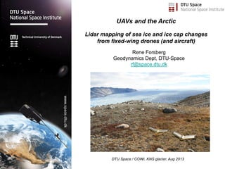
  • 1. Rene Forsberg Geodynamics Dept, DTU-Space rf@space.dtu.dk UAVs and the Arctic Lidar mapping of sea ice and ice cap changes from fixed-wing drones (and aircraft) DTU Space / COWI, KNS glacier, Aug 2013
  • 2. Drone use in Greenland … • Urban and settlement mapping/ASIAQ (E-bees) • Emergency services • Mining and tailings mapping • Sciences – archeology, biology, glaciology (mapping/imagery) Upcoming / future: • Defense – surveilance, sovereignity, situational awareness … • Search and Rescue • Communications relays … • Environent /landslide/cryosphere monitoring … • ?? Nuuk Uummaanaq
  • 3. Monitoring the Arctic cryosphere changes .. Space missions give the overview … space agency focus (ESA, NASA, …) Details and validation by aircraft, drones and in-situ campaings Drones have the potential for frequent, year-round monitoring CryoSat GRACE GOCE Greenland ice sheet elevations from CryoSat (DTU-Space)
  • 4. Greenland ice sheet changes .. Rapid melt of the ice sheet margins and outlet glaciers (ESA CryoSat, Sentinel-3) Increasing ice velocity for outlet glaciers .. especially in summer (ESA Sentinel-1) Global concern: sea level rise .. (p.t. 0.7 mm/year) Height changes (DTU) Ice Velocities (Enveo)
  • 5. Cryosphere changes … Land ice: global Sea ice: - local fishery and hunting - ship navigation - climate feedbacks Jakobshavn glacier front Arctic Ocean sea ice north of Greenland Qaanaaq
  • 6. Changing ice cover in the Arctic Ocean 1979 2007 The satellite measurements since 1979 shows a gradual decrease with acceleration in recent years … 2007 onwards new records year by year…
  • 7. Sea ice thickness … Sea ice thickness a special problem for space and sub-orbital flight: Principle: measurement of freeboard .. Lead Example of laserscanning of sea ice Arctic Ocean north of Greenland 300 m wide swath Ice thickness 2-3 m Ice Ridges
  • 8. UAV’s for research/climate - Testing small and medium UAV’s: Glacier mapping, sea ice, icebergs, urban mapping High-techonology fund project – ”smart UAV” - Sensor development: Lightweight GPS, miniature IMU, geodetic GPS, scanning lidar, magnetometer … - Polar deployments (Villum Station Nord) - Other cooperations: NASA/Danish Defense (GlobalHawk tests in Greenland) MonMap/Mongolia (glacier surveys) .. Villum Station Nord lidar droneHawkeye UAV / MonMap, Mongolia Snow mapping in Svalbard
  • 9. Drones for measuring cryosphere elevation changes… Challenges: down-sizing of sensors (GPS, lidar, radar ..) Off-the-shelf: Camera solutions – dense flight pattern… static objects (i.e. drifting sea ice not working) Single-profile measurements – laser scanning / BVLOS drones Elevation change KNS–glacier near Nuuk 2013-2009 (skale 0-80 m) Drone fotomosaic KNS 2013
  • 11. DTU Space DroneCenter 2014- Research o Development of Smart UAV (fixed-wing VTOL) o Close cooperation with Sky-Watch and InteGra o UAV landing on moving platforms (AutoDescent) o Mini Aerial Vehicle (MAV) o Development of sensors for use on unmanned platforms (gravimeter, magnetometer, LiDAR) o Formationflying and “swarming” using high precision-navigation and antikollision-teknology for “proximity operations” SmartUAV Hugin-X1 Cumulus-1
  • 12. Cooperation with NASA Armstrong Flight Research Facility, Northrop Grumman Corporation og NOAA to use NASA Global Hawk in the Arctic. US cooperation: large drones
  • 13. Airborne remote sensing / geophysics CryoVex 2017 Blå: Marts (POF) Green: April (FAZ) - GPS/INS, Positioning @ cm level - Scanning lidar - Radar (Ku-band, VHF, P-band) - Gravimeter, magnetometers
  • 16. Mow-the-lawn flight over R/V Lance April 24, 2015
  • 17. Villum: UAV – Penguin B (payload 10 kg – BVLOS ops) Velodyne Puck and Riegl VUX-1 lidar Stn Nord
  • 18. Villum Penguin B lidar setup .. (gasoline engine, skis under construction, servicing ….) Lidar GPS/IMU Iridium Autopilot controller GoPro camera below Science computer
  • 19. Villum Station Nord, Greenland New science station – 10 million Euro Private foundation funding – open 2015 Århus University lead .. Fleet of drones: E-bees, Penguin B/C, Prion Mk3 Flights from DK via Svalbard Close to ice cap, sea ice, tundra .. www.villumresearchstation.dk
  • 20. Drones in the Arctic Numerous applications … society, military, research … Scanning lidar to supplement airborne and satellite data acquisitions for cryosphere changes and satellite data cal/val .. Penguin-B campaigns: Ice cap (Kangerlussuaq) Oct 2017, sea ice (St Nord) Apr 2017