SlideShare a Scribd company logo
1 of 38
REMOTE SENSING APPLICATIONS IN URBAN PLANNING


INTRODUCTION
 The modern technology of Remote Sensing which includes both aerial as
well as satellite based systems, allow us to collect lot of physical data easily,
with speed and on repetitive basis, and together with GIS helps us to
analyze the data spatially, offering possibilities of generating various options
(including modelling), thereby optimizing the whole planning process. These
information systems also offer interpretation of physical (spatial) data with
other socio-economic data, and thereby providing an important linkage in
the total planning process and making it more effective and meaningful.
Generally, these Remote Sensing data products have following applications
ü        in mapping
ü         in interpretation / analysis
ü        as map substitutes
REQUIREMENT OF URBAN AND REGIONAL PLANNERS

    Apart from topographical mapping, the planners also look forward to
    the Remote Sensing (data products) technology to provide them
    information on existing land use and their periodic updating and
    monitoring. In addition, with appropriate technique and methodology
    the same data products can be used to:

Ø      Study urban growth/sprawl and trend of growth.
Ø      Updating and monitoring using repetitive coverage.
Ø      Study of urban morphology, population estimation and other
       physical aspects of urban environment.
Ø      Space use surveys in city centers.
Ø      Slum detection, monitoring and updating.
Ø      Study of transportation system and important aspects both in
       static and dynamic mode.
Ø      Site suitability and catchment area analysis.
Ø      Study of open/vacant space.
Ø      -------------------
Satellite Imagery for Different Levels of Development Planning

Level of Planning   Macro Level (Regional &            Meso Level ( District/             Micro Level ( Project, Micro-
                                                                                                                 Micro-
                    Perspective)                       Development)                       watershed, Village)

                    Low Resolution (80 -360 M)
                                   (80-                Medium Resolution (20 – 40 M)      High Resoution (0.6M – 5 M)

Scale Mapping       1: 50000 to 1:1M                   1:25000 to 1: 50000                1:1000 to 1:5000


Urban Planning      •Urban Sprawl analysis             •Urban landuse mapping (level-1)
                                                                              (level-     •Urban landuse mapping (level 1, 2
                    •Urban land use at level-1
                                       level-          •Urban suitability analysis        & 3)
                    •Transportation network            •Mapping of major transport        •Slum typology
                    •(Highways, Railways etc.)         network                            •Mapping of street level Urban road
                                                       •Updation of city guide maps       network
                                                                                          •Mapping of property parcels
                                                                                          •Inputs for infrastructure
                                                                                          development
                                                                                          •Utilities and service maps
                                                                                          •Population estimation

Infrastructure      Regional level corridor planning   •Broad Site Suitability analysis   Specific Project Site Analysis
Planning                                               •Mapping of major road network     •Dams
                                                                                          •Highways
                                                                                          •Canal
                                                                                          •Industries
                                                                                          •Power Plants

Disaster            •Flood Prone Area Maps             •Post Disaster Damage assessment   • Post Disaster Relief Management
                    •Cyclone Monitoring                •Property Insurance for Natural    Support
                    •Drought Monitoring & Forecast     Disasters                          • Tracing of approach routes
                    •Earthquake prone areas                                               • Waste disposal and solid waste
                                                                                          management
                    •Landslide prone area mapping
                    •Slope stability mapping

Rural Development   •Regional maps                     •Land and water resources          •Cadastral level landuse maps
Planning            •Settlement network                development maps                   •Land parcel maps
                                                                                          •Micro level watershed/ village
                                                                                          planning
SATELLITE MISSIONS supported by NRSC

• IRS series                    • Landsat series
                                   – MSS and TM (archived)
  – IRS-1A/1B/P2 (L-II)         – NOAA series
     • LISS-I and LISS-II          – AVHRR & TOVS
  – IRS-1C/1D                   • ERS-1 & 2
     • PAN, LISS-III and WiFS      – SAR
  – IRS-P3                      • SPOT
     • MOS and WiFS                – MLA/PLA(archived)
  – IRS-P4                      • RADARSAT, ENVISAT
     • OCM and MSMR               (Only data distribution)

  – IRS-P6                      • IKONOS, QUICK BIRD
                                  (Only data distribution)
     • LISS-IV,LISS-III and
       AWiFS
                                   ORBVIEW
                                  (Only data distribution)
  - IRS-P5                      • MODIS (Hyper spectral)
     • PAN
INDIAN IMAGING CAPABILITY


 •1 Km to 1 m spatial Resolution
 •24 Days to every 30 mts. Repetitivity
 •1 Million scale to Cadastral Level
IRS-P3
                                                                         WiFS, MOS X-Ray
                                     1995/1997
                                IRS-1C/1D LISS-3 (23/70M,
                                STEERABLE PAN (5.8 M);
                1994                  WiFS (188M)
                IRS-P2                                                      1999
                LISS-2                                                    INSAT-2E
                                                                         CCD (1 KM)


    1988/91
IRS-1A & 1B LISS-1&2 (72/36M)
                                INDIAN IMAGING                                  1999
                                                                             IRS-P4 (OCEANSAT -1)
                                   SYSTEMS                                        OCM, MSMR


                                          IRS-P6(Resourcesat-1)
   1982                                   LISS III - 23M ; 140 Km; 4Xs
                                          LISS IV - 5.8M ; 3Xs                        2001
RS-D1 SMART SENSOR
                                          AWiFS - 60M; 740 Km
                                                                            TES
    1979/81                                                                 STEP & STARE CONCEPT

BHASKARA VIDICON, SAMIR

                                                                 2003
   CARTOSAT-2/2A                   IRS-P5(Cartosat-1)
  PAN – 1.0 m, 11km                  PAN-2.5M, 2005
IKONOS
Space Imaging EOSAT
 IKONOS 1 failed April 1999
IKONOS 2 Sept., 29 1999
sensor: Kodak linear array

pixel size: 0.82m panchr. in nadir swath: 11.3km
            3.2m multisp. In nadir    swath: 11.3km
pointing in track: +/-52°, across track +/-52°
680km flying height, sun-synchr.

panchromatic: 0.45 – 0.90µm          13 816 pixel
multispectral: blue 0.45 – 0.52µm,
    green 0.52 – 0.60µm, red 0.63 – 0.69µm,
    NIR 0.76 – 0.90µm                 3 454 pixel
quantization: 11bit
 standalone geo-location: horizontal 12m, vert. 8m
QUICK BIRD DATA

• Panchromatic             • Multispectral
  – 1 band visible           – 4 band
  – 61 cm (nadir) 72 cm      – 2.44 m (nadir) and
     (off nadir) spatial       2.88 (off nadir)
     resolution                resolution
  – 16.5 km swath            – 16.5 km swath
  - stereo acquisition       – 11 bit acquisition
  – 11 bit acquisition
Quick Bird Image
Vidhan Soudha,
Bangalore

  ♦ Panchromatic (single
    band - black and white)
    images with a spatial
    resolution of 61 cm
    with swath 16.5 km
  ♦ Multispectral images in
    four spectral bands with
    4 m spatial resolution.

    The four bands are:
    Blue : 0.45 - 0.52 mm
    Green : 0.52 - 0.60 mm
    Red : 0.63 - 0.69 mm
    and
    Near Infra Red: 0.76-
    0.90 mm
  • 11 bit
Quick Bird Image


Vidhan Soudha,
Bangalore
 ♦ Panchromatic (single
   band - black and white)
   images with a spatial
   resolution of 61 cm
   with swath 16.5 km
 ♦ Multispectral images in
   four spectral bands with
   4 m spatial resolution.

   The four bands are:
   Blue : 0.45 - 0.52 mm
   Green : 0.52 - 0.60 mm
   Red : 0.63 - 0.69 mm
   and
   Near Infra Red: 0.76-
   0.90 mm
 • 11 bit
GeoEye-1

GeoEye-1 launched on Sept. 6, 2008
—the world's highest resolution
commercial earth-imaging satellite.

GeoEye-1 is equipped with
sophisticated technology ever used
in a commercial satellite system.

It offers unprecedented spatial
resolution by simultaneously
acquiring 0.41-meter panchromatic
and 1.65-meter multispectral
imagery. The detail and geospatial
accuracy of GeoEye-1 imagery
further expands applications for
satellite imagery in every
commercial and government market
sector.
Application of Remote Sensing and GIS for change detection and
             updation of maps using mobile mapping :
                  A case study of Gurgaon city.
 DATA USED


SOFTWARE USED               INSTRUMENT USED

GIS software: Arc GIS 9.1   GPS SX BLUE II

ERDAS imagine 8.7           MIO DIGI WALKER

SUPERPAD 2
1993
5,369.60 ha.


   2000
12,050.43 ha.


   2005
13,068.21 ha.
Map updation at micro level


Map preparation using       Mobile            Field visit
High Resolution Data      mapping unit


                          Transfer to          Update
             Map           computer      location/attributes
           Updation        from PDA       of objects in field
Pocket A 14.88 ha.
Strategy Development to mitigate the impact of Urban Heat Islands –
                    An input to Master Plan Preparation

Objectives:
 - What are the major factors that govern Urban Heat Island?
- What is the relationship between land use/land cover to heat production?
- How Geoinformatics Technology can be used to monitor/control the impact of UHI?
- Economic value of trees /vegetation, water bodies and its effect on UHI?
- What are the legislative and regulatory mechanisms that can be adopted to
mitigate/control the impact of Urban Heat Island?

                                                                                     LANDSAT-
                                                                                     LANDSAT -7 ETM+ (22/10/1999 )
                                                                                                Day time
                                                              55.00
                              Temperature in degree Celsius


                                                              50.00


                                                              45.00


                                                              40.00


                                                              35.00


                                                              30.00


                                                              25.00
                                                                      Water bodies   Agricultural     Dense        Sparse        Low dense     Dense built-up Commercial and Bare soil/waste   Fallow land
                                                                                      crop land     vegetation   vegetation        built-up                     industrial        land

                                                                                                                         Land use/ land cover

                                                                                                                       Minimum       Maximum        Mean
Surface Temperature Analysis with LU/LC
                                                                          52.00


                                          Temperature in degree Celsius
                                                                          49.00
                                                                          46.00
                                                                          43.00
                                                                          40.00
                                                                          37.00
                                                                          34.00
                                                                          31.00
                                                                          28.00
                                                                          25.00


                                                                                                                            Dense vegetation
                                                                                  Water bodies


                                                                                                                                                                                                                                                          Waste land/bare soil
                                                                                                                                                                               Low dense built-up


                                                                                                                                                                                                                                                                                 Fallow land
                                                                                                                                                                                                                                  Commercial/industrial
                                                                                                   Agricultural crop land


                                                                                                                                                                                                            High dense built-up
                                                                                                                                                   Sparse vegetation
                                                                                                                                (forest)
                                                                                                                                                                       Land use/land cover

                                                                                                                                               Mean °C (day time)                                   Mean °C (night time)


                                                                                                  ASTER (18/10/2001) Day time
                                                                                                              &
                                                                                                 ASTER (07/10/2001) Night time
Industrial Hazard, Vulnerability and Risk Assessment for Land Use Planning:
                 A Case Study of Haldia, West Bengal, India

Objectives:
    Generation of hazard scenarios for fire, explosion and toxic rel ease.
                                                                 release.
    (Support from ERRIS).
    Quantification of elements at risk and risk zonation.
    Impact of possible hazard scenarios on buildings and population at different time periods.
    Utilization of risk maps for future land use planning.
       Morning                     Day                      Evening                     Night


                                                                       Medium

        Population Risk Assessment for Toxic Release…
                                             Release…                  High
                                                                       Very High
Risk Assessment for Haldia ……


                                                                           High
                                        Risk       Total        No. of
                                      Category   Population   households   Medium
                                      Very Low     41911         6987      Low
                                        Low        43841         8061
0   125 250   500   750   1,000
                                                                           Very Low
                                      Medium       86960        18868
                             Meters
                                        High       7117          1648
Environmental Monitoring of Vegetation, Temperature and
LU/ LC arameters and simulation of air pollutant dispersion
Gaussian plume model :

                             Q            − 1 y 2       −1 z − H 2        − 1 z + H 2 
    • c(x, y, z : H) =               exp     ( )   exp 
                                                           2 (     )  + exp 
                                                                              2 ( σ )   
                           2πσ z σ y      2 σy                σz                       
                                                                                     z


C = concentration,
Q=emissions,
? y, ?       z    are dispersion parameters
u = wind speed,
x,y,z= downwind point location
H = plume height
u, ?     y,   ?    z : meteorology input
?   y,   ?    z   increase with distance
downwind, and area function of
atmospheric stability (‘mixing’)
USER INTERFACE IN ARC GIS 8.1
Dehra Dun -Water Supply Study
Name Of the Tube Well       LPM          Year of Installation          Hour        LMD
Nehru Colony Tube Well -3         1800                          1981          16         1.73

Nehru Colony Tube Well -5         2500                          1989          16          2.4
Nehru Colony Tube Well -4         2200                          1986          16         2.11
Internet
   address


Map hosted
in ArcGIS
   server
 (Internet)
Conclusion
•More and more sensors and sensor types are available
•Number of available space images is growing permanently
•More and more companies are entering the space market
•Tendency to real private projects
•Competition will reduce the cost
•0.6m pixel size from space available – allowance up to 0.5m pixel size
is useful for mapping up to map scale 1 : 5000 – 1 : 10 000
•Stronger overlap of space and airborne applications
A

More Related Content

What's hot

Geo referencing by Mashhood Arif
Geo referencing by Mashhood ArifGeo referencing by Mashhood Arif
Geo referencing by Mashhood ArifKU Leuven
 
Land use and land cover classification
Land use and land cover classification Land use and land cover classification
Land use and land cover classification Calcutta University
 
Gis (geographic information system)
Gis (geographic information system)Gis (geographic information system)
Gis (geographic information system)Saad Bare
 
Introduction to GIS systems
Introduction to GIS systemsIntroduction to GIS systems
Introduction to GIS systemsVivek Srivastava
 
Advantages and disadvantages of Remote Sensing
Advantages and disadvantages of Remote SensingAdvantages and disadvantages of Remote Sensing
Advantages and disadvantages of Remote SensingEr Abhi Vashi
 
Application of gis in urban planning
Application of gis in urban planningApplication of gis in urban planning
Application of gis in urban planningWESLEY MELI
 
LAND USE /LAND COVER CLASSIFICATION AND CHANGE DETECTION USING GEOGRAPHICAL I...
LAND USE /LAND COVER CLASSIFICATION AND CHANGE DETECTION USING GEOGRAPHICAL I...LAND USE /LAND COVER CLASSIFICATION AND CHANGE DETECTION USING GEOGRAPHICAL I...
LAND USE /LAND COVER CLASSIFICATION AND CHANGE DETECTION USING GEOGRAPHICAL I...IAEME Publication
 
Seminar on gis analysis functions
Seminar on gis analysis functionsSeminar on gis analysis functions
Seminar on gis analysis functionsPramoda Raj
 
Geometry and types of aerial photographs
Geometry and types of aerial photographsGeometry and types of aerial photographs
Geometry and types of aerial photographsPooja Kumari
 
Urban Sprawl for modelling using GIS
Urban Sprawl for modelling using GISUrban Sprawl for modelling using GIS
Urban Sprawl for modelling using GISpankaj kumar
 
Geometry of Aerial photograph
Geometry of Aerial photographGeometry of Aerial photograph
Geometry of Aerial photographApoorva Mathur
 
QUERY AND NETWORK ANALYSIS IN GIS
QUERY AND NETWORK ANALYSIS IN GISQUERY AND NETWORK ANALYSIS IN GIS
QUERY AND NETWORK ANALYSIS IN GISDEVANG KAPADIA
 
Principle of aerial photography and types.ppt
Principle of aerial photography and types.pptPrinciple of aerial photography and types.ppt
Principle of aerial photography and types.pptsrinivas2036
 
Applications of gis
Applications of gisApplications of gis
Applications of gisPramoda Raj
 
ENERGY INTERACTIONS WITH EARTH SURFACE FEATURES
 ENERGY INTERACTIONS WITH EARTH SURFACE FEATURES  ENERGY INTERACTIONS WITH EARTH SURFACE FEATURES
ENERGY INTERACTIONS WITH EARTH SURFACE FEATURES diponnath
 
Application of RS and GIS in Groundwater Prospects Zonation
Application of RS and GIS in Groundwater Prospects ZonationApplication of RS and GIS in Groundwater Prospects Zonation
Application of RS and GIS in Groundwater Prospects ZonationVishwanath Awati
 

What's hot (20)

Georeferencing
GeoreferencingGeoreferencing
Georeferencing
 
Geo referencing by Mashhood Arif
Geo referencing by Mashhood ArifGeo referencing by Mashhood Arif
Geo referencing by Mashhood Arif
 
Land use and land cover classification
Land use and land cover classification Land use and land cover classification
Land use and land cover classification
 
Gis (geographic information system)
Gis (geographic information system)Gis (geographic information system)
Gis (geographic information system)
 
Introduction to GIS systems
Introduction to GIS systemsIntroduction to GIS systems
Introduction to GIS systems
 
Advantages and disadvantages of Remote Sensing
Advantages and disadvantages of Remote SensingAdvantages and disadvantages of Remote Sensing
Advantages and disadvantages of Remote Sensing
 
Application of gis in urban planning
Application of gis in urban planningApplication of gis in urban planning
Application of gis in urban planning
 
LAND USE /LAND COVER CLASSIFICATION AND CHANGE DETECTION USING GEOGRAPHICAL I...
LAND USE /LAND COVER CLASSIFICATION AND CHANGE DETECTION USING GEOGRAPHICAL I...LAND USE /LAND COVER CLASSIFICATION AND CHANGE DETECTION USING GEOGRAPHICAL I...
LAND USE /LAND COVER CLASSIFICATION AND CHANGE DETECTION USING GEOGRAPHICAL I...
 
Seminar on gis analysis functions
Seminar on gis analysis functionsSeminar on gis analysis functions
Seminar on gis analysis functions
 
Geometry and types of aerial photographs
Geometry and types of aerial photographsGeometry and types of aerial photographs
Geometry and types of aerial photographs
 
Digital Elevation Model (DEM)
Digital Elevation Model (DEM)Digital Elevation Model (DEM)
Digital Elevation Model (DEM)
 
Urban Sprawl for modelling using GIS
Urban Sprawl for modelling using GISUrban Sprawl for modelling using GIS
Urban Sprawl for modelling using GIS
 
Geometry of Aerial photograph
Geometry of Aerial photographGeometry of Aerial photograph
Geometry of Aerial photograph
 
QUERY AND NETWORK ANALYSIS IN GIS
QUERY AND NETWORK ANALYSIS IN GISQUERY AND NETWORK ANALYSIS IN GIS
QUERY AND NETWORK ANALYSIS IN GIS
 
Principle of aerial photography and types.ppt
Principle of aerial photography and types.pptPrinciple of aerial photography and types.ppt
Principle of aerial photography and types.ppt
 
Visual Interpretation
Visual InterpretationVisual Interpretation
Visual Interpretation
 
Applications of gis
Applications of gisApplications of gis
Applications of gis
 
ENERGY INTERACTIONS WITH EARTH SURFACE FEATURES
 ENERGY INTERACTIONS WITH EARTH SURFACE FEATURES  ENERGY INTERACTIONS WITH EARTH SURFACE FEATURES
ENERGY INTERACTIONS WITH EARTH SURFACE FEATURES
 
Spatial data for GIS
Spatial data for GISSpatial data for GIS
Spatial data for GIS
 
Application of RS and GIS in Groundwater Prospects Zonation
Application of RS and GIS in Groundwater Prospects ZonationApplication of RS and GIS in Groundwater Prospects Zonation
Application of RS and GIS in Groundwater Prospects Zonation
 

Similar to Iirs Remote sensing application in Urban Planning

Empowering institutions and stakeholders for spatial planning - Dr. Nagaraj R...
Empowering institutions and stakeholders for spatial planning - Dr. Nagaraj R...Empowering institutions and stakeholders for spatial planning - Dr. Nagaraj R...
Empowering institutions and stakeholders for spatial planning - Dr. Nagaraj R...NeGD Capacity Building
 
Intelligent satellites
Intelligent satellitesIntelligent satellites
Intelligent satellitesClifford Stone
 
Improve Your Work with Esri Contents
Improve Your Work with Esri ContentsImprove Your Work with Esri Contents
Improve Your Work with Esri ContentsEsri
 
Iirs Remote sensing and GIS application in Agricultur- Indian Experience
Iirs Remote sensing and GIS application in Agricultur- Indian ExperienceIirs Remote sensing and GIS application in Agricultur- Indian Experience
Iirs Remote sensing and GIS application in Agricultur- Indian ExperienceTushar Dholakia
 
Iirs overview -Remote sensing and GIS application in Water Resources Management
Iirs overview -Remote sensing and GIS application in Water Resources ManagementIirs overview -Remote sensing and GIS application in Water Resources Management
Iirs overview -Remote sensing and GIS application in Water Resources ManagementTushar Dholakia
 
Satellite services in India
Satellite services in India Satellite services in India
Satellite services in India Sanket Yavalkar
 
Introduction of GIS & Remote Sensing (RS)
Introduction of GIS & Remote Sensing (RS)Introduction of GIS & Remote Sensing (RS)
Introduction of GIS & Remote Sensing (RS)Subtain Hussain Syed
 
Indian Remote Sensing satellites (IRS).pptx
Indian Remote Sensing satellites (IRS).pptxIndian Remote Sensing satellites (IRS).pptx
Indian Remote Sensing satellites (IRS).pptxsapna kinattinkara
 
PIAS 2013-GIS.pptxfskjczjsbchdbfscnnND dHSA
PIAS 2013-GIS.pptxfskjczjsbchdbfscnnND  dHSAPIAS 2013-GIS.pptxfskjczjsbchdbfscnnND  dHSA
PIAS 2013-GIS.pptxfskjczjsbchdbfscnnND dHSAFloridaTLaoaten
 
BAUP_IGARSS_2011.pdf
BAUP_IGARSS_2011.pdfBAUP_IGARSS_2011.pdf
BAUP_IGARSS_2011.pdfgrssieee
 
Image classification and land cover mapping
Image classification and land cover mappingImage classification and land cover mapping
Image classification and land cover mappingKabir Uddin
 
Remote Sensing and GIS
Remote Sensing and GISRemote Sensing and GIS
Remote Sensing and GISMEHALAS3
 
GIS and Remote sensing CIvil Engg by Mrunmayee
GIS and Remote sensing CIvil Engg by MrunmayeeGIS and Remote sensing CIvil Engg by Mrunmayee
GIS and Remote sensing CIvil Engg by MrunmayeeMrunmayee Manjari
 
RS_GIS_Crop_monitoring-converted.pptx
RS_GIS_Crop_monitoring-converted.pptxRS_GIS_Crop_monitoring-converted.pptx
RS_GIS_Crop_monitoring-converted.pptxSouvikPal60
 

Similar to Iirs Remote sensing application in Urban Planning (20)

Bhuvan
BhuvanBhuvan
Bhuvan
 
Eastern WV LiDAR Acquisition
Eastern WV LiDAR Acquisition Eastern WV LiDAR Acquisition
Eastern WV LiDAR Acquisition
 
Empowering institutions and stakeholders for spatial planning - Dr. Nagaraj R...
Empowering institutions and stakeholders for spatial planning - Dr. Nagaraj R...Empowering institutions and stakeholders for spatial planning - Dr. Nagaraj R...
Empowering institutions and stakeholders for spatial planning - Dr. Nagaraj R...
 
Intelligent satellites
Intelligent satellitesIntelligent satellites
Intelligent satellites
 
Improve Your Work with Esri Contents
Improve Your Work with Esri ContentsImprove Your Work with Esri Contents
Improve Your Work with Esri Contents
 
Iirs Remote sensing and GIS application in Agricultur- Indian Experience
Iirs Remote sensing and GIS application in Agricultur- Indian ExperienceIirs Remote sensing and GIS application in Agricultur- Indian Experience
Iirs Remote sensing and GIS application in Agricultur- Indian Experience
 
Iirs overview -Remote sensing and GIS application in Water Resources Management
Iirs overview -Remote sensing and GIS application in Water Resources ManagementIirs overview -Remote sensing and GIS application in Water Resources Management
Iirs overview -Remote sensing and GIS application in Water Resources Management
 
Satellite services in India
Satellite services in India Satellite services in India
Satellite services in India
 
Introduction of GIS & Remote Sensing (RS)
Introduction of GIS & Remote Sensing (RS)Introduction of GIS & Remote Sensing (RS)
Introduction of GIS & Remote Sensing (RS)
 
Indian Remote Sensing satellites (IRS).pptx
Indian Remote Sensing satellites (IRS).pptxIndian Remote Sensing satellites (IRS).pptx
Indian Remote Sensing satellites (IRS).pptx
 
Gis in urban
Gis in urbanGis in urban
Gis in urban
 
PIAS 2013-GIS.pptxfskjczjsbchdbfscnnND dHSA
PIAS 2013-GIS.pptxfskjczjsbchdbfscnnND  dHSAPIAS 2013-GIS.pptxfskjczjsbchdbfscnnND  dHSA
PIAS 2013-GIS.pptxfskjczjsbchdbfscnnND dHSA
 
BAUP_IGARSS_2011.pdf
BAUP_IGARSS_2011.pdfBAUP_IGARSS_2011.pdf
BAUP_IGARSS_2011.pdf
 
gis.pdf
gis.pdfgis.pdf
gis.pdf
 
gis.pdf
gis.pdfgis.pdf
gis.pdf
 
Image classification and land cover mapping
Image classification and land cover mappingImage classification and land cover mapping
Image classification and land cover mapping
 
Remote Sensing and GIS
Remote Sensing and GISRemote Sensing and GIS
Remote Sensing and GIS
 
GIS and Remote sensing CIvil Engg by Mrunmayee
GIS and Remote sensing CIvil Engg by MrunmayeeGIS and Remote sensing CIvil Engg by Mrunmayee
GIS and Remote sensing CIvil Engg by Mrunmayee
 
RS_GIS_Crop_monitoring-converted.pptx
RS_GIS_Crop_monitoring-converted.pptxRS_GIS_Crop_monitoring-converted.pptx
RS_GIS_Crop_monitoring-converted.pptx
 
Tx dot gps applications fuegner
Tx dot gps applications   fuegnerTx dot gps applications   fuegner
Tx dot gps applications fuegner
 

More from Tushar Dholakia

Iirs lecure notes for Remote sensing –An Overview of Decision Maker
Iirs lecure notes for Remote sensing –An Overview of Decision MakerIirs lecure notes for Remote sensing –An Overview of Decision Maker
Iirs lecure notes for Remote sensing –An Overview of Decision MakerTushar Dholakia
 
Iirs lecturers & gis for regional planning
Iirs lecturers & gis for regional planningIirs lecturers & gis for regional planning
Iirs lecturers & gis for regional planningTushar Dholakia
 
Iirs lecture space inputs to disaster management in india
Iirs lecture space inputs to disaster management in indiaIirs lecture space inputs to disaster management in india
Iirs lecture space inputs to disaster management in indiaTushar Dholakia
 
Operational Remote sensing Applications
Operational Remote sensing ApplicationsOperational Remote sensing Applications
Operational Remote sensing ApplicationsTushar Dholakia
 
Iirs Institutions-Geospatial services in India
Iirs Institutions-Geospatial services in IndiaIirs Institutions-Geospatial services in India
Iirs Institutions-Geospatial services in IndiaTushar Dholakia
 
Iirs Artificial Naural network based Urban growth Modeling
Iirs Artificial Naural network based Urban growth ModelingIirs Artificial Naural network based Urban growth Modeling
Iirs Artificial Naural network based Urban growth ModelingTushar Dholakia
 
Iirs remote sensing data policy (RSDP)
Iirs remote sensing data policy (RSDP)Iirs remote sensing data policy (RSDP)
Iirs remote sensing data policy (RSDP)Tushar Dholakia
 
Iirs Role of Remote sensing and GIS in Ground water studies
Iirs Role of Remote sensing and GIS in Ground water studiesIirs Role of Remote sensing and GIS in Ground water studies
Iirs Role of Remote sensing and GIS in Ground water studiesTushar Dholakia
 
Iirs- Opensources software solutions and Data services for Domain
Iirs- Opensources software solutions and Data services for DomainIirs- Opensources software solutions and Data services for Domain
Iirs- Opensources software solutions and Data services for DomainTushar Dholakia
 
effective use of consultant
effective use of consultanteffective use of consultant
effective use of consultantTushar Dholakia
 
LARGE SCALE INSTALLATION OF SUBSURFACE DRAINAGE SYSTEM
LARGE SCALE INSTALLATION OF SUBSURFACE DRAINAGE SYSTEM LARGE SCALE INSTALLATION OF SUBSURFACE DRAINAGE SYSTEM
LARGE SCALE INSTALLATION OF SUBSURFACE DRAINAGE SYSTEM Tushar Dholakia
 
Panam Project Presentation
Panam Project PresentationPanam Project Presentation
Panam Project PresentationTushar Dholakia
 
Design Aspects of Gates of Dam
Design Aspects of Gates of DamDesign Aspects of Gates of Dam
Design Aspects of Gates of DamTushar Dholakia
 
Scope and prospects of micro irrigation
Scope and prospects of micro irrigationScope and prospects of micro irrigation
Scope and prospects of micro irrigationTushar Dholakia
 
Rule level & gate operation
Rule level & gate operationRule level & gate operation
Rule level & gate operationTushar Dholakia
 

More from Tushar Dholakia (20)

Iirs rstechnologypdf
Iirs rstechnologypdfIirs rstechnologypdf
Iirs rstechnologypdf
 
Iirs lecure notes for Remote sensing –An Overview of Decision Maker
Iirs lecure notes for Remote sensing –An Overview of Decision MakerIirs lecure notes for Remote sensing –An Overview of Decision Maker
Iirs lecure notes for Remote sensing –An Overview of Decision Maker
 
Iirs lecturers & gis for regional planning
Iirs lecturers & gis for regional planningIirs lecturers & gis for regional planning
Iirs lecturers & gis for regional planning
 
Iirs lecture space inputs to disaster management in india
Iirs lecture space inputs to disaster management in indiaIirs lecture space inputs to disaster management in india
Iirs lecture space inputs to disaster management in india
 
Operational Remote sensing Applications
Operational Remote sensing ApplicationsOperational Remote sensing Applications
Operational Remote sensing Applications
 
Iirs Institutions-Geospatial services in India
Iirs Institutions-Geospatial services in IndiaIirs Institutions-Geospatial services in India
Iirs Institutions-Geospatial services in India
 
Iirs Artificial Naural network based Urban growth Modeling
Iirs Artificial Naural network based Urban growth ModelingIirs Artificial Naural network based Urban growth Modeling
Iirs Artificial Naural network based Urban growth Modeling
 
Iirs district plan1
Iirs district plan1Iirs district plan1
Iirs district plan1
 
Iirs remote sensing data policy (RSDP)
Iirs remote sensing data policy (RSDP)Iirs remote sensing data policy (RSDP)
Iirs remote sensing data policy (RSDP)
 
Iirs Role of Remote sensing and GIS in Ground water studies
Iirs Role of Remote sensing and GIS in Ground water studiesIirs Role of Remote sensing and GIS in Ground water studies
Iirs Role of Remote sensing and GIS in Ground water studies
 
Iirs gps dmc 2010
Iirs gps dmc 2010Iirs gps dmc 2010
Iirs gps dmc 2010
 
Iirs - Overview of GIS
Iirs - Overview of GISIirs - Overview of GIS
Iirs - Overview of GIS
 
Iirs- Opensources software solutions and Data services for Domain
Iirs- Opensources software solutions and Data services for DomainIirs- Opensources software solutions and Data services for Domain
Iirs- Opensources software solutions and Data services for Domain
 
effective use of consultant
effective use of consultanteffective use of consultant
effective use of consultant
 
Nashik photos
Nashik photosNashik photos
Nashik photos
 
LARGE SCALE INSTALLATION OF SUBSURFACE DRAINAGE SYSTEM
LARGE SCALE INSTALLATION OF SUBSURFACE DRAINAGE SYSTEM LARGE SCALE INSTALLATION OF SUBSURFACE DRAINAGE SYSTEM
LARGE SCALE INSTALLATION OF SUBSURFACE DRAINAGE SYSTEM
 
Panam Project Presentation
Panam Project PresentationPanam Project Presentation
Panam Project Presentation
 
Design Aspects of Gates of Dam
Design Aspects of Gates of DamDesign Aspects of Gates of Dam
Design Aspects of Gates of Dam
 
Scope and prospects of micro irrigation
Scope and prospects of micro irrigationScope and prospects of micro irrigation
Scope and prospects of micro irrigation
 
Rule level & gate operation
Rule level & gate operationRule level & gate operation
Rule level & gate operation
 

Recently uploaded

General Principles of Intellectual Property: Concepts of Intellectual Proper...
General Principles of Intellectual Property: Concepts of Intellectual  Proper...General Principles of Intellectual Property: Concepts of Intellectual  Proper...
General Principles of Intellectual Property: Concepts of Intellectual Proper...Poonam Aher Patil
 
Towards a code of practice for AI in AT.pptx
Towards a code of practice for AI in AT.pptxTowards a code of practice for AI in AT.pptx
Towards a code of practice for AI in AT.pptxJisc
 
Spellings Wk 3 English CAPS CARES Please Practise
Spellings Wk 3 English CAPS CARES Please PractiseSpellings Wk 3 English CAPS CARES Please Practise
Spellings Wk 3 English CAPS CARES Please PractiseAnaAcapella
 
Sensory_Experience_and_Emotional_Resonance_in_Gabriel_Okaras_The_Piano_and_Th...
Sensory_Experience_and_Emotional_Resonance_in_Gabriel_Okaras_The_Piano_and_Th...Sensory_Experience_and_Emotional_Resonance_in_Gabriel_Okaras_The_Piano_and_Th...
Sensory_Experience_and_Emotional_Resonance_in_Gabriel_Okaras_The_Piano_and_Th...Pooja Bhuva
 
Introduction to Nonprofit Accounting: The Basics
Introduction to Nonprofit Accounting: The BasicsIntroduction to Nonprofit Accounting: The Basics
Introduction to Nonprofit Accounting: The BasicsTechSoup
 
Sociology 101 Demonstration of Learning Exhibit
Sociology 101 Demonstration of Learning ExhibitSociology 101 Demonstration of Learning Exhibit
Sociology 101 Demonstration of Learning Exhibitjbellavia9
 
Beyond_Borders_Understanding_Anime_and_Manga_Fandom_A_Comprehensive_Audience_...
Beyond_Borders_Understanding_Anime_and_Manga_Fandom_A_Comprehensive_Audience_...Beyond_Borders_Understanding_Anime_and_Manga_Fandom_A_Comprehensive_Audience_...
Beyond_Borders_Understanding_Anime_and_Manga_Fandom_A_Comprehensive_Audience_...Pooja Bhuva
 
Unit-V; Pricing (Pharma Marketing Management).pptx
Unit-V; Pricing (Pharma Marketing Management).pptxUnit-V; Pricing (Pharma Marketing Management).pptx
Unit-V; Pricing (Pharma Marketing Management).pptxVishalSingh1417
 
Key note speaker Neum_Admir Softic_ENG.pdf
Key note speaker Neum_Admir Softic_ENG.pdfKey note speaker Neum_Admir Softic_ENG.pdf
Key note speaker Neum_Admir Softic_ENG.pdfAdmir Softic
 
How to Manage Global Discount in Odoo 17 POS
How to Manage Global Discount in Odoo 17 POSHow to Manage Global Discount in Odoo 17 POS
How to Manage Global Discount in Odoo 17 POSCeline George
 
Application orientated numerical on hev.ppt
Application orientated numerical on hev.pptApplication orientated numerical on hev.ppt
Application orientated numerical on hev.pptRamjanShidvankar
 
Understanding Accommodations and Modifications
Understanding  Accommodations and ModificationsUnderstanding  Accommodations and Modifications
Understanding Accommodations and ModificationsMJDuyan
 
TỔNG ÔN TẬP THI VÀO LỚP 10 MÔN TIẾNG ANH NĂM HỌC 2023 - 2024 CÓ ĐÁP ÁN (NGỮ Â...
TỔNG ÔN TẬP THI VÀO LỚP 10 MÔN TIẾNG ANH NĂM HỌC 2023 - 2024 CÓ ĐÁP ÁN (NGỮ Â...TỔNG ÔN TẬP THI VÀO LỚP 10 MÔN TIẾNG ANH NĂM HỌC 2023 - 2024 CÓ ĐÁP ÁN (NGỮ Â...
TỔNG ÔN TẬP THI VÀO LỚP 10 MÔN TIẾNG ANH NĂM HỌC 2023 - 2024 CÓ ĐÁP ÁN (NGỮ Â...Nguyen Thanh Tu Collection
 
How to Create and Manage Wizard in Odoo 17
How to Create and Manage Wizard in Odoo 17How to Create and Manage Wizard in Odoo 17
How to Create and Manage Wizard in Odoo 17Celine George
 
SKILL OF INTRODUCING THE LESSON MICRO SKILLS.pptx
SKILL OF INTRODUCING THE LESSON MICRO SKILLS.pptxSKILL OF INTRODUCING THE LESSON MICRO SKILLS.pptx
SKILL OF INTRODUCING THE LESSON MICRO SKILLS.pptxAmanpreet Kaur
 
This PowerPoint helps students to consider the concept of infinity.
This PowerPoint helps students to consider the concept of infinity.This PowerPoint helps students to consider the concept of infinity.
This PowerPoint helps students to consider the concept of infinity.christianmathematics
 
ICT Role in 21st Century Education & its Challenges.pptx
ICT Role in 21st Century Education & its Challenges.pptxICT Role in 21st Century Education & its Challenges.pptx
ICT Role in 21st Century Education & its Challenges.pptxAreebaZafar22
 
2024-NATIONAL-LEARNING-CAMP-AND-OTHER.pptx
2024-NATIONAL-LEARNING-CAMP-AND-OTHER.pptx2024-NATIONAL-LEARNING-CAMP-AND-OTHER.pptx
2024-NATIONAL-LEARNING-CAMP-AND-OTHER.pptxMaritesTamaniVerdade
 
Salient Features of India constitution especially power and functions
Salient Features of India constitution especially power and functionsSalient Features of India constitution especially power and functions
Salient Features of India constitution especially power and functionsKarakKing
 

Recently uploaded (20)

General Principles of Intellectual Property: Concepts of Intellectual Proper...
General Principles of Intellectual Property: Concepts of Intellectual  Proper...General Principles of Intellectual Property: Concepts of Intellectual  Proper...
General Principles of Intellectual Property: Concepts of Intellectual Proper...
 
Towards a code of practice for AI in AT.pptx
Towards a code of practice for AI in AT.pptxTowards a code of practice for AI in AT.pptx
Towards a code of practice for AI in AT.pptx
 
Spellings Wk 3 English CAPS CARES Please Practise
Spellings Wk 3 English CAPS CARES Please PractiseSpellings Wk 3 English CAPS CARES Please Practise
Spellings Wk 3 English CAPS CARES Please Practise
 
Sensory_Experience_and_Emotional_Resonance_in_Gabriel_Okaras_The_Piano_and_Th...
Sensory_Experience_and_Emotional_Resonance_in_Gabriel_Okaras_The_Piano_and_Th...Sensory_Experience_and_Emotional_Resonance_in_Gabriel_Okaras_The_Piano_and_Th...
Sensory_Experience_and_Emotional_Resonance_in_Gabriel_Okaras_The_Piano_and_Th...
 
Introduction to Nonprofit Accounting: The Basics
Introduction to Nonprofit Accounting: The BasicsIntroduction to Nonprofit Accounting: The Basics
Introduction to Nonprofit Accounting: The Basics
 
Sociology 101 Demonstration of Learning Exhibit
Sociology 101 Demonstration of Learning ExhibitSociology 101 Demonstration of Learning Exhibit
Sociology 101 Demonstration of Learning Exhibit
 
Beyond_Borders_Understanding_Anime_and_Manga_Fandom_A_Comprehensive_Audience_...
Beyond_Borders_Understanding_Anime_and_Manga_Fandom_A_Comprehensive_Audience_...Beyond_Borders_Understanding_Anime_and_Manga_Fandom_A_Comprehensive_Audience_...
Beyond_Borders_Understanding_Anime_and_Manga_Fandom_A_Comprehensive_Audience_...
 
Unit-V; Pricing (Pharma Marketing Management).pptx
Unit-V; Pricing (Pharma Marketing Management).pptxUnit-V; Pricing (Pharma Marketing Management).pptx
Unit-V; Pricing (Pharma Marketing Management).pptx
 
Key note speaker Neum_Admir Softic_ENG.pdf
Key note speaker Neum_Admir Softic_ENG.pdfKey note speaker Neum_Admir Softic_ENG.pdf
Key note speaker Neum_Admir Softic_ENG.pdf
 
How to Manage Global Discount in Odoo 17 POS
How to Manage Global Discount in Odoo 17 POSHow to Manage Global Discount in Odoo 17 POS
How to Manage Global Discount in Odoo 17 POS
 
Application orientated numerical on hev.ppt
Application orientated numerical on hev.pptApplication orientated numerical on hev.ppt
Application orientated numerical on hev.ppt
 
Mehran University Newsletter Vol-X, Issue-I, 2024
Mehran University Newsletter Vol-X, Issue-I, 2024Mehran University Newsletter Vol-X, Issue-I, 2024
Mehran University Newsletter Vol-X, Issue-I, 2024
 
Understanding Accommodations and Modifications
Understanding  Accommodations and ModificationsUnderstanding  Accommodations and Modifications
Understanding Accommodations and Modifications
 
TỔNG ÔN TẬP THI VÀO LỚP 10 MÔN TIẾNG ANH NĂM HỌC 2023 - 2024 CÓ ĐÁP ÁN (NGỮ Â...
TỔNG ÔN TẬP THI VÀO LỚP 10 MÔN TIẾNG ANH NĂM HỌC 2023 - 2024 CÓ ĐÁP ÁN (NGỮ Â...TỔNG ÔN TẬP THI VÀO LỚP 10 MÔN TIẾNG ANH NĂM HỌC 2023 - 2024 CÓ ĐÁP ÁN (NGỮ Â...
TỔNG ÔN TẬP THI VÀO LỚP 10 MÔN TIẾNG ANH NĂM HỌC 2023 - 2024 CÓ ĐÁP ÁN (NGỮ Â...
 
How to Create and Manage Wizard in Odoo 17
How to Create and Manage Wizard in Odoo 17How to Create and Manage Wizard in Odoo 17
How to Create and Manage Wizard in Odoo 17
 
SKILL OF INTRODUCING THE LESSON MICRO SKILLS.pptx
SKILL OF INTRODUCING THE LESSON MICRO SKILLS.pptxSKILL OF INTRODUCING THE LESSON MICRO SKILLS.pptx
SKILL OF INTRODUCING THE LESSON MICRO SKILLS.pptx
 
This PowerPoint helps students to consider the concept of infinity.
This PowerPoint helps students to consider the concept of infinity.This PowerPoint helps students to consider the concept of infinity.
This PowerPoint helps students to consider the concept of infinity.
 
ICT Role in 21st Century Education & its Challenges.pptx
ICT Role in 21st Century Education & its Challenges.pptxICT Role in 21st Century Education & its Challenges.pptx
ICT Role in 21st Century Education & its Challenges.pptx
 
2024-NATIONAL-LEARNING-CAMP-AND-OTHER.pptx
2024-NATIONAL-LEARNING-CAMP-AND-OTHER.pptx2024-NATIONAL-LEARNING-CAMP-AND-OTHER.pptx
2024-NATIONAL-LEARNING-CAMP-AND-OTHER.pptx
 
Salient Features of India constitution especially power and functions
Salient Features of India constitution especially power and functionsSalient Features of India constitution especially power and functions
Salient Features of India constitution especially power and functions
 

Iirs Remote sensing application in Urban Planning

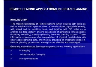
  • 1. REMOTE SENSING APPLICATIONS IN URBAN PLANNING INTRODUCTION The modern technology of Remote Sensing which includes both aerial as well as satellite based systems, allow us to collect lot of physical data easily, with speed and on repetitive basis, and together with GIS helps us to analyze the data spatially, offering possibilities of generating various options (including modelling), thereby optimizing the whole planning process. These information systems also offer interpretation of physical (spatial) data with other socio-economic data, and thereby providing an important linkage in the total planning process and making it more effective and meaningful. Generally, these Remote Sensing data products have following applications ü in mapping ü in interpretation / analysis ü as map substitutes
  • 2. REQUIREMENT OF URBAN AND REGIONAL PLANNERS Apart from topographical mapping, the planners also look forward to the Remote Sensing (data products) technology to provide them information on existing land use and their periodic updating and monitoring. In addition, with appropriate technique and methodology the same data products can be used to: Ø Study urban growth/sprawl and trend of growth. Ø Updating and monitoring using repetitive coverage. Ø Study of urban morphology, population estimation and other physical aspects of urban environment. Ø Space use surveys in city centers. Ø Slum detection, monitoring and updating. Ø Study of transportation system and important aspects both in static and dynamic mode. Ø Site suitability and catchment area analysis. Ø Study of open/vacant space. Ø -------------------
  • 3. Satellite Imagery for Different Levels of Development Planning Level of Planning Macro Level (Regional & Meso Level ( District/ Micro Level ( Project, Micro- Micro- Perspective) Development) watershed, Village) Low Resolution (80 -360 M) (80- Medium Resolution (20 – 40 M) High Resoution (0.6M – 5 M) Scale Mapping 1: 50000 to 1:1M 1:25000 to 1: 50000 1:1000 to 1:5000 Urban Planning •Urban Sprawl analysis •Urban landuse mapping (level-1) (level- •Urban landuse mapping (level 1, 2 •Urban land use at level-1 level- •Urban suitability analysis & 3) •Transportation network •Mapping of major transport •Slum typology •(Highways, Railways etc.) network •Mapping of street level Urban road •Updation of city guide maps network •Mapping of property parcels •Inputs for infrastructure development •Utilities and service maps •Population estimation Infrastructure Regional level corridor planning •Broad Site Suitability analysis Specific Project Site Analysis Planning •Mapping of major road network •Dams •Highways •Canal •Industries •Power Plants Disaster •Flood Prone Area Maps •Post Disaster Damage assessment • Post Disaster Relief Management •Cyclone Monitoring •Property Insurance for Natural Support •Drought Monitoring & Forecast Disasters • Tracing of approach routes •Earthquake prone areas • Waste disposal and solid waste management •Landslide prone area mapping •Slope stability mapping Rural Development •Regional maps •Land and water resources •Cadastral level landuse maps Planning •Settlement network development maps •Land parcel maps •Micro level watershed/ village planning
  • 4. SATELLITE MISSIONS supported by NRSC • IRS series • Landsat series – MSS and TM (archived) – IRS-1A/1B/P2 (L-II) – NOAA series • LISS-I and LISS-II – AVHRR & TOVS – IRS-1C/1D • ERS-1 & 2 • PAN, LISS-III and WiFS – SAR – IRS-P3 • SPOT • MOS and WiFS – MLA/PLA(archived) – IRS-P4 • RADARSAT, ENVISAT • OCM and MSMR (Only data distribution) – IRS-P6 • IKONOS, QUICK BIRD (Only data distribution) • LISS-IV,LISS-III and AWiFS ORBVIEW (Only data distribution) - IRS-P5 • MODIS (Hyper spectral) • PAN
  • 5. INDIAN IMAGING CAPABILITY •1 Km to 1 m spatial Resolution •24 Days to every 30 mts. Repetitivity •1 Million scale to Cadastral Level
  • 6. IRS-P3 WiFS, MOS X-Ray 1995/1997 IRS-1C/1D LISS-3 (23/70M, STEERABLE PAN (5.8 M); 1994 WiFS (188M) IRS-P2 1999 LISS-2 INSAT-2E CCD (1 KM) 1988/91 IRS-1A & 1B LISS-1&2 (72/36M) INDIAN IMAGING 1999 IRS-P4 (OCEANSAT -1) SYSTEMS OCM, MSMR IRS-P6(Resourcesat-1) 1982 LISS III - 23M ; 140 Km; 4Xs LISS IV - 5.8M ; 3Xs 2001 RS-D1 SMART SENSOR AWiFS - 60M; 740 Km TES 1979/81 STEP & STARE CONCEPT BHASKARA VIDICON, SAMIR 2003 CARTOSAT-2/2A IRS-P5(Cartosat-1) PAN – 1.0 m, 11km PAN-2.5M, 2005
  • 7. IKONOS Space Imaging EOSAT IKONOS 1 failed April 1999 IKONOS 2 Sept., 29 1999 sensor: Kodak linear array pixel size: 0.82m panchr. in nadir swath: 11.3km 3.2m multisp. In nadir swath: 11.3km pointing in track: +/-52°, across track +/-52° 680km flying height, sun-synchr. panchromatic: 0.45 – 0.90µm 13 816 pixel multispectral: blue 0.45 – 0.52µm, green 0.52 – 0.60µm, red 0.63 – 0.69µm, NIR 0.76 – 0.90µm 3 454 pixel quantization: 11bit standalone geo-location: horizontal 12m, vert. 8m
  • 8. QUICK BIRD DATA • Panchromatic • Multispectral – 1 band visible – 4 band – 61 cm (nadir) 72 cm – 2.44 m (nadir) and (off nadir) spatial 2.88 (off nadir) resolution resolution – 16.5 km swath – 16.5 km swath - stereo acquisition – 11 bit acquisition – 11 bit acquisition
  • 9. Quick Bird Image Vidhan Soudha, Bangalore ♦ Panchromatic (single band - black and white) images with a spatial resolution of 61 cm with swath 16.5 km ♦ Multispectral images in four spectral bands with 4 m spatial resolution. The four bands are: Blue : 0.45 - 0.52 mm Green : 0.52 - 0.60 mm Red : 0.63 - 0.69 mm and Near Infra Red: 0.76- 0.90 mm • 11 bit
  • 10. Quick Bird Image Vidhan Soudha, Bangalore ♦ Panchromatic (single band - black and white) images with a spatial resolution of 61 cm with swath 16.5 km ♦ Multispectral images in four spectral bands with 4 m spatial resolution. The four bands are: Blue : 0.45 - 0.52 mm Green : 0.52 - 0.60 mm Red : 0.63 - 0.69 mm and Near Infra Red: 0.76- 0.90 mm • 11 bit
  • 11. GeoEye-1 GeoEye-1 launched on Sept. 6, 2008 —the world's highest resolution commercial earth-imaging satellite. GeoEye-1 is equipped with sophisticated technology ever used in a commercial satellite system. It offers unprecedented spatial resolution by simultaneously acquiring 0.41-meter panchromatic and 1.65-meter multispectral imagery. The detail and geospatial accuracy of GeoEye-1 imagery further expands applications for satellite imagery in every commercial and government market sector.
  • 12.
  • 13.
  • 14. Application of Remote Sensing and GIS for change detection and updation of maps using mobile mapping : A case study of Gurgaon city. DATA USED SOFTWARE USED INSTRUMENT USED GIS software: Arc GIS 9.1 GPS SX BLUE II ERDAS imagine 8.7 MIO DIGI WALKER SUPERPAD 2
  • 15. 1993 5,369.60 ha. 2000 12,050.43 ha. 2005 13,068.21 ha.
  • 16. Map updation at micro level Map preparation using Mobile Field visit High Resolution Data mapping unit Transfer to Update Map computer location/attributes Updation from PDA of objects in field
  • 17.
  • 19. Strategy Development to mitigate the impact of Urban Heat Islands – An input to Master Plan Preparation Objectives: - What are the major factors that govern Urban Heat Island? - What is the relationship between land use/land cover to heat production? - How Geoinformatics Technology can be used to monitor/control the impact of UHI? - Economic value of trees /vegetation, water bodies and its effect on UHI? - What are the legislative and regulatory mechanisms that can be adopted to mitigate/control the impact of Urban Heat Island? LANDSAT- LANDSAT -7 ETM+ (22/10/1999 ) Day time 55.00 Temperature in degree Celsius 50.00 45.00 40.00 35.00 30.00 25.00 Water bodies Agricultural Dense Sparse Low dense Dense built-up Commercial and Bare soil/waste Fallow land crop land vegetation vegetation built-up industrial land Land use/ land cover Minimum Maximum Mean
  • 20. Surface Temperature Analysis with LU/LC 52.00 Temperature in degree Celsius 49.00 46.00 43.00 40.00 37.00 34.00 31.00 28.00 25.00 Dense vegetation Water bodies Waste land/bare soil Low dense built-up Fallow land Commercial/industrial Agricultural crop land High dense built-up Sparse vegetation (forest) Land use/land cover Mean °C (day time) Mean °C (night time) ASTER (18/10/2001) Day time & ASTER (07/10/2001) Night time
  • 21. Industrial Hazard, Vulnerability and Risk Assessment for Land Use Planning: A Case Study of Haldia, West Bengal, India Objectives: Generation of hazard scenarios for fire, explosion and toxic rel ease. release. (Support from ERRIS). Quantification of elements at risk and risk zonation. Impact of possible hazard scenarios on buildings and population at different time periods. Utilization of risk maps for future land use planning. Morning Day Evening Night Medium Population Risk Assessment for Toxic Release… Release… High Very High
  • 22. Risk Assessment for Haldia …… High Risk Total No. of Category Population households Medium Very Low 41911 6987 Low Low 43841 8061 0 125 250 500 750 1,000 Very Low Medium 86960 18868 Meters High 7117 1648
  • 23. Environmental Monitoring of Vegetation, Temperature and LU/ LC arameters and simulation of air pollutant dispersion
  • 24.
  • 25.
  • 26.
  • 27. Gaussian plume model : Q  − 1 y 2   −1 z − H 2   − 1 z + H 2  • c(x, y, z : H) = exp  ( )   exp   2 ( )  + exp    2 ( σ )   2πσ z σ y  2 σy   σz      z C = concentration, Q=emissions, ? y, ? z are dispersion parameters u = wind speed, x,y,z= downwind point location H = plume height u, ? y, ? z : meteorology input ? y, ? z increase with distance downwind, and area function of atmospheric stability (‘mixing’)
  • 28. USER INTERFACE IN ARC GIS 8.1
  • 29.
  • 30. Dehra Dun -Water Supply Study
  • 31. Name Of the Tube Well LPM Year of Installation Hour LMD Nehru Colony Tube Well -3 1800 1981 16 1.73 Nehru Colony Tube Well -5 2500 1989 16 2.4 Nehru Colony Tube Well -4 2200 1986 16 2.11
  • 32.
  • 33.
  • 34.
  • 35. Internet address Map hosted in ArcGIS server (Internet)
  • 36.
  • 37. Conclusion •More and more sensors and sensor types are available •Number of available space images is growing permanently •More and more companies are entering the space market •Tendency to real private projects •Competition will reduce the cost •0.6m pixel size from space available – allowance up to 0.5m pixel size is useful for mapping up to map scale 1 : 5000 – 1 : 10 000 •Stronger overlap of space and airborne applications
  • 38. A