1. Why do we manage River
Basins?
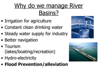
• Irrigation for agriculture
• Constant clean drinking water
• Steady water supply for industry
• Better navigation
• Tourism
(lakes/boating/recreation)
• Hydro-electricity
• Flood Prevention/alleviation
3. Causes of flooding
Physical Human
Intense precipitation Changes in land use
Prolonged rainfall
Urbanisation
Snow Melt or Ice Thaw
Climate Change
Storm Surges
Landslides Poor dam construction
Volcanic Eruptions Poverty
4. Vaiont River Valley, Northern Italy
In 1963, a major
rock slide resulted in
the deaths of over
2600 people. The
slide block moved
suddenly into the
newly filled Vaiont
Reservoir, flushing
lake water up & over
the dam. The wall of
water was over 200 ft
high as it swept into
nearby villages,
wiping out everything
in its path.
6. Indirect/soft/behavioural
strategies
1. Land Use Regulation (washland/wetland –
land left deliberately to flood)
2. Warning Systems (allows for evacuation)
3. Afforestation (usually on slopes of upper
sections of the river basin…sometimes called
‘flood abatement schemes’ along with
modified agricultural practices)
4. Flood Proofing measures – houses on stilts.
Or better built to withstand flood conditions.
5. Flood damage insurance
7. Cost/benefit analysis
STRATEGY BENEFITS COSTS
Regulations Low cost, promotes Possible losses of livestock
suitable use of land
Reservoirs Reduces flooding & costs. Cost of construction and
Multipurpose use maintenance. Environment
Levees Reduces flooding by Expensive to strengthen.
holding more water Catastrophic if breached.
Dredging More water can be Costly & needs to be repeated
contained. Affects local ecosystem.
Channelisaton Reduces flooding in area May increase flooding
of strengthening downstream.
Insurance Spreads cost Reliance on public money
Warning system Less damage, loss & Little use if ignored.
death Response not solution
8. Flooding in the Tees Valley
• Heavy rainfall & steep relief in the upper
Pennines. Low infiltration, impermeable rock
• Elongated river basin, with many tributaries.
• It is a ‘flashy’ river system. Almost instant
response to a rainfall event, with a small lag time.
• High tides (coastal flooding)
• Draining of peat bogs & new drainage systems
for intensive agriculture had decreased soil storage
& increased run off
• Urbanisation - building on flood plains before
strategic land use planning.
9. Tees Valley River Management
• Reservoirs e.g. Cow Green
reservoir (1970) – regulates
river flow by storing excess
water, so reducing flooding
and the water can be released
in times of low flow.
• The Tees Barrage
• Tunnel used to add water
from the Kielder at times of
low flow
• New developments
discouraged in low lying areas
• Yarm flood defence system
(gabions, meander cut)
10. Tees Valley River Management:
Other options
• Improved flood warning
system & emergency reaction
procedures
• Diversionary spillways
• Re-routing of rivers
• Embankments/levees
• Afforestation of the
catchment
• Dredging
• Cutting of meanders
12. Why Bangladesh floods:
Physical causes
• The country is a giant flood plain - 70% of
Bangladesh is less than 1m above sea
level
• Rivers, lakes & swamps cover 10% of the
land area
• Tropical cyclones & monsoon rain bring
heavy rain & storm surges
• Snowmelt from the Himalayas increases
discharge
13. Why Bangladesh floods:
Human causes
• Global warming
• Deforestation in Nepal
• Dam building in India
• Urbanisation
14. Bangladesh:
management strategies pre-87
• Hard’ embankment building schemes,
such as the Meghna-Dhonagoda
irrigation project
• Dredging
• River diversion & channelisation
15. Current proposals
• Stream storage by building 7 huge dams taking
40 years to complete
• 12 to 15 floodplain retention basins to absorb
excess flow diverted from the main rivers and
released after the main floodwaters subside
• Lowering of water table in the Himalayas
• Avoid all ‘hard’ schemes & advocate better
warning systems, improved flood shelters &
emergency services
16. New focus on ‘softer’ strategies
• High–tech weather data analysis &
forecasting systems
• New & improved flood shelters
• Education & advance warning
system (volunteers on bikes with
megaphones)
• Better organised emergency
services & aid teams
• Embankments around major urban
areas, whilst letting low lying rural
areas flood
17. Future trends & issues
• In 2003, disasters stemming from natural hazards
affected seven times more people than those tied up
with conflict.
• More than two billion people around the world could be
at risk of flood devastation by 2050, according to
United Nations University forecasts. Today floods
happen mainly in Asia, but climate change and
overpopulation will make them a real and constant
threat in many other regions.