SlideShare a Scribd company logo
1 of 16
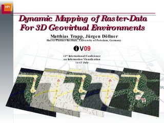
Dynamic Mapping of Raster-Data For 3D Geovirtual Environments Matthias Trapp , Jürgen Döllner Hasso-Plattner-Institute, University of Potsdam, Germany 13 th  International Conference on Information Visualisation 14-17 July
motivation ,[object Object]
motivation ,[object Object],Preprocessing Time:  days-hours Preprocessing Time:  hours-minutes Preprocessing Time:  minutes
wrap-up: challenges & goals ,[object Object],[object Object],[object Object],[object Object],[object Object],[object Object],[object Object],[object Object],[object Object],[object Object],[object Object]
overview: dynamic texture mapping ,[object Object],[object Object],[object Object],[object Object],[object Object],[object Object],[object Object],[object Object],[object Object]
texture coordinate generation ,[object Object],[object Object],U V
color transfer functions ,[object Object],[object Object]
rendering at a glance ,[object Object],[object Object],[object Object],[object Object],[object Object],[object Object],#Vertex #Mappings FPS without FPS with FPS loss (%) 1,040,503 3 10.41 9.87 5.19 41,032 4 52.88 51.20 3.18 61,756 27 156.10 27.94 82.10 6 4 1063.83 236.97 77.72 37,404 16 206.21 45.70 77.84 6 6 1075.27 110.54 89.72
application examples ,[object Object],Building category data Traffic frequency data Data Layer: Color Layer: Data Layer: Color Layer:
 
application examples ,[object Object],Landmark objects Landmark objects Route
 
application examples ,[object Object]
conclusions ,[object Object],[object Object],[object Object],[object Object],[object Object],[object Object],[object Object],[object Object],[object Object]
thank you... Contact: Matthias Trapp [email_address] Jürgen Döllner [email_address] Computer Graphics System Group www.hpi.uni-potsdam.de/3d Researchgroup 3D-Geoinformation www.3dgi.de

More Related Content

What's hot

Smooth, Interactive Rendering and On-line Modification of Large-Scale, Geospa...
Smooth, Interactive Rendering and On-line Modification of Large-Scale, Geospa...Smooth, Interactive Rendering and On-line Modification of Large-Scale, Geospa...
Smooth, Interactive Rendering and On-line Modification of Large-Scale, Geospa...Christian Kehl
 
Point cloud library
Point cloud libraryPoint cloud library
Point cloud libraryBindu Karki
 
Benchmarking Tool for Graph Algorithms
Benchmarking Tool for Graph AlgorithmsBenchmarking Tool for Graph Algorithms
Benchmarking Tool for Graph AlgorithmsYash Khandelwal
 
Benchmarking tool for graph algorithms
Benchmarking tool for graph algorithmsBenchmarking tool for graph algorithms
Benchmarking tool for graph algorithmsYash Khandelwal
 
Stereoscopy for Non-Planar Projections (TRUE 3D 2009)
Stereoscopy for Non-Planar Projections (TRUE 3D 2009)Stereoscopy for Non-Planar Projections (TRUE 3D 2009)
Stereoscopy for Non-Planar Projections (TRUE 3D 2009)Matthias Trapp
 
ePOM - Intro to Ocean Data Science - Raster and Vector Data Formats
ePOM - Intro to Ocean Data Science - Raster and Vector Data FormatsePOM - Intro to Ocean Data Science - Raster and Vector Data Formats
ePOM - Intro to Ocean Data Science - Raster and Vector Data FormatsGiuseppe Masetti
 
On Integrating Information Visualization Techniques into Data Mining: A Revie...
On Integrating Information Visualization Techniques into Data Mining: A Revie...On Integrating Information Visualization Techniques into Data Mining: A Revie...
On Integrating Information Visualization Techniques into Data Mining: A Revie...Sushant Gautam
 
GRASS and OSGeo: a framework for archeology
GRASS and OSGeo: a framework for archeologyGRASS and OSGeo: a framework for archeology
GRASS and OSGeo: a framework for archeologyMarkus Neteler
 
QGIS Module 3
QGIS Module 3QGIS Module 3
QGIS Module 3CAPSUCSF
 
Visual Saliency: Learning to Detect Salient Objects
Visual Saliency: Learning to Detect Salient ObjectsVisual Saliency: Learning to Detect Salient Objects
Visual Saliency: Learning to Detect Salient ObjectsVicente Ordonez
 
3D Web Services And Models For The Web: Where Do We Stand?
3D Web Services And Models For The Web: Where Do We Stand?3D Web Services And Models For The Web: Where Do We Stand?
3D Web Services And Models For The Web: Where Do We Stand?Camptocamp
 
Use of CityGML standard in the context of Smart City
Use of CityGML standard in the context of Smart CityUse of CityGML standard in the context of Smart City
Use of CityGML standard in the context of Smart Cityi-SCOPE Project
 
How Rough Is Your Runway?
How Rough Is Your Runway? How Rough Is Your Runway?
How Rough Is Your Runway? Safe Software
 
Colour Correction using Histogram Stretching
Colour Correction using Histogram StretchingColour Correction using Histogram Stretching
Colour Correction using Histogram StretchingPoul Kjeldager Sørensen
 
3D enabling Smart Cities
3D enabling Smart Cities3D enabling Smart Cities
3D enabling Smart Citiesi-SCOPE Project
 

What's hot (20)

Smooth, Interactive Rendering and On-line Modification of Large-Scale, Geospa...
Smooth, Interactive Rendering and On-line Modification of Large-Scale, Geospa...Smooth, Interactive Rendering and On-line Modification of Large-Scale, Geospa...
Smooth, Interactive Rendering and On-line Modification of Large-Scale, Geospa...
 
Point cloud library
Point cloud libraryPoint cloud library
Point cloud library
 
Benchmarking Tool for Graph Algorithms
Benchmarking Tool for Graph AlgorithmsBenchmarking Tool for Graph Algorithms
Benchmarking Tool for Graph Algorithms
 
Benchmarking tool for graph algorithms
Benchmarking tool for graph algorithmsBenchmarking tool for graph algorithms
Benchmarking tool for graph algorithms
 
DTM DEM Generation
DTM DEM GenerationDTM DEM Generation
DTM DEM Generation
 
Stereoscopy for Non-Planar Projections (TRUE 3D 2009)
Stereoscopy for Non-Planar Projections (TRUE 3D 2009)Stereoscopy for Non-Planar Projections (TRUE 3D 2009)
Stereoscopy for Non-Planar Projections (TRUE 3D 2009)
 
MapInfo Discover 3D: From 2D to 3D
MapInfo Discover 3D: From 2D to 3DMapInfo Discover 3D: From 2D to 3D
MapInfo Discover 3D: From 2D to 3D
 
3D Analyst
3D Analyst3D Analyst
3D Analyst
 
ePOM - Intro to Ocean Data Science - Raster and Vector Data Formats
ePOM - Intro to Ocean Data Science - Raster and Vector Data FormatsePOM - Intro to Ocean Data Science - Raster and Vector Data Formats
ePOM - Intro to Ocean Data Science - Raster and Vector Data Formats
 
On Integrating Information Visualization Techniques into Data Mining: A Revie...
On Integrating Information Visualization Techniques into Data Mining: A Revie...On Integrating Information Visualization Techniques into Data Mining: A Revie...
On Integrating Information Visualization Techniques into Data Mining: A Revie...
 
Tn oservices
Tn oservicesTn oservices
Tn oservices
 
GRASS and OSGeo: a framework for archeology
GRASS and OSGeo: a framework for archeologyGRASS and OSGeo: a framework for archeology
GRASS and OSGeo: a framework for archeology
 
QGIS Module 3
QGIS Module 3QGIS Module 3
QGIS Module 3
 
Visual Saliency: Learning to Detect Salient Objects
Visual Saliency: Learning to Detect Salient ObjectsVisual Saliency: Learning to Detect Salient Objects
Visual Saliency: Learning to Detect Salient Objects
 
3D Web Services And Models For The Web: Where Do We Stand?
3D Web Services And Models For The Web: Where Do We Stand?3D Web Services And Models For The Web: Where Do We Stand?
3D Web Services And Models For The Web: Where Do We Stand?
 
Use of CityGML standard in the context of Smart City
Use of CityGML standard in the context of Smart CityUse of CityGML standard in the context of Smart City
Use of CityGML standard in the context of Smart City
 
TIN IN GIS
TIN IN GISTIN IN GIS
TIN IN GIS
 
How Rough Is Your Runway?
How Rough Is Your Runway? How Rough Is Your Runway?
How Rough Is Your Runway?
 
Colour Correction using Histogram Stretching
Colour Correction using Histogram StretchingColour Correction using Histogram Stretching
Colour Correction using Histogram Stretching
 
3D enabling Smart Cities
3D enabling Smart Cities3D enabling Smart Cities
3D enabling Smart Cities
 

Viewers also liked

Customer Loyalty and Geosocial
Customer Loyalty and GeosocialCustomer Loyalty and Geosocial
Customer Loyalty and GeosocialGleb Kaplun
 
Gdit 819 social justice phase iii
Gdit 819 social justice phase iiiGdit 819 social justice phase iii
Gdit 819 social justice phase iiiemtinanalqurashi
 
703 Alqurashi Google drive as a collaborative tool
703 Alqurashi Google drive as a collaborative tool703 Alqurashi Google drive as a collaborative tool
703 Alqurashi Google drive as a collaborative toolemtinanalqurashi
 
Hioki 3174 rus
Hioki 3174 rusHioki 3174 rus
Hioki 3174 rushiokirus
 
Q1 tinashe (1)
Q1 tinashe (1)Q1 tinashe (1)
Q1 tinashe (1)SolaMedia
 
スプリングセミナー2016 "ソフトウェア開発ビッグデータ解析技術 ~数千人が共同開発するオープンソースの世界~"
スプリングセミナー2016 "ソフトウェア開発ビッグデータ解析技術 ~数千人が共同開発するオープンソースの世界~"スプリングセミナー2016 "ソフトウェア開発ビッグデータ解析技術 ~数千人が共同開発するオープンソースの世界~"
スプリングセミナー2016 "ソフトウェア開発ビッグデータ解析技術 ~数千人が共同開発するオープンソースの世界~"奈良先端大 情報科学研究科
 
my film opening idea
my film opening idea my film opening idea
my film opening idea tobymedia
 
スプリングセミナー2016 "嗜好にあわせたキュレーションシステムの開発"
スプリングセミナー2016 "嗜好にあわせたキュレーションシステムの開発"スプリングセミナー2016 "嗜好にあわせたキュレーションシステムの開発"
スプリングセミナー2016 "嗜好にあわせたキュレーションシステムの開発"奈良先端大 情報科学研究科
 
Демоверсии ЕГЭ-2016: литература
Демоверсии ЕГЭ-2016: литератураДемоверсии ЕГЭ-2016: литература
Демоверсии ЕГЭ-2016: литератураNewtonew
 
Демоверсии ЕГЭ-2016: обществознание
Демоверсии ЕГЭ-2016: обществознаниеДемоверсии ЕГЭ-2016: обществознание
Демоверсии ЕГЭ-2016: обществознаниеNewtonew
 
Демоверсии ЕГЭ-2016: английский язык, устная часть
Демоверсии ЕГЭ-2016: английский язык, устная частьДемоверсии ЕГЭ-2016: английский язык, устная часть
Демоверсии ЕГЭ-2016: английский язык, устная частьNewtonew
 

Viewers also liked (15)

Customer Loyalty and Geosocial
Customer Loyalty and GeosocialCustomer Loyalty and Geosocial
Customer Loyalty and Geosocial
 
Gdit 819 social justice phase iii
Gdit 819 social justice phase iiiGdit 819 social justice phase iii
Gdit 819 social justice phase iii
 
705 Lesson plan
705 Lesson plan705 Lesson plan
705 Lesson plan
 
703 Alqurashi Google drive as a collaborative tool
703 Alqurashi Google drive as a collaborative tool703 Alqurashi Google drive as a collaborative tool
703 Alqurashi Google drive as a collaborative tool
 
Hioki 3174 rus
Hioki 3174 rusHioki 3174 rus
Hioki 3174 rus
 
Q1 tinashe (1)
Q1 tinashe (1)Q1 tinashe (1)
Q1 tinashe (1)
 
スプリングセミナー2016 "ソフトウェア開発ビッグデータ解析技術 ~数千人が共同開発するオープンソースの世界~"
スプリングセミナー2016 "ソフトウェア開発ビッグデータ解析技術 ~数千人が共同開発するオープンソースの世界~"スプリングセミナー2016 "ソフトウェア開発ビッグデータ解析技術 ~数千人が共同開発するオープンソースの世界~"
スプリングセミナー2016 "ソフトウェア開発ビッグデータ解析技術 ~数千人が共同開発するオープンソースの世界~"
 
my film opening idea
my film opening idea my film opening idea
my film opening idea
 
スプリングセミナー2016 "嗜好にあわせたキュレーションシステムの開発"
スプリングセミナー2016 "嗜好にあわせたキュレーションシステムの開発"スプリングセミナー2016 "嗜好にあわせたキュレーションシステムの開発"
スプリングセミナー2016 "嗜好にあわせたキュレーションシステムの開発"
 
726 Group work
726 Group work726 Group work
726 Group work
 
Демоверсии ЕГЭ-2016: литература
Демоверсии ЕГЭ-2016: литератураДемоверсии ЕГЭ-2016: литература
Демоверсии ЕГЭ-2016: литература
 
Демоверсии ЕГЭ-2016: обществознание
Демоверсии ЕГЭ-2016: обществознаниеДемоверсии ЕГЭ-2016: обществознание
Демоверсии ЕГЭ-2016: обществознание
 
Демоверсии ЕГЭ-2016: английский язык, устная часть
Демоверсии ЕГЭ-2016: английский язык, устная частьДемоверсии ЕГЭ-2016: английский язык, устная часть
Демоверсии ЕГЭ-2016: английский язык, устная часть
 
726 Japan
726 Japan726 Japan
726 Japan
 
Алтын ұрпақ
Алтын ұрпақАлтын ұрпақ
Алтын ұрпақ
 

Similar to Dynamic Mapping of Raster Data (IV 2009)

High resolution textured models for engineering applications
High resolution textured models for engineering applicationsHigh resolution textured models for engineering applications
High resolution textured models for engineering applicationsArtemis Valanis
 
Presentation NBMP and PCC
Presentation NBMP and PCCPresentation NBMP and PCC
Presentation NBMP and PCCRufael Mekuria
 
Interactive Editing of Signed Distance Fields
Interactive Editing of Signed Distance FieldsInteractive Editing of Signed Distance Fields
Interactive Editing of Signed Distance FieldsMatthias Trapp
 
Real-time Screen-space Geometry Draping for 3D Digital Terrain Models
Real-time Screen-space Geometry Draping for 3D Digital Terrain ModelsReal-time Screen-space Geometry Draping for 3D Digital Terrain Models
Real-time Screen-space Geometry Draping for 3D Digital Terrain ModelsMatthias Trapp
 
Terrain Rendering in Frostbite using Procedural Shader Splatting (Siggraph 2007)
Terrain Rendering in Frostbite using Procedural Shader Splatting (Siggraph 2007)Terrain Rendering in Frostbite using Procedural Shader Splatting (Siggraph 2007)
Terrain Rendering in Frostbite using Procedural Shader Splatting (Siggraph 2007)Johan Andersson
 
Cogent3 d master slides (12 april 2009)
Cogent3 d master slides (12 april 2009)Cogent3 d master slides (12 april 2009)
Cogent3 d master slides (12 april 2009)Danny Bronson
 
Geometry Batching Using Texture-Arrays
Geometry Batching Using Texture-ArraysGeometry Batching Using Texture-Arrays
Geometry Batching Using Texture-ArraysMatthias Trapp
 
DDGK: Learning Graph Representations for Deep Divergence Graph Kernels
DDGK: Learning Graph Representations for Deep Divergence Graph KernelsDDGK: Learning Graph Representations for Deep Divergence Graph Kernels
DDGK: Learning Graph Representations for Deep Divergence Graph Kernelsivaderivader
 
Google Earth Web Service as a Support for GIS Mapping in Geospatial Research ...
Google Earth Web Service as a Support for GIS Mapping in Geospatial Research ...Google Earth Web Service as a Support for GIS Mapping in Geospatial Research ...
Google Earth Web Service as a Support for GIS Mapping in Geospatial Research ...Universität Salzburg
 
D3 D10 Unleashed New Features And Effects
D3 D10 Unleashed   New Features And EffectsD3 D10 Unleashed   New Features And Effects
D3 D10 Unleashed New Features And EffectsThomas Goddard
 
Desktop Softwares for Unmanned Aerial Systems(UAS))
Desktop Softwares for Unmanned Aerial Systems(UAS))Desktop Softwares for Unmanned Aerial Systems(UAS))
Desktop Softwares for Unmanned Aerial Systems(UAS))Kamal Shahi
 
Interactive Close-Up Rendering for Detail+Overview Visualization of 3D Digita...
Interactive Close-Up Rendering for Detail+Overview Visualization of 3D Digita...Interactive Close-Up Rendering for Detail+Overview Visualization of 3D Digita...
Interactive Close-Up Rendering for Detail+Overview Visualization of 3D Digita...Matthias Trapp
 
Classified 3d Model Retrieval Based on Cascaded Fusion of Local Descriptors
Classified 3d Model Retrieval Based on Cascaded Fusion of Local Descriptors  Classified 3d Model Retrieval Based on Cascaded Fusion of Local Descriptors
Classified 3d Model Retrieval Based on Cascaded Fusion of Local Descriptors ijcga
 
3D WebGIS using Opensource software
3D WebGIS using Opensource software3D WebGIS using Opensource software
3D WebGIS using Opensource softwareParthesh Bulbule
 
Gis capabilities on Big Data Systems
Gis capabilities on Big Data SystemsGis capabilities on Big Data Systems
Gis capabilities on Big Data SystemsAhmad Jawwad
 
GIS and CAD Integration: The Bentley Perspective
GIS and CAD Integration: The Bentley PerspectiveGIS and CAD Integration: The Bentley Perspective
GIS and CAD Integration: The Bentley PerspectiveAndrew Bashfield
 

Similar to Dynamic Mapping of Raster Data (IV 2009) (20)

High resolution textured models for engineering applications
High resolution textured models for engineering applicationsHigh resolution textured models for engineering applications
High resolution textured models for engineering applications
 
Presentation NBMP and PCC
Presentation NBMP and PCCPresentation NBMP and PCC
Presentation NBMP and PCC
 
Interactive Editing of Signed Distance Fields
Interactive Editing of Signed Distance FieldsInteractive Editing of Signed Distance Fields
Interactive Editing of Signed Distance Fields
 
Real-time Screen-space Geometry Draping for 3D Digital Terrain Models
Real-time Screen-space Geometry Draping for 3D Digital Terrain ModelsReal-time Screen-space Geometry Draping for 3D Digital Terrain Models
Real-time Screen-space Geometry Draping for 3D Digital Terrain Models
 
Digital image processing
Digital image processingDigital image processing
Digital image processing
 
MDT7
MDT7MDT7
MDT7
 
Terrain Rendering in Frostbite using Procedural Shader Splatting (Siggraph 2007)
Terrain Rendering in Frostbite using Procedural Shader Splatting (Siggraph 2007)Terrain Rendering in Frostbite using Procedural Shader Splatting (Siggraph 2007)
Terrain Rendering in Frostbite using Procedural Shader Splatting (Siggraph 2007)
 
Cogent3 d master slides (12 april 2009)
Cogent3 d master slides (12 april 2009)Cogent3 d master slides (12 april 2009)
Cogent3 d master slides (12 april 2009)
 
Praseed Pai
Praseed PaiPraseed Pai
Praseed Pai
 
3 D Lidar Epfl Iccsa 08
3 D Lidar Epfl Iccsa 083 D Lidar Epfl Iccsa 08
3 D Lidar Epfl Iccsa 08
 
Geometry Batching Using Texture-Arrays
Geometry Batching Using Texture-ArraysGeometry Batching Using Texture-Arrays
Geometry Batching Using Texture-Arrays
 
DDGK: Learning Graph Representations for Deep Divergence Graph Kernels
DDGK: Learning Graph Representations for Deep Divergence Graph KernelsDDGK: Learning Graph Representations for Deep Divergence Graph Kernels
DDGK: Learning Graph Representations for Deep Divergence Graph Kernels
 
Google Earth Web Service as a Support for GIS Mapping in Geospatial Research ...
Google Earth Web Service as a Support for GIS Mapping in Geospatial Research ...Google Earth Web Service as a Support for GIS Mapping in Geospatial Research ...
Google Earth Web Service as a Support for GIS Mapping in Geospatial Research ...
 
D3 D10 Unleashed New Features And Effects
D3 D10 Unleashed   New Features And EffectsD3 D10 Unleashed   New Features And Effects
D3 D10 Unleashed New Features And Effects
 
Desktop Softwares for Unmanned Aerial Systems(UAS))
Desktop Softwares for Unmanned Aerial Systems(UAS))Desktop Softwares for Unmanned Aerial Systems(UAS))
Desktop Softwares for Unmanned Aerial Systems(UAS))
 
Interactive Close-Up Rendering for Detail+Overview Visualization of 3D Digita...
Interactive Close-Up Rendering for Detail+Overview Visualization of 3D Digita...Interactive Close-Up Rendering for Detail+Overview Visualization of 3D Digita...
Interactive Close-Up Rendering for Detail+Overview Visualization of 3D Digita...
 
Classified 3d Model Retrieval Based on Cascaded Fusion of Local Descriptors
Classified 3d Model Retrieval Based on Cascaded Fusion of Local Descriptors  Classified 3d Model Retrieval Based on Cascaded Fusion of Local Descriptors
Classified 3d Model Retrieval Based on Cascaded Fusion of Local Descriptors
 
3D WebGIS using Opensource software
3D WebGIS using Opensource software3D WebGIS using Opensource software
3D WebGIS using Opensource software
 
Gis capabilities on Big Data Systems
Gis capabilities on Big Data SystemsGis capabilities on Big Data Systems
Gis capabilities on Big Data Systems
 
GIS and CAD Integration: The Bentley Perspective
GIS and CAD Integration: The Bentley PerspectiveGIS and CAD Integration: The Bentley Perspective
GIS and CAD Integration: The Bentley Perspective
 

More from Matthias Trapp

Interactive Control over Temporal Consistency while Stylizing Video Streams
Interactive Control over Temporal Consistency while Stylizing Video StreamsInteractive Control over Temporal Consistency while Stylizing Video Streams
Interactive Control over Temporal Consistency while Stylizing Video StreamsMatthias Trapp
 
A Framework for Art-directed Augmentation of Human Motion in Videos on Mobile...
A Framework for Art-directed Augmentation of Human Motion in Videos on Mobile...A Framework for Art-directed Augmentation of Human Motion in Videos on Mobile...
A Framework for Art-directed Augmentation of Human Motion in Videos on Mobile...Matthias Trapp
 
A Framework for Interactive 3D Photo Stylization Techniques on Mobile Devices
A Framework for Interactive 3D Photo Stylization Techniques on Mobile DevicesA Framework for Interactive 3D Photo Stylization Techniques on Mobile Devices
A Framework for Interactive 3D Photo Stylization Techniques on Mobile DevicesMatthias Trapp
 
ALIVE-Adaptive Chromaticity for Interactive Low-light Image and Video Enhance...
ALIVE-Adaptive Chromaticity for Interactive Low-light Image and Video Enhance...ALIVE-Adaptive Chromaticity for Interactive Low-light Image and Video Enhance...
ALIVE-Adaptive Chromaticity for Interactive Low-light Image and Video Enhance...Matthias Trapp
 
A Service-based Preset Recommendation System for Image Stylization Applications
A Service-based Preset Recommendation System for Image Stylization ApplicationsA Service-based Preset Recommendation System for Image Stylization Applications
A Service-based Preset Recommendation System for Image Stylization ApplicationsMatthias Trapp
 
Design Space of Geometry-based Image Abstraction Techniques with Vectorizatio...
Design Space of Geometry-based Image Abstraction Techniques with Vectorizatio...Design Space of Geometry-based Image Abstraction Techniques with Vectorizatio...
Design Space of Geometry-based Image Abstraction Techniques with Vectorizatio...Matthias Trapp
 
A Benchmark for the Use of Topic Models for Text Visualization Tasks - Online...
A Benchmark for the Use of Topic Models for Text Visualization Tasks - Online...A Benchmark for the Use of Topic Models for Text Visualization Tasks - Online...
A Benchmark for the Use of Topic Models for Text Visualization Tasks - Online...Matthias Trapp
 
Efficient GitHub Crawling using the GraphQL API
Efficient GitHub Crawling using the GraphQL APIEfficient GitHub Crawling using the GraphQL API
Efficient GitHub Crawling using the GraphQL APIMatthias Trapp
 
CodeCV - Mining Expertise of GitHub Users from Coding Activities - Online.pdf
CodeCV - Mining Expertise of GitHub Users from Coding Activities - Online.pdfCodeCV - Mining Expertise of GitHub Users from Coding Activities - Online.pdf
CodeCV - Mining Expertise of GitHub Users from Coding Activities - Online.pdfMatthias Trapp
 
Non-Photorealistic Rendering of 3D Point Clouds for Cartographic Visualization
Non-Photorealistic Rendering of 3D Point Clouds for Cartographic VisualizationNon-Photorealistic Rendering of 3D Point Clouds for Cartographic Visualization
Non-Photorealistic Rendering of 3D Point Clouds for Cartographic VisualizationMatthias Trapp
 
TWIN4ROAD - Erfassung Analyse und Auswertung mobiler Multi Sensorik im Strass...
TWIN4ROAD - Erfassung Analyse und Auswertung mobiler Multi Sensorik im Strass...TWIN4ROAD - Erfassung Analyse und Auswertung mobiler Multi Sensorik im Strass...
TWIN4ROAD - Erfassung Analyse und Auswertung mobiler Multi Sensorik im Strass...Matthias Trapp
 
Web-based and Mobile Provisioning of Virtual 3D Reconstructions
Web-based and Mobile Provisioning of Virtual 3D ReconstructionsWeb-based and Mobile Provisioning of Virtual 3D Reconstructions
Web-based and Mobile Provisioning of Virtual 3D ReconstructionsMatthias Trapp
 
Visualization of Knowledge Distribution across Development Teams using 2.5D S...
Visualization of Knowledge Distribution across Development Teams using 2.5D S...Visualization of Knowledge Distribution across Development Teams using 2.5D S...
Visualization of Knowledge Distribution across Development Teams using 2.5D S...Matthias Trapp
 
FERMIUM - A Framework for Real-time Procedural Point Cloud Animation & Morphing
FERMIUM - A Framework for Real-time Procedural Point Cloud Animation & MorphingFERMIUM - A Framework for Real-time Procedural Point Cloud Animation & Morphing
FERMIUM - A Framework for Real-time Procedural Point Cloud Animation & MorphingMatthias Trapp
 
Integration of Image Processing Techniques into the Unity Game Engine
Integration of Image Processing Techniques into the Unity Game EngineIntegration of Image Processing Techniques into the Unity Game Engine
Integration of Image Processing Techniques into the Unity Game EngineMatthias Trapp
 
Interactive GPU-based Image Deformation for Mobile Devices
Interactive GPU-based Image Deformation for Mobile DevicesInteractive GPU-based Image Deformation for Mobile Devices
Interactive GPU-based Image Deformation for Mobile DevicesMatthias Trapp
 
Interactive Photo Editing on Smartphones via Intrinsic Decomposition
Interactive Photo Editing on Smartphones via Intrinsic DecompositionInteractive Photo Editing on Smartphones via Intrinsic Decomposition
Interactive Photo Editing on Smartphones via Intrinsic DecompositionMatthias Trapp
 
Service-based Analysis and Abstraction for Content Moderation of Digital Images
Service-based Analysis and Abstraction for Content Moderation of Digital ImagesService-based Analysis and Abstraction for Content Moderation of Digital Images
Service-based Analysis and Abstraction for Content Moderation of Digital ImagesMatthias Trapp
 
A Non-Photorealistic Rendering Techniquefor Art-directed Hatching of 3D Point...
A Non-Photorealistic Rendering Techniquefor Art-directed Hatching of 3D Point...A Non-Photorealistic Rendering Techniquefor Art-directed Hatching of 3D Point...
A Non-Photorealistic Rendering Techniquefor Art-directed Hatching of 3D Point...Matthias Trapp
 
Interactive Height-Based Filtering in 2.5D Treemaps
Interactive Height-Based Filtering in 2.5D TreemapsInteractive Height-Based Filtering in 2.5D Treemaps
Interactive Height-Based Filtering in 2.5D TreemapsMatthias Trapp
 

More from Matthias Trapp (20)

Interactive Control over Temporal Consistency while Stylizing Video Streams
Interactive Control over Temporal Consistency while Stylizing Video StreamsInteractive Control over Temporal Consistency while Stylizing Video Streams
Interactive Control over Temporal Consistency while Stylizing Video Streams
 
A Framework for Art-directed Augmentation of Human Motion in Videos on Mobile...
A Framework for Art-directed Augmentation of Human Motion in Videos on Mobile...A Framework for Art-directed Augmentation of Human Motion in Videos on Mobile...
A Framework for Art-directed Augmentation of Human Motion in Videos on Mobile...
 
A Framework for Interactive 3D Photo Stylization Techniques on Mobile Devices
A Framework for Interactive 3D Photo Stylization Techniques on Mobile DevicesA Framework for Interactive 3D Photo Stylization Techniques on Mobile Devices
A Framework for Interactive 3D Photo Stylization Techniques on Mobile Devices
 
ALIVE-Adaptive Chromaticity for Interactive Low-light Image and Video Enhance...
ALIVE-Adaptive Chromaticity for Interactive Low-light Image and Video Enhance...ALIVE-Adaptive Chromaticity for Interactive Low-light Image and Video Enhance...
ALIVE-Adaptive Chromaticity for Interactive Low-light Image and Video Enhance...
 
A Service-based Preset Recommendation System for Image Stylization Applications
A Service-based Preset Recommendation System for Image Stylization ApplicationsA Service-based Preset Recommendation System for Image Stylization Applications
A Service-based Preset Recommendation System for Image Stylization Applications
 
Design Space of Geometry-based Image Abstraction Techniques with Vectorizatio...
Design Space of Geometry-based Image Abstraction Techniques with Vectorizatio...Design Space of Geometry-based Image Abstraction Techniques with Vectorizatio...
Design Space of Geometry-based Image Abstraction Techniques with Vectorizatio...
 
A Benchmark for the Use of Topic Models for Text Visualization Tasks - Online...
A Benchmark for the Use of Topic Models for Text Visualization Tasks - Online...A Benchmark for the Use of Topic Models for Text Visualization Tasks - Online...
A Benchmark for the Use of Topic Models for Text Visualization Tasks - Online...
 
Efficient GitHub Crawling using the GraphQL API
Efficient GitHub Crawling using the GraphQL APIEfficient GitHub Crawling using the GraphQL API
Efficient GitHub Crawling using the GraphQL API
 
CodeCV - Mining Expertise of GitHub Users from Coding Activities - Online.pdf
CodeCV - Mining Expertise of GitHub Users from Coding Activities - Online.pdfCodeCV - Mining Expertise of GitHub Users from Coding Activities - Online.pdf
CodeCV - Mining Expertise of GitHub Users from Coding Activities - Online.pdf
 
Non-Photorealistic Rendering of 3D Point Clouds for Cartographic Visualization
Non-Photorealistic Rendering of 3D Point Clouds for Cartographic VisualizationNon-Photorealistic Rendering of 3D Point Clouds for Cartographic Visualization
Non-Photorealistic Rendering of 3D Point Clouds for Cartographic Visualization
 
TWIN4ROAD - Erfassung Analyse und Auswertung mobiler Multi Sensorik im Strass...
TWIN4ROAD - Erfassung Analyse und Auswertung mobiler Multi Sensorik im Strass...TWIN4ROAD - Erfassung Analyse und Auswertung mobiler Multi Sensorik im Strass...
TWIN4ROAD - Erfassung Analyse und Auswertung mobiler Multi Sensorik im Strass...
 
Web-based and Mobile Provisioning of Virtual 3D Reconstructions
Web-based and Mobile Provisioning of Virtual 3D ReconstructionsWeb-based and Mobile Provisioning of Virtual 3D Reconstructions
Web-based and Mobile Provisioning of Virtual 3D Reconstructions
 
Visualization of Knowledge Distribution across Development Teams using 2.5D S...
Visualization of Knowledge Distribution across Development Teams using 2.5D S...Visualization of Knowledge Distribution across Development Teams using 2.5D S...
Visualization of Knowledge Distribution across Development Teams using 2.5D S...
 
FERMIUM - A Framework for Real-time Procedural Point Cloud Animation & Morphing
FERMIUM - A Framework for Real-time Procedural Point Cloud Animation & MorphingFERMIUM - A Framework for Real-time Procedural Point Cloud Animation & Morphing
FERMIUM - A Framework for Real-time Procedural Point Cloud Animation & Morphing
 
Integration of Image Processing Techniques into the Unity Game Engine
Integration of Image Processing Techniques into the Unity Game EngineIntegration of Image Processing Techniques into the Unity Game Engine
Integration of Image Processing Techniques into the Unity Game Engine
 
Interactive GPU-based Image Deformation for Mobile Devices
Interactive GPU-based Image Deformation for Mobile DevicesInteractive GPU-based Image Deformation for Mobile Devices
Interactive GPU-based Image Deformation for Mobile Devices
 
Interactive Photo Editing on Smartphones via Intrinsic Decomposition
Interactive Photo Editing on Smartphones via Intrinsic DecompositionInteractive Photo Editing on Smartphones via Intrinsic Decomposition
Interactive Photo Editing on Smartphones via Intrinsic Decomposition
 
Service-based Analysis and Abstraction for Content Moderation of Digital Images
Service-based Analysis and Abstraction for Content Moderation of Digital ImagesService-based Analysis and Abstraction for Content Moderation of Digital Images
Service-based Analysis and Abstraction for Content Moderation of Digital Images
 
A Non-Photorealistic Rendering Techniquefor Art-directed Hatching of 3D Point...
A Non-Photorealistic Rendering Techniquefor Art-directed Hatching of 3D Point...A Non-Photorealistic Rendering Techniquefor Art-directed Hatching of 3D Point...
A Non-Photorealistic Rendering Techniquefor Art-directed Hatching of 3D Point...
 
Interactive Height-Based Filtering in 2.5D Treemaps
Interactive Height-Based Filtering in 2.5D TreemapsInteractive Height-Based Filtering in 2.5D Treemaps
Interactive Height-Based Filtering in 2.5D Treemaps
 

Recently uploaded

What's New in Teams Calling, Meetings and Devices March 2024
What's New in Teams Calling, Meetings and Devices March 2024What's New in Teams Calling, Meetings and Devices March 2024
What's New in Teams Calling, Meetings and Devices March 2024Stephanie Beckett
 
New from BookNet Canada for 2024: BNC CataList - Tech Forum 2024
New from BookNet Canada for 2024: BNC CataList - Tech Forum 2024New from BookNet Canada for 2024: BNC CataList - Tech Forum 2024
New from BookNet Canada for 2024: BNC CataList - Tech Forum 2024BookNet Canada
 
DevoxxFR 2024 Reproducible Builds with Apache Maven
DevoxxFR 2024 Reproducible Builds with Apache MavenDevoxxFR 2024 Reproducible Builds with Apache Maven
DevoxxFR 2024 Reproducible Builds with Apache MavenHervé Boutemy
 
How to write a Business Continuity Plan
How to write a Business Continuity PlanHow to write a Business Continuity Plan
How to write a Business Continuity PlanDatabarracks
 
"LLMs for Python Engineers: Advanced Data Analysis and Semantic Kernel",Oleks...
"LLMs for Python Engineers: Advanced Data Analysis and Semantic Kernel",Oleks..."LLMs for Python Engineers: Advanced Data Analysis and Semantic Kernel",Oleks...
"LLMs for Python Engineers: Advanced Data Analysis and Semantic Kernel",Oleks...Fwdays
 
SIP trunking in Janus @ Kamailio World 2024
SIP trunking in Janus @ Kamailio World 2024SIP trunking in Janus @ Kamailio World 2024
SIP trunking in Janus @ Kamailio World 2024Lorenzo Miniero
 
Anypoint Exchange: It’s Not Just a Repo!
Anypoint Exchange: It’s Not Just a Repo!Anypoint Exchange: It’s Not Just a Repo!
Anypoint Exchange: It’s Not Just a Repo!Manik S Magar
 
Take control of your SAP testing with UiPath Test Suite
Take control of your SAP testing with UiPath Test SuiteTake control of your SAP testing with UiPath Test Suite
Take control of your SAP testing with UiPath Test SuiteDianaGray10
 
Human Factors of XR: Using Human Factors to Design XR Systems
Human Factors of XR: Using Human Factors to Design XR SystemsHuman Factors of XR: Using Human Factors to Design XR Systems
Human Factors of XR: Using Human Factors to Design XR SystemsMark Billinghurst
 
Dev Dives: Streamline document processing with UiPath Studio Web
Dev Dives: Streamline document processing with UiPath Studio WebDev Dives: Streamline document processing with UiPath Studio Web
Dev Dives: Streamline document processing with UiPath Studio WebUiPathCommunity
 
Gen AI in Business - Global Trends Report 2024.pdf
Gen AI in Business - Global Trends Report 2024.pdfGen AI in Business - Global Trends Report 2024.pdf
Gen AI in Business - Global Trends Report 2024.pdfAddepto
 
Advanced Computer Architecture – An Introduction
Advanced Computer Architecture – An IntroductionAdvanced Computer Architecture – An Introduction
Advanced Computer Architecture – An IntroductionDilum Bandara
 
Hyperautomation and AI/ML: A Strategy for Digital Transformation Success.pdf
Hyperautomation and AI/ML: A Strategy for Digital Transformation Success.pdfHyperautomation and AI/ML: A Strategy for Digital Transformation Success.pdf
Hyperautomation and AI/ML: A Strategy for Digital Transformation Success.pdfPrecisely
 
CloudStudio User manual (basic edition):
CloudStudio User manual (basic edition):CloudStudio User manual (basic edition):
CloudStudio User manual (basic edition):comworks
 
Vertex AI Gemini Prompt Engineering Tips
Vertex AI Gemini Prompt Engineering TipsVertex AI Gemini Prompt Engineering Tips
Vertex AI Gemini Prompt Engineering TipsMiki Katsuragi
 
"Subclassing and Composition – A Pythonic Tour of Trade-Offs", Hynek Schlawack
"Subclassing and Composition – A Pythonic Tour of Trade-Offs", Hynek Schlawack"Subclassing and Composition – A Pythonic Tour of Trade-Offs", Hynek Schlawack
"Subclassing and Composition – A Pythonic Tour of Trade-Offs", Hynek SchlawackFwdays
 
From Family Reminiscence to Scholarly Archive .
From Family Reminiscence to Scholarly Archive .From Family Reminiscence to Scholarly Archive .
From Family Reminiscence to Scholarly Archive .Alan Dix
 
TrustArc Webinar - How to Build Consumer Trust Through Data Privacy
TrustArc Webinar - How to Build Consumer Trust Through Data PrivacyTrustArc Webinar - How to Build Consumer Trust Through Data Privacy
TrustArc Webinar - How to Build Consumer Trust Through Data PrivacyTrustArc
 
Ensuring Technical Readiness For Copilot in Microsoft 365
Ensuring Technical Readiness For Copilot in Microsoft 365Ensuring Technical Readiness For Copilot in Microsoft 365
Ensuring Technical Readiness For Copilot in Microsoft 3652toLead Limited
 

Recently uploaded (20)

What's New in Teams Calling, Meetings and Devices March 2024
What's New in Teams Calling, Meetings and Devices March 2024What's New in Teams Calling, Meetings and Devices March 2024
What's New in Teams Calling, Meetings and Devices March 2024
 
New from BookNet Canada for 2024: BNC CataList - Tech Forum 2024
New from BookNet Canada for 2024: BNC CataList - Tech Forum 2024New from BookNet Canada for 2024: BNC CataList - Tech Forum 2024
New from BookNet Canada for 2024: BNC CataList - Tech Forum 2024
 
DevoxxFR 2024 Reproducible Builds with Apache Maven
DevoxxFR 2024 Reproducible Builds with Apache MavenDevoxxFR 2024 Reproducible Builds with Apache Maven
DevoxxFR 2024 Reproducible Builds with Apache Maven
 
How to write a Business Continuity Plan
How to write a Business Continuity PlanHow to write a Business Continuity Plan
How to write a Business Continuity Plan
 
"LLMs for Python Engineers: Advanced Data Analysis and Semantic Kernel",Oleks...
"LLMs for Python Engineers: Advanced Data Analysis and Semantic Kernel",Oleks..."LLMs for Python Engineers: Advanced Data Analysis and Semantic Kernel",Oleks...
"LLMs for Python Engineers: Advanced Data Analysis and Semantic Kernel",Oleks...
 
SIP trunking in Janus @ Kamailio World 2024
SIP trunking in Janus @ Kamailio World 2024SIP trunking in Janus @ Kamailio World 2024
SIP trunking in Janus @ Kamailio World 2024
 
Anypoint Exchange: It’s Not Just a Repo!
Anypoint Exchange: It’s Not Just a Repo!Anypoint Exchange: It’s Not Just a Repo!
Anypoint Exchange: It’s Not Just a Repo!
 
Take control of your SAP testing with UiPath Test Suite
Take control of your SAP testing with UiPath Test SuiteTake control of your SAP testing with UiPath Test Suite
Take control of your SAP testing with UiPath Test Suite
 
Human Factors of XR: Using Human Factors to Design XR Systems
Human Factors of XR: Using Human Factors to Design XR SystemsHuman Factors of XR: Using Human Factors to Design XR Systems
Human Factors of XR: Using Human Factors to Design XR Systems
 
Dev Dives: Streamline document processing with UiPath Studio Web
Dev Dives: Streamline document processing with UiPath Studio WebDev Dives: Streamline document processing with UiPath Studio Web
Dev Dives: Streamline document processing with UiPath Studio Web
 
Gen AI in Business - Global Trends Report 2024.pdf
Gen AI in Business - Global Trends Report 2024.pdfGen AI in Business - Global Trends Report 2024.pdf
Gen AI in Business - Global Trends Report 2024.pdf
 
Advanced Computer Architecture – An Introduction
Advanced Computer Architecture – An IntroductionAdvanced Computer Architecture – An Introduction
Advanced Computer Architecture – An Introduction
 
Hyperautomation and AI/ML: A Strategy for Digital Transformation Success.pdf
Hyperautomation and AI/ML: A Strategy for Digital Transformation Success.pdfHyperautomation and AI/ML: A Strategy for Digital Transformation Success.pdf
Hyperautomation and AI/ML: A Strategy for Digital Transformation Success.pdf
 
CloudStudio User manual (basic edition):
CloudStudio User manual (basic edition):CloudStudio User manual (basic edition):
CloudStudio User manual (basic edition):
 
Vertex AI Gemini Prompt Engineering Tips
Vertex AI Gemini Prompt Engineering TipsVertex AI Gemini Prompt Engineering Tips
Vertex AI Gemini Prompt Engineering Tips
 
"Subclassing and Composition – A Pythonic Tour of Trade-Offs", Hynek Schlawack
"Subclassing and Composition – A Pythonic Tour of Trade-Offs", Hynek Schlawack"Subclassing and Composition – A Pythonic Tour of Trade-Offs", Hynek Schlawack
"Subclassing and Composition – A Pythonic Tour of Trade-Offs", Hynek Schlawack
 
E-Vehicle_Hacking_by_Parul Sharma_null_owasp.pptx
E-Vehicle_Hacking_by_Parul Sharma_null_owasp.pptxE-Vehicle_Hacking_by_Parul Sharma_null_owasp.pptx
E-Vehicle_Hacking_by_Parul Sharma_null_owasp.pptx
 
From Family Reminiscence to Scholarly Archive .
From Family Reminiscence to Scholarly Archive .From Family Reminiscence to Scholarly Archive .
From Family Reminiscence to Scholarly Archive .
 
TrustArc Webinar - How to Build Consumer Trust Through Data Privacy
TrustArc Webinar - How to Build Consumer Trust Through Data PrivacyTrustArc Webinar - How to Build Consumer Trust Through Data Privacy
TrustArc Webinar - How to Build Consumer Trust Through Data Privacy
 
Ensuring Technical Readiness For Copilot in Microsoft 365
Ensuring Technical Readiness For Copilot in Microsoft 365Ensuring Technical Readiness For Copilot in Microsoft 365
Ensuring Technical Readiness For Copilot in Microsoft 365
 

Dynamic Mapping of Raster Data (IV 2009)

  • 1. Dynamic Mapping of Raster-Data For 3D Geovirtual Environments Matthias Trapp , Jürgen Döllner Hasso-Plattner-Institute, University of Potsdam, Germany 13 th International Conference on Information Visualisation 14-17 July
  • 2.
  • 3.
  • 4.
  • 5.
  • 6.
  • 7.
  • 8.
  • 9.
  • 10.  
  • 11.
  • 12.  
  • 13.
  • 14.
  • 15.
  • 16. thank you... Contact: Matthias Trapp [email_address] Jürgen Döllner [email_address] Computer Graphics System Group www.hpi.uni-potsdam.de/3d Researchgroup 3D-Geoinformation www.3dgi.de

Editor's Notes

  1. Hello! Thank you very much for the introduction. Now, I‘d like to present a concept for dynamically mapping raster-data to complex 3D GeoVE [CLICK]
  2. The main idea of this projects is to use 3D GeoVE, such as 3D City and landscape models as scenery for visualizing information which maybe the result of a geo-analytics process. Such as these exemplary visualization, on which I‘ll focus later on. But, what exactly is the problem to achieve this within 3D geovirtual environments ? [CLICK]
  3. If you take a look on this picture of a 3D GeoVE, Pre-processing time Model + Textures So where is the problem? 3D GeoVE require
  4. So, let me wrap-up the challenges and goals of this project: To render large-scale geo data sets at interactive frame rates, usually a specific out-of-core render is necessary. Such renderer require pre-processed data. The time for pre-processing depends on the complexity and is often time consuming. So such approach cannot be used to incorporate time critical data. That‘s why we need to partially de-couple geometry and appreance.
  5. To achive this major goal we use dyanmic texture mapping A combination of texture coordinate generator, texture sampling and color transfer functions. In other words… texture coordinate geeration and enhanced multitexturing. So, our approach need at least three inputs: the 3D coordinate of a point to texture, data & color layer as well as the mapping parameterizations. The output is a final color. The data and color layers can be 1D/2D and 3D texture image, which function as mask, data values, or color gradient sfor the color mapping.
  6. For dynamic texture coordinate generation, we use projective texture mapping introduced by Cass Everitt in 2001. This is simply a vector-matrix multiplication using the 3D point-coordinates as input. As the projector matrix MP we use an orthogonal projection matrix since we can assume that 3D GeoVE at our scale can be approximated by a 3D plane. The projector matrix is adjusted using two vector as depicted on the right. [CLICK]
  7. The color transfer function component is inspired by Bruckner and describes the color mapping. It supports the standard blending operations For details on this topic I‘d like to refer to the paper and give only a simple example [CLICK]
  8. To implement our concept on modern consumer graphics hardware we have to extend the existing OpenGl/DirectX muti-texturing pipeline. We are able to render all mappings within a single rendering pass. All the work, is performed with a fragment shader program. The data and color layers are encode in texture arrays , some kind of 3D textures. The performance of our approach is fill-limited, i.e. the more fragments and mappings the more drops the FPS. [CLICK]
  9. Let me know focus on some selected application examples. The main field is the hierarchical mapping and combination of thematic raster data. In this example you can see two data layers [CLICK] combined using two masks and applied to a section of the virtual 3D city model of Berlin. The same works also for dynamic simulation data [CLICK].
  10. This is an pseudo examples that show two video data layers containing the results of fluid simulations. These both applied to an artificial city model. The blending modes of the color transfer functions results in violet color where the red and blue data overlaps. [CLICK]
  11. Our frame work can also be used for object and route highlighting to facilitate orientation and navigation in 3D geovirtual environments. Here, two types of landmarks [CLICK] , a navigation route with its start and end points, as well as the current position is visualized. The next video shows the creation process for such an visualization. [CLICK]
  12. First we load specifi data layers for the highlighting apperance. Then loading the position data for the landmark and change some appearance parameters.
  13. We further can use our concept to facilitate the creation of 3D digital maps by enhancing the 3D city models with symbolic annotations. The left inset shows the texture atlas of the used symbols. With our technique it becomes possible to dynamically adjust the symbols position, size and alignment. [CLICK]
  14. Finally, one can use our approach to easily implement 2D magic lenses. This examples use three mask layer, two geo-referenced input textures, and a set of symbols. The same setting can be used with different color mapping and blending functions.
  15. We present an extendable concept for dynamically mapping 2D raster-data to 3D geovirtual environments. It is based on projective texture mapping for dynamic texture coordinate generation and provides a fully hardware accelerated implementation that enables the interactive rendering for a high number of projective mappings. The major limitation of our approach is that it require the 3D GeoVEO to approximate by a 3D plane. For future work we concentrate on extending the existing color transfer function to enable complete style transfers. [CLICK]
  16. Thank you very much for your attention. I‘ll welcome any question you may have on this topic.