Everything About Aviation Charts
•Download as PPT, PDF•
5 likes•2,303 views

Here you will find everything that you need to know about Aviation Charts right from their history, evolution and the type of charts that we use today.

Recommended
More Related Content
What's hot
What's hot (20)
Viewers also liked
Viewers also liked (20)
Similar to Everything About Aviation Charts
Similar to Everything About Aviation Charts (20)
Recently uploaded
Recently uploaded (20)
Everything About Aviation Charts
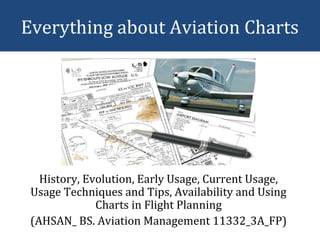
- 1. Everything about Aviation Charts History, Evolution, Early Usage, Current Usage, Usage Techniques and Tips, Availability and Using Charts in Flight Planning (AHSAN_ BS. Aviation Management 11332_3A_FP)
- 2. With an aeronautical chart in hand: • Plan flights • Plot your progress • Use dead reckoning • Practice recognizing symbols on the chart • But: – Chart reading skills and General Navigation Abilities required!
- 3. • Charles Lindbergh was known for his methodical navigation: – His eyes moved from map, to landmarks below, to instrument panel, to map, and so on. – He continuously practiced dead reckoning. – Every moment he compared what he saw on the map to the world beneath his wings. With an aeronautical chart in hand:
- 4. Old fashioned Navigation • Pilotage • Reading Charts • Dead Reckoning • Navigating with a Compass
- 5. • Early flight instructions might have read: – "From the runway follow the train tracks below, keeping the river and a large red barn on your left. Then fly toward a tall evergreen tree and a small town with a white train depot at the intersection of two roads..." Old fashioned Navigation
- 6. The sky was truly the limit!!! • Pilots could fly virtually anywhere without permission from anyone; there were few flight regulations.
- 7. Drivers or Pilots? • During aviation's early years, pilots flew by simply observing and following visual elements on the landscape, such as lakes, rivers, roads, and train tracks—a navigational technique called pilotage.
- 8. Reason for Development: • As aviation evolved, however, – pilots and navigation got more sophisticated, – the skies got more crowded, – airports developed, and – the need arose for detailed aeronautical charts.
- 9. Until the 1920s: • Few official aeronautical maps existed. • Aeronautical bulletins: – that included information about airfields, – flight instructions, which outlined airfield approaches and air routes between towns and cities. – Compiled from pilots' notes
- 10. Strip Maps • In 1926, Congress passed the Air Commerce Act, which produced the first list of aviation regulations and required pilots to have licenses. • Also, in 1926 and 1927, the Department of Commerce began publishing maps of civil airways. • This program created airway charts, or "strip maps,“
- 11. Strip Maps • Covered 330 miles of flight information. • The strip maps were a scale of 1:500,000— or about 8 miles per inch—the same scale aviation sectional charts use today.
- 12. Who was Jeppesen? • Elrey Jeppesen’s license was signed by Orville Wright. • He spent time barnstorming, became a flight instructor, and later worked in aerial surveying. • During the winter of 1930 and 1931 his fellow flyers were killed, he felt their loss was largely due to the lack of published flight information.
- 13. • Jeppesen set out to change things. • In a black notebook, he recorded field lengths and notes on lights and various obstacles. • He drew airport layouts and included the phone numbers of farmers who could report weather conditions. • Soon, pilots asked Jeppesen to share his flight information so often that he began selling copies of his black notebook for $10. Who was Jeppesen?
- 14. • Today, Jeppesen remains the most respected source for instrument aeronautical charts, GPS NavData, and flight planning software. • The larger a chart's the scale, the more area it covers. At the same time, larger-scale charts include less detail. Who was Jeppesen?
- 15. 1st of the Aeronautical Charts • The first United States government aeronautical charts were printed in three colors and included – airfields, – occasional navigational aides, – topographical features, and – prominent landmarks.
- 16. Today! • Today's complex aviation charts contain nearly – 150 symbols for cultural and topographical information, as well as – 100 symbols for aeronautical information. – They reflect the mosaic of open and restricted airspaces, – controlled and uncontrolled airports, – and myriad features such as VOR beacons, dams, airways, compass roses, and radio antennae.
- 17. Reading the Chart • Pilotage and chart-reading are a natural pair. • The general trick: – is learning the chart symbols and recognizing their real-world counterparts.
- 18. Kneeboards?
- 19. Type of Charts • SIM Charts (Simulator Charts) – VFR/IFR – Designed for navigation in Flight Simulator (entire world) • Availability: – Jeppesen Online Stores
- 20. Type of Charts • Sectional Charts – VFR – Topographic, landmark, airport, radio, and hazard information; 1:500,000 scale • Availability: – Pilot supply stores (at airports and on the Web)
- 21. • Visual Navigation Charts (VNC) – VFR (Canada) – Topographic, landmark, airport, radio, and hazard information; 1:500,000 scale • Availability: – Pilot supply stores Type of Charts
- 22. • World Aeronautical Charts (WAC) – VFR – Same as sectionals but 1:1,000,000 scale (United States and Caribbean). • Availability: – Pilot supply stores Type of Charts
- 23. • Global Navigation Charts (GNC) – VFR – Same as WACs but 1:5,000,000 scale (entire world). • Availability: – Pilot supply stores Type of Charts
- 24. • Operational Navigation Charts (ONC) – VFR – Same as WACs but cover entire world. • Availability: – Pilot supply stores Type of Charts
- 25. • Jet Navigation Charts (JNC) – VFR – Same as WACs but 1:5,000,000 scale (entire world). • Availability: – Pilot supply stores Type of Charts
- 26. • Tactical Pilotage Charts (TPC) – VFR – Same as WACs but 1:5,000,000 scale (entire world). • Availability: – Pilot supply stores Type of Charts
- 27. • Terminal Area Charts (TAC) – VFR – Depicts information similar to sectionals but in 1:250,000 scale in United States Class B airspace. • Availability: – Pilot supply stores Type of Charts
- 28. • Visual Terminal Charts (VTC) – VFR (Canada) – Depicts information similar to sectionals but in 1:250,000 scale in five Canadian terminal airspaces • Availability: – Pilot supply stores Type of Charts
- 29. • Airport/Facility Directory – VFR/IFR – Specific airport information • Availability: – Pilot supply stores Type of Charts
- 30. • Low Altitude Enroute – IFR – Airways, airspace boundaries, radio navigational aids, airports with instrument approaches and more. – For use below 18,000 feet MSL • Availability: – Jeppesen Type of Charts
- 31. • High Altitude Enroute (jets) – IFR – Airways, airspace boundaries, radio navigational aids, selected airports and more. – For use above 18,000 feet MSL • Availability: – Jeppesen Type of Charts
- 32. • Instrument Approach Procedures – IFR – Procedures for specific precision and non- precision approaches • Availability: – Jeppesen Type of Charts
- 33. • DP or Departure Procedures or Standard Instrument Departure (SID) – IFR – Procedures for specific routes – Used when departing selected airports • Availability: – Jeppesen Type of Charts
- 34. • STARS (Standard Terminal Arrival Routes) – IFR – Procedures for specific routes used when arriving at selected airports • Availability: – Jeppesen Type of Charts
- 35. • Aeroplanner.com – IFR • Facility: – STARs, – DPs, – Approach procedures • Availability: On the Web Online Procedures
- 36. The key is to: • Using All the Navigational Methods All the Time • Charles Lindbergh was known for his methodical navigation: – His eyes moved from map, to landmarks below, to instrument panel, to map, and so on. – He continuously practiced dead reckoning. – Every moment he compared what he saw on the map to the world beneath his wings.
- 37. • Sources: – Federal Aviation Administration (US) FAA – IFR Charts & Regulations – Air Safety Institute, US – Aeronautical Information Manual – AOPA (Aircraft Owners & Pilot Association) – Ask me more on: axon.kan@gmail.com Questions?