SlideShare a Scribd company logo
1 of 15
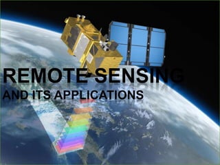
REMOTE SENSING
AND ITS APPLICATIONS
Remote Sensing
Weather forecasting
Google mapping
Remote Sensing?
 Remote sensing is defined as the technique
of obtaining information about objects
through the analysis of data collected by
special instruments that are not in physical
contact with the objects of investigation.
 Collection of information about an object
without coming into physical contact.
 The information needs a physical carrier to
travel from the objects/events to the sensors
through an intervening medium.
 The electromagnetic radiation is normally
used as an information carrier in remote
sensing.
 The output of a remote sensing system is
usually an image representing the scene
being observed.
 The technology of modern remote sensing
began with the invention of the camera more
than 150 years ago.
 The idea and practice of looking down at the
Earth's surface emerged in the 1840s when
pictures were taken from cameras secured to
tethered balloons for purposes of topographic
mapping.
 Satellite remote sensing can be traced to the
early days of the space age (both Russian and
American programs) and actually began as a
dual approach to imaging surfaces using
several types of sensors from spacecraft.
 The term "remote sensing," first used in the
United States in the 1950s by Ms. Evelyn
Pruitt of the U.S.
History
Elements involved in Remote sensing
1. Energy Source or Illumination
(A)
2. Radiation and the Atmosphere
(B)
3. Interaction with the Object (C)
4. Recording of Energy by the
Sensor (D)
5. Transmission, Reception and
Processing (E)
6. Interpretation and Analysis (F)
7. Application (G)
Remote Sensing Sensors
 Active Remote Sensors :-
 Active remote sensing uses an artificial source for
energy.
 For example the satellite itself can send a pulse of
energy which can interact with the target.
 In active remote sensing, humans can control the
nature (wavelength, power, duration) of the source
energy. Active remote sensing can be carried out
during day and night and in all weather conditions.
Conti…
Passive remote sensing:-
 Passive remote sensing depends on a natural
source to provide energy.
 For example sun is the most powerful and
commonly used source of energy for passive
remote sensing.
 The satellite sensor in this case records primarily
the radiation that is reflected from the target.
ACTIVE & PASSIVE REMOTE
SENSING
Platforms
Platforms :
The base on which remote
sensors are placed to
acquire information about
the Earth surface is called
platforms.
• Ground based
• Airborne
• Space borne
Platforms used for Remote
Sensing
 Ground-based platforms: ground, vehicles and/or towers
=> up to 50 m
 Airborne platforms: airplanes, helicopters, high-altitude
aircrafts, balloons => up to 50 km
 Space borne: rockets, satellites, shuttle => from about 100
km to 36000 km
1. Space shuttle: 250-300 km
2. Space station: 300-400 km
3. Low-level satellites: 700-1500 km
4. High-level satellites: about 36000 km
Advantages of remote sensing:-
 Provides a regional view (large areas).
 Provides repetitive looks at the same area.
 Remote sensors "see" over a broader.
portion of the spectrum than the human
eye.
 Provides geo-referenced, digital, data.
 Some remote sensors operate in all
seasons, at night, and in bad weather.
DISADVANTAGE OF REMOTE
SENSING:-
 Expensive to build and operate
 Needs ground verification
 Not the best tool for small areas
 Needs expert system to extract data
Applications of Remote sensing
 Meteorology
 Profiling of atmospheric temp. and water
vapor
 Measuring wind velocity
 Oceanography
 Measurements of sea surface temperature
 Mapping ocean currents
 Glaciology
 Mapping motion of sea ice and ice sheets
 Determining the navigability of the sea
 Geology
 Identification of rock types
 Location of geological faults and
anomalies
Applications of Remote sensing
 Agriculture
Monitoring the extend and type of vegetation
Mapping soil types
 Hydrology
Assessing water resources
Forecasting melt water run-off from snow
 Disaster control
Warning of sand and dust storms, flooding
Monitoring of pollution
7528
Thankyou
for
yourkindattention!!!

More Related Content

What's hot

Remote sensing & Gis
Remote sensing & GisRemote sensing & Gis
Remote sensing & Gisgopichand's
 
Remote sensing and gis ppt
Remote sensing and gis pptRemote sensing and gis ppt
Remote sensing and gis pptpreeti patil
 
Remote sensing - Sensors, Platforms and Satellite orbits
Remote sensing - Sensors, Platforms and Satellite orbitsRemote sensing - Sensors, Platforms and Satellite orbits
Remote sensing - Sensors, Platforms and Satellite orbitsAjay Singh Lodhi
 
Geographic information system
Geographic information systemGeographic information system
Geographic information systemSumanta Das
 
Remote sensing concept, history and principles
Remote sensing  concept, history and principlesRemote sensing  concept, history and principles
Remote sensing concept, history and principlesAjay Singh Lodhi
 
Role of electromagnetic Radiation in Remote Sensing
Role of electromagnetic Radiation in  Remote SensingRole of electromagnetic Radiation in  Remote Sensing
Role of electromagnetic Radiation in Remote SensingNzar Braim
 
groundtruth collection for remotesensing support
groundtruth collection for remotesensing supportgroundtruth collection for remotesensing support
groundtruth collection for remotesensing supportThiruvengadam .
 
Multispectral remote sensing
Multispectral remote sensingMultispectral remote sensing
Multispectral remote sensingDharmendera Meena
 
Application of remote sensing
Application of remote sensingApplication of remote sensing
Application of remote sensingAnurag Kumar
 
Components of Remote Sensing
Components of Remote SensingComponents of Remote Sensing
Components of Remote SensingAbby Varghese
 
Image interpretation keys & image resolution
Image interpretation keys & image resolutionImage interpretation keys & image resolution
Image interpretation keys & image resolutionPramoda Raj
 
Principles of Remote Sensing
Principles of Remote Sensing Principles of Remote Sensing
Principles of Remote Sensing Ariful Islam
 
Remote Sensing Data Acquisition,Scanning/Imaging systems
Remote Sensing Data Acquisition,Scanning/Imaging systemsRemote Sensing Data Acquisition,Scanning/Imaging systems
Remote Sensing Data Acquisition,Scanning/Imaging systemsdaniyal rustam
 
Microwave remote sensing
Microwave remote sensingMicrowave remote sensing
Microwave remote sensingMohsin Siddique
 
Remote Sensing and GIS in Land Use / Land Cover Mapping
Remote Sensing and GIS in Land Use / Land Cover MappingRemote Sensing and GIS in Land Use / Land Cover Mapping
Remote Sensing and GIS in Land Use / Land Cover MappingVenkatKamal1
 
Principle of aerial photography and types.ppt
Principle of aerial photography and types.pptPrinciple of aerial photography and types.ppt
Principle of aerial photography and types.pptsrinivas2036
 
Types of aerial photographs
Types of aerial photographsTypes of aerial photographs
Types of aerial photographsHARITHANAIR15
 

What's hot (20)

Remote sensing & Gis
Remote sensing & GisRemote sensing & Gis
Remote sensing & Gis
 
Remote sensing
Remote sensingRemote sensing
Remote sensing
 
Remote sensing and gis ppt
Remote sensing and gis pptRemote sensing and gis ppt
Remote sensing and gis ppt
 
Remote sensing - Sensors, Platforms and Satellite orbits
Remote sensing - Sensors, Platforms and Satellite orbitsRemote sensing - Sensors, Platforms and Satellite orbits
Remote sensing - Sensors, Platforms and Satellite orbits
 
Geographic information system
Geographic information systemGeographic information system
Geographic information system
 
Remote sensing
Remote sensingRemote sensing
Remote sensing
 
Remote sensing concept, history and principles
Remote sensing  concept, history and principlesRemote sensing  concept, history and principles
Remote sensing concept, history and principles
 
Role of electromagnetic Radiation in Remote Sensing
Role of electromagnetic Radiation in  Remote SensingRole of electromagnetic Radiation in  Remote Sensing
Role of electromagnetic Radiation in Remote Sensing
 
groundtruth collection for remotesensing support
groundtruth collection for remotesensing supportgroundtruth collection for remotesensing support
groundtruth collection for remotesensing support
 
Multispectral remote sensing
Multispectral remote sensingMultispectral remote sensing
Multispectral remote sensing
 
Introduction to Remote Sensing
Introduction to Remote SensingIntroduction to Remote Sensing
Introduction to Remote Sensing
 
Application of remote sensing
Application of remote sensingApplication of remote sensing
Application of remote sensing
 
Components of Remote Sensing
Components of Remote SensingComponents of Remote Sensing
Components of Remote Sensing
 
Image interpretation keys & image resolution
Image interpretation keys & image resolutionImage interpretation keys & image resolution
Image interpretation keys & image resolution
 
Principles of Remote Sensing
Principles of Remote Sensing Principles of Remote Sensing
Principles of Remote Sensing
 
Remote Sensing Data Acquisition,Scanning/Imaging systems
Remote Sensing Data Acquisition,Scanning/Imaging systemsRemote Sensing Data Acquisition,Scanning/Imaging systems
Remote Sensing Data Acquisition,Scanning/Imaging systems
 
Microwave remote sensing
Microwave remote sensingMicrowave remote sensing
Microwave remote sensing
 
Remote Sensing and GIS in Land Use / Land Cover Mapping
Remote Sensing and GIS in Land Use / Land Cover MappingRemote Sensing and GIS in Land Use / Land Cover Mapping
Remote Sensing and GIS in Land Use / Land Cover Mapping
 
Principle of aerial photography and types.ppt
Principle of aerial photography and types.pptPrinciple of aerial photography and types.ppt
Principle of aerial photography and types.ppt
 
Types of aerial photographs
Types of aerial photographsTypes of aerial photographs
Types of aerial photographs
 

Viewers also liked

Elements of remote sensing
Elements of remote sensingElements of remote sensing
Elements of remote sensingAlbein Vivek
 
Differential gps (dgps) 09 04-12
Differential gps (dgps) 09 04-12Differential gps (dgps) 09 04-12
Differential gps (dgps) 09 04-12Sumant Diwakar
 
Dgps concept
Dgps conceptDgps concept
Dgps conceptegovindia
 
Carmon remote sensinggis
Carmon remote sensinggisCarmon remote sensinggis
Carmon remote sensinggisnavdeepjamwal
 
Remote Sensing Techniques for Oceanography Satelitte and In Situ Observations
Remote Sensing Techniques for Oceanography Satelitte and In Situ ObservationsRemote Sensing Techniques for Oceanography Satelitte and In Situ Observations
Remote Sensing Techniques for Oceanography Satelitte and In Situ ObservationsA.Tuğsan İşiaçık Çolak
 
Global positioning system(GPS)
Global positioning system(GPS)Global positioning system(GPS)
Global positioning system(GPS)Arghaya Goswami
 
Ppt on remote sensing system
Ppt on remote sensing systemPpt on remote sensing system
Ppt on remote sensing systemAlisha Korpal
 
Advantages and disadvantages of Remote Sensing
Advantages and disadvantages of Remote SensingAdvantages and disadvantages of Remote Sensing
Advantages and disadvantages of Remote SensingEr Abhi Vashi
 
Electromagnetic waves
Electromagnetic wavesElectromagnetic waves
Electromagnetic wavesmeenng
 
Electromagnetic Waves Class 12
Electromagnetic Waves Class 12 Electromagnetic Waves Class 12
Electromagnetic Waves Class 12 Self-employed
 
Electromagnetic waves
Electromagnetic wavesElectromagnetic waves
Electromagnetic wavesKANNAN
 
Electromagnetic waves
Electromagnetic wavesElectromagnetic waves
Electromagnetic wavess7822143g
 
What is GIS
What is GISWhat is GIS
What is GISEsri
 
Basic of Remote Sensing
Basic of Remote SensingBasic of Remote Sensing
Basic of Remote Sensinggueste5cfed
 
REMOTE SENSING
REMOTE SENSINGREMOTE SENSING
REMOTE SENSINGKANNAN
 
The Electromagnetic Spectrum
The Electromagnetic SpectrumThe Electromagnetic Spectrum
The Electromagnetic SpectrumJan Parker
 

Viewers also liked (20)

Elements of remote sensing
Elements of remote sensingElements of remote sensing
Elements of remote sensing
 
remote sensing
remote sensingremote sensing
remote sensing
 
Differential gps (dgps) 09 04-12
Differential gps (dgps) 09 04-12Differential gps (dgps) 09 04-12
Differential gps (dgps) 09 04-12
 
Dgps concept
Dgps conceptDgps concept
Dgps concept
 
Carmon remote sensinggis
Carmon remote sensinggisCarmon remote sensinggis
Carmon remote sensinggis
 
Remote Sensing Techniques for Oceanography Satelitte and In Situ Observations
Remote Sensing Techniques for Oceanography Satelitte and In Situ ObservationsRemote Sensing Techniques for Oceanography Satelitte and In Situ Observations
Remote Sensing Techniques for Oceanography Satelitte and In Situ Observations
 
GPS
GPS GPS
GPS
 
Global positioning system(GPS)
Global positioning system(GPS)Global positioning system(GPS)
Global positioning system(GPS)
 
Semiconductor laser
Semiconductor laserSemiconductor laser
Semiconductor laser
 
Ppt on remote sensing system
Ppt on remote sensing systemPpt on remote sensing system
Ppt on remote sensing system
 
Advantages and disadvantages of Remote Sensing
Advantages and disadvantages of Remote SensingAdvantages and disadvantages of Remote Sensing
Advantages and disadvantages of Remote Sensing
 
Electromagnetic waves
Electromagnetic wavesElectromagnetic waves
Electromagnetic waves
 
Electromagnetic Waves Class 12
Electromagnetic Waves Class 12 Electromagnetic Waves Class 12
Electromagnetic Waves Class 12
 
Electromagnetic waves
Electromagnetic wavesElectromagnetic waves
Electromagnetic waves
 
Electromagnetic waves
Electromagnetic wavesElectromagnetic waves
Electromagnetic waves
 
Electromagnetic waves
Electromagnetic wavesElectromagnetic waves
Electromagnetic waves
 
What is GIS
What is GISWhat is GIS
What is GIS
 
Basic of Remote Sensing
Basic of Remote SensingBasic of Remote Sensing
Basic of Remote Sensing
 
REMOTE SENSING
REMOTE SENSINGREMOTE SENSING
REMOTE SENSING
 
The Electromagnetic Spectrum
The Electromagnetic SpectrumThe Electromagnetic Spectrum
The Electromagnetic Spectrum
 

Similar to RS-APPLICATIONS

Module 5 Remote Sensing in Civil Engineering.pptx
Module 5 Remote Sensing in Civil Engineering.pptxModule 5 Remote Sensing in Civil Engineering.pptx
Module 5 Remote Sensing in Civil Engineering.pptxsurekha1287
 
remote sensing
remote sensingremote sensing
remote sensing78harshith
 
Remote Sensing_2020-21 (1).pdf
Remote Sensing_2020-21  (1).pdfRemote Sensing_2020-21  (1).pdf
Remote Sensing_2020-21 (1).pdfBAGARAGAZAROMUALD2
 
Concepts of Remote Sensing: Process and Stages of Remote Sensing, Remote Sens...
Concepts of Remote Sensing: Process and Stages of Remote Sensing, Remote Sens...Concepts of Remote Sensing: Process and Stages of Remote Sensing, Remote Sens...
Concepts of Remote Sensing: Process and Stages of Remote Sensing, Remote Sens...ShavnamMehta
 
Remote sensing and its applications in environment
Remote sensing and its applications in environmentRemote sensing and its applications in environment
Remote sensing and its applications in environmentMuhammad Sajjad
 
Remote Sensing - by Ashwini
Remote Sensing - by AshwiniRemote Sensing - by Ashwini
Remote Sensing - by AshwiniSanthosh Sundar
 
remote sensing for study.docx
remote sensing for study.docxremote sensing for study.docx
remote sensing for study.docxbbc37142
 
rsgis-unitii-160731062950.pdf
rsgis-unitii-160731062950.pdfrsgis-unitii-160731062950.pdf
rsgis-unitii-160731062950.pdfBSuresh26
 
Remote sensing by Priyanshu kumar, 9608684800
Remote sensing by Priyanshu kumar, 9608684800Remote sensing by Priyanshu kumar, 9608684800
Remote sensing by Priyanshu kumar, 9608684800PRIYANSHU KUMAR
 
Basic Understanding of Remote Sensing.pdf
Basic Understanding of Remote Sensing.pdfBasic Understanding of Remote Sensing.pdf
Basic Understanding of Remote Sensing.pdfrupalibgisnetra
 
A Brief Introduction to Remote Sensing Satellites
A Brief Introduction to Remote Sensing Satellites A Brief Introduction to Remote Sensing Satellites
A Brief Introduction to Remote Sensing Satellites Alireza Rahimzadeganasl
 
civil Remote Sensing ppt.pptx
civil Remote Sensing ppt.pptxcivil Remote Sensing ppt.pptx
civil Remote Sensing ppt.pptxHellGod3
 
applicationsofremotesensingingeologicalaspects-170606133459.pdf
applicationsofremotesensingingeologicalaspects-170606133459.pdfapplicationsofremotesensingingeologicalaspects-170606133459.pdf
applicationsofremotesensingingeologicalaspects-170606133459.pdfCIVIL48
 

Similar to RS-APPLICATIONS (20)

Module 5 Remote Sensing in Civil Engineering.pptx
Module 5 Remote Sensing in Civil Engineering.pptxModule 5 Remote Sensing in Civil Engineering.pptx
Module 5 Remote Sensing in Civil Engineering.pptx
 
Remote sensing
Remote sensingRemote sensing
Remote sensing
 
remote sensing
remote sensingremote sensing
remote sensing
 
Remote Sensing_2020-21 (1).pdf
Remote Sensing_2020-21  (1).pdfRemote Sensing_2020-21  (1).pdf
Remote Sensing_2020-21 (1).pdf
 
Remote sensing
Remote sensingRemote sensing
Remote sensing
 
Ch 5 b remote sensing
Ch 5 b remote sensingCh 5 b remote sensing
Ch 5 b remote sensing
 
Remote sensing
Remote sensingRemote sensing
Remote sensing
 
Concepts of Remote Sensing: Process and Stages of Remote Sensing, Remote Sens...
Concepts of Remote Sensing: Process and Stages of Remote Sensing, Remote Sens...Concepts of Remote Sensing: Process and Stages of Remote Sensing, Remote Sens...
Concepts of Remote Sensing: Process and Stages of Remote Sensing, Remote Sens...
 
Remote sensing and its applications in environment
Remote sensing and its applications in environmentRemote sensing and its applications in environment
Remote sensing and its applications in environment
 
Remote Sensing - by Ashwini
Remote Sensing - by AshwiniRemote Sensing - by Ashwini
Remote Sensing - by Ashwini
 
remote sensing for study.docx
remote sensing for study.docxremote sensing for study.docx
remote sensing for study.docx
 
rsgis-unitii-160731062950.pdf
rsgis-unitii-160731062950.pdfrsgis-unitii-160731062950.pdf
rsgis-unitii-160731062950.pdf
 
Report
ReportReport
Report
 
intro.pptx
intro.pptxintro.pptx
intro.pptx
 
Remote sensing by Priyanshu kumar, 9608684800
Remote sensing by Priyanshu kumar, 9608684800Remote sensing by Priyanshu kumar, 9608684800
Remote sensing by Priyanshu kumar, 9608684800
 
Basic Understanding of Remote Sensing.pdf
Basic Understanding of Remote Sensing.pdfBasic Understanding of Remote Sensing.pdf
Basic Understanding of Remote Sensing.pdf
 
A Brief Introduction to Remote Sensing Satellites
A Brief Introduction to Remote Sensing Satellites A Brief Introduction to Remote Sensing Satellites
A Brief Introduction to Remote Sensing Satellites
 
Remote sensing
Remote sensingRemote sensing
Remote sensing
 
civil Remote Sensing ppt.pptx
civil Remote Sensing ppt.pptxcivil Remote Sensing ppt.pptx
civil Remote Sensing ppt.pptx
 
applicationsofremotesensingingeologicalaspects-170606133459.pdf
applicationsofremotesensingingeologicalaspects-170606133459.pdfapplicationsofremotesensingingeologicalaspects-170606133459.pdf
applicationsofremotesensingingeologicalaspects-170606133459.pdf
 

Recently uploaded

Advanced Views - Calendar View in Odoo 17
Advanced Views - Calendar View in Odoo 17Advanced Views - Calendar View in Odoo 17
Advanced Views - Calendar View in Odoo 17Celine George
 
General AI for Medical Educators April 2024
General AI for Medical Educators April 2024General AI for Medical Educators April 2024
General AI for Medical Educators April 2024Janet Corral
 
Software Engineering Methodologies (overview)
Software Engineering Methodologies (overview)Software Engineering Methodologies (overview)
Software Engineering Methodologies (overview)eniolaolutunde
 
Class 11th Physics NEET formula sheet pdf
Class 11th Physics NEET formula sheet pdfClass 11th Physics NEET formula sheet pdf
Class 11th Physics NEET formula sheet pdfAyushMahapatra5
 
Beyond the EU: DORA and NIS 2 Directive's Global Impact
Beyond the EU: DORA and NIS 2 Directive's Global ImpactBeyond the EU: DORA and NIS 2 Directive's Global Impact
Beyond the EU: DORA and NIS 2 Directive's Global ImpactPECB
 
Key note speaker Neum_Admir Softic_ENG.pdf
Key note speaker Neum_Admir Softic_ENG.pdfKey note speaker Neum_Admir Softic_ENG.pdf
Key note speaker Neum_Admir Softic_ENG.pdfAdmir Softic
 
IGNOU MSCCFT and PGDCFT Exam Question Pattern: MCFT003 Counselling and Family...
IGNOU MSCCFT and PGDCFT Exam Question Pattern: MCFT003 Counselling and Family...IGNOU MSCCFT and PGDCFT Exam Question Pattern: MCFT003 Counselling and Family...
IGNOU MSCCFT and PGDCFT Exam Question Pattern: MCFT003 Counselling and Family...PsychoTech Services
 
The Most Excellent Way | 1 Corinthians 13
The Most Excellent Way | 1 Corinthians 13The Most Excellent Way | 1 Corinthians 13
The Most Excellent Way | 1 Corinthians 13Steve Thomason
 
Explore beautiful and ugly buildings. Mathematics helps us create beautiful d...
Explore beautiful and ugly buildings. Mathematics helps us create beautiful d...Explore beautiful and ugly buildings. Mathematics helps us create beautiful d...
Explore beautiful and ugly buildings. Mathematics helps us create beautiful d...christianmathematics
 
SOCIAL AND HISTORICAL CONTEXT - LFTVD.pptx
SOCIAL AND HISTORICAL CONTEXT - LFTVD.pptxSOCIAL AND HISTORICAL CONTEXT - LFTVD.pptx
SOCIAL AND HISTORICAL CONTEXT - LFTVD.pptxiammrhaywood
 
Ecosystem Interactions Class Discussion Presentation in Blue Green Lined Styl...
Ecosystem Interactions Class Discussion Presentation in Blue Green Lined Styl...Ecosystem Interactions Class Discussion Presentation in Blue Green Lined Styl...
Ecosystem Interactions Class Discussion Presentation in Blue Green Lined Styl...fonyou31
 
BASLIQ CURRENT LOOKBOOK LOOKBOOK(1) (1).pdf
BASLIQ CURRENT LOOKBOOK  LOOKBOOK(1) (1).pdfBASLIQ CURRENT LOOKBOOK  LOOKBOOK(1) (1).pdf
BASLIQ CURRENT LOOKBOOK LOOKBOOK(1) (1).pdfSoniaTolstoy
 
Q4-W6-Restating Informational Text Grade 3
Q4-W6-Restating Informational Text Grade 3Q4-W6-Restating Informational Text Grade 3
Q4-W6-Restating Informational Text Grade 3JemimahLaneBuaron
 
Kisan Call Centre - To harness potential of ICT in Agriculture by answer farm...
Kisan Call Centre - To harness potential of ICT in Agriculture by answer farm...Kisan Call Centre - To harness potential of ICT in Agriculture by answer farm...
Kisan Call Centre - To harness potential of ICT in Agriculture by answer farm...Krashi Coaching
 
Holdier Curriculum Vitae (April 2024).pdf
Holdier Curriculum Vitae (April 2024).pdfHoldier Curriculum Vitae (April 2024).pdf
Holdier Curriculum Vitae (April 2024).pdfagholdier
 
microwave assisted reaction. General introduction
microwave assisted reaction. General introductionmicrowave assisted reaction. General introduction
microwave assisted reaction. General introductionMaksud Ahmed
 
Call Girls in Dwarka Mor Delhi Contact Us 9654467111
Call Girls in Dwarka Mor Delhi Contact Us 9654467111Call Girls in Dwarka Mor Delhi Contact Us 9654467111
Call Girls in Dwarka Mor Delhi Contact Us 9654467111Sapana Sha
 
Arihant handbook biology for class 11 .pdf
Arihant handbook biology for class 11 .pdfArihant handbook biology for class 11 .pdf
Arihant handbook biology for class 11 .pdfchloefrazer622
 

Recently uploaded (20)

Advanced Views - Calendar View in Odoo 17
Advanced Views - Calendar View in Odoo 17Advanced Views - Calendar View in Odoo 17
Advanced Views - Calendar View in Odoo 17
 
General AI for Medical Educators April 2024
General AI for Medical Educators April 2024General AI for Medical Educators April 2024
General AI for Medical Educators April 2024
 
Software Engineering Methodologies (overview)
Software Engineering Methodologies (overview)Software Engineering Methodologies (overview)
Software Engineering Methodologies (overview)
 
Class 11th Physics NEET formula sheet pdf
Class 11th Physics NEET formula sheet pdfClass 11th Physics NEET formula sheet pdf
Class 11th Physics NEET formula sheet pdf
 
Beyond the EU: DORA and NIS 2 Directive's Global Impact
Beyond the EU: DORA and NIS 2 Directive's Global ImpactBeyond the EU: DORA and NIS 2 Directive's Global Impact
Beyond the EU: DORA and NIS 2 Directive's Global Impact
 
Key note speaker Neum_Admir Softic_ENG.pdf
Key note speaker Neum_Admir Softic_ENG.pdfKey note speaker Neum_Admir Softic_ENG.pdf
Key note speaker Neum_Admir Softic_ENG.pdf
 
IGNOU MSCCFT and PGDCFT Exam Question Pattern: MCFT003 Counselling and Family...
IGNOU MSCCFT and PGDCFT Exam Question Pattern: MCFT003 Counselling and Family...IGNOU MSCCFT and PGDCFT Exam Question Pattern: MCFT003 Counselling and Family...
IGNOU MSCCFT and PGDCFT Exam Question Pattern: MCFT003 Counselling and Family...
 
The Most Excellent Way | 1 Corinthians 13
The Most Excellent Way | 1 Corinthians 13The Most Excellent Way | 1 Corinthians 13
The Most Excellent Way | 1 Corinthians 13
 
Mattingly "AI & Prompt Design: The Basics of Prompt Design"
Mattingly "AI & Prompt Design: The Basics of Prompt Design"Mattingly "AI & Prompt Design: The Basics of Prompt Design"
Mattingly "AI & Prompt Design: The Basics of Prompt Design"
 
Explore beautiful and ugly buildings. Mathematics helps us create beautiful d...
Explore beautiful and ugly buildings. Mathematics helps us create beautiful d...Explore beautiful and ugly buildings. Mathematics helps us create beautiful d...
Explore beautiful and ugly buildings. Mathematics helps us create beautiful d...
 
SOCIAL AND HISTORICAL CONTEXT - LFTVD.pptx
SOCIAL AND HISTORICAL CONTEXT - LFTVD.pptxSOCIAL AND HISTORICAL CONTEXT - LFTVD.pptx
SOCIAL AND HISTORICAL CONTEXT - LFTVD.pptx
 
Ecosystem Interactions Class Discussion Presentation in Blue Green Lined Styl...
Ecosystem Interactions Class Discussion Presentation in Blue Green Lined Styl...Ecosystem Interactions Class Discussion Presentation in Blue Green Lined Styl...
Ecosystem Interactions Class Discussion Presentation in Blue Green Lined Styl...
 
BASLIQ CURRENT LOOKBOOK LOOKBOOK(1) (1).pdf
BASLIQ CURRENT LOOKBOOK  LOOKBOOK(1) (1).pdfBASLIQ CURRENT LOOKBOOK  LOOKBOOK(1) (1).pdf
BASLIQ CURRENT LOOKBOOK LOOKBOOK(1) (1).pdf
 
Q4-W6-Restating Informational Text Grade 3
Q4-W6-Restating Informational Text Grade 3Q4-W6-Restating Informational Text Grade 3
Q4-W6-Restating Informational Text Grade 3
 
Kisan Call Centre - To harness potential of ICT in Agriculture by answer farm...
Kisan Call Centre - To harness potential of ICT in Agriculture by answer farm...Kisan Call Centre - To harness potential of ICT in Agriculture by answer farm...
Kisan Call Centre - To harness potential of ICT in Agriculture by answer farm...
 
Holdier Curriculum Vitae (April 2024).pdf
Holdier Curriculum Vitae (April 2024).pdfHoldier Curriculum Vitae (April 2024).pdf
Holdier Curriculum Vitae (April 2024).pdf
 
microwave assisted reaction. General introduction
microwave assisted reaction. General introductionmicrowave assisted reaction. General introduction
microwave assisted reaction. General introduction
 
Call Girls in Dwarka Mor Delhi Contact Us 9654467111
Call Girls in Dwarka Mor Delhi Contact Us 9654467111Call Girls in Dwarka Mor Delhi Contact Us 9654467111
Call Girls in Dwarka Mor Delhi Contact Us 9654467111
 
INDIA QUIZ 2024 RLAC DELHI UNIVERSITY.pptx
INDIA QUIZ 2024 RLAC DELHI UNIVERSITY.pptxINDIA QUIZ 2024 RLAC DELHI UNIVERSITY.pptx
INDIA QUIZ 2024 RLAC DELHI UNIVERSITY.pptx
 
Arihant handbook biology for class 11 .pdf
Arihant handbook biology for class 11 .pdfArihant handbook biology for class 11 .pdf
Arihant handbook biology for class 11 .pdf
 

RS-APPLICATIONS

  • 1. REMOTE SENSING AND ITS APPLICATIONS
  • 3. Remote Sensing?  Remote sensing is defined as the technique of obtaining information about objects through the analysis of data collected by special instruments that are not in physical contact with the objects of investigation.  Collection of information about an object without coming into physical contact.  The information needs a physical carrier to travel from the objects/events to the sensors through an intervening medium.  The electromagnetic radiation is normally used as an information carrier in remote sensing.  The output of a remote sensing system is usually an image representing the scene being observed.
  • 4.  The technology of modern remote sensing began with the invention of the camera more than 150 years ago.  The idea and practice of looking down at the Earth's surface emerged in the 1840s when pictures were taken from cameras secured to tethered balloons for purposes of topographic mapping.  Satellite remote sensing can be traced to the early days of the space age (both Russian and American programs) and actually began as a dual approach to imaging surfaces using several types of sensors from spacecraft.  The term "remote sensing," first used in the United States in the 1950s by Ms. Evelyn Pruitt of the U.S. History
  • 5. Elements involved in Remote sensing 1. Energy Source or Illumination (A) 2. Radiation and the Atmosphere (B) 3. Interaction with the Object (C) 4. Recording of Energy by the Sensor (D) 5. Transmission, Reception and Processing (E) 6. Interpretation and Analysis (F) 7. Application (G)
  • 6. Remote Sensing Sensors  Active Remote Sensors :-  Active remote sensing uses an artificial source for energy.  For example the satellite itself can send a pulse of energy which can interact with the target.  In active remote sensing, humans can control the nature (wavelength, power, duration) of the source energy. Active remote sensing can be carried out during day and night and in all weather conditions.
  • 7. Conti… Passive remote sensing:-  Passive remote sensing depends on a natural source to provide energy.  For example sun is the most powerful and commonly used source of energy for passive remote sensing.  The satellite sensor in this case records primarily the radiation that is reflected from the target.
  • 8. ACTIVE & PASSIVE REMOTE SENSING
  • 9. Platforms Platforms : The base on which remote sensors are placed to acquire information about the Earth surface is called platforms. • Ground based • Airborne • Space borne
  • 10. Platforms used for Remote Sensing  Ground-based platforms: ground, vehicles and/or towers => up to 50 m  Airborne platforms: airplanes, helicopters, high-altitude aircrafts, balloons => up to 50 km  Space borne: rockets, satellites, shuttle => from about 100 km to 36000 km 1. Space shuttle: 250-300 km 2. Space station: 300-400 km 3. Low-level satellites: 700-1500 km 4. High-level satellites: about 36000 km
  • 11. Advantages of remote sensing:-  Provides a regional view (large areas).  Provides repetitive looks at the same area.  Remote sensors "see" over a broader. portion of the spectrum than the human eye.  Provides geo-referenced, digital, data.  Some remote sensors operate in all seasons, at night, and in bad weather.
  • 12. DISADVANTAGE OF REMOTE SENSING:-  Expensive to build and operate  Needs ground verification  Not the best tool for small areas  Needs expert system to extract data
  • 13. Applications of Remote sensing  Meteorology  Profiling of atmospheric temp. and water vapor  Measuring wind velocity  Oceanography  Measurements of sea surface temperature  Mapping ocean currents  Glaciology  Mapping motion of sea ice and ice sheets  Determining the navigability of the sea  Geology  Identification of rock types  Location of geological faults and anomalies
  • 14. Applications of Remote sensing  Agriculture Monitoring the extend and type of vegetation Mapping soil types  Hydrology Assessing water resources Forecasting melt water run-off from snow  Disaster control Warning of sand and dust storms, flooding Monitoring of pollution