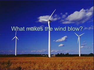
2. What makes the wind blow?
A difference in air pressure is what
causes the wind to blow.
Wind is simply air moving from a place of
high air pressure to a place of low air
pressure.
The greater the difference in air pressure,
the stronger the winds.
3.
4. What Causes Differences in Air Pressure?
A) Differential Heating
Due to the curvature and tilt of the planet.
Cold temperatures at the poles and hot conditions near the
equator.
Temperature extremes produce their own air pressure
patterns.
For instance, extreme cold produces high air pressure.
Why?
– Think about if you were to open a window in your bedroom on a
cold and calm winter's night and you stood away from the window
in the middle of the room. On what part of your body would you first
feel the cold? Near your feet. This is because cold air is dense and
the air molecules are sinking.
On a larger scale, a cold air mass pushing down on the
earth's surface creates an area of high air pressure.
5.
6. What Causes Differences in Air Pressure?
A) Differential Heating
On the other hand, extreme heat produces
low air pressure.
– Think about the air rising above a camp fire or
the heat radiating above an asphalt road on a
hot summer's day.
The air molecules as they are heated, begin
to expand and leave the earth's surface
putting less pressure on it.
On a larger scale, this hot air creates an
area of low air pressure.
7. What Causes Differences in Air Pressure?
B) Processes of Precipitation Generate Low
Pressure
In convectional precipitation, the heat of
the sun warms the ground and the ground
then heats the air above it.
This causes the air molecules to rise
leaving low pressure on the earth's
surface.
Air from surrounding areas moves from
higher pressure to low pressure (= wind)
8.
9. What Causes Differences in Air Pressure?
B) Processes of Precipitation Generate Low
Pressure
With orographic precipitation it is not
extreme heat that causes the air to rise.
– Rather, the presence of mountains on the
windward side forces the air to rise and create
lower air pressure at the surface.
– In contrast, on the rainshadow or leeward side
of the mountains the air is descending and
pushing down the earth's surface producing
higher air pressure in comparison to the
windward side.
10.
11. What Causes Differences in Air Pressure?
B) Processes of Precipitation Generate Low
Pressure
With frontal precipitation, it is the meeting
of two different air masses that causes
the air to rise.
The warmer air mass is forced above the
colder air mass leaving lower air
pressure at the surface.
Air from surrounding areas moves from
higher pressure to low pressure (= wind)
13. What Causes Differences in Air Pressure?
c) Convection Currents in the Atmosphere
The deserts of the world are associated with high air pressure
whether they are hot such as the Sahara or cold such as the
Canadian Tundra.
Recall that high air pressure is consistently associated with dry
conditions because the air is descending.
Air that is descending is not rising, cooling, condensing, and
forming clouds readily.
A convection current of air rising at the equator where the
average annual temperature is even hotter than the Sahara desert.
– Deserts, such as the Sahara, can get quite cool at night due to the
loss of heat with clear skies.
– The air that rises over the equator, cools, condenses, and forms
clouds and considerable precipitation via convective processes.
– After releasing its moisture, this air proceeds northward and
descends over the Sahara desert generating high air pressure and
dry conditions.
14. Global Pattern of Prevailing
Surface Winds
On a global scale, the prevailing winds at the
surface follow the same principles described
above namely that
– wind is simply air moving from a place of high air
pressure to a place of low air pressure
– extreme temperatures produce their own pressure
patterns
– rising air is associated with low air pressure, and
– subsiding air is associated with high air pressure
15.
16. Global Pattern of Prevailing
Surface Winds
Coriolis Effect – Since the Earth is rotating on its
axis:
– Winds moving anywhere in the Northern
hemisphere will turn to the right.
– Winds moving anywhere in the Southern hemisphere
will turn to the left.
19. Global Pattern of Prevailing
Surface Winds
A wind is always named for the direction that it
is coming from.
The winds near the equator are often relatively
light, hence the area has been named the
doldrums by sailors.
Similarly, light winds under stable high air pressure
near thirty degrees north and south have resulted
in the regions being nicknamed the horse latitudes.
– Some sailors, frustrated by their lack of progress
under such conditions, would resort to throwing
their horses overboard to lighten the load and
presumably increase their speed; hence the
nickname.
22. Low Pressure Areas
Low pressure areas are also known as
depressions or mid-latitude cyclones.
In the northern hemisphere, low pressure areas
rotate counterclockwise versus clockwise in
the southern hemisphere.
– This is similar for the direction water goes down a
drain.
– This is all due to the rotation of the earth about its
axis.
– On satellite photo, the low pressure areas are
labeled with an (L).
Low pressure areas are associated with clouds
and precipitation which is evidence of unstable
conditions.
25. High Pressure Areas
On a satellite photo, the high pressure areas
(H) are associated with clearer conditions.
High means dry
These areas are also known as ridges or
anticyclones.
– In the northern hemisphere, they rotate clockwise
and the reverse in the southern hemisphere.
They produce stable conditions in the
atmosphere.
26.
27.
28. Local Scale Winds - Sea Breeze
Land heats up faster than water.
Consequently, as the land heats up on a clear,
hot summer's day, localized low air pressure
develops as the air molecules expand and rise.
In contrast, over the ocean the temperature is
cooler and consequently the air pressure is
relatively higher.
Since wind is simply air moving from a place of
higher air pressure to a place of lower air
pressure, a local sea breeze develops often in
the afternoon.
29.
30. Local Scale Winds - Land Breeze
Land cools down faster than water.
Consequently, as the land cools down on a
clear, summer's night, localized high air
pressure develops as the air molecules
descend towards the earth's surface.
In contrast, over the ocean the temperature
remains warmer and consequently the air
pressure is relatively lower.
The net result is a local land breeze as the air
moves from the land to the sea.
31.
32. Larger Scale Winds - Monsoons
Same principles as land and seas breezes but on a large
scale –
a subcontinental scale.
A monsoon is typically associated with India and its
surrounding countries
On the Indian subcontinent, there are two types of monsoons
– a Southwest Summer Monsoon and
– a Northeast Winter Monsoon.
Over India during the Summer, it becomes extremely hot (i.e.
40 degrees Celsius).
– This extreme heat generates low air pressure.
In contrast, the Indian Ocean is relatively cooler and therefore
has relatively higher air pressure.
The air starts to move from the ocean to the land as this
pressure differential is established.
This is the onset of the monsoon season which brings
torrential precipitation as moisture laden air moves onshore.
33.
34. Larger Scale Winds - Monsoons
On the other hand, for much of the rest of the
year it is quite dry.
This is due to an offshore wind blowing from
the land to the sea.
Northeast Winter Monsoon:
extreme cold over the Himalayas and the Tibetan
Plateau helps to form high air pressure.
Over the Indian Ocean it is considerably warmer
resulting in relatively lower air pressure.
Again, air moves from a place of high air pressure to
low air pressure.
35.
36. Upper Air Westerlies and the Jet Stream
Another key factor that influences our weather
is upper level winds.
Notice in the satellite images, the path of the
jet stream as shown by the white line.
In the northern hemisphere, the jet stream
flows in a general west to east progression
moving frontal systems along its path.
37.
38. Chinook Winds
Foehn winds
Warm rainshadow winds that blow down the
leeward side of mountain ranges
– East side of Rockies
Calgary, AB
Air warms as it compresses back towards
lower elevations