Definition of Surveying
Objects of Surveying
Uses of Surveying
Primary Divisions of Surveying
Principles of Surveying
List of Classification of Surveying
Definitions : Plan and Map, scales :Plain Scale and Diagonal Scale,
2. Prepared by:
Ms. Saiyed Farhana M.
Assistant Professor
Chadubhai S.Patel Institute of Technology (CSPIT)
CHARUSAT
ME_143_FUNDAMENTALS OF MECHANICAL
AND CIVIL ENGINEERING
UNIT 8 :
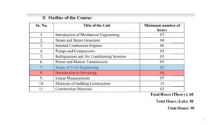
INTRODUCTION TO SURVEYING
3. TOPICS TO BE COVERED
8.1
Definition of Surveying
Objects of Surveying
Uses of Surveying
8.2
Primary Divisions of Surveying
Principles of Surveying
8.3
List of Classification of Surveying
Definitions : Plan and Map, scales :Plain Scale and Diagonal
Scale,
Conventional Symbols
4. SURVEYING
“ Those activities involved in planning and
execution of surveys for the Location, Design,
Construction, Operation and Maintenance of Civil
and Other Engineering Projects.”
5. DEFINITION OF SURVEYING
Surveying is the art and science of
determining the relative positions of various
points or stations on the surface of the
earth by measuring the horizontal and
vertical distances , Angles and taking the
details of these points and by preparing a
map or plan to any scale.
Measurements taken in Horizontal and Vertical planes
6. OBJECTS OF SURVEYING
To Prepare a map or plan.
To show the relative
position of the objects on
the surface of the earth.
To establish the
boundaries of the land.
To select a suitable site
for an engineering
project.
7. USES OF SURVEYING
To prepare a Topographical Map which shows hills, valleys, river, forests,
villages, towns etc.
To prepare a Cadastral Map which shows the boundaries of fields, plots
houses and other properties.
To prepare an Engineering Map which shows the properties of engineering
works such as buildings, roads, railways , dams, canals, etc.
To prepare a Contour Map to know the topography of the area to find out
the best possible site for road , railways, bridges, reservoirs , canals, etc.
To prepare Military Maps, Geological Maps, Archeological Maps etc.
To set out works and transfer details from the work on the ground.
15. TOPICS TO BE COVERED
8.1
Definition of Surveying
Objects of Surveying
Uses of Surveying
8.2
Primary Divisions of Surveying
Principles of Surveying
8.3
List of Classification of Surveying
Definitions : Plan and Map, scales :Plain Scale and Diagonal
Scale,
Conventional Symbols
16. PRIMARY DIVISIONS OF SURVEYING
PLANE SURVEYING
• Type of surveying in which earth surface is
considered as a plane and the curvature of the
earth is ignored.
• In such surveying the line joining any two stations is
considered to be straight.
GEODETIC SURVEYING
• Type of surveying in which the curvature of the
earth is taken into consideration.
• The line joining any two stations is considered as
curved line.
17. DIFFERNCE BETWEEN GEODETIC AND PLANE SURVEYING
Earth surface is considered as a curved surface.
The curvature of the earth is taken into account.
The line joining any two stations is considered as a
curved line.
The triangle formed by any three points is
considered as spherical.
The angles of the triangle are considered to be
spherical.
Carried out for a large area >250km2 .
Earth surface is considered as a plane surface.
The curvature of the earth is ignored.
The line joining any two stations is considered as a
straight line.
The triangle formed by any three points is
considered as a plane.
The angles of the triangle are considered to be
plane angles.
Carried out for a small area < 250km2 .
Geodetic SurveyingPlane Surveying
18. FUNDAMENTAL PRINCIPLES OF SURVEYING
Principle: 1
WHOLE TO PART
Always work from whole to part
Principle: 2
LOCATE A POINT BY ATLEAST
TWO MEASUREMENTS
Locate a new station by at least 2
measurements whether linear or
angular from fixed reference
points.
19. Principle: 1
In surveying large areas, a system of control
points are identified and they are located
with high precision.
Then secondary control points are located
using lesser precise methods.
The details of the localized areas are
measured and plotted with respect to the
secondary control points.
This is called working from whole to part.
This principle in surveying helps in localising
the errors.
If the surveying is carried out by adding
localized areas errors accumulated and may
become unacceptable when large area is
covered.
20. Principle: 2
Control points are selected in the area and
the distance between them is measured
accurately. The line joining these two points
is plotted to the scale on drawing sheet.
Now the desired point(new station) can be
plotted by making suitable measurements
from the given control point.
The new stations are located by linear or
angular measurements or by both.
21. TOPICS TO BE COVERED
8.1
Definition of Surveying
Objects of Surveying
Uses of Surveying
8.2
Primary Divisions of Surveying
Principles of Surveying
8.3
List of Classification of Surveying
Definitions : Plan and Map, scales :Plain Scale and Diagonal
Scale,
Conventional Symbols
22. CLASSIFICATION OF SURVEYING
1.BASED ON ACCURACY
DESIRED
2.BASED ON
INSTRUMENTS USED
3.BASED ON
PLACE OF SURVEY
4.BASED ON
PURPOSE OF
SURVEYING
5.BASED ON
METHODS
OF SURVEY
24. 2.BASED ON INSTRUMENTS
USED
CHAIN SURVEY
COMPASS
SURVEY
CHAIN AND
COMPASS
SURVEY
LEVELLING
PLANE TABLE
SURVEY
THEODOLITE TACHEOMETRY PHOTOGRAMETRY EMD
25. Simplest type of surveying in which only linear measurements are
made with a chain or tape .Angular measurements are not taken.
25
CHAIN
SURVEY
26. The angles are measure with the help of a magnetic compass.
26
COMPASS
SURVEY
27. The type of survey is used to determine the vertical
distances(elevation) and relative heights of points with the help of
an instrument known as level.
27
LEVELLING
SURVEY
28. It’s a graphical method of surveying in which field works and
plotting both are done simultaneously.
28
PLANE
TABLE
SURVEY
29. THEODOLITE Is a precision instrument for measuring angles in
the horizontal and vertical planes.
29
THEODOLITE
SURVEY
30. is a system of rapid surveying, by which the positions,
both horizontal and vertical, of points on the earth
surface relatively to one another are determined without
using a chain or tape or a separate leveling instrument.
30
TACHEOMETRIC
SURVEY
31. Photogrammetry is the science of making measurements
from photographs, especially for .... 3D data acquisition
and object reconstruction
31
PHOTOGRAMETRY
SURVEY
32. Electronic distance measuring instrument is a surveying
instrument for measuring distance electronically between
two points through electromagnetic waves.
32
EDM SURVEY
33. 3.BASED ON PLACE OF SURVEY
LAND SURVEY TOPOGRAPHICAL
SURVEY
CADASTRAL
SURVEY
CITY SURVEY
HYDROGRAPHICAL
SURVEY
UNDERGROUND
SURVEY AERIAL SURVEY
34. 4.BASED ON PURPOSE OF
SURVEY
ENGINEERING
SURVEY
DEFENCE SURVEY
GEOLOGICAL
SURVEY
GEOGRAPHICAL
SURVEY
MINE SURVEY
ARCHEOLOGICAL
SURVEY
ROUTE SURVEY
RECONNAISSANCE
SURVEY
PRELIMINARY
SURVEY
CONTROL SURVEY LOCATION SURVEY
36. DIFFERENCE BETWEEN PLAN AND MAP
(1) Plan: Plan is a graphical representation to some scale of the features on near or below the surface of
the earth as projected or a horizontal plane.
(2) Map: If the of graphical projection on a horizontal plane is small, the plan is called a map.
38. SCALE
Scale:
It is the basic requirement for the preparation of plans or maps.
The proportion or ratio between the dimensions adopted for the
drawing and the corresponding dimensions of the object
R.F. (Representation Fraction): The ratio of the distance on the
drawing to the corresponding actual length of the object on the
ground is know as the representative fraction.
• REPRESENTATIVE FACTOR (R.F.) = DIMENSION OF DRAWING
DIMENSION OF OBJECT
i.e . = LENGTH OF DRAWING
ACTUAL LENGTH
39. To construct the scale the data required is :
1. The R.F of the scale
2. The units which it has to represent i.e. millimetres or centimetres
or metres or kilometres in M.K.S or inches or feet or yards or miles
in F.P.S)
3. Maximum length which it should measure. If the maximum length is
not given, some suitable length can be assumed.
• The maximum length of the scale to be constructed on the drawing
sheet = R.F X maximum length the scale should measure.
•This should be generally of 15 to 20 cm length.
Need : When an unusual proportion is to be adopted and when the ready made scales are not
available then the required scale is to be constructed on the drawing sheet itself.
SCALE & ITS CONSTRUCTION
40. The following two types of scales are used:
1.PLAIN SCALE
2.DIAGONAL SCALE
SCALE & ITS TYPES
41. PLAIN SCALE
The plain scale is the most commonly used in maps to represent
two consecutive units.i.e. a unit and its sub unit.
This scale is not drawn like ordinary foot rule (30 cm scale).
If a scale of 1 : 40 is to be drawn, the markings are not like 4
m, 8 m, 12 m etc. at every 1 cm distance.
42. Example : Construct a plain scale of RF = 1 /500 and indicate 66 m. on it.
Solution. If the total length of the scale is selected as 20 cm, it represents a total length of
500 × 20 = 10000 cm = 100 m. Hence, draw a line of 20 cm and divide it into 10 equal parts.
Hence, each part correspond to 10 m on the ground. First part on extreme left is subdivided
into 10 parts, each subdivision representing 1 m on the field. Then they are numbered as 1 to 10
from right to left as shown in Fig. 11.6. If a distance on the ground is between 60 and 70 m, it
is picked up with a divider by placing one leg on 60 m marking and the other leg on subdivision in
the first part. Thus field distance is easily converted to map distance.
43. DIAGONAL SCALE
In plain scale only unit and tenths can be shown whereas in
diagonal scales it is possible to show units, tenths and
hundredths.
Units and tenths are shown in the same manner as in plain
scale.
44. Construction of Diagonal scales
Draw the line AC of convenient length at right angles to
plain scale AB. Divide it into 10 equal parts. Join BC. From
each tenth point on line AC draw lines parallel to AB till
they meet line BC.
Then line 1–1 represent 1 / 10th of AB, 6–6 represent 6 /
100th of AB and so on.
Figure shows the construction of diagonal scale with RF = 1
/ 500 and indicates 62.6 m.