SlideShare a Scribd company logo
1 of 15
Download to read offline
THE DIGITAL METALLOGENIC MAPTHE DIGITAL METALLOGENIC MAP
OF SOUTH AMERICAOF SOUTH AMERICA
1:5.000.000 scale1:5.000.000 scale
Eduardo O. Zappettini and Gabriel Asato
SERVICIO GEOLOGICO MINERO ARGENTINO
Florence, August 2004
OBJECTIVESOBJECTIVES
Promoting organizations: CGMW - ASGMI
General coordination: Geological and Mining Survey of Argentina
Local Coordinations: National Geological Surveys of South America
ORGANIZATIONS INVOLVEDORGANIZATIONS INVOLVED
THE DIGITAL METALLOGENIC MAPTHE DIGITAL METALLOGENIC MAP
OF SOUTH AMERICAOF SOUTH AMERICA
Educational: To promote the knowledge of the mineral
resources of the Continent
To integrate and update the metallogenic knowledge of
South America
To contribute to the preparation of the Metallogenic Map of
the World
WORKINGWORKING GROUP: 68 geologists – 4 techniciansGROUP: 68 geologists – 4 technicians
General Coordination
Eduardo Zappettini (SEGEMAR)
National Coordinators
Argentina: Eduardo Zappettini (SEGEMAR)
Bolivia: Carlos Riera Kilibarda (SERGEOMIN)
Brazil: Carlos Schobbenhaus (CPRM)
Chile: Waldo Vivallo (SERNAGEOMIN)
Colombia: Rosalba Salinas (INGEOMINAS)
Ecuador: Guillermo Rosero (DINAGE)
Paraguay: Maria Eugenia González (DM Paraguay)
Peru: Manuel Paz (INGEMMET)
Uruguay: Humberto Pirelli (DINAMIGE)
Venezuela: Rosario Bajo de Osuna (INGEOMIN)
 
Databases Coordination
Susana Segal (SEGEMAR).
Digital cartography and GIS coordination
Carlos Gabriel Asato (SEGEMAR)
THE DIGITAL METALLOGENIC MAPTHE DIGITAL METALLOGENIC MAP
OF SOUTH AMERICAOF SOUTH AMERICA
Geographic Information System
Tectonostratigraphic units
Inventory of mineral resources
Associated databases
THE PRODUCTTHE PRODUCT
THE DIGITAL METALLOGENIC MAPTHE DIGITAL METALLOGENIC MAP
OF SOUTH AMERICAOF SOUTH AMERICA
DEPOSITS CLASSIFICATIONDEPOSITS CLASSIFICATION
Deposits associated with mafic and ultramafic intrusions in
tectonically stable areas
Deposits associated with mafic and ultramafic intrusions in
tectonically unstable areas
Deposits associated with alkaline rocks and systems
Deposits associated with mafic continental volcanism
Pegmatites
Deposits associated with granites
Porphyry type deposits
Metasomatic deposits (including greissens and skarns)
Deposits associated with mesosilicic to acid volcanics and
subvolcanics in a continental domain
Deposits associated with clastic sediments
Deposits associated with carbonate sediments
Deposits associated with carbonate sediments-BIF
Deposits associated with chemical sediments
Deposits associated with biogenic sediments
Deposits associated with dehydration and metamorphic
segregation fluids
Deposits associated with metamorphic crystallization
Residual deposits
Deposits associated with submarine volcanism and
volcanosedimentary marine sequences
Placer deposits
DEPOSIT CLANS
Cr, Ni, Co, Ti, Fe-Ti-V, Cu-Ni
Dimensional stones (granite, travertine, marble, flatsones, etc.)
U, U-V-Cu, Th, REE, Nb, Ta, Be, Li, Zr
Gemstones (diamond, sapphire, amethyst, topaz, tourmaline,
emerald, aquamarine, etc.)
Sn, Sn-Ag, W, Mo, Bi, Sb
Ba, F, Sr
Industrial Minerals (Al silicates, garnet, wollastonite, asbest, talc,
clays, bentonite, grafite, industrial diamonds, sulfur, perlite, etc.)
Phosphates, magnesite, Na, K, B, Li (salts), gypsum, nitrates
Al (bauxite)
Fe, Mn
Pb-Ag-Zn, Pb-Zn, Pb, Zn
Au, Au-Ag, PGE, Au-Cu, As, Se, Te, Hg
Cr, Cu, Cu-Pb-Zn, Cu-Ag, Cu-Au, Cu-Mo
COMMODITIES
THE DIGITAL METALLOGENIC MAPTHE DIGITAL METALLOGENIC MAP
OF SOUTH AMERICAOF SOUTH AMERICA
DEPOSIT MODEL CLASSIFICATION (USGS)
Model N° MODEL NAME
1 STILLWATER NI~CU
2A BUSHVELD CHROMITITE
2B MERENSKY REEF PGE
3 BUSHVELD FE -TI-V
4A CU-NI PIPES
4B PGE PIPES
5A DULUTH CU -NI-PGE
5B NORIL'SK CU -NI-PGE
6A KOMATIITIC NI -CU
6B DUNITIC NI -CU
7A SYNOROGENIC -SYNVOLCANIC NI -CU
7B ANORTHOSITE -TI
8A PODIFORM CHROMITE
8B MAJOR PODIFORM CHROMITE
8C LIMASSOL FOREST CO -NI
8D SERPENTINE -HOSTED ASBESTOS
8E SERPENTINITE -HOSTED MAGNESITE
8F SERPENTINITE -HOSTED TALC -MAGNESITE
8G ULTRAMAFIC -HOSTED TALC
8J VERDE ANTIQUE
9 ALASKAN PGE
10 CARBONATITE
THE DIGITAL METALLOGENIC MAPTHE DIGITAL METALLOGENIC MAP
OF SOUTH AMERICAOF SOUTH AMERICA
Size limits
(tons of metal/mineral contained except otherwise indicated)Element
1-2 2-3 3-4
Ag 250 5,000 10,000
Al (Bauxite) 10,000,000 100,000,000 1,000,000,000
Amethyst (gem quality, kg) 500 5,000 10,000
Andalousite 1,000,000 5,000,000
Asbestos 100,000 2,000,000 10,000,000
Au 25 250 5,000
Barite 50,000 5,000,000 20,000,000
Bauxite (refractory) 100,000 2,500,000 15,000,000
Be (oxide) 100 1,000 10,000
Bentonite 500,000 5,000,000 10,000,000
Bi 100 1,000 10,000
Bitumen 10,000,000 100,000,000 500,000,000
Borates (B2O3) 500,000 10,000,000 100,000,000
Celestite 100,000 500,000 2,500,000
Clays 500,000 5,000,000 10,000,000
Co 1,000 20,000 100,000
Corundm (gem, kg) 25 500 1,000
Corundum 20,000 500,000 1,000,000
Cr 50,000 1,000,000 100,000,000
Cu 50,000 1,000,000 10,000,000
Diamond 1 10 15
Diatomite 100,000 2,000,000 20,000,000
Dimensional stones 5,000,000 20,000,000 100,000,000
Dolostone 5,000,000 20,000,000 100,000,000
Emerald (gem quality, kg) 25 500 1000
THE DIGITAL METALLOGENIC MAPTHE DIGITAL METALLOGENIC MAP
OF SOUTH AMERICAOF SOUTH AMERICA
THE DIGITAL METALLOGENIC MAPTHE DIGITAL METALLOGENIC MAP
OF SOUTH AMERICAOF SOUTH AMERICA
#
#
#
#
#
Ì
Ì
Ì
Ì
Ì
Specific symbology
Color: Au
External ring
Deposit size
Placer type deposit, medium size
Deposit Clan
THE DIGITAL METALLOGENIC MAPTHE DIGITAL METALLOGENIC MAP
OF SOUTH AMERICAOF SOUTH AMERICA
Look Up Table Archivo de Simbolos
SIMBOLO
YAC_COD
Look_up_table
YacimientosCobertura Arc-Info
YAC_COD
Metal.mrk
Arc-info coverage Deposits Symbols fileLook up table
Symbols are generated from the database with an AML program
The diagram shows the relationship between data and symbology
THE DIGITAL METALLOGENIC MAPTHE DIGITAL METALLOGENIC MAP
OF SOUTH AMERICAOF SOUTH AMERICA
Magmatic units
1.     Forearc volcanism
2.     Forearc plutonism
3.     Arc volcanism
4.     Arc plutonism
5.     Back arc volcanism
6.     Back arc plutonism
7.     Extensional volcanism
8.     Extensional plutonism
9.     Syncollisional volcanism
10.  Syncollisional plutonism
11.  Postcollisional or postorogenic volcanism
12.  Postcollisional or postorogenic plutonism
13.  Intraplate volcanism
14.  Intraplate plutonism
15.  Rapakivi granites
16.  Island arc magmatism (with or without
interbedded sediments)
17.  Ophiolitic complex, oceanic basalt,ofiolitic
mélange
18.  Stratified mafic complex
19.  Greenstone belts
20.  Kimberlites
21.  Carbonatites
22.  Alkaline complexes
Sedimentary sequences 
1.    Plataform deposits
2.    Continental passive margin deposits
3.    Transitional margin deposits (passive to active)
4.    Talus deposits
5.    Accretionary prism deposits
6.    Fore arc deposits
7.    Intraarc deposits
8.    Back arc deposits
9.    Foreland basin deposits
10.  Marginal basin deposits
11.  Intracratonic basin deposits
12.  Rift deposits
13.  Termal subsidence (SAG) deposits
14.  Oblique flexural basin deposits
15.  Pull apart basin deposits
 
Unclassified metamorphic units
 
1.   Sedimentary or volcano-sedimentary
metamorphosed units
2.   Igneous metamorphosed units
3.   Volcanic metamorphosed units
4.   Plutonic metamorphosed units
TECTONOSTRATIGRAPHIC UNITS CLASSIFICATIONTECTONOSTRATIGRAPHIC UNITS CLASSIFICATION
THE DIGITAL METALLOGENIC MAPTHE DIGITAL METALLOGENIC MAP
OF SOUTH AMERICAOF SOUTH AMERICA
Mineral deposits info
Resources and grades info
Look up tables
Query tool
DATABASE SOFTWARE: World Mineral Geoscience Database ProjectDATABASE SOFTWARE: World Mineral Geoscience Database Project
Comprehensive database including information of more than 1,500 deposits
THE DIGITAL METALLOGENIC MAPTHE DIGITAL METALLOGENIC MAP
OF SOUTH AMERICAOF SOUTH AMERICA
METALLIC PROVINCES AND BELTSMETALLIC PROVINCES AND BELTS
A second database has been
incorporated in the GIS,
including more than 27,000
deposits, in order to facilitate the
Production of thematic maps
showing provinces, belts and
Districts.
Information contained:
• Country
• Deposit name
• Coordinates
• Commodities
THE DIGITAL METALLOGENIC MAPTHE DIGITAL METALLOGENIC MAP
OF SOUTH AMERICAOF SOUTH AMERICA
The first map: Stappenbeck, 1926
This version
THE DIGITAL METALLOGENIC MAPTHE DIGITAL METALLOGENIC MAP
OF SOUTH AMERICAOF SOUTH AMERICA
From the GIS two main products will be
generated:
1. The metallogenic map at 1:5.000.000
2. A deposits query system
Other derivated thematic products can be
generated like:
1. Metallogenic atlas
2. Thematic maps for specific deposit
types or tectonic environments
THE DIGITAL METALLOGENIC MAPTHE DIGITAL METALLOGENIC MAP
OF SOUTH AMERICAOF SOUTH AMERICA
PRODUCT AVAILABILITYPRODUCT AVAILABILITY
PRELIMINARY GIS
available in the WEB site of SEGEMAR by December 2004
PRESENTATION AND DISTRIBUTION OF FINAL PRODUCTS:
CGMW MEETING - PARIS, 2006
BUENOS AIRES, 2006

More Related Content

Viewers also liked

Theme six lecture 16 to 18(1)
Theme six lecture 16 to 18(1)Theme six lecture 16 to 18(1)
Theme six lecture 16 to 18(1)
Mxolisi Mazwayi
 
South Asia Physical
South Asia PhysicalSouth Asia Physical
South Asia Physical
Alison Kurtz
 
Climate And Vegetation of Africa South of the Sahara
Climate And  Vegetation of Africa South of the SaharaClimate And  Vegetation of Africa South of the Sahara
Climate And Vegetation of Africa South of the Sahara
mr_rodriguez23
 
18.3 East Asia Natural Resources and Land Use
18.3 East Asia Natural Resources and Land Use18.3 East Asia Natural Resources and Land Use
18.3 East Asia Natural Resources and Land Use
mshyland
 
The Physical Features of Sub Saharan Africa
The  Physical  Features of  Sub  Saharan  AfricaThe  Physical  Features of  Sub  Saharan  Africa
The Physical Features of Sub Saharan Africa
mr_rodriguez23
 
Physical geography of africa i
Physical geography of africa iPhysical geography of africa i
Physical geography of africa i
Jean L. Moore
 
Physical Geography Of South Asia
Physical Geography Of South AsiaPhysical Geography Of South Asia
Physical Geography Of South Asia
mr_rodriguez23
 

Viewers also liked (20)

Standards promote interoperability of USGS data on the U.S. Geoscience Inform...
Standards promote interoperability of USGS data on the U.S. Geoscience Inform...Standards promote interoperability of USGS data on the U.S. Geoscience Inform...
Standards promote interoperability of USGS data on the U.S. Geoscience Inform...
 
South asia
South asiaSouth asia
South asia
 
South america
South america South america
South america
 
Theme six lecture 16 to 18(1)
Theme six lecture 16 to 18(1)Theme six lecture 16 to 18(1)
Theme six lecture 16 to 18(1)
 
Natural vegetation of Latin America
Natural vegetation of Latin AmericaNatural vegetation of Latin America
Natural vegetation of Latin America
 
South Asia Physical
South Asia PhysicalSouth Asia Physical
South Asia Physical
 
South Africa
South AfricaSouth Africa
South Africa
 
9.2 - Climate and Vegetation of Latin America
9.2 - Climate and Vegetation of Latin America9.2 - Climate and Vegetation of Latin America
9.2 - Climate and Vegetation of Latin America
 
Indian and South Asia climate and vegetation
Indian and South Asia climate and vegetationIndian and South Asia climate and vegetation
Indian and South Asia climate and vegetation
 
24.2 - South Asia Climate and Vegetation
24.2 - South Asia Climate and Vegetation24.2 - South Asia Climate and Vegetation
24.2 - South Asia Climate and Vegetation
 
Climate And Vegetation of Africa South of the Sahara
Climate And  Vegetation of Africa South of the SaharaClimate And  Vegetation of Africa South of the Sahara
Climate And Vegetation of Africa South of the Sahara
 
18.3 East Asia Natural Resources and Land Use
18.3 East Asia Natural Resources and Land Use18.3 East Asia Natural Resources and Land Use
18.3 East Asia Natural Resources and Land Use
 
South america
South americaSouth america
South america
 
Physical Geography of Latin America
Physical Geography of Latin AmericaPhysical Geography of Latin America
Physical Geography of Latin America
 
Landuse Mapping
Landuse Mapping Landuse Mapping
Landuse Mapping
 
The Physical Features of Sub Saharan Africa
The  Physical  Features of  Sub  Saharan  AfricaThe  Physical  Features of  Sub  Saharan  Africa
The Physical Features of Sub Saharan Africa
 
Physical geography of africa i
Physical geography of africa iPhysical geography of africa i
Physical geography of africa i
 
Land Resources and Mineral resources
Land Resources and Mineral resources Land Resources and Mineral resources
Land Resources and Mineral resources
 
Physical Geography Of South Asia
Physical Geography Of South AsiaPhysical Geography Of South Asia
Physical Geography Of South Asia
 
Non-metallic Mineral Deposits
Non-metallic Mineral DepositsNon-metallic Mineral Deposits
Non-metallic Mineral Deposits
 

Similar to THE DIGITAL METALLOGENIC MAP OF SOUTH AMERICA AT 1:5.000.000 SCALE

Porpnyry Copper Deposits and Model Cox.pdf
Porpnyry Copper Deposits and Model Cox.pdfPorpnyry Copper Deposits and Model Cox.pdf
Porpnyry Copper Deposits and Model Cox.pdf
VictorValdivia20
 
7.Greenfield_MnW2015_abstract_edit6 (1)
7.Greenfield_MnW2015_abstract_edit6 (1)7.Greenfield_MnW2015_abstract_edit6 (1)
7.Greenfield_MnW2015_abstract_edit6 (1)
Cameron Perks
 
Sareic martin hand
Sareic martin handSareic martin hand
Sareic martin hand
Brett Johnson
 
Sareic ferris
Sareic ferrisSareic ferris
Sareic ferris
Brett Johnson
 

Similar to THE DIGITAL METALLOGENIC MAP OF SOUTH AMERICA AT 1:5.000.000 SCALE (20)

Where Are The Uranium Resources Insight
Where Are The Uranium Resources InsightWhere Are The Uranium Resources Insight
Where Are The Uranium Resources Insight
 
PDAC 2020 ppp hand out 2020 [autosaved]
PDAC 2020 ppp hand out 2020 [autosaved]PDAC 2020 ppp hand out 2020 [autosaved]
PDAC 2020 ppp hand out 2020 [autosaved]
 
PhD Thesis SJB Dec_04
PhD Thesis SJB Dec_04PhD Thesis SJB Dec_04
PhD Thesis SJB Dec_04
 
The Bathurst Metallogenic map
The Bathurst Metallogenic mapThe Bathurst Metallogenic map
The Bathurst Metallogenic map
 
Sedimentary ore deposit environments
Sedimentary ore deposit environmentsSedimentary ore deposit environments
Sedimentary ore deposit environments
 
Nimfopoulos_and_Pattrick_1991
Nimfopoulos_and_Pattrick_1991Nimfopoulos_and_Pattrick_1991
Nimfopoulos_and_Pattrick_1991
 
Kristineberg VMS deposit, northern Sweden
Kristineberg VMS deposit, northern SwedenKristineberg VMS deposit, northern Sweden
Kristineberg VMS deposit, northern Sweden
 
Porpnyry Copper Deposits and Model Cox.pdf
Porpnyry Copper Deposits and Model Cox.pdfPorpnyry Copper Deposits and Model Cox.pdf
Porpnyry Copper Deposits and Model Cox.pdf
 
7.Greenfield_MnW2015_abstract_edit6 (1)
7.Greenfield_MnW2015_abstract_edit6 (1)7.Greenfield_MnW2015_abstract_edit6 (1)
7.Greenfield_MnW2015_abstract_edit6 (1)
 
PDAC 2016 presentation by Martini, Carey, & Witter
PDAC 2016 presentation by Martini, Carey, & WitterPDAC 2016 presentation by Martini, Carey, & Witter
PDAC 2016 presentation by Martini, Carey, & Witter
 
Sareic martin hand
Sareic martin handSareic martin hand
Sareic martin hand
 
Sareic ferris
Sareic ferrisSareic ferris
Sareic ferris
 
FICQ. G 2016 HONOURS
FICQ. G 2016 HONOURS FICQ. G 2016 HONOURS
FICQ. G 2016 HONOURS
 
igneous-class-text.ppt
igneous-class-text.pptigneous-class-text.ppt
igneous-class-text.ppt
 
2015 Broken Hill Resources Investment Symposium - Geological Survey of New So...
2015 Broken Hill Resources Investment Symposium - Geological Survey of New So...2015 Broken Hill Resources Investment Symposium - Geological Survey of New So...
2015 Broken Hill Resources Investment Symposium - Geological Survey of New So...
 
Minerals
MineralsMinerals
Minerals
 
Minerals
MineralsMinerals
Minerals
 
A. preliminary model porphyry
A. preliminary model porphyryA. preliminary model porphyry
A. preliminary model porphyry
 
Articulo3
Articulo3Articulo3
Articulo3
 
Articulo2
Articulo2Articulo2
Articulo2
 

More from Carlos Gabriel Asato

La Calidad de la Información Geoespacial Digital, sus Limitaciones, y su Imp...
La Calidad de la Información Geoespacial Digital, sus Limitaciones,  y su Imp...La Calidad de la Información Geoespacial Digital, sus Limitaciones,  y su Imp...
La Calidad de la Información Geoespacial Digital, sus Limitaciones, y su Imp...
Carlos Gabriel Asato
 

More from Carlos Gabriel Asato (20)

EXPERIENCIAS EN EL DESARROLLO DE LA PRODUCCIÓN CARTOGRÁFICA AUTOMATIZADA MED...
EXPERIENCIAS EN EL DESARROLLO DE LA  PRODUCCIÓN CARTOGRÁFICA AUTOMATIZADA MED...EXPERIENCIAS EN EL DESARROLLO DE LA  PRODUCCIÓN CARTOGRÁFICA AUTOMATIZADA MED...
EXPERIENCIAS EN EL DESARROLLO DE LA PRODUCCIÓN CARTOGRÁFICA AUTOMATIZADA MED...
 
Introducción a la Creación de Mapas de Potencial Geotérmico Mediante el Métod...
Introducción a la Creación de Mapas de Potencial Geotérmico Mediante el Métod...Introducción a la Creación de Mapas de Potencial Geotérmico Mediante el Métod...
Introducción a la Creación de Mapas de Potencial Geotérmico Mediante el Métod...
 
Proyecto de Transformación Digital de la Información Geológica Regional en YP...
Proyecto de Transformación Digital de la Información Geológica Regional en YP...Proyecto de Transformación Digital de la Información Geológica Regional en YP...
Proyecto de Transformación Digital de la Información Geológica Regional en YP...
 
APLICACIÓN DEL MÉTODO PLAY FAIRWAY PARA LA DETERMINACIÓN DE ZONAS DE FAVORABI...
APLICACIÓN DEL MÉTODO PLAY FAIRWAY PARA LA DETERMINACIÓN DE ZONAS DE FAVORABI...APLICACIÓN DEL MÉTODO PLAY FAIRWAY PARA LA DETERMINACIÓN DE ZONAS DE FAVORABI...
APLICACIÓN DEL MÉTODO PLAY FAIRWAY PARA LA DETERMINACIÓN DE ZONAS DE FAVORABI...
 
Características del Sensor Aster
Características del Sensor AsterCaracterísticas del Sensor Aster
Características del Sensor Aster
 
Contextual Elements for Geoscience Standards Adoption and Development in SA S...
Contextual Elements for Geoscience Standards Adoption and Development in SA S...Contextual Elements for Geoscience Standards Adoption and Development in SA S...
Contextual Elements for Geoscience Standards Adoption and Development in SA S...
 
Análisis Geoespacial y Potencial Minero
Análisis Geoespacial y Potencial MineroAnálisis Geoespacial y Potencial Minero
Análisis Geoespacial y Potencial Minero
 
Comparación Presupuestaria En el contexto de los aportes de los Servicios Geo...
Comparación Presupuestaria En el contexto de los aportes de los Servicios Geo...Comparación Presupuestaria En el contexto de los aportes de los Servicios Geo...
Comparación Presupuestaria En el contexto de los aportes de los Servicios Geo...
 
Estudio sobre política pública, Servicios Geológicos y Desarrollo (DRAFT=
Estudio sobre política pública, Servicios Geológicos y Desarrollo (DRAFT=Estudio sobre política pública, Servicios Geológicos y Desarrollo (DRAFT=
Estudio sobre política pública, Servicios Geológicos y Desarrollo (DRAFT=
 
2019 Geopackage estándar de OGC para la transferencia física de datos geoespa...
2019 Geopackage estándar de OGC para la transferencia física de datos geoespa...2019 Geopackage estándar de OGC para la transferencia física de datos geoespa...
2019 Geopackage estándar de OGC para la transferencia física de datos geoespa...
 
Las Bases de Datos Geoespaciales. Impactos en SIG y Cartografía Digital
Las Bases de Datos Geoespaciales. Impactos en SIG y Cartografía DigitalLas Bases de Datos Geoespaciales. Impactos en SIG y Cartografía Digital
Las Bases de Datos Geoespaciales. Impactos en SIG y Cartografía Digital
 
Introduccion sql geoespacial
Introduccion sql geoespacialIntroduccion sql geoespacial
Introduccion sql geoespacial
 
A GIS Based Satellite Data Management Application
A GIS Based Satellite Data Management ApplicationA GIS Based Satellite Data Management Application
A GIS Based Satellite Data Management Application
 
Los Topónimos su manejo mediante SIG y sus aplicaciones en cartografía
Los Topónimos su manejo mediante SIG y sus aplicaciones en cartografíaLos Topónimos su manejo mediante SIG y sus aplicaciones en cartografía
Los Topónimos su manejo mediante SIG y sus aplicaciones en cartografía
 
ATLAS TECHNOLOGY, A DIGITAL FRAMEWORK FOR EFFICIENT MANAGEMENT AND USE OF RE...
ATLAS  TECHNOLOGY, A DIGITAL FRAMEWORK FOR EFFICIENT MANAGEMENT AND USE OF RE...ATLAS  TECHNOLOGY, A DIGITAL FRAMEWORK FOR EFFICIENT MANAGEMENT AND USE OF RE...
ATLAS TECHNOLOGY, A DIGITAL FRAMEWORK FOR EFFICIENT MANAGEMENT AND USE OF RE...
 
La Calidad de la Información Geoespacial Digital, sus Limitaciones, y su Imp...
La Calidad de la Información Geoespacial Digital, sus Limitaciones,  y su Imp...La Calidad de la Información Geoespacial Digital, sus Limitaciones,  y su Imp...
La Calidad de la Información Geoespacial Digital, sus Limitaciones, y su Imp...
 
How cool can be the migration of an old gis corporate dataset to a new system...
How cool can be the migration of an old gis corporate dataset to a new system...How cool can be the migration of an old gis corporate dataset to a new system...
How cool can be the migration of an old gis corporate dataset to a new system...
 
Introducción al los Modelos Digitales de Terreno y su Análisis con Sistemas d...
Introducción al los Modelos Digitales de Terreno y su Análisis con Sistemas d...Introducción al los Modelos Digitales de Terreno y su Análisis con Sistemas d...
Introducción al los Modelos Digitales de Terreno y su Análisis con Sistemas d...
 
Ser Informado con RSS
Ser Informado con RSSSer Informado con RSS
Ser Informado con RSS
 
Explotación de Información Geocientífica por Internet. Desde Geo-RSS a WMS, h...
Explotación de Información Geocientífica por Internet. Desde Geo-RSS a WMS, h...Explotación de Información Geocientífica por Internet. Desde Geo-RSS a WMS, h...
Explotación de Información Geocientífica por Internet. Desde Geo-RSS a WMS, h...
 

THE DIGITAL METALLOGENIC MAP OF SOUTH AMERICA AT 1:5.000.000 SCALE

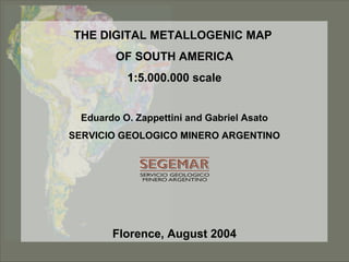
  • 1. THE DIGITAL METALLOGENIC MAPTHE DIGITAL METALLOGENIC MAP OF SOUTH AMERICAOF SOUTH AMERICA 1:5.000.000 scale1:5.000.000 scale Eduardo O. Zappettini and Gabriel Asato SERVICIO GEOLOGICO MINERO ARGENTINO Florence, August 2004
  • 2. OBJECTIVESOBJECTIVES Promoting organizations: CGMW - ASGMI General coordination: Geological and Mining Survey of Argentina Local Coordinations: National Geological Surveys of South America ORGANIZATIONS INVOLVEDORGANIZATIONS INVOLVED THE DIGITAL METALLOGENIC MAPTHE DIGITAL METALLOGENIC MAP OF SOUTH AMERICAOF SOUTH AMERICA Educational: To promote the knowledge of the mineral resources of the Continent To integrate and update the metallogenic knowledge of South America To contribute to the preparation of the Metallogenic Map of the World
  • 3. WORKINGWORKING GROUP: 68 geologists – 4 techniciansGROUP: 68 geologists – 4 technicians General Coordination Eduardo Zappettini (SEGEMAR) National Coordinators Argentina: Eduardo Zappettini (SEGEMAR) Bolivia: Carlos Riera Kilibarda (SERGEOMIN) Brazil: Carlos Schobbenhaus (CPRM) Chile: Waldo Vivallo (SERNAGEOMIN) Colombia: Rosalba Salinas (INGEOMINAS) Ecuador: Guillermo Rosero (DINAGE) Paraguay: Maria Eugenia González (DM Paraguay) Peru: Manuel Paz (INGEMMET) Uruguay: Humberto Pirelli (DINAMIGE) Venezuela: Rosario Bajo de Osuna (INGEOMIN)   Databases Coordination Susana Segal (SEGEMAR). Digital cartography and GIS coordination Carlos Gabriel Asato (SEGEMAR) THE DIGITAL METALLOGENIC MAPTHE DIGITAL METALLOGENIC MAP OF SOUTH AMERICAOF SOUTH AMERICA
  • 4. Geographic Information System Tectonostratigraphic units Inventory of mineral resources Associated databases THE PRODUCTTHE PRODUCT THE DIGITAL METALLOGENIC MAPTHE DIGITAL METALLOGENIC MAP OF SOUTH AMERICAOF SOUTH AMERICA
  • 5. DEPOSITS CLASSIFICATIONDEPOSITS CLASSIFICATION Deposits associated with mafic and ultramafic intrusions in tectonically stable areas Deposits associated with mafic and ultramafic intrusions in tectonically unstable areas Deposits associated with alkaline rocks and systems Deposits associated with mafic continental volcanism Pegmatites Deposits associated with granites Porphyry type deposits Metasomatic deposits (including greissens and skarns) Deposits associated with mesosilicic to acid volcanics and subvolcanics in a continental domain Deposits associated with clastic sediments Deposits associated with carbonate sediments Deposits associated with carbonate sediments-BIF Deposits associated with chemical sediments Deposits associated with biogenic sediments Deposits associated with dehydration and metamorphic segregation fluids Deposits associated with metamorphic crystallization Residual deposits Deposits associated with submarine volcanism and volcanosedimentary marine sequences Placer deposits DEPOSIT CLANS Cr, Ni, Co, Ti, Fe-Ti-V, Cu-Ni Dimensional stones (granite, travertine, marble, flatsones, etc.) U, U-V-Cu, Th, REE, Nb, Ta, Be, Li, Zr Gemstones (diamond, sapphire, amethyst, topaz, tourmaline, emerald, aquamarine, etc.) Sn, Sn-Ag, W, Mo, Bi, Sb Ba, F, Sr Industrial Minerals (Al silicates, garnet, wollastonite, asbest, talc, clays, bentonite, grafite, industrial diamonds, sulfur, perlite, etc.) Phosphates, magnesite, Na, K, B, Li (salts), gypsum, nitrates Al (bauxite) Fe, Mn Pb-Ag-Zn, Pb-Zn, Pb, Zn Au, Au-Ag, PGE, Au-Cu, As, Se, Te, Hg Cr, Cu, Cu-Pb-Zn, Cu-Ag, Cu-Au, Cu-Mo COMMODITIES THE DIGITAL METALLOGENIC MAPTHE DIGITAL METALLOGENIC MAP OF SOUTH AMERICAOF SOUTH AMERICA
  • 6. DEPOSIT MODEL CLASSIFICATION (USGS) Model N° MODEL NAME 1 STILLWATER NI~CU 2A BUSHVELD CHROMITITE 2B MERENSKY REEF PGE 3 BUSHVELD FE -TI-V 4A CU-NI PIPES 4B PGE PIPES 5A DULUTH CU -NI-PGE 5B NORIL'SK CU -NI-PGE 6A KOMATIITIC NI -CU 6B DUNITIC NI -CU 7A SYNOROGENIC -SYNVOLCANIC NI -CU 7B ANORTHOSITE -TI 8A PODIFORM CHROMITE 8B MAJOR PODIFORM CHROMITE 8C LIMASSOL FOREST CO -NI 8D SERPENTINE -HOSTED ASBESTOS 8E SERPENTINITE -HOSTED MAGNESITE 8F SERPENTINITE -HOSTED TALC -MAGNESITE 8G ULTRAMAFIC -HOSTED TALC 8J VERDE ANTIQUE 9 ALASKAN PGE 10 CARBONATITE THE DIGITAL METALLOGENIC MAPTHE DIGITAL METALLOGENIC MAP OF SOUTH AMERICAOF SOUTH AMERICA
  • 7. Size limits (tons of metal/mineral contained except otherwise indicated)Element 1-2 2-3 3-4 Ag 250 5,000 10,000 Al (Bauxite) 10,000,000 100,000,000 1,000,000,000 Amethyst (gem quality, kg) 500 5,000 10,000 Andalousite 1,000,000 5,000,000 Asbestos 100,000 2,000,000 10,000,000 Au 25 250 5,000 Barite 50,000 5,000,000 20,000,000 Bauxite (refractory) 100,000 2,500,000 15,000,000 Be (oxide) 100 1,000 10,000 Bentonite 500,000 5,000,000 10,000,000 Bi 100 1,000 10,000 Bitumen 10,000,000 100,000,000 500,000,000 Borates (B2O3) 500,000 10,000,000 100,000,000 Celestite 100,000 500,000 2,500,000 Clays 500,000 5,000,000 10,000,000 Co 1,000 20,000 100,000 Corundm (gem, kg) 25 500 1,000 Corundum 20,000 500,000 1,000,000 Cr 50,000 1,000,000 100,000,000 Cu 50,000 1,000,000 10,000,000 Diamond 1 10 15 Diatomite 100,000 2,000,000 20,000,000 Dimensional stones 5,000,000 20,000,000 100,000,000 Dolostone 5,000,000 20,000,000 100,000,000 Emerald (gem quality, kg) 25 500 1000 THE DIGITAL METALLOGENIC MAPTHE DIGITAL METALLOGENIC MAP OF SOUTH AMERICAOF SOUTH AMERICA
  • 8. THE DIGITAL METALLOGENIC MAPTHE DIGITAL METALLOGENIC MAP OF SOUTH AMERICAOF SOUTH AMERICA # # # # # Ì Ì Ì Ì Ì Specific symbology Color: Au External ring Deposit size Placer type deposit, medium size Deposit Clan
  • 9. THE DIGITAL METALLOGENIC MAPTHE DIGITAL METALLOGENIC MAP OF SOUTH AMERICAOF SOUTH AMERICA Look Up Table Archivo de Simbolos SIMBOLO YAC_COD Look_up_table YacimientosCobertura Arc-Info YAC_COD Metal.mrk Arc-info coverage Deposits Symbols fileLook up table Symbols are generated from the database with an AML program The diagram shows the relationship between data and symbology
  • 10. THE DIGITAL METALLOGENIC MAPTHE DIGITAL METALLOGENIC MAP OF SOUTH AMERICAOF SOUTH AMERICA Magmatic units 1.     Forearc volcanism 2.     Forearc plutonism 3.     Arc volcanism 4.     Arc plutonism 5.     Back arc volcanism 6.     Back arc plutonism 7.     Extensional volcanism 8.     Extensional plutonism 9.     Syncollisional volcanism 10.  Syncollisional plutonism 11.  Postcollisional or postorogenic volcanism 12.  Postcollisional or postorogenic plutonism 13.  Intraplate volcanism 14.  Intraplate plutonism 15.  Rapakivi granites 16.  Island arc magmatism (with or without interbedded sediments) 17.  Ophiolitic complex, oceanic basalt,ofiolitic mélange 18.  Stratified mafic complex 19.  Greenstone belts 20.  Kimberlites 21.  Carbonatites 22.  Alkaline complexes Sedimentary sequences  1.    Plataform deposits 2.    Continental passive margin deposits 3.    Transitional margin deposits (passive to active) 4.    Talus deposits 5.    Accretionary prism deposits 6.    Fore arc deposits 7.    Intraarc deposits 8.    Back arc deposits 9.    Foreland basin deposits 10.  Marginal basin deposits 11.  Intracratonic basin deposits 12.  Rift deposits 13.  Termal subsidence (SAG) deposits 14.  Oblique flexural basin deposits 15.  Pull apart basin deposits   Unclassified metamorphic units   1.   Sedimentary or volcano-sedimentary metamorphosed units 2.   Igneous metamorphosed units 3.   Volcanic metamorphosed units 4.   Plutonic metamorphosed units TECTONOSTRATIGRAPHIC UNITS CLASSIFICATIONTECTONOSTRATIGRAPHIC UNITS CLASSIFICATION
  • 11. THE DIGITAL METALLOGENIC MAPTHE DIGITAL METALLOGENIC MAP OF SOUTH AMERICAOF SOUTH AMERICA Mineral deposits info Resources and grades info Look up tables Query tool DATABASE SOFTWARE: World Mineral Geoscience Database ProjectDATABASE SOFTWARE: World Mineral Geoscience Database Project Comprehensive database including information of more than 1,500 deposits
  • 12. THE DIGITAL METALLOGENIC MAPTHE DIGITAL METALLOGENIC MAP OF SOUTH AMERICAOF SOUTH AMERICA METALLIC PROVINCES AND BELTSMETALLIC PROVINCES AND BELTS A second database has been incorporated in the GIS, including more than 27,000 deposits, in order to facilitate the Production of thematic maps showing provinces, belts and Districts. Information contained: • Country • Deposit name • Coordinates • Commodities
  • 13. THE DIGITAL METALLOGENIC MAPTHE DIGITAL METALLOGENIC MAP OF SOUTH AMERICAOF SOUTH AMERICA The first map: Stappenbeck, 1926 This version
  • 14. THE DIGITAL METALLOGENIC MAPTHE DIGITAL METALLOGENIC MAP OF SOUTH AMERICAOF SOUTH AMERICA From the GIS two main products will be generated: 1. The metallogenic map at 1:5.000.000 2. A deposits query system Other derivated thematic products can be generated like: 1. Metallogenic atlas 2. Thematic maps for specific deposit types or tectonic environments
  • 15. THE DIGITAL METALLOGENIC MAPTHE DIGITAL METALLOGENIC MAP OF SOUTH AMERICAOF SOUTH AMERICA PRODUCT AVAILABILITYPRODUCT AVAILABILITY PRELIMINARY GIS available in the WEB site of SEGEMAR by December 2004 PRESENTATION AND DISTRIBUTION OF FINAL PRODUCTS: CGMW MEETING - PARIS, 2006 BUENOS AIRES, 2006