2. Syllabus
• Smart Transportation, Real Time
Information Systems, Traffic Information
Management, Remote Sensing & GIS
Technologies
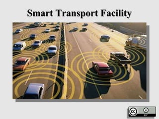
3. Smart Transportation
• City transportation is an important pillar
for quality of life of citizens in a city.
Currently, in most of the cities, public and
private road transportation are the key mode of
commuting and logistics. Some large and
mega cities have metro and local train
network as the backbone transportation
mode.
5. Smart Transportation
• Lack of quality and safe public transportation,
inadequate capacity of public transportation, road
safety concerns, overcrowded road network, poor
traffic management, parking issues, theft, poor road
conditions, lack of modal options (including pedestrian
walkways) remain the key issues in most of the cities.
Most cities also lack the integrated transportation plans
leading to huge demand-supply gap and poor
transportation network. For transport operators, huge
demand-supply gap, under recovery and poor asset
management remain the key issues.
7. Smart Transportation
• Transforming Public Transportation leveraging Smart
Technology Solutions
• Technology plays an important role by predicting demand
and supply data to feed into transportation planning.
Technology can also help in improving reliability of public
transportation network by providing visibility on
arrivals/departures/route information for travellers for hassle-
free journey. Multi modal fare integration can help citizens
to use multiple modal options without hassle of purchasing
different tickets. Intelligent traffic management can aid
efficient traffic flow.
8. Smart Transportation
• Geospatial-enabled efficient transportation
system: Geospatial-enabled services provide
periodic traffic forecast, journey planning
mobile applications based on real-time data,
etc..
9. Smart Transportation
• Dynamic carpooling/car sharing: Carpooling
applications link drivers and passengers in real-
time, thus enabling dynamic carpooling. Drivers
wishing to profit from their journeys can find people
situated on the same route via a smartphone app and
vice versa. Passengers can also directly debit his or
her fare to app, eliminating the need for any
money exchange. The costs of travel would
typically be capped.
11. Smart Transportation
• GPS-based tracking and route information of
public transport: Advanced vehicle tracking
solutions enhances operations and optimizes
public transportation and ridership. These
solutions offer real-time GPS tracking from mobile
devices thus increasing the reliability of public
transportation.
• Integrated transit hubs: Integrated transport hubs
seamlessly connect multiple modes of transportation
like bus system, metro system, etc..
13. Smart Transportation
• Public transport surveillance: As the public
transit population grows, it becomes increasingly
important to launch surveillance system on the
public transport, for e.g. buses, mass transit
railway, underground, and trains to secure public
transportation. The administrators can monitor the
public transport remotely and take action against any
accidents/incidents. The video footage can also be
used as legal evidence against damage or criminal
action on the public transport.
15. Smart Transportation
• Road user charging: Road user charges are direct charges
levied for the use of roads, including road tolls, distance or
time-based fees, congestion charges and charges designed to
discourage use of certain classes of vehicle, fuel sources or
more polluting vehicles. These charges help to reduce peak
hour travel and the associated traffic congestion or other
social and environmental negative externalities associated
with road travel such as air pollution, greenhouse gas
emissions, and visual intrusion, noise and road accidents. It
can be leveraged in certain busy areas or selected cities to
discourage private transport usage.
17. Smart Transportation
• Single fare card: Single fare card for fare payment
on the various participating public transportation
systems. The cards can be recharged by mobile
applications/internet/retail outlets. Potential extension
of the cards could also be for street parking.
• Smart parking: A smart parking leverages
parking sensors, cameras, smart parking solution,
etc.. to provide efficient management of on street
and off street parking spaces.
19. Smart Transportation
• Smart toll: Smart toll leverages technology
like number plate detection, RFID, etc.. to
charge toll fees to user account so that vehicles
do not have to wait at toll gates on local,
national and state highway.
• Smart traffic lights: Smart traffic lights
leverages technology to sense traffic
condition to tune traffic lights which enable
smooth flow of traffic.
22. Smart Transportation
• Freight ICT services: Freight ICT applications can
help save time and energy by improving the
efficiency of freight vehicle operations including
processes at entry and exit and making better use
of the freight network. ICT brings the potential for
virtually unlimited data collection, greatly enhanced
predictive capabilities, and real-time, dynamic
decision-making and implementation which lead
to a more efficient freight system based on
completely visible and accessible physical and
digital networks.
24. Smart Transportation
• Electric vehicles: Support electricity and
renewable energy operated cars with the
required infrastructure. Make a few cities as
pilot for "Plug-in" ready cities by facilitating
the expansion of a Public Electric Vehicle
(EV) infrastructure that ensures the safe,
reliable, and efficient integration of EV
charging loads with the power grid.
26. There are several existing modes
of sensing:
• static sensing, where sensors
are statically placed on the
road,
• mobile sensing, where sensors
are placed in the
moving vehicles
• hybrid sensing, where both in-
vehicle
and on-road infrastructure are
needed
Technologies In ITS
27. Static sensing: techniques
• Loops and magnetic sensors - Vehicle
detection and counting using magnetic
sensors or loops under the road surface, and
deployed systems
• Images and videos - Video surveillance
to monitor traffic states and detect incidents
and hotspots is fairly common gives a
comprehensive survey of the major
computer vision techniques used in traffic
applications.
• Acoustic sensors - Some recent research
is being done to use acoustic sensors for
traffic state estimation, especially in
developing regions, where traffic being
chaotic is noisy .
• RF sensors - Wireless radios placed
across the road have communication signals
affected by vehicular movement in between..
Technologies In ITS
28. Mobile sensing: techniques
• GPS on public transport or fleet
vehicles – Many public transport and
fleet companies have GPS installed in
their vehicles for real time tracking..
• GPS on Smartphone's - With the
recent proliferation of smart phones,
Smartphone GPS is being studied for
hotspot detection and travel time
estimation, after handling noise in
GPS readings
• Sensors on Smartphone's - Other
than GPS, smart phones also have
sensors that can provide interesting
information. solved the problem of
reorienting the accelerometer of a
Smartphone to match the car axes.
Technologies In ITS
29. Hybrid sensing: techniques There are a set of techniques that use both
static infrastructure and mobile sensors to gain traffic information.
(1) Teledensity - Cell phone operators can give approximate vehicle
densities in the neighborhood of a given cell tower, based on
subscribers seen at that tower. There are commercial systems and
research efforts are based on this.
(2) Bluetooth – it is a system where roadside Bluetooth detectors sense
Bluetooth radios in phones inside vehicles. Correlating the sensed
Bluetooth addresses among different detectors, gives travel times of
the vehicles between the detectors.
(3) RFID - Similar systems are being explored using RFID tags on
vehicles and RFID readers on roads
Technologies In ITS
31. • Indian traffic can benefit
from several possible ITS
applications. One set of
applications is for traffic
management.
• Intersection control
• Incident detection
• Vehicle classification
• Monitoring
• Revenue collection
• Historical traffic data
Applications OF ITS
33. • Another set of applications can
aid the commuters on roads.
• Congestion maps and travel
time estimates
• Public transport
• Information about arrival of
public transport
• Individual vehicle management
- Getting information
• Accident handling -
Emergency
Applications OF ITS
36. Real Time Traffic
Information Systems
• On–line information can be provided either
before or during the journey. The main
forms of information are:
37. Real Time Traffic
Information Systems
• (i) Public Information Services: in house, in office
or in hotel information is provided via radio and
television bulletins or via a terminal (either computer
or television screen) using radio, TV, telephone or the
Internet to provide the communications link.
Examples of information provided to the TV
screen are Teletext, cable TV and Prestel.
39. Real Time Traffic
Information Systems
• (ii) Pre–trip information in public places. This can
be provided:
• by the use of information kiosks, placed in
airports, rail stations, bus stations and other
interchange points and also in offices (to encourage
employees to travel on public transport), hotel foyers
and at strategic places on streets. They consist of a
computer with a touch screen interface linked to
information sources via telephone and, in future
41. Real Time Traffic
Information Systems
• by the use of Personal Digital Assistants – hand
held computers with on–line access to a variety of
travel information sources.
42. Real Time Traffic
Information Systems
• by traffic speed monitoring and display systems,
Large screen versions are increasingly being used
in motorway service stations, airports, hotels and
offices to give pre–trip or on–trip information. The
system employs a screen with a diagram of the
motorway networks, different sections of which can
be displayed at will. On–line information about
traffic conditions on the UK motorways, together
with a growing number of trunk and urban
strategic roads, is accessed via a network of speed
monitoring points.
44. Real Time Traffic
Information Systems
(iii) On–trip information
• Dynamic Information Systems
• Variable Message Signs (VMS) are employed by highway
operators in order to enable important information to be
disseminated to roads users during their journey. Types of VMS
are many and varied, using fairly basic electromechanical plates,
which rotate in order to alter the information presented to drivers,
through to fully–variable text message signs which can display
information about current road, weather or congestion conditions
ahead. Electromechanical Plate Signs are often employed in
place of a fixed direction or route information sign, e.g., for
describing the status of car parks or directing traffic to a
particular area of a city.
46. Real Time Traffic
Information Systems
Lane Control Signs
• Lane Control Signs, as the name implies, are used on
expressways and are situated above each running lane of
the carriageway. In their most primitive form, the sign
provides a limited number of displays which are used to advise
drivers that they should expect to change lane, leave the
expressway or reduce their speed. More advanced Lane
Control Signs are capable of displaying an enforceable
speed restriction and, by being linked to enforcement
cameras, are able to regulate the flow of traffic on
particular areas of carriageway. This enables a greater
number of vehicles to be carried on the network, reducing
congestion and preventing flow breakdown.
48. Real Time Traffic
Information Systems
City Information Systems
• This system, which has at its heart an Urban
Traffic Control system, takes information from a
number of sources and makes it available to all
categories of road user. Variable Message Signs are
used to provide information about the number of
car park spaces available in the city, traffic flow
and congestion on major routes into, out of and
around the city and real time passenger information at
bus terminals and bus stops.
49. Real Time Traffic
Information Systems
(iv) In–vehicle navigation systems
• These are of two main types (although a third could be defined as
combining the technologies from the two types):
• autonomous systems, which use digital maps and a direction finder
(GPS) within the vehicle to show where the vehicle is, on a small screen
map display within the driver’s range of vision; or
• dynamic systems, which comprise an in–vehicle direction finder,
computer system and small–screen display, connected via a form of
wire–less link (radio, digital telephone, microwave or infra–red have
all been used) to a central computer system. The driver keys in his
destination and is guided step–by–step to that location by means of voice–
over and directional arrows on the small screen, when approaching
junctions.
51. Real Time Traffic
Information Systems
(v) Use of existing flows of information
• There are several sources of travel information
which are not being used to their full potential –
which is, perhaps, the key issue under–pinning the
debate on the marketable value of information
referred to above.
• For example, the SCOOT (Split, Cycle and Offset
Optimization Technique) system for co–
coordinating the timings of traffic signals across a
network of junctions
52. Real Time Traffic
Information Systems
• Other sources of information include the ever–
increasing use of light aircraft and helicopter
surveillance of traffic on motorways and in cities;
discrete systems which are monitoring the
performance of fleets, such as buses and trucks;;
incident detection systems, using loops, image
processing or overhead detectors
54. Real Time Traffic
Information Systems
• These systems can assist travellers in a multiplicity of
ways:
• (i) They can relieve traffic congestion by suggesting the
alternative routes and by persuading travellers to move
their journey in time.
• (ii) In–car systems save time for drivers either by the
provision of route guidance which enables them to choose
the shortest route, or by providing traffic information so that
they can avoid hold–ups.
• (iii) Pre–trip information helps public transport passengers
to choose the fastest available or most convenient route. It
also encourages the use of combined modes of transport, and
helps transport operators to integrate their services.
56. Real Time Traffic
Information Systems
• (iv) Real time passenger information at bus stops increases the
users’ confidence in the service and improves comfort. The
Countdown system in London and the Stopwatch system in
Southampton are being trialled.
• (v) Variable Message Signs can also be used to provide parking
guidance so that an effective Park and Ride system can be set up,
from some miles outside a city. They can also be used to inform
drivers entering the city of the location of car parks and the number
of spaces available.
• (vi) In–vehicle information systems help freight drivers
undertaking Just–in–Time deliveries: on–line traffic information,
in particular, helps them to meet deadlines.
• (vii) All types of systems can be used to help the emergency
services improve their performance.
58. Implementation of Traffic Information
Systems
Key issues are:
(i) the collection of information from a variety of
sources involves co–operation between a number of
organizations who may not have operated in this way
before –
• e.g.. police, traffic managers, the motorway
organizations
(ii) the processing of information in a coherent and
consistent way in a standard form.
(iii) dissemination of information must be done as
quickly and efficiently as possible, via the means
described earlier.
59. Implementation of Traffic Information
Systems
(iv) monitoring – the information flow must be
monitored continuously to ensure a uniformly high
quality, and to avoid gaps in provision.
(v) institutional issues arise because of the
multiplicity of information sources, and the need for
a variety of public and private sector organizations
to co–operate, e.g. the police, motoring organizations,
private sector information collectors, passenger
transport operators, the Department of Transport and
local authority transport departments.
60. Implementation of Traffic Information
Systems
(vi) funding – the cost of setting up such systems will
need to be assessed against “value for money”
criteria plus normal local or central government
spending criteria. If the private sector is to become
involved, the business case must clearly identify sources
of capital, anticipated revenues, risk levels and the level
of public funding required.
• A special public/private sector association may
need to be set up in order to fund the “start up” of
such a multiple on–line information system in a
city, for example.
61. Traffic Information Management
• Traffic information system may be
defined as an information system
which involves the collection and
processing of current traffic data by
traffic control agencies for dissemination
of such information to the users.
62. Traffic Information Management
• Traffic congestion has always been a serious
problem for commuters in the metropolitan
areas around the world. It causes unpleasant
and unpredictable delay.
• With a good T I S in place the users
can react to congestion by taking an
alternative less congested route based on the
traffic information they receive.
64. T.I.S. helps to
• Monitor and manage traffic flow.
• Reduce congestion.
• Provide safety.
• Enhance mobility.
• Reduce energy consumption.
• Reduce pollution.
• Develop a multi-modal public transport enquiry
system to encourage the public to use public transport
services
65. ELEMENTS OF T.I.S.
• T I S consist of 3 key elements, namely
• Traffic information data collection
• Data Processing
• Information Dissemination
Data
Processing
Data
collection
Information
Dissemination
66. Information To Be Shared
• Transit Routes
• Transit Schedules
• Turning restrictions
• Speed Restrictions
• Direction Controls
• Lane Closures
• Road Diversions
• Delay time
• Travel time
• New Roads
• Accidents
• Incidents
• Traffic Conditions
• Operational
Statistics
• Trends
• Usage
• Congestion
69. • It involve a central authority to collect, process and
disseminate the data.
• Data of vehicle speed and traffic flow are calculated by
– Embedded censors.
• This data is sent to T.M.C. for processing and analyzing.
• The result of this analysis is disseminated via
– Radio broadcasts.
– Internet.
– Variable message signs.
– Direct to user on demand.
• Disadvantage
– Cost intensive.
– Limited coverage.
70. Decentralized system
• It is a zero public infrastructure vehicle based traffic
information system.
• A traffic situation analysis is performed in each individual
vehicle and the result is transferred via wireless data-link
to all surrounding vehicles in the local neighborhood.
71. Why decentralized T.I.?
The problems with Centralized T.I.S.
•A large number of sensors is needed to be deployed in order to
monitor the traffic situation.
•The traffic information service is limited to streets where
sensors are integrated.
•Traffic information is distributed with a relatively high delay
(typically in the range of 20-50 minutes).
•It is not suited for vehicle-to-vehicle emergency notifications.
•Cannot include specific details on the area close to the current
position of the driver.
•An extremely large investment for the communication infrastructure
(sensors, central unit, wired and wireless connections) is necessary.
72. Role of Geospatial Technologies in
Building Smart Cities
• Smart cities observe the state of their
environment and activities of citizens to
provide improved services. The move toward
smart cities promises to bring greater
automation, intelligent routing and
transportation, better monitoring, and
better city management.
73. Role of Geospatial Technologies in
Building Smart Cities
• The enabling trends that coincide with
smarter cities include the drive to open up
municipal data for more transparent
operations, the creation of sensor networks to
improve infrastructure monitoring and
performance, networked connectivity of the
Internet of Things, and bidirectional
communication with citizens regarding city
services.
75. Role of Geospatial Technologies in
Building Smart Cities
• In smart cities, everything will be measured in real
time and fine detail through the deployment of
sophisticated sensors. Technology will play a major
part in integrating mountains of real-time data so it
can be acted upon. It will improve applications that
range from managing environmental quality and
the built environment to land use and
transportation planning. The result: better
decisions, more efficiency, and improved
communication.
77. Role of Geospatial Technologies in
Building Smart Cities
• Smart cities are the future to sustainably
support population growth and urban
expansion. Location is a common dominator
in every aspect and geospatial technology is
central to providing a technology platform
that forms the backbone of the city.
78. Role of Geospatial Technologies in
Building Smart Cities
Geospatial Technology
• Geospatial technology (also known as geometrics)
is a multidisciplinary field that includes surveying,
photogrammetry, remote sensing, mapping,
geographic information systems (GIS), geodesy and
global navigation satellite system (GNSS)
80. Role of Geospatial Technologies in
Building Smart Cities
• According to the US Department of Labour, the
geospatial industry can be regarded as “an
information technology field of practice that
acquires, manages, interprets, integrates, displays,
analyses, or otherwise uses data focusing on the
geographic, temporal, and spatial context”
• Geospatial technology takes in data from sensors
dotted around the city and spatially references it
in a consistent manner; for example, by means of
latitude and longitude, a national coordinate grid or
postal codes, or some other system.
81. Role of Geospatial Technologies in
Building Smart Cities
• In recent decades, there has been significant
growth in this subject. Global positioning
system (GPS) -based determination of location
was an incredible innovation in the 1990s. And
GIS applications enabled greater awareness
and analytical capability using a feature-
based modelling of environments.
82. Role of Geospatial Technologies in
Building Smart Cities
• There are now various types of geospatial
technologies:
• Remote sensing: Imagery and data collected from
space or airborne camera and sensor platforms
• GIS: Suite of software tools to map and analyse
geo-referenced data; can be used to detect
geographic patterns in other data, such as disease
clusters resulting from toxins, suboptimal water
access, etc.
84. Role of Geospatial Technologies in
Building Smart Cities
• GPS: A network of satellites that can give
precise coordinate locations to civilian and
military users with proper receiving
equipment
• Internet mapping technologies: Software like
Google Earth and web features like
Microsoft Virtual Earth to view and share
geospatial data
85. Role of Geospatial Technologies in
Building Smart Cities
Citywide Applications
• For decades, cities have used geospatial technology to
improve services and operations. It can increase speed,
accuracy and cost-effectiveness related to a wide range of
government priorities, including those related to crime
prevention, emergency management, disaster recovery,
social services, health care, transportation, urban
planning, environmental initiatives, and facility planning
and management. For creating smart cities, a number of ICT
and geospatial technologies need to be applied at various
stages.
86. Role of Geospatial Technologies in
Building Smart Cities
• Cities are increasingly making their information
available as open geospatial services (maps) that
speak of the policies they have taken. All
transactions and changes are illustrated virtually,
resulting in informed and engaged citizens.
• Hong Kong, for instance, has used GIS and geospatial
analytics to create an online street map that shows
where historical sites, cycling tracks, and other public
facilities are located. Users can easily navigate
through the map with a cursor and click on a location
for detailed information.
87. Role of Geospatial Technologies in
Building Smart Cities
• Indeed, the smart city concept is synchronized
with advancements in geospatial technology that
are moving toward more real-time data inputs, 3D
visualization, and the ability to track change over
time. In San Francisco, the SFpark initiative collects
real-time information about available parking spaces
using sensors embedded in lots and ports the
information to a public Web site.
88. Role of Geospatial Technologies in
Building Smart Cities
• The system also adjusts prices
dynamically—charging less in areas with
many open parking spaces—in response to
shifts in demand. Among other advantages,
SFpark reduces traffic congestion by
decreasing the number of drivers circling
and double parking. The public, in turn,
benefits by having more certainty about
available spaces.
89. Role of Geospatial Technologies in
Building Smart Cities
• Evidently, governments and citizens can use
GIS technology and geospatial analyses to
improve service delivery.
90. Role of Geospatial Technologies in
Building Smart Cities
• In terms of the environment, geospatial
technologies can help us get a better handle
on the balance to improve efficiency and
help us respond and manage threats facing
cities. As urbanization accelerates, our cities
will become laboratories for balancing
climate change, poverty, energy and the
environment.
91. Role of Geospatial Technologies in
Building Smart Cities
• For instance, Boston has created a GIS map of
renewable-energy sources, such as solar and wind
systems, to guide investment decisions, track clean-
energy progress, and meet the mayor’s goal to reduce
greenhouse-gas emissions by 25 percent by 2020.
And New York City uses the Hazards US
(HAZUS) tool to identify at-risk geographic locations
and buildings and estimate potential flood damage; in
the event of a fire, the geospatial technology would
manage traffic lights so fire engines can reach the
blaze swiftly.
93. Role of Geospatial Technologies in
Building Smart Cities
• The potential for geospatial technologies in
infrastructure is tremendous with advances in
technologies like 3D modelling, LiDAR and other
terrestrial scanning, mobile mapping, surveying,
positioning services, remote sensing, high-
resolution satellite imagery and photogrammetry.
Geospatial standards are a vital component of the
building information modelling (BIM) picture.
96. Role of Geospatial Technologies in
Building Smart Cities
• BIM is much more than the assembled 2D or 3D
computer-aided design (CAD) and facilities management
(FM) drawings. The facility and its detailed information base
need to be linked to the land on which it is sited and made
available as an effective tool to owners and operators. A BIM
links to and makes use of geospatial information such as
property boundaries, zoning, soil data, elevation, jurisdictions,
aerial images, land cover and land use, etc.. And it includes
data of interest to buyers, owners, lenders, realtors, first
responders, repairers, occupants, safety inspectors,
lawyers, emergency planners, and people working on
neighboring facilities.
98. Role of Geospatial Technologies in
Building Smart Cities
In conclusion
• All considered, having one platform to manage the
entire urban landscape of a city means significant
cost savings, implementation consistency, quality and
manageability, which is the plus point of geospatial
technology.
99. Role of Geospatial Technologies in
Building Smart Cities
• In smart cities reliant on ICT-driven
solutions to address urban problems on one
hand and spatially enable citizens on the
other, urbanity merges with digital
information so that the built environment is
dynamically sensed and synchronously
actuated to perform more efficiently,
intelligently and sustainably.
100. Role of Geospatial Technologies in
Building Smart Cities
• Under such circumstances, the gamut of
geospatial technologies, in combination with
telecommunication networks that provide
access to real-time information, as well as for
place-based or context-aware social
networking, blur the distinction between
'here' and 'there', and 'present', 'past' and
'future'.