HUMAN SETTLEMENTS
•
349 likes•90,714 views

Origin of human settlements,determinants,evolution through the course of history,changing scenario in the context of globalization

Recommended
More Related Content
What's hot
What's hot (20)
Similar to HUMAN SETTLEMENTS
Similar to HUMAN SETTLEMENTS (20)
Recently uploaded
Recently uploaded (20)
HUMAN SETTLEMENTS
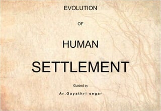
- 1. GAI3 GAI3 EVOLUTION OF HUMAN SETTLEMENT Guided by A r . G a y a t h r i s e g a r
- 3. GAI3 GAI3 CLASS I INTRODUCTION TO HUMAN SETTLEMENT SETTLEMENTHUMAN EVOLUTIO N
- 5. GAI3 GAI3 SAFETY & SECURITY TO PROTECT THEMSELVES FROM PREDATORS & ENEMIES TO PROTECT THEMSELVES FROM ADVERSE WEATHER CONDITIONS LIKE EXTREME TEMPERATURE ,STORMY WINDS AND RAIN TO SAFEGUARD THEIR FOOD SUPPLIES & DOMESTIC ANIMALS WHY HUMAN NEEDS A SHELTER? VJ
- 6. GAI3 GAI3 Settlement is a process of grouping of people and acquiring of some territory to build houses as well as for their economic support. It is defined as any form of human habitation which ranges from a single dwelling to a large city. Its a process of opening up and settling of a previously uninhabited area by the people. SETTLEMENT
- 7. GAI3 GAI3MAMMOTH BONE HUT - MOLDAVA PALEOLITHIC PEOPLE LIVE IN CAVES PALEOLITHIC AGE NOMADS AND HUNTERS SHELTER - CAVE,TREES MESOLITHIC AGE NOMADS AND HUNTERS SHELTER – TEMPORARY Huts were built using mammoth bone followed by houses of wood, straw & rock.
- 8. GAI3 GAI3 NEOLITHIC AGE FARMERS AND HERDERS SHELTER – PERMANENT - Neolithic houses were rectangular and made using tree trunks. -The roof was usually made from timber beams with a reed thatch covering. - The houses usually had a hearth which was used for cooking: unlike the earlier Mesolithic people, Neolithic people cooked food indoors
- 9. GAI3 GAI3 PRIMITIVE NON ORGANIZED HUMAN SETTLEMENT PRIMITIVE MAN (tree tops, branches , tree holes & caves) PALEOLITHIC - OLD STONE AGE NOMAD TEMPORARY SHELTER (ISOLATED DWELLING-HAMLET) ( Huts were built using mammoth bone ,wood , straw & rock) MESOLITHIC - MIDDLE STONE AGE FARMERS & HERDERS PERMANENT SHELTER (FORMATION OF VILLAGE) (The roof was usually made from timber beams with a reed thatch covering) NEOLITHIC - NEW STONE AGE CONFLICT BETWEEN MAN - WINNER BECAME THE KING NON AGRICULTURAL FORTIFIED SETTLEMENTS WERE BUILT WITH MOATS ALL AROUND (FORMATION OF TOWN) (people started migrating to this town centre for better wages & employment) BRONZE AGE DUE TO EXCESSIVE MIGRATION DEVELOPMENT CAME OUT OF FORTS TO ACCOMDATE MORE PEOPLE GIVING RISE TO A BIGGER SETTLEMENTS (FORMATION OF LARGER TOWNS & CITIES) IRON AGE PRIMITIVE ORGANIZED HUMAN SETTLEMENT STATIC URBAN SETTLEMENTS OR CITIES PHASE 1 PHASE2 PHASE 3 DIFFERENT PHASES OF HUMAN SETTLEMENT
- 10. GAI3 GAI3 DYNAPOLIS 30 MILES IN DIAMETER 17TH CENTURY ONWARDS METROPOLIS 100 SQKM IN DIAMETER MEGALOPOLIS 1000 SQKM IN DIAMETER ECUMENOPOLIS WHOLE EARTH WILL BE COVERED BY ONE HUMAN SETTLEMENT (population explosion will be the decisive factor) UPCOMING PHASE UNIVERSAL HUMAN SETTLEMENT DYNAMIC URBAN SETTLEMENTS PHASE 4 PHASE 5
- 11. GAI3 GAI3 CLASSIFICATION OF URBAN SETTLEMENT HUMAN SETTLEMENT RURAL SETTLEMENT URBAN SETTLEMENT ISOLATED DWELLING HAMLET VILLAGE TOWN CITY CONURBATION
- 12. GAI3 GAI3 SETTLEMENT HIERARCHY PATTERN 1 FAMILY 5 0R 6 UNITS OF FAMILIES UP TO SEVERAL 100 PEOPLE UP TO 10 TO 20 THOUSAND PEOPLE UP TO 100,000 PEOPLE UP TO HALF A MILLION PEOPLE ONE OR TWO MILLION PEOPLE SEVERAL MILLION PEOPLE PRIMATE
- 13. GAI3 GAI3 ADMINISTRATIVE New Delhi, Chandigarh, Bhubaneshwar, Gandhi Nagar INDUSTRIAL Jamshedpur, Bhilai, Salem, Coimbatore,Modinagar, Surat TRANSPORT Kandla, Kochi, Road and Rail Junctions like MughalSarai, COMMERCIAL TOWNS Kolkata, Mumbai, Saharanpur, Indore, Chennai, etc. MINING TOWNS Raniganj, Jharia, Dhanbad, Digboi, Ankaleswar CANTONMENT Meerut, Ambala, Jalandhar, Mhow, Pathankot, EDUCATIONAL Roorkee, Pilani, Manipal, Aligarh, Varanasi, etc. RELIGIOUS Puri, Mathura, Madurai, Tirupati, Katra, Amritsar, TOURIST Nainital, Mussorie, Shimla, Pachmarhi, DIFFERENT TYPES OF CITIES
- 14. GAI3 GAI3 EKISTICS ▪The term Ekistics was first coined by the renowned planner ▪DOXIADIS (1903-75) ▪ It is defined as the SCIENCE OF HUMAN SETTLEMENTS drawing on the research and experience of diverse disciplines ▪Including urban, regional, city and community planning and architecture as well as behavioral science including human psychology, anthropology, culture and politics.
- 15. GAI3 GAI3 15 EKISTICS UNITS – CA DOXIADIS MAN - 1 ROOM - 2 HOUSE - 5 HAMLET - 40 VILLAGE - 250 NEIGHBOURHOOD - 1500 SMALL POLIS – 10,000 POLIS / CITY – 75,000 SMALL METROPOLIS - 5,00,000 METROPOLIS – 4 MILLION MEGALOPOLIS – 150 MILLION SMALL EPERO POLIS- 750 MILLION EPEROPOLIS – 7500 MILLION ECUMENOPOLIS – 50,000 MILLION PEOPLE SMALL MEGALOPOLIS – 25 MILLION
- 16. GAI3 GAI3 The physical elements / components comprises of 1)SHELTER ( The superstructures of different shape, size, type and materials erected by mankind for security, privacy, and protection from the elements and for his singularity within a community ) 2) INFRASTRUCTURE ( The complex networks designed to deliver to or remove from the shelter people, goods, energy or information ) 3) SERVICES ( Cover those required by a community for the fulfillment of its functions as a social body, such as education, health, culture, welfare, recreation and nutrition ) “The fabric of human settlements consists of physical elements and services to which these elements provide the material support.
- 17. GAI3 GAI3 FIRST DIMENSION (RELATIVE TO SCALE) SECOND DIMENSION (MAN'S FIVE ENVIRONMENTAL ELEMENTS) EKISTICS FRAME WORK
- 18. GAI3 GAI3 LOWER END- THE INDIVIDUAL, THE ROOM, AND THE DWELLING INCREASE IN SIZE OTHER EXTREME END - THE CITY, THE URBAN CONTINENT, AND THE "WORLD-WIDE CITY“ WHICH HE CALLED AN ECUMENOPOLIS FIRST DIMENSION (RELATIVE TO SCALE)
- 19. GAI3 GAI3 SECOND DIMENSIONS - EKISTICS ELEMENTS (MAN'S FIVE ENVIRONMENTAL ELEMENTS) NATURE MAN/ANTHROPOS SOCIETYSHELL NETWORK
- 20. GAI3 GAI3 DETERMINANTS OF HUMAN SETTLEMENTS 1) ENVIRONMENTAL FACTOR WATER SUPPLY: Settlements are located near water bodies such as RIVERS, LAKES, AND SPRINGS Water supply is a main factor as it is used for DRINKING, COOKING, WASHING, IRRIGATION AND TRANSPORTATION PURPOSES TOPOGRAPHY: Topography refers to the SHAPE AND ELEVATION OF THE LAND. It includes features like mountains, hills, plains, valleys, and deserts. Farmers preferred to settle IN FLAT, OPEN AREAS SUCH AS PLAINS AND VALLEYS FOR CULTIVATION which has rich fertile soil MOUNTAINS WERE LESS FRIENDLY to human settlement. Steep mountains were hard to cross. Their jagged peaks, cold temperatures, and rocky land made farming difficult. DESERTS ALSO DISCOURAGED SETTLEMENT. They were hot and dry. They contained very little water for farming. VEGETATION: There are many kinds of vegetation, such as TREES, BUSHES, FLOWERS, GRASS, AND REEDS. plants were a source of FOOD and useful products out of plants, including BASKETS,
- 21. GAI3 GAI3 2) CULTURAL FACTOR These include aspects like CASTE, COMMUNITY, ETHNICITY AND RELIGION. In India it is commonly found that the MAIN LAND OWNING CASTE resides at the CENTRE of the village and the OTHER SERVICE PROVIDING CASTES ON THE PERIPHERY. This leads to SOCIAL SEGREGATION AND FRAGMENTATION of a settlement into several units 3) HISTORICAL OR DEFENCE FACTOR In the past and also today’s context mostly border areas were conquered or attacked frequently by outsiders. SECURITY concerns favored the EVOLUTION OF NUCLEATED SETTLEMENTS. building on high ground allowed people the chance TO LOOK OUT FOR ENEMIES Surrounding a settlement with water also helped with DEED DEFENCE 4) ACCESSIBILITY Need to COMMUNICATE with other areas of trade and travel Settlements are often located along TRANSPORT ROUTES AND COMMUNICATION LINES road and trail lines Settlement needs communication network
- 22. GAI3 GAI3 CLASSIFICATION OF RURAL SETTLEMENT 1 ) ON THE BASIS OF LOCATION PLAIN VILLAGES PLATEAU VILLAGES COASTAL VILLAGES FOREST VILLAGES DESERT VILLAGES 2 ) ON THE BASIS OF FUNCTION / OCCUPATION FARMING VILLAGES FISHERMEN’S VILLAGES LUMBERJACK VILLAGES PASTORAL VILLAGES 3 ) ON THE BASIS OF SHAPE OF SETTLEMENT NUCLEATED SETTLEMENT LINEAR PATTERN RECTANGULAR PATTERN SQUARE PATTERN CIRCULAR PATTERN STAR / RADIAL PATTERN DISPERSED SETTLEMENT SEMI COMPACT SETTLEMENT T-SHAPED PATTERN CHECKER BOARD PATTERN FAN SHAPED PATTERN ELONGATED PATTERN DOUBLE PATTERN CROSS-SHAPED ETC. Y SHAPED PATTERN CRUCIFORM PATTERN
- 23. GAI3 GAI3 KURINCHI NEITHAL PALAI MULLAI MARUTHAM SANGAM LITERATURE – FIVE LANDSCAPES
- 24. GAI3 GAI3 1 ) ON THE BASIS OF POPULATION SIZE MEGA CITIES ( MORE THAN 5 MILLION POPULATION) METROPOLITAN (ONE MILLION TO FIVE MILLION POPULATION) CITY (ONE LAKH TO ONE MILLION POPULATION) TOWN (LESS THAN ONE LAKH POPULATION) 2 ) ON THE BASIS OF FUNCTION ADMINISTRATIVE New Delhi, Chandigarh, Bhubaneshwar, Gandhi Nagar INDUSTRIAL Jamshedpur, Bhilai, Salem, Coimbatore,Modinagar, Surat, TRANSPORT Kandla, Kochi, Road and Rail Junctions like MughalSarai, COMMERCIAL TOWNS Kolkata, Mumbai, Saharanpur, Indore, Chennai, etc. MINING TOWNS Raniganj, Jharia, Dhanbad, Digboi, Ankaleswar CANTONMENT Meerut, Ambala, Jalandhar, Mhow, Pathankot, EDUCATIONAL Roorkee, Pilani, Manipal, Aligarh, Varanasi, etc. RELIGIOUS Puri, Mathura, Madurai, Tirupati, Katra, Amritsar, CLASSIFICATION OF URBAN SETTLEMENT Class Population Class I (city) 1,00,000 and above Class II (town) 50,000 – 99,999 Class III 20,000 – 49,999 Class IV 10,000 – 19,999 Class V 5,000 – 9,999 Class VI less than 5,000
- 26. GAI3 GAI3
- 27. GAI3 GAI3
- 28. GAI3 GAI3
- 29. GAI3 GAI3
- 30. GAI3 GAI3
- 31. GAI3 GAI3 ANCIENT TOWN PLANNING PRINCIPLES IN INDIA DANDAKA NANDYAVARTA SARVATOBHADRA SWASTIKA PRASTARA PADMAKA KARMUKHA CHATURMUKHA ACCORDING TO SHAPE AND PURPOSE ANCIENT TOWNS EIGHT TYPES MANASARA VASTU SASTRA
- 32. GAI3 GAI3 CHANAKYAS ARTHA SASTRA - HIERARCHY OF SETTLEMENT & CASTE SYSTEM PRIEST AND MINISTERS DEPRESSED CLASS CEMETRY FOREST FOOD AND GOODS TRADERS SKILLED WORKERS KSHATRIYA S TREASURY GOLDSMIT H INDUSTRIES DOCTORS ARTISTS PALAC E AND TEMPL E N WALL AROUND THE TOWN, ‐ 6 dandas (10.8m) high and 12 dandas (21.6m) wide. beyond this wall there should BE THREE MOATS OF 14‘, 12’AND 10’ WIDE to be constructed four arm‐lengths apart. depth – 3/4th of width. city located near A PERENNIAL WATER BODY east west and three north – south roads, should divide the town the MAIN ROADS should be 8 DANDAS(14.4M) wide and OTHER ROADS 4 DANDAS(7.2M) WIDE. 1 well for 10 houses. shape might be circular, rectangular or square as would suit the topography.
- 33. GAI3 GAI3 JAIPUR CITY PLANNING CONCEPTS Jaipur was founded in 1726 by Jai Singh II, the Raja of Amer capital SHIFTS from AMER, 11 KM (7 MILES) FROM JAIPUR to accommodate the GROWING POPULATION AND INCREASING SCARCITY OF WATER VIDYADHAR BHATTACHARYA CHIEF ARCHITECT OF Jaipur City was planned based on the principles of VASTU SHASTRAAND SHILPA SHASTRA The city was divided into nine blocks State buildings and palaces were occupied in two blocks Remaining seven blocks allotted to the public. 1 2 3 4 5 6 7 8 9
- 34. GAI3 GAI3 The main streets of the city were 111FT. WIDE Secondary streets 55 FT WIDE The smaller ones 27FT. WIDE. CHAUPAR – It’s a square that occurs at THE INTERSECTION OF EAST WEST ROADS WITH THRE NORTH SOUTH ROADS. Each chaupar is around 100M X 100M The distance between two chaupars is about 700M which is ideal for PEDESTRIAN MOVEMENT. Used for PUBLIC GATHERING ON FESTIVE OCCASIONS. INHABITABLE DUE TO DEEP SLOPE PALACE PRECINT WESTERN GATE CHAND POL (MOON GATE) EASTERN GATE SURAJ POL (SUN GATE) CHAUPAR NORTHERN GATE (AMER GATE ) SETTLEMENT
- 35. GAI3 GAI3 UNIT II HISTORICAL PERIODS AND ITS SETTLEMENT PATTERN
- 36. GAI3 GAI3
- 37. GAI3 GAI3 DIFFERENT PERIODS IN WORLD HISTORY
- 38. GAI3 GAI3 TIME LINE OF CIVILIZATION RIVER BASED CIVILIZATION 3700 BCE 3150 BCE 2900 BCE 1850 BCE
- 40. GAI3 GAI3 MESOPOTAMIA CIVILIZATION – UR CITY FAMOUS FOR ZIGGURAT OLDEST SETTLEMENT OF THE WORLD UR was an important SUMERIAN CITY-STATE in ancient Mesopotamia IRAQ It was a FERTILE LAND RICH, ALLUVIAL SOIL laid down by the TWIN RIVERS, THE TIGRIS AND EUPHRATES and was ENORMOUSLY PRODUCTIVE The RIVER CHANGED ITS COURSE, settlement came to an END In order to HARNESS THE POWER OF THE FLOOD, an elaborate system of CANALS, DAMS AND FLOODGATES was developed. GOVERNMENT OFFICIALS, PRIESTS & SOLDIERS MERCHANTS, TEACHERS LABOURERS, FARMERS & CRAFT-MAKERS SLAVES (CAPTURED FROM BATTLE) SUPREME POWER TOP LEVEL PEOPLE MIDDLE LEVEL PEOPLE BOTTOM LEVEL PEOPLE SOCIAL STRUCTURE
- 41. GAI3 GAI3 GREAT ZIGGURAT UR CITY ,IRAQ Sumerians place their important TEMPLES on PLATFORMS OR, IN THE CASE OF ZIGGURATS, on a stepped series of platforms. They are built out of a core of MUD-BRICK with an outer skin of fired bricks, set in BITUMEN MORTAR, to protect it AGAINST FLOOD DAMAGE
- 42. GAI3 GAI3 Good irrigation system gave ABUNDANT CROPS, not everybody needed to work on farms. The CHISEL WORKERS made sculptures, THE GEM CUTTERS made gems, and THE FULLER stomped on woven wools to make them soft. The METAL WORKERS made weapons. RESIDENTIAL AREA FORTIFICATIO N GATE COURT OF NANNA ZIGGURA T GIPARU SACRED PRECINT CITY WALL RESIDENTIAL AREA EUPHRATES RIVER CANA L WEST HARBOU R NORTH HARBOUR E.DUBLALMAH PLACE OF JUDGEMENT UR SETTLEMENT LAYOUT
- 43. GAI3 GAI3 VARIOUS ACTIVITIES INSIDE RESIDENTIAL AREA OF UR SETTLEMENT SHRINE SCHOOL HOUSE SHOPS THE KHAN COOK HOUSE
- 44. GAI3 GAI3 BAKER SQUARE ENTRANCE PASSAGE COURTYARD WITH TWO FURNACE LARGE COURTYARD FURNACE SHOPS & BUSINESS RELATIVELY LONG AND NARROW SHOPS WORKSHOPS AND STORE ROOM LOW WINDOWS ACTS LIKE A COUNTER THE KAHN 3 SEPARATE ENTRANCE 19 GROUND FLOOR ROOMS MAY BE HOTEL THREE STOREY HIGH THE COOK HOUSE HOUSE CONVERTED INTO FAST FOOD RESTAURANT BREAD OVEN INDOOR SEATING IN OLD DOMESTIC CHAPEL FOOD PREPARATION CAN BE VIEWED BY PASSERS THROUGH LOW WINDOW PLANNING CONCEPTS IN UR CITY
- 45. GAI3 GAI3 Each house had a DOMESTIC CHAPEL where cult structures and the FAMILY BURIAL-VAULT was kept. KITCHENS, STAIRWAYS, WORKROOMS, LAVATORIES were all part of the household structures. The houses were packed in very tightly, with EXTERIOR WALLS of one household immediately ABUTTING THE NEXT ONE THE INTERIOR COURTYARDS and wide STREETS PROVIDED LIGHT CLOSE-SET HOUSES protects the EXTERIOR WALLS IN HEATING especially during the hot summers. TYPICAL LAYOUT OF PRIVATE HOUSES IN UR CITY Four main residential areas of the city included HOMES WITH BAKED MUD BRICK FOUNDATIONS arranged along long, narrow, winding streets and alley ways. Typical houses included an OPEN CENTRAL COURTYARD with two or more main living rooms in which the families resided. The use of BITUMEN AS A MORTAR, particularly in the construction of large structures such as city walls, also provided an effective PROTECTION AGAINST DAMP PRIVATE HOUSES PLANNING CONCEPTS IN UR CITY
- 46. GAI3 GAI3 REMAINS OF UR CITY ,IRAQ 2017
- 48. GAI3 GAI3
- 49. GAI3 GAI3 INDUS VALLEY CIVILIZATION INTRODUCTION: Time period 3300 -1300 B.C Indus valley civilization is bordered around India, Pakistan and Afghanistan Flourished along River Indus Bronze age civilization Inhabitants developed new techniques in handicraft and metallurgy City is famous for URBAN PLANNING Innovative use of baked bricks Elaborate drainage & water supply system Trade and transport were the main occupation Pioneers of cotton cultivation They have good knowledge with measurement like length , mass and time Mohenjodaro people have fine knowledge about personal hygiene with fine bath facilities Main streets and roads were set in a line varying from 4m to 10m with fire burnt bricks Roads are suitable for wheeled traffic Lanes are joined with streets and designed with lamp post City follow the grid pattern Main streets divide the city at right angles dividing the city onto squares
- 51. GAI3 GAI3 City was divided into two parts higher city and lower city Higher city(Acropolis)was safeguarded by walls which look like a fort usually occupied by rulers Acropolis comprises of assembly halls, religious structure, granaries and great bath Lower part of the city was occupied by former and common people spread over a square mile Rich ruling class people dwell in the multi roomed house while poor live in small tenements Public buildings and big houses are situated in the broad roadsEncroachments on roads and lanes are strictly not permitted Bathrooms were attached to rooms Each house is equipped with well, attached toilets and cover drain which in turn connects to main drain line Houses are made out of burnt bricks and gypsum and even double storied Rooms are designed around courtyard Each house has well connected sink and it is further linked with underground sink
- 52. GAI3 GAI3 INDUS VALLEY CIVILIZATION- CITADEL OF MOHENJODARO
- 53. GAI3 GAI3 INDUS VALLEY CIVILIZATION- CITADEL OF MOHENJODARO A planned city based on a street grid of rectilinear buildings Spread around 300 hectare City divided into citadel and lower city Citadel – mound of mud bricks of 12m height encloses great bath, granary residential area for 5000 citizens and two large assembly halls City has central market place and a public well Large granary building in massive wooden super structure with air ducts to dry the grain Colonnaded courtyard steps leads to a built brick pool water proofed by bitumen water proofing Pool of size 12x7x2.4m Granary of size is 150’x75’x15’ Granary indicates high level of a agricultural civilization Flood by Indus is thought to be the cause of destruction
- 54. GAI3 GAI3 DHOLAVIRA SETTLEMENT BAILLE Y CASTLE NORTH GATE LOWER TOWN MIDDLE TOWN RESERVOI R CEREMONIAL GROUND
- 56. GAI3 GAI3
- 57. GAI3 GAI3
- 58. GAI3 GAI3 GREEK CIVILIZATION Greek civilization developed in the mainland, that extends into the Mediterranean Sea. Greek mainland was rocky and barren and therefore bad for agriculture Greeks lived along the coastal islands where the soil was also good for farming . The Aegean and Mediterranean Seas enhanced the communication and trade with other places. PLANNING CONCEPTS OF GREEK TOWNS Old cities such as Athens had IRREGULAR STREET PLANS reflecting their gradual organic development. New cities, especially colonial cities established during the Hellenistic period, had a GRID-IRON STREET PLAN Usually City is divided in to ACROPOLIS, AGORA & TOWN The period of ancient Greek history can be divided into four as follows: •1100 B. C. –750 B. C Greek Dark Ages •750 B. C. –490 B. C. Archaic Period •5000 B. C. –323 B. C. Classical Period •323 B. C. –147 B. C. Hellenistic Period
- 59. GAI3 GAI3 SETTLEMENT PATTERN - ATHENS CITY- HELLINIC PERIOD
- 60. GAI3 GAI3 Its an ancient citadel located on an extremely rocky outcrop above the city of Athens It has the remains of several ancient buildings of great architectural and historic significance The most famous being the Parthenon. The acropolis combined Doric orders and Ionic orders ACROPOLIS ATHENS
- 63. GAI3 GAI3 AGORA - ATHENS Located to the northwest of the Acropolis Most important gathering place in a Greek city. Open area where the council of the city met to take decisions. It emerged as the heart of Greek intellectual life and discourse. A place for combined social, commercial and political activities. Usually located on a flat ground for ease of communication It is also located close to the Acropolis.
- 64. GAI3 GAI3 TOWN - ATHENS The town was where the people lived. This was the domain of women, who did not have any public role. Early Greek towns had an irregular street pattern, resulting from its organic growth. Later Hellenistic towns were made up of formal rectilinear pattern. The town was made up of only residential houses
- 65. GAI3 GAI3 SETTLEMENT PATTERN - MESSENE CITY - HELLENISTIC PERIOD Under the Hellenistic period they created urban centers (new cities), Urban centres followed a Hippodamian structure. The Hippodamian system was an urban planning concept that follows orthogonal grid system, This plan was pre-determined, strictly geometric in nature, and based on the virtues of the democratic constitution. Hippodamian system resulted in the creation of public space of human scale In the Hellenistic era, city were fulley walled The location of Ancient Messene is not random Surrounded by the mountains of Ithome and Eva, both acting as natural fortifications for the city, new city was geographically located in the centre of the new state of Messenia there was a dominant water feature within the city's walls (the Klepsydra spring), feeding the
- 66. GAI3 GAI3
- 68. GAI3 GAI3
- 69. GAI3 GAI3
- 70. GAI3 GAI3 The romans were NOT SEAFARING PEOPLE AND COLONISTS like the Greeks. The ancient capital Rome founded near RIVER TIBER was protected by SEVEN SURROUNDING HILLS. They did not depend on mere colonization but THEY CONQUERED FIRST BY WAR AND THEN RULED BY LAW. The STREETS which divided these blocks were 15 TO 16 FT. WIDE The two main streets, connect the PRINCIPAL GATES, All the streets had WELL-BUILT SEWERS BENEATH THEM The ancient Romans also employed REGULAR ORTHOGONAL STRUCTURES inspired by Greek and Hellenic examples The basic plan consisted of a CENTRAL FORUM WITH CITY SERVICES, surrounded by a COMPACT, RECTILINEAR GRID OF STREETS. A RIVER sometimes flowed near or through the city, PROVIDING WATER, TRANSPORT, AND SEWAGE DISPOSAL. They would lay out the STREETS AT RIGHT ANGLES, IN THE FORM OF A SQUARE GRID. ALL ROADS WERE EQUAL IN WIDTH AND LENGTH, EXCEPT FOR TWO, which were slightly wider than the others. PLANNING PRINCIPLES OF ROME CIVILIZATION
- 71. GAI3 GAI3 TYPICAL HOUSE ARRANGEMENT IN STREET One of these ran east–west, the other, north–south, and intersected in the middle to form the centre of the grid. All roads were made of carefully fitted flag stones and filled in with smaller, hard-packed rocks and pebbles. Bridges were constructed where needed. Each SQUARE marked BY FOUR ROADS WAS CALLED AN INSULA the Roman equivalent of a modern city block EACH INSULA WAS ABOUT 80 YARDS (73 M) SQUARE. Areas OUTSIDE CITY LIMITS were left open as FARMLAND. A portcullis covered the opening when the city was under siege, and additional watchtowers were constructed along the city walls. An AQUEDUCT was BUILT OUTSIDE THE CITY WALLS.
- 72. GAI3 GAI3 ROME CIVILZATION - TIMGAD TIMGAD ALGERIA ROMAN MILITARY TOWN It’s a Roman military colony Timgad adopts the guidelines of Roman town- planning governed by a remarkable grid system. The streets were paved with large rectangular limestone slabs
- 74. GAI3 GAI3 MEDIVAL CITY Medieval period lasted roughly from A.D. 1000 to 1500 Most cities of present-day Europe were founded during this period Revival of local and long-distance trade Trading networks required protected markets and supply centers, functions that renewed life in cities Long-distance trading led to the development of a new class of people — the merchant class MEDIEVAL TOWN - HIRSCH HORN IS NECKAR, GERMANY This town reveals three important features of urban morphology: castle, wall, and cathedral.3 castle caps the summit of a fortified spur in the bend of the Neckar River, affording a clear view of the river and forested valley. THE FORTRESS Usually cities were clustered around a fortified place Reflected in place names — German -burg, French -Bourg, English -burgh all meaning a fortified castle The terms burgher and bourgeoisie, originally referred to a citizen of the medieval city
- 75. GAI3 GAI3 THE CHARTER Governmental decree from a regional power granting political autonomy to the town Freed the population from feudal restrictions Made the city responsible for its own defense and government Allowed cities to coin their own money These freedoms contributed to development of urban social, economic, and intellectual life. THE MARKETPLACE Symbolized role of economic activities in the city City depended on the countryside for food and produce was traded in the market Center for long-distance trade linking city to city THE WALL Symbol of the sharp distinction between country and city Within the wall most inhabitants were free; outside most were serfs People inside were able to move about with little restriction Goods entering the gates were inspected and taxed Nonresidents were issued permits for entry, but often required to leave by sundown when the gates were shut Suburbs called faubourgs sprang up, and in time demanded to be included into the city If the suburbs were allowed to be part of the city, the wall was extended to include them At one end stood the fairly tall town hail Meeting space for city’s political leaders Market hail for storage and display of finer goods.
- 76. GAI3 GAI3 PROBLEMS CREATED FOR CONTEMPORARY URBAN LIFE BY MEDIEVAL CITY MORPHOLOGY AND LANDSCAPE Streets were narrow, wandering lanes, rarely more than 15 feet wide Today, in 141 German cities, 77 percent of streets are too narrow for two- way traffic THE RENAISSANCE AND BAROQUE PERIODS Form and function of the city changed significantly during the Renaissance (1500 — 1600) and baroque (1600-1800) periods Rising middle class slowly gave up their freedoms in pursuit of economic gain City size grew rapidly because bureaucracies of regional power structures came to dominate them Trade patterns expanded with the beginning of European imperial conquest City planning and military technology acted to remold and constrain the physical form of the city BAROQUE PLANNING: PARIS, FRANCE During the 1800s, Napoleon III carried out a building plan in Paris. Cobblestone streets carefully paved to prevent loose ammunition for rioting Parisians Streets were straightened and widened, and cul-de-sacs broken down to give army space to Maneuver Thousands were displaced as apartment buildings were demolished Many ended up in congested working-class sections of east and north Paris The east and north sections are still crowded today
- 78. GAI3 GAI3
- 79. GAI3 GAI3
- 80. GAI3 GAI3
- 81. GAI3 GAI3TREES SOLUTION EVILS OF INDUSTRIES Break down of traditional communities ,handicrafts and art forms Formation of slums ,inadequate housing no proper ventilation , drainage congestion Health disorders Depletion of natural resources Pollution of five elements Emission of co2 capitalism child labor unemployment
- 82. GAI3 GAI3 INDUSTRIALAGE Around 18th century began on Britain It replaced the hand tools with power driven machines Invention of steam engines and power looms Out break of many large scale industries Faster transportation Drastic growth in the textile industry because of the invention of power looms Mass production and low cost More number of institutions were built to provide education Middle and upper class enjoyed all benefits MIDDLE CLASS WORKING CLASS SOCIAL STRUCTURE UPPER CLASS Land lords, merchants, Industrialist Bosiness men Professionals, lawyers, doctors, Workers
- 83. GAI3 GAI3 MIDDLE AND UPPER CLASS : Middle and upper class enjoyed all benefits Better housing and food Fewer diseases and long living They faced minimal difficulty during industrial revolution LOWER CLASS : Long working hours & Low wages Children and female worked for minimal wages Over crowding and congestion Poor sanitation Breakout of contagious diseases Settlement started near factories Hig h amount of Carbon di oxide emission Diminishing of natural resources Affected by the Use of pesticides and hazardous chemicals At the end of 19th century governments assumed more responsibility for improvement of the cities in Europe. Germany encouraged co operative housing. British law empowered state and local authorities to build houseS for rent to the working class In 1871 in USA, Boson Co operative Co started a scheme of rental housing for workers with big plots, large rooms& less Plot coverage City planning was initiated in North America by using zoning Regulations – building to be allowed, height limits & prohibited land uses As cities started getting congested, people moved to suburbs for better opportunities & clean
- 85. GAI3 GAI3 Tony Garnier (1869- 1948) was the son of Pierre Garnier the architect of the famous Paris Opera house that Formed one of the focus points of the 19th century transformation of Paris. the design of cities as a whole should be approached rational and that industry had to be separated from living quarters. On the other hand he showed great sensibility to the symbolic meaning of buildings and the quality of urban space, He also considered the city to be a 'rhizome' where citizens could circulate freely, whereas the modernists advocated strict hierarchical road networks and separation of types of traffic. In hind sight Garnier was a 'stand alone' case in urban designThe grid patterns are not 'stamped' all over the city. The design of the civic centre is based on a disposition of buildings around a central axle. This shows elements of classic design. On the other hand all buildings are free standing and the open spaces are enormous. In the whole of the plan there are few squares, let alone enclosed squares. The living quarters show an innovative new type of building block with free standing houses and 'urban villas' on an 'island' between streets. This type of building block had been taken up in recent urban design in the Netherlands. The result is that there are no enclosed streets. Trees form very much part of the design Indicating the more important streets and losely planted within the blocks. He designed lots of public space in living quarters, indicating that he cared everyday living conditions.
- 87. GAI3 GAI3 EBENEZER HOWARD sociologist, English founder of the garden city movement FAMOUS BOOKS To-Morrow: A Peaceful Path to Real Reform, Garden cities tomorrow He explained the garden city concept through “Three magnets theory” - TOWN (high population density & traffic congestion – disadvantage) - COUNTRY (fresh air, close to nature & low land value) - TOWN & COUNTRY (attractive feature of both town, country) He offered a vision of towns free of slums and enjoying the benefits of both town (such as opportunity, amusement and good wages) and country (such as beauty, fresh air and low rents) Howard was heavily influenced by the utopian visions of Edward Bellamy and his publication “Looking Backward”(1888) He studied the industrial evils in Britain and gave the concept “Garden city movement” Garden Cities were created to avoid the downfalls of industrial cities of the time such as urban poverty, overcrowding, low wages, dirty alleys with no drainage, poorly ventilated houses, toxic substances, dust, carbon gases, infectious disease and lack of interaction with nature First proposed garden cities were Letchworth and Welwyn in 1903 and 1920 respectively.
- 88. GAI3 GAI3 central park and shopping street are surrounded by dwellings in all directions at a density of 12families per acre The streets for houses are formed by a series of concentric ringed tree lined avenues Distance between each ring vary between 3-5km 420 feet wide , 3 mile long, Grand avenue which run in the center of concentric rings , houses the schools and churches and acts as a continuous public park. outer circle of factories and industries whole is surrounded by a permanent green belt of 5000 acres Town area is about of 1000 acres Garden city was designed for healthy living and industry land will remain in a single ownership of the community or held in trust for the community Circular city growing in a radial pattern. Divided into six equal wards, by six main Boulevards that radiated from the central park/garden a large central park containing public buildings (Town Hall, Library, Hospital, Theatre, Museum etc. ) are placed around the central garden. central park surrounded by a shopping street with indoor shops and winter gardens. “GARDEN CITY” layout
- 89. GAI3 GAI3 CENTRAL PARK CONTAINING PUBLIC BUILDINGS PUBLIC BUILDINGS LIBRARY,THEATRE MUSEUM,HOSPITAL ,CONCERT HALL SHOPPING STREET DWELLINGS FACTORIES AND INDUSTRIES 5000 ACRES OF GREEN BELT RADIATING BOULEYARDS “GARDEN CITY” layout
- 90. GAI3 GAI3 FRAMED NEW CONCEPTS PATRICK GEDDES Scottish biologist, sociologist, geographer, philanthropist and pioneering town planner FAMOUS WORKS Ramsay Garden and the Outlook Tower, both in Castle hill FAMOUS BOOKS - Cities in evolution He introduced the concept of "region" to and coined the term "conurbation“ He was the originator of the idea and technique of regional survey and city survey He viewed the family as the central "biological unit of human society“ According to geddes, healthy homes providing the necessary conditions for mental and moral development resulting with beautiful and healthy children who are able to fully participate in life He explained that house is an inseparable part of the neighborhood, the city and the surrounding open country and the region He describes the relationship between people and cities and how they affect one another He also emphasized that people do not merely needed shelter, but also food and work, the recreation and social life KEY UNITS OF SOCIETY (PLACE, WORK, FAMILY) HERBERT SPENCERFREDERIC LE PLAY PATRICK GEDDES INFLUENCED BY CONCEPT OF BIOLOGICAL EVOLUTION GEDESSIAN TRIAD CONSTELLATION THEORY CONURBATION GEDDES VALLEY SECTION - REGION
- 91. GAI3 GAI3 FOLK (Organism) Social aspect WORK (Function) Economical aspect PLACE (Environment) Physical aspect (GEDDESIAN TRIAD) The town planning primarily meant ESTABLISHING ORGANIC RELATIONSHIP AMONG PLACE WORK AND ‘FOLK , which corresponds to triad (GEDDESIAN TRIAD) of organism, function and environment. He explains an organism's relationship to its environment as follows “THE ENVIRONMENT ACTS, THROUGH FUNCTION, UPON THE ORGANISM AND CONVERSELY THE ORGANISM ACTS, THROUGH FUNCTION, UPON THE ENVIRONMENT.“ (CITIES IN EVOLUTION, 1915) In human terms this can be understood as a place acting through climatic and geographic processes upon people and thus shaping them. At the same time people act, through economic processes such as farming and construction, on a place and thus shape it. Thus both place and folk are linked and through work are in constant transition.
- 92. GAI3 GAI3 GEDDES VALLEY SECTION – “REGION” Geddes said that "it takes a whole region to make the city” The valley section is a complex model, which combines physical condition- geology and geomorphology and their biological associations - with so-called natural or basic occupations such as miner, hunter, shepherd or fisher, and with the human settlements that arise from them The valley section illustrated the application of Geddes's trilogy of 'folk/work/place' to analysis of the MINE FOREST REARING FIELD FARM & FIELD WATER BODIES MINING CUTTING AND HUNTING GOAT AND COW REARING FARMING & GARDENING FISHING MINER WOOD LOGER & HUNTING SHEPARD FARMER & GARDENER FISHERMAN PLACE WORK FOLK
- 93. GAI3 GAI3 CONSTELLATION THEORY Four or more cities, which are not economically, politically, socially equal come together in developing a whole region” prominent cities in Maharashtra are connected forming ‘CONSTELLATION’ shape. theory is most prominently used because planning cities in a particular shape pattern is not possible in Today’s times. STARS CONSTELLATION - A group of stars linked together to form a recognizable pattern MUMBAI- Economic and Capital city NASIK- Religious city AURANGABAD- Administrative city NAGPUR- Political city PUNE-Educational importance city MUMBAI- Economic and Capital city NASIK- Religious city AURANGABAD- Administrative city NAGPUR- Political city PUNE-Educational importance city Above five cities need to be developed for the development of the region The distance between the cities ranges mostly in 100km-300km making transportation, connectivity, inter- dependency prosper within the state. State has gained prime importance and formed in early 60’s, contributing 15% to country’s industrial output and 13.3% GDP.
- 94. GAI3 GAI3 CONURBATION THEORY He was the first person to coin the term “conurbation” He describe that conurbation is actually a waves of population inflow to large cities, followed by overcrowding and slum formation resulting in the merging of several cities A conurbation is a region comprising a number of cities, large towns, and other urban areas that, through population growth and physical expansion, have merged to form one continuous urban and industrially developed area The term is used in North America, a metropolitan area can be defined by the Census Bureau or it may consist of a central city and its suburbs, while a conurbation consists of adjacent metropolitan areas that are connected with one another by urbanization. LONDON
- 95. GAI3 GAI3 THE OUTLOOK TOWER INTERPRETER’S HOUSE (INDEX MUSEUM - SOCIOLOGICAL LAB) It REPRESENTS THE ESSENCE OF GEDDES’S THOUGHT - his holism, visual thinking, and commitment to UNDERSTANDING THE CITY IN THE REGION He said of it: ‘OUR GREATEST NEED TODAY IS TO CONCEIVE LIFE AS A WHOLE, to see its many sides in their proper relations, but we must have a PRACTICAL AS WELL AS A PHILOSOPHIC INTEREST in such an integrated view of life Hence the first contribution of this TOWER TOWARDS UNDERSTANDING LIFE IS PURELY VISUAL, one can also grasp what a natural region actually is and how a GREAT CITY IS LINKED TO SUCH A REGION Now the tower is home to the PATRICK GEDDES CENTRE FOR PLANNING STUDIES, where an archive and exhibition ROOF of the Outlook Tower OFFERS SPECTACULAR VIEWS across the Firth of Forth and the surrounding city region The tower was conceived as a TOOL FOR REGIONALANALYSIS, index-museum and the ‘WORLD’S FIRST SOCIOLOGICAL LABORATORY’
- 96. GAI3 GAI3 LEWIS MUMFORD American historian, sociologist, philosopher of technology, and literary critic. FAMOUS WORKS The City in History Technics and Civilization The Myth of the Machine in the name of sanity, he has constantly worked to rescue and extend the qualities of urban life that will preserve and stimulate the human spirit of western civilization” He explains that the structure of modern cities is partially responsible for many social problems. Urban planning should emphasize an organic relationship between people and their living spaces. “Cities have some of the human attributes of personality. That they show character, moods, visible gestures of welcoming or rejecting is something that men have know almost since they began to live in cities.” Robert Moses had a comprehensive plan for NY and unprecedented power to carry it out; Lewis Mumford was one of those critics most responsible for preventing him from driving that plan to completion. Mumford called Moses the unbuilder. Displacing neighborhoods and communities. In 1958 Moses threatened to build a four-lane highway through Washington Square and Mumford opposed him. Koch said Mumford was a deciding factor. Mumford’s Critique of the World Trade Center, 1970:“characteristic example of the purposeless giantism and technological exhibitionism that are now eviscerating the living tissue of every great city” Port Authority executives “their duty to funnel more motor traffic into the city, through new bridges and tunnels, than its streets and its parking spaces can handle..”
- 97. GAI3 GAI3 He even criticizes the prevailing culture: And as the machine itself became, as it were, more active and human, reproducing the organic properties of eye and ear, the human beings who employed the machine as a mode of escape have tended to become more passive and mechanical. Unsure of their own voices, unable to hold a tune, they carry a phonograph or a radio set with them even on a picnic: afraid to be alone with their own thoughts, afraid to confront the blankness and inertia of their own minds, they turn on the radio and eat and talk and sleep to the accompaniment of a continuous stimulus from the outside world.” He says there is “a need for a conception of what constitutes a valid human life, and how much of life will be left is we go on ever more rapidly in the present direction. What has to be challenged is an economy that is based not on organics needs, historic experience, human aptitudes, ecological complexity and variety, but upon a system of empty abstractions: money, power, speed, quantity, progress… He claimed that the evolution of language was a key factor that separated humans from other animals. He claimed the evolution of language was far more important to early human development than the evolution of physical tools He asks the eternal question. Why had technological progress brought with it such catastrophic ruin? He was a witness to the worst 20 years of humankind, Hitler and Hiroshima, and he wanted an explanation of what went wrong. Was the modern association of power and productivity with mass violence and destructiveness merely coincidental? MYTH OF MACHINE : Polytechnic – different modes of technology providing a complex framework to solve human problems Monotechnic – technology only for its own sake, which oppresses humanity as it moves along its own trajectory. An example of monotechnic is the modern American transportation network. Reliance on cars which become an obstacle to walking, bicycle and light rail. Large hierarchical organizations are megamachines, a machine using humans as its components.
- 98. GAI3 GAI3 PENTAGON OF POWER: He emphasizes the electronic computer’s insidious impact on personal privacy and autonomy. To him the computer is merely another overrated tool, vastly inferior to the human brain; in the wrong hands, however, an extraordinarily dangerous one. The test of maturity, for nations as well as individuals, is not the increase in power but the increase of self-understanding, self-control, self direction and self-transcendence. For in a mature society, man himself, and not his machines or his organizations, is the chief work of art”. ENDING QUOTE OF LEWIS MUMFORD :I would die happy if I knew that on my tombstone could be written these words, “This man was an absolute fool. None of the disastrous things that he reluctantly predicted ever came to pass!”
- 99. GAI3 GAI3 INDIA DURING BRITISH RULE INDIA AFTER INDEPENDANCE EAST PUNJAB WAS LEFT WITHOUT CAPITAL
- 100. GAI3 GAI3 CURRENT 1966 PUNJAB WAS DIVIDED INTO HARYANA CHANDIAGRH
- 101. GAI3 GAI3 UNION TERRITORIES OF INDIA
- 102. GAI3 GAI3 CHANDIGARH – THE ONLY BUILT CITY OF CORBUSIER
- 103. GAI3 GAI3 CHANDIGARH CITY PLANNING With the partition in the subcontinent, Lahore, the capital of undivided Punjab fell within Pakistan, leaving East Punjab without a Capital It was decided to built a new Capital city called Chandigarh (fort of chandi goddess ) After the death of Nowicki Mayer , Le corbusier was given a chance to build his dream city The city plan was conceived as post war ‘Garden City’ wherein vertical and high rise buildings were ruled out, keeping in view the socio economic-conditions and living habits of the people. MASTER PLAN WAS TO BE REALIZED IN TWO PHASES Phase-I low density sector - 9000 acres (Sector 1 to 30) for 1,50,000 people Phase-II high density Sectors - 6000 acres ( Sectors 31 to 47) for 3,50,000 people The primary module of city’s design is a Sector of size 800 x 1200m It is a self-sufficient unit having shops, school, health centres, places of recreations and worship The shopping street of each sector is linked to the shopping street of the adjoining sectors thus forming one long, continuous ribbon like shopping street The central green of each Sector also stretches to the green of the next sector well designed roads & streets with hierarchy
- 104. GAI3 GAI3 LE CORBUSIER CONCEIVED THE MASTER PLAN OF CHANDIGARH AS ANALOGOUS TO HUMAN BODY CITIES ALSO FOLLOWS BIOLOGICAL PHENOMENA – CITIES ALSO HAVE BRAIN, HEART, LUNGS, LIMBS AND ARTERIES LIKE HUMAN BEING. WITH A CLEARLY DEFINED HEAD (THE CAPITAL COMPLEX, SECTOR 1) THE HEART (THE CITY CENTRE, SECTOR 17) LUNGS (THE LEISURE VALLEY, INNUMERABLE OPEN SPACE, GREEN SPACES AND THEIR LINKAGES) THE CIRCULATORY SYSTEM(THE NETWORK OF ROADS, THE 7VS’) AND THE VISCERA (THE INDUSTRIAL AREA). THE CONCEPT OF THE CITY IS BASED ON FOUR MAJOR FUNCTIONS LIVING (Residential sector ) WORKING (Capitol Complex, city centre, Educational Zone (Punjab Engineering College, Punjab University & Industrial Area ) CARE OF BODY (The Leisure Valley, Gardens, Sector Greens & Open Courtyards ) SPIRIT & CIRCULATION (7 different types of roads known as 7 Vs & V8)
- 105. GAI3 GAI3 HEAD CAPITAL COMPLEX, SECTOR 1 HEART CITY CENTRE, SECTOR 17 VISCERA INDUSTRIAL AREA CIRCULATORY SYSTEM THE NETWORK OF ROADS, THE 7VS’ LUNGS THE LEISURE VALLEY, OPEN SPACE, GREEN SPACES CONCEPT OF CHANDIGARH CITY
- 106. GAI3 GAI3 SECRETARIAT HIGHCOURT ASSEMBLY HALL OPEN HAND MONUMENT
- 107. GAI3 GAI3 7 V’S ROAD AND ITS HIERARCHY THE 7VS ESTABLISHES A HIERARCHY OF TRAFFIC CIRCULATION RANGING FROM ARTERIAL ROADS (V1) MAJOR BOULEVARDS (V2) SECTOR DEFINERS (V3) SHOPPING STREETS (V4) NEIGHBORHOOD STREETS(V5) ACCESS LANES (V6) PEDESTRIAN PATHS (V7) CYCLE TRACKS (V8) V1 CONNECTS CHANDIGARH TO OTHER CITIES V2 ARE THE MAJOR AVENUES OF THE CITY E.G MADHYA MARG ETC V3 ARE THE CORRIDORS STREETS FOR VEHICULAR TRAFFIC ONLY V4…..V7 ARE THE ROADS WITHIN THE SECTORS
- 108. GAI3 GAI3 Till 1960 Rio de Janerio Brazil capital Brasilia Brazil new capital city BRASILIA, BRAZIL New city built in less than four years (from 1956 to 1960) The design competition for the new capital was won by Lúcio Costa, whose entry incorporated grandeur and modernism. The city was meant to serve as a basis for a new, egalitarian society – a society which does not look back to the past. Costa and Niemeyer have created an ultra-modernist, monumental city. It is impressive in terms of infrastructure investment and the grandeur of the civic buildings but it lacks a sense of place and vitality that
- 109. GAI3 GAI3 BRASILIA, BRAZIL capital of Brazil in 1960. city was planned by Lucio Costa Urban planner Oscar Niemeyer was the principal architect, Roberto Burle Marx was the principal landscape designer. It is a modernist dream come true, a gigantic piece of land art. city shape resembles a bird or a air plane UNESCO's World Heritage Sites Brasilia was designed for automobile transport, with no traffic lights and few sidewalks in the center. Avenues are massive to prevent traffic jams. Brasilia grew larger than predicted. It is now surrounded by smaller cities and settlements that provide cheap labor for the wealthy capital. Urban growth in the periphery did not follow a modernist plan. Most of these residential areas grew through land speculation and informal construction. Brasilia has the highest per capita income of Brazil's major cities.
- 110. GAI3 GAI3 BRASILIA , BRAZIL – LAND USE ZONING
- 111. GAI3 GAI3 SOUTHERN WING OF THE CITY — SATELLITE VIEW SOUTHERN WING OF THE CITY - PERSPECTIVE VIEW BRASILIA , BRAZIL – SETTLEMENT VIEW
- 112. GAI3 GAI3 HIGH-INCOME LAGO SUL NEIGHBORHOOD IN CENTRAL BRASILIA. LOW-INCOME SOL NASCENTE NEIGHBORHOOD IN CEILÂNDIA, 26 KILOMETERS WEST OF THE CAPITAL. BRASILIA , BRAZIL – SETTLEMENT PATTERN
- 113. GAI3 GAI3 LINCOLNPARK D.CUNITED U.SSTATECAPITAL NATIONAL MALL WARMEMORIAL LINCOLNMEMORIAL WASHINGTON MONUMENT LINCOLNMEMORIAL REFLECTINGPOOL WASHINGTON D.C PIERRE CHARLES L'ENFANT architect of federal capital city (Washington D.C) best known for designing the layout of the streets of Washington He designed the city from the scratch with envisioning the grand capital with wide avenues, public squares and inspiring buildings The centre piece of L'Enfant plan was a great public walk Today's national mall is a wide straight strip of grass and trees that stretc for two miles from capital hill to the Potomac river. NATIONAL MALL
- 114. GAI3 GAI3 WASHINGTON D.C CITY LAYOUT- CONCEPT
- 115. GAI3 GAI3 WASHINGTON D.C CITY LAYOUT President Washington chose an area of land measuring 100 square miles where the Eastern Branch (today's Anacostia River) met the Potomac just north of Mount Vernon. "The entire city was built around the idea that every citizen was equally important. "The Mall was designed as open to all comers. It's a very sort of egalitarian idea.“ The city was planned in the combination of both rectilinear and radial, diagonal boulevard pattern NATIONAL MALL & MAIN MONUMENTS
- 116. GAI3 GAI3 NEW DELHI Delhi lies close to the geographical center of the ancient India, British government shifted the capital to capital to new delhi from calcutta Construction of new delhi started at 1911 Edwin lutyens was the chief architect of new delhi Other architect involved were Herbert baker, Robert Russel India gains independence with delhi as its capital Viceroy house became the Rastrapathi bhavan
- 117. GAI3 GAI3 Lutyens had initially designed Delhi with all the streets crossing at right angles, much like in New York. Dust storms often sweep the landscape in these parts, so revised with roundabouts, hedges and trees to break their force. Delhi layout resembles giving the plans of Rome, Paris and Washington to study and apply to Delhi. NEWYORK CITY LAYOUT WASHINGTON DC LAYOUT PARIS LAYOUT INTIAL DESIGN LAYOUT NEW DELHI CITY LAYOUT
- 119. GAI3 GAI3 CONNAUGHT PLACE RASTRAPATHI BHAVAN INDIA GATE RAJ PATH NEW DELHI LAND MARK
- 120. GAI3 GAI3 NEW DELHI ZONING Plan of new delhi is purely Geometrical Tree line streets radiate from central vista and converge into hexagonal node The plan reflects Lutyens’ “transcendent fervour for geometric symmetry,” which is expressed through amazing sequences of triangles and hexagons, through sightlines and axis. At the heart of the city was the impressive Rashtrapati Bhawan, located on the top of Raisina Hill. The Rajpath connects India Gate to Rashtrapati Bhawan, while Janpath, which crosses it at a right angle, connects South end with Connaught Place. The Secretariat Building, which houses various ministries of the Government of India including Prime Minister's Office are beside the Rashtrapati Bhawan and were designed by Herbert Baker. GOVERNMENT COMPLEX BUNGALOW ZONE COMMERCIAL DISTRICT
- 122. GAI3 GAI3 A sustainable city, or eco-city (also "ecocity") is acity designed with consideration of environmental impact, inhabited by people dedicated towards minimization of required inputs of energy, water and food, and waste output of heat, air pollution - CO2, methane, and water pollution. SUSTAINABLE CITY, "There is a sense of great opportunity and hope that a new world can be built, in which economic development, social development and environmental protection as interdependent and mutually reinforcing components of sustainable development can be realized through solidarity and cooperation within and between countries and through effective partnerships at all levels." CHARACTERISTICS OF LESS & MORE SUSTAINABLE SUSTAINABLE CITY,
- 123. GAI3 GAI3 KEY FEATURES OF A SUSTAINABLE CITY Resources and services in the city are accessible to all Public transport is seen as a viable alternative to cars Public transport is safe and reliable Walking and cycling is safe Areas of open space are safe, accessible and enjoyable Wherever possible, renewable resources are used instead of non-renewable resources Waste is seen as a resource and is recycled wherever possible New homes are energy efficient There is access to affordable housing Community links are strong and communities work together to deal with issues such as crime and security Cultural and social amenities are accessible to all Inward investment is made to the CBD COPENHAGEN DENMARK THE SUSTAINABLE CITY Copenhagen is truly a green city surrounded by water and parks, with climate-friendly citizens to match. Copenhageners excel in combining sustainable solutions with growth and a high quality of life. In fact, Copenhagen was European Green Capital 2014. The ambitious green profile of the city has a clear goal: The City of Copenhagen aims to become the world's first CO2 neutral capital by 2025.
- 124. GAI3 GAI3 1) CYCLING AND PEDESTRAIN CULTURE Cycling has always been Danish tradition but Copenhagen has gone one step further and made cycling integral to urban planning and design The city’s airport, rail and suburbs are all connected to the centre by the metro system Many public squares and streets are pedestrianised Reduced noise, air pollution and CO2 emissions Short journey times and less congestion Green ways for cycling resulting in faster mode 2) INTEGRATED TRANSPORT SYSTEM Easy transfer between transport modes One ticket for metro, train and bus Bicycles are allowed on metro and trains Online journey planner across different transport modes Fall in private car usage finally resulting in the reduction of carbon di oxide gas emissions Reduction of congestion and saves time and money 3) HIGH QUALITY TAP WATER Its one of the capital city in which one can drink high quality water directly from the tap Citizens can enjoy clean swimming water tanks to municipalities waste water treatment plants to remove nutrient salts, minimize discharge of heavy metals and modernizing its sewer system Harbor is open to public bath due to modernization of sewer system
- 125. GAI3 GAI3 5) USE OF RENEWABLE ENERGY 22% of Denmark's total electricity consumption is produced by wind turbines, the highest rate in the world They follow most carbon efficient and flexible ways to produce and supply energy, by integrating renewable energy such as bio mass, surplus wing energy and geo thermal energy Resulting in the reduction of carbon emission 4)RECYCLING 90% of construction waste has been recycled & 75% of household garbage used for city’s district heating network Only 2% waste for send to landfill Generation of heat and power from residual waste is a core feature of incineration Incineration has a central role in waste management system 7) KEEPING COOL UNDER CO 2 PRESSURE Air conditioning results in high electricity consumption District cooling network were based on free cooling from seawater abstraction along with surplus heat generated by district heating network Project is estimated to save 14,000 tonnes of carbon di oxide per year 80% of electricity consumption is reduced by district cooling system 70% of carbon di oxide emission is reduced in district cooling system 8) CARBON NEUTRAL – COPENHAGEN BY 2025 Install more renewable energy Encourage more cycling Invest in hybrid buses- consumes less fuel Retrofit old buildings to conserve energy Make all buildings Energy efficient Built green economy- adopt to changing climate change 6) DISTRICT HEATING SYSTEM Waste heat, usually sent into the sea as a byproduct from the incineration plants and Combined Heat and Power plants (CHPs), is pumped through a 1,300 km network of pipes straight into homes. The system maintains water temperature providing homes with cheap heat from a waste product.
- 126. GAI3 GAI3 UNIT III HUMAN SETTLEMENTS AND THEIR CHARACTERISTICS
- 127. GAI3 GAI3 CITY VILLAGE OBSERVE THE TWO IMAGES EXPLAIN THE CHARACTERISTICS FEATURE OF THE TWO IMAGE RURALAREA 1.Harmony 2.Homogenous setting 3.Low density URBAN AREA 1.Diversity & Hierarchy 2.Heterogenous setting 3.High density
- 128. GAI3 GAI3 Cities are ‘MAGNETS’AGGREGATING PEOPLE and activities within an urban form Cities has its OWN DIVERSITY AND HIERARCHY. Rural settlements have the homogenous spatial structure, while city appears as a COMPLICATED SPATIALARRANGEMENT WITH MACHINERY OF POWER AND CONTROL. This DIVERSITIES MAKE THE CITY TO EXIST. Traditional cities also has the same diversity and hierarchy like palace, temple and warehouse These were the SYMBOL OF POWER – POLITICAL IDEOLOGY AND ECONOMY The building which survive time till now represents the same value. City core is invariably composed of BUILDINGS EXPRESSING VALUES AND HAVING MEANING; Constant feature of city is “CHANGE” IMPORTANCE OF SHELTER AND ITS FORM AND SCALE IN THE CITY
- 129. GAI3 GAI3 City is a LIVING ORGANISM, an AUTONOMOUS INDIVIDUAL WITH A DEFINITE BOUNDARY AND SPECIFIC SIZE. City doesn’t change by adding mere parts ,but it happens through REORGANIZATION AS IT REACHES LIMITS OR THERSHOLDS. City also follows the concept “FORM AND FUNCTION” AND BOTH ARE LINKED. The whole organism is SELF REPAIRING AND REGULATING towards a DYNAMIC BALANCE. It’s a separate spatial and social unit made up of HIGHLY CONNECTED PLACES AND PEOPLE. HEALTHY CITY is HETEROGENEOUS AND DIVERSE Like organism, SETTLEMENTS WERE BORN, GROW AND MATURE & if further growth is necessary NEW ENTITY HAS TO BE FORMED. If the city GO BEYOND OPTIMUM SIZE ,it will result in MENTAL DISEASE condition, chaos and confusion everywhere Green belts not only ensure INTIMATE CONTACT WITH NATURE BUT ALSO PROVIDES GOOD HEALTHY GROWTH. CITY IS A LIVING COMMERCIAL,CULTURAL & FUNCTIONAL ENTITY
- 130. GAI3 GAI3 LANDMARK OF CITY PARIS EIFFEL TOWER USA STATUE OF LIBERTY INDIA TAJ MAHAL ROME COLOSSEUM These landmarks represent their city as a mark .a badge ,a brand sending ripples beyond the city boundary Humans need to understand their place and the relationship with the surrounding environment To fulfill the basic need like food, travel, stay and safe we need to be well informed about the environment. Primeval landmarks were at first natural features and then modified natural features. First landmarks provided basic survival information like turn left ,cross place like this a safe place to stay but also embodied important associations like
- 131. GAI3 GAI3 Landmarks are important symbols associated with place which increased in significance with time through use It represents a quality of place, depth of tradition and culture in today's context Landmark have essential characteristics- height, distinctiveness, form, visibility, views and they define place. They also develop cultural, economic or religious meaning. Landmarks were needed for knowing where we are (static), orientation when moving (dynamic), expressing values (communication), understanding meanings (relationship with culture) and defining place (design)
- 132. GAI3 GAI3 AXIS AND ORIENTATION IN CITY From the early times people of HIGH DEPENDENCE TO THE NATURE Tremendous FORCES OF NATURE, believed to CHANGE THE PEOPLE BEHAVIOR which always trying to adapt And synchronize with nature. SPACE is regarded as a PLACE FOR ENTIRE COSMIC ENVIRONMENT . HUMAN BEING is regarded as A MICRO COSMOS meanwhile HOUSE is considered as a MACRO COSMOS. In the next CITY LEVEL, HOUSE is CONSIDERED AS MICRO COSMOS meanwhile CITY IS CONSIDERED AS MACRO COSMOS. The HARMONY should be maintained between MICRO AND MACRO COSMOS. HARMONY can be achieved by SEVERE ARRANGEMENTS in SPACE ORDERS AND ORIENTATION SPACE ORIENTATION determines LINKAGE PATTERN BETWEEN ENTIRE COSMOS POWER. Every ROAD IN THE CITY is made by GIVING HONOR TO THE COSMIC, so that HARMONYAND BALANCE BETWEEN ENTIRE COSMIC FORCES can be achieved. Imaginary axis appears as a connection between entire cosmic powers. In the city development plan, THIS IMAGINARYAXIS IS TREATED AS A ROAD SYSTEM. An axis of the SUN ORBIT IS THE EASIEST COSMIC FORCE we can feel in everyday, life. ROAD JUNCTION is considered as a SACRED PLACE which as a BIG COSMIC
- 133. GAI3 GAI3 AXIS AND ORIENTATION IN CAPITALCITY NEW DELHI