Air traffic control & air navigation
•
118 likes•26,391 views

This slideshow was made for an invited talk at a local radio club that took place in early 2013. It introduces the methods of navigation and gives overview on the role of aerodrome and airspace traffic control. This powerpoint has some copyrighted materials which I don't have copyright for. Please msg/comment to let me know so I can amend/delete it.

Recommended
More Related Content
What's hot
What's hot (20)
Viewers also liked
Similar to Air traffic control & air navigation
Similar to Air traffic control & air navigation (20)
More from Kelvin Lam
More from Kelvin Lam (18)
Recently uploaded
Recently uploaded (20)
Air traffic control & air navigation
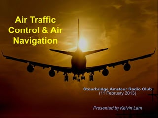
- 1. Air Traffic Control & Air Navigation Stourbridge Amateur Radio Club (11 February 2013) Presented by Kelvin Lam
- 3. We ensure your safety…
- 5. Aims: • Basic terminology for aviation • Different types of air navigational rule • How these navigation technologies are implemented in commercial aviation industry
- 6. 2 Flight Rules • There are two main flight conditions: • VFR (Visual Flight Rule) The pilot operates an aircraft when the visibility is high, and can fly a plane with the reference of the ground and local landmarks/landscape, and able to avoid other air traffic.
- 7. • IFR (Instrumental Flight Rule) The pilot rely only on the airborne instruments. Navigation is based on electronic signals. The exterior visual reference is not safe (due to weather/nighttime/altitu de etc.)
- 8. Navigation • We probably would have used these devices before: SatNav (GPS) Map reading Asking for direction
- 9. • But up at 30,000 ft up the sky, you cannot ask a friend how to get to New York, nor you cannot simply read a map and say: “I saw the Atlantic Ocean, I must be heading to New York”!
- 10. Basic concepts • Directions: They are measured in magnetic north bearings (000 to 360). • Altitudes: In most part of the world they are measured in Imperial “feets”. Often the term “flight level” is used to represent altitudes. In the Eastern Bloc often metric “metres” is used instead for political and historical reasons.
- 11. Basic concepts • Speed/Velocity: In Western countries speed in aviation is measured in knots (kts). In the Eastern Bloc (some), speed is measured in km h-1 (kph).
- 12. Basic concepts • Taxiway • Runway • Ramp/Jetway/Parking • Threshold line • Touch-down zone • Displaced threshold/runway safety zone
- 13. Basic concepts • There are different type of speed: GS (Ground Speed) The speed of the aircraft relative to the ground. IAS (Indicated airspeed) The speed of the aircraft relative to the still air of a certain air pressure. (2992 Hg) TAS (True Air Speed) The speed of the aircraft relative to the air outside. Wind speed The rate of the wind. TAS-WS = IAS.
- 14. Flight deck
- 15. True North and Magnetic North • Angular difference +/- 3 degrees.
- 16. Why Air Navigation is important? • Busy airspace (you can cause accidents if you fly in the fly route and altitude) • Flying into countries with no transition rights (Korean Air 007) • Saves fuel when flying in the correct weather and route • Saves time! • You are flying to the correct destination
- 17. How should the map look like?
- 18. Or this?
- 19. Map projection • The first is known as Mercator-map projection method. Such conventional map is easy to read, however assumed the world is a perfect sphere. • (The latter is known as the Robinson projection method). • After satellite launches, human realised the world is a sphere. • Charts nowadays use a WGS84 standard to ensure it is accurate and valid. It is based on GPS with an accuracy of +/- 2m.
- 20. Great Bear • Aviators in the past used the Polar Star to locate the north point. • But imagine the air navigator has to constantly plot where they are using the stars and the airspeed: this is not accurate! • This is known as astronavigation.
- 22. Modern navigation • Air charts • ATC (Air Traffic Controls) • GPS (Global Positioning System) • INS (Inertial Navigation System) • Radio beacons • Etc…
- 23. Air charts • They are basically the aviator’s version of the “Explorers Map”. • It shows the … Routings (jetways) Beacons (VOR, DME transmitter) Aerodromes (airfields, airport) Frequency of the ATC
- 25. Air Traffic Controls • They give directions to pilots to regulate traffic in the airspace. • They also provide navigation service by giving bearings or information about airspace traffic/nearest airport.
- 26. Global Positioning System • It was developed by the Department of Defense of America. It was allowed for civilian use at the 1980s. • It is composed of a system with 24 satellites. A GPS receiver needs signals from 3 satellite so that, using the mean of triangulation, to figure out the exact position/co- ordinate in the map.
- 27. Global Positioning System • The satellite each has a very accurate atomic clock. The time at the satellite should be (around) 2 seconds faster than the UTC due to Einstein’s relativity theory. • Time delay/difference measures the distance that the wave has travelled. • GPS signals include satellite information and euphemistic details (positioning). • Signals are sent at 1.8MBit/second.
- 28. Inertial Navigation System • Inertia: In other words, momentum. It is the relunctance of an object/particle to change its velocity. • INS is a method of navigation relying solely on inertial equipment: accelerometer & gyroscope. • The aircraft is calibrated in a certain position. The “map is plotted” in that exact position. The plotter moves as the IN equipment sense a change in inertia (i.e. acceleration, airspeed, altitude change) thus finds out the position of the aircraft.
- 30. Radio Beacons • There are a few types of beacons: NDB (Non- directional beacon) (or VOR, VHF Omnidirectional Range) Single letter HF ILS Localiser (Marker beacon)
- 31. VOR (Conventional Navigation) • The VOR beacon sends out a 3 letter Morse code of the station name. • The pilot sets a omni- bearing (CRS bearing), which is the bearing which the plane should aim for. • If the bearing from the radio wave mismatch to that of the CRS bearing, the pilot must be off- course.
- 32. VOR • VOR radio has a channel frequency between 108.00 to 117.95MHz. • The accuracy of VOR navigation is +/- 1.4 degree.
- 33. DME • Distance – measuring equipment: • By calculating the time- delay between the time which the incident wave is sent, and the time which the responded wave is received • We work out the slant distance between the aircraft and the beacon.
- 34. Performance-based navigation (PBN) • Instead of drifting away from a specific route, sometimes aircraft fly at a specified 3D airspace between two waypoints. • Such navigation required on-board alerting and monitoring. • A route of RNP1 allows the aircraft only to drift away from specific route by 1 nm. RNP 10= 10 nm. • This is widely used in terrain approaches.
- 35. • RNP (Required Navigation Performance): measures the required accuracy of the navigation system in order to fly in that route. • ANP (Actual Navigation Performance): measures the actual accuracy of the on- board navigation system. There must be a slight variability due to different manufacturer settings (systemic error).
- 36. From the above diagram, it illustrates that RNAV (aRea Navigation) allows the aircraft not following segments to customise route. The RNP type navigation further allows aircraft to fly at the best route possible, within a certain limit.
- 38. ILS • Instrumental Landing System • Glideslope: The path that an aircraft follows during landing. • The localiser/VOR beacon sends a radio signal at a certain angle at a certain frequency. • It allows the pilot to judge whether it is in line with the runway or not under a very poor visibility conditions.
- 39. ILS
- 40. ILS • In the flight display (which shows the airspeed, altitude to the pilot), the aircraft received the certain signals only if they are too high/low or left/right. • The FD then informs the pilot the position the aircraft compared to the glideslope.
- 41. When you need ILS…
- 43. End of Air Navigation
- 45. Not this!
- 46. Aims: • What is ATC • The role of ATC • How ATC works • How airspace are organised and categorised • Some application of special ATC service • Future technologies on air traffic control
- 47. What is ATC? • Air traffic control (abrv: ATC) is a ground-based service to regulate air traffic in an organised and safe fashion inside a specific airspace. • They also provide airspace/meteological information of the region.
- 48. Speak English! • The ICAO (International Civil Aviation Organisation) rules out that English should be used within ATC communication. • In many other countries where English is their secondary or third language, their local language is usually used instead amongst local pilots. • ICAO has unified alphabets (known as NATO alphabets) that are used in the radio transmission.
- 50. Different controllers • Air traffic control is composed of these parts: • Clearance delivery: Files the route of the flight, i.e. taxi route, jetway, time of departure/arrival etc. • Ground : Taxiing, ground vehicles • Local control (Tower): Clears aircraft to land/take- off. They control the runway and its nearby airspace.
- 51. Different controllers • Terminal controller: It handles airspace up to around 20,000ft, radius of around 100nm from the airport. They usually coordinate traffic inbound/outbound of the airport. • Area control: Known as “centre”, which provides flight traffic service for high altitudes, above 20,000ft. They are responsible traffic within a FIR (Flight Information Region), which is a large airspace assigned by ICAO.
- 52. ATC in the UK • Traffic services are provided by NATS (National Air Traffic Service). • They are responsible for all traffic flying into/from/over the UK. • They are also responsible for Kent/London airspace – one of the top 3 busiest airspace in the world.
- 53. How it works? • Let us start from the very beginning of a typical commercial flight…
- 54. Flight planning • It is similar when we want to drive from Birmingham to Bristol – we use motorways, exit at certain junctions and estimate a rough journey time. • Flying also needs planning!
- 55. Flight planning • Flight dispatcher will write up a flight plan for each individual flight. Contents include: • Time for T/O and ETA (Estimated time arrival) • Routes (airspace transition, airspace rights, jetways, backup airport, waypoints) • Routes (great circle, jetstream, loxodrome) • Weather (are there any storm, extreme temperature) • Payload (zero weight, maximum T/O weight) • Cruising (True airspeed, flight levels including RVSM) • Fuel on board (fuel for flying, emergency) • Economy (!!) (Fuel efficiency, rate of climb, throttle, balance between time and cost)
- 56. Airspace • Routings: As we discussed before, airways are air routes laid out with nav - aids (VOR beacons, etc.) They are usually 10 nautical miles wide, and are controlled airspace (VFR flights have to report to ATC). • Airspace classes: Airspace in the world are divided according to political, military or commercial reasons:
- 57. Airspace Classes Controlled? IFR/VFR ATC Clearance Traffic separation A Yes IFR only Required Provided to all B (Not existing in UK) Yes Both Required Provided to all C Yes Both Required Provided to all IFR/SVFR D Yes Both Required Provided to all IFR/SVFR E Yes Both Required for IFR/SVFR Provided to all IFR/SVFR F No Both except SVFR Not required Provided to all IFR/SVFR G No Both except SVFR Not required Not provided
- 58. British Airspace • The UK has two special airspace classes that does not fall into the ICAO categories (although most of the world also have similar classification): • Aerodrome Traffic Zone: It is based around the airfield with busy inbound/outbound traffic. Pilot has to contact with the tower before transition into such airspace. • Military Traffic Zone: It lies around the military base. It is treated as a controlled airspace.
- 59. Airspace
- 60. Departure • The pilot has to initiate his flight plan by obtaining clearance from the “Clearance delivery” before push-back and taxi. • The Clearance Delivery gives information to the pilot about the weather, route, runway closure etc. Often the CD loops the recording of the ATIS in busier airports. (Automatic Terminal Information System)
- 61. Departure • After doing pre-take off checks and preparation, the pilot will now contact “Ground controller” to obtain permission to push back and taxi out. • Taxiing is probably the hardest among all – the amount of aeroplanes attempting to taxi at the same time is enormous!
- 62. Take off/Landing • The pilot halts behind the threshold line and change its frequency to the Tower Controller. The pilot at this point should have done their pre-take off checks (i.e. fuel, flaps, TOGA throttle, autopilots etc.) • The tower controller, in a bigger airfield, is situated among with the other ATCs. In smaller aerodrome often he is situated at a small van near the runway so that he could visually check if the runway has been cleared. • If an aircraft has to taxi across an active runway, it must first gain permission from the Tower Controller.
- 63. STAR/SID • After take off the pilot tunes his frequency again after leaving the runway airspace. He contacts the local terminal control. • The control extends around 100nm from the airport, and up to 20,000ft (FL200). • The terminal control is mainly responsible for two things: To ensure that departing aircraft are at the right altitude as they are handled off; To ensure the arriving traffic is at the right route, pattern and rate of descent.
- 64. STAR/SID • SID (Standard Instrument Departure) are set of regulations that IFR traffic complies after taking-off. The ATC usually gives the vector which the traffic should head to: “Speedbird 001, fly heading 110 and ascend and maintain FL170 prior to making any turns.”
- 65. STAR/SID • STAR (Standard Terminal Arrival Route) is the published regulation that pilots follow before arriving the airport. • It could be sub-classified into two categories: Instrumental approach or visual approach. • Similar to SID, it is a set of waypoints/ visual landmarks that a traffic follows before cleared for landing.
- 67. Cruising • Above FL200 the airspace class is Class A – it is controlled and only IFR is allowed. • The en-route/ area control, who is responsible for each FIR, is taking control of the aircraft’s cruising stage. • They are responsible to allow the aircraft to fly in their planned altitudes and at the same time maintain separation both vertically and horizontally.
- 68. Cruising • RVSM (Reduced Vertical Separation Minima) • Before when airborne instruments were not as accurate as it is now, aircraft are separated far apart (i.e. 3000ft) to avoid collision. • This wastes a lot of precious airspace! • As pitot tubes are more accurate and reliable now, we can measure the altitude in a more reliable and precised way. • We can reduce the separation to increase air capacity.
- 70. Cruising • Again the pilot has to comply with ATC instructions. Usually the route has already been inputted to flight computer. • Area chart (high altitude) are usually used.
- 72. Radios • ATC range from 1nm to roughly 300nm. Some FIR are as large as a time zone! • VHF/UHF is used in ground controls. This is because of the short range and high clarity. • MF/VHF is used for area controls. 121.50MHz is reserved as emergency frequency.
- 73. Transponder • Little dots are used to represent an aircraft in the ATC screen. However these dots does not tell us what exact flight it is. • A squawk code is allocated to each flight. The pilot enters the code into their transponder. • 7700 is the emergency squawk code.
- 74. Callsign and registration • Each aircraft has its unique registration. The letters are based on which country it is registered at. • For example: G-CFKG (UK); D-ERT (Germany) etc. • It is read out using the NATO alphabets. • In practice some pilots identify themselves using the 3 last alphabets of the aircraft reg.
- 75. Callsign and registration • Similar to all radio communications, callsign is used to identify exactly where the message was coming from. • Each flight/airline has an unique callsign. • I.e. BA 053 would be “Speedbird Zero- Five-Three”, LH 034 would be “Lufthansa Zero-Three Four”
- 76. Callsign and registration • There are special cases: • Aircraft with T/O weights more than 300,000lbs must append “Heavy” behind their callsign, i.e. “Airfrance 001 heavy”. • Air ambulance must append “Pan Pan Medical Speedbird One Niner Three” to indicate that it is urgent and there is a medical situation onboard. • VIP transports have their own callsign, i.e. “Air Force One” for US’s president plane.
- 77. Emergencies • There are two degree of emergency: Problem: “London Centre, we have got a slight problem with…” Pan-pan: A condition concerning the safety of an aircraft or other vehicle, or of some person on board or within sight, but which does not require immediate assistance.
- 78. Emergencies • Mayday: A condition of being threatened by serious and/or imminent danger and of requiring immediate assistance • Non – traditional methods includes: • “Trangular Distress Pattern” – making 120 degree turn several times.
- 79. Future ATC • The sky is more packed with aircrafts. We need a new way to organise the increasingly difficult traffic in an efficient and organised fashion. • New technologies has been developed. Some are digital signals that aims to develop airspace where radios are not possible; some are computerised ATC!
- 80. Transatlantic Flights • Since early 20th century many aviators attempted to cross the Atlantic Ocean with their bi-plane. • The violent weather and the few thousand miles ocean simply make it impossible. • Scheduled jet flights commenced in 1957. After aviation laws on transatlantic flights were loosened in 1980s, many flights now compete in trans-Atlantic market.
- 81. Transatlantic routes • It is known as NAT (North Atlantic Tracks) • Unlike other airways, the NAT are changed daily. This is based on jetstream etc. to reduce fuel burn. • Aircraft has to enter the route at special entrance points. • As there are no beacon in the ocean, ATC separation are simply not possible. Time separation (of 10 minutes) is used instead. The crew has to report their position and the expected time that they reach the next waypoint.
- 83. Controller-pilot datalink communication • If a tower controls a large airspace, then the pilot will have to use the same frequency for a long time. • As the airspace is large, the frequency may also be used by the nearby tower, causing confusion. • The voice clarity is also a problem. • The ATC is unable to handle anymore traffic.
- 84. Controller-pilot datalink communication • Instead of using radios, a HF carrier wave transmits digital signals to the aircraft. • The pilot and the ATC can transfer information quicker and in indefinite format (any texts). • New airways can be developed where terrain are very rough (i.e. Mount Everest, oceans etc.)
- 85. • Other systems, i.e. ADSB (Automatic dependent surveillance broadcast) uses satellite, radar and airbourne nav to generate a digital display of information. • It aims to improve ‘visibility’, better flow of traffic, higher accuracy and improved spacing.
- 86. Video • http://www.youtube.com/watch?v=- IS5dCkGXZI • http://www.youtube.com/watch?v=sgOZN UoT9L4
- 87. End of Air Traffic Control