Map Kibera: Methods for Citizen Engagement in Mapping and Reporting
•
1 like•1,013 views

Presented by Erica Hagen, Map Kibera, at the July 2012 Workshop on Mapping Community Based Global Health Programs for M&E

Recommended
Recommended
More Related Content
What's hot
What's hot (18)
Similar to Map Kibera: Methods for Citizen Engagement in Mapping and Reporting
Similar to Map Kibera: Methods for Citizen Engagement in Mapping and Reporting (20)
More from MEASURE Evaluation
More from MEASURE Evaluation (20)
Recently uploaded
Recently uploaded (20)
Map Kibera: Methods for Citizen Engagement in Mapping and Reporting
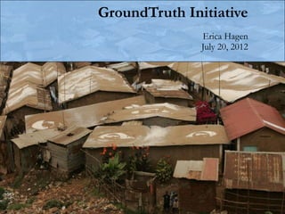
- 1. GroundTruth Initiative Erica Hagen July 20, 2012
- 2. GroundTruth Initiative We help communities use digital media, mapping, and open data tools For greater influence and representation in development, and democracy.
- 3. Why? Local communities are the most reliable, important knowledge-holders (and stakeholders) for development and political engagement. Participatory and open technologies and citizen media can help citizens amplify voices and increase influence and participation in processes of development.
- 4. What is Community Mapping? 1) Community creates/gathers the map data. That is, geographical coordinates alongside any other information. 2) Community also edits the map data themselves, and comes to agreement on the final product. 3) Mapped information is generally shared openly, online, contributing to commons. 4) Community uses the map afterwards, themselves. Can be part of a larger participatory development, local planning, or advocacy process, as well as a base for citizen reporting.
- 5. Kibera slum in Nairobi, Kenya… ~ 250,000 people, 2.5 km2
- 6. …was a blank spot on the map
- 7. This is all the media shows about Kibera…
- 8. The Mappers: 13 Kibera youth * The Mappers
- 9. We start Map Kibera pilot project to help Kibera people get “on the map”.
- 10. What did they collect? • water points • public latrines • medical clinics • informal schools • churches/mosques • video shops • salons • community organizations and much more!
- 11. OpenStreetMap Global Collaborative Mapping “like Wikipedia for Maps”
- 12. Kibera Map Today
- 13. The Densest Map Ever?
- 14. Data + Storytelling Voice of Kibera www.voiceofkibera.org
- 15. Voice of Kibera
- 16. Reports
- 17. Reports
- 18. Reports
- 19. Need photo here of the guys out on a shoot…
- 21. Selection of Video Topics - Landslide in Kibera - Power disruptions - Protest over anti-Muslim schoolteacher - Stray monkey entertains Kiberans - HIV positive woman’s story - Draft constitution campaign - Railway line evictions
- 22. Thematic Mapping: Health Education Water/Sanitation Safety
- 23. 2322759509
- 29. Training others
- 31. Mathare Slum
- 32. Mathare Slum
- 33. Community Forum
- 34. Toilets, Open Drainage and ODAs
- 36. Dar es Salaam, Tandale community, Tanzania
- 37. Dar es Salaam, Tandale community, Tanzania
- 38. Dar es Salaam, Tandale community, Tanzania •Tanzania has remnants of socialist structures and governance from time of Nyerere •Informal areas are not as dense, cover most of city •Citizens tend to trust local government
- 39. Thanks! erica@groundtruthinitiative.org @ricaji Groundtruth.in mapkibera.org Kiberanewsnetwork.org voiceofkibera.org