

Recommended
More Related Content
What's hot
What's hot (20)
Viewers also liked
Viewers also liked (20)
Similar to ladakh flash flood
Similar to ladakh flash flood (20)
More from michellesahay
More from michellesahay (14)
Recently uploaded
Recently uploaded (20)
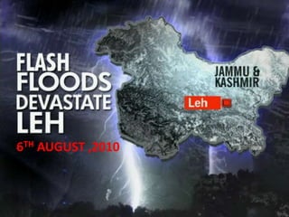
ladakh flash flood
- 2. CONTENTS • Study area • An Overview about Cloud Bursting • History of Flash Flood in Ladakh • Why Leh was prone to flood? • Results of the 2010 Leh Flash Flood • Aftermath Of the disaster-economic ,social & physical impacts • Relief/Rescue efforts-local and international aids of disaster • Ways to prevent and control Flash Flood-own interpretation • References
- 3. Source: Social and economic characteristics of Ladakh, India,Katharine Sherratt ,Geology for Global Development • Ladakh, a part of Jammu and Kashmir State in north on India, consists of two districts – Leh and Kargil. • Pakistan occupied Kashmir in the West • China in the north Eastern part and • Lahul Spiti of Himachal Pradesh in South East
- 4. Topography near the city of Leh, India. The Indus River flows to the northwest and is just south of the city of Leh. The rivers of India and Pakistan. The Indus River originates in China and flows through India and Pakistan before reaching the Arabian Sea to the southwest. Source: Simulation of a Flash Flooding Storm at the Steep Edge of the Himalayas,ANIL KUMAR,NASA Goddard Space Flight Center, Greenbelt, and Earth System Science Interdisciplinary Center, University of Maryland. • 112inhabited villages • 1un-inhabited village • total population is 1.17 lacs. • largest town in Jammu and Kashmir. • 3500 meters above sea level
- 5. Source:Yojana,Vol 56,March 2012 INDIA ‘S MAJOR DISASTERS
- 6. Source:Yojana,Vol 56,March 2012 LADAKH’S MAJOR DISASTERS
- 7. Over the centuries the Indus has been the life line for several civilizations. In Ladakh most of the villages have come up on the north bank along the tributaries that are fed by the glacial melt into the Indus. It is now these very villages along the north bank of the Indus belt in Ladakh that have been affected. Settlements around Indus Threatened • With rise in temperatures, • glaciers receding, • increase in rainfall and tributaries changing course settlements History of floods in Ladakh Ladakh witnessed many Glacial Lake Outbursts Floods (GlOFS) in recent history. 1907 Leh bazaar was filled with mud 19711930 Bursting of glacial lake formed by blocking of Shayok River by surging of Chong Kumdan glacier Nyemo village - Save the Children UK 1999 2006 2011 Cloud burst
- 8. Flash floods and cloudburst in 2010 • Increased temperature and hot summers in the plains lead to increased evaporation and subsequent cloud formation in the hills. • Increased duration of snowfall (May) in Ladakh. • Winter prolonged. • Bright sunshine in June and July lead to melting of snow and high relative humidity (72%) against 50% of previous years. • Snow absorbed latent heat also, monthly max and min temp remained low leading to dense low clouds in the valley. • Clouds further condensed trying to cross the glaciers and could not retain the water droplets and burst.
- 9. Source :Thayyen et al 2012 LOCATION OF THE CLOUD BURST
- 10. Source :Thayyen et al 2012 • Flash floods, short lived extreme events, which usually occur under slowly moving or stationary thunderstorms, lasting less than 24 hours • High velocity of the current which can wash away all obstacles in its way • Glacial melting due to Global warming is another major cause of flash floods. • The major glaciers in the higher mountains are receding at an alarming rate. • Glaciers in Jammu and Kashmir are receding at a faster rate compared to other glacial regions in the world.
- 11. The thick blue band across the Himalayas shows snow cover declining by at least 16 percent. Source: water resources in the Himalayas(assessment and sustainability),R.D.Singh The Himalayan glaciers, the source of water for billions, are retreating faster than in any other part of the world and are in danger of disappearing by 2035. Floods in Leh were due to the bursting of recessional glacial lakes of Phuche glacier in Leh valley. In the catchment of Phiyang Tokpo, the terminal moraines of Phyang glacier has breached resulting in GLOF.
- 12. Source: water resources in the Himalayas(assessment and sustainability),R.D.Singh
- 13. Source: water resources in the Himalayas(assessment and sustainability),R.D.Singh Himalayan catchment
- 14. FLASH FLOOD IN LEH, JAMMU AND KASHMIR • August 6, 2010, Leh in Ladakh • 2 hours-rainfall of 14 inches. • The Indus River and its tributaries and waterways were overflowing • 234 killed • 800 injured • 1000 houses collapsed • local residents (49.6%) • foreigners (10.2%) • 25–50 years -44.4% of deaths • 11–25-year -22.2% deaths. • 61.5% - males • 38.5% - females • Female age groups <10 years and ≥50 years. Source: Gupta, Preeti, Khanna, Anurag & Majumdar, S. Disaster Management in Flash Floods in Leh (Ladakh,Indian Journal of Community Medicine (2012).
- 16. Source: An Assessment of the impact of flash flood on 5th August 2010 in Leh District – Final Report STOD REGION (UPPER LEH) SHAM REGION (LOWER LEH). LEGEND VILLAGES AFFECTED: • 40 villages (around 50 hamlets altogether) spread in 28 Halqa Panchayats • 2 severely hit, • 19 substantially and • 19 partially affected. • Some other villages, reported to have been partly affected (e.g., Yangthang, Nyoma, Anley, Kumdok, Shang, etc.)
- 17. LEH PHOTO , SHOWING THE AREA BETWEEN THE OLD AND NEW BUS STAND , AND MAIN STREET IN CHOGLAMSAR
- 18. • Old town Leh sits below the ridge with the Leh Palace . • North and east the terrain forms a tilted bowl , the flood ( 48 millimeters of rain in one minute ..) have come down this way , before heading down towards the Indus. • The least affected part was the Changspa area ,north of the ridge with palace
- 19. Source: Leh Flash Floods 2010, February 2011 ,unified response strategy Manetselding, August 6, 2010 View of bus stand area, August 6, 2010 Choglamsar, August 11, 2010 Driving through Choglamsar, August 11, 2010
- 20. Sectors of Economical Dependence HUMAN LOSSES: • 106 persons (from 63 HHs) have died. • 48 persons (from 27 HHs) -Choglamsar • 26 persons (from 16 HHs) -Leh. • 92 persons (from 83 HHs) -injured HOUSES: • Houses damaged - 1458 • 499 houses fully damaged/ washed away, • 353 substantially damaged and • 606 partially damaged. • estimated (average) cost of loss -Rs. 48 crores. LIVESTOCK: • 277 cattle heads (of 148 HHs) • 578 sheep/ goat heads (of 94 HHs • estimated (average) cost of loss - Rs. 39 Lacs CROPS: • Rs. 10 crores is estimated for standing crops (barley, alfa alfa and vegetable) TREES/ PLANTATION: • Rs. 61 crores • Around 2.41 lac timber trees (belonging to 1795HHs), • 24747 fruit trees (796 HHs) and • 1.43 lac plants (Laktsugs) OTHER: 261 greenhouses (of 254 HHs), 2 commercial greenhouses (of 2 HHs), field wallings of 1659 HHs food/ fodder reserves of 41 HHs Estimated loss is around Rs. 2.13 crores OTHER LOSSES: At HHs level includes HH goods of 755 families (Rs. 7.55 crores at an average)
- 21. Source: Simulation of a Flash Flooding Storm at the Steep Edge of the Himalayas,ANIL KUMAR,NASA Goddard Space Flight Center, Greenbelt, and Earth System Science Interdisciplinary Center, University of Maryland. Leh Flood was due to a moving squall line with trailing stratiform rain forming over the Tibetan Plateau. It drew upon the warm moist air rising up the steep Himalayan barrier as it moved over the steep edge of the Plateau and was exacerbated by prior storms moistening the soil on the sides of the mountains surrounding Leh. Conceptual model demonstrating key meteorological elements that led to the anomalous flash flooding case in Leh.
- 22. Source: Simulation of a Flash Flooding Storm at the Steep Edge of the Himalayas, ANIL KUMAR,NASA Goddard Space Flight Center, Greenbelt, and Earth System Science Interdisciplinary Center, University of Maryland. HOW TO PREDICT CLOUD BURST HYPOTHESIS • Storm , which formed over the Tibetan Plateau, was steered over the steep edge of the plateau by 500-hPa winds • Energized by the ingestion of lower-level moist air, which was approaching from the Arabian Sea and Bay of Bengal and rose up the Himalayan barrier. • A coupled land surface and atmospheric model simulation validates this hypothesized storm scenario, with the model storm taking the form of a traveling meso scale squall line with a leading convective line, trailing stratiform region, and midlevel inflow jet. • In this region, the development of a meso scale storm over high terrain is highly unusual, especially one in the form of a propagating squall line system. • This unusual storm occurrence and behaviour could serve as a warning sign in flash flood prediction. Model nested domains 27 KM 9 KM 3 KM 1 KM
- 23. SOIL MOISTURE PRECIPITATION (MM) FROM 2 TO 5 AUG 2010. Source: Simulation of a Flash Flooding Storm at the Steep Edge of the Himalayas, ANIL KUMAR,NASA Goddard Space Flight Center, Greenbelt, and Earth System Science Interdisciplinary Center, University of Maryland. 2-3 in Ladakh (low soil moisture) 40-140 in Ladakh
- 24. Source: Simulation of a Flash Flooding Storm at the Steep Edge of the Himalayas, ANIL KUMAR,NASA Goddard Space Flight Center, Greenbelt, and Earth System Science Interdisciplinary Center, University of Maryland. 15-50mm 1-2 15-50mm 2-4 75-130mm 1-2 <0.1 <0.1
- 25. MODEL SIMULATED GEOPOTENTIAL HEIGHT (M) CONTOURS AND GEOSTROPHIC WIND VECTORS (M S21) AT 500 HPA GEOPOTENTIAL HEIGHT CONTOURS AT 700 HPA AND TERRAIN-FOLLOWING SURFACE WINDS FOR 3–5 AUG 2010 Source: Simulation of a Flash Flooding Storm at the Steep Edge of the Himalayas, ANIL KUMAR,NASA Goddard Space Flight Center, Greenbelt, and Earth System Science Interdisciplinary Center, University of Maryland.
- 26. Source :Investigating the Leh 'Cloudburst‘. Raghavendra Ashrit , National Centre for Medium Range Weather Forecasting ,Ministry of Earth Sciences
- 27. ACCUMULATED 3H RAINFALL ON 5TH AUG 2010 AS PER TRMM PRODUCT 3B41RT Source :Investigating the Leh 'Cloudburst‘. Raghavendra Ashrit , National Centre for Medium Range Weather Forecasting ,Ministry of Earth Sciences
- 28. ACCUMULATED 3H RAINFALL ON 5TH AUG 2010 IN THE OPERATIONAL WRF MODEL. Source :Investigating the Leh 'Cloudburst‘. Raghavendra Ashrit , National Centre for Medium Range Weather Forecasting ,Ministry of Earth Sciences
- 29. Source: Simulation of a Flash Flooding Storm at the Steep Edge of the Himalayas,ANIL KUMAR,NASA Goddard Space Flight Center, Greenbelt, and Earth System Science Interdisciplinary Center, University of Maryland. Horizontal map of maximum reflectivity and horizontal wind at the 850-mb level Model simulated accumulated rainfall (1500–2300 UTC) on 5 Aug 2010
- 30. vertical cross section along the red line of reflectivity and air motion vectors in the plane of the cross section vertical cross section of hydrometeor mixing ratios. Source: Simulation of a Flash Flooding Storm at the Steep Edge of the Himalayas,ANIL KUMAR,NASA Goddard Space Flight Center, Greenbelt, and Earth System Science Interdisciplinary Center, University of Maryland. • The coupled atmosphere and land surface model showed that the excessive runoff leading to the flood and landslide were favoured by the occurrence of this unusual meteorological event coinciding temporally and spatially with favourable hydrologic conditions. • Additionally, the model simulations showed that previous rainstorms had moistened the soil during the entire season and especially over the few days leading up to the Leh flood, so the normally arid mountainsides were likely not able to rapidly absorb the additional rainfall of the sudden 5 August squall line.
- 31. Source: Simulation of a Flash Flooding Storm at the Steep Edge of the Himalayas,ANIL KUMAR,NASA Goddard Space Flight Center, Greenbelt, and Earth System Science Interdisciplinary Center, University of Maryland. Hydrological parameters from May to August 2010 and (a) top soil layer (at 5-cm soil depth) soil moisture (m3m23), (b) hourly rain rate (mmh21), (c) surface runoff (mmh21)
- 32. RESCUE: • The Army, • ITBP, • Ladakh Scouts, • GREF, • Air Force, • volunteers from various social organizations (including a large number mobilized by LBA and ‘Anjumans’) and • tourists (mainly foreigners) quickly responded. • The village leadership and local Administration arranged for care of displaced people through establishing camps providing shelter and food. • LAHDC and District Administration undertook a rapid assessment of the extent of damage and initiated payment of relief and compensation to affected families. Source:Yojana,Vol 56,March 2012, An Assessment of the impact of flash flood on 5th August 2010 in Leh District – Final Report
- 33. TRADITIONAL VALUES THAT HELPED LADAKH TO REBUILD THEIR LIVES • Ladakhis, known for their hospitality worldwide, succeeded in recovering from the devastating natural calamity. • With the help of the Army and ITBP which were at the forefront of the rescue work, civilians pitched in for rescue and relief works. • The floods were unable to destroy the social fabric of the region • Floods not only washed away the agricultural land but covered it with infertile mud. • The government provided three to four bulldozers to each village • Today, Ladakhi housewives, still working in the agricultural fields, grow the local crops Source:Yojana,Vol 56,March 2012, An Assessment of the impact of flash flood on 5th August 2010 in Leh District – Final Report Societal resilience
- 34. GOVERNMENT INITIATIVES: Jammu & Kashmir has a reasonably well-detailed disaster management plan that deals broadly with the variety of earthquakes, droughts, and fires in the state (DRRR 2011). National and state responses to the cloudburst involved search-and-rescue and shelter provision by the Indian forces, as well as air-lifting in food and water supplies, of critical importance with high import More specifically, Leh’s recently formalised (post-2010 cloudburst) disaster management plan lays out the range of available facilities, infrastructure and communications for dealing with emergency hazards (LAHDC-Leh DCO 2011). Source: Social and economic characteristics of Ladakh, India,Katharine Sherratt ,Geology for Global Development
- 35. Source: Leh Flash Floods 2010, February 2011 ,unified response strategy • Addressing the urgent shelter needs before the onset of winter, pre- fabricated units were provided to nearly all the affected families by the Leh district administration. • 450 units supplied by Hindustan Prefab Limited (supported by a number of public sector undertakings) and close to 100 additional units supplied by the National Bamboo Mission. • Shelters were unsuitable for the local needs and climatic conditions and had low occupancy levels. • The occupancy levels were much lower in the case of the bamboo units. • Each unit supplied by Hindustan Prefab Ltd costs close to Rs. 4,00,000, these units have also meant an increased dependence on heating appliances and fuel and a lost opportunity to build local economic and social capital FAILURE:
- 36. GENDER ISSUES: • . A number of families (3-4) are living within the same tent and women’s privacy was a major concern. • The assessment reports that women members, living in tents, have expressed the need for extra shelter support so that families can begin to live in a dignified manner. • Lack of water for newly constructed toilets whereas dry pit latrines were the local usage. Source: LADAKH FLOOD RESPONSE PLAN,AUGUST 2010,Leh Town and Adjoining villages,OXFAM
- 37. Profile of Agency Respondents to Questionnaires (No.of Respondents) Source: Leh Flash Floods 2010, February 2011 ,unified response strategy Six affected villages were chosen for the consultations . The choice of villages was based on a random sample Choglamsar Solar Colony is a new settlement where 170 affected families were allotted land. RESULTS FROM CONSULTATION
- 38. RECONSTRUCTION PROCESS SUGGESTED: Source: Leh Flash Floods 2010, February 2011 ,unified response strategy • Construction of permanent shelters in the spring and summer of 2011 should be carried out after due consultation with the communities and take into account their preferences and the distinct climatic conditions of the region Shelter • restoration of irrigation channels and reclamation of agricultural land covered in silt and boulders, needs to be undertaken on an urgent basisRestoration of Livelihoods Provision of sanitation facilities in reconstructed shelters • among communities and all other actors in LehDisaster Risk Reduction and Mitigation measures over the medium to long term
- 39. OPINIONS OF COMMUNITY MEMBERS AND AGENCIES ON RESPONSE Source: Leh Flash Floods 2010, February 2011 ,unified response strategy Improved significantly, with the support of the district administration and NGOs and civil society groups. • Areas in and around Leh which were easily accessible received a disproportionately large amount of aid . Disparity in distribution of aid • lack of adequate sanitation facilities and separate bathing facilities for women, poor conditions of hygiene and a shortage of tents due to which two or three families had to share the same tent. Initial conditions in some relief camps • lack of uniformity in the quality of materials distributed by agencies on occasion was pointed out by the community members. Excessive amounts of non-food items (NFIs) particularly blankets • cases of culturally inappropriate foodstuffs and material being distributed both in the relief camps as well as in the affected areas. Inappropriate relief materials • Agencies responding to the questionnaire identified the sectors of livelihoods, shelter and psycho-social support as those in which the response was poor or lacking Poor response in the areas of livelihoods, shelter and psycho-social support Limited access on account of damage to roads and infrastructure also led to delays in relief reaching some of the more remote locations. organizations across India (and internationally), resulted in a number of civil society organizations and individuals who were not entirely familiar with local conditions and needs
- 40. Source: Leh Flash Floods 2010, February 2011 ,unified response strategy Regular monitoring of needs and situation in camps during future emergencies Protection and Trafficking • The Sphere Minimum Standards and the National Guidelines being developed by the National Disaster Management Authority (NDMA) could be useful tools for this purpose • Evolving checklists with key issues and concerns relating to the different thematic areas in consultation with agencies • children who were separated from their families and sent to Jammu received widespread coverage in the national media • that this incident remained unknown to agencies until it was highlighted by the district administration and the media is a cause for concern These checklists could also be adapted to include specific local conditions, preferences and considerations wherever necessary. Point towards the need for increased awareness on the issues of protection and rights violations in disasters, and the need for a review by agencies of the ways and methods employed in monitoring situations in future emergencies LESSON LEARNT
- 41. OPINIONS OF AGENCIES OF TASKS CARRIED OUT BY NGO FACILITATION CENTRE, LEH Source: Leh Flash Floods 2010, February 2011 ,unified response strategy
- 42. Source: Leh Flash Floods 2010, February 2011 ,unified response strategy ROLE OF VARIOUS ORGANISATION
- 43. Source: Leh Flash Floods 2010, February 2011 ,unified response strategy
- 44. Source: Leh Flash Floods 2010, February 2011 ,unified response strategy
- 45. Source: Leh Flash Floods 2010, February 2011 ,unified response strategy
- 46. Source: Leh Flash Floods 2010, February 2011 ,unified response strategy
- 47. Source: Leh Flash Floods 2010, February 2011 ,unified response strategy
- 48. REBUILD LADAKH Source: Leh Flash Floods 2010, February 2011 ,unified response strategy
- 49. TRADITIONAL BUILDINGS • SEEDS took a holistic approach to shelter rehabilitation, bringing together an understanding of safety, comfort, environmental sustainability and local socio-cultural factors. • Past disasters show that shelter rehabilitation schemes which haven’t addressed these factors have been left unoccupied, or have disrupted social interactions and activity patterns and harmed communities. A traditional Ladakhi house Source: Leh Flash Floods 2010, February 2011 ,unified response strategy
- 50. Source: Leh Flash Floods 2010, February 2011 ,unified response strategy Bus stand area, August 7, 2010 Volunteers at the new hospital, August 8, 2010 Relief aid, August 11, 2010