
Recommended
Recommended
More Related Content
Similar to Teaching New Cartography
Similar to Teaching New Cartography (20)
More from nacis_slides
More from nacis_slides (20)
Recently uploaded
Recently uploaded (20)
Teaching New Cartography
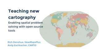
- 1. Teaching new cartography Enabling spatial problem solving with open source tools Rich Donohue, NewMapsPlus Andy Eschbacher, CARTO
- 2. Modeling analytical thinking with CARTO Andy Eschbacher Map Scientist, CARTO @MrEPhysics
- 3. Research & Data team Stuart Mamata John Andy Andrew MichelleMehak
- 4. My first maps Studying the statistics of chaos on a toroid
- 5. Physics Teacher Arlington Public Schools, Virginia Radio Telescope, 2014
- 6. Education at Carto is going from how to do things in carto?
- 7. how to think through your problem with carto and other open source tools Education at Carto is going from how to do things in carto?
- 8. Demo time
- 9. Question: How many Californians would be affected (within 50 miles) by a significant earthquake?
- 10. 1. Find events which happen in California (intersects)Question: How many Californians would be affected (within 50 miles) by a significant earthquake?
- 11. 1. Find events which happen in California (intersects) 2. Filter out non-significant ones Question: How many Californians would be affected (within 50 miles) by a significant earthquake?
- 12. 1. Find events which happen in California (intersects) 2. Filter out non-significant ones 3. Find the total population within 50 miles (buffer + data observatory) Question: How many Californians would be affected (within 50 miles) by a significant earthquake?
- 13. 1. Find events which happen in California (intersects) 2. Filter out non-significant ones 3. Find the total population within 50 miles (buffer + data observatory) 4. Symbolize by population counts Question: How many Californians would be affected (within 50 miles) by a significant earthquake?
- 15. ● Question/hypothesis-based ● Modeling thinking to solve problems ● Guided instruction via UI ● Prerequisites link to more traditional skill-based pages Our new Map Academy (soon to be released)
- 18. Teaching New Technology Shifting GIS Education to the Web by Rich Donohue @rgdonohue
- 27. Cartography Cubed Diagram Source: Roth, 2013
- 28. Map by Lauren Winkler, 2016
- 29. Map by Anna Bard, 2016
- 30. Q: How can our intro course better shift our mapping practices to the web?
- 41. Every theoretical physicist who is any good knows six or seven different theoretical representations for exactly the same physics? - Richard Feynman (theoretical physicist)
- 42. You don't understand something unless you know seven different ways of explaining it. - Andy and Rich (paraphrased)
- 43. Rich Donohue, @rgdonohue Andy Eschbacher, @MrEPhysics thank you!