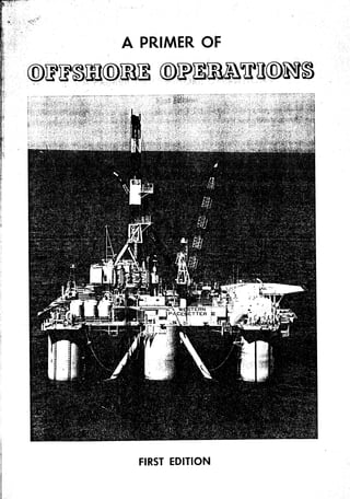
3. Forewordto the First Edition
Energy requirements are increasing wolld wide. Available supplies of
natural gasand crude oil are being depletedat a rate which threatensacute
shortagesrvithin the foreseeablefuture. Alternative sources- energy are
of
being exploited by both government and industry. Some of these are nx-
clear, geothermal,and coal deposits. Each of these a'lternativesrequires
many i*p.ouements in technologyto meet the potential dangersinherent in
tltem. Radiation, destrrrctionof the balanceof nature, and air pollution are
amongthe ofrenders.
A desirablesolution to meeting energyneedsmay lie in the improvement
and expausionof currently succissful technologiesof exploration and pro-
duction of oil and gas. Beneath the seabedsand the ocean floors are the
remaining areasin *t ich to find and recover the additional hydrocarbons
sonecessary tfe presenteconomy.
to
Inland and ofishoretechnologies have many similar or identical character-
istics. Sinceonshoreoperationsare discussed A Primer of Oilwell Drilling
in
and A Prhner of Oil and GasProduction,this publication will devote itself
principally to equiprnent ancl methodstrsedto iolve problems encouptered
in offshoreoperations,
Witlr this purposein view A Primer of OffshoreOpetatiorwis submiited.
Curtis F. Kruse
PetroleumExtensionService
The Universityof Texasat Austin
Austin, Texas
August 1976
I
I
I
I
I
l x
4. CONTENTS
Introduction
Marine Exploration .
L -
Environmental Information . ! 7
Rigs for OffshoreExplory tory Drilling t3
Moving on Location . ,.,t15
Station Keeping . .
Rig Componentsand ProceduresPeculiar to Floaters .
BOP Stacks .
.
Rotrtine Drilling Operations and Relaled Services .
.1,"
!4
ProductionWell Testing .
Abandonment Procedure 39
C rews-Q u artef,s-TransP ort at ion 4t
'
':
: . t
_.'.:
" '
Safetyandsurvival . . . . . 45
:.
'.. .
t:-r
'{7,,,'
.'
i, :t. _.
OfishoreDrilling/Production Platforms ' t ,
.'.:
Storageand Transport to Shore ffi
' .:.
. ' : l
i .
Bases-spills-Reguf ations-Contingency Planning 67
G l o s s a r y . . . . 69
.
Acknowledgements , . 73
t
I
I
5. -"INTRODUCTION
extensions of
Offshoreoperationsof the petroleum industry !"Sul^ll .-oo,'
gy surveys
rfttt" "-pfori'r,g, 4rilling, and^productttg' the late l93os,seismic.
bays adjacent'to
had be"r, madl of "oori*l maril lar,ds,5*yuut, and -shallow
with water
,:tlte Gulf of Mexico.In Louisianabargessunk in dredgedchannels
'iiH, "f;;;';il and securedin iositio' with sptid and cluster'-piles'hacl
proyed themselves arUing ptatfo^rms.
", Drilling operationsin sha$owblys .Platform'
Firstofishgre
tr;;""ffi";;r *;od"r,"il*tfor*, mounteii timber
tln supplies
piles'
,' were brought to these op"oiiotrr !)t b"tge- throrgh accesschannelso: 9I
'
f.oit n"orbf titoti ot boatlandin[tu"*tio"t'-ot.:"tP " tfl,tl*
trestles
from L;alilornra
i,rg *o, done fronr'wlrarves extending out into the Pacific
ilil;.;"rn "l'irt" early activities ii water coveredareaswere to extend '
' already defined on shore'
--nub.y
;;lil;;"rlr ""a a.ecou", oil from reservoirs
dry land
odu"n""*"* "*uy from the solid ground.ofprairiesand
, toward the bpen r"*rir"r bi'o,.,ghtconfrontaiions problemsthat-hadto
with
'|1e
solvecl.T'fterrsuirlpatteru *'",,sfor tlre operatorto first try the.equipment
the oper-
and skillsalreadyin his possession; wlrentlris was not enough,
and
ator had to seekitew rnaferials, designs, and methods'
' were quickly imitated or im-
S,,"""rsful adaptations of existingresottrces
provedby cor-,rpeii'g operato's. OfEn the e'rphasis wasmoreo' cooperation
io achieve "un,,rloro, tll,.n on individtraigains.
,, gionl The net resttlthas been
a fairly steaclyevolutionin every aspectof offslrore activity'
water dept6s aud more lostile
, As ofis6oreoperatio's rnoveinto greater effectsis
,' .envirorrmelts, costsilcrease raplily' Ole of t[e-most striking
tr'il
" irr.f.," in"r"nrl i' size of petroleurrir"rlru", r'equiredto iustify tt::9:::t:t:
' at 100'000,000
ment of a discoveryfieldi,In sorneareasa ,*r"iu" estimated-
- frfri of' petroleum irt st be consideredmargintll l$ ."y,"it developmenton
;ro.thatbasis.Comrnercialreserves begin at 3d),(n0,000bbl of anticipat"d Pt-
,l tluctiou for somefields.
otlrer fact'ors u4richare influencingrising costsand feasihilityof develop-
patticipation of host cottntriesin leases, bonuses'.anu.
ment are iucreasirrg
: :ii'op"Jil;i i*p".t*
;t"d;Jtion. ltestrictions regulationscapital outlays are
and :.*T*:::
opirations ar.egenerally repressivein efiect sincelarger
needed.
much
, lVith this backgrolncl tlre entire field of exploration has become rig.
Firsi semisubmersible
ii' bro".l".. All the tiols available to geophysicists used: seismic,
are gravity'
magnetic, surveysbasedupon core drilling are comrnol].
;il;;;;;;i'iu*g #-;;' **:
greatlyiixpa'ded' iTt l",ii*9
to determinu,ur".uoiito"*tiotr uni rir". ThJnumberand designof drilling/
is determiuedby i'formation.obtainable onlv from
ilJ;;;;;;; ;i;;f;'*r
actual drilling. Productionand transportation facilities will not be con-
structed until theirneed assured.
is
operations
A; ;,I.*;^,,.fi,,! "f ofislrore reqrrires eli4talq{-#9$
tlrat
rs
a'd developme*t Iritbng -b_.^loo.l., .listincrrislred- Exploratory drilltng
r r^--^r^---^--+ J-;tl:*- L.o "_!.gedndg!,ll-guis6ed.
--*F#
ExnloratOrv
oilffii *6il1b rigs,andthe we.lMtlg!g-?j-*
**r-- In *ater deepgr
uctlon alx
than abotrt 1000 drilled from mobile
floating rigs.
6. .'-;"'
Areas of ofishore activify.
.t,,,. a
:
'...
:rl.'
:
'''':::''
:'i.it,
-.ii .
'
...:.,. l
.ri,.:
. .',i:
' 1 .
- .-
' ,':
.: .1,
' .
i : ; : :
Firsi self-elevatingrig.
Activifies start with exploratory surveys.Erploratory
drilling is nert. Productiondrilling is last. Mobile drill-
ing rigs test the ProsPectivereservoirsto determine
the feasibility of develoPment.
Rig count---€arly 1976.
I
I -
RIqS 286
!^JORKING
Louisiana 64
I
Texas 12
U .S . P a c i i c
f 3
Afri ca 1B
A t l a nt i c 5
Aus tral i a 2
Canadaand Great Lakes 1 0 Self-elevating with open-fabricatedlegs.
rig
Cari bbean 3
C e lt i c S e a I
Medi terranean 12
Mex coi 3
M id d l e East 45
North Sea 47
South America 30
S o u t h e a s t A si a 31
Idle Rigs 26
Enroute 6
UNDERCONSTRUCTION 127
Drillships 29
J ackups 50
Semi subrnersi es
bl 4B Large drilling ship.
7. :-:
:..'-:
formations
Subsurface
Introduction
Oil and gas reservoirs under bays, gulfs, electrical, radioactivity, geothermal, geochem-
and seas ar; just like those ttnder lancl sur- ical, slim hole drilling, and seismic surveys.
fac;es;sonretirnesthese reservOirs arc exten- Exploratory drilling,is the final method-
sions of those alre"dy proved on shore. Irregtr-
larities in subsurfacestrata exist iu such forms
Es
EIPL0RlTl0rTEcllrlqu
bqrig* Iqgfs,-.f+slls,
as sdlJlpgs gi. dgryes, .
folds, anticlines, synclines, oi- otlrej geqtgglg
e i-egularities or anomalies
@the presence of oil or gas de-
posits;' Tlrere must be 'a sou_{9e:tlpe__Lo..ck
formation, a reservoir-type rock rvith pore
structqre able t bons, aird a SE|S$C
barrier-t@ich will trap And retain
.
hydrocarbons'migrating from their sourcebed.
, Excltrsive of actual drilling the seismic
Exploration Techniques
method accounts for riiore than 95%of monies
Geophysicists and geologists have several spent each year for acquiring and Progessing
sources of data including magnetic, gravity, geophysical data.
8. ' seismic JtrkfiA.Hi*"
/ l '
survey
t f ' : - q
Vesselsequipped f6r seismic suryeys are in
the 165-175 feet range in length. Op"rating
speed is 4-6 knots which pennits rechargrng
of the compressed air guns between shots and
holds within acceptable levels noise interfer-
ence and motion accelerations ( trim, pitch,
Iist, and roll ).
An acoustic wAve train or impulse is trans-
rnitted through the water column into the
earth and is fiactionally reflected from inter-
facesof strata lraving unlike velocity and den-
sity characteristics.These acoustic echoesare
detected by groups of hydrophones ,mounted
in a plastic covered streamer or seismic array
Satellite-Doppler navigator
sonar
towei behind the vessel. Depth controlleis
maintain a constant depth of tlie streamer be-
low the vessel.The acoustic data is gathered,
Position determination 0 , digitized apd stored on mag4etic [ap*r for
The rfifila Wtreophvsical
ffiodepends computer analysis, resulting in displays which
ruporl ffii"
tne to
;$F6fF Fo#rettirn provide a graphic representation of the
the precise location of the prospective struc- structure of the earth over which the vessel
tnre. An accrlracy to a horizontal error of 16 traveled.
feet and an altittrde error of six feet is possible Sotrnd sorlrces of marine seismic surveys
lry taking 20-30 satellite observertiort rccord- incltrde:
ings frorn a fixed position for an offshore loca-
o Ai,_guns or air gun arrays using compres-
tion.
Integrated navigation systernspcrrlrit all- sed air discharge
' Single pulse using compressecl air
weathsr, 24-hotrr-a-day navigation without
. Small chemical explosive charges
tlre need to establish base stations for radio
o Vibratory ( non-dynamite
positioning. The navigation glrtion of a typi- )
o Acoustic pulse ( Exxon
cal integrated system consistsof r ( 1) a gyro- )
o sparker (electrical for minimal
compass,( 2 ) a fotrr-beam Doppler sonar, (3 ) ) penetra-
a satellite navigation receiver, and ( 4 ) a cen- tio', high resolution ( shallow gas, mud
tral digital computer. line data )
a Courtesy
Seismic
Engineering
Otlrer ftrnctions generally performed l>y the Company.
integrated systeminclude :
Diqital recorder
o Automatic logging on magretic tape of
navigation and geophysicaldata
o Steering the ship along tlre desired sur-
vey track
' I)riving a plottcr
to rccord ship's track,
shot point iverit.s, and.time ann;tation
' Atrtomatic firing
of seismicshotsbasedon
uniform incren-ents of tirne or distance
' AScepti'g,
corlverti'g, and recordirg
oth,ergeophysical da ta
4
9. Hydrophone, acfual size.
SeismicSurvelor:-a speed of | 2.5 knotsand | 0,000-
mile range t"'ku possiblelong movesto remoteareas.
-
ONE SECTTONDETAIL
LINEAR OR TAPERED
3O-5O HYDROPHONES, SPACING
@
5Om--tl
fr-,r'
Typical 48 trace geophysicalarray.
SHOT f, SHOT 2 SHOT I
Streamer,reel, and depfh controller.
Strrveys are initiadd io't.rr"iul'*"ytt (1)
reflectorpointtechnique-
common
Seismic A sirrgle company may contract for a survey.
( 2 ) A combination of several companies may
Detectors used in marine seisrnicwork are share the cost of a spqcifie contract. ( 3 ) The
pressuresensitive devices called hydrophones. seismic survey corporation may speculate by
These are placed in long cables called streanF making a survey in promising territory with
ers and towed behind the survey vessel.Cable the expectation of profitability when industry
length may reach 3600-3800 meters with attention focuseson this new area. I)ata banks
2000-3000 hydrophones. For marine Lrsehy- eventually acquire much of the information,
I l -
drophones replace the geophones Lrsed or] and participating companies have access to
land. I them.
I
/
i -
D
10. Surface synoptic clrart prePared by NWAC'
/
i#"'
%)S
,t-I
'Te: '',,.-=.../.1
'r' l"-'
.SYMROLS FOIT SIGNIFICAN"I' WE,ATHE,IT SYM BO I,S F O IT F R ON 'T S, ( :ON VN IT C N N ( :N I,IN N S, ET C :.
THUNDERSTORM ^ ^ - COLD FRONT AT
K - THESURFACE
R TROPICAL REVOLVING STORM
a> COLD FRONT
-..
(HURRICANE/TYPHOON, ETC.1
ABOVE THE
SURFACE
^= o FfS'ii'IfJi?"+'.tJ
'
SEVERE LINE SQUALL SURFACE
n
I '-'
WARM FRONT
fi HAIL I,INE
CONVETTGENCE
V
c_ WIDESPREADSANDS-I'ORM
lJ;lx8'
J OR DUSTSTORM INTER.TROPICAI,
WARM FRONT
N N N ABOVE,THE CONVERGENCEZONE
() FREEZING RAIN SURFACE
. RAIN
- ^ fJ;$i8,
OCCLUDED FRONT
* sNow
,. NOTE: THE SEPARATION OF THE TWO LINES
GIVES A QUALITATTVE REPRE.SENTATIONOF
OCCLUDED FRONT THE WIDTH OF TIIE ZONE, THE HATCHED
r^ r1"-A ABOVE THE LINES MAY BE ADDED TO INDTCATE AREAS
SURFACE OF ACTIVITY.
A FRONT ANI)
AN ARROW INDICATES THE EXPECTED DIRECTION OF MOVEMENT OF
'I'HE (IN KNOTS). IS GIVEN'
IIE,,X-[.TO THE ARROW EXPECTED SPEEI) OF MOVEMENT
usedon radio facsimileweatherrepork-
Symbolsand notation commonfy
11. Sea conditions
Waoe,s are formed by the frictional contact
the surface of the ocean and water bodies ( tt of the blowing wind upon the surface of the
gulfs and bays ) connected with the ocean that water, Windslre seldom calrn because the
occur twice a day and are caused by the gravi- circulation system of the atrnospherekceps all
tational attraction of the sun and moon occur- levels of air in. constant motion either verti-
ing uqeqnally on different parts of the earth. cally or horizontally. Horizontal motion of qir
Ordinary tides are completely predictable and is wirrd. On the surface of the water first rufles
tide tables can be obtained which indicate then waves are formed. Waves ar€ not mass
high and low tirnes for ahnost any water body transfers of water; wsves transmit,.,pnery.
connected with the oceAns. Forces generated by wind velocity are trans-
Storm tides are associated with the move- mitted frorn one particle of water to the next
ment of hurricanes. In the Gulf of Mexico particle with only a minute loss of ener$r (the
storm tides of 20 feet inundate beaches and same principle which operates in a hydraulic
lorvlands as a maior storm system approaches sptem. ) The area of wave propagation is
-sornetirnes as mlrch as 24 hours in advance. where a certain wind force prevails from the
In other parts of the world hurricane-type same direction for a period of time. This is
stonnsrnay be called typhoons or cyclones,btrt called the FETCII. Wave movement expres-
the basic frnr*rds are itr* same. sed in feet per se(nnd is called CELERITY.
Currents are a part of the circulation sys- Once in rnotion waves will continue until
tem of the eartlr's water which covers approxi- tlre energy they contain has been transferred
nrately 7LAof the surface.Major currents such to the blanket of air above or to the ocean
as tlre Gtrlf Stream and the Japanese Current floor. In the shallows waves crest and break
'waves
are well known to residentsof coastal {.f.S.and and become suRF. which travel be-
shippittg interests.The Gulf Stream is a warm yond the wind which formed them are called
ocean current in the North Atlantic flowing SWELLS. Swells may occur many miles from
frorn the Gulf of Mexico N. along coast of (f.S. the area that produced them. suRGEs are
to Nanttrcket Island and thence E. The weath- Iarge waves ot i*"lls or a seriesof them.
er of the British Isles and the English North Ts.unaffib, notably in the North Pacific, are
Sea are products of this current. The japanese lruge shock waves produced by submarine
Current moves northeastward from Japan to- earthquakes. Effects of this energy transfer
ward the Arctic, ttrnrs southward and sirongly are less serious in deep ocean waiers, but in
affectsthe weather and clirnate of Alaska, Can- shallows and on shore immense breakers may
ada, and the U.S. Pacific Coast. Other major inunda'te and destroy boats and installations.
currents are the Labrador, tlre Htrmboldt, thtr Often there is no warning unless it is observed
Equatorial currentsand their counter currents. and reported by a ship a-tsea,
Tidal currents occrrr where water flows into
or from tidal basins.The B"y of Fundy, an in- The following definitions are related to sea
Iet o[ the Atlantic SE Canacla with r:eportecl conditions:
tidcs of 40 feet, is one exirmple of strorr! ddal ( 1) A cunent is defi'ed by the direction
currents. It hasbeen reported that at one point tou;ard which it flows; ihir is the SET.
along the coast of India tidal flow limited drill- (2) Rate of flow of a current, the velocifr,
ing operations to three hours a d*y. is called the DRIFT
12. ( 3 ) Winds are named for the direction
fromwhich they flow
( 4 ) Rate of flow of the wind is called
WIND FORCB
( 5 ) Both curent and wind velocities are
expressedin KNOTS
( 6 ) A knot is a velocity, not a distance; it
is one nautical mile per hour
( 7 ) The nautical mile is 6080 feet ( 1.15
statute miles )
( 8 ) A time rate of linear motion in a given
direction is a VELOCITY
( e )A time rate of charlge of velocity is art
ACCELERATION.
CookInletplatform.
Sourcesof oceanographic information
Pack iceis sea ice formed into " *rrs by the
Oceanoqraphers' charts and tables of dy- crtrsltirtg together of pans, floes,and brash-
namic o"""ttograPhy strpply basic informatior"t L pan is a drifting fragment of the flat thin
on crtrrents,tides, and waves for variotrsparts ice that forms in bays or along the shore.
of the earth'soceans. h fl,oeis floating ice formed in a large sheet
Tables of tides are available in book form on the strrfaceof a body of water.
arrd rnuclt of the information is available otl Brashis a massof ice fragments.
regular radio broadcasts. Icebergs are large floating massesof ice de-
Logs and recorded observations of both tached from a glacier. The average iceberg is
fixed and mobile platforrns c?n be obtained. calculated to weig one million tons. Hun-
Indus t y publications often report unusual dreds of lcebergs threaten drilling from 100-
::', i..
sea states that have occtrrred. 300 miles off the shore of the Labrador Sea'. As
First hand observationsof ships at sea with with pack ice drillshipr with qtrick disconnect
facilities to transmit ship's rveather messages and reconnect capabilities can functiotr, leav-
and storm data to coastal radio stations are itrg the BOP stack on the seafloor.
sometimesa good source. Major iceberg detection is by radar. Heli-
"hindcastiug"
Special studies irrcltrding re-
copters can spot approaching pack ice or ice-
late observed weather conditions to the sea bergs in time for disconnects to be performed.
states that might have been expected. In some instances icebergs can be torved by
Company retained consultants interpret tugs or other auxiliary craft to a course that
and predict conditions requiring special Pre- will bypass the dril'lship if the BOP stack is
catrtions. threatened. fu a safety precaution a workboat
may be stationed within one mile of the drill-
Ice ship to assistwhen icebergs threaten the oper-
Tlre presence of sheet ice may limit drilling ation. In a danger zone an ice management
( 1) to short seasonal operationsof 4-Srnonths consultant supervises the safety procedures.
during srunmer ancl early fall when there is Freezing spray and build up of ice on the
tro sheet ice, or (2) to specially designed srrperstrtrcttrre from freezing rain can halt or
fixed drilling lilatforms with caisson-type hinder drilling operations. In some instances
l"g conshuction as those used in the Cook small craft have been lost because of super-
Inlet, or ( 3 ) to dynamically positioned drill- strtrcture ice accumulations. Day rates for ice-
ships with capability for quick disconnects troubled operations are two to three times
and reconnects. those of mild conditions.
I
13. Weather
Weather is defined as a state of the atmos-
phere with respect to heat or cold, wetness or
dryr"ss, calm or storm, clearnessor cloudiness.
"weatller"
In many sittrations the term is used
principally to indicate conditions hazardous
or unfavorable to the operation in progress.
Sea states and weather are so conrpletely
interrelated that both figure in long tenn plan-
ning as well as daily work schedules.
Circtrlation of the earth's ahnosphere, Iike
the circulation of its water, is constant. The
sun supplies the energy. The rotation of the rig storm.
Drilling tenderduringa severe
earrtlr is a factor. Differences in heating and
eooling rates of land and water surfaceshave Fronts are strrfacesof discontirruity or inter-
tlreir effect. The zane of maxirnum heating b)' faces between unlike massesof air. Cold fronts
incoming solar radiation changes throtr{h ; move toward warmer air; warm fronts rnove
range of 47 degreesas the surl reachesits ze- toward cooler air. Stationary fronts appear to
nith between 23.5 N. Lat. abotrt June 21st and remain motionless; an occluded front exists
23.5 S. Lzrt. ahout December 2L. Heating in wlrcn a cold front ovcrtakcs a warm front lift-
equatorial or tropical erreas, cooling at bot'h irrg the warm air above the earth's surface.
prles and the two temperate zones between Lows are potential storm centers. Fronts lie in
tr<lpic.s urrd thcrpolcs givc risc to cli.stirrctcir'- trouglrs of lowcr prcssure where wind shifts
ctrlrrtionpatterns of the carth'satmosphere. itrrtl ternperature clranges will occur. Rapicl
Seasonally cold air advances from polar rnoving cold fronts sometimes produce squall
areas into temperate areas; the warln equa- lines ( a squall line is a line of prefrontal rain-
torial band of atmospheremovesnorthward or showers and thunderstorms which form in
sotrthw:rrdinto the temperatezolles. warm air masses At the front, precipitation
).
Air massesacquire their temperature and will occur if the warrn air contains adequate
rnoisttrre characteristicsfrom the surface over rnoisture. Cold fronts move faster than warm
which they originate. Arctic or polar air fronts. Warm fronts may actually indicate cold
Inasses fomred over continents have lower air receding
teurperattrresand contain less moisttrre than Some areas, the North Sea is one, have a
ltrctic maritinle arirnrasses. high incidence of frontal storms with high
Tropicrll air mrrsscs
':,;L,
winds and dangerous sea states. Rigs must
i.:!::j '.:
resulting from heating of land strrfaceslrave
have t}e capability to operate in this hostile
Ii:ii=, high temperattrres and low water vapor corr-
environrnent. Iluy rates are based upon rig
tent; maritinre air masscs have lower tempera-
capability and include rig rental, drill prp€
trtres and rnuch higher water vapor content.
use, and fuel consumed. Rates for severe
The chief point of interest in these rneteoro-
weather areas are about double those of mild
Iogical facts is that the energy to prodtrce lraz- weather locations. .
arclotrsweather lies in lncl is transported by A hurricane forms as an extremely low pres-
the ,vatercontent of the atmosphere,added in sure system along an easterly wave. For the
tlre form of vapor. The release this euergy at
of Gulf the months of June to November are the
the tinre it conderlses from the gaseous form to most critical.
the liqtrid forrn supplies the erlergy to produce To'radoes develop as spin offs from hurri-
fronttrl st'o'rnls,
thunderstorffis,hurricalles, ancl canes coming aslrore; at sea they are called
related disturbances. water spouts.
14. --E:l'.rys.;i".:'-arc-;s:
Areas wherecyclones forrn.
{hurricanesl
SoiI conditions Corrosive elements
Every phase of drilling and producing off- The composition of the waters in which
shore petrolerlm is affected by soil conditions steel structures are submerged varies widely
at the site of the operation. For jacktrp rigs in dilferent environtnetlts. The degree of sa-
penetratiorr depths of the legs, the use of mats, linity and the prevailing temperatures affect
footings, piles, arld anchors to stab ilize the rig rates of corrosion and methods used to oombat
rnust be accurately predicted. Floaters must it. Natural seawater, brackish water, and P"t-
assess their anchoring and mooring needs. lution-laden water all differ.
Fixed platfouns and.pipeline construction re- Contact and abrasion by water in splash
quire accurate soil condition surveys in order zones or spray generally require coatings de-
to design footings,clttsterpiles, artclpiles to be sigrred to prevent air or water frpm contact
driven, with metal. The coating should also prevent
or reduce flow of electric current.
Soil testsinclude combinations of : Corrosion occurs when unlike metals either
( 1) Core drilling and sampling in direct contact or proximity in an electrolyte
(2) Side-scansolrar to detect pipelines or produce a flow of low electrical current which
other seafloor structures. dissolvesone of the metals and either takes the
( 3 ) Ivtagnetometer to detect caprocks or rnetal into solution or deposits it on another
other rocks surface as in electroplating and anodizing
( 4 ) Precision echo sounder to obtain accu- Processes.
rate water depths and mud thickness Cathodic protection is based upon the es-
( 5 ) Laboratory analyses determine shear
to tablished principle that both the amount ancl
strength, load bearing capabilities, arrd clirection of current flow can be controlled by
estirnatepile depth penetration tlre placing of anodes in strategic locations.
Various metals and metal alloys and impressed
Specialistsperform these soil tests. Bottorrr current systemsare used. The desired result is
soundings to deternrine the suitability for to prevent the protected metal from dissolving
anchoring and mooring a dlillship or semisub- and instead to deposit a thin protective metal--
rnersible may cost $30,000a duy. lic layer on it.
10
15. Station: BOSTON, MASS. (NMF, NIK, IVOU)
drca afcctcd:r
(a) Nrrrth Artantic warcrs rxrrrlr of t0" N. tn<l wcsr of .lio W.
(b) Coastal waters: [,ast1xrrt. Mairrc. !lerrimacl R.. I{ars.
{c) Mcrrinrack R.. Mass.. to Block lsland, R.l.
(d) Oftshore waters: nonh of 4lo and west of {i0" W- (Ncw E,nglarrrl watcr.s).
(!) Ofishore-waters: 32" N.-{1" N. arrd west of 650 lv. (West eentral Noritr Arlarrric waters).
(f) Boston Harbor. .r
Frcguencies Ctass.ol loioct
(hHz)
_""":'g_ Time ol broadc*l €rntJJton (kw)
NTK 5320
8502
i!i1:.,:.1
NIK l2t8 8502
I'ii i' r.
127511
j:,' '
;!.t - :. I NT|F {X}50.
1650:H*ltl or.H+{8t 472
i:-.':r.
'':'...
l NMF r
Ou reccilrt 2t82
;l:-:.:i ---
267q
NIt{F ot.to.irxo, t{i4o.22,t0 2670
ill.-r.:..
NMF 0t30.07J0,
t330,t930 E?643 t0
woU o{20. 1020. 1120.l{i20.222O:
on 2450 560w
rcceipt arrder€n H+20 until next 2506 560w
schcdtrled hroadcast 2566. 5fr)w
0 0 r 8 ,t 2 r 8 lce bullerin lce relxrrts dtrring the icc seasoe. March l-f uly
l, approxirnarely. Broadcast at l6 wpm,-fol-
lowed try a rcbroaclcasr at 22 wpm.
0050 Forecast Forecasts anrl warninpi for ar€:rs h, c. and d.
t650 tine<ast Forccaslr arxt warrrilrgr for:rreas tr. <. and d:
localir.crl rnarine for,ecasts.e
0420,2220 Forecasr Forecasts and warning-s for areas b, c. d, e, and f.
l0:t0. il20. t620 Forct'as( Forccasts and warningr for areas b, <- d, e, and f;
l<rcalized marine forecasts.i
o{.10.
t{}40.22{{) Forccast Forccast an<t warnings for area d.
(f7:r0.
{||:t{1. l3$0,t!,:to t'orc<:ast F<u'ccastarrd warrrings lirr arca a. lce lrtrllitinr
in scasorrar 0130 and 1330.
r8+0 Ifarnings (ialc/storm/hurricane warnings.
0n receipt2: 'l'arrrings Gale/storm/hurricarre warnings.
H+lE or H*{8; e
on receipt and even
Ht2O until next.sched-
uled broa<lcast
Worldwide MarineWealher Broadcastr, United SfatesDepartmento{ Commerce
a publication, tfie princi-
is
pal source informationon marineweatherbroadcasls all U.5.ships.
of for
Forecast services
Information and forecasts by radio and ( 2 ) Continuous Weather Broadcasts, tI.S,
,r'adiolelephoneare available in all parts of the National Weather Service, VHF-FM
woitd with the obvious differences that widely radio stations
' $pacedreporting stationsproduce. ( 3 ) Radio Facsimile Transmissions
" Lii-t.edbelow are the principal sources:
( 4 ) (J.S. Offshore Marine Weather Broad-
Marine Weather Broad- casts-Radiotelephone
, ,(t)Worldwidg
casts,a publication of the {,t.S.Depart- (s) lU.S.High SeasMarine Weather Broad-
' '' casts.Radiotelephone
ment.,of Commerce, National Oceanic
Service; revised annuAlly, changes ancl ( 6 ) Hurricane Warniog Service
( 7 ) l{WS Severe Weather Circuit
I ,, , .: , 'Sgpelintendent of Documents ( B ) Professional forecasting services,
tI.S. Govenrment Printing Office weather consultants in company em-
Waslrington, D. C. 2A402 ploy.
11
17. I,RIGSFOROFFSHORE
EXPTORATORY
DRILLTNG
J '
--y
-7
*oY
-F.ef I-
comparative "f ,Sfft" ris "o#g?l"WtQ+itp^.+-
view
The,,.e:ryironnrent in which each type_.gf ^^n inlength
.iiiii ng
nrobil" irrg func dDrillshipr.yfi"fty range from200
tions ir-de
best tffi Y'
ate in water depths of 3000feet, Engineering
sttrdiesfor the Mohole proiect and the core
clrilling successes the Eureka, the Glomar
of
JnckupiliCvelargelyreplacedsubmersibles. Cftalle"nger, a predecerso.,
and Cuss l, have
Aiackup.rig: (1)provides-affxeddrillingpfaf proved ihe capability "f drillships for opera-
forlr, ( 2 ) its initial costis lessthanothers,(3 ) iio,r in deep iater. Li-it"tiorrs:are fouid io
it can wor,r"l,rl"Uorn areasof deltas if the lack of suitable risersto suppdrt drilling
-rr
dntpPdd with fi'fffto srrpportthe legs, (4) it mud circulation-wellhead to di-Uins foor.
can be designed,to:withstand hurricane-type r. /i
storms, (5) it is the best tool available for
[:# gtiprtrep-s- incl-udq qftbc[e=ArilUng+lat-
-zf""riiiir"i(
water depths of lessthan ;rOU
rrer oeprns or tessuran 300 feet. teet. rformsthat ( t ) "r" self_pronellE *a UG ih"
I are self_pronelled havethe
arrd
In5%itri#ffi
t l'ffigii;;131i-t_fJjh$'ft
cun to tow' (z) legq..must
P-e-!gid*q"o^up-.g{n{(2) d:4lips@ot
*
,ig-6lr,"{m
i:i1lu,tf-lf"tg:g;:;j'"(q[Fi'{,#es'+
(4)gr.'"BggJ_g$,;-*rT;EIiiI'Ab"-;g;
y'il*"1..b+:stle:ts-u*rts, e.q "il-"taliea1istfi!fiffi
-
Ios.ttig.Lis raise low- tro*
lraz4r{ls5iacking.to or the
$fifff6frn:fffiier commonty
usi4wig*_* .
;:::"i3'.t',:k: -s=$*9-JyJegord.
raYP "l:]-ti*_np na,1x4qd4",5"*' ;i'iJ;fitrff
s-+-4prrev $
lavg pr-gdgcg{po.qJ f"ffi.Fui6i66oittol by a'barsemasterralher
feattii'esl! its control b
s
1 Amo.ng
t$*p.Jy;egoid.
Pr-gg!l-c-9{P9.9J
Drillships liave a number of advantages.
them are: (1).proven deep water
than a "ffi-ffi6
;nEcEsfffrffie-bodiedsea'-"rr*refn"h*rg
r.?:i'I}?d?l rTffii a-".lfl*""ff:":?,x'n:il*fJ:
*Xffi";?;.;,T::,
travcl timesto remotelocatibns, no need
(4)
_. costs
"'.,,-catering continue.
Drilling U"rguJ:EffifrT**'
for ffi"i3 they areself-propelled, ) lower /' these
(f costs.
costs to operating company-maintenance
"l ,,
'*ff ih;Ttrilffi *
il.&Jffffii.#"i;:iln:H,i,T::i".I:l#Eii,H
$..Tl,il;iffi ;FF,^A fir#ffirl
ot.o!l't"s*",!
In:. limitedcapacity operate
lrc its to i'-riind or' r.tla1r " ott"rl-iH-ftfiffi5ilrrtil'for water
,t
wave conditions
whichproduce
ekf6ffil06plat. eAffij
ronrlrnouou. 2000 fert, (+),g!r*gggg-$fqy r"gqrCJ
13
18. DE' LOADING FOR DISCOIERER CLASS
TYPICAL SUMMA.RY 9I VARIABLES
'- : . WEIGHT
ITEt"l: QUANTITY
4250 bbl. 7 A7 tons
FueI
Brake Cooling Water bbl .,!
460 ,, 85 tons
Engine Cooling Water NONE
Lube, Hydraulic & Gear Oil 5 tons
Wash Water 1000 bbl. 180 tons
Drilling Water 4000 bbl. 700 tons
Potable Water 825 bbl. 148 tons
3 400 tons
Bulk Mud & Cement .7060 ft.
Liquid lvlud 1700 bbl. 600 tons
Flume Stabilization Water 5'800 bbl . 1020 tons
Chemicals 5000 sacks 300 tons
Drill Pipe , Collars, Casing and t'larine
Riser 500 tons
Chain, Wire RoPe & Anchors 50 tons
Dry Stores, Misc. Toolg e Misc. Equipment 40 tons
Mooring Line PulI Down 60 tons
Ballast NONE
Contingency 575 tons
TOTAL: 5370 tons
Semiqu,bmersi'bles : ( 1 )--linnlte-{Seqt?::
have is it
If the semispbmersible self-propetled,
will have a shipmaster who will suPervise its
ilv {'ol.LgHggjHlryIF:li9sJ?e-qsirs
Jr rgpre
*i tffiffimfrjply, aqqlror andlipg,
strouort
"ci.4ffi,*!ilef_
propulsiott, towing, moorinS, iind anchoring.
$Ei,
ls]-]frfft t_et-r.r*ee-dd A fewaie6ilBa-
Dy_ IacSgP!.
'.biitti"g
gjtsA**ffi;iffi. ffi-.bt. n'fiiwai6'ffiBa-
,"* bargeshavethe advantages ( 1) of Efu of *odiftcition to drill in water depthsuP
'i
i rlo*"t "oit than other
l.r.rror ,^r^r.r rl'rnr. nfhcr foaters^
v Yr (2) smaller
floaters, ( 2 smallgr to 1000 feet. Under construction and testing
'e:-i crew and quarters needs. T'heir disadvantaggt
i{i{',i
are a number of semisubmersibleswith nomi-
i
i *r", (1) low towing speeds,and (2) depend- nal depth ratings of 2000 feet. )
'?, i -
Relative initial costs are statistical in nature
ence on tugs and other work boats-
(semisubmersible drilling rigs cArneinto use btrt to indicate the range, these figures are
its it became clear that floating drilling plat- suggested:
forms instead of bottorn supported must be ft.)
]ackup( 100-150 $10,000,000-$12,000,0m
used in cleeper waters.>A few strbmersibles
were convett".t to ,"*irubmersibles. Newer ft,
Jackup( 100-300 ) $20,000,000-$25,000,q00
sernisubrnersibles resemble their prededessors Semisubmersible
in rlppearancebtrt improved streamlining and
( 600-2000ft.) $40,000,000-$50,000,000
design changes in the buoyancy and flotation
clrambershave increased towing sPeedsfrom Drillship
3-4 kno ts to 9-10 knots.'$-L9W-ip*isubmersi- ( 600-2m0 ft.) $35,000,000-$40,000,000
t,tu ir;"""1+
n . .d:-*;T,I
pr:qpglled lit'ff-lmia
ifrbG: #eed- D"y rates or rentals will likely be approxi-
ing balast cTramberswith seawater. The ves- mately $1200 lday per $1,000,000 invest-
of
wave,
r"i G1fixin"ond-*rd-ufffiffi-tfi6Test ment with additionalcharges supportbase
for
ctrrrent, and wind relationships ancl tnoored Severeweather locationsand ice-
farcilities.
anclanchored.- trotrbled areaswill increaserates.
L4
19. MOVING ON LOCATION
lackup Platfonns
Towing
Igs5yp*{lgt,t.{eT,grgdJrg$"'9n9}*Rgp*J.o of footing
Close-up
q--rl-.a.Lhgi.-bj Average towing speeds in
_J,gS":.
calm seasaie 4 knots using three 9,000 ltp sea
tugs. Under less favorable conditions the tow-
Setting the legs on bottom
iug speed will be slower. The daily cost of a
9,000-hp ttrg is at least $3,000. A rePresenta- Sea floor and soil conditions will have been
tive figure for towing is $10,000/day. Modern 6ftffi
d" Tfiralaili;;m;
;affi ce-
supllort vesselsare capable of serying as a tug, for plat-
tid-;ili" 6JRfi6ffi.*itootings iackup
"of
'
a supply boat, or an anchor handlittg boat. formssometimes are cffibn-3a]rii,r-iH;a
-6 -gJ iackup ri gs.€I
gyed _ s;1a;tr6;nr#ir*ffi r
iil|.ffi reduce the depth of-"Lqg*pg,gg*trj-slt1
g_l_Bg1^9J_gI
I "ffbi; ; ffii&rits*i
tian.th ;iJi_frfu
s"di; the legs
into tft r&-floo;.'
r"g'fr"?il"tioil;rnffmes
l h aJ ZOOfeet of soil depth'
Tlre use of mats permits erection in dJltas
_ ;
and shallow bays where mud deposits have
ing crews with special trainitrg have been de-
atr.r.
accumulated.
veloped bv several contractors for in transit Preloading of jack*p legs helps assure,tle
and going off or on locatiorl. suitability of the sea floor as a foundation.,.i , I '
20. ::::- r'
'.,i:,:-,
-,:=...
'..
,:1-':
:::::
:.:...,,.
.j:_ i
t:1. ,
i:. :
',":'i -
:- .
:
Jackuprack-pinion teeth.
Positioning the platform
With the legs on bottom, jacking crews ele-
vate the drilling floor to the height above
wave action anticipated to be safe for the sea-
son and the area. In the Gulf of Mexico clear-
itncc for tlrc stonrrscasorr 35 fcct,25 fcct lor Overall
viewof iackup
duringouffifting.
is
rest of year.
Three areils with the tytry of pertineut in-
On location legs are lowerecl to bottom.
formation to be used in positioning a clrilling
overall I"g length of nine jackup rigs in the
cleck .bove nlear level water follorir:
Zapata fleet ranges from 2L3 feet to 460 feet.
Offshore Louisiarra ( I00 year storm ) Available l"g length below hull ranges from
L?.5rnph winds ( I0gk ) 165 feet to 390 feet. Watet d"pth ratings range
57 ft. waves from 100 feet to 300 feet with two depths rated
l
2.4 fpr current for North Seaoperations.
280 ft. water depth
North Sea Year
Nameof
H"iil T:ft #*lli,,
Briilt ]ackup Rating Lenglh Below Hutt
f 30 mph winds ( ltg k )
94 ft. waves r966 Chapparal 300' 460' 390'
420 ft. water 1965 Endeavour 250' 360' 290'
1966 Heron 300' 48A' 390'
Persian GuIf r964 {ntrepid 300' 460' 3g0'
94 k wincls ( I08 mph ) 1967 Topper I 100' 213' L7O'
1968 Topper II 115' 22L' 165'
39 ft. waves
' 1956 Vinegarron 165' 245' 2Lg'
.0,9,ft. tide 1967 Explorer 230'NS 363' 306'
154 ft. water r972 Nordic 300'Ns 400' 339'
seven of the above have three triangular
t,,c::npariso. of ratcd water depths with legs, one has three square legs, another has.
avafltrble le'gtlrs
l.q in tlr"' n""o*pr,nying three rectangular legs. six of lhe above have
table will indicate=that Iengt6s*ili permir
l% slant I*g design, three have straight legs. Six
ft'onrapploximately to-90flet of Air^space
40 eqtripped with Le Tournea,, J*"trif
between meiln water level and the hull. :rre i""lq.,
ing and slanting systems, electromagnetic
16
21. Drillingequipment
stot.
brakes and with rack and pinion final drive;
three are eqtripped with'siraight I"g design
jacking systems. )
jagking speed at maximurn load is approxi- Zapafa Ugland underway-self-propelled.
"rn[ef vi"-tnibrlrriiirti'ftlT6l:i6rn"E]ildl{iiils1*--***
g*d -".{**;",r-:r-'rrri:i+r-*sa*-*q
(.i*;:==r*"--".. --.-**Or****3tl-ti+'rtit
"
<rr.;rr.,*.d
Anchorin$systems vary with size.The basic
pattern is the use of four wire line .anchor
SEDCO 135-note winchesand anchorchains"
winches rated 50,000 lb. pull at ?n fpm and.
fotrr 10,000-lb. anchors.
Mr. Sam uses cylindrical legs. Note anchors at right
22. <.-..4 7.':4i --
Mr. Charlie, first submersiblebarge capable of operating in open sea at 4O-foot depths, photograph on sea
trialsby J. M. Payne Shell,
of fint user.
Moving on location and riggitrg Load capacity enabling all movcments to be
up semisubmersibles made witli anchors and anchor chains
lone of the newest semisubmersibleswith a stowed aboard the vessel
nominal water depth rating of 2000 feet has a Mooring system for at least 1,000 feet of
towing speed in calm sea or ro knots. some of water
'HS,[qLg-*$e dritlllg rig
the early sernisubmersibleswere rated at tow- .arlives on location
itrg speedsof 3 knots. rg1'"1"!-ptgp-a_rSiory-op;agong_iho:trlA-Ey"
:
*.+:-r
zapata's ugland, a semisubmersible built in b_9S1_c_oygJiteted:
f*x--r-r"n':F.-..!
L974, is self propelled. It has a speed in calm 1. Bottom soil conditions deterrnined
seasof I knots. Its platform specificationsare 2. Prevailing winds and sea states known
3ff7'x 210' X B0', displacement of 90,000 3. Surveysmade and buoy markers placed
short tons and variable deck load capability of for exact anchor locations
3,000 tons. The deck area is approximately 4" i"-
-- -
L.75 acres.on its trip from sabine Pass,Texas, ventoried
to Aberdeen, scotland, it set a record time of 5. f,iiiEffcommunication deftnitely estab-
2l days, L4y, hours. It crossed the Atlantic Iished: operating companl, drilling con-
from North Ameri'ca to Europe without assist- tractor, anchor handling boat, and qpecial
ance from a towing vessel. Other features crew.
worth noting are: Tlre sequence of anchor placing includes
such considerations as placing stern anchors
Ability to continue operations in seasof 40- and mooring lines as the rig cornes on site, fol-
50 feet lowed by placing of bow anchors in the direc-
Ability to remain moored in seastrp to 100 tion of heading, pr€vailing winds, and sea
feet states.
1B
23. STATIONKEEPING
DRITUN
DRILLING rtP ENT
EQU t[E]
AND SUPPLYo rDS
LC)AD
WEIGHI
WIND FORCES
I I
WATET
'HOORINGFORCES
Forcesacting on floafing rigs.
€ A
r&
Stationkeepittgof a semisubmersible
Semisubmersibles crested with
are hg*g
n fr;- a re-
; apabilitv
b!.s.{df4?F-..*.t*-<.r+,-,e-.V-s-1qr::iEsrf.r.ii-Fi--.njr;:€t4erJa,1'-q:..?@ i
F
o[_gg:ftif "rU"lng:ape;ati_o-nl.ggd=g"f
_*g,tq.d,gyge
W$g$gj;J9-31,"-*,+tes. They are positioned to
resist the maximurn anticipated loadings from
qtrartering winds and c,rri"uts. fn roml areas
a cornbination of wind, waves, and currents
tnay el from an !.iiqrf 150
$qg6;r rathe
Station keeping involves all of the opera-
tions used to keep the platform over the hole.
It is to be expected that floating platforms will
lrc in coustant rnotion. &p ru *qtiop;5"._,[g-
=fl$ yess*l.ji;ffii
* l-':gh*1 glg.. ir, rrrg",
{d?:'r} ?''"r':r-:'6"
n 19
{*"a{, **l { { #t} { {i;t'ku
24. t*
.lv
/
-p,
.#
S y m m e t r i cS i x - l i n e ( 6 s ) Syrnm ef ric E ighf- | i ne (8 s)
F
ff
S y m r n e t r i cN i n e - l i n e ( 9 s ) Symme ric Ten- tine (lOs)
t
DANFORTH
"
t45
tl
go"
)
S y m r n e t r i cT w e l v e - l i n e t l 2 s ) 45o-90" Eighl-l ine(8o)
c";
Des
U .S . N A V I ' L I G H T ' E I G H T ( L W T )
Anchors.
3O"- 60" Eight-f ine (Bb) 45o-90"Ten-line (lOo)
Spread Mooring patterns.
Careful monitoring of individual line loads :
( 1) ZapataConcord
is essential.A number of line load measuring night Vincinay Offdrill 40,000lb. on-
ancl indicating devices are used. Some meas- chors with eight 2,500 lengths of 2y4
rrre line deflection. Others involve very com- steelstud length chain and eight 4,500-
plicated electronic compu'ting and recorditrg ft. lengthsof 21[-in.
wire rolry for Skagit
faciliti*r,-, p- double drum wildcat windlasses:rated
osite tlfe:'applied=tffit" nothin at 450,000 tensionwith release to
lb. up
aud- qre tlackened to reduce tension on lines 900,000 tension.
lb.
trnder full load (2) ZapataUgland :
@eloa,@
mooring Tinei, called pretension, can be ac- Ten 40,000lb. Baldt Moortast anchors,
cornplished with a mooring cunputer pro- ten 3" x 3,500' chain lines; four dual
grrun. Better horizontal control can be achiev- and two singlewildcat anchor'windlass
units.
a
ed r,vithout overloading the mooring lines.
The hardware for anchoring systems of Modiftcations of mooring systems of semi-
sernisubrnersible,svaries.In the examplesused submersibles require longer lines and larger
here differences are based upon nominal op- anchor flukes when depth capabilities are in-
erating water depths, 2,000 feet for Concord creased.One example aaaed SO0feet to each
arncl600 feet for Ugland, and in the overall line and enlarged anchor flukes by g0% for
size. 1200 feet water depths.
l . ; .
f i '
2A
25. M o o e , / N q S v s r E ^, s
Turet mooring
Mooring turrets usedbvfrhe OffshoreCom-
ilffiir Dffi,6"6ffi#6ss
?'po"v enabte ship's
rrr"
ffi_i. frry'li"
ffiffi;-a*-Bt@Serutftji{$m
op.lhg*rggll. From a roller-mounted tu*et in
the shipk well beneath the derrick, eight an-
chor lines extend outward to the anchors. The
marine conductor is the vertical axis around
which the entire ship rotates. One bow thrust-
er and two steryr thrusters supply a total of
2250hp to change headings. The vesselcan be
revolved 360 degrees around the mooring
pl.rg by the bow and stern thrusters.
Dynamic positioning
E"rly successesin maintaining a position
over the wellbore by use of dynamic position-
ing equipment were achieved by Shell's Eu-
reka and Global Marine's Cuss I. The Mohole
project led to progress in core drilling where
mud rettrrns to the drillship were not made.
Dynarnic positioning has as its principal ob-
iective maintaining the horizontal position of
the rnoonpool over the marine riser and the
BOP stack on the ocean floor.
The Royal Dutch Shell Group and South-
, ....:,
eastern Drilling and Exploration Company
,' :i,il,i
engineerr ioined in develo'pit g dynamic sta-
tjonilg equipment and techniques using a
: . : . t ,
, , ::r,l.,r: MOORTt{G
'',' 1,.; .
':'.::.:
,
ROLLERS
,
:l'..'-i,':
.i:;:
drillship also equipped with conventional &
:':. .t::.:t:':,.
":-:. point mooring and anchorittg capabilities.
., : .i..
. i::-,.:..j
SA-Q9-A--4'€'=w.?,s*$S3gl,9g,"-tg;dgi
,gf yg.lls-+S]9.
- :'i'
'..:'.
i rr- i...:"J
--- "*g_^=d
i.:.;. _'._"-
without
..:Pi**_"_g*,gYgi"
::,':,,i.
TRAAISV€RSE S€CNOil anchor-type mooring. Dynamic sta-
ffffias$d,{6rs;;-ffi.bffi
-ri !;i.
';:..:,:-1:
,.r r,
:;_.-
1':;f-i.: Station keepir,gsystemsfor drillships
ti ti sn qf a qpssel-bJaJrl .g[.
ggs thrustTiopellers
;;!;i:
exert thrust in controlleddirectionsand these
. !at:.tr.
propellers can be activated by controls which
::3a-'
:! :ni-r
3rce-P3L!-gfj}hgmt4is
" i,i.r'
':i .:a.
--:-aer
Sensing equipment includes acoustic positioi
ii;i,:
i, j . i i '
' :-.+ ; indicators, taut wire position sensing systeffi,
and a riser a_nglemethod of controllins the
- :.-l'
- t,;.
l-ailmprtet
:;ii
r i,:,ii
2l
26. r--- -l
ITHRUSTER SCREW
AND COMMANTIS I
:
POSITION
COMMANDED I
ANDHEADITUG
BASIC AUTOMATIG SYSTEM THRUSTiil.
STATIONKEEPING CONTROT A[[0cATiofU
SYSTEM TOGIC
RTFERENCE
POSITION
AND
HEADING
ASK
c0MPu_TlE
_i
WINDSENSOR
{.-WINO F0RCE,
F
,.#--,'-.J€
THBUST,
Fil - suBtAcE GUBRENT
F0RCE,
Fc
MAIN SCREW
THRUSTTRS
TAUTWIBE HYDROPHONES
MARINT
R
'vACgUSTfC
BEAC0N
Position Sensing rHydrophone Array Top VieW
Systems
Thrusters
Pendulum
Potentiometer
//'?-
'N -T-r
)Hydrophones
I
I
-Riser
Taut Wire Inclinometer
2?.
I
27. Typlcal Thruster
Configuration
u Thrusters Control Sway,
Yaw Motions
Cycloidal Thrusters
s @
r : !
l
l / |
/ l
Tunnel Thruster
Main Screws Control o Variable Pitch
Surge Motions o Fixed or Azimuthing
Operational performance: Six of the twelve 7ffi hp main screw
o SEDCO 445 can rotate 360" to align tlre motors supplv required thrust
Dyrrarnic stittioning system is capable of
ship with the best ship to wave-wind operating in water depths as shallow as
relation. 100-500 feet.
' Tlrrtrstcrs nurintain a {ixcd hcacling;
Ilolds position in 50 knot wincls, LZ feet
change of heading is manual significant waves and 1.5 knot ctrrrent.
C H A R A C T E R I S TO FS Y N A M I C A L L Y O S I T I O N ED R I t t S H t P S
IC D P D
LENGTH BEAM DRAFT DISPLACEMENT MAIN
VESSE
L FT FT FT L O N GT O N S SCREWS LATERALTHRUSTERS
DISCOVERER34
5 534 22 18400 2 @ 8000 HP 6 - B I R D . J O H N S O N E T R A C T .
R
EACH -
A B L E ,C O N T R O L L A B L E
PITCH @ 25OO EACH HP
SAIPEM UE
D 431 22.5 12795 4 - VOITH SCHNEIDER
C Y C L O I D A L , 2F W D@ 1 1 O O
H P E A C H , 2 A F T @2 5 5 0H P
EACH (AFT THRUSTERS SED U
AS MAIN SCREWS)
L E P EL I C A N 490 70 24 15500 2 @ 3000 HP 5 _ T U N N E LT H R U S T E R S ,
:,t'f'.9.1
i:i:i;:,:,
EACH C O N T R O L L A B L E I T C H@
P
-
-'.',$:
ti:.'-: :- .
'"!i:" 15OO EACH
HP
SEDCO 445 445 70 22 15100 2 @ 4254 HP 11 _ BAYLOR RETRACTABLE,
.': EACH F I X E D P I T C H@ 8 O O P E A C H
H
.r t'!: '
;'r€:
]..'tl .i . GLOMAR 386 65 20 10500 2 @ 2250 HP 4 - S C H O T T E L U N N E L
T
' r'.;-.1
CHALLENGE
R EACH T H R U S T E R SF I X E DP I T C H
,
':,.'
. . i :
'i",''i' @ 750 HP EACH
'j,.-::'.
-,,
::.'
- t ;
23
:ti:...;.i
!'::la
.;!iJ: