SlideShare a Scribd company logo
1 of 15
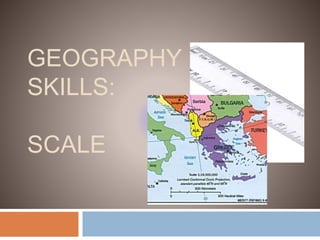
GEOGRAPHY
SKILLS:
SCALE
Map Scale
 A scale is a
statement of the
relationship
between distances
on a map and
distances in real life.
 A drawing that is
made according to
scale will be an exact
copy of the real
object, but will be
smaller or larger than
the real object.
Map Scale
 Scale drawings are often used in real life
because they are very accurate, including in
maps, blueprints, and architectural models.
Three Types of Scale
Section A:
Three Types of Scale
 There are three different ways to write
scale.
• 1 cm = 250 kmWord
Scale
Linear
Scale or
Bar Scale
• 1:25 000 000
Ratio
Scale
or
Representative
Fraction Scale
Map Scales
Word Scale 1 cm = 8 km
 A stated scale says exactly how much distance
is represented by 1 cm, in this case, 8 km.
 It is the most useful scale for calculating
distances.
1 cm = 8 km
Map Scales
Linear Scale:
 A linear scale is usually present on most
maps. It tells us how much map distance
represents a certain real distance.
 For example, the scale shows the map
distance that equals 10 kilometers in real
distance.
Map Scales
Ratio Scale
 A ratio scale will almost always be found on maps.
It is very accurate.
 In this example we can see that
1 unit on the map represents
25 000 000 units in real life.
 So, 1 cm = 25 000 000 cm
and 1 m = 25 000 000 m,
etc.
Map Scales: Changing
Scales
 Distances such as 25 000 000 cm are very
difficult to imagine. So, we usually change a
ratio scale into a stated scale.
 In this example, we would use the metric
system to help us change the ratio scale of
1:25 000 000 into a stated scale of 1 cm = 250
km.
Metric System Review
Section B:
Metric System Review
 Recall that the metric system is based
on multiplying and dividing by 10. To
change from one unit to another you
just need to multiply or divide by 10
the correct number of times.
Large Scale vs. Small Scale
Map Scales:
Larg
e
Scal
e vs.
Smal
l
Scal
Map Scales:
Large Scale vs. Small Scale
 A map showing the
whole world is on a
very small scale
(1:360 000 000 000)
which allows for an
overall view, but not
much detail.
 Small scale maps are
ideal for travelling by
car because they cover
large areas of land.
1:250 000
Map Scales:
Large Scale vs. Small Scale
 A town plan is on a
much larger scale so
that features such as
roads can be shown
clearly (1cm:500m)
 Large scale maps are
better for showing
individual buildings in
detail because they
only cover a small
area of land.

More Related Content

What's hot

Geography Skills: Scale
Geography Skills:  ScaleGeography Skills:  Scale
Geography Skills: ScaleTim Bonnar
 
Types of Maps
Types of MapsTypes of Maps
Types of Mapsitutor
 
Geographic coordinate system & map projection
Geographic coordinate system & map projectionGeographic coordinate system & map projection
Geographic coordinate system & map projectionvishalkedia119
 
Types of maps
Types of mapsTypes of maps
Types of mapsrrodri37
 
Distribution maps
Distribution mapsDistribution maps
Distribution mapsivisdude82
 
Topographic Map
Topographic MapTopographic Map
Topographic Mapmjcnavarro
 
Projections and coordinate system
Projections and coordinate systemProjections and coordinate system
Projections and coordinate systemMohsin Siddique
 
Mean centre of population
Mean centre of populationMean centre of population
Mean centre of populationArindam Sarkar
 
Cartographic symbology. By proj jasper
Cartographic symbology. By proj jasperCartographic symbology. By proj jasper
Cartographic symbology. By proj jasperAgbajiJacob
 
Interaction of EMR with atmosphere and earth surface
Interaction of EMR with atmosphere and earth surfaceInteraction of EMR with atmosphere and earth surface
Interaction of EMR with atmosphere and earth surfaceSumant Diwakar
 
Remote Sensing Platforms and Its types
Remote Sensing Platforms and Its typesRemote Sensing Platforms and Its types
Remote Sensing Platforms and Its typesSenthamizhan M
 
Geo referencing by Mashhood Arif
Geo referencing by Mashhood ArifGeo referencing by Mashhood Arif
Geo referencing by Mashhood ArifKU Leuven
 

What's hot (20)

Map Projections
Map ProjectionsMap Projections
Map Projections
 
Definition, nature and scope of population geography
Definition, nature and scope of population geographyDefinition, nature and scope of population geography
Definition, nature and scope of population geography
 
Geography Skills: Scale
Geography Skills:  ScaleGeography Skills:  Scale
Geography Skills: Scale
 
The Mapping Skills
The Mapping SkillsThe Mapping Skills
The Mapping Skills
 
Introduction to Maps
Introduction to MapsIntroduction to Maps
Introduction to Maps
 
Cartography intro
Cartography introCartography intro
Cartography intro
 
Types of Maps
Types of MapsTypes of Maps
Types of Maps
 
Geographic coordinate system & map projection
Geographic coordinate system & map projectionGeographic coordinate system & map projection
Geographic coordinate system & map projection
 
Types of maps
Types of mapsTypes of maps
Types of maps
 
Distribution maps
Distribution mapsDistribution maps
Distribution maps
 
Topographic Map
Topographic MapTopographic Map
Topographic Map
 
Projections and coordinate system
Projections and coordinate systemProjections and coordinate system
Projections and coordinate system
 
Mean centre of population
Mean centre of populationMean centre of population
Mean centre of population
 
Maps & globes
Maps & globesMaps & globes
Maps & globes
 
Cartographic symbology. By proj jasper
Cartographic symbology. By proj jasperCartographic symbology. By proj jasper
Cartographic symbology. By proj jasper
 
Interaction of EMR with atmosphere and earth surface
Interaction of EMR with atmosphere and earth surfaceInteraction of EMR with atmosphere and earth surface
Interaction of EMR with atmosphere and earth surface
 
Map reading
Map readingMap reading
Map reading
 
Remote Sensing Platforms and Its types
Remote Sensing Platforms and Its typesRemote Sensing Platforms and Its types
Remote Sensing Platforms and Its types
 
Geo referencing by Mashhood Arif
Geo referencing by Mashhood ArifGeo referencing by Mashhood Arif
Geo referencing by Mashhood Arif
 
Remote sensing
Remote sensingRemote sensing
Remote sensing
 

Similar to Types of Map Scales

Measurement and Scale
Measurement and ScaleMeasurement and Scale
Measurement and ScaleJohn Reiser
 
Lab three map scale
Lab three map scaleLab three map scale
Lab three map scalelschmidt1170
 
Lab three map scale
Lab three map scaleLab three map scale
Lab three map scaleLisa Schmidt
 
Scale And Distance
Scale And DistanceScale And Distance
Scale And Distanceigrant
 
Topographic maps presentation_mine
Topographic maps presentation_mineTopographic maps presentation_mine
Topographic maps presentation_minemisterbatroms
 
Scale and distance
Scale and distanceScale and distance
Scale and distanceSteven Heath
 
map reading unit 1.pdf
map reading unit 1.pdfmap reading unit 1.pdf
map reading unit 1.pdfwarkisafile1
 
geographic techniques.ppt
geographic techniques.pptgeographic techniques.ppt
geographic techniques.pptssuser2350ae
 
Maps-and-map-interpretation.pdf
Maps-and-map-interpretation.pdfMaps-and-map-interpretation.pdf
Maps-and-map-interpretation.pdfshucaybcabdi
 
contour analysis and visulaization documetation -1
contour analysis and visulaization documetation -1contour analysis and visulaization documetation -1
contour analysis and visulaization documetation -1Arulalan T
 
Continuing Our Look At Primary And Secondary Data
Continuing Our Look At Primary And Secondary DataContinuing Our Look At Primary And Secondary Data
Continuing Our Look At Primary And Secondary Dataguest2137aa
 
Continuing Our Look At Primary And Secondary Data
Continuing Our Look At Primary And Secondary DataContinuing Our Look At Primary And Secondary Data
Continuing Our Look At Primary And Secondary Dataguest9fa52
 
Topographic Map Presentation
Topographic Map PresentationTopographic Map Presentation
Topographic Map Presentationdwinter1
 
Latitude, Longitude, And Scale
Latitude, Longitude, And ScaleLatitude, Longitude, And Scale
Latitude, Longitude, And Scaleacavis
 

Similar to Types of Map Scales (20)

Measurement and Scale
Measurement and ScaleMeasurement and Scale
Measurement and Scale
 
Lab three map scale
Lab three map scaleLab three map scale
Lab three map scale
 
Lab three map scale
Lab three map scaleLab three map scale
Lab three map scale
 
Scale And Distance
Scale And DistanceScale And Distance
Scale And Distance
 
Topographic maps presentation_mine
Topographic maps presentation_mineTopographic maps presentation_mine
Topographic maps presentation_mine
 
Grade-6-Geography-Task-6-.pdf
Grade-6-Geography-Task-6-.pdfGrade-6-Geography-Task-6-.pdf
Grade-6-Geography-Task-6-.pdf
 
Scale and distance
Scale and distanceScale and distance
Scale and distance
 
Scales
ScalesScales
Scales
 
map reading unit 1.pdf
map reading unit 1.pdfmap reading unit 1.pdf
map reading unit 1.pdf
 
Scale for web
Scale for webScale for web
Scale for web
 
geographic techniques.ppt
geographic techniques.pptgeographic techniques.ppt
geographic techniques.ppt
 
Scale
ScaleScale
Scale
 
Maps-and-map-interpretation.pdf
Maps-and-map-interpretation.pdfMaps-and-map-interpretation.pdf
Maps-and-map-interpretation.pdf
 
contour analysis and visulaization documetation -1
contour analysis and visulaization documetation -1contour analysis and visulaization documetation -1
contour analysis and visulaization documetation -1
 
Continuing Our Look At Primary And Secondary Data
Continuing Our Look At Primary And Secondary DataContinuing Our Look At Primary And Secondary Data
Continuing Our Look At Primary And Secondary Data
 
Continuing Our Look At Primary And Secondary Data
Continuing Our Look At Primary And Secondary DataContinuing Our Look At Primary And Secondary Data
Continuing Our Look At Primary And Secondary Data
 
Topographic Map Presentation
Topographic Map PresentationTopographic Map Presentation
Topographic Map Presentation
 
Contouring
ContouringContouring
Contouring
 
Latitude, Longitude, And Scale
Latitude, Longitude, And ScaleLatitude, Longitude, And Scale
Latitude, Longitude, And Scale
 
construction of SCALES
construction  of  SCALES construction  of  SCALES
construction of SCALES
 

More from Lyric Treco-Hanna (20)

The Queen Conch Bahamas BJC Review
The Queen Conch Bahamas BJC ReviewThe Queen Conch Bahamas BJC Review
The Queen Conch Bahamas BJC Review
 
Slave-life-in-the-bahamas
Slave-life-in-the-bahamasSlave-life-in-the-bahamas
Slave-life-in-the-bahamas
 
Agriculture-Commercial Farming
Agriculture-Commercial FarmingAgriculture-Commercial Farming
Agriculture-Commercial Farming
 
Bahamas Tourism Statistics
Bahamas Tourism StatisticsBahamas Tourism Statistics
Bahamas Tourism Statistics
 
Bahamas Marine Protected Areas
Bahamas Marine Protected AreasBahamas Marine Protected Areas
Bahamas Marine Protected Areas
 
Forms of Government
Forms of GovernmentForms of Government
Forms of Government
 
Hedonism
HedonismHedonism
Hedonism
 
Ethical Egoism
Ethical EgoismEthical Egoism
Ethical Egoism
 
Utilitarianism
UtilitarianismUtilitarianism
Utilitarianism
 
Fronts
FrontsFronts
Fronts
 
Air masses
Air massesAir masses
Air masses
 
Weatherreview
WeatherreviewWeatherreview
Weatherreview
 
Weather instruments powrpt
Weather instruments powrptWeather instruments powrpt
Weather instruments powrpt
 
Weather
WeatherWeather
Weather
 
Types of Clouds
Types of CloudsTypes of Clouds
Types of Clouds
 
Air Pressure
Air PressureAir Pressure
Air Pressure
 
The Eleutheran Adventurers
The Eleutheran AdventurersThe Eleutheran Adventurers
The Eleutheran Adventurers
 
The Loyalist
The LoyalistThe Loyalist
The Loyalist
 
Ethiopian eunuch
Ethiopian eunuchEthiopian eunuch
Ethiopian eunuch
 
Eucharist
EucharistEucharist
Eucharist
 

Recently uploaded

INTRODUCTION TO CATHOLIC CHRISTOLOGY.pptx
INTRODUCTION TO CATHOLIC CHRISTOLOGY.pptxINTRODUCTION TO CATHOLIC CHRISTOLOGY.pptx
INTRODUCTION TO CATHOLIC CHRISTOLOGY.pptxHumphrey A Beña
 
How to Make a Duplicate of Your Odoo 17 Database
How to Make a Duplicate of Your Odoo 17 DatabaseHow to Make a Duplicate of Your Odoo 17 Database
How to Make a Duplicate of Your Odoo 17 DatabaseCeline George
 
DIFFERENT BASKETRY IN THE PHILIPPINES PPT.pptx
DIFFERENT BASKETRY IN THE PHILIPPINES PPT.pptxDIFFERENT BASKETRY IN THE PHILIPPINES PPT.pptx
DIFFERENT BASKETRY IN THE PHILIPPINES PPT.pptxMichelleTuguinay1
 
Decoding the Tweet _ Practical Criticism in the Age of Hashtag.pptx
Decoding the Tweet _ Practical Criticism in the Age of Hashtag.pptxDecoding the Tweet _ Practical Criticism in the Age of Hashtag.pptx
Decoding the Tweet _ Practical Criticism in the Age of Hashtag.pptxDhatriParmar
 
Grade 9 Quarter 4 Dll Grade 9 Quarter 4 DLL.pdf
Grade 9 Quarter 4 Dll Grade 9 Quarter 4 DLL.pdfGrade 9 Quarter 4 Dll Grade 9 Quarter 4 DLL.pdf
Grade 9 Quarter 4 Dll Grade 9 Quarter 4 DLL.pdfJemuel Francisco
 
Concurrency Control in Database Management system
Concurrency Control in Database Management systemConcurrency Control in Database Management system
Concurrency Control in Database Management systemChristalin Nelson
 
Congestive Cardiac Failure..presentation
Congestive Cardiac Failure..presentationCongestive Cardiac Failure..presentation
Congestive Cardiac Failure..presentationdeepaannamalai16
 
ClimART Action | eTwinning Project
ClimART Action    |    eTwinning ProjectClimART Action    |    eTwinning Project
ClimART Action | eTwinning Projectjordimapav
 
Expanded definition: technical and operational
Expanded definition: technical and operationalExpanded definition: technical and operational
Expanded definition: technical and operationalssuser3e220a
 
ICS2208 Lecture6 Notes for SL spaces.pdf
ICS2208 Lecture6 Notes for SL spaces.pdfICS2208 Lecture6 Notes for SL spaces.pdf
ICS2208 Lecture6 Notes for SL spaces.pdfVanessa Camilleri
 
Man or Manufactured_ Redefining Humanity Through Biopunk Narratives.pptx
Man or Manufactured_ Redefining Humanity Through Biopunk Narratives.pptxMan or Manufactured_ Redefining Humanity Through Biopunk Narratives.pptx
Man or Manufactured_ Redefining Humanity Through Biopunk Narratives.pptxDhatriParmar
 
Reading and Writing Skills 11 quarter 4 melc 1
Reading and Writing Skills 11 quarter 4 melc 1Reading and Writing Skills 11 quarter 4 melc 1
Reading and Writing Skills 11 quarter 4 melc 1GloryAnnCastre1
 
Q-Factor HISPOL Quiz-6th April 2024, Quiz Club NITW
Q-Factor HISPOL Quiz-6th April 2024, Quiz Club NITWQ-Factor HISPOL Quiz-6th April 2024, Quiz Club NITW
Q-Factor HISPOL Quiz-6th April 2024, Quiz Club NITWQuiz Club NITW
 
ROLES IN A STAGE PRODUCTION in arts.pptx
ROLES IN A STAGE PRODUCTION in arts.pptxROLES IN A STAGE PRODUCTION in arts.pptx
ROLES IN A STAGE PRODUCTION in arts.pptxVanesaIglesias10
 
Measures of Position DECILES for ungrouped data
Measures of Position DECILES for ungrouped dataMeasures of Position DECILES for ungrouped data
Measures of Position DECILES for ungrouped dataBabyAnnMotar
 
Beauty Amidst the Bytes_ Unearthing Unexpected Advantages of the Digital Wast...
Beauty Amidst the Bytes_ Unearthing Unexpected Advantages of the Digital Wast...Beauty Amidst the Bytes_ Unearthing Unexpected Advantages of the Digital Wast...
Beauty Amidst the Bytes_ Unearthing Unexpected Advantages of the Digital Wast...DhatriParmar
 
BIOCHEMISTRY-CARBOHYDRATE METABOLISM CHAPTER 2.pptx
BIOCHEMISTRY-CARBOHYDRATE METABOLISM CHAPTER 2.pptxBIOCHEMISTRY-CARBOHYDRATE METABOLISM CHAPTER 2.pptx
BIOCHEMISTRY-CARBOHYDRATE METABOLISM CHAPTER 2.pptxSayali Powar
 
MS4 level being good citizen -imperative- (1) (1).pdf
MS4 level   being good citizen -imperative- (1) (1).pdfMS4 level   being good citizen -imperative- (1) (1).pdf
MS4 level being good citizen -imperative- (1) (1).pdfMr Bounab Samir
 

Recently uploaded (20)

INTRODUCTION TO CATHOLIC CHRISTOLOGY.pptx
INTRODUCTION TO CATHOLIC CHRISTOLOGY.pptxINTRODUCTION TO CATHOLIC CHRISTOLOGY.pptx
INTRODUCTION TO CATHOLIC CHRISTOLOGY.pptx
 
How to Make a Duplicate of Your Odoo 17 Database
How to Make a Duplicate of Your Odoo 17 DatabaseHow to Make a Duplicate of Your Odoo 17 Database
How to Make a Duplicate of Your Odoo 17 Database
 
DIFFERENT BASKETRY IN THE PHILIPPINES PPT.pptx
DIFFERENT BASKETRY IN THE PHILIPPINES PPT.pptxDIFFERENT BASKETRY IN THE PHILIPPINES PPT.pptx
DIFFERENT BASKETRY IN THE PHILIPPINES PPT.pptx
 
Decoding the Tweet _ Practical Criticism in the Age of Hashtag.pptx
Decoding the Tweet _ Practical Criticism in the Age of Hashtag.pptxDecoding the Tweet _ Practical Criticism in the Age of Hashtag.pptx
Decoding the Tweet _ Practical Criticism in the Age of Hashtag.pptx
 
Grade 9 Quarter 4 Dll Grade 9 Quarter 4 DLL.pdf
Grade 9 Quarter 4 Dll Grade 9 Quarter 4 DLL.pdfGrade 9 Quarter 4 Dll Grade 9 Quarter 4 DLL.pdf
Grade 9 Quarter 4 Dll Grade 9 Quarter 4 DLL.pdf
 
Concurrency Control in Database Management system
Concurrency Control in Database Management systemConcurrency Control in Database Management system
Concurrency Control in Database Management system
 
Congestive Cardiac Failure..presentation
Congestive Cardiac Failure..presentationCongestive Cardiac Failure..presentation
Congestive Cardiac Failure..presentation
 
ClimART Action | eTwinning Project
ClimART Action    |    eTwinning ProjectClimART Action    |    eTwinning Project
ClimART Action | eTwinning Project
 
prashanth updated resume 2024 for Teaching Profession
prashanth updated resume 2024 for Teaching Professionprashanth updated resume 2024 for Teaching Profession
prashanth updated resume 2024 for Teaching Profession
 
Expanded definition: technical and operational
Expanded definition: technical and operationalExpanded definition: technical and operational
Expanded definition: technical and operational
 
ICS2208 Lecture6 Notes for SL spaces.pdf
ICS2208 Lecture6 Notes for SL spaces.pdfICS2208 Lecture6 Notes for SL spaces.pdf
ICS2208 Lecture6 Notes for SL spaces.pdf
 
Faculty Profile prashantha K EEE dept Sri Sairam college of Engineering
Faculty Profile prashantha K EEE dept Sri Sairam college of EngineeringFaculty Profile prashantha K EEE dept Sri Sairam college of Engineering
Faculty Profile prashantha K EEE dept Sri Sairam college of Engineering
 
Man or Manufactured_ Redefining Humanity Through Biopunk Narratives.pptx
Man or Manufactured_ Redefining Humanity Through Biopunk Narratives.pptxMan or Manufactured_ Redefining Humanity Through Biopunk Narratives.pptx
Man or Manufactured_ Redefining Humanity Through Biopunk Narratives.pptx
 
Reading and Writing Skills 11 quarter 4 melc 1
Reading and Writing Skills 11 quarter 4 melc 1Reading and Writing Skills 11 quarter 4 melc 1
Reading and Writing Skills 11 quarter 4 melc 1
 
Q-Factor HISPOL Quiz-6th April 2024, Quiz Club NITW
Q-Factor HISPOL Quiz-6th April 2024, Quiz Club NITWQ-Factor HISPOL Quiz-6th April 2024, Quiz Club NITW
Q-Factor HISPOL Quiz-6th April 2024, Quiz Club NITW
 
ROLES IN A STAGE PRODUCTION in arts.pptx
ROLES IN A STAGE PRODUCTION in arts.pptxROLES IN A STAGE PRODUCTION in arts.pptx
ROLES IN A STAGE PRODUCTION in arts.pptx
 
Measures of Position DECILES for ungrouped data
Measures of Position DECILES for ungrouped dataMeasures of Position DECILES for ungrouped data
Measures of Position DECILES for ungrouped data
 
Beauty Amidst the Bytes_ Unearthing Unexpected Advantages of the Digital Wast...
Beauty Amidst the Bytes_ Unearthing Unexpected Advantages of the Digital Wast...Beauty Amidst the Bytes_ Unearthing Unexpected Advantages of the Digital Wast...
Beauty Amidst the Bytes_ Unearthing Unexpected Advantages of the Digital Wast...
 
BIOCHEMISTRY-CARBOHYDRATE METABOLISM CHAPTER 2.pptx
BIOCHEMISTRY-CARBOHYDRATE METABOLISM CHAPTER 2.pptxBIOCHEMISTRY-CARBOHYDRATE METABOLISM CHAPTER 2.pptx
BIOCHEMISTRY-CARBOHYDRATE METABOLISM CHAPTER 2.pptx
 
MS4 level being good citizen -imperative- (1) (1).pdf
MS4 level   being good citizen -imperative- (1) (1).pdfMS4 level   being good citizen -imperative- (1) (1).pdf
MS4 level being good citizen -imperative- (1) (1).pdf
 

Types of Map Scales

  • 2. Map Scale  A scale is a statement of the relationship between distances on a map and distances in real life.  A drawing that is made according to scale will be an exact copy of the real object, but will be smaller or larger than the real object.
  • 3. Map Scale  Scale drawings are often used in real life because they are very accurate, including in maps, blueprints, and architectural models.
  • 4. Three Types of Scale Section A:
  • 5. Three Types of Scale  There are three different ways to write scale. • 1 cm = 250 kmWord Scale Linear Scale or Bar Scale • 1:25 000 000 Ratio Scale or Representative Fraction Scale
  • 6. Map Scales Word Scale 1 cm = 8 km  A stated scale says exactly how much distance is represented by 1 cm, in this case, 8 km.  It is the most useful scale for calculating distances. 1 cm = 8 km
  • 7. Map Scales Linear Scale:  A linear scale is usually present on most maps. It tells us how much map distance represents a certain real distance.  For example, the scale shows the map distance that equals 10 kilometers in real distance.
  • 8. Map Scales Ratio Scale  A ratio scale will almost always be found on maps. It is very accurate.  In this example we can see that 1 unit on the map represents 25 000 000 units in real life.  So, 1 cm = 25 000 000 cm and 1 m = 25 000 000 m, etc.
  • 9. Map Scales: Changing Scales  Distances such as 25 000 000 cm are very difficult to imagine. So, we usually change a ratio scale into a stated scale.  In this example, we would use the metric system to help us change the ratio scale of 1:25 000 000 into a stated scale of 1 cm = 250 km.
  • 11. Metric System Review  Recall that the metric system is based on multiplying and dividing by 10. To change from one unit to another you just need to multiply or divide by 10 the correct number of times.
  • 12. Large Scale vs. Small Scale Map Scales:
  • 14. Map Scales: Large Scale vs. Small Scale  A map showing the whole world is on a very small scale (1:360 000 000 000) which allows for an overall view, but not much detail.  Small scale maps are ideal for travelling by car because they cover large areas of land. 1:250 000
  • 15. Map Scales: Large Scale vs. Small Scale  A town plan is on a much larger scale so that features such as roads can be shown clearly (1cm:500m)  Large scale maps are better for showing individual buildings in detail because they only cover a small area of land.