Smart village through convergence ppt
•Download as PPT, PDF•
9 likes•3,338 views

Rural Development

Recommended
Recommended
More Related Content
What's hot
What's hot (20)
Viewers also liked
Viewers also liked (20)
Similar to Smart village through convergence ppt
Similar to Smart village through convergence ppt (20)
More from Dr. Ravindra Pastor
More from Dr. Ravindra Pastor (20)
Recently uploaded
Recently uploaded (20)
Smart village through convergence ppt
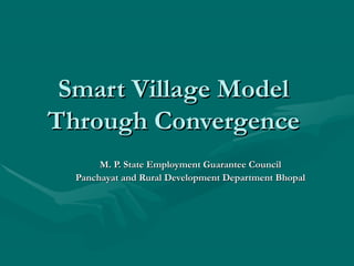
- 1. Smart Village ModelSmart Village Model Through ConvergenceThrough Convergence M. P. State Employment Guarantee CouncilM. P. State Employment Guarantee Council Panchayat and Rural Development Department BhopalPanchayat and Rural Development Department Bhopal
- 2. Village profile Preparation for transit walk Digitised Patwari Village Map Demographic Village Information Family List from Voter List Animal-husbandry Census Mapping of Village Land Use Map Social Map Irrigation Map Cropping pattern Map Double Crop Map Occupation Pattern
- 3. Transit Walk for Data Collection and Up gradations Core Team for Transit Walk Gram Rojgar Sahayak Secretary of Panchayat Sub-Engineer One Social Action Expert Stockholders of Village Development Plan Village Level Organisations Members Village Level Government Servants Village Level Civil Society Organisations Jagar Dal / Village Bhajan Mandali
- 4. Transit Walk Internal Village Walk Door to Door Survey Information Collection and Upgrade Information marking on Village Map Village meeting/FGD Field Visit Field to Field Survey Information Collection and Upgrade Information marking on Patwari Map
- 5. Identification of Gaps Gaps at household level Gaps at Village Level Gaps in Backward Linkage Gaps in Forward Linkage Gaps in Infrastructure Gaps in Skill Gaps in Equipment Prioritization of gaps Who is to be benefitted-priority ranking -Poorest/ vulnerable sections What is to be taken up –priority ranking of families
- 6. Civic Amenities at Village Level Cement Concrete Roads with drains Street Light Safe Drinking Water Supply to households/common places-De- fluoridation/ RO Sanitation Facilities E-Library /Library/ Functional School Building Functional Aganwadi Centre Play ground / play materials Cremation ground Public Park Building for Social purpose Passenger shade
- 7. Civic Amenities at Household Level Pucca House Toilet Cattle-shed Biogas Nadep Vermi -compost Working-shed for artisans Kitchen garden
- 8. Farm Infrastructure Land Levelling Irrigation well Green Fencing Kisan Credit Card Membership in PACS Horticulture Commercial Plantation Percolation tank Lift/Gravity flow irrigation Ground water recharge facilities
- 9. Facilities for Village Economic Activities Collection cum Distribution Centre Milk Collection Centre with Computer Godown, grading, packing facility Centre Fish pond Common working shed Multi facilities trimming (Training?) Centre Panchayat building Ultra Small Bank Branch Village Market Agriculture equipment bank Grading cum meeting platforms with shade
- 10. Education/Health Facilities School Building with good furniture Aganwadi Centre with play school/toys/games materials and day care Centre Library with reading room/computer learning facility Play ground with room and sports/game materials Supporting health facilities wherever relevant
- 11. Interventions for common lands/resources Forest management/conservation Grazing lands Common reservoirs/ponds-fisheries Groundwater management
- 12. Village Convergence Plan Identified components and prepare list of works Prepare estimates for each work Identified funding source for each component Take technical and administrative approval Include in village Shelf of Project Identified user group/management committees for stake building-community contribution/execution Identified execution agencies Develop to bring Public Participation through PPP Develop mechanism for operation and maintenance
- 14. Need for Participatory Planning It is easily understood that the people of a village know better them any outsider. To Address their problems and improve their situation. Participatory planning is an approach and a methodology which helps identify community problems and to Plan solutions with the active participation of community members. Facilitates the identification, preparation and design of community project based on the reality and criteria of its members. It is a people- centric process that puts the poorest first.
- 15. Key Features And Benefits of Participation Mobilizes the community.Informs People of the possibilities for planning and executing local development individual. Promotes greater inclusiveness by using techniques.It builds trust understanding between different groups in a community . Promotes greater transparency.It acknowledges power differentials within the community and ensures that the voice of the ‘last is heard first’. It teaches skills which last beyond the planning process. Shifts control of development from a few to the lager community and increases ownership Increases the credibility of the projects that are taken up because they
- 16. Key Steps In The Planning Process Step -1: Orientation on meeting Meeting of Block officials To the identified BPT members Orientation meeting of elected heads of GP’s, members of JP’s, and GP/Block level functionaries of community based organizations. The meeting will finalize the block level IPPE Calendar.
- 17. Key Steps In The Planning Process Step -2: First Visit to GP BPT & Block officials explain IPPE to all elected members of the GP GP facilitates a meeting of the BPT with elected Representatives and identified members of people’s institutions. Meeting identifies local contact persons for villages/hamlets/wards and finalises IPPE calendar for GP.
- 18. Key Steps In The Planning Process Step -3: understanding the community Opening discussion in public meeting at the ward/hamlet/village. FGDs with key stakeholders, undertaking social mapping, Amenities mapping, Resource Mapping, Transect walk, Household survey for Identified Most Vulnerable Households, seasonality Analysis, Problem Analysis.
- 19. Key Steps In The Planning Process Step -4: Planning for development Visioning exercise fot Village Development through MGNREGS. Identification of MGNREGS Work through FGDs With stakeholders and transect walks. Prioritising of works at the ward/hamlet/village level. Matching works to Demand for Employment. Step -5: Presentation of plan First at the sub- panchayat level. Final prioritization and approval in gram sabha.
- 20. Who will conduct the IPPE
- 21. IEC Activities
- 22. Understanding the Community Tools to understand the community provides us with information on : Vulnerable Communities Vulnerable Households Their current status in terms of MGNREGA employment and Assets Their current resource ownership & Control (Community & individual) Their need for MGNREGA Employment with seasonality of need Their need for Assets in terms of community and individual assets.
- 23. Key Acctivities Social map Seasonality mapping Door to door survey at thr habitation level Resource Mapping Transect walk
- 24. Key Activities – 1. Social Map Social Map presents information of different households residing in the location. Basic focus is on Vulnerability groups and their information about MGNREGA registration, employment and individual asset creation. It also depicts amenities available in the area to discuss the potential of MGNREGA by plotting current assets and the need & potential to develop new ones. A team of one facilitator, one observer and one documenter helps in facilitating social maps.
- 25. Key Activities – 1. Social Map Key questions which it helps in answering : How many households in villages & where are they located? Institutions and amenities found in the village and where? Assets previously created under MGNREGA and employment status of past year Socio-economic status of Vulnerable groups.
- 26. Key Activities – 2. Seasonality Map Life and Livelihoods in villages of India vary from season to season. There are seasons when there is a lot of Agricultural work, forest produce work and wage employment availability. Also there are lean seasons when neither Agricultural work nor common property based livelihoods are available. These seasons can be harnessed for MGNREGA employment. To create Seasonality Maps, use the names of seasons and months as locally used by people.
- 27. Key Activities – 2. Seasonality Map Seasonality of livelihoods and employment varies between different communities and between women and men. For example, Among forest neighbouring communities, ST households and especially women, might be having greater dependence on Non Timber Forest Produce (e.g Mahua flower or Tendu Patta Collection).
- 28. Key Activities – 2. Seasonality Map How to make a Seasonality Map? Introduce the purpose and ask the participants on how the local people divide the year. Let the community construct the calendar rather than directing the process. Take the variables such as Agriculture, wage employment, migration, MGNREGA work, forest resources, etc. on the top side. Focus attention on one particular variable and encourage people to plot this on the calendar using drawing symbols or objects. Eg. Labour demand, determine the 4 least busy months, lean period etc.
- 29. Occupation/ Month Agriculture Wage Employment Migration MGNREGA Works Forest Resources Chaitra Baishakh Jesth Asarh Shravan Bhado Ashwin Kartik Agahan Poush Magh Falgun Example of a Seasonal Calendar for Livelihood :
- 30. Key Activities – Resource Mapping How to make a Resource mapping Collect the revenue maps of the target villages. Carry material required for drawing resource map on the earth/floor of chart papers. Identify 2-3 persons from the village/hamlet who have knowledge and understanding about revenue map and land. Preparing the map in the village The following are the major step a. Step 1- lay out village boundary b. Step 2- mark out directions c. Step 3- draw major rivers, existing NRLM assets d. Step 4- refine by drawing out patches of land (either by patta/community/soil/crop)with the help of the community.
- 31. Key Activities – Transect walk What is a transect walk Transect walk gives us an actual feel of the habitation as well as the resources. To given idea of housing conditions and nature of amenities available in the village. Transect across agricultural fields can provide an idea about land use, drainage, soil quality and so on. Materials and time required Large sheets of paper, markers, notebooks/paper and pens are needed to make a copy of the diagram and also for the note-taker to record the discussion generated
- 32. Smart village for SmartSmart village for Smart peoplepeople ThanksThanks www.nrega.org.inwww.nrega.org.in