SlideShare a Scribd company logo
1 of 20
APPLICATION OF REMOTE SENSING
AND GIS IN URBAN PLANNING
PRESENTED BY
GEM GEORGE JACOB
SEMESTER 1, M.PLAN
SAP CAMPUS, ANNA UNIVERSITY, CHENNAI
 Acquiring information about an
object without touching the
object itself.
 Acquired data is digitized and
processed into image.
 Captures spatial (area),
spectral (colour)and temporal
(time) datas with accuracy,
speed and cost effective on a
repetative basis.
REMOTE SENSING
URBAN PLANNING - APPLICATIONS OF RS
 Important source of data for urban landuse/land cover
mapping
 Environmental monitoring
 helps in encroaching urban problems even of very
small magnitude.
URBAN PLANNING - APPLICATIONS OF RS
 Digitization of planning basemaps facilitated updating
of basemaps whereverchanges have taken place in
terms of land development etc.
 Superimposition of any two digital maps which are on
two different scales is feasible.
 Superimposition of revenue maps on basemaps with
reasonable accuracy is great advantage compared
to manually done jobs.
URBAN PLANNING - APPLICATIONS OF RS
• Study urban growth/sprawl and trend of growth
• Updating and monitoring using repetitive coverage
• Study of urban morphology, population estimation
• Space use surveys in city centers
• Slum detection, monitoring and updating
• Study of transportation system and important aspects both in static and
dynamic mode
• Site suitability and catchments area analysis
• Study of open/vacant space.
GIS
(GEOGRAPHIC INFORMATION SYSTEM)
GIS-WHAT IS IT?
Geographic/Geospatial Information
information about places on the earth’s surface
knowledge about “what is where when”
(Don’t forget time!)
Geographic/geospatial: synonymous
GIS--what’s in the S?
• Systems: the technology
• Science: the concepts and theory
• Studies: the societal context
GIS
DATA TYPES – SPATIAL & ATTRIBUTE
 Spatial - the absolute and relative
location of Geographic features.
 Attribute data – which describes the
characteristics of the spatial features.
characteristics can be quantitative
and/or qualitative in nature. Attribute
data is often referred to as tabular data.
GIS
 A map with a database behind it.
 A virtual representation of the real world and its
infrastructure.
 A consistent “as-built” of the real world, natural and
manmade which is queried to support on-going operations
 summarized to support strategic decision making and policy
formulation
 analyzed to support scientific inquiry
GIS
GIS TECHNIQUE PLANNING APPLICATION
OVERLAYING LAND SUITABILITY, LANDUSE
CHANGE DETECTION
BUFFERING LOCATION ANALYSIS (police
station, education etc)
ACCESIBILITY TO
TRANSPORTATION ( to find
inaccessible areas)
OPTIMAL ROUTE ANALYIS In terms of time, distance,
relevance, safety
GIS IN URBAN PLANNING, MANAGEMENT & POLICY
• Zoning, subdivision planning
• Land acquisition
• Economic development
• Code enforcement
• Housing renovation programs
• Emergency response
• Crime analysis
• Tax assessment
URBAN PLANNING - APPLICATIONS OF GIS
Area monitoring (both on a sectoral and integral basis)
Regional potential and feasibility analyses.
Site selection studies
Alternate plans are generated (flexible design,
optimization and evaluation tools)
URBAN PLANNING - APPLICATIONS OF GIS
Documentation of spatial plans and in the approval
process for the development, building and installation
permit.
Land management and land use planning issues
including the interpretation and formulation of land use
policy.
Land-use policy can be interpreted within GIS using a
modelling approach.
GEOGRAPHIC INFORMATION
TECHNOLOGIES
Global Positioning Systems (GPS)
• a system of earth-orbiting satellites which can provide
precise (100 meter to sub-cm.) location on the earth’s
surface (in lat/long coordinates or equiv.)
Remote Sensing (RS)
• use of satellites or aircraft to capture information about
the earth’s surface
• Digital ortho images a key product (map accurate
digital photos)
Geographic Information Systems (GIS)
• Software systems with capability for input, storage,
manipulation/analysis and output/display of
geographic (spatial) information.
GPS and RS are sources of input data for a GIS.
A GIS provides for storing and manipulating GPS and RS data.
CONCLUSION
 The present study indicates the uses of Remote
Sensing and Geographic Information System for
spatial planning.
 very easy to use analysis and visualization tools.
 Rapid development in city poses several
challenges including problems associated with
urbanization for urban managers and policy
makers. Meeting these challenges requires
access to timely and reliable information.
REFERENCES
 Remote Sensing and Urban Analysis, Taylor and Francis
Publications, London.
 Patkar, V.N. (2003), “Directions for GIS in Urban Planning”
 Tiwari, D.P. (2006), Remote Sensing and GIS for efficient
Urban Planning, GIS Development.
 GIS for Urban and Regional Planning, ESRI
THANK YOU!

More Related Content

What's hot

Applications of RS and GIS in Urban Planning by Rakshith m murthy
Applications of RS and GIS in Urban Planning by Rakshith m murthyApplications of RS and GIS in Urban Planning by Rakshith m murthy
Applications of RS and GIS in Urban Planning by Rakshith m murthys0l0m0n7
 
Remote Sensing and GIS in Land Use / Land Cover Mapping
Remote Sensing and GIS in Land Use / Land Cover MappingRemote Sensing and GIS in Land Use / Land Cover Mapping
Remote Sensing and GIS in Land Use / Land Cover MappingVenkatKamal1
 
Network analysis in gis
Network analysis in gisNetwork analysis in gis
Network analysis in gisstudent
 
Spatial analysis and modeling
Spatial analysis and modelingSpatial analysis and modeling
Spatial analysis and modelingTolasa_F
 
Land use and land cover classification
Land use and land cover classification Land use and land cover classification
Land use and land cover classification Calcutta University
 
land suitability under R.S and G.I.S
land suitability under R.S and G.I.Sland suitability under R.S and G.I.S
land suitability under R.S and G.I.Shena parveen
 
Projections and coordinate system
Projections and coordinate systemProjections and coordinate system
Projections and coordinate systemMohsin Siddique
 
Introduction to GIS systems
Introduction to GIS systemsIntroduction to GIS systems
Introduction to GIS systemsVivek Srivastava
 
Application of gis and gps in civil engineering
Application of gis and gps in civil engineeringApplication of gis and gps in civil engineering
Application of gis and gps in civil engineeringAvinash Anand
 
Geographic information system
Geographic information systemGeographic information system
Geographic information systemDhaval Jalalpara
 
LAND DEVELOPMENT PLANNING
LAND DEVELOPMENT PLANNINGLAND DEVELOPMENT PLANNING
LAND DEVELOPMENT PLANNINGMC Tubera
 
Application of GIS (Geographical information system)
Application of GIS (Geographical information system)Application of GIS (Geographical information system)
Application of GIS (Geographical information system)Fayaz Ahamed A P
 

What's hot (20)

National urban information system
National urban information systemNational urban information system
National urban information system
 
Land cover and Land Use
Land cover and Land UseLand cover and Land Use
Land cover and Land Use
 
Applications of RS and GIS in Urban Planning by Rakshith m murthy
Applications of RS and GIS in Urban Planning by Rakshith m murthyApplications of RS and GIS in Urban Planning by Rakshith m murthy
Applications of RS and GIS in Urban Planning by Rakshith m murthy
 
Remote Sensing and GIS in Land Use / Land Cover Mapping
Remote Sensing and GIS in Land Use / Land Cover MappingRemote Sensing and GIS in Land Use / Land Cover Mapping
Remote Sensing and GIS in Land Use / Land Cover Mapping
 
Gis in urban
Gis in urbanGis in urban
Gis in urban
 
Georeferencing
GeoreferencingGeoreferencing
Georeferencing
 
Types of GIS Data
Types of GIS DataTypes of GIS Data
Types of GIS Data
 
Network analysis in gis
Network analysis in gisNetwork analysis in gis
Network analysis in gis
 
Spatial analysis and modeling
Spatial analysis and modelingSpatial analysis and modeling
Spatial analysis and modeling
 
Digital Elevation Model (DEM)
Digital Elevation Model (DEM)Digital Elevation Model (DEM)
Digital Elevation Model (DEM)
 
Land use and land cover classification
Land use and land cover classification Land use and land cover classification
Land use and land cover classification
 
land suitability under R.S and G.I.S
land suitability under R.S and G.I.Sland suitability under R.S and G.I.S
land suitability under R.S and G.I.S
 
Projections and coordinate system
Projections and coordinate systemProjections and coordinate system
Projections and coordinate system
 
Introduction to GIS systems
Introduction to GIS systemsIntroduction to GIS systems
Introduction to GIS systems
 
Application of gis and gps in civil engineering
Application of gis and gps in civil engineeringApplication of gis and gps in civil engineering
Application of gis and gps in civil engineering
 
Geographic information system
Geographic information systemGeographic information system
Geographic information system
 
LAND DEVELOPMENT PLANNING
LAND DEVELOPMENT PLANNINGLAND DEVELOPMENT PLANNING
LAND DEVELOPMENT PLANNING
 
Application of GIS (Geographical information system)
Application of GIS (Geographical information system)Application of GIS (Geographical information system)
Application of GIS (Geographical information system)
 
GIS Data Types
GIS Data TypesGIS Data Types
GIS Data Types
 
Topology in GIS
Topology in GISTopology in GIS
Topology in GIS
 

Viewers also liked

Socio-Cultural Sustainability of Housing Environments in Kuwait
Socio-Cultural Sustainability of Housing Environments in KuwaitSocio-Cultural Sustainability of Housing Environments in Kuwait
Socio-Cultural Sustainability of Housing Environments in KuwaitGalala University
 
01 المحاضرة الاولى
01 المحاضرة الاولى01 المحاضرة الاولى
01 المحاضرة الاولىKhaled Ali
 
Impact of Infrastructure Projects on City Center - تأثير مشاريع البنية التحتي...
Impact of Infrastructure Projects on City Center - تأثير مشاريع البنية التحتي...Impact of Infrastructure Projects on City Center - تأثير مشاريع البنية التحتي...
Impact of Infrastructure Projects on City Center - تأثير مشاريع البنية التحتي...Galala University
 
Architecture in the Middle East
Architecture in the Middle EastArchitecture in the Middle East
Architecture in the Middle EastGalala University
 
District Cooling and Architecture
District Cooling and ArchitectureDistrict Cooling and Architecture
District Cooling and ArchitectureGalala University
 
هوية المدينة العربية وتحديات التحولات العمرانية السريعة" ورقة مقدمة فى المؤتم...
هوية المدينة العربية وتحديات التحولات العمرانية السريعة" ورقة مقدمة فى المؤتم...هوية المدينة العربية وتحديات التحولات العمرانية السريعة" ورقة مقدمة فى المؤتم...
هوية المدينة العربية وتحديات التحولات العمرانية السريعة" ورقة مقدمة فى المؤتم...Galala University
 
Remote Sensing PPT
Remote Sensing PPTRemote Sensing PPT
Remote Sensing PPTAmal Murali
 

Viewers also liked (9)

Socio-Cultural Sustainability of Housing Environments in Kuwait
Socio-Cultural Sustainability of Housing Environments in KuwaitSocio-Cultural Sustainability of Housing Environments in Kuwait
Socio-Cultural Sustainability of Housing Environments in Kuwait
 
01 المحاضرة الاولى
01 المحاضرة الاولى01 المحاضرة الاولى
01 المحاضرة الاولى
 
Impact of Infrastructure Projects on City Center - تأثير مشاريع البنية التحتي...
Impact of Infrastructure Projects on City Center - تأثير مشاريع البنية التحتي...Impact of Infrastructure Projects on City Center - تأثير مشاريع البنية التحتي...
Impact of Infrastructure Projects on City Center - تأثير مشاريع البنية التحتي...
 
Architecture in the Middle East
Architecture in the Middle EastArchitecture in the Middle East
Architecture in the Middle East
 
Cairo and Egypt maps
Cairo and Egypt mapsCairo and Egypt maps
Cairo and Egypt maps
 
KATARA, Doha, Qatar Photos
KATARA, Doha, Qatar PhotosKATARA, Doha, Qatar Photos
KATARA, Doha, Qatar Photos
 
District Cooling and Architecture
District Cooling and ArchitectureDistrict Cooling and Architecture
District Cooling and Architecture
 
هوية المدينة العربية وتحديات التحولات العمرانية السريعة" ورقة مقدمة فى المؤتم...
هوية المدينة العربية وتحديات التحولات العمرانية السريعة" ورقة مقدمة فى المؤتم...هوية المدينة العربية وتحديات التحولات العمرانية السريعة" ورقة مقدمة فى المؤتم...
هوية المدينة العربية وتحديات التحولات العمرانية السريعة" ورقة مقدمة فى المؤتم...
 
Remote Sensing PPT
Remote Sensing PPTRemote Sensing PPT
Remote Sensing PPT
 

Similar to Application of gis & rs in urban planning

application of gis rs in urban planninggem-150307035531-conversion-gate01 (1)...
application of gis rs in urban planninggem-150307035531-conversion-gate01 (1)...application of gis rs in urban planninggem-150307035531-conversion-gate01 (1)...
application of gis rs in urban planninggem-150307035531-conversion-gate01 (1)...Rajashekhar L
 
GEOGRAPHIC INFORMATION SYSTEM.pptx
GEOGRAPHIC INFORMATION SYSTEM.pptxGEOGRAPHIC INFORMATION SYSTEM.pptx
GEOGRAPHIC INFORMATION SYSTEM.pptxFizaNaaz8
 
Intro of geographic info system
Intro of geographic info systemIntro of geographic info system
Intro of geographic info systemJanak Parmar
 
Gis Geographical Information System Fundamentals
Gis Geographical Information System FundamentalsGis Geographical Information System Fundamentals
Gis Geographical Information System FundamentalsUroosa Samman
 
INTRODUCTION_TO_GIS.ppt
INTRODUCTION_TO_GIS.pptINTRODUCTION_TO_GIS.ppt
INTRODUCTION_TO_GIS.pptSafriyana1
 
GIS and GPS - applications in civil engg
GIS and GPS - applications  in civil enggGIS and GPS - applications  in civil engg
GIS and GPS - applications in civil enggPundlik Rathod
 
Introduction of GIS & Remote Sensing (RS)
Introduction of GIS & Remote Sensing (RS)Introduction of GIS & Remote Sensing (RS)
Introduction of GIS & Remote Sensing (RS)Subtain Hussain Syed
 
Lecture 1_ Intro n Basics_GIS.pptx
Lecture 1_ Intro n Basics_GIS.pptxLecture 1_ Intro n Basics_GIS.pptx
Lecture 1_ Intro n Basics_GIS.pptxnobelhasssan
 
Fundamentals of gis
Fundamentals of gisFundamentals of gis
Fundamentals of gisJessy Mol
 
Geographical information system
Geographical information systemGeographical information system
Geographical information systemBipin Karki
 
Geographical information system
Geographical information systemGeographical information system
Geographical information systemBipin Karki
 
Remote Sensing & GIS.ppt
Remote Sensing & GIS.pptRemote Sensing & GIS.ppt
Remote Sensing & GIS.pptyhmamdam1
 
Topic Introduction to GIS and its Applications.pptx
Topic Introduction to GIS and its Applications.pptxTopic Introduction to GIS and its Applications.pptx
Topic Introduction to GIS and its Applications.pptxAneeqaa Abrar
 
Basic of gis concept and theories
Basic of gis concept and theoriesBasic of gis concept and theories
Basic of gis concept and theoriesMohsin Siddique
 

Similar to Application of gis & rs in urban planning (20)

application of gis rs in urban planninggem-150307035531-conversion-gate01 (1)...
application of gis rs in urban planninggem-150307035531-conversion-gate01 (1)...application of gis rs in urban planninggem-150307035531-conversion-gate01 (1)...
application of gis rs in urban planninggem-150307035531-conversion-gate01 (1)...
 
Gis dr rahul
Gis dr rahulGis dr rahul
Gis dr rahul
 
GEOGRAPHIC INFORMATION SYSTEM.pptx
GEOGRAPHIC INFORMATION SYSTEM.pptxGEOGRAPHIC INFORMATION SYSTEM.pptx
GEOGRAPHIC INFORMATION SYSTEM.pptx
 
Gis basic-2
Gis basic-2Gis basic-2
Gis basic-2
 
Intro of geographic info system
Intro of geographic info systemIntro of geographic info system
Intro of geographic info system
 
Gis Geographical Information System Fundamentals
Gis Geographical Information System FundamentalsGis Geographical Information System Fundamentals
Gis Geographical Information System Fundamentals
 
INTRODUCTION_TO_GIS.ppt
INTRODUCTION_TO_GIS.pptINTRODUCTION_TO_GIS.ppt
INTRODUCTION_TO_GIS.ppt
 
GIS and GPS - applications in civil engg
GIS and GPS - applications  in civil enggGIS and GPS - applications  in civil engg
GIS and GPS - applications in civil engg
 
Introduction of GIS & Remote Sensing (RS)
Introduction of GIS & Remote Sensing (RS)Introduction of GIS & Remote Sensing (RS)
Introduction of GIS & Remote Sensing (RS)
 
Lecture 1_ Intro n Basics_GIS.pptx
Lecture 1_ Intro n Basics_GIS.pptxLecture 1_ Intro n Basics_GIS.pptx
Lecture 1_ Intro n Basics_GIS.pptx
 
Geographical information system
Geographical information systemGeographical information system
Geographical information system
 
Fundamentals of gis
Fundamentals of gisFundamentals of gis
Fundamentals of gis
 
Geographical information system
Geographical information systemGeographical information system
Geographical information system
 
Geographical information system
Geographical information systemGeographical information system
Geographical information system
 
gis.pdf
gis.pdfgis.pdf
gis.pdf
 
gis.pdf
gis.pdfgis.pdf
gis.pdf
 
Remote Sensing & GIS.ppt
Remote Sensing & GIS.pptRemote Sensing & GIS.ppt
Remote Sensing & GIS.ppt
 
Topic Introduction to GIS and its Applications.pptx
Topic Introduction to GIS and its Applications.pptxTopic Introduction to GIS and its Applications.pptx
Topic Introduction to GIS and its Applications.pptx
 
Basic of gis concept and theories
Basic of gis concept and theoriesBasic of gis concept and theories
Basic of gis concept and theories
 
Remote sensing
Remote sensing   Remote sensing
Remote sensing
 

Recently uploaded

MINDCTI Revenue Release Quarter One 2024
MINDCTI Revenue Release Quarter One 2024MINDCTI Revenue Release Quarter One 2024
MINDCTI Revenue Release Quarter One 2024MIND CTI
 
Architecting Cloud Native Applications
Architecting Cloud Native ApplicationsArchitecting Cloud Native Applications
Architecting Cloud Native ApplicationsWSO2
 
Apidays New York 2024 - Passkeys: Developing APIs to enable passwordless auth...
Apidays New York 2024 - Passkeys: Developing APIs to enable passwordless auth...Apidays New York 2024 - Passkeys: Developing APIs to enable passwordless auth...
Apidays New York 2024 - Passkeys: Developing APIs to enable passwordless auth...apidays
 
Web Form Automation for Bonterra Impact Management (fka Social Solutions Apri...
Web Form Automation for Bonterra Impact Management (fka Social Solutions Apri...Web Form Automation for Bonterra Impact Management (fka Social Solutions Apri...
Web Form Automation for Bonterra Impact Management (fka Social Solutions Apri...Jeffrey Haguewood
 
Apidays New York 2024 - The value of a flexible API Management solution for O...
Apidays New York 2024 - The value of a flexible API Management solution for O...Apidays New York 2024 - The value of a flexible API Management solution for O...
Apidays New York 2024 - The value of a flexible API Management solution for O...apidays
 
Six Myths about Ontologies: The Basics of Formal Ontology
Six Myths about Ontologies: The Basics of Formal OntologySix Myths about Ontologies: The Basics of Formal Ontology
Six Myths about Ontologies: The Basics of Formal Ontologyjohnbeverley2021
 
Modular Monolith - a Practical Alternative to Microservices @ Devoxx UK 2024
Modular Monolith - a Practical Alternative to Microservices @ Devoxx UK 2024Modular Monolith - a Practical Alternative to Microservices @ Devoxx UK 2024
Modular Monolith - a Practical Alternative to Microservices @ Devoxx UK 2024Victor Rentea
 
WSO2's API Vision: Unifying Control, Empowering Developers
WSO2's API Vision: Unifying Control, Empowering DevelopersWSO2's API Vision: Unifying Control, Empowering Developers
WSO2's API Vision: Unifying Control, Empowering DevelopersWSO2
 
Biography Of Angeliki Cooney | Senior Vice President Life Sciences | Albany, ...
Biography Of Angeliki Cooney | Senior Vice President Life Sciences | Albany, ...Biography Of Angeliki Cooney | Senior Vice President Life Sciences | Albany, ...
Biography Of Angeliki Cooney | Senior Vice President Life Sciences | Albany, ...Angeliki Cooney
 
Rising Above_ Dubai Floods and the Fortitude of Dubai International Airport.pdf
Rising Above_ Dubai Floods and the Fortitude of Dubai International Airport.pdfRising Above_ Dubai Floods and the Fortitude of Dubai International Airport.pdf
Rising Above_ Dubai Floods and the Fortitude of Dubai International Airport.pdfOrbitshub
 
CNIC Information System with Pakdata Cf In Pakistan
CNIC Information System with Pakdata Cf In PakistanCNIC Information System with Pakdata Cf In Pakistan
CNIC Information System with Pakdata Cf In Pakistandanishmna97
 
Artificial Intelligence Chap.5 : Uncertainty
Artificial Intelligence Chap.5 : UncertaintyArtificial Intelligence Chap.5 : Uncertainty
Artificial Intelligence Chap.5 : UncertaintyKhushali Kathiriya
 
Finding Java's Hidden Performance Traps @ DevoxxUK 2024
Finding Java's Hidden Performance Traps @ DevoxxUK 2024Finding Java's Hidden Performance Traps @ DevoxxUK 2024
Finding Java's Hidden Performance Traps @ DevoxxUK 2024Victor Rentea
 
Apidays New York 2024 - The Good, the Bad and the Governed by David O'Neill, ...
Apidays New York 2024 - The Good, the Bad and the Governed by David O'Neill, ...Apidays New York 2024 - The Good, the Bad and the Governed by David O'Neill, ...
Apidays New York 2024 - The Good, the Bad and the Governed by David O'Neill, ...apidays
 
ProductAnonymous-April2024-WinProductDiscovery-MelissaKlemke
ProductAnonymous-April2024-WinProductDiscovery-MelissaKlemkeProductAnonymous-April2024-WinProductDiscovery-MelissaKlemke
ProductAnonymous-April2024-WinProductDiscovery-MelissaKlemkeProduct Anonymous
 
ICT role in 21st century education and its challenges
ICT role in 21st century education and its challengesICT role in 21st century education and its challenges
ICT role in 21st century education and its challengesrafiqahmad00786416
 
Exploring Multimodal Embeddings with Milvus
Exploring Multimodal Embeddings with MilvusExploring Multimodal Embeddings with Milvus
Exploring Multimodal Embeddings with MilvusZilliz
 
Repurposing LNG terminals for Hydrogen Ammonia: Feasibility and Cost Saving
Repurposing LNG terminals for Hydrogen Ammonia: Feasibility and Cost SavingRepurposing LNG terminals for Hydrogen Ammonia: Feasibility and Cost Saving
Repurposing LNG terminals for Hydrogen Ammonia: Feasibility and Cost SavingEdi Saputra
 
MS Copilot expands with MS Graph connectors
MS Copilot expands with MS Graph connectorsMS Copilot expands with MS Graph connectors
MS Copilot expands with MS Graph connectorsNanddeep Nachan
 
presentation ICT roal in 21st century education
presentation ICT roal in 21st century educationpresentation ICT roal in 21st century education
presentation ICT roal in 21st century educationjfdjdjcjdnsjd
 

Recently uploaded (20)

MINDCTI Revenue Release Quarter One 2024
MINDCTI Revenue Release Quarter One 2024MINDCTI Revenue Release Quarter One 2024
MINDCTI Revenue Release Quarter One 2024
 
Architecting Cloud Native Applications
Architecting Cloud Native ApplicationsArchitecting Cloud Native Applications
Architecting Cloud Native Applications
 
Apidays New York 2024 - Passkeys: Developing APIs to enable passwordless auth...
Apidays New York 2024 - Passkeys: Developing APIs to enable passwordless auth...Apidays New York 2024 - Passkeys: Developing APIs to enable passwordless auth...
Apidays New York 2024 - Passkeys: Developing APIs to enable passwordless auth...
 
Web Form Automation for Bonterra Impact Management (fka Social Solutions Apri...
Web Form Automation for Bonterra Impact Management (fka Social Solutions Apri...Web Form Automation for Bonterra Impact Management (fka Social Solutions Apri...
Web Form Automation for Bonterra Impact Management (fka Social Solutions Apri...
 
Apidays New York 2024 - The value of a flexible API Management solution for O...
Apidays New York 2024 - The value of a flexible API Management solution for O...Apidays New York 2024 - The value of a flexible API Management solution for O...
Apidays New York 2024 - The value of a flexible API Management solution for O...
 
Six Myths about Ontologies: The Basics of Formal Ontology
Six Myths about Ontologies: The Basics of Formal OntologySix Myths about Ontologies: The Basics of Formal Ontology
Six Myths about Ontologies: The Basics of Formal Ontology
 
Modular Monolith - a Practical Alternative to Microservices @ Devoxx UK 2024
Modular Monolith - a Practical Alternative to Microservices @ Devoxx UK 2024Modular Monolith - a Practical Alternative to Microservices @ Devoxx UK 2024
Modular Monolith - a Practical Alternative to Microservices @ Devoxx UK 2024
 
WSO2's API Vision: Unifying Control, Empowering Developers
WSO2's API Vision: Unifying Control, Empowering DevelopersWSO2's API Vision: Unifying Control, Empowering Developers
WSO2's API Vision: Unifying Control, Empowering Developers
 
Biography Of Angeliki Cooney | Senior Vice President Life Sciences | Albany, ...
Biography Of Angeliki Cooney | Senior Vice President Life Sciences | Albany, ...Biography Of Angeliki Cooney | Senior Vice President Life Sciences | Albany, ...
Biography Of Angeliki Cooney | Senior Vice President Life Sciences | Albany, ...
 
Rising Above_ Dubai Floods and the Fortitude of Dubai International Airport.pdf
Rising Above_ Dubai Floods and the Fortitude of Dubai International Airport.pdfRising Above_ Dubai Floods and the Fortitude of Dubai International Airport.pdf
Rising Above_ Dubai Floods and the Fortitude of Dubai International Airport.pdf
 
CNIC Information System with Pakdata Cf In Pakistan
CNIC Information System with Pakdata Cf In PakistanCNIC Information System with Pakdata Cf In Pakistan
CNIC Information System with Pakdata Cf In Pakistan
 
Artificial Intelligence Chap.5 : Uncertainty
Artificial Intelligence Chap.5 : UncertaintyArtificial Intelligence Chap.5 : Uncertainty
Artificial Intelligence Chap.5 : Uncertainty
 
Finding Java's Hidden Performance Traps @ DevoxxUK 2024
Finding Java's Hidden Performance Traps @ DevoxxUK 2024Finding Java's Hidden Performance Traps @ DevoxxUK 2024
Finding Java's Hidden Performance Traps @ DevoxxUK 2024
 
Apidays New York 2024 - The Good, the Bad and the Governed by David O'Neill, ...
Apidays New York 2024 - The Good, the Bad and the Governed by David O'Neill, ...Apidays New York 2024 - The Good, the Bad and the Governed by David O'Neill, ...
Apidays New York 2024 - The Good, the Bad and the Governed by David O'Neill, ...
 
ProductAnonymous-April2024-WinProductDiscovery-MelissaKlemke
ProductAnonymous-April2024-WinProductDiscovery-MelissaKlemkeProductAnonymous-April2024-WinProductDiscovery-MelissaKlemke
ProductAnonymous-April2024-WinProductDiscovery-MelissaKlemke
 
ICT role in 21st century education and its challenges
ICT role in 21st century education and its challengesICT role in 21st century education and its challenges
ICT role in 21st century education and its challenges
 
Exploring Multimodal Embeddings with Milvus
Exploring Multimodal Embeddings with MilvusExploring Multimodal Embeddings with Milvus
Exploring Multimodal Embeddings with Milvus
 
Repurposing LNG terminals for Hydrogen Ammonia: Feasibility and Cost Saving
Repurposing LNG terminals for Hydrogen Ammonia: Feasibility and Cost SavingRepurposing LNG terminals for Hydrogen Ammonia: Feasibility and Cost Saving
Repurposing LNG terminals for Hydrogen Ammonia: Feasibility and Cost Saving
 
MS Copilot expands with MS Graph connectors
MS Copilot expands with MS Graph connectorsMS Copilot expands with MS Graph connectors
MS Copilot expands with MS Graph connectors
 
presentation ICT roal in 21st century education
presentation ICT roal in 21st century educationpresentation ICT roal in 21st century education
presentation ICT roal in 21st century education
 

Application of gis & rs in urban planning

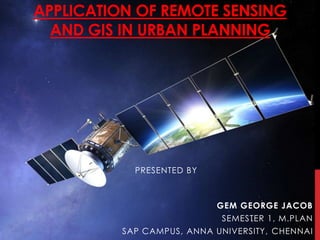
  • 1. APPLICATION OF REMOTE SENSING AND GIS IN URBAN PLANNING PRESENTED BY GEM GEORGE JACOB SEMESTER 1, M.PLAN SAP CAMPUS, ANNA UNIVERSITY, CHENNAI
  • 2.  Acquiring information about an object without touching the object itself.  Acquired data is digitized and processed into image.  Captures spatial (area), spectral (colour)and temporal (time) datas with accuracy, speed and cost effective on a repetative basis. REMOTE SENSING
  • 3. URBAN PLANNING - APPLICATIONS OF RS
  • 4. URBAN PLANNING - APPLICATIONS OF RS  Important source of data for urban landuse/land cover mapping  Environmental monitoring  helps in encroaching urban problems even of very small magnitude.
  • 5. URBAN PLANNING - APPLICATIONS OF RS  Digitization of planning basemaps facilitated updating of basemaps whereverchanges have taken place in terms of land development etc.  Superimposition of any two digital maps which are on two different scales is feasible.  Superimposition of revenue maps on basemaps with reasonable accuracy is great advantage compared to manually done jobs.
  • 6. URBAN PLANNING - APPLICATIONS OF RS • Study urban growth/sprawl and trend of growth • Updating and monitoring using repetitive coverage • Study of urban morphology, population estimation • Space use surveys in city centers • Slum detection, monitoring and updating • Study of transportation system and important aspects both in static and dynamic mode • Site suitability and catchments area analysis • Study of open/vacant space.
  • 8. GIS-WHAT IS IT? Geographic/Geospatial Information information about places on the earth’s surface knowledge about “what is where when” (Don’t forget time!) Geographic/geospatial: synonymous GIS--what’s in the S? • Systems: the technology • Science: the concepts and theory • Studies: the societal context
  • 9. GIS DATA TYPES – SPATIAL & ATTRIBUTE  Spatial - the absolute and relative location of Geographic features.  Attribute data – which describes the characteristics of the spatial features. characteristics can be quantitative and/or qualitative in nature. Attribute data is often referred to as tabular data.
  • 10. GIS  A map with a database behind it.  A virtual representation of the real world and its infrastructure.  A consistent “as-built” of the real world, natural and manmade which is queried to support on-going operations  summarized to support strategic decision making and policy formulation  analyzed to support scientific inquiry
  • 11. GIS GIS TECHNIQUE PLANNING APPLICATION OVERLAYING LAND SUITABILITY, LANDUSE CHANGE DETECTION BUFFERING LOCATION ANALYSIS (police station, education etc) ACCESIBILITY TO TRANSPORTATION ( to find inaccessible areas) OPTIMAL ROUTE ANALYIS In terms of time, distance, relevance, safety
  • 12.
  • 13.
  • 14. GIS IN URBAN PLANNING, MANAGEMENT & POLICY • Zoning, subdivision planning • Land acquisition • Economic development • Code enforcement • Housing renovation programs • Emergency response • Crime analysis • Tax assessment
  • 15. URBAN PLANNING - APPLICATIONS OF GIS Area monitoring (both on a sectoral and integral basis) Regional potential and feasibility analyses. Site selection studies Alternate plans are generated (flexible design, optimization and evaluation tools)
  • 16. URBAN PLANNING - APPLICATIONS OF GIS Documentation of spatial plans and in the approval process for the development, building and installation permit. Land management and land use planning issues including the interpretation and formulation of land use policy. Land-use policy can be interpreted within GIS using a modelling approach.
  • 17. GEOGRAPHIC INFORMATION TECHNOLOGIES Global Positioning Systems (GPS) • a system of earth-orbiting satellites which can provide precise (100 meter to sub-cm.) location on the earth’s surface (in lat/long coordinates or equiv.) Remote Sensing (RS) • use of satellites or aircraft to capture information about the earth’s surface • Digital ortho images a key product (map accurate digital photos) Geographic Information Systems (GIS) • Software systems with capability for input, storage, manipulation/analysis and output/display of geographic (spatial) information. GPS and RS are sources of input data for a GIS. A GIS provides for storing and manipulating GPS and RS data.
  • 18. CONCLUSION  The present study indicates the uses of Remote Sensing and Geographic Information System for spatial planning.  very easy to use analysis and visualization tools.  Rapid development in city poses several challenges including problems associated with urbanization for urban managers and policy makers. Meeting these challenges requires access to timely and reliable information.
  • 19. REFERENCES  Remote Sensing and Urban Analysis, Taylor and Francis Publications, London.  Patkar, V.N. (2003), “Directions for GIS in Urban Planning”  Tiwari, D.P. (2006), Remote Sensing and GIS for efficient Urban Planning, GIS Development.  GIS for Urban and Regional Planning, ESRI