MSB Wetlands Projects Summary
•
1 like•812 views

The document summarizes wetlands planning and projects in the Matanuska-Susitna Borough. It discusses the borough's definition of wetlands, reasons for focusing on wetlands work including population growth, and completed and ongoing wetlands projects like mapping, education, assessments, and management planning. These projects aim to increase awareness and protection of wetlands in the rapidly developing borough.

Recommended
Recommended
More Related Content
What's hot
What's hot (20)
Viewers also liked
Viewers also liked (20)
Similar to MSB Wetlands Projects Summary
Similar to MSB Wetlands Projects Summary (20)
More from Southeast Alaska Watershed Coalition
More from Southeast Alaska Watershed Coalition (13)
Recently uploaded
Recently uploaded (20)
MSB Wetlands Projects Summary
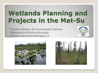
- 1. Wetlands Planning and Projects in the Mat-Su Frankie Barker, Environmental Planner Matanuska-Susitna Borough frankie.barker@matsugov.us
- 4. “Those areas that are inundated and saturated by surface or groundwater at a frequency at a frequency and duration sufficient to support, and that under normal circumstances do support, a prevalence of vegetation typically adapted for life in saturated soil conditions, including swamps, marshes, bogs and similar areas. “ MSB Wetlands Definition (17.125.10)
- 5. WHY IS MSB DOING WETLANDS WORK? Rapid population growth and land use development (50% growth in 10 years) Concern about loss of wetlands and benefits they provide Desire to earn revenue from Borough owned property with large wetlands areas Funding and technical assistance offered from federal agencies to do wetlands projects Lack of public information about wetlands
- 6. Population Growth in Alaska--Grew By 95,258 Between 2000-2011 Population growth 2000-2011 Alaska 15% 722,190 Fairbanks 15% 18% 97,615 Southeast 0% 1% Anchorage 33% 14% 296,197 Matsu 34% 55% Gulf Coast 7% 8% 91,697 Southwest 2% 6% Northern 3% 13% America 10% Sources: AKDOWL, R&A and U.S. Census Bureau
- 7. MSB Wetlands Projects Wetlands Mitigation Bank (Big Lake South ) Wetlands Mapping (Greater core area) Public Education (atlases, web page & wetlands viewer) Wetlands Functional Assessment (Greater core area 2010 -2012) Wetlands Management Plan (2010- 2012) Increase awareness and protection of wetlands
- 8. MSB Wetlands Mitigation Bank Su-Knik Mitigation Bank was created in partnership with Sustainable Environments, LLC and Great Land Trust to manage the wetlands mitigation bank. Purpose of the Su-Knik Mitigation Bank is to provide mitigation opportunities to permit applicants, when the Army Corps of Engineers (ACOE) determines that compensatory mitigation is required for impacts to wetlands that are within ACOE’s jurisdiction.
- 10. MSB Wetlands Mitigation Bank Adopted by MSB in 2005 to protect wetlands areas, provide mitigation options for development and generate revenue for MSB. Total 12,700 acres Big Lake South 2279 acres, Fish Creek Watershed Big Lake West 4,923 acres, Little Susitna Watershed Fish Creek West 5,554 acres, Lower Susitna Watershed December 4, 2009 – Approval by ACOE to release credits
- 12. Su-Knik Mitigation Bank South-Central Alaska There are three different service areas for the properties that comprise the Su-Knik Mitigation Bank : Fish Creek Watershed, Little Susitna Watershed and the Lower Susitna Watershed. At this time, the bank only has credits for sale in the "Fish Creek Watershed". However, for projects outside this service area, credits may be able to be utilized from the Big Lake Watershed. This is determined on a case by case basis by the Army Corps. For more information: www.su-knikmitigationbank.com or MSB Land Management Division
- 13. Wetlands Technical Group December 5 & 6, 2007: An interagency group of 15- 20 people met to review the purpose and scope of the wetlands mapping and assessment work planned for the Mat-Su Watershed study. Participants discussed the status of past and ongoing wetlands studies in the Mat-Su. Mapping work and results from 2007 field season were reported and suggestions were made to form a technical group for wetlands assessment work. March, April & May 2008: A technical wetlands assessment group was assembled to discuss methodology for Mat-Su wetlands assessment. Various existing wetlands assessment guidebooks were suggested as models for the Mat-Su. Wetlands mapping plans, methods and staffing were planned for the 2008 field season. Organizations participating in the technical group were ACOE, EPA, USFWS, Aquatic Research and Restoration Institute (ARRI), Kenai Watershed Forum, Mat-Su Borough, USGS, and NRCS.
- 15. Mike Gracz, Kenai Watershed Forum, mike@kenaiwatershed.org
- 16. Army Corps Mat-Su Watershed Study Purpose: To provide resources to produce comprehensive watershed assessments for the Susitna and Matanuska watersheds. Dates : October 2007 –present. Funding: Mat-Su Borough is matching ACOE funds 1:1 through related in-kind work. Phase I cost was approximately $600,000. Projects: The initial priority (Phase I) identified for the study was wetlands mapping, functional assessment and data gap analysis.
- 19. Wetlands Mapping 2007-2009 Wasilla & Cottonwood Creek Watersheds 2007 – 101,113 acres, 134 sites visited Little Su, Big Lake, Knik-Fairview 2008 – 189,183 acres, 110 sites visited Big Lake SW, Butte 2009 – 102,268 acres, 207 sites visited (32,195 acres of wetlands, 31.5% of area – wettest area) Total: 374,184 acres mapped Includes 105,485 acres of wetlands in 6646 wetlands polygons (28.2% of the land surface), 13,800 acres of lakes and 2500 acres of wetland birch forests.
- 20. Jan. 15, 2007 PRESS RELEASE First Borough atlas on wetlands adds tool to planning The Matanuska-Susitna Borough has produced a “Big Lake Watershed Atlas” covering about ninety square miles of watershed. The 138-page document is the first Borough atlas of wetlands. The atlas provides an important planning tool within one of the Borough’s fastest growing areas. The atlas contains 134 photographs overlaid with wetlands, culverts, roads, and parcel boundaries. Each of the map pages is a square mile. The atlas lays out where wetlands and waterbodies are in relation to existing parcels and undeveloped lots.
- 21. WETLANDS WEB RESOURCES Wetlands Viewer: MSB GIS has developed a wetlands viewer that shows MSB and NWI mapped wetlands. Viewer is used by planners, contractors, surveyors and general public to locate wetlands. http://maps.matsugov.us/Wetlands/ Wetlands Website: MSB has created a website for public access to wetlands information and maps and is soliciting services to redesign and update. http://wetlands.matsugov.us
- 22. Wetlands Functional Assessment Function/Value 1. Streamflow Moderation 2. Contribution to Groundwater 3. Anadromous Fish Habitat 4. Transmission of Groundwater 5. Floodflow Alteration 6. Sediment/Toxicant/Pathogen Retention 7. Sediment Shoreline Stabilization 8. Foodchain Support 9. Recreation 10. Education 11. Nutrient Removal/Retention/Transformation 12. Consumptive Uses 13. Uniqueness 14. Habitat and Maintenance of Biodiversity 15. Habitat for Species of Interest 16. Visual Quality/Aesthetics 17. Culture/History
- 24. Wetlands Functional Assessment Status: Sections under review by technical committee. Due for completion summer 2012 For more information contact: Robin Reich Solstice Alaska Consulting, Inc 2607 Fairbanks Street, Suite B Anchorage, AK 99503 907.929.5960
- 25. Wetlands Management Plan Why develop a wetlands plan? Bring together wetlands information in one place Build awareness of wetlands characteristics, benefits, and functions Provide information about wetlands regulatory process for development Provide information about mitigation and conservation options Develop recommendations for future wetlands management
- 26. Wetlands Management Plan Timeline: EPA awarded MSB a Wetlands Development Grant of $117,788, June 2009 EPA approved MSB Work Plan, September 2009 EPA Grant & MSB match ($50,481) approved by Assembly, November 2009 RFP issued, contract awarded to HDR, Inc., August 2010
- 27. Wetlands Management Plan Wetlands Advisory Group Agencies - USFWS, ACOE, EPA, NRCS Businesses – Developers, Real Estate, Science Technology, Mining Conservation Organizations (NGO’s)– GLT, WSWCD, KWF, ARRI, FOMS Recreation groups – Willow Trails WAG Meetings – December 2010, February 2011, May 2011
- 28. Wetlands Management Plan Public Review Draft Plan Contents Importance of Wetlands Definitions, Functions, Values Regulations - USACOE Issues Goals and Actions Coordination, Education, Conservation, Science, Implementation
- 29. PUBLIC NOTICE MSB PROPERTY OWNERS AND RESIDENTS The DRAFT Matanuska-Susitna Borough Wetlands Management Plan is now available for public review. The draft plan can be found on the MSB web site at http://www.matsugov.us/planning/prd. Hard copies are available at the MSB Permit Center or can be mailed by calling MSB Planning Office at 745-9833. Please review the draft and submit your comments, suggestions or corrections by Friday, November 18, 2011. Comments can be mailed to the Planning Department at 350 E. Dahlia Avenue, Palmer, Alaska 99645 or by email to planning@matsugov.us. For further information, please contact the Planning Department at 907-745-9833.
- 30. MSB Wetlands Projects Wetlands Mitigation Bank (in business – selling credits) Wetlands Mapping (north of Willow 2012) Public Education (web page & & wetlands viewer - ongoing) Wetlands Functional Assessment (Completion summer 2012) Wetlands Management Plan (To MSB Assembly summer 2012) Increase awareness and protection of wetlands
- 31. Thanks to our partners: US Army Corps of Engineers Kenai Watershed Forum Environmental Protection Agency US Fish and Wildlife Service Sustainable Environments LLC Great Land Trust Frankie Barker, Environmental Planner Matanuska-Susitna Borough 907-746-7439 frankie.barker@matsugov.us