Detailed understanding of the master plan ar. m. senthil
•
9 likes•3,731 views
![Ar. M. Senthil [ senthilmani ]](https://cdn.slidesharecdn.com/profile-photo-senshots-48x48.jpg?cb=1701263084)
Chennai the fourth largest metropolis in India. Chennai Metropolitan Area (CMA) extends over 1189 sq.km.and comprises of Chennai Corporation, 16 Municipalities, 20 Town Panchayats and 214 villages covered in 10 Panchayats Unions It encompasses the Chennai District (176 sq.km.), part of Thiruvallur District (637 sq.km.) and a part of Kancheepuram District (376 sq.km.).

Recommended
More Related Content
What's hot
What's hot (20)
Viewers also liked
Viewers also liked (18)
Similar to Detailed understanding of the master plan ar. m. senthil
Similar to Detailed understanding of the master plan ar. m. senthil (20)
More from Ar. M. Senthil [ senthilmani ]
More from Ar. M. Senthil [ senthilmani ] (18)
Recently uploaded
Recently uploaded (20)
Detailed understanding of the master plan ar. m. senthil
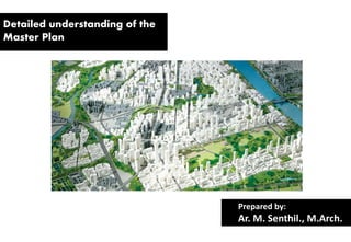
- 1. Detailed understanding of the Master Plan Prepared by: Ar. M. Senthil., M.Arch.
- 2. What is MASTER PLAN?
- 3. "A Master Plan is the long term perspective plan for guiding the sustainable planned development of the city. This document lays down the planning guidelines, policies, development code and space requirements for various socio-economic activities supporting the city population during the plan period. It is also the basis for all infrastructure requirements."
- 4. Master plan is one of the few documents which has all infrastructure developmental plans for the entire metropolis. This planning exercise encompassed various sectors, it required the support and positive interaction with many public and private agencies / departments. Their support has also been acknowledged at appropriate places in the document. Master plan is to steer market forces in the city building towards citizen welfare and public good. Zoning and building byelaws are still among the primary tools of such planning. Master plans serve as a guide for public agencies to tailor their sectoral programming to the plan while facilitating private investments in the same manner.
- 5. REQUIREMENTS OF MASTER PLAN
- 6. Master Plan Requirements 1. to present a comprehensive, long-range development plan 2. to provide an orderly, professional, and aesthetic development plan 3. to enable to proceed directly into preparation of Schematic Design documents for each phase of development.
- 7. ELEMENTS OF MASTER PLAN
- 8. The elements of a Master Plan identified are: • goals and policies • land use • housing • economic development • natural resources • open space and recreation • services and facilities • transportation and circulation
- 9. OBJECTIVES OF MASTER PLAN
- 10. • Assessment of the existing situation with regard to demographic and economic growth, infrastructure services, municipal finances, etc; • Identification of gaps in service delivery including the issues faced by the urban poor; • Vision and goal formulation for each sector to enable achieve the objectives enunciated above; • Formulation of a city investment plan with appropriate financing strategies for the identified interventions.
- 11. CONTENTS OF MASTER PLAN
- 12. Introduction Demography Economy Land use & structure Infrastructure -water supply -sewage -Electricity Environment and Disaster Management Traffice and Transportation Urban basic services for the poor -slum rehabilitation -schemes -Housing Social facilities Finance patterns Visions and goals Investment plans
- 14. Chennai the fourth largest metropolis in India. Chennai Metropolitan Area (CMA) extends over 1189 sq.km.and comprises of •Chennai Corporation, •16 Municipalities, •20 Town Panchayats and •214 villages covered in 10 Panchayats Unions It encompasses the Chennai District (176 sq.km.), part of Thiruvallur District (637 sq.km.) and a part of Kancheepuram District (376 sq.km.).
- 15. Development Planning in Chennai Metropolitan Area The major plans that had been prepared for Chennai. (i) General Town Planning Scheme (1957) prepared by Madras Corporation. (ii) The Madras Interim Plan prepared by D.T.P., Govt. of Tamilnadu. (iii) Madras Metropolitan Plan 1971-91 (1971) prepared by multi- agency group and published by RD&LA Dept., Govt. of Tamilnadu. (iv) Madras Urban Development Project (1974) prepared by MMDA (now CMDA). (v) Master Plan for MMA (1975) prepared by MMDA (now CMDA) (vi) Structure Plan for Chennai Metropolitan Area (1980) prepared by CMDA with Alan Turner & Associates as consultants
- 16. The first Master Plan laid down policies and programmes for overall development of CMA taking long-term view of the requirements. It dealt with distribution of future population in various parts of CMA, policies for economic growthand future location of economic activities, future physical developments, circulation pattern, programmes for Traffic and Transportation, developments of land use zoning, requirements of urban infrastructures for the future population, policies and programmes for sectoral developments and development control regulations.
- 17. The Second Master Plan for CMA – 2026 has brought out Development Regulations for all developments within the CMA which is a positive sign to attract development in the slow and medium growth settlements also because of the provisions such as: • Permitting multi-storeyed buildings in the rest of the CMA also excluding the Island Grounds, approved layout areas, Aquifer recharge area and Redhills catchment area • Permitting IT buildings and bio-informatics centers in mixed residential, commercial, institutional use zones • Defining IT corridor along the Rajiv Gandhi Salai (Old Mamallapuram Road)
- 18. • Treating buildings with maximum 6 dwelling units under ‘Ordinary Building’ category as against the earlier limit of 4 dwelling units • Accommodating working women’s hostels and old age homes in the primary residential areas • Proposing transfer of development rights in cases of road widening • Providing for restricted developments in aquifer recharge area • Reducing plot extent or side setback requirements
- 19. • Allowing multi-storey buildings (MSBs) along 12 m and 15 m wide roads with limitations on FSI and height • Reservation of 10 percent of land for EWS/LIG with dwelling sizes not exceeding 45 sqm, in the case of special buildings, group developments, multi-storeyed buildings on land of extent exceeding 1 hectare either within the site proposed for the development or in a location within a radius of 2 km from a site under reference • Allowing additional FSI 0.25 in cases of special buildings and group developments with dwelling units each not exceeding 45 sqm floor area
- 20. Further there are projects in store for the immediate future such as • Elevated expressway; • Extension of Corporation limit by including 8 Municipalities, 8 Town Panchayats and 25 Village Panchayats in CMA; • Truck terminal at Karunakaracheri and Annambedu villages near Thiruninravur along Outer Ring Road; • Sea water desalination plants; and • Extension of jurisdiction of Chennai Metropolitan Water Supply and Sewerage Board for providing water supply and sewerage facilities in villages outside city limit.
- 29. SWOT ANALYSIS
- 30. The major agencies involved in the infrastructure planning and development in Chennai Metropolitan Area are listed below.
- 32. Chennai Metropolitan Area spreads over 1189 square kilometers. The trend of its growth is very short and steep. The rapid developments increase the density of population and utilize urban land in a large scale. Land is the basic need for any type of development and it becomes a scarce commodity. So pre-planning of the land use is necessary. Chennai Metropolitan Development Authority categories the urban land into various zones and advocates the planned way of development. Later on based on the request a reclassification scheme is introduced to change the use of urban land. To assess the directed land use development in Chennai Metropolitan Area, a study is conducted along the four major arterials on few selected locations. The physical developments in selected locations are compared with the land use maps.
- 33. Land use regulation under Master Plan for CMA, 1975: The land use plan was enforced through a set of regulations under Development Control Rules, which formed part of the master plan. Any person intending to make any development is required to apply under Tamil Nadu Town and Country Planning Act, 1971, and obtain Planning Permission.
- 34. OBJECTIVES FOR LAND USE PLANNING 1. To analyze the existing land use pattern 2. To estimate the future land requirements and identify alternatives for land use. 3. To select and adopt the best land use options available. 4. To allocate land uses to meet the economic and social needs of people while safeguarding future resources.
- 35. LAND USE ZONES The following use z ones have been classified broadly into nine categories of land uses namely - Residential Commercial - Industrial Institutional - Public & Semi – public Transportation - Agricultural Open spaces & vacant lands - Water bodies
- 36. ZONING OF LAND PARCELS: The idea of zoning is that the segregation of certain uses from others reduces the effect of negative externalities, which some uses have on others. Zoning provides spatial segregation of conflicting uses. It also has the benefit of increasing positive externalities because many uses find an advantage in being grouped with other similar uses. Because of its predominant role, modern zoning encompasses expanded objectives for supplying certain public goods such as preservation of open space, prime agriculture land and ecologically sensitive areas also. Zoning is also desired on reduction of costs of providing certain public services.
- 39. Spatial Strategy The objectives of the plan are to provide for: (a) Optimum utilization of land by channalising the developments considering the latest policies and programmes of the Government. (b) The future needs of the metropolitan area by recognising the existing growth trends and by suitable allocation of land uses and strengthening the infrastructure facilities (c) Preservation and conservation of the ecologically sensitive areas in CMA.
- 40. (d) Wide scope for employment generation and economic development (e) A conducive climate/environment to make Chennai as a primate city. (f) The sustainable development and improving the quality of life (g) Efficient transportation net works integrating the land use patterns for balanced developments.
- 43. The issues that need to be addressed immediately are the following: Capacity of almost all roads in the present system is reduced due to poor quality of riding surface, inadequate pedestrian pavement, poor lighting conditions and lack of properly designed intersections. Establishment of large of number of IT (Infosys, Wipro, TCS) and IT enabling service establishments is bound to increase car ownership in the CMA thereby adversely affecting the traffic condition. The parking shortage is acute in the CBD area. The demand for parking in CBD is 1.5 to 2 times the supply and the acute shortage of parking supply is pronounced in the commercial areas of Anna Salai, T.Nagar, Purasawalkam and Mylapore. Parking is inadequate along the major arterial roads.
- 45. PROPOSALS: Strengthening and expanding the urban rail network including MRTS; Completion and commissioning of other strategic transport developments such as the ongoing MRTS Ph.II, Gauge Conversion project, northern segment of NH bypass, missing links to Inner Ring Road (IRR) and grade separators on IRR would assist in improving the modal share of rail to increase by 10% and that of bus by 16%. Improving the capacity of major arterial road corridors such as Anna Salai, Periyar EVR Salai, Jawaharlal Nehru Salai by exploiting the potentials of Area Traffic Control (ATC) measures in the initial years including promoting exclusive bus lanes where applicable; Augmenting the capacity of the major arterial road corridors such as Anna Salai, Periyar EVR Salai, Jawaharlal Nehru Salai as a whole by constructing elevated road-way / transit- way along the median of the road
- 46. CONCLUSIONS In the context of rapid urbanization, planning for development of the metropolitan area deserves utmost importance on par with the city area. Since the urban areas abutting the city area are targeted by the urbanization process, projection of future population, planning for achieving a balanced growth in terms of population density, planning for provision of adequate infrastructure facilities, strengthening of the institutional mechanisms, monitoring and enforcing of regulatory measures, planning for in-built mid-course corrective measures and futuristic planning for adjacent areas outside the metropolitan area need emphasis.
- 47. References Chennai Metropolitan Development Authority (2008) Second Master Plan for Chennai Metropolitan Area – 2026, Chennai Metropolitan Development Authority, Chennai. Chennai Metropolitan Development Authority. (2004). Development control rules for Chennai Metropolitan Area, CMDA: Chennai. WEBSITES https://www.pps.org/reference/benefits-and-drawbacks-of-master-planning/ http://www.hindu.com/nic/draftmasterplanii_short.pdf