Designing Scenarios for Liveable Cities Using Visualisations
•
10 likes•2,106 views

This document summarizes Serena Pollastri's presentation on using diagrams and visualizations to design future scenarios for liveable cities. It describes Pollastri's background and theoretical framework of metadesign. It also outlines an experiment conducting future visioning workshops with different sectors to map issues, explore possible futures, and design future city visions. Preliminary results are shown from retail, environment, heritage and transport sectors. The conclusion discusses limitations but notes conversations are more important than artifacts for analysis to inform the Liveable Cities project outcomes.

Recommended
Recommended
More Related Content
What's hot
What's hot (20)
Viewers also liked
Viewers also liked (10)
Similar to Designing Scenarios for Liveable Cities Using Visualisations
Similar to Designing Scenarios for Liveable Cities Using Visualisations (20)
More from serena pollastri
Recently uploaded
Recently uploaded (20)
Designing Scenarios for Liveable Cities Using Visualisations
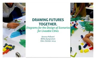
- 1. Drawing Futures Together. Diagrams for the Design of Scenarios for Liveable Cities Serena Pollastri RSD3 Symposium Oslo, October 2014
- 2. a brief history of me How (and why) I got where I am. Milan service design collaborative urban maps creative communities
- 3. a brief history of me How (and why) I got where I am. Milan agriculture sustainability Shanghai service design urban food service design “rururban” collaborative urban maps creative communities
- 4. a brief history of me How (and why) I got where I am. Toronto Milan agriculture sustainability Shanghai service design urban food service design “rururban” collaborative urban maps creative communities food graphic design service design
- 5. a brief history of me How (and why) I got where I am. Lancaster urban living future(s) metadesign Toronto Milan agriculture sustainability Shanghai service visualisations design urban food service design “rururban” collaborative urban maps creative communities food graphic design service design
- 6. Scenarios of future urban living Foresight report: Living in the City Urry, J., Caletrio, J., Birtchnell, T., Pollastri, S. Future Cities: Living in the Cities. UK Government Office for Science. 2014 https://www.gov.uk/government/publications/future-cities-living- in-the-city.
- 7. Scenarios of future urban living Foresight report: Living in the City Urry, J., Caletrio, J., Birtchnell, T., Pollastri, S. Future Cities: Living in the Cities. UK Government Office for Science. 2014 https://www.gov.uk/government/publications/future-cities-living- in-the-city.
- 8. Scenarios of future urban living Foresight report: Living in the City
- 9. Scenarios of future urban living Foresight report: Living in the City
- 10. Scenarios of future urban living Foresight report: Living in the City
- 11. Scenarios of future urban living Foresight report: Living in the City
- 12. Scenarios of future urban living Foresight report: Living in the City Urry, J., Caletrio, J., Birtchnell, T., Pollastri, S. Future Cities: Living in the Cities. UK Government Office for Science. 2014 https://www.gov.uk/government/publications/future-cities-living- in-the-city.
- 13. Research context Cities, complexity, futures Design approach: - map the system to find emerging opportunities, rather than solving single problems - design tools for collaboration.
- 14. how many designers does it take to change a light bulb?
- 15. how many designers does it take to change a light bulb? Does it have to be a light bulb?
- 16. Theoretical framework Metadesign approach. Metadesign: John Wood (2008, p. 4) identifies Metadesign as an approach able to “transform the world by reimagining new ways to live”. This profound rethinking of the system is needed because working within the limits of the current system to make it “sustainable” is not enough (Wood, 2009). Metadesign is the collaborative design of the design tools, processes that are able to produce a systemic change
- 17. Theoretical framework Metadesign approach. Metadesign: John Wood (2008, p. 4) identifies Metadesign as an approach able to “transform the world by reimagining new ways to live”. This profound rethinking of the system is needed because working within the limits of the current system to make it “sustainable” is not enough (Wood, 2009). Metadesign is the collaborative design of the design tools, processes that are able to produce a systemic change “How can visualisation processes contribute to the design of future scenarios of radically different liveable cities?”
- 18. A visual history of the future (foresight) Evidence based report on how future cities have been visualised in the past 100 years.
- 19. A visual history of the future (foresight) Evidence based report on how future cities have been visualised in the past 100 years. * who makes the visualisation --> process and actors * what is the purpose -> agency of the image * subject of the visualisation
- 20. The key role of diagrams as negotiation and decision-making tools is to enable common and shared understanding in multi-actors context (Ciuccarelli, Ricci and Valsecchi, 2008). Diagrams have always been integral part of different disciplines, from architecture and engineering to mathematics and natural sciences. In design research, diagrams are “operating devices able to reveal weak links among the elements of the system and to show the driving forces that can facilitate (or hinder) a design intervention” (Scagnetti et al., 2007) diagrams for design As a method for representing the complexity of urban life
- 21. Diagrams for design Using information visualisation processes throughout the design process
- 22. scenarios Policy-Orienting Scenarios Future Studies S1 S2 S3 P1 P2 P3 Strategic Planning S1 S2 S3 P1 P P2 P3 Design-Orienting Scenarios Design S1 S2 S3 P Decision Making in the scenario(s) Design of the scenario(s) key S P P scenario project / potential project Scenarios POS and DOS
- 23. Design Experiment: Future visioning workshops series
- 24. liveable cities August 2013 Activity of mapping relationships between research topics
- 25. Diagrams for design Using information visualisation processes throughout the design process - Macro scale - Collaborative (sync and non sync)
- 26. Future visioning workshop A multidisciplinary design orienting conversation on radically different future
- 27. Future visioning workshop A multidisciplinary design orienting conversation on radically different future
- 28. Future visioning workshop A multidisciplinary design orienting conversation on radically different future 1 Set the context What are the most relevant things that happened in the last 50 years in your sector? “not just in London, but in a lot of the major towns, what has changed is how people are moving using the bicycle and the decline of the car. Other than fashion and accessories for the middle age men who like to buy stuff, it is also about taking the street back, and making car drivers think twice about driving at speed (because there are more bikes).” Integrated planning Decline of the car Popularity of bikes “what changed in the sector is the belief that car is the answer.” “the assumption that the railway industry was in ter-minal Design with people in mind Re-birth of the railway “we started to make more efficient the use of roads that are already in place. We started to implement a multimodal approach, in which we look at all the steps of getting from A to B in an integrated way, to max-imize journey time and economic Energy issues Movement of goods decline” “the role of stations has changed: from big, celebrated places where people would meet, to something that, as cities get denser, people don’t pay attention to. Now people are back thinking more about the stations, which are being upgrad-ed and made more open. Stations now are thought of more from the people point of view, and are becoming something more than places where you go to get somewhere else.” Lenght of travel “the amount of long distance journey has doubled over the past 15 years in the UK, that means that we need to think about transport in a different way: people will need to travel further and more frequently” “the idea of a green infra-structure. We can use the landscape to link different elements together, for ex-ample through cycle ways, transport corridors, water, energy, climate control. This holistic use of landscape makes it much more plea-surable to move around. Landscape design can be-come one of the key disci-pline to improve the way we live in cities” “internal combustion engine is really not the future. The view now is that there must be alternative ways to produce energy for vehicles, which is something that 10, 15 years ago people wouldn’t really consider” “the change is that I heard this morning an engineer saying ‘cities are about people’” “the containerization of freight, that has made the world as a whole in the way things move around” “if we imagine a chicken and egg scenario of planning, which comes first: transport or land-use? In this country, as in many other countries in the world, we plan for the land use, and then we retrospectively fit the transport system around it. I think that this is the wrong way to do it, and historically strong networks were what gave shape to the society that we want.” impact”
- 29. Future visioning workshop A multidisciplinary design orienting conversation on radically different future 1 Set the context What are the most relevant things that happened in the last 50 years in your sector? 2 get negativity out of the way What are the worst possible things that could happen in the last 50 years?
- 30. Future visioning workshop A multidisciplinary design orienting conversation on radically different future 1 Set the context What are the most relevant things that happened in the last 50 years in your sector? 2 get negativity out of the way What are the worst possible things that could happen in the last 50 years? 3 explore possible worlds Thinking cards + silly ideas Thinking cards - technology - society - politics/economics - environment
- 31. Future visioning workshop A multidisciplinary design orienting conversation on radically different future 1 Set the context What are the most relevant things that happened in the last 50 years in your sector? 2 get negativity out of the way What are the worst possible things that could happen in the last 50 years? 3 explore possible worlds Thinking cards + silly ideas 4 design the future city of your sector Design your city. How will people live, what the city will look like, what are the paradigms of production and consumption
- 32. Future visioning workshop Some (very) preliminary results Retail Sector Environment and natural scientists Archaelogists, and culture and heritage sector Transport and utilities
- 33. Future visioning workshop Reports and other outcomes liveablecities.org.uk/ challenges/future-visions
- 34. visualise Focus on activity 3 and 4 (Work in progress)
- 35. visualise Activity 3 Mapping emerging is-sues, relevance and rela-tions Transport and Utilities sector
- 36. visualise Activity 3 Mapping emerging is-sues, relevance and rela-tions Archaeologists and historians
- 37. visualise Activity 3 Mapping emerging is-sues, relevance and rela-tions Archaeologists and historians Transport and utilities sector
- 38. visualise Activity 3 Mapping emerging is-sues, relevance and rela-tions Archaeologists and historians “Slowness” Transport and utilities sector “Slowness”
- 39. visualise Next steps retail environm. heritage transport X X X X X X X liveable cities framework Feedback, dissemination, further discussions 1. workshops 2. visions of future (mapped conversations) 3. themes + synergies and controversies * Mapping of activity 2 to be completed Mapping of activity 3 to be designed Comparative mapping, overlaying *
- 40. Future visioning workshop Conclusions Preliminary findings Limitations - Interesting when compared - Design of the activities and material is crucial (more than facilitation) - Fine balance creativity/structure - Leave room to disagree - Conversations are more important for the analysis than artefacts produced in the workshops. - Participant’s profile - Time available - We have no detailled information on how the results will be used (even thou we know it will be included in Liveable Cities outcome)
- 41. Some notes on my research Putting the experiment in context visualisations future scenarios why why what type? what type? why what types? diagrams design orienting scenarios methods, processes, and tools literature review research question design experiments context cities&liveability interdisciplinarity complexity future visioning workshops visualisations
- 42. Thank you Grazie Takk Serena Pollastri Imagination at Lancaster University s.pollastri@lancaster.ac.uk