SlideShare a Scribd company logo
1 of 105
Download to read offline
CHICAGO LONDON NEW DELHI PARIS SEOUL SYDNEY TAIPEI TOKYO
MY FIRST BRITANNICA
Asia, Australia,
and New Zealand
7
© 2008 by Encyclopædia Britannica, Inc.
International Standard Book Number: 978-1-59339-476-9 (set)
No part of this work may be reproduced or utilized in any form or by any means, electronic or mechanical,
including photocopying, recording, or by any information storage and retrieval system, without permission
in writing from the publisher.
My First Britannica:
Volume 7: Asia, Australia, and New Zealand 2008
Britannica.com may be accessed on the Internet at http://www.britannica.com.
Encyclopædia Britannica, Britannica, and the Thistle logo are registered trademarks of Encyclopædia Britannica, Inc.
Asia, Australia, and New Zealand
TABLE OF CONTENTS
INTRODUCTION. . . . . . . . . . . . . . . . . . . . . . . . . . . . . . . . 5
Asia: The Largest Continent . . . . . . . . . . . . . . 6
East Asia
China: Asia’s Largest Country . . . . . . . . . . . . . . . . . . . . . . 8
Beijing, China: Home of the Forbidden City. . . . . . . . . . 10
The Great Wall: Ancient China’s Giant Guardian . . . . . 12
Japan: Volcanoes, Earthquakes, and Plum Rains . . . . . . 14
Japan: Modern Nation of Ancient Traditions . . . . . . . . 16
Korean Peninsula: An Asian Land Divided. . . . . . . . . . . . 18
Pyongyang, North Korea:
North Korea’s Age-Old Capital . . . . . . . . . . . . . . . . . 20
Seoul, South Korea: A Modern Ancient Capital . . . . . . . 22
Southeast Asia
Phnom Penh, Cambodia: The City of Lady Penh . . . . . . . . 24
Angkor Wat: Cambodia’s Treasured Temple . . . . . . . . . 26
Indonesia: Island Nation of Southeast Asia. . . . . . . . . . . 28
Yangon, Myanmar: City of the Gold Pagoda . . . . . . . . . . . 30
Philippines: Tropical Island Republic . . . . . . . . . . . . . . . 32
Singapore: The Lion City . . . . . . . . . . . . . . . . . . . . . . . . . 34
Thailand: Kingdom of Southeast Asia . . . . . . . . . . . . . . . 36
Bangkok, Thailand: City of Angels . . . . . . . . . . . . . . . . 38
Vietnam: North and South. . . . . . . . . . . . . . . . . . . . . . . . 40
Hanoi, Vietnam: Capital of Reunited Vietnam. . . . . . . . 42
South Asia
Afghanistan: Mountain Country. . . . . . . . . . . . . . . . . . . . 44
Bangladesh: Land of the Bengals . . . . . . . . . . . . . . . . . . 46
Thimphu, Bhutan: City in the Heart of the Himalayas . . . 48
India: Land of Temples and Shrines . . . . . . . . . . . . . . . . 50
Taj Mahal: Wonder of the World . . . . . . . . . . . . . . . . . . 52
Nepal: Country of Mount Everest . . . . . . . . . . . . . . . . . . . 54
Kathmandu, Nepal: City of Palaces . . . . . . . . . . . . . . . 56
Pakistan: A Young Country with an Ancient History. . . . . 58
Pakistan: Land of the Indus Civilization . . . . . . . . . . . 60
Sri Lanka: Island Nation of Natural Riches. . . . . . . . . . . 62
The Middle East and Transcaucasia
Fertile Crescent: Cradle of Civilization . . . . . . . . . . . . . . . 64
Yerevan, Armenia: City of Cafés . . . . . . . . . . . . . . . . . . . . 66
Istanbul, Turkey: City on Two Continents. . . . . . . . . . . . . 68
Iran: Modern Persia . . . . . . . . . . . . . . . . . . . . . . . . . . . . 70
Baghdad, Iraq: City of Arabian Nights . . . . . . . . . . . . . . . 72
Israel: The Jewish State . . . . . . . . . . . . . . . . . . . . . . . . . 74
Jerusalem: Holy City . . . . . . . . . . . . . . . . . . . . . . . . . . . . 76
Amman, Jordan: City on Seven Hills . . . . . . . . . . . . . . . . 78
Beirut, Lebanon: The City of Wells. . . . . . . . . . . . . . . . . . 80
Oman: Rocky Soils and Oil Riches . . . . . . . . . . . . . . . . . . 82
Mecca, Saudi Arabia: Holiest City of Islam . . . . . . . . . . . 84
Damascus, Syria: Pearl of the East . . . . . . . . . . . . . . . . . 86
Australia and New Zealand
AUSTRALIA
Australia: Island Continent . . . . . . . . . . . . . . . . . . . . . . . 88
Canberra, Australia: Meeting Place on a Hill . . . . . . . . 90
Great Barrier Reef: Island of Reefs Within Reefs . . . . . 92
Sydney, Australia: A Magnificent Harbor City . . . . . . . . 94
Western Australia: Desert State . . . . . . . . . . . . . . . . . . 96
NEW ZEALAND
New Zealand: Land of the Long White Cloud . . . . . . . . . . 98
Wellington, New Zealand:
A Visit to New Zealand’s Capital . . . . . . . . . . . . . . 100
GLOSSARY. . . . . . . . . . . . . . . . . . . . . . . . . . . . . . . . . . 102
INDEX . . . . . . . . . . . . . . . . . . . . . . . . . . . . . . . . . . . . . 103
Asia, Australia, and New Zealand
In Volume 7, Asia,
Australia,
and New
Zealand,
you’ll discover answers to
these questions and many
more. Through pictures,
articles, and fun facts,
you’ll learn about the
people, traditions,
landscapes, and history
that make up many of the
countries and cities of
Asia, Australia, and New
Zealand.
I N T R O D U C T I O N
How did the Forbidden City get its name?
What is the holiest city of Islam? Who built the Taj Mahal?
Where is the largest coral reef in the world?
To help you on your journey, we’ve provided the following guideposts in
Asia, Australia, and New Zealand:
■ Subject Tabs—The colored box in the upper corner of each right-hand
page will quickly tell you the article subject.
■ Search Lights—Try these mini-quizzes before and after you read the
article and see how much—and how quickly—you can learn. You can even
make this a game with a reading partner. (Answers are upside down at the
bottom of one of the pages.)
■ Did You Know?—Check out these fun facts about the article subject.
With these surprising “factoids,” you can entertain your friends, impress
your teachers, and amaze your parents.
■ Picture Captions—Read the captions that go with the photos. They
provide useful information about the article subject.
■ Vocabulary—New or difficult words are in bold type. You’ll find
them explained in the Glossary at the back of this volume. And there’s a
complete listing of all Glossary terms in the set in the Reference Guide
and Index, Volume 13.
■ Learn More!—Follow these pointers to related articles throughout the set.
■ Maps—You’ll find lots of information in this volume’s many maps.
■ The Country Maps point out national capitals. Globes beside Subject
Tabs show where countries are located in the world.
■ The Continent Maps have a number key showing the location of all
countries.
Cover photos (top): the Great Wall of China, © Keren Su/Corbis; (center): Taj Mahal, Agra, India, © Galen Rowell/Corbis; (bottom): koala, © Wes Thompson/Corbis
MY FIRST BRITANNICA
Have a great trip!
■ The Icons on the maps highlight major geographic features and climate.
Here’s a key to what the map icons mean:
■ The Mini-Atlas, found in Volume 13, offers detailed maps, useful data
tables, and assorted photographs of each continent.
And don’t forget: If you’re not sure where to start, where you saw something
before, or where to go next, the Index at the back of this volume and the
Reference Guide and Index (Volume 13) will point the way.
Deserts and Other Dry Areas
Polar Regions and Other Frozen Areas
Mountains
Rainforests
General Forests
The Great Wall of China
© Keren Su/Corbis
34
1
5
12
19
45
43
26
9
42
39
1518
16
23
35
47 30
44
33
420
14
31
11
2 3
40
21
28
6
41
8
27
46
22
25
38
24
13
7
36
6
DID YOU KNOW?
Asia is the birthplace of all the major
religions of the world.
True or
false?
The highest
point on Earth is
in Asia.
SEA
RCH LI
GHT
Statue of Buddha in Si Satchanalai, Thailand.
© Royalty-Free/Corbis
A S I A
Asia is the world’s largest continent. It covers about one-third of
the Earth’s land and has about three-fifths of the world’s population.
Japan, China, and India are some of the most familiar of Asia’s
nearly 50 countries. In fact, Asia is so big that it’s often easier to talk
about the regions rather than the countries of Asia. The region
names commonly used are North Asia, Central Asia, East Asia,
Southeast Asia, South Asia, and Southwest Asia (the last one is
usually called the Middle East).
Most of the continent is made up of mountains and tablelands.
The Himalayan mountain chain in South Asia includes the highest
point on Earth, Mount Everest. The Earth’s lowest point, the Dead
Sea, is in Asia too.
Asia is home to many kinds of animals. Reindeer, Arctic foxes
and hares, seals, walruses, and lemmings can be found in the far
north. Elk, brown bears, and sables live in the cool forests. Antelope,
wild sheep, and goats are found in the steppes and deserts. Black
bears, pandas, tigers, and monkeys can be found in southern and
eastern Asia. Southern Asia is also noted for elephants, leopards,
crocodiles, cobras, and peacocks.
Northern Asia has very cold winters and cool summers. It is
covered by tundra—vast treeless plains common in cold regions.
Central Asia has cold winters and hot summers with little rainfall.
Southern Asia has a warm climate all year, with a lot of rain. There
are rainforests all across southern Asia. And nearly all Asian
countries share one very important food plant: rice.
Answer:TRUE.Theworld’stallestmountain,MountEverest,is
inAsia.
★
The Largest
Continent
01. Afghanistan
02. Armenia
03. Azerbaijan
04. Bahrain
05. Bangladesh
06. Bhutan
07. Brunei
08. Cambodia
09. China
10. East Timor
11. Georgia
12. India
13. Indonesia
14. Iran
15. Iraq
16. Israel
17. Japan
18. Jordan
19. Kazakhstan
20. Kuwait
21. Kyrgyzstan
22. Laos
23. Lebanon
24. Malaysia
25. Maldives
26. Mongolia
27. Myanmar
28. Nepal
29. North Korea
30. Oman
31. Pakistan
32. Philippines
33. Qatar
34. Russia (part)
35. Saudi Arabia
36. Singapore
37. South Korea
38. Sri Lanka
39. Syria
40. Tajikistan
41. Thailand
42. Turkey
43. Turkmenistan
44. United Arab Emirates
45. Uzbekistan
46. Vietnam
47. Yemen
COUNTRIES OF ASIA
17
37
29
32
13
10
LEARN MORE! READ THESE ARTICLES…
CONTINENTS (VOLUME 1) • EUROPE (VOLUME 6)
MOUNTAINS (VOLUME 1)
8
The People’s Republic of China
is Asia’s largest country and has
more people than any other
country in the world—more than
a billion and a quarter! The capital city is Beijing.
Han (or Mandarin) is the most widely spoken
language of China’s several dozen languages. The Chinese
civilization is one of the world’s oldest and has produced such famous
thinkers as Confucius.
Parts of China are very mountainous, as is the Plateau of Tibet in
southwest China. One part of the plateau is called “the Roof of the World.”
China is so big that some parts are scorching hot deserts while it rains
almost every day in some southeastern regions. Many boats and ships carry
people and goods on China’s major rivers—the Huang He, Yangtze, and
Xi. China also has many railroads as well as three of the world’s longest
highways.
China’s enormous and varied land area supports many plants and
animals. Some Chinese animals have become extinct in the rest of the
world, including the giant salamander, the giant panda, and the
great paddlefish. Many of China’s trees provide useful
substances. The tung tree and the camphor tree produce
valuable oils. The lacquer (or varnish) tree produces
substances used in making wooden objects. And from the star
anise tree comes a food flavoring. In addition, Chinese
farmers produce more rice than does any other country.
People around the world enjoy eating Chinese food. But
China has many more traditional and regional dishes than
most non-Chinese know about. In addition to rice and
noodles, Chinese dishes include delicacies such as steamed
chicken feet and hundred-year-old eggs.
LEARN MORE! READ THESE ARTICLES…
CONFUCIUS (VOLUME 5) • MAO ZEDONG (VOLUME 4)
PANDAS (VOLUME 12)
Find and
correct the
error in the
following sentence:
The People’s Republic
of China is the
largest country in Asia
and has the most
people: more than a
million and a quarter.
SEA
RCH LI
GHT
Largest Country
Asia’s
Beijing
C H I N A
9
Answer:ThePeople’sRepublicofChinaisthelargestcountryin
Asiaandhasthemostpeopleintheworld:morethanabillion
andaquarter.
★
DID YOU KNOW?You may think of pasta as an Italiandish, but actually it was created inChina. So were fireworks, compasses,silk, chopsticks, crossbows, paper,and paper money.
Rice is one of the most important crops grown
in China. Farmers use terraced fields such as
these to grow rice on hillsides.
© Keren Su/Corbis
DID YOU KNOW?
The Forbidden City was well named.
The “common people” were never
allowed in. Even those who were
allowed in, such as the emperor’s
family, could go into only certain
parts of the city.
Many people in Beijing use bicycles
to get from place to place.
© Joseph Sohm—ChromoSohm Inc./Corbis
10
B e i j i n g , C H I N A
Answer:ThecityofBeijinghasmanynarrowalleys,orhutongs.
★
Beijing is the capital of the People’s Republic of China. For many years
the city was known by English speakers as Peking. China used to be ruled
by emperors, and Beijing was the home of those emperors. Their palaces
were located in an area that is called the Forbidden City because common
people were not allowed inside. The Forbidden City is now a museum.
Next to the Forbidden City is Tiananmen Square. It is one of the
largest public squares in the world. Beijing is also famous for its parks.
Zhongshan Park is located in the heart of the
city. It holds the Altar of Earth and
Harvests, where the emperor made offerings
to the gods of earth and farming. Beihai Park
has a big lake and several artificial hills and
islands. Atop one of the hills stands the
beautiful White Pagoda. In summer the lake
is full of rowboats. In winter it freezes, and
people use it as a skating rink.
The Beijing Zoo was once called the Garden of Ten Thousand
Animals. It doesn’t really have that many animals, but it does have lots of
interesting ones, including some famous giant pandas. Of course, there are
places to visit outside the parks. Some people like to tour the
neighborhoods of the city. The city has many narrow alleys, or
hutongs. Old houses with enclosed courtyards and tiny gardens of
potted plants open off the alleys.
There’s much to see in Beijing. And, especially exciting, the
Olympics will be held there in 2008.
LEARN MORE! READ THESE ARTICLES…
CHINA (VOLUME 7)
A CHINESE CINDERELLA STORY: YEH-SHEN (VOLUME 5)
EMPRESS OF CHINA (VOLUME 4)
The Forbidden City, in Beijing, China.
© Keren Su/Corbis
Find and
correct the
error in the
following sentence:
The city of Beijing
has many lovely
parks, or hutongs.
SEA
RCH LI
GHT
Home of the
Forbidden City
DID YOU KNOW?
In the 200s BC the first emperor of a
united China connected parts of the
wall that stood as separate sections
to make one long wall.
T H E G R E A T W A L L
13
The Great Wall of China is the largest structure humans have
ever built. Chinese emperors had the wall built to guard the
country from raids or invasions. It runs from east to west for more
than 4,000 miles as it stretches across the mountains and valleys
of northern China. It is about 20 feet thick at its base and as tall
as a house. The entire wall is made of earth and stones. The
wall also had watchtowers
placed along its length.
Different parts of the wall
were built at different times, but all of it was
finished long before there were machines to
help with the building. Thousands of men
worked to build the wall. Many of them died
while working on it.
After the Great Wall was built, the people
of China felt safer. If an enemy approached
the wall, smoke signals would be passed
from watchtower to watchtower. A signal fire would be lighted if an attack
came at night. An alarm would be sounded, and the emperor’s army would
rush to defend the wall.
But the Great Wall didn’t always provide protection. Because the wall
was so long, some parts of it were guarded better than others. Sometimes
enemies broke through. Finally, the Chinese stopped depending on their
wall.
Today the Great Wall is a great attraction for visitors to China. In 1987,
UNESCO (the United Nations Educational, Scientific, and Cultural
Organization) named the Great Wall a World Heritage site.
LEARN MORE! READ THESE ARTICLES…
ANGKOR WAT (VOLUME 7) • CHINA (VOLUME 7) • EGYPT (VOLUME 8)
Answer:Theemperorshadthewallbuilttokeepoutthepeople
whowereraidingnorthernChina.
★
Tourists visiting the Great Wall of China.
© Dean Conger/Corbis
Why
did the
Chinese emperors
have the
Great Wall
built?
SEA
RCH LI
GHT
The Great Wall of China is one of the most remarkable
structures on Earth. It is more than 4,000 miles long and is
one of the largest construction projects ever carried out.
Work on parts of the wall began more than 2,500 years ago.
© Keren Su/Corbis
Ancient China’s
Giant Guardian
Japan is made up of a string of islands that stretches for
nearly 1,500 miles along the coast of northeastern Asia in the
Pacific Ocean. The four main islands are Honshu, Hokkaido,
Kyushu, and Shikoku. The largest of them is Honshu.
Most of the islands are covered with hills and mountains. Many of
the mountains are volcanoes. Some of them are active, and
some are “asleep.” Mount Fuji is an active volcano
though it hasn’t erupted since 1707. It is Japan’s
highest mountain, reaching a height of 12,388 feet.
Rivers flowing past the volcanoes get so much acid in
them that they can’t be used to water crops.
There are many lush forests in Japan. Japanese cherry trees, famous for
their spring blossoms, are planted throughout the country. The forests stay
beautifully green because it rains and snows so much in Japan. Most
parts of the country get more than 40 inches of rain each year. The
summer rains are called baiu, which means “plum rain.” They
are called that because they begin at the time when the
plums ripen. Some parts of Japan get many feet of
snow each winter.
Many kinds of wild animals can be
found in Japan’s forests. They
include bears, badgers,
otters, mink, deer,
and foxes.
DID YOU KNOW?
Mount Fuji may not seem so high
compared with some of the world’s
other mountains. But it’s high enough
that during the summer the
temperature at the top is 40° F
cooler than it is at the bottom.
Volcanoes, Earthquakes,and Plum Rains
Tokyo
14
J A P A N
Japan has many wildlife sanctuaries to
protect all these wonderful creatures.
Did you know that there are
about 1,000 earth tremors in
Japan every year? Fortunately,
most are not very strong,
but violent earthquakes
do occur sometimes.
When that happens
there is a danger of
tsunamis, giant tidal
waves along the coasts.
LEARN MORE! READ THESE ARTICLES…
• JAPAN: MODERN NATION OF ANCIENT
TRADITIONS (VOLUME 7)
• KOREAN PENINSULA (VOLUME 7)
• TSUNAMIS (VOLUME 1)
Answer:a)Honshu.
★
Mount Fuji is considered the sacred symbol
of Japan. It’s actually a volcano, but it hasn’t
erupted since 1707. At right is a pagoda, a
kind of tower with curving roofs at each story.
© Jose Fuste Raga/Corbis
The largest
island in
Japan is
a) Honshu.
b) Kyushu.
c) Hokkaido.
SEA
RCH LI
GHT
16
When you’re in Japan, you’ll notice something that is really striking:
the mixture of old things and new. On the one hand, you’ll see beautiful
old pagodas and shrines. On the other hand, you’ll find skyscrapers,
overpasses, and subways.
Some people in Japan continue to fish for a living, just as their
ancestors had for thousands of years. Salmon, sardines, tuna, squid,
mackerel, cod, and mullet are the
important fish they catch. The Japanese
people catch more than 5 million tons of
fish each year. This makes Japan one of
the world’s leading fishing nations.
But Japan is also one of the most
developed countries in the world. It is
one of the world’s biggest producers of
automobiles, computers, cameras, radio
and television sets, watches, microwave
ovens, and many more electronic items.
Tokyo, Japan’s capital, is one of the world’s largest cities. It has many
skyscrapers and grand shopping plazas that may remind you of New York
City. The Ginza shopping area is often referred to as Tokyo’s Fifth Avenue.
But you will also find many Buddhist temples and shrines scattered
throughout the city, and they are quiet and peaceful.
The traditional court music of Japan is called gagaku and can be
heard in Tokyo. But so can a lot of Western music, such as jazz,
rock, and blues. And all the latest pop songs that you would hear
in English-speaking countries can be heard in Tokyo too.
This mix of ancient and modern culture makes Japan an
exciting place to live or visit.
LEARN MORE! READ THESE ARTICLES…
BASHO (VOLUME 3) • HIROHITO (VOLUME 4)
JAPAN: VOLCANOES, EARTHQUAKES, AND PLUM RAINS (VOLUME 7)
Skyscrapers in Shinjuku, a main shopping
district in Tokyo.
© Jose Fuste Raga/Corbis
Are each
of the following
things part of old
Japan or new Japan?
- shrines
- skyscrapers
- subways
- gagaku
- rock and jazz
- fishing
SEA
RCH LI
GHT
of Ancient Traditions
Modern Nation
J A P A N
17
Answer:Shrines,gagaku(courtmusic),andfishinghaveallbeen
partofJapanformanyhundredsofyears.Skyscrapers,subways,
androckandjazzmusicareallfairlynewtoJapan.
★
Built in the 7th century, Senso Temple is the oldest
of Tokyo’s many Buddhist temples.
© Richard T. Nowitz/Corbis
Shinjuku train
station in Tokyo
is perhaps the
busiest train
station in the
world. About 2
million people
pass through it
every day.
DID YOU
KNOW?
18
DID YOU KNOW?
For many Koreans the number 4 is
considered unlucky, just like the
number 13 is for some Westerners.
Four is unlucky because in Korean it
is pronounced the same as the word
for “death.”
K O R E A N P E N I N S U L A
19
Answer:FALSE.TheKoreanpeninsulawasdividedintotwo
countriesin1948.NorthKoreabecamecommunist,butSouth
Koreadidnot.
★
The Korean peninsula is a land of beautiful
mountains. For a long time it was a single
country. Today it is divided into two
countries—North Korea and South Korea.
But though they are separate, they share a
border and a common history that stretches back
thousands of years.
Korea has a rich culture that was influenced by
China, especially in early times. The Buddhist and
Confucian religions came to Korea from China.
Over the years, however, Korea developed a culture that is very
much its own. For example, even though it once used
the Chinese system of writing, the Korean language
isn’t closely related to any other language. And Korean music
sounds quite different from other East Asian music. In the folk
music called p’ansori, a singer-storyteller performs with a
drummer. In dance and other music, the kayagum, a stringed
instrument, is an original Korean favorite. Many people around the
world love to eat Korean food—especially tasty barbecued meat and a
spicy cabbage dish called kimchee.
In 1948, after World War II, the Korean peninsula was officially
divided into North Korea and South Korea. North Korea became a
communist country, but South Korea did not. In 1950 a war broke
out between the two. This was the Korean War, which ended in
1953 with the two Koreas remaining separate.
Both North and South Korea have been rebuilt since the war.
In 2000 the two countries held talks about joining together again.
People were finally allowed to cross between them and meet family
members they had not seen since the war, almost 50 years before.
LEARN MORE! READ THESE ARTICLES…
PENINSULA (VOLUME 1) • PYONGYANG, NORTH KOREA (VOLUME 7)
SEOUL, SOUTH KOREA (VOLUME 7)
North Korea
South Korea
This monument honors soldiers who fought in the Korean War. The
memorial stands near the village of Panmunjom. It lies within a neutral
zone established between North and South Korea after the war.
© Robert Holmes/Corbis
An Asian
Land Divided
True or
false?
The Korean
peninsula became
a communist
country in 1948.
SEA
RCH LI
GHT
Pyongyang
Seoul
20
Pyongyang is the capital and largest city of the East Asian
country of North Korea. It lies along the Taedong River, close
to the Yellow Sea. The name Pyongyang means “flat land” or
“cozy place” in Korean.
People have lived where Pyongyang now stands for many
thousands of years. According to legend, the modern city
was started in 1122 BC. Since then it has faced a number of
invasions and wars. Armies from China and Japan captured
Pyongyang at different times, and much of the city was
destroyed in a war between those two countries in the 1890s. The Japanese
ruled Pyongyang from 1910 to 1945.
In 1948, when Korea was divided into
two nations, Pyongyang became the
capital of communist North Korea.
The city was heavily damaged once
again during the Korean War of 1950
to 1953.
A bronze statue of a winged horse
towers over Pyongyang. It is meant to
remind people of the way the city
grew after the end of the Korean War.
Other large monuments built in recent
years include the wide Arch of Triumph and the Tower of the Juche Idea.
(Juche means “self-reliance”—that is, depending on yourself rather than on
other people.)
Pyongyang has a university, a medical school, and a school for training
Communist Party leaders. There are also a large theater, a large assembly
hall, and a large stadium. In addition, North Korea’s main museums and
libraries are located in the city.
LEARN MORE! READ THESE ARTICLES…
BERLIN, GERMANY (VOLUME 6) • KOREAN PENINSULA (VOLUME 7)
SEOUL, SOUTH KOREA (VOLUME 7)
Children giving a concert at the Children’s Palace
in Pyongyang.
© Jeremy Horner/Corbis
Why
have parts
of Pyongyang
been rebuilt
a number of times?
SEA
RCH LI
GHT
North Korea’s
Age-Old Capital
P y o n g y a n g , N O R T H K O R E A
21
Answer:SeveralwarshavebeenfoughtinKoreaoverthe
centuries,andthecityhasbeenpartiallydestroyedduringthe
manybattles.
★
The Tower of the Juche Idea rises above the city
center of Pyongyang. The monument celebrates
juche (“self-reliance”), a quality favored by
Kim Il-Sung, the first ruler of North Korea.
© Jeremy Horner/Corbis
DID YOU KNOW?
Wrestling is very popular in North
Korea. The largest crowd to watch a live
wrestling match was in Pyongyang in
1995, when 190,000 people gathered
there to watch The International Sports
and Culture Festival for Peace.
DID YOU KNOW?
The name Seoul comes from the
Korean word sorabol, which means
“capital.”
S e o u l , S O U T H K O R E A
23
Seoul, the capital of South Korea, has been attacked and
destroyed many times in the past. As a result, it reflects the
struggles of Korea in important ways.
In the 16th century Japanese invaders partially destroyed the
city. Between 1910 and 1945 Seoul came under Japan’s control,
and Japan made the city its colonial
capital. The city was devastated
during the Korean War, from 1950
to 1953. Since the 1950s the city
has been rebuilt once again. It is sometimes
described as an “endless construction project.”
There is much Chinese influence in Seoul,
especially in its design. A long defensive wall with
gates, in Chinese style, was built around the city
near the end of the 14th century. Parts of the wall
and the gates can still be seen.
Today Seoul is a modern city with ancient
accents. It has freeways, plazas, and high-rise
buildings alongside centuries-old pagodas. In
downtown Seoul there are striking palaces and
other structures from the city’s royal past. Several of these, such as Toksu
and Changgyong palaces, are open to the public as museums.
Any tour of Seoul should include a view from Seoul Tower in Namsan
Park near the city center. From the tower you can see many historic and
modern sights. These include Kyongbok Palace, one of the royal palaces
of the Choson dynasty, and Olympic Park, site of the 1988 Summer
Olympic Games.
LEARN MORE! READ THESE ARTICLES…
JAPAN: MODERN NATION OF ANCIENT TRADITIONS (VOLUME 7)
A KOREAN FOLKTALE: THE TIGER IN THE TRAP (VOLUME 5)
PYONGYANG, NORTH KOREA (VOLUME 7)
Answer:Seoulhasbeendestroyedandrebuiltseveraltimes.
★Statues of men in traditional Korean
clothing, at the National Folk
Museum of South Korea, in Seoul.
© Royalty-Free/Corbis
Seoul is home to historic palaces as well as modern
high-rise buildings. Changgyong Palace can be seen
here in front of the skyline of downtown Seoul.
© Jose Fuste Raga/Corbis
Why
is Seoul
sometimes
called an
“endless
construction project”?
SEA
RCH LI
GHT
A Modern
Ancient Capital
24
Phnom Penh is the capital of the Kingdom of Cambodia
in Southeast Asia. It is located at the meeting point of
three rivers: the Basak, the Sab, and the Mekong.
Phnom Penh is more than 500 years old. According
to legend, a woman named Lady Penh was walking on a hill and found a
bronze statue of the Buddha, the founder of the Buddhist
religion. There she started the town of Phnom Penh,
whose name means “Penh Hill.” Her ashes, it is
said, were kept in a pagoda at the top of the hill.
Phnom Penh was built around the Preah
Morokot pagoda. Its floor is paved with tiles of
solid silver. The pagoda is built like a tower, with
several stories. At the edge of every story, the roof
curves upward. It and other stately buildings are near
the Royal Palace, where the king and his family live.
There are many museums in Phnom Penh. The
National Museum has a fine collection of art by the
Khmer people, who make up more than 85 percent of the population of
Cambodia. The Tuol Sleng Museum is devoted to the memory of the many
Cambodians who were killed in the 1970s by Cambodia’s communist
government. This was a terrible time in the history of the city
and country.
The Royal Ballet of Phnom Penh is known the world over. Its
ballets deal with ancient Buddhist and Hindu legends. There was
a time when the dancers performed only for the Cambodian royal
family. Now everyone can enjoy them.
LEARN MORE! READ THESE ARTICLES…
ANGKOR WAT (VOLUME 7)
A CAMBODIAN MYTH: MONI MEKHALA AND REAM EYSO (VOLUME 5)
THAILAND (VOLUME 7)
What
kind of
government does
Cambodia have?
(Hint: Think of the
country’s full name.)
SEA
RCH LI
GHT
Lady Penh
The City of
Phnom Penh
P h n o m P e n h , C A M B O D I A
25
Answer:Cambodiaisakingdom,soit’ssupposedlyruledbya
kingoraqueen.However,inmoderntimesmostmonarchshave
governmentofficialsandlawmakerstohelprunthecountry.
★
In the 1970s
Phnom Penh
nearly became a
ghost town when
Cambodia’s rulers
forced almost
everyone out of
the city to work
in farm fields.
DID YOU
KNOW?
The Royal Palace in Phnom Penh is home to
Cambodia’s king and his family.
© Nevada Wier/Corbis
26
Angkor Wat is a temple in the Southeast Asian country of Cambodia.
The word angkor means “capital,” and wat means “monastery.” Angkor
Wat is more than 800 years old. It is the world’s largest religious structure.
The Khmer people are native to Cambodia, and the city of Angkor was
once the capital of the Khmer Empire. King Suryavarman II built Angkor
Wat. He dedicated the temple to the three Hindu gods Brahma,
Vishnu, and Shiva. It was not just a temple but also the
government center of Suryavarman II’s empire.
The temple walls are covered with sculptures of Hindu
gods. They also show scenes from ancient Khmer history. In
addition, there are hundreds of carved statues of apsaras, or
“heavenly dancers.” They are seen wearing beautiful costumes,
jewelry, and crowns.
About 20 years after the complex was built, a foreign army
attacked the Khmers and looted the city. King Jayavarman VII,
who was ruling the Khmer, felt that the gods had failed him.
He became a Buddhist and built a new capital nearby called
Angkor Thom. Angkor Wat then became a Buddhist shrine.
Many of the statues and carvings were replaced by
Buddhist art.
After many years, however, the forest grew and covered Angkor Wat.
Most people forgot all about it. A French explorer named Henri Mouhot
rediscovered the city while traveling on the Mekong River in 1858. In 1992
UNESCO (the United Nations Educational, Scientific and Cultural
Organization) named the entire Angkor area a World Heritage site. Today
Angkor Wat is one of the main attractions for visitors to Cambodia.
LEARN MORE! READ THESE ARTICLES…
BUDDHISM (VOLUME 5) • HINDUISM (VOLUME 5)
PHNOM PENH (VOLUME 7)
Fill in
the blanks:
Angkor Wat is
more than _______
years old and is the
world’s _______
religious structure.
SEA
RCH LI
GHT
Tree roots growing on the Ta Prohm temple,
part of the temple center at Angkor, Cambodia.
© Royalty-Free/Corbis
Treasured Temple
Cambodia’s
A N G K O R W A T
Answer:AngkorWatismorethan800yearsoldandistheworld’s
largestreligiousstructure.
★
DID YOU KNOW?
When UNESCO named Angkor Wat a
World Heritage site, it meant that the
place has major importance for the
entire world. Being a World Heritage
site makes it easier for countries to
cooperate to protect a cultural or
natural treasure.
28
Fill in
the blank:
Indonesia is
a country made up
of about 13,670
_______.
SEA
RCH LI
GHT
DID YOU KNOW?
Indonesia has more than 200 active
volcanoes. Among them is the famous
Krakatoa. When it erupted more than
a hundred years ago the explosions
were heard thousands of miles away.
Indonesians use a process called batik to dye
fabrics. The results can be quite colorful.
© Wolfgang Kaehler/Corbis
I N D O N E S I A
29
The Republic of Indonesia consists of a group of islands
lying between the Indian and Pacific oceans. Its capital is
Jakarta on the island of Java.
Indonesia is made up of about 13,670 islands, though
some are shared with other countries. The largest island is New Guinea,
which Indonesia shares with Papua New Guinea. Parts of Borneo, the
second largest island in the group, belong to Malaysia and Brunei.
Sumatra, Java, and Celebes are the other major islands of Indonesia. Most
of Indonesia’s people live on these five islands.
Most of the islands are mountainous. Only about one-tenth of the land
is used for growing crops, but many of the people make their living from
farming. Rice is the main crop grown there. Other crops include coffee,
tea, tobacco, and spices. There are also many palm and rubber trees in
Indonesia. The country produces many things made of palm oil and is a
major supplier of natural rubber.
The climate in Indonesia is hot and humid. Rain falls heavily
throughout the year. Because of that, much of Indonesia is covered with
rainforests. Mangrove tree swamps are common along the coasts.
Indonesia is known for more than its natural resources, though. The
people of Indonesia practice special decorative arts throughout the islands.
Perhaps the most popular art with tourists is batik, a special way of dyeing
fabric. Indonesians are also known for their traditional dance and puppet
performances. Puppetry is one of the favorite arts of the islanders themselves.
LEARN MORE! READ THESE ARTICLES…
FOLK ARTS AND CRAFTS (VOLUME 3) • DANCE (VOLUME 3)
VOLCANOES (VOLUME 1)
Answer:Indonesiaisacountrymadeupofabout13,670islands.
★
Jakarta
Southeast Asia
Island Nation of
Yangon is the largest city in Myanmar and the country’s
business center. It is located near the Yangon River. In
the past the city was known as Rangoon and the
country was called Burma.
At one time Yangon and the rest of Myanmar were controlled by Great
Britain. The center of the city, known as the Cantonment, was planned by
the British. It is laid out in a system of blocks. Each block is divided by
streets running north to south and east to west. As Yangon’s population
increased, new settlements were built around the Cantonment.
If you visit Yangon, you’ll find many interesting places to see. The
most famous building is the Shwe Dagon Pagoda. It is a great Buddhist
temple on a hill. The pagoda is a solid brick structure that is covered with
gold. It has been a place of pilgrimage for many centuries. Yangon also
has many other important shrines, including the World Peace Pagoda.
DID YOU KNOW?
The city’s name in the English language
was changed from Rangoon to Yangon in
1989. Yangon is closer to the way that
the name is said in Burmese, the most
widely spoken language in Myanmar.
City of the
Gold Pagoda
Y a n g o n , M Y A N M A R
Most of the buildings in the city center are made of
bricks. Some of these old brick buildings are from the British
colonial days. The Office of Ministers is one of them. Other
British buildings built around the same time include the Law
Courts, Yangon General Hospital, and the customhouse. In other
parts of the city you’ll see many traditional wooden houses.
To the north of the city center is Royal Lake. The lake is
surrounded by a wooded park. Nearby are the city’s zoo and
botanical gardens.
LEARN MORE! READ THESE ARTICLES…
BANGKOK, THAILAND (VOLUME 7)
BUDDHISM (VOLUME 5) • U THANT (VOLUME 4)
Answer:Yangonisalsothenameoftheriverthatpassesnear
thecity.
★
Yangon
Yangon
shares
its name
with what
geographic feature?
SEA
RCH LI
GHT
Many people travel to Yangon to visit
the Buddhist temple known as the
Shwe Dagon Pagoda.
© Christophe Loviny/Corbis
31
Find and
correct the
error in the
following sentence:
The Philippines is a
large group of islands
in the Indian Ocean.
SEA
RCH LI
GHT
DID YOU KNOW?
The most famous Filipino athlete of
all time is Rafael (“Paeng”)
Nepomuceno. He is a professional
bowler who is in the International
Bowling Hall of Fame in St. Louis,
Missouri, in the United States.
P H I L I P P I N E S
Answer:ThePhilippinesisalargegroupofislandsinthe
PacificOcean.
★
The Republic of the Philippines is made up of
about 7,100 islands in the Pacific Ocean along the
southeastern coast of Asia. The two main islands are
Luzon, in the north, and Mindanao, in the south.
Manila, the capital and most important port, is on Luzon. Most of the
larger islands have mountains and dormant, or “sleeping,” volcanoes.
Being an island country and in the tropics, the Philippines has a
climate that’s warm and humid, with a lot of rain. The eastern islands are
sometimes soaked by typhoons. These strong storms are called
“hurricanes” in other parts of the world.
Watered by all that rain are nearly 10,000 kinds of flowering plants
and ferns. There are 800 kinds of orchids in the Philippines. Some are very
rare. Important trees of the Philippine forests include pine and lauan, which
is better known as Philippine mahogany. The country’s animals include
monkeys, water buffalo, and more than 50 kinds of bats.
The monkey-eating eagle is one of the rarer birds.
Farming is an important business in the
Philippines. The people grow mostly rice and corn,
though they also grow sugarcane, bananas, and
pineapples. The Philippines also produces many
coconuts. Most of the farming is done on the
central plain of Luzon.
The Philippine people are known as Filipinos.
They speak many languages. The official
languages are Pilipino and English. The English
language came to the Philippines when the
country was led by the United States after the
Spanish-American War of 1898.
LEARN MORE! READ THESE ARTICLES…
BATS (VOLUME 12) • INDONESIA (VOLUME 7)
VOLCANOES (VOLUME 1)
A woman sells colorful flowers at a market
in Manila, the capital of the Philippines.
© David Samuel Robbins/Corbis
Manila
Republic
Tropical Island
33
Singapore has
four official
languages—Malay,
Mandarin Chinese,
Tamil (an Indian
language), and English.
Most countries have
one or two. Why do
you think Singapore
has so many?
SEA
RCH LI
GHT
S I N G A P O R E
35
The Republic of Singapore is a small island nation in
Southeast Asia. Singapore is also the name of the
country’s main island and of its capital city. Legend says
that a prince named the island Singapura, meaning “lion
city,” because he thought he saw a lion there.
Singapore Island and about 60 little nearby islands make up the
country. All these islands lie off the southern tip of the Malay Peninsula.
Singapore Island is shaped like a diamond. It is
linked to the country of Malaysia on the Malay
Peninsula by a road and railway that cross the
water of the Johor Strait.
As of 1995, almost 3 million people lived
in this small island nation. That makes
Singapore one of the most crowded countries in
the world. But Singapore is also one of the most well-
to-do Asian nations because it has been a busy world
shipping port for a long time. People have moved there
from all parts of Asia, giving Singapore a rich and varied cultural heritage.
Most people speak the Malay language, but Mandarin Chinese, Tamil (an
Indian language), and English are also official languages.
Singapore’s weather is hot and very rainy—a typical monsoon climate.
The lowlands often flood when it rains hard, but the
rainy weather is good for plants. While only a few
of Singapore’s native plants remain, patches of
original rainforests still survive. There are some
original mangrove forests on the main island’s
northwestern side. And people often call
Singapore city the “Garden City” because of its
many parks, gardens, and tree-lined streets.
Answer:Singapore’sfourofficiallanguagesreflectthefactthat
peoplefrommanydifferentcultureshavemovedthere.Also,
beingabusyandsuccessfulworldportmeansthatpeoplefrom
allovertheworldlive,work,andpassthroughSingapore.
★
Singapore
The Lion City
Singapore is sometimes known as the
“Lion City.” Its symbol is a merlion, a
creature that is half lion and half fish.
© Earl & Nazima Kowall/Corbis
DID YOU KNOW?
If you want to give a gift to someone
from Singapore, you shouldn’t give
a clock or a handkerchief. These
objects are linked with death or
funerals. Umbrellas are not good
gifts either—they are associated with
accidents.
LEARN MORE! READ THESE ARTICLES…
INDONESIA (VOLUME 7) • ISLANDS (VOLUME 1)
RAINFORESTS (VOLUME 1)
DID YOU KNOW?
Long ago, the kings of Thailand gave
white elephants to people who upset
them. No one could refuse such a rare
gift, but owners often went bankrupt
because caring for the elephants was
very expensive. Today the phrase
“white elephant” is used to describe
a gift that nobody wants.
37
The people of the Kingdom of Thailand often describe
their land as looking like an elephant’s head. The trunk is
the south. The ear is the northeast. The top of the head is
the mountainous north. The mouth is the delta and harbor
of the Chao Phraya River, where you will also find Bangkok, the country’s
capital and chief port. The plains of the river’s basin make up the
elephant’s eyes.
Monsoons shape the weather in most of Thailand, bringing lots of rain
from May to September. The heavy rain was good for the forests that once
covered half of the country. But many of the forests have been cut
down by loggers since 1970. Forestland has also been cleared to
provide land for farming, especially for growing rice, the
main food crop. The remaining forests in Thailand contain
teak, bamboo, palms, and rattan. All of these are used to
make things to sell.
The royal palace plays an important part in preserving
traditional Thai culture. Many ceremonies are held at the
palace. One of these is the yearly kathina (“cloth”) ceremony, in
which people present gifts to Buddhist monks who have just
returned from a period of seclusion.
Thai cooking has become very popular in many
countries outside Thailand. Seafood, meats, and vegetables are
often flavored with coconut milk and peanuts in spicy and
delicious curries, or stews, and served over rice or noodles. If
there is a Thai restaurant in your area, you can enjoy a sample of
Thailand’s famous cuisine.
Answer:There’snooneanswer.Compareyouranswerwithyour
friends’answers.
★
Kingdom of
Southeast Asia
T H A I L A N D
Here, Buddhist monks in Thailand take part in a special ceremony.
Buddhism, the national religion, plays an important role in Thai culture.
© Jeremy Horner/Corbis
Bangkok
Look at
the map of
Thailand. Do you
think it looks
like an elephant?
Can you make out the
head, ear, and trunk?
SEA RCH LI
GHT
LEARN MORE! READ THESE ARTICLES…
ELEPHANTS (VOLUME 12) • MONASTICISM (VOLUME 5)
VIETNAM (VOLUME 7)
DID YOU KNOW?
The full official Thai name for
Bangkok has more than 160 letters.
According to some sources, it is
the longest name of any place in
the world.
B a n g k o k , T H A I L A N D
39
Bangkok is the capital of Thailand and the country’s largest and most
important port. The Thai people call the city Krung Thep, which means
“city of angels.” Bangkok spreads across both sides of the Chao Phraya
River. From the river a network of canals spreads through the city.
The Grand Palace, where the kings of
Thailand once lived, stands on the river’s east
bank. The palace is surrounded by walls. Also
within these walls is Wat Phra Kaeo, a temple
full of Thai art treasures. It holds the Emerald
Buddha, the holiest statue of the Buddha in all
of Thailand.
There are many other Buddhist temples,
or wats, along the banks of the Chao Phraya
River. A wat usually has living quarters for
monks, shrines for meditation, towers,
and a meeting place. Some of the wats are
decorated with beautiful carvings. The Temple of Dawn, or Wat Arun, is
one of these.
Wat Pho is the oldest and largest wat in Bangkok. It has the largest
reclining Buddha and the largest collection of Buddha images in Thailand.
People call Wat Pho the first university in Thailand. An early king
had texts carved in stone and set around the temple so that
people could read and learn from them.
In Bangkok’s famous floating markets, merchants sell
fruits, vegetables, flowers, and other items from boats in the
canals. Shoppers step from boat to boat as they look at all the
things to buy.
LEARN MORE! READ THESE ARTICLES…
BUDDHISM (VOLUME 5) • SCULPTURE (VOLUME 3)
THAILAND (VOLUME 7)
Answer:b)“cityofangels.”
★
Goods sold from small boats in a floating
market in Bangkok.
© Louis K. Meisel Gallery/Corbis
The name
Krung Thep
means
a) “grand palace.”
b) “city of angels.”
c) “emerald Buddha.”
SEA
RCH LIGHT
These Buddhist monks walk on the grounds of one
of Bangkok’s famous temples, the Wat Phra Kaeo.
Inside the temple is a sacred image called the Emerald
Buddha. Buddhism is the city’s main religion.
© Paul Almasy/Corbis
City of Angels
©SteveRaymer/Corbis
40
The Socialist Republic of Vietnam is located in Southeast
Asia, near China, Laos, and Cambodia. It is made up of
what for many years were two countries: North Vietnam
(the Democratic Republic of Vietnam)
and South Vietnam (the Republic of Vietnam). After a
long war, the two countries were reunited in 1976.
The capital of Vietnam is Hanoi.
Most people know of Vietnam because of its wars.
The one that led to the reunification of North and South
Vietnam began in the 1950s. The communists who ruled
North Vietnam wanted to bring the two countries together
under their leadership. South Vietnam, with support from the
United States, tried to stop them. During the late 1960s and the
early 1970s, both the Vietnamese and the Americans suffered great
losses. Many people were killed, and Vietnamese cities and much of
the countryside were badly damaged. South Vietnam surrendered to
North Vietnam in 1975.
In spite of the troubles Vietnam has faced, it still has a
number of interesting places to visit. Hanoi has centuries-
old temples as well as modern art and history museums.
Bustling Ho Chi Minh City (formerly Saigon,
capital of South Vietnam) has Buddhist pagodas
and a cathedral among its attractions.
Most of Vietnam’s people are farmers. Much of the
farmland is used for growing rice. There are also farms that
grow coffee, tea, rubber, sugarcane, soybeans, and coconuts.
The people often eat meals of rice with fish.
LEARN MORE! READ THESE ARTICLES…
BUDDHISM (VOLUME 5) • HANOI, VIETNAM (VOLUME 7)
RICE (VOLUME 10)
Hanoi
Fill in
the blanks:
Present-day
Vietnam is the
result of joining
_______ and _______
Vietnam in the 1970s.
SEA
RCH LI
GHT
North and South
V I E T N A M
41
Answer:Present-dayVietnamistheresultofjoiningNorthand
SouthVietnaminthe1970s.
★
DID YOU KNOW?
French is one of the languages spoken
in Vietnam, and French cooking is part
of Vietnam’s cuisine. Sound odd?
France once ruled the country as a
colony, until the Vietnamese gained
their independence in the 1950s.
Farmers work in a rice paddy
in central Vietnam.
42
Hanoi has been the capital of Vietnam since 1976. It is
located on the western bank of the Red River. Ha means
“river” and noi means “within.” Hanoi has been called by
many other names in the past. First it was Dong Kinh, then
Tonquin, Tonkin, and finally Hanoi.
From the 1880s to the 1940s, Hanoi was the center of
French-controlled Southeast Asia. Then Hanoi became the
capital of North Vietnam when it went to war with South
Vietnam. The North defeated the South in 1975. The two
parts of the country became one again, and Hanoi became
the capital.
The streets in Hanoi are named for the things that
used to be sold there long ago. Pho Hang Bun was where noodles were
sold. Pho Hang Ma was the place for paper products. And Pho Hang Bac
was the road for buying jewelry. Some streets have shrines dedicated to
the gods of these trades.
During the Vietnam War many of Hanoi’s monuments and palaces were
destroyed. One that survived was Lake Hoan Kiem. It was once
part of the Red River and was called Luc Thuy, or “Green
Water,” because of its color. Two interesting historical places are
the Co Loa citadel and the Temple of Literature. The citadel is
what remains of an ancient capital. The thousand-year-old temple
is a shrine dedicated to Confucius, the great Chinese thinker. The
Temple of the Trung Sisters is an interesting place to visit too. It
honors two women who led a rebellion against the Chinese Han
dynasty in the 1st century AD.
LEARN MORE! READ THESE ARTICLES…
CONFUCIUS (VOLUME 5)
PHNOM PENH, CAMBODIA (VOLUME 7) • VIETNAM (VOLUME 7)
Dong Kinh,
the original
name of Hanoi,
became Tonquin
only because
Europeans
had trouble
pronouncing
the name.
DID YOU
KNOW?
If Pho Hang
Bun means
“street of noodles”
and Pho Hang Bac
means “street
of jewelry” what do
you think
Pho Hang means?
SEA
RCH LI
GHT
Capital of
Reunited Vietnam
H a n o i , V I E T N A M
43
Answer:IfyouguessedthatPhoHangmeans“streetof,”then
you’reright.Itcanalsomean“district.”
★
In this picture you can see many sides of Hanoi. Women
sell produce from nearby farms, modern motorcycles and
cars share space with bicycles, and in the background is
a French-built opera house from colonial times.
© Steve Raymer/Corbis
44
Unscramble
these words
connected
with Afghanistan:
- blaKu
- niHud shuK
- tinamouns
SEA
RCH LI
GHTDID YOU KNOW?
Conflict is not new to
Afghanistan. During the 1800s,
Russia and England supported
different tribal groups in
Afghanistan. This led to many
battles and wars in the region.
The Europeans called this
contest the “Great Game.”
A F G H A N I S T A N
45
Afghanistan is a dry country in southern Central
Asia. Kabul is Afghanistan’s capital city. Mountains
cover a large part of the country. The Pamir
Mountains rise in the northeast, and the giant Hindu
Kush range spreads across the country from northeast to southwest. Many
of Afghanistan’s rivers get their water from the melting snow and glaciers
in the mountains. The Kabul River provides water for the fertile valleys
and basins around the cities of Kabul and Jalalabad.
Not much of Afghanistan’s land can be used for farming, though. It’s
either too rocky or too dry. Only farmers who live in the river valleys
where water is available are able to grow crops. They mostly grow wheat,
corn, grapes, and rice. Instead of farming, many people raise herds of
sheep, goats, cattle, or camels.
For centuries Afghanistan was ruled by a king. It suffered a long
civil war in the 1980s when the Soviet Union supported Afghanistan’s
communist government. In the 1990s a Muslim group overthrew the
government and then fought among themselves. Finally one group, called
the Taliban, took control. They made many strict laws and took away a lot
of the Afghan people’s rights. Many people around the world
were upset by this.
In 2001 the United States was attacked by terrorists. The
U.S. government blamed the terrorism on al-Qaeda, a
Muslim group supported by the Taliban. A few
weeks later the United States, Britain, and other
allies attacked Afghanistan and forced the
Taliban from power. The new government
restored many of the rights of the Afghan
people that the Taliban had taken away.
LEARN MORE! READ THESE ARTICLES…
ISLAM (VOLUME 5) • MOUNTAINS (VOLUME 1)
PAKISTAN (VOLUME 7)
Answer:-blaKu=Kabul
-niHudshuK=HinduKush
-tinamouns=mountains
★
Complex designs cover a wall of a mosque in the city of Mazar-e
Sharif, Afghanistan. Many Muslims believe that inside the
mosque is the tomb of Ali, the son-in-law of Muhammad, the
founder of the Islamic religion.
© Charles & Josette Lenars/Corbis
Kabul
Mountain Country
46
This young woman is picking tea leaves in a field in
Bangladesh. Tea is one of the country’s major crops.
© Roger Wood/Corbis
DID YOU KNOW?
One of the most popular sports in this
land of tigers and jute is kite flying.
B A N G L A D E S H
47
Bangladesh is a small, densely populated
country in South Asia. It’s also a young
country, born only in 1971. Before that it
was called East Pakistan. But the area it
lies in is traditionally known as Bengal.
East Pakistan was part of the country of Pakistan. The
people of East Pakistan wanted their freedom, and they
won it after fighting a war with the help of the
neighboring country of India. Today Bangladesh shares
a language (Bengali) and culture with the Indian state of West Bengal.
Most of the people are of the Islamic faith, though a number are Hindu.
Bangladesh is generally hot and humid. Two major rivers—the Ganges
(Ganga) and the Brahmaputra—come together there as the Padma River.
Summer brings heavy rains. Every two or three years the Brahmaputra
River floods the countryside, killing many people and damaging crops and
houses.
Bangladesh’s capital, Dhaka, is divided into Old and New Dhaka. In
Old Dhaka you can see many styles of buildings, most notably Mughal
(Islamic) monuments, gardens, and mosques. In the maze
of crowded narrow lanes, bazaars sell everything from
bracelets to silk to books.
In the fertile central region of Bangladesh, many
crops are grown. These include rice and jute, a fiber
often used to make sacks and mats. Jute is sold to other
countries. Parts of Bangladesh are covered with
forests—bamboo trees in the east and mangrove
swamps along the coast. Elephants, bears, deer, and
monkeys live in the forests and grasslands. But the
country’s best-known animal is the Bengal tiger—
larger than all the big cats except the Siberian tiger.
Answer:Withoutforestsinwhichtohideandhuntforfood,tigers
woulddie.SobysavingtheplacewheretheBengaltigerlivesand
getsitsprey,wehaveabetterchanceofsavingtheanimalaswell.
★
People are
trying to save
the Bengal tiger
by saving its habitat.
Why would that help?
(Hint: What
does the forest do
for the tiger?)
SEA
RCH LI
GHT
Land of the
Bengals
Dhaka
LEARN MORE! READ THESE ARTICLES…
BAMBOO (VOLUME 10) • PAKISTAN (VOLUME 7)
TIGERS (VOLUME 12)
48
Fill in
the blank:
Thimphu sits
high above sea level
in a valley of the
_______ Mountains.
SEA
RCH LI
GHT
Schoolchildren sit on a hill above Thimphu. Before the
1960s the city had no formal schools except ones that
taught religion. But since then great progress has been
made in non-religious education.
© Karan Kapoor/Corbis
T h i m p h u , B H U T A N
49
Thimphu is the capital of Bhutan, a small country in
South Asia. It is a small city located in a valley in the
heart of the Himalaya Mountains.
The people of Thimphu are not allowed to build
houses in just any way they choose. There are strict rules for how all
buildings must look. Buildings must be a certain height, and they have to
follow the traditional building style of Bhutan. The
similar-looking buildings give Thimphu a special
look.
The Tashi Chho dzong is a good example of
the Bhutanese style of building. Styled like a
fortress, the dzong was originally a
monastery. It’s been remodeled and now
also houses the offices of the royal
government.
Farming is very important to the people of
Thimphu. All fertile soil is used for growing crops—even the land around
the royal palace. The main crops are rice, corn, and wheat.
Tourists usually like to visit the vegetable market in Thimphu. At one
end of the market, you’ll find people selling handicrafts and other locally
made items. These include Buddhist prayer wheels and flags, baskets,
handwoven and hand-knitted clothes, and many different kinds of hats.
Another interesting place is the memorial chorten, or small shrine, at the
temple called Changangkha Lhakhang. And you should make time to go up
the hill known as Sangay Gang. From there
you’ll get a spectacular view of Thimphu.
Answer:Thimphusitshighabovesealevelinavalleyofthe
HimalayaMountains.
★
DID YOU KNOW?
The government of Bhutan limits the
number of tourists who can enter the
country. One result is that Thimphu is
a quiet city with little of the crowding
common in other capitals.
City in the Heart
of the Himalayas
Thimphu
LEARN MORE! READ THESE ARTICLES…
KATHMANDU, NEPAL (VOLUME 7)
MONASTICISM (VOLUME 5)
MOUNTAINS (VOLUME 1)
True
or false?
A chaitya
is a place
where Hindus pray.
SEA
RCH LI
GHT
DID YOU KNOW?
In India’s capital, New Delhi, is a
slender five-story-tall tower called the
Qutub Minar. The tower was built by
early Muslim kings. It is part of a
group of buildings that also includes
a mosque made from pieces of Hindu
and Jain temples.
I N D I A
51
India is a country of more than a billion people. The
people speak dozens of languages, including Hindi,
Bengali, Telugu, and Tamil. Many also speak English. The
country is the birthplace of two major religions: Hinduism
and Buddhism. Both were founded in ancient times, but many people in
India still practice them, especially Hinduism. Other religions in India
include Islam, Christianity, and Sikhism. The country’s capital is New Delhi.
People from all over the world travel to India to see its many beautiful
and historic buildings. Long ago, for instance, Buddhists built dome-
shaped shrines called stupas. These were built in places where the founder
of the religion, the Buddha, lived, visited, or preached. Some of the most
famous stupas are at Sanchi and Sarnath. A chaitya is a Buddhist temple,
or place where people pray together. There are some beautiful chaityas
among a group of caves carved out of cliffs at Ajanta. The Ajanta caves are
also known for their paintings. Though the paintings are about 2,000 years
old, they still look bright and beautiful.
India also has several Hindu rock temples. The Kailash Temple at
Ellora is carved out of solid rock. So are the sculptured temples of
Khajuraho. The stone rathas, or shrines, in
Mahabalipuram are also remarkable.
Many tourists like to see India’s grand
mausoleums, where important people are buried. The
Taj Mahal, one of the most beautiful sites in the
world, is the mausoleum complex Emperor Shah
Jahan built for his queen in the 1600s.
LEARN MORE! READ THESE ARTICLES…
BUDDHISM (VOLUME 5)
HINDUISM (VOLUME 5)
TAJ MAHAL (VOLUME 7)
Answer:FALSE.AchaityaisaplacewhereBuddhistspray.
★
The Buddhist religion began in India many years ago.
These caves in western India were used as temples and
monasteries by early followers of the religion. The walls
of the caves are covered with religious paintings.
© David Gurr—Eye Ubiquitous/Corbis
Temples and Shrines
Land of
New Delhi
52
Several hundred years ago most of India was conquered
and ruled by the Mughals, who followed the religion of Islam.
When the emperor Jahangir ruled over northern India, his
son, Prince Khurram, married Arjumand Banu Baygam.
Prince Khurram called his wife Mumtaz Mahal, meaning
“chosen one of the palace.” The two were almost always
together, and together they had 14 children.
Prince Khurram became emperor in 1628 and was
called Emperor Shah Jahan. But three years later Mumtaz Mahal died
while having a baby. Shah Jahan was heartbroken. He decided to build the
most beautiful monument to his wife. He had the best architects design it
in a perfect blend of Indian, Persian, and Islamic styles. Beginning in about
1632, over 20,000 workers labored for 22 years to create what was to
become one of the wonders of the world.
The great monument was called the Taj Mahal (a form of Mumtaz
Mahal’s name). It was built in the city of Agra, India, the capital of Shah
Jahan’s empire. Its several buildings sit in a large garden on the south bank
of the Yamuna River. From the garden’s south gateway you can see the
front of the white marble mausoleum. It contains the tombs of Mumtaz
Mahal and Shah Jahan. The mausoleum stands on a high marble platform
surrounded by four minarets, or towers. Many of its walls and pillars
shimmer with inlaid gemstones, including lapis lazuli, jade, crystal,
turquoise, and amethyst. And verses from the Koran (the Muslim
holy book) appear on many parts of the Taj.
Many visitors still come to the Taj Mahal. To
help protect and care for it for many years to come,
the Taj was made a World Heritage site in 1983.
LEARN MORE! READ THESE ARTICLES…
ARCHITECTURE (VOLUME 3) • INDIA (VOLUME 7)
KORAN (VOLUME 5)
Find and
correct the
error in the
following sentence:
The Taj Mahal was
built as a palace for
Shah Jahan’s wife.
SEA
RCH LI
GHT
DID YOU KNOW?
According to tradition, Shah Jahan
planned to have a tomb built for
himself across the river from the Taj
Mahal, with a bridge connecting the
two. But he was removed from power
and imprisoned by his son before his
plan could be carried out.
Wonder
of the World
T A J M A H A L
53
Answer:TheTajMahalwasbuiltasatombforShahJahan’swife.
★
Visitors flock to see the breathtaking Taj Mahal in Agra,
India. Many people in the city claim to be descendants
of the 20,000 workers who built the structure.
© Vince Streano/Corbis
DID YOU KNOW?
There have been many expeditions to
find a Yeti. One of the most famous
was led by Edmund Hillary, one of the
first two men to climb Mount Everest.
He didn’t find any.
This village in Nepal sits on many terraces, or
steps, cut into the side of a mountain. Most of
the country’s farms are terraced. Each terrace
helps the land soak up water that might
otherwise simply slide downhill.
© Robin Prange/Corbis
N E P A L
Answer:TherehasbeennoproofthattheYetiexists—nophotos,
films,orlivingexamples.Ontheotherhand,mostanimalsthat
are“discovered”byscientistsareknownforalongtimebythe
localpeople.SomelocalpeopleclaimtohaveseenaYeti.
★
Nepal is a mountainous country between India and the
Tibet Autonomous Region of China. Its capital is
Kathmandu. Mount Everest, the world’s tallest
mountain, stands on the border between China and
Nepal. The people of Nepal call it Sagarmatha. Everest and many
other of the world’s highest peaks belong to the mountain range
called the Himalayas.
Rain falls in Nepal between June and September, which is
good for farming. Among the crops grown are rice, sugarcane,
and wheat. Most of the fields are in steps, or terraces.
Farmers also raise sheep, cattle, and the longhaired oxen
known as yaks.
Nepal has many forests in the valleys and lower mountains. The
country’s wild animals include sheep, goats, and deer. The snow leopard
and the great Indian rhinoceros are also present but are seldom seen.
The Himalayas are famous for the Yeti, or Abominable Snowman.
Some people point to strange footprints in the snow and say that only a
monstrous Yeti could have made them. But most scientists say that the
footprints are actually made by bears and that the Yeti is only a legend.
Even if you don’t see the Abominable Snowman, there are still many
interesting sights in Nepal. Lumbini is said to have been the birthplace of
the Buddha, a religious leader whose followers are called Buddhists. The
valley of Kathmandu also has
nearly 2,500 ancient temples
and other places of worship.
Followers of Hinduism, the
ancient religion of India,
think that the temple of Lord
Pashupatinath, a guardian spirit, is the
holiest place in Nepal.
Does
the
Yeti exist?
SEA
RCH LI
GHT
Kathmandu
Mount Everest
Country of
55
LEARN MORE! READ THESE ARTICLES…
BUDDHA (VOLUME 5) • HINDUISM (VOLUME 5)
KATHMANDU, NEPAL (VOLUME 7)
56
Kathmandu is the capital city of the mountainous
South Asian country of Nepal. Kathmandu means
“wooden temple.” The city got its present name more
than 400 years ago, when a temple was built there from
the wood of a single tree. The temple still stands in
Kathmandu’s central square. It is one of many temples
in the city built by followers of the Buddhist and
Hindu religions.
Even older than the temple is the palace of the
Malla family. The palace was built by a raja. Raja is
a title given to many princes and rulers in South
Asia. The main gate of the palace is guarded by a figure of the monkey
god Hanuman. The palace has a small adjoining square where there are
many pagoda-style temples.
Many other palaces stand just outside Kathmandu. The grandest among
these is the Singha Palace. It used to be the residence of the prime
ministers of Nepal. The palace is now the government secretariat.
The city also has a large parade ground. In the center of the ground is a
stone platform surrounding a tree. This place was used long ago for
making important announcements to the army.
It is interesting to visit Kathmandu during festival time. And there are
many festivals. In spring there is the Machendra Jatra, when the image of
the god Machendra is carried in a long procession through the streets. In
late summer is the Gai Jatra, a festival of cows. As part of the autumn
festival called Indra Jatra, a young girl is dressed up as the goddess Devi
and carried through the city.
LEARN MORE! READ THESE ARTICLES…
BUDDHISM (VOLUME 5) • HINDUISM (VOLUME 5) • NEPAL (VOLUME 7)
Fill in
the blanks:
Kathmandu means
“_______ _______”
because a temple
was built there
from a single _______.
SEA
RCH LI
GHT
City of Palaces
K a t h m a n d u , N E P A L
57
Answer:Kathmandumeans“woodentemple”becauseatemple
wasbuilttherefromasingletree.
★
Many of Kathmandu’s temples and
monuments are clustered in Durbar Square,
at the center of the city’s historic district.
© Macduff Everton/Corbis
DID YOU KNOW?
In the Kathmandu Valley, where the
city lies, people celebrate the festival
of cows to honor loved ones who have
died. Any family who has lost a
relative leads a cow in the parade.
The cows are believed to help dead
loved ones travel to heaven. If real
cows aren’t available, then young
boys dress up as cows.
58
A group sets up camp in the Karakoram Range in Pakistan.
© Galen Rowell/Corbis
True
or false?
Pakistan
used to be
part of India.
SEA
RCH LI
GHT
Islamabad
P A K I S T A N
59
Pakistan is a country in South Asia. Its neighbor to the
east is India. For many years Pakistan and India were
a single country known as British India. Pakistan was
created to provide a homeland for India’s Muslims.
It became an independent country in 1947. Its capital is Islamabad.
Pakistan was established in two sections, East Pakistan and
West Pakistan. Later, in 1971, East Pakistan became a
separate country called Bangladesh.
Although Pakistan is a young country, it has
a rich history. It was the site of the ancient Indus
civilization. This was one of the largest of the
early city-based civilizations. Pakistan is also
home to many historic mosques, tombs, and
shrines. Some of these are hundreds of years old.
Pakistan is a rugged place. In the north are the mountains of the
Karakoram Range and the Himalayas. Some of the world’s tallest
mountains are part of these ranges. Huge glaciers and roaring rivers cross
this landscape. Other parts of the country are very dry. Pakistan’s natural
plant life is mainly grass and bushes. But on the slopes of the Himalayas,
oak, cherry, cedar, and pine trees grow. Brown bears, black Himalayan
bears, leopards, and wild sheep are found in the northern mountains. The
rare snow leopard is found there too.
Most of Pakistan’s people speak Urdu. But Punjabi, Sindhi, Pashto, and
Balochi are also spoken. Many people can also speak English.
Many Pakistanis are farmers. They grow rice and
cotton. Some people make a living from logging and
fishing. Others make beautiful carpets and do fine
embroidery.
LEARN MORE! READ THESE ARTICLES…
BANGLADESH (VOLUME 7)
MOHAMMED ALI JINNAH (VOLUME 4)
PAKISTAN: LAND OF THE INDUS CIVILIZATION (VOLUME 7)
Answer:TRUE.
★
DID YOU KNOW?The official emblem, or
symbol, of Pakistan featuresthe crescent-and-star symbolof the national religion, Islam.The emblem also displays whatwere originally Pakistan’s fourmain crops: cotton, tea,wheat, and jute.
with an Ancient History
A Young Country
60
There are some great mysteries in history. One of the greatest concerns
the ancient Indus civilization. Nearly 4,000 years ago the Indus people and
their civilization disappeared. Why did this happen? If there’s an answer to
be found, it lies in what is now the country of Pakistan.
For thousands of years no trace remained
of the Indus civilization. Then, beginning in 1921,
its remains were discovered by archaeologists.
Buried near the Indus River in Sindh, now in
Pakistan, were bricks, seals (imprinting stamps),
water ducts, and fossils. They told an interesting
story.
The remains showed that the Indus people had
lived in two large cities and more than 100 towns
and villages. The two cities were Mohenjo-daro
and Harappa. Both had a huge fortress on a raised
mound and houses laid out below.
The Indus people were farmers. They grew
wheat, peas, sesame, and cotton. They kept
different kinds of cattle and fowl. They may have also kept pigs, camels,
and elephants. And they traded. They bought precious metals such as gold,
silver, and copper from southern India or perhaps Afghanistan. And they
had their own form of writing, with 250 to 500 symbols or letters.
How did the civilization come to an end? Mohenjo-daro was destroyed
by outside invaders. But most of the towns were close
to the Indus River and were often flooded. It is possible
that the region suffered many natural disasters. It also
may be that no single thing caused the civilization to
decline. No one knows for sure.
LEARN MORE! READ THESE ARTICLES…
FERTILE CRESCENT (VOLUME 7) • FOSSILS (VOLUME 1)
PAKISTAN: A YOUNG COUNTRY WITH AN
ANCIENT HISTORY (VOLUME 7)
Ancient stone tablets containing an
early form of writing.
© Charles & Josette Lenars/Corbis
Land of the
Indus Civilization
DID YOU KNOW?Although such major cities ofthe Indus civilization asMohenjo-daro existed manythousands of years ago, theyhad very good drainage andsanitation systems. Many houseshad their own bathrooms.
P A K I S T A N
Answer:a)4,000yearsago.
★
The people
of the Indus
Valley civilization
disappeared
a) 4,000 years ago.
b) 40,000 years ago.
c) 400 years ago.
d) yesterday.
SEA
RCH LI
GHT
Thousands of years ago the Indus River
civilization developed in what is now Pakistan.
Remains of the civilization’s largest city,
Mohenjo-daro, can be seen here.
© Paul Almasy/Corbis
The cloth of your shirt or the lead in your
pencil may be from Sri Lanka! Tea is
another famous export of this island
nation.
Sri Lanka lies just south of India in the Indian Ocean. For
hundreds of years it was called Ceylon. In 1972 its name was
changed to Sri Lanka. Colombo is Sri Lanka’s capital, but the
country’s legislature and law courts are based in the city of Sri
Jayewardenepura Kotte.
Most Sri Lankans are farmers. Because the country has a
tropical climate, with high humidity and plenty of rainfall, it is easy to
grow rice, tea, sugarcane, rubber trees, and coconut palms. Sri Lankans
mine precious gems such as sapphires and rubies. They also produce
graphite, the material used to make pencil leads and other products.
Sri Lanka was ruled by different countries for hundreds of years. The
Portuguese were the first Europeans to conquer the island, arriving in
1505. Then the Dutch gained control by promising to help drive the
Portuguese away. Finally, in 1802 the British took over the island. They
ruled for almost 150 years. Each of these countries wanted to colonize the
island so they could make money trading its natural goods.
Despite long years of foreign rule, the Sri Lankan people have
preserved their traditional sculpture, painting, and
architecture. The ancient religions of Buddhism and
Hinduism have strongly influenced the arts in Sri
Lanka. The country’s many Buddhist and Hindu
temples, with their dramatic ceremonies, are a focus of
the island’s cultural life.
LEARN MORE! READ THESE ARTICLES…
BUDDHISM (VOLUME 5)
HINDUISM (VOLUME 5) • INDIA (VOLUME 7)
Colombo
Which of
these products
does Sri Lanka sell
to other countries?
a) tea, tobacco,
and coconuts
b) tea, coconuts,
and gold
c) tea, rubber, and gems
SEA
RCH LI
GHT
Island Nation of
Natural Riches
S R I L A N K A
Answer:c)tea,rubber,andgems
★
DID YOU KNOW?
Some people in Sri Lanka believe
it’s bad luck to have a chameleon
cross your path.
People in Sri Lanka practice a
traditional form of fishing using stilts.
© Torleif Svensson/Corbis
63
64
Where does
the Fertile
Crescent get
its name?
(Hint: Check the
first paragraph.)
SEA
RCH LI
GHT
DID YOU KNOW?
Early inhabitants of the Fertile
Crescent known as the Sumerians are
believed to have been the first to use
wheels. They built heavy chariots that
had two or four wheels and were
pulled by animals.
Scientists uncovered these ruins (seen from an airplane) of
the ancient city of Hazor, in what is now northern Israel.
Located on an important trade route through the Fertile
Crescent, the city blossomed during biblical times.
© Richard T. Nowitz/Corbis
F E R T I L E C R E S C E N T
65
The Fertile Crescent is an area in the Middle East. It is called that for
two reasons. First, the land was fertile—that is, rich and productive—for
growing crops and could feed many people. Many of the earliest
civilizations started here. And, second, the area formed the shape of a
crescent, which is what the Moon looks like when most of it is in shadow.
The Fertile Crescent is located between the Arabian Desert and the
mountains of Armenia. The Tigris and Euphrates rivers are major
waterways within the Fertile Crescent.
Some people also include the Nile River
valley of Egypt as part of the region. The
other modern countries that lie in the area
of the Fertile Crescent include Jordan,
Syria, Lebanon, Israel, Iraq, and part
of Turkey.
This area was particularly good for
farming long ago, especially in the Nile
valley. That is why it is called “fertile.” It
is still a farming area today. Just like in days long ago, people today use
man-made methods of watering for crops to grow. This is called
“irrigation.” In fact, it would be impossible to grow anything without
irrigation in some places there.
For many years historians believed that the earliest civilization started
in the Fertile Crescent. Much later, when scientists discovered new
methods for finding out how old a place or a thing was, they proved the
historians right. Scientists now believe that the early villages and the things
found in the Fertile Crescent belong to a time many, many thousands of
years ago.
LEARN MORE! READ THESE ARTICLES…
DAMASCUS, SYRIA (VOLUME 7)
ISRAEL (VOLUME 7)
NILE RIVER: EGYPT’S GIFT (VOLUME 8)
Answer:TheFertileCrescentwasgivenitsnamefortworeasons.
First,itiscrescent-shaped,likeaNewMoon.Second,itisan
areathatwasverygoodforgrowingcrops.
★
Ancient sculpture from the Fertile Crescent showing
merchants carrying goods on horseback.
© Archivo Iconografico, S.A./Corbis
of Civilization
Cradle
Yerevan is an attractive city in a fine natural setting
framed by “dead” volcanoes, including the snow-capped
peaks of Mount Ararat. Many of the city’s buildings were
made using local stone of various colors, especially pink.
© Dean Conger/Corbis
Find and
correct the
error in the
following sentence:
Yerevan is famous
for being one of the
world’s largest cities.
SEA
RCH LI
GHT
Y e r e v a n , A R M E N I A
67
Yerevan is one of the world’s oldest cities. A fortress
was built there in 783 BC. Yerevan is the capital of
Armenia, a country at the northwestern edge of Asia.
The Hrazdan River divides the city. In early times
the city became an important stop for traders. In modern times dams have
been built on the river to supply electric power for the city’s many
industries.
Republic Square lies at the center of the city. Yerevan spreads out
from the riverbank to the slopes of the surrounding hills. The
peaks of Mount Aragats, Mount Azhdaak, and Mount Ararat can
be seen from the city. All three are “dead” volcanoes. Mount
Ararat is traditionally considered the place where Noah’s ark
came to a rest at the end of the flood described in the Jewish
and Christian Bible. Most of the houses in the city are pink
because they are made with pink “tuff” stones from the
volcanoes.
Yerevan’s many museums include the National Art
Gallery and the Children’s Art Gallery. There is also a
painters’ bazaar during weekends where paintings are
sold at reasonable prices. The Matenadaran archives houses books that
were written long ago. It has a wonderful collection of old illustrated
manuscripts. The Erebuni Museum contains many historical objects,
including coins and ancient tools.
One of the most unforgettable things about Yerevan is its many cafés.
In summer there are so many sidewalk cafés that it’s
often hard to tell where one ends and the next one
begins!
LEARN MORE! READ THESE ARTICLES…
BIBLE (VOLUME 5) • ISTANBUL, TURKEY (VOLUME 7)
VOLCANOES (VOLUME 1)
Answer:Yerevanisfamousforbeingoneoftheworld’s
oldestcities.
★
City of Cafés
Yerevan
DID YOU KNOW?
Many Armenians hold Mount Ararat
sacred. They believe their ancestors
were the first people to appear in the
world—and therefore on the
mountain—after the great flood
described in the Bible.
Istanbul was
formerly known as
a) Constantinople
and Ottoman.
b) Byzantium and
Constantinople.
c) Bosporus and
Byzantium.
SEA
RCH LI
GHT
I s t a n b u l , T U R K E Y
69
Istanbul is the only city in the
world that sits on two continents.
It is divided by the Bosporus
Strait—a narrow stretch of water
that separates Europe from Asia. So part of
Istanbul lies in Asia and part in Europe. The city
has been a gateway between Asia and Europe for centuries. Today it is the
largest city in Turkey and its most important port.
Istanbul has a long history. In the 7th century BC the Greeks built a
colony on the site and called it Byzantium. For more than 1,000 years,
beginning in the 4th century AD, the city was the capital of the Byzantine
Empire. It became known as Constantinople during this period. In 1453 the
Turks of the Ottoman Empire conquered Constantinople and made it their
capital. After the fall of the Ottoman Empire, Turkey became a republic in
1923. The capital was then moved to Ankara. Istanbul took its current
name in 1930.
Fires, earthquakes, and invasions have greatly
damaged Istanbul over the years, but the old part of
the city still has many historic sights. One of these
is Topkapi Palace, where the Ottoman sultans
lived. Another landmark is the Hagia Sophia, which
was built as a church almost 1,500 years ago. It later
became a mosque and is now a museum.
Of the many mosques built by the Ottomans, the Blue Mosque is
the most famous. Another interesting place to visit is the Grand Bazaar.
It has shops selling gold, carpets, ceramics, copper, brass, and hundreds
of other items.
LEARN MORE! READ THESE ARTICLES…
ASIA (VOLUME 7) • EUROPE (VOLUME 6)
MEDITERRANEAN SEA (VOLUME 1)
Answer:b)ByzantiumandConstantinople.
★Ankara
The Hagia Sophia, in the background, and
the Blue Mosque are two of the best-known
sights in Istanbul.
© Danny Lehman/Corbis
DID YOU KNOW?
Two bridges spanning the Bosporus
Strait connect Istanbul’s European and
Asian sides. So you can actually walk
from one continent to another!
City on
Two Continents
Find
and correct
the error in the
following sentence:
Iran was once the
center of the mighty
Ottoman Empire.
SEA
RCH LI
GHT
I R A N
71
The country of Iran, in southwestern Asia, was the
center of a mighty empire in ancient times. Today it is a
strict Islamic republic, meaning that its laws are based
on the religion of Islam. Many people in the countries
around Iran also follow Islam. However, most Iranians follow Shi‘ah Islam,
a form that is less common elsewhere. The country’s capital is the ancient
city of Tehran.
The people of the region always called the land Iran, but outsiders gave
it the name Persia. The name came from the province of
Pars, or Persis, where some of the early kings of the
region had their capital. In about 550 BC one of those
kings, Cyrus the Great, expanded his kingdom and
created the Persian Empire. The empire lasted for more
than 200 years until the Macedonian empire-builder
Alexander the Great defeated the last Persian ruler.
After that the region changed hands many times.
All the different groups that ruled Iran through the
centuries contributed to its rich culture. One of Iran’s
best-known poets was Omar Khayyam. He
wrote beautiful poems that are still read today. Iran is also famous
for its miniature paintings, silver work, and Persian rugs. Iran
continues to produce these traditional crafts, but it has worked to
develop modern industries as well.
Iran relies on selling its oil and natural gas for much of its
income. The country also produces chemicals from those two
substances. Iran borders the Persian Gulf and the Caspian Sea, and
fisheries there provide jobs for some Iranians.
LEARN MORE! READ THESE ARTICLES…
DAMASCUS, SYRIA (VOLUME 7)
FROM THE KALILAH WA DIMNAH: THE POOR MAN AND THE
FLASK OF OIL (VOLUME 5) • ISLAM (VOLUME 5)
Answer:IranwasoncethecenterofthemightyPersianEmpire.
★
Modern Persia
Tehran
Shop windows in Tehran, Iran, display jewelry and other goods.
© Shepard Sherbell/Corbis
The religion of
Zoroastrianism
was founded in
Iran by a man
named
Zoroaster, or
Zarathushtra,
more than 2,500
years ago.
DID YOU
KNOW?
72
Unscramble
these words
that have to do
with Baghdad:
- phical
- qIra
- squome
- diMled tEas
SEA
RCH LI
GHT
B a g h d a d , I R A Q
73
Have you heard the stories of The Arabian Nights?
Did you know that most of the stories are set in
Baghdad? Baghdad is the capital of Iraq. It
lies on the banks of the Tigris River.
People have lived in the area where Baghdad now
stands for about 4,000 years. The city itself, however, did
not develop until many years later. About 1,200 years ago a
Muslim caliph (leader) named al-Mansur chose a village called
Baghdad for his capital. The new city was built within rounded walls. At
the center stood the caliph’s palace and a grand mosque. People called
Baghdad the City of Peace or the Round City. During the reign of a later
caliph named Harun al-Rashid, Baghdad was said to be the richest and
most beautiful city in the world. The stories in The Arabian Nights tell
about the glory of Baghdad during this period.
Today Baghdad is one of the largest cities in the Middle East. It is also
a center of the art and culture of the religion of Islam. It has many
mosques, museums, and libraries. People go to the Awqaf Library to study
Arabic history and literature. The Iraqi National Museum has a famous
collection of items from the country’s early history.
Despite its many advantages, Baghdad has faced many problems in
recent times. After Iraq invaded Kuwait in 1990, the United States and
other countries bombed Baghdad and other parts of Iraq. Parts of the city
were destroyed. Baghdad was damaged again in 2003, during another war
with the United States. Once again the people of
Baghdad had to work to rebuild their city.
LEARN MORE! READ THESE ARTICLES…
FERTILE CRESCENT (VOLUME 7)
ISLAM (VOLUME 5)
MYTHS AND LEGENDS, FOLKTALES AND FABLES
(VOLUME 5)
Answer:-phical=caliph-qIra=Iraq
-squome=mosque-diMledtEas=MiddleEast
★
Most of the people of Baghdad follow the
religion of Islam. The city has many mosques,
or houses of worship for Muslims.
© Charles & Josette Lenars/Corbis
DID YOU KNOW?The caliphs of Baghdad in the 800s
and 900s AD were great supporters of
the game of chess. The city was home
to some of the world’s best players.
City of
Arabian Nights
Baghdad
Fill in
the blank:
Israel’s founding
as a Jewish state
caused problems
for the __________,
the Arab people
already living in
the same area.
SEA
RCH LI
GHT
Several cities were located on the shores of
Lake Tiberias in northern Israel in ancient times.
The lake is called the Sea of Galilee in the Bible.
© David G. Houser/Corbis
I S R A E L
Answer:Israel’sfoundingasaJewishstatecausedproblemsfor
thePalestinians,theArabpeoplealreadylivinginthesamearea.
★
Although Israel did not become a country until 1948, the
region where it is located, formerly called Palestine,
has a rich history. It was the ancient home of the
Jewish people, and for many hundreds of years it has
been home to Arabs. The region, especially the city of Jerusalem, is
important to people of the Christian, Jewish, and Islamic faiths.
Much of Israel is a desert. But there are also well-watered areas
where crops can grow. Israel’s major crops are citrus fruits, flowers, and
vegetables. An important feature of Israel is the Jordan River. It rises in
the north and flows south into Lake Tiberias (the Sea of Galilee) and then
into the Dead Sea, a large salt lake.
Israel was created as a country where Jews could rule themselves and
live without fear of persecution. But this caused problems for the Arabs
already living on the land. These people, called Palestinians, felt that the
land was being taken away from them. The neighboring Arab countries
also objected to a Jewish state in Palestine and tried to overrun the country
just after it was founded.
Israel won that war as well as several others. During one war Israel
took control of areas called the Gaza Strip and the West Bank. Palestinians
there want to form their own state. They also want control of part of
Jerusalem, which Israel claims as its capital. The Israelis and the
Palestinians have tried to settle their differences peacefully, but conflicts
between the two groups continued into the 21st century.
LEARN MORE! READ THESE ARTICLES…
YASIR ARAFAT (VOLUME 4) • JUDAISM (VOLUME 5) • GOLDA MEIR (VOLUME 4)
Jerusalem
DID YOU KNOW?
Salt water is buoyant—that is, it
makes things float. The Dead Sea is
so salty that when you swim in it, you
float even if you don’t want to.
Jewish State
The
75
76
DID YOU KNOW?
People called Canaanites built the
original town of Jerusalem. Their
name comes from either a word
meaning “merchant” or another word
meaning “red wool.” The Canaanites
were merchants famous for their red
and purple dyes.
77
Answer:c)Islam,Christianity,andJudaism
★
J E R U S A L E M
Jerusalem is a very holy city for Jews, Christians, and
Muslims. The section of Jerusalem called the Old City is full of
churches, mosques, and synagogues. People have lived in the
Old City for nearly 5,000 years.
There are many sounds in the Old City. You can hear the
ringing of church bells and the Muslim call to prayer from
the minarets. You can also hear the sound of chanting at the
Western Wall. The wall is the
only remaining part of an
ancient Jewish temple.
Because of the sound of the prayers offered
there, the wall is often called the Wailing
Wall. Above it is the Temple Mount, which is
sacred to Muslims. It is the site of the
beautiful gold-capped shrine called the
Dome of the Rock. It is said that
Muhammad, the founder of Islam, made his
journey to heaven from this site.
To the north of the Temple Mount lies Via Dolorosa, or Street of
Sorrows. This is believed to be the path Jesus walked while carrying the
cross. It ends at the Church of the Holy Sepulchre. This church is the most
important shrine for Christians. It is said to have been built over the place
where Jesus died, was buried, and rose from the dead.
Because of Jerusalem’s religious importance, control of the city has
long been disputed. Israel claims Jerusalem as its capital, but some people
disagree with this claim. Among them is a group called the Palestinians,
who live in East Jerusalem and nearby territories. Some of them want a
separate state created for Palestinians, and they want part of Jerusalem to
be its capital.
LEARN MORE! READ THESE ARTICLES…
CHRISTIANITY (VOLUME 5) • ISLAM (VOLUME 5) • JUDAISM (VOLUME 5)
The Church of the Holy Sepulchre.
© Michael Nicholson/Corbis
Jerusalem is
holy to which
three religions?
a) Islam, Buddhism,
and Hinduism
b) Islam, Hinduism,
and Judaism
c) Islam, Christianity,
and Judaism
SEA
RCH LI
GHT
Jews pray at the Western Wall. The
Dome of the Rock is in the background.
© Richard T. Nowitz/Corbis
Holy City
DID YOU KNOW?
Nearly 2,400 years ago the Egyptian
king Ptolemy II Philadelphus took
over the city of Amman. He decided
to rename it. The name he chose?
Philadelphia, for himself.
Answer:a)hill.
★
A m m a n , J O R D A N
Amman is the capital of the Hashemite Kingdom of
Jordan. “Hashemite” means that the ruling family is
descended from the Prophet Muhammad. The city is
spread over seven hills, called jabals in the Arabic
language. Most of Amman’s historical sites are clustered in the downtown
area, at the bottom of the jabals.
An ancient citadel towers over the city of
Amman. It is at the top of Al-Qala Hill. Al-Qasr is
the most imposing building of the citadel. Al-
Qasr means “the palace.” Nearby is the Jordan
Archaeological Museum. It has many exhibits
from the prehistoric age up to recent times.
Probably its most famous possessions are the Dead
Sea Scrolls. These ancient manuscripts are about 2,000
years old, and they include parts of the Torah (the first
five books of the Hebrew Bible) and other
writings.
At the bottom of Al-Qala Hill is a Roman
amphitheater. The theater was cut into the northern side
of a hill and can seat 6,000 people. It is still used to stage shows,
and it has two museums. The Jordan Folklore Museum has many
things that tell us how the people of Jordan used to live. The Museum
of Popular Traditions has traditional costumes and antique jewelry.
Many of the costumes feature beautiful embroidery. The odeum is
another theater, nearly as old as the Roman one. It seats just 500
people. Romans used it as a concert hall, and it’s still used for
concerts.
Visitors to Amman enjoy the city’s many bazaars (markets)
called souks. Each souk sells different things. The gold souk is greatly
admired.
LEARN MORE! READ THESE ARTICLES…
FOLK ARTS AND CRAFTS (VOLUME 3) • JERUSALEM (VOLUME 7)
MUHAMMAD (VOLUME 5)
Houses in Amman, Jordan, cover a hill above an ancient
Roman amphitheater. This huge outdoor theater was built
more than 1,800 years ago and is remarkably well preserved.
© Adam Woolfitt/Corbis
Amman
In the
Arabic language,
jabal means
a) hill.
b) bazaar.
c) theater.
SEA
RCH LI
GHT
79
City on
Seven Hills
80
Beirut, the capital of Lebanon, lies on the coast of
the Mediterranean Sea. It is the country’s chief
port and largest city. Until the late 20th century
Beirut was a social and cultural center of the
Middle East. In many ways, the city was a complicated mix of
peoples and ideas. People from all over the world have
attended its schools, colleges, and universities, including the
American University of Beirut.
Long ago the city was part of a region called Phoenicia.
The Phoenicians called the city Be’erot, which means
“wells,” because of its underground supply of water. It
was one of the most attractive cities in the Middle East.
And it was the most important port in the eastern
Mediterranean for a long time. Its location made it a
natural crossroads between Asia and Europe.
But Lebanon has been torn apart by many wars and conflicts. Much of
Beirut was destroyed in a civil war that lasted from 1975 to 1991.
Some parts of the city have been rebuilt now. Traditional two-
story houses with red-tiled roofs sit side by side with
fashionable new houses. Many houses and buildings, though,
are still in bad shape and need to be repaired.
Despite the destruction, there are many things to see in
Beirut. The American University of Beirut Museum, the Nicolas
Sursock Museum, and the National Museum are some of them. At
the National Museum you can see objects that are thousands of
years old. The city also has many shopping centers and a large
number of cafés where you can relax and enjoy Lebanese
food, such as baba ganouj (eggplant dip) or tabbouleh
(cracked-wheat salad).
LEARN MORE! READ THESE ARTICLES…
CEDARS (VOLUME 10) • AMMAN, JORDAN (VOLUME 7)
MEDITERRANEAN SEA (VOLUME 1)
What event
led to the
destruction of
large parts of the
city of Beirut in the
late 20th century?
SEA
RCH LI
GHT
The City of Wells
Beirut
A street vendor carries his goods on a bicycle
through the streets of Beirut.
D. Mace/Robert Harding Picture Library
81
Answer:ThecivilwarinLebanon,whichlastedfrom1975until
1991,destroyedmuchofBeirut.
★
B e i r u t , L E B A N O N
DID YOU KNOW?
The city of Beirut has been damaged
and rebuilt several times in its long
history. Once, about 1,500 years ago,
it was destroyed by an earthquake
and a tidal wave.
82
The sultanate of Oman is a country on the eastern
coast of the Arabian Peninsula in southwestern Asia.
Oman’s leader is called the sultan. He rules the
country from a palace in Muscat, the capital city.
Oman is one of the hottest and driest countries in the world. Most of
the country is rocky and sandy as well. Farming is possible only on narrow
plains along the northern and southern coasts. The Al-Hajar Mountains
separate the northern coastal plain, called Al-Batinah, from the vast desert
to the southwest. The southern coastal plain lies in the region called
Dhofar. Most of the country’s people live on these fertile plains.
Dates are Oman’s most important crop. Omani farmers also grow
vegetables, bananas, mangoes, and melons. They water their
crops through an ancient system of canals. The Dhofar
region is well known for trees that produce the
sweet-smelling substance called “frankincense.”
Fine camels are raised in the Dhofar
region, where camel racing is a popular sport.
Camels bred in Oman are among the best on
the Arabian Peninsula. But the oil industry
is the most important part of Oman’s
economy by far. Oil from Omani wells is
sold to other countries and is made into
gasoline and other products.
DID YOU KNOW?
Frankincense comes from the oil of
certain trees found only in Yemen,
Somalia, and Oman. Merchants from
these regions have traded in
frankincense since ancient times, when
the spice was considered important in
worship and as a medicine.
Rocky Soils and
Oil Riches
83
Answer:Omanisoneofthehottestanddriestcountriesinthe
world,withlittleyearlyrainfall.
★
O M A N
Omanis often gather for meals. If you were to join a
typical group dinner, you’d probably have rice and spiced
lamb or fish. Then you’d have dates for dessert and coffee or
tea to drink. After the meal was over, the host might burn
incense, probably the famous frankincense.
Fill in
the blanks:
Oman is one of the
_______ and _______
countries in the world,
with little yearly rainfall.
SEA
RCH LI
GHT
Camel racing is a traditional sport in Oman.
© Arthur Thévenart/Corbis
Muscat
LEARN MORE! READ THESE ARTICLES…
DESERTS (VOLUME 1) • IRAN (VOLUME 7) • OIL (VOLUME 2)
84
Mecca is the holiest city for followers of
the religion of Islam. The city, located in
Saudi Arabia, is the birthplace of the
Prophet Muhammad, the founder of Islam.
Muslims all over the world face in the direction of Mecca
five times each day to pray.
The Haram, or Great Mosque, and the Kaaba are the
most important places in Mecca. The mosque can hold a
million worshipers. The Kaaba lies in the central
courtyard of the mosque. It is a cube-shaped shrine
made of black stone and wood. This is the holiest
shrine of Islam. It is the object toward which Muslims pray when facing
Mecca, and it is the most important site for Muslim pilgrims to visit when
they go to the city. Muslims call the pilgrimage, or journey, to Mecca the
hajj. All adult Muslims are supposed to try to make the trip at least once.
There are numerous sites from Islamic history in Mecca. Mount Hira,
in the northeastern part of the city, has a cave where Muhammad went to
meditate in private before he became a prophet. Muslims believe he
received the first verse of the Koran, the holy book of Islam, in this cave.
Mecca changed greatly in the 20th century. The areas surrounding the
Great Mosque were cleared. New houses were built. The streets were made
wider, and new tunnels were built to handle more traffic. Like Riyadh (the
nation’s capital), Mecca is now one of the largest and most modern cities
in Saudi Arabia.
Fill in
the blanks:
Muslims go to
Mecca to see the
birthplace of the
____________
_________________.
SEA
RCH LI
GHT
Holiest City
of Islam
Mecca
Riyadh
LEARN MORE! READ THESE ARTICLES…
AMMAN, JORDAN (VOLUME 7)
MUHAMMAD (VOLUME 5) • VATICAN CITY (VOLUME 6)
85
Answer:MuslimsgotoMeccatoseethebirthplaceofthe
ProphetMuhammad.
★
M e c c a , S A U D I A R A B I A
Hundreds of thousands of people gather at the Great
Mosque in Mecca on the 27th night of the Muslim
holy month of Ramadan. Muslims believe that the
Prophet Muhammad first received the Koran on that
night many years ago.
© AFP/Corbis
DID YOU KNOW?
There are more than 1 billion
Muslims in the world today. Every
year about 2 million Muslims, from
nearly every country of the world,
make the pilgrimage to Mecca.
DID YOU KNOW?
Damascus is believed to be the
world’s oldest continuously inhabited
city. People have apparently lived
there since about 2500 BC.
Mfb 07
Mfb 07
Mfb 07
Mfb 07
Mfb 07
Mfb 07
Mfb 07
Mfb 07
Mfb 07
Mfb 07
Mfb 07
Mfb 07
Mfb 07
Mfb 07
Mfb 07
Mfb 07
Mfb 07
Mfb 07

More Related Content

Viewers also liked

Actividad 5.1 Aprendizaje
Actividad 5.1 AprendizajeActividad 5.1 Aprendizaje
Actividad 5.1 Aprendizajefredy purizaca
 
Proyecto TIC
Proyecto TICProyecto TIC
Proyecto TICjarmr
 
Бойченко
БойченкоБойченко
Бойченкоandrey3281
 
3. pathways 1 introduction
3. pathways 1 introduction3. pathways 1 introduction
3. pathways 1 introductionNikki Mattson
 
Ifla carnegie for history 17 july 2014
Ifla carnegie for history 17 july 2014Ifla carnegie for history 17 july 2014
Ifla carnegie for history 17 july 2014Mary Nassimbeni
 
Referencias Bibliograficas con normas APA
Referencias Bibliograficas con normas APAReferencias Bibliograficas con normas APA
Referencias Bibliograficas con normas APALola Costa
 
NASBE SXSWedu application presentation
NASBE SXSWedu application presentationNASBE SXSWedu application presentation
NASBE SXSWedu application presentationAmelia Vance, Esq.
 
ME & NH Town Managers Meeting
ME & NH Town Managers MeetingME & NH Town Managers Meeting
ME & NH Town Managers MeetingLynnelle Wilson
 

Viewers also liked (12)

Actividad 5.1 Aprendizaje
Actividad 5.1 AprendizajeActividad 5.1 Aprendizaje
Actividad 5.1 Aprendizaje
 
Proyecto TIC
Proyecto TICProyecto TIC
Proyecto TIC
 
Бойченко
БойченкоБойченко
Бойченко
 
Guia didactica las tic
Guia didactica las ticGuia didactica las tic
Guia didactica las tic
 
3. pathways 1 introduction
3. pathways 1 introduction3. pathways 1 introduction
3. pathways 1 introduction
 
CMS Site Index
CMS Site IndexCMS Site Index
CMS Site Index
 
Ifla carnegie for history 17 july 2014
Ifla carnegie for history 17 july 2014Ifla carnegie for history 17 july 2014
Ifla carnegie for history 17 july 2014
 
Oxford University Hospital
Oxford University HospitalOxford University Hospital
Oxford University Hospital
 
Referencias Bibliograficas con normas APA
Referencias Bibliograficas con normas APAReferencias Bibliograficas con normas APA
Referencias Bibliograficas con normas APA
 
Hackathon6
Hackathon6Hackathon6
Hackathon6
 
NASBE SXSWedu application presentation
NASBE SXSWedu application presentationNASBE SXSWedu application presentation
NASBE SXSWedu application presentation
 
ME & NH Town Managers Meeting
ME & NH Town Managers MeetingME & NH Town Managers Meeting
ME & NH Town Managers Meeting
 

Similar to Mfb 07

_International World Heritage Day by Slidesgo.pptx
_International World Heritage Day by Slidesgo.pptx_International World Heritage Day by Slidesgo.pptx
_International World Heritage Day by Slidesgo.pptxsnehalshah72
 
_International World Heritage Day by Slidesgo.pptx
_International World Heritage Day by Slidesgo.pptx_International World Heritage Day by Slidesgo.pptx
_International World Heritage Day by Slidesgo.pptxsnehalshah72
 
2015 16 크리스탈크루즈 with 크루즈 얼라이언스
2015 16 크리스탈크루즈 with 크루즈 얼라이언스2015 16 크리스탈크루즈 with 크루즈 얼라이언스
2015 16 크리스탈크루즈 with 크루즈 얼라이언스Youngdo Shin
 
أطلس العالم
أطلس العالمأطلس العالم
أطلس العالمMamdouh Sobhy
 
Crossing barriers
Crossing barriersCrossing barriers
Crossing barriersibaronina
 
The history of the place where we live
The history of the place where we liveThe history of the place where we live
The history of the place where we liveAgnieszka Tymińska
 
General knowledge
General  knowledgeGeneral  knowledge
General knowledgeNawaz Kakar
 
Basic gk for all competitive exam
Basic gk for all competitive examBasic gk for all competitive exam
Basic gk for all competitive examabhijit das
 
General knowledge pdf for last minute preparation
General knowledge pdf   for last minute preparationGeneral knowledge pdf   for last minute preparation
General knowledge pdf for last minute preparationdinesh selvan
 
BASIC GENERAL KNOWLEDGE
BASIC GENERAL KNOWLEDGEBASIC GENERAL KNOWLEDGE
BASIC GENERAL KNOWLEDGENEERAJ JAIN
 
1103181300428639467 492 basic g
1103181300428639467 492 basic g1103181300428639467 492 basic g
1103181300428639467 492 basic gPriyabrata Behera
 
Basic general knowledge
Basic general knowledgeBasic general knowledge
Basic general knowledgeALI RAZA
 
Material development
Material developmentMaterial development
Material developmentcina1234
 

Similar to Mfb 07 (20)

Mfb 13
Mfb 13Mfb 13
Mfb 13
 
Mfb 12
Mfb 12Mfb 12
Mfb 12
 
Mfb 11
Mfb 11Mfb 11
Mfb 11
 
Mfb 02
Mfb 02Mfb 02
Mfb 02
 
_International World Heritage Day by Slidesgo.pptx
_International World Heritage Day by Slidesgo.pptx_International World Heritage Day by Slidesgo.pptx
_International World Heritage Day by Slidesgo.pptx
 
_International World Heritage Day by Slidesgo.pptx
_International World Heritage Day by Slidesgo.pptx_International World Heritage Day by Slidesgo.pptx
_International World Heritage Day by Slidesgo.pptx
 
2015 16 크리스탈크루즈 with 크루즈 얼라이언스
2015 16 크리스탈크루즈 with 크루즈 얼라이언스2015 16 크리스탈크루즈 with 크루즈 얼라이언스
2015 16 크리스탈크루즈 with 크루즈 얼라이언스
 
أطلس العالم
أطلس العالمأطلس العالم
أطلس العالم
 
Crossing barriers
Crossing barriersCrossing barriers
Crossing barriers
 
The history of the place where we live
The history of the place where we liveThe history of the place where we live
The history of the place where we live
 
Encyclopedia britannica
Encyclopedia britannicaEncyclopedia britannica
Encyclopedia britannica
 
Britannica 2010
Britannica 2010Britannica 2010
Britannica 2010
 
General knowledge
General  knowledgeGeneral  knowledge
General knowledge
 
Basic gk for all competitive exam
Basic gk for all competitive examBasic gk for all competitive exam
Basic gk for all competitive exam
 
General knowledge pdf for last minute preparation
General knowledge pdf   for last minute preparationGeneral knowledge pdf   for last minute preparation
General knowledge pdf for last minute preparation
 
BASIC GENERAL KNOWLEDGE
BASIC GENERAL KNOWLEDGEBASIC GENERAL KNOWLEDGE
BASIC GENERAL KNOWLEDGE
 
1103181300428639467 492 basic g
1103181300428639467 492 basic g1103181300428639467 492 basic g
1103181300428639467 492 basic g
 
Basic general knowledge
Basic general knowledgeBasic general knowledge
Basic general knowledge
 
Material development
Material developmentMaterial development
Material development
 
Nycguide
NycguideNycguide
Nycguide
 

Mfb 07

  • 1.
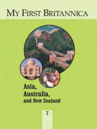
  • 2. CHICAGO LONDON NEW DELHI PARIS SEOUL SYDNEY TAIPEI TOKYO MY FIRST BRITANNICA Asia, Australia, and New Zealand 7
  • 3. © 2008 by Encyclopædia Britannica, Inc. International Standard Book Number: 978-1-59339-476-9 (set) No part of this work may be reproduced or utilized in any form or by any means, electronic or mechanical, including photocopying, recording, or by any information storage and retrieval system, without permission in writing from the publisher. My First Britannica: Volume 7: Asia, Australia, and New Zealand 2008 Britannica.com may be accessed on the Internet at http://www.britannica.com. Encyclopædia Britannica, Britannica, and the Thistle logo are registered trademarks of Encyclopædia Britannica, Inc.
  • 4. Asia, Australia, and New Zealand TABLE OF CONTENTS INTRODUCTION. . . . . . . . . . . . . . . . . . . . . . . . . . . . . . . . 5 Asia: The Largest Continent . . . . . . . . . . . . . . 6 East Asia China: Asia’s Largest Country . . . . . . . . . . . . . . . . . . . . . . 8 Beijing, China: Home of the Forbidden City. . . . . . . . . . 10 The Great Wall: Ancient China’s Giant Guardian . . . . . 12 Japan: Volcanoes, Earthquakes, and Plum Rains . . . . . . 14 Japan: Modern Nation of Ancient Traditions . . . . . . . . 16 Korean Peninsula: An Asian Land Divided. . . . . . . . . . . . 18 Pyongyang, North Korea: North Korea’s Age-Old Capital . . . . . . . . . . . . . . . . . 20 Seoul, South Korea: A Modern Ancient Capital . . . . . . . 22 Southeast Asia Phnom Penh, Cambodia: The City of Lady Penh . . . . . . . . 24 Angkor Wat: Cambodia’s Treasured Temple . . . . . . . . . 26 Indonesia: Island Nation of Southeast Asia. . . . . . . . . . . 28 Yangon, Myanmar: City of the Gold Pagoda . . . . . . . . . . . 30 Philippines: Tropical Island Republic . . . . . . . . . . . . . . . 32 Singapore: The Lion City . . . . . . . . . . . . . . . . . . . . . . . . . 34 Thailand: Kingdom of Southeast Asia . . . . . . . . . . . . . . . 36 Bangkok, Thailand: City of Angels . . . . . . . . . . . . . . . . 38 Vietnam: North and South. . . . . . . . . . . . . . . . . . . . . . . . 40 Hanoi, Vietnam: Capital of Reunited Vietnam. . . . . . . . 42 South Asia Afghanistan: Mountain Country. . . . . . . . . . . . . . . . . . . . 44 Bangladesh: Land of the Bengals . . . . . . . . . . . . . . . . . . 46 Thimphu, Bhutan: City in the Heart of the Himalayas . . . 48 India: Land of Temples and Shrines . . . . . . . . . . . . . . . . 50 Taj Mahal: Wonder of the World . . . . . . . . . . . . . . . . . . 52 Nepal: Country of Mount Everest . . . . . . . . . . . . . . . . . . . 54 Kathmandu, Nepal: City of Palaces . . . . . . . . . . . . . . . 56 Pakistan: A Young Country with an Ancient History. . . . . 58 Pakistan: Land of the Indus Civilization . . . . . . . . . . . 60 Sri Lanka: Island Nation of Natural Riches. . . . . . . . . . . 62 The Middle East and Transcaucasia Fertile Crescent: Cradle of Civilization . . . . . . . . . . . . . . . 64 Yerevan, Armenia: City of Cafés . . . . . . . . . . . . . . . . . . . . 66 Istanbul, Turkey: City on Two Continents. . . . . . . . . . . . . 68 Iran: Modern Persia . . . . . . . . . . . . . . . . . . . . . . . . . . . . 70 Baghdad, Iraq: City of Arabian Nights . . . . . . . . . . . . . . . 72 Israel: The Jewish State . . . . . . . . . . . . . . . . . . . . . . . . . 74 Jerusalem: Holy City . . . . . . . . . . . . . . . . . . . . . . . . . . . . 76 Amman, Jordan: City on Seven Hills . . . . . . . . . . . . . . . . 78 Beirut, Lebanon: The City of Wells. . . . . . . . . . . . . . . . . . 80 Oman: Rocky Soils and Oil Riches . . . . . . . . . . . . . . . . . . 82 Mecca, Saudi Arabia: Holiest City of Islam . . . . . . . . . . . 84 Damascus, Syria: Pearl of the East . . . . . . . . . . . . . . . . . 86 Australia and New Zealand AUSTRALIA Australia: Island Continent . . . . . . . . . . . . . . . . . . . . . . . 88 Canberra, Australia: Meeting Place on a Hill . . . . . . . . 90 Great Barrier Reef: Island of Reefs Within Reefs . . . . . 92 Sydney, Australia: A Magnificent Harbor City . . . . . . . . 94 Western Australia: Desert State . . . . . . . . . . . . . . . . . . 96 NEW ZEALAND New Zealand: Land of the Long White Cloud . . . . . . . . . . 98 Wellington, New Zealand: A Visit to New Zealand’s Capital . . . . . . . . . . . . . . 100 GLOSSARY. . . . . . . . . . . . . . . . . . . . . . . . . . . . . . . . . . 102 INDEX . . . . . . . . . . . . . . . . . . . . . . . . . . . . . . . . . . . . . 103
  • 5. Asia, Australia, and New Zealand In Volume 7, Asia, Australia, and New Zealand, you’ll discover answers to these questions and many more. Through pictures, articles, and fun facts, you’ll learn about the people, traditions, landscapes, and history that make up many of the countries and cities of Asia, Australia, and New Zealand. I N T R O D U C T I O N How did the Forbidden City get its name? What is the holiest city of Islam? Who built the Taj Mahal? Where is the largest coral reef in the world? To help you on your journey, we’ve provided the following guideposts in Asia, Australia, and New Zealand: ■ Subject Tabs—The colored box in the upper corner of each right-hand page will quickly tell you the article subject. ■ Search Lights—Try these mini-quizzes before and after you read the article and see how much—and how quickly—you can learn. You can even make this a game with a reading partner. (Answers are upside down at the bottom of one of the pages.) ■ Did You Know?—Check out these fun facts about the article subject. With these surprising “factoids,” you can entertain your friends, impress your teachers, and amaze your parents. ■ Picture Captions—Read the captions that go with the photos. They provide useful information about the article subject. ■ Vocabulary—New or difficult words are in bold type. You’ll find them explained in the Glossary at the back of this volume. And there’s a complete listing of all Glossary terms in the set in the Reference Guide and Index, Volume 13. ■ Learn More!—Follow these pointers to related articles throughout the set. ■ Maps—You’ll find lots of information in this volume’s many maps. ■ The Country Maps point out national capitals. Globes beside Subject Tabs show where countries are located in the world. ■ The Continent Maps have a number key showing the location of all countries. Cover photos (top): the Great Wall of China, © Keren Su/Corbis; (center): Taj Mahal, Agra, India, © Galen Rowell/Corbis; (bottom): koala, © Wes Thompson/Corbis
  • 6. MY FIRST BRITANNICA Have a great trip! ■ The Icons on the maps highlight major geographic features and climate. Here’s a key to what the map icons mean: ■ The Mini-Atlas, found in Volume 13, offers detailed maps, useful data tables, and assorted photographs of each continent. And don’t forget: If you’re not sure where to start, where you saw something before, or where to go next, the Index at the back of this volume and the Reference Guide and Index (Volume 13) will point the way. Deserts and Other Dry Areas Polar Regions and Other Frozen Areas Mountains Rainforests General Forests The Great Wall of China © Keren Su/Corbis
  • 7. 34 1 5 12 19 45 43 26 9 42 39 1518 16 23 35 47 30 44 33 420 14 31 11 2 3 40 21 28 6 41 8 27 46 22 25 38 24 13 7 36 6 DID YOU KNOW? Asia is the birthplace of all the major religions of the world. True or false? The highest point on Earth is in Asia. SEA RCH LI GHT Statue of Buddha in Si Satchanalai, Thailand. © Royalty-Free/Corbis
  • 8. A S I A Asia is the world’s largest continent. It covers about one-third of the Earth’s land and has about three-fifths of the world’s population. Japan, China, and India are some of the most familiar of Asia’s nearly 50 countries. In fact, Asia is so big that it’s often easier to talk about the regions rather than the countries of Asia. The region names commonly used are North Asia, Central Asia, East Asia, Southeast Asia, South Asia, and Southwest Asia (the last one is usually called the Middle East). Most of the continent is made up of mountains and tablelands. The Himalayan mountain chain in South Asia includes the highest point on Earth, Mount Everest. The Earth’s lowest point, the Dead Sea, is in Asia too. Asia is home to many kinds of animals. Reindeer, Arctic foxes and hares, seals, walruses, and lemmings can be found in the far north. Elk, brown bears, and sables live in the cool forests. Antelope, wild sheep, and goats are found in the steppes and deserts. Black bears, pandas, tigers, and monkeys can be found in southern and eastern Asia. Southern Asia is also noted for elephants, leopards, crocodiles, cobras, and peacocks. Northern Asia has very cold winters and cool summers. It is covered by tundra—vast treeless plains common in cold regions. Central Asia has cold winters and hot summers with little rainfall. Southern Asia has a warm climate all year, with a lot of rain. There are rainforests all across southern Asia. And nearly all Asian countries share one very important food plant: rice. Answer:TRUE.Theworld’stallestmountain,MountEverest,is inAsia. ★ The Largest Continent 01. Afghanistan 02. Armenia 03. Azerbaijan 04. Bahrain 05. Bangladesh 06. Bhutan 07. Brunei 08. Cambodia 09. China 10. East Timor 11. Georgia 12. India 13. Indonesia 14. Iran 15. Iraq 16. Israel 17. Japan 18. Jordan 19. Kazakhstan 20. Kuwait 21. Kyrgyzstan 22. Laos 23. Lebanon 24. Malaysia 25. Maldives 26. Mongolia 27. Myanmar 28. Nepal 29. North Korea 30. Oman 31. Pakistan 32. Philippines 33. Qatar 34. Russia (part) 35. Saudi Arabia 36. Singapore 37. South Korea 38. Sri Lanka 39. Syria 40. Tajikistan 41. Thailand 42. Turkey 43. Turkmenistan 44. United Arab Emirates 45. Uzbekistan 46. Vietnam 47. Yemen COUNTRIES OF ASIA 17 37 29 32 13 10 LEARN MORE! READ THESE ARTICLES… CONTINENTS (VOLUME 1) • EUROPE (VOLUME 6) MOUNTAINS (VOLUME 1)
  • 9. 8 The People’s Republic of China is Asia’s largest country and has more people than any other country in the world—more than a billion and a quarter! The capital city is Beijing. Han (or Mandarin) is the most widely spoken language of China’s several dozen languages. The Chinese civilization is one of the world’s oldest and has produced such famous thinkers as Confucius. Parts of China are very mountainous, as is the Plateau of Tibet in southwest China. One part of the plateau is called “the Roof of the World.” China is so big that some parts are scorching hot deserts while it rains almost every day in some southeastern regions. Many boats and ships carry people and goods on China’s major rivers—the Huang He, Yangtze, and Xi. China also has many railroads as well as three of the world’s longest highways. China’s enormous and varied land area supports many plants and animals. Some Chinese animals have become extinct in the rest of the world, including the giant salamander, the giant panda, and the great paddlefish. Many of China’s trees provide useful substances. The tung tree and the camphor tree produce valuable oils. The lacquer (or varnish) tree produces substances used in making wooden objects. And from the star anise tree comes a food flavoring. In addition, Chinese farmers produce more rice than does any other country. People around the world enjoy eating Chinese food. But China has many more traditional and regional dishes than most non-Chinese know about. In addition to rice and noodles, Chinese dishes include delicacies such as steamed chicken feet and hundred-year-old eggs. LEARN MORE! READ THESE ARTICLES… CONFUCIUS (VOLUME 5) • MAO ZEDONG (VOLUME 4) PANDAS (VOLUME 12) Find and correct the error in the following sentence: The People’s Republic of China is the largest country in Asia and has the most people: more than a million and a quarter. SEA RCH LI GHT Largest Country Asia’s Beijing
  • 10. C H I N A 9 Answer:ThePeople’sRepublicofChinaisthelargestcountryin Asiaandhasthemostpeopleintheworld:morethanabillion andaquarter. ★ DID YOU KNOW?You may think of pasta as an Italiandish, but actually it was created inChina. So were fireworks, compasses,silk, chopsticks, crossbows, paper,and paper money. Rice is one of the most important crops grown in China. Farmers use terraced fields such as these to grow rice on hillsides. © Keren Su/Corbis
  • 11. DID YOU KNOW? The Forbidden City was well named. The “common people” were never allowed in. Even those who were allowed in, such as the emperor’s family, could go into only certain parts of the city. Many people in Beijing use bicycles to get from place to place. © Joseph Sohm—ChromoSohm Inc./Corbis 10
  • 12. B e i j i n g , C H I N A Answer:ThecityofBeijinghasmanynarrowalleys,orhutongs. ★ Beijing is the capital of the People’s Republic of China. For many years the city was known by English speakers as Peking. China used to be ruled by emperors, and Beijing was the home of those emperors. Their palaces were located in an area that is called the Forbidden City because common people were not allowed inside. The Forbidden City is now a museum. Next to the Forbidden City is Tiananmen Square. It is one of the largest public squares in the world. Beijing is also famous for its parks. Zhongshan Park is located in the heart of the city. It holds the Altar of Earth and Harvests, where the emperor made offerings to the gods of earth and farming. Beihai Park has a big lake and several artificial hills and islands. Atop one of the hills stands the beautiful White Pagoda. In summer the lake is full of rowboats. In winter it freezes, and people use it as a skating rink. The Beijing Zoo was once called the Garden of Ten Thousand Animals. It doesn’t really have that many animals, but it does have lots of interesting ones, including some famous giant pandas. Of course, there are places to visit outside the parks. Some people like to tour the neighborhoods of the city. The city has many narrow alleys, or hutongs. Old houses with enclosed courtyards and tiny gardens of potted plants open off the alleys. There’s much to see in Beijing. And, especially exciting, the Olympics will be held there in 2008. LEARN MORE! READ THESE ARTICLES… CHINA (VOLUME 7) A CHINESE CINDERELLA STORY: YEH-SHEN (VOLUME 5) EMPRESS OF CHINA (VOLUME 4) The Forbidden City, in Beijing, China. © Keren Su/Corbis Find and correct the error in the following sentence: The city of Beijing has many lovely parks, or hutongs. SEA RCH LI GHT Home of the Forbidden City
  • 13. DID YOU KNOW? In the 200s BC the first emperor of a united China connected parts of the wall that stood as separate sections to make one long wall.
  • 14. T H E G R E A T W A L L 13 The Great Wall of China is the largest structure humans have ever built. Chinese emperors had the wall built to guard the country from raids or invasions. It runs from east to west for more than 4,000 miles as it stretches across the mountains and valleys of northern China. It is about 20 feet thick at its base and as tall as a house. The entire wall is made of earth and stones. The wall also had watchtowers placed along its length. Different parts of the wall were built at different times, but all of it was finished long before there were machines to help with the building. Thousands of men worked to build the wall. Many of them died while working on it. After the Great Wall was built, the people of China felt safer. If an enemy approached the wall, smoke signals would be passed from watchtower to watchtower. A signal fire would be lighted if an attack came at night. An alarm would be sounded, and the emperor’s army would rush to defend the wall. But the Great Wall didn’t always provide protection. Because the wall was so long, some parts of it were guarded better than others. Sometimes enemies broke through. Finally, the Chinese stopped depending on their wall. Today the Great Wall is a great attraction for visitors to China. In 1987, UNESCO (the United Nations Educational, Scientific, and Cultural Organization) named the Great Wall a World Heritage site. LEARN MORE! READ THESE ARTICLES… ANGKOR WAT (VOLUME 7) • CHINA (VOLUME 7) • EGYPT (VOLUME 8) Answer:Theemperorshadthewallbuilttokeepoutthepeople whowereraidingnorthernChina. ★ Tourists visiting the Great Wall of China. © Dean Conger/Corbis Why did the Chinese emperors have the Great Wall built? SEA RCH LI GHT The Great Wall of China is one of the most remarkable structures on Earth. It is more than 4,000 miles long and is one of the largest construction projects ever carried out. Work on parts of the wall began more than 2,500 years ago. © Keren Su/Corbis Ancient China’s Giant Guardian
  • 15. Japan is made up of a string of islands that stretches for nearly 1,500 miles along the coast of northeastern Asia in the Pacific Ocean. The four main islands are Honshu, Hokkaido, Kyushu, and Shikoku. The largest of them is Honshu. Most of the islands are covered with hills and mountains. Many of the mountains are volcanoes. Some of them are active, and some are “asleep.” Mount Fuji is an active volcano though it hasn’t erupted since 1707. It is Japan’s highest mountain, reaching a height of 12,388 feet. Rivers flowing past the volcanoes get so much acid in them that they can’t be used to water crops. There are many lush forests in Japan. Japanese cherry trees, famous for their spring blossoms, are planted throughout the country. The forests stay beautifully green because it rains and snows so much in Japan. Most parts of the country get more than 40 inches of rain each year. The summer rains are called baiu, which means “plum rain.” They are called that because they begin at the time when the plums ripen. Some parts of Japan get many feet of snow each winter. Many kinds of wild animals can be found in Japan’s forests. They include bears, badgers, otters, mink, deer, and foxes. DID YOU KNOW? Mount Fuji may not seem so high compared with some of the world’s other mountains. But it’s high enough that during the summer the temperature at the top is 40° F cooler than it is at the bottom. Volcanoes, Earthquakes,and Plum Rains Tokyo 14
  • 16. J A P A N Japan has many wildlife sanctuaries to protect all these wonderful creatures. Did you know that there are about 1,000 earth tremors in Japan every year? Fortunately, most are not very strong, but violent earthquakes do occur sometimes. When that happens there is a danger of tsunamis, giant tidal waves along the coasts. LEARN MORE! READ THESE ARTICLES… • JAPAN: MODERN NATION OF ANCIENT TRADITIONS (VOLUME 7) • KOREAN PENINSULA (VOLUME 7) • TSUNAMIS (VOLUME 1) Answer:a)Honshu. ★ Mount Fuji is considered the sacred symbol of Japan. It’s actually a volcano, but it hasn’t erupted since 1707. At right is a pagoda, a kind of tower with curving roofs at each story. © Jose Fuste Raga/Corbis The largest island in Japan is a) Honshu. b) Kyushu. c) Hokkaido. SEA RCH LI GHT
  • 17. 16 When you’re in Japan, you’ll notice something that is really striking: the mixture of old things and new. On the one hand, you’ll see beautiful old pagodas and shrines. On the other hand, you’ll find skyscrapers, overpasses, and subways. Some people in Japan continue to fish for a living, just as their ancestors had for thousands of years. Salmon, sardines, tuna, squid, mackerel, cod, and mullet are the important fish they catch. The Japanese people catch more than 5 million tons of fish each year. This makes Japan one of the world’s leading fishing nations. But Japan is also one of the most developed countries in the world. It is one of the world’s biggest producers of automobiles, computers, cameras, radio and television sets, watches, microwave ovens, and many more electronic items. Tokyo, Japan’s capital, is one of the world’s largest cities. It has many skyscrapers and grand shopping plazas that may remind you of New York City. The Ginza shopping area is often referred to as Tokyo’s Fifth Avenue. But you will also find many Buddhist temples and shrines scattered throughout the city, and they are quiet and peaceful. The traditional court music of Japan is called gagaku and can be heard in Tokyo. But so can a lot of Western music, such as jazz, rock, and blues. And all the latest pop songs that you would hear in English-speaking countries can be heard in Tokyo too. This mix of ancient and modern culture makes Japan an exciting place to live or visit. LEARN MORE! READ THESE ARTICLES… BASHO (VOLUME 3) • HIROHITO (VOLUME 4) JAPAN: VOLCANOES, EARTHQUAKES, AND PLUM RAINS (VOLUME 7) Skyscrapers in Shinjuku, a main shopping district in Tokyo. © Jose Fuste Raga/Corbis Are each of the following things part of old Japan or new Japan? - shrines - skyscrapers - subways - gagaku - rock and jazz - fishing SEA RCH LI GHT of Ancient Traditions Modern Nation
  • 18. J A P A N 17 Answer:Shrines,gagaku(courtmusic),andfishinghaveallbeen partofJapanformanyhundredsofyears.Skyscrapers,subways, androckandjazzmusicareallfairlynewtoJapan. ★ Built in the 7th century, Senso Temple is the oldest of Tokyo’s many Buddhist temples. © Richard T. Nowitz/Corbis Shinjuku train station in Tokyo is perhaps the busiest train station in the world. About 2 million people pass through it every day. DID YOU KNOW?
  • 19. 18 DID YOU KNOW? For many Koreans the number 4 is considered unlucky, just like the number 13 is for some Westerners. Four is unlucky because in Korean it is pronounced the same as the word for “death.”
  • 20. K O R E A N P E N I N S U L A 19 Answer:FALSE.TheKoreanpeninsulawasdividedintotwo countriesin1948.NorthKoreabecamecommunist,butSouth Koreadidnot. ★ The Korean peninsula is a land of beautiful mountains. For a long time it was a single country. Today it is divided into two countries—North Korea and South Korea. But though they are separate, they share a border and a common history that stretches back thousands of years. Korea has a rich culture that was influenced by China, especially in early times. The Buddhist and Confucian religions came to Korea from China. Over the years, however, Korea developed a culture that is very much its own. For example, even though it once used the Chinese system of writing, the Korean language isn’t closely related to any other language. And Korean music sounds quite different from other East Asian music. In the folk music called p’ansori, a singer-storyteller performs with a drummer. In dance and other music, the kayagum, a stringed instrument, is an original Korean favorite. Many people around the world love to eat Korean food—especially tasty barbecued meat and a spicy cabbage dish called kimchee. In 1948, after World War II, the Korean peninsula was officially divided into North Korea and South Korea. North Korea became a communist country, but South Korea did not. In 1950 a war broke out between the two. This was the Korean War, which ended in 1953 with the two Koreas remaining separate. Both North and South Korea have been rebuilt since the war. In 2000 the two countries held talks about joining together again. People were finally allowed to cross between them and meet family members they had not seen since the war, almost 50 years before. LEARN MORE! READ THESE ARTICLES… PENINSULA (VOLUME 1) • PYONGYANG, NORTH KOREA (VOLUME 7) SEOUL, SOUTH KOREA (VOLUME 7) North Korea South Korea This monument honors soldiers who fought in the Korean War. The memorial stands near the village of Panmunjom. It lies within a neutral zone established between North and South Korea after the war. © Robert Holmes/Corbis An Asian Land Divided True or false? The Korean peninsula became a communist country in 1948. SEA RCH LI GHT Pyongyang Seoul
  • 21. 20 Pyongyang is the capital and largest city of the East Asian country of North Korea. It lies along the Taedong River, close to the Yellow Sea. The name Pyongyang means “flat land” or “cozy place” in Korean. People have lived where Pyongyang now stands for many thousands of years. According to legend, the modern city was started in 1122 BC. Since then it has faced a number of invasions and wars. Armies from China and Japan captured Pyongyang at different times, and much of the city was destroyed in a war between those two countries in the 1890s. The Japanese ruled Pyongyang from 1910 to 1945. In 1948, when Korea was divided into two nations, Pyongyang became the capital of communist North Korea. The city was heavily damaged once again during the Korean War of 1950 to 1953. A bronze statue of a winged horse towers over Pyongyang. It is meant to remind people of the way the city grew after the end of the Korean War. Other large monuments built in recent years include the wide Arch of Triumph and the Tower of the Juche Idea. (Juche means “self-reliance”—that is, depending on yourself rather than on other people.) Pyongyang has a university, a medical school, and a school for training Communist Party leaders. There are also a large theater, a large assembly hall, and a large stadium. In addition, North Korea’s main museums and libraries are located in the city. LEARN MORE! READ THESE ARTICLES… BERLIN, GERMANY (VOLUME 6) • KOREAN PENINSULA (VOLUME 7) SEOUL, SOUTH KOREA (VOLUME 7) Children giving a concert at the Children’s Palace in Pyongyang. © Jeremy Horner/Corbis Why have parts of Pyongyang been rebuilt a number of times? SEA RCH LI GHT North Korea’s Age-Old Capital
  • 22. P y o n g y a n g , N O R T H K O R E A 21 Answer:SeveralwarshavebeenfoughtinKoreaoverthe centuries,andthecityhasbeenpartiallydestroyedduringthe manybattles. ★ The Tower of the Juche Idea rises above the city center of Pyongyang. The monument celebrates juche (“self-reliance”), a quality favored by Kim Il-Sung, the first ruler of North Korea. © Jeremy Horner/Corbis DID YOU KNOW? Wrestling is very popular in North Korea. The largest crowd to watch a live wrestling match was in Pyongyang in 1995, when 190,000 people gathered there to watch The International Sports and Culture Festival for Peace.
  • 23. DID YOU KNOW? The name Seoul comes from the Korean word sorabol, which means “capital.”
  • 24. S e o u l , S O U T H K O R E A 23 Seoul, the capital of South Korea, has been attacked and destroyed many times in the past. As a result, it reflects the struggles of Korea in important ways. In the 16th century Japanese invaders partially destroyed the city. Between 1910 and 1945 Seoul came under Japan’s control, and Japan made the city its colonial capital. The city was devastated during the Korean War, from 1950 to 1953. Since the 1950s the city has been rebuilt once again. It is sometimes described as an “endless construction project.” There is much Chinese influence in Seoul, especially in its design. A long defensive wall with gates, in Chinese style, was built around the city near the end of the 14th century. Parts of the wall and the gates can still be seen. Today Seoul is a modern city with ancient accents. It has freeways, plazas, and high-rise buildings alongside centuries-old pagodas. In downtown Seoul there are striking palaces and other structures from the city’s royal past. Several of these, such as Toksu and Changgyong palaces, are open to the public as museums. Any tour of Seoul should include a view from Seoul Tower in Namsan Park near the city center. From the tower you can see many historic and modern sights. These include Kyongbok Palace, one of the royal palaces of the Choson dynasty, and Olympic Park, site of the 1988 Summer Olympic Games. LEARN MORE! READ THESE ARTICLES… JAPAN: MODERN NATION OF ANCIENT TRADITIONS (VOLUME 7) A KOREAN FOLKTALE: THE TIGER IN THE TRAP (VOLUME 5) PYONGYANG, NORTH KOREA (VOLUME 7) Answer:Seoulhasbeendestroyedandrebuiltseveraltimes. ★Statues of men in traditional Korean clothing, at the National Folk Museum of South Korea, in Seoul. © Royalty-Free/Corbis Seoul is home to historic palaces as well as modern high-rise buildings. Changgyong Palace can be seen here in front of the skyline of downtown Seoul. © Jose Fuste Raga/Corbis Why is Seoul sometimes called an “endless construction project”? SEA RCH LI GHT A Modern Ancient Capital
  • 25. 24 Phnom Penh is the capital of the Kingdom of Cambodia in Southeast Asia. It is located at the meeting point of three rivers: the Basak, the Sab, and the Mekong. Phnom Penh is more than 500 years old. According to legend, a woman named Lady Penh was walking on a hill and found a bronze statue of the Buddha, the founder of the Buddhist religion. There she started the town of Phnom Penh, whose name means “Penh Hill.” Her ashes, it is said, were kept in a pagoda at the top of the hill. Phnom Penh was built around the Preah Morokot pagoda. Its floor is paved with tiles of solid silver. The pagoda is built like a tower, with several stories. At the edge of every story, the roof curves upward. It and other stately buildings are near the Royal Palace, where the king and his family live. There are many museums in Phnom Penh. The National Museum has a fine collection of art by the Khmer people, who make up more than 85 percent of the population of Cambodia. The Tuol Sleng Museum is devoted to the memory of the many Cambodians who were killed in the 1970s by Cambodia’s communist government. This was a terrible time in the history of the city and country. The Royal Ballet of Phnom Penh is known the world over. Its ballets deal with ancient Buddhist and Hindu legends. There was a time when the dancers performed only for the Cambodian royal family. Now everyone can enjoy them. LEARN MORE! READ THESE ARTICLES… ANGKOR WAT (VOLUME 7) A CAMBODIAN MYTH: MONI MEKHALA AND REAM EYSO (VOLUME 5) THAILAND (VOLUME 7) What kind of government does Cambodia have? (Hint: Think of the country’s full name.) SEA RCH LI GHT Lady Penh The City of Phnom Penh
  • 26. P h n o m P e n h , C A M B O D I A 25 Answer:Cambodiaisakingdom,soit’ssupposedlyruledbya kingoraqueen.However,inmoderntimesmostmonarchshave governmentofficialsandlawmakerstohelprunthecountry. ★ In the 1970s Phnom Penh nearly became a ghost town when Cambodia’s rulers forced almost everyone out of the city to work in farm fields. DID YOU KNOW? The Royal Palace in Phnom Penh is home to Cambodia’s king and his family. © Nevada Wier/Corbis
  • 27. 26 Angkor Wat is a temple in the Southeast Asian country of Cambodia. The word angkor means “capital,” and wat means “monastery.” Angkor Wat is more than 800 years old. It is the world’s largest religious structure. The Khmer people are native to Cambodia, and the city of Angkor was once the capital of the Khmer Empire. King Suryavarman II built Angkor Wat. He dedicated the temple to the three Hindu gods Brahma, Vishnu, and Shiva. It was not just a temple but also the government center of Suryavarman II’s empire. The temple walls are covered with sculptures of Hindu gods. They also show scenes from ancient Khmer history. In addition, there are hundreds of carved statues of apsaras, or “heavenly dancers.” They are seen wearing beautiful costumes, jewelry, and crowns. About 20 years after the complex was built, a foreign army attacked the Khmers and looted the city. King Jayavarman VII, who was ruling the Khmer, felt that the gods had failed him. He became a Buddhist and built a new capital nearby called Angkor Thom. Angkor Wat then became a Buddhist shrine. Many of the statues and carvings were replaced by Buddhist art. After many years, however, the forest grew and covered Angkor Wat. Most people forgot all about it. A French explorer named Henri Mouhot rediscovered the city while traveling on the Mekong River in 1858. In 1992 UNESCO (the United Nations Educational, Scientific and Cultural Organization) named the entire Angkor area a World Heritage site. Today Angkor Wat is one of the main attractions for visitors to Cambodia. LEARN MORE! READ THESE ARTICLES… BUDDHISM (VOLUME 5) • HINDUISM (VOLUME 5) PHNOM PENH (VOLUME 7) Fill in the blanks: Angkor Wat is more than _______ years old and is the world’s _______ religious structure. SEA RCH LI GHT Tree roots growing on the Ta Prohm temple, part of the temple center at Angkor, Cambodia. © Royalty-Free/Corbis Treasured Temple Cambodia’s
  • 28. A N G K O R W A T Answer:AngkorWatismorethan800yearsoldandistheworld’s largestreligiousstructure. ★ DID YOU KNOW? When UNESCO named Angkor Wat a World Heritage site, it meant that the place has major importance for the entire world. Being a World Heritage site makes it easier for countries to cooperate to protect a cultural or natural treasure.
  • 29. 28 Fill in the blank: Indonesia is a country made up of about 13,670 _______. SEA RCH LI GHT DID YOU KNOW? Indonesia has more than 200 active volcanoes. Among them is the famous Krakatoa. When it erupted more than a hundred years ago the explosions were heard thousands of miles away. Indonesians use a process called batik to dye fabrics. The results can be quite colorful. © Wolfgang Kaehler/Corbis
  • 30. I N D O N E S I A 29 The Republic of Indonesia consists of a group of islands lying between the Indian and Pacific oceans. Its capital is Jakarta on the island of Java. Indonesia is made up of about 13,670 islands, though some are shared with other countries. The largest island is New Guinea, which Indonesia shares with Papua New Guinea. Parts of Borneo, the second largest island in the group, belong to Malaysia and Brunei. Sumatra, Java, and Celebes are the other major islands of Indonesia. Most of Indonesia’s people live on these five islands. Most of the islands are mountainous. Only about one-tenth of the land is used for growing crops, but many of the people make their living from farming. Rice is the main crop grown there. Other crops include coffee, tea, tobacco, and spices. There are also many palm and rubber trees in Indonesia. The country produces many things made of palm oil and is a major supplier of natural rubber. The climate in Indonesia is hot and humid. Rain falls heavily throughout the year. Because of that, much of Indonesia is covered with rainforests. Mangrove tree swamps are common along the coasts. Indonesia is known for more than its natural resources, though. The people of Indonesia practice special decorative arts throughout the islands. Perhaps the most popular art with tourists is batik, a special way of dyeing fabric. Indonesians are also known for their traditional dance and puppet performances. Puppetry is one of the favorite arts of the islanders themselves. LEARN MORE! READ THESE ARTICLES… FOLK ARTS AND CRAFTS (VOLUME 3) • DANCE (VOLUME 3) VOLCANOES (VOLUME 1) Answer:Indonesiaisacountrymadeupofabout13,670islands. ★ Jakarta Southeast Asia Island Nation of
  • 31. Yangon is the largest city in Myanmar and the country’s business center. It is located near the Yangon River. In the past the city was known as Rangoon and the country was called Burma. At one time Yangon and the rest of Myanmar were controlled by Great Britain. The center of the city, known as the Cantonment, was planned by the British. It is laid out in a system of blocks. Each block is divided by streets running north to south and east to west. As Yangon’s population increased, new settlements were built around the Cantonment. If you visit Yangon, you’ll find many interesting places to see. The most famous building is the Shwe Dagon Pagoda. It is a great Buddhist temple on a hill. The pagoda is a solid brick structure that is covered with gold. It has been a place of pilgrimage for many centuries. Yangon also has many other important shrines, including the World Peace Pagoda. DID YOU KNOW? The city’s name in the English language was changed from Rangoon to Yangon in 1989. Yangon is closer to the way that the name is said in Burmese, the most widely spoken language in Myanmar. City of the Gold Pagoda
  • 32. Y a n g o n , M Y A N M A R Most of the buildings in the city center are made of bricks. Some of these old brick buildings are from the British colonial days. The Office of Ministers is one of them. Other British buildings built around the same time include the Law Courts, Yangon General Hospital, and the customhouse. In other parts of the city you’ll see many traditional wooden houses. To the north of the city center is Royal Lake. The lake is surrounded by a wooded park. Nearby are the city’s zoo and botanical gardens. LEARN MORE! READ THESE ARTICLES… BANGKOK, THAILAND (VOLUME 7) BUDDHISM (VOLUME 5) • U THANT (VOLUME 4) Answer:Yangonisalsothenameoftheriverthatpassesnear thecity. ★ Yangon Yangon shares its name with what geographic feature? SEA RCH LI GHT Many people travel to Yangon to visit the Buddhist temple known as the Shwe Dagon Pagoda. © Christophe Loviny/Corbis 31
  • 33. Find and correct the error in the following sentence: The Philippines is a large group of islands in the Indian Ocean. SEA RCH LI GHT DID YOU KNOW? The most famous Filipino athlete of all time is Rafael (“Paeng”) Nepomuceno. He is a professional bowler who is in the International Bowling Hall of Fame in St. Louis, Missouri, in the United States.
  • 34. P H I L I P P I N E S Answer:ThePhilippinesisalargegroupofislandsinthe PacificOcean. ★ The Republic of the Philippines is made up of about 7,100 islands in the Pacific Ocean along the southeastern coast of Asia. The two main islands are Luzon, in the north, and Mindanao, in the south. Manila, the capital and most important port, is on Luzon. Most of the larger islands have mountains and dormant, or “sleeping,” volcanoes. Being an island country and in the tropics, the Philippines has a climate that’s warm and humid, with a lot of rain. The eastern islands are sometimes soaked by typhoons. These strong storms are called “hurricanes” in other parts of the world. Watered by all that rain are nearly 10,000 kinds of flowering plants and ferns. There are 800 kinds of orchids in the Philippines. Some are very rare. Important trees of the Philippine forests include pine and lauan, which is better known as Philippine mahogany. The country’s animals include monkeys, water buffalo, and more than 50 kinds of bats. The monkey-eating eagle is one of the rarer birds. Farming is an important business in the Philippines. The people grow mostly rice and corn, though they also grow sugarcane, bananas, and pineapples. The Philippines also produces many coconuts. Most of the farming is done on the central plain of Luzon. The Philippine people are known as Filipinos. They speak many languages. The official languages are Pilipino and English. The English language came to the Philippines when the country was led by the United States after the Spanish-American War of 1898. LEARN MORE! READ THESE ARTICLES… BATS (VOLUME 12) • INDONESIA (VOLUME 7) VOLCANOES (VOLUME 1) A woman sells colorful flowers at a market in Manila, the capital of the Philippines. © David Samuel Robbins/Corbis Manila Republic Tropical Island 33
  • 35. Singapore has four official languages—Malay, Mandarin Chinese, Tamil (an Indian language), and English. Most countries have one or two. Why do you think Singapore has so many? SEA RCH LI GHT
  • 36. S I N G A P O R E 35 The Republic of Singapore is a small island nation in Southeast Asia. Singapore is also the name of the country’s main island and of its capital city. Legend says that a prince named the island Singapura, meaning “lion city,” because he thought he saw a lion there. Singapore Island and about 60 little nearby islands make up the country. All these islands lie off the southern tip of the Malay Peninsula. Singapore Island is shaped like a diamond. It is linked to the country of Malaysia on the Malay Peninsula by a road and railway that cross the water of the Johor Strait. As of 1995, almost 3 million people lived in this small island nation. That makes Singapore one of the most crowded countries in the world. But Singapore is also one of the most well- to-do Asian nations because it has been a busy world shipping port for a long time. People have moved there from all parts of Asia, giving Singapore a rich and varied cultural heritage. Most people speak the Malay language, but Mandarin Chinese, Tamil (an Indian language), and English are also official languages. Singapore’s weather is hot and very rainy—a typical monsoon climate. The lowlands often flood when it rains hard, but the rainy weather is good for plants. While only a few of Singapore’s native plants remain, patches of original rainforests still survive. There are some original mangrove forests on the main island’s northwestern side. And people often call Singapore city the “Garden City” because of its many parks, gardens, and tree-lined streets. Answer:Singapore’sfourofficiallanguagesreflectthefactthat peoplefrommanydifferentcultureshavemovedthere.Also, beingabusyandsuccessfulworldportmeansthatpeoplefrom allovertheworldlive,work,andpassthroughSingapore. ★ Singapore The Lion City Singapore is sometimes known as the “Lion City.” Its symbol is a merlion, a creature that is half lion and half fish. © Earl & Nazima Kowall/Corbis DID YOU KNOW? If you want to give a gift to someone from Singapore, you shouldn’t give a clock or a handkerchief. These objects are linked with death or funerals. Umbrellas are not good gifts either—they are associated with accidents. LEARN MORE! READ THESE ARTICLES… INDONESIA (VOLUME 7) • ISLANDS (VOLUME 1) RAINFORESTS (VOLUME 1)
  • 37. DID YOU KNOW? Long ago, the kings of Thailand gave white elephants to people who upset them. No one could refuse such a rare gift, but owners often went bankrupt because caring for the elephants was very expensive. Today the phrase “white elephant” is used to describe a gift that nobody wants.
  • 38. 37 The people of the Kingdom of Thailand often describe their land as looking like an elephant’s head. The trunk is the south. The ear is the northeast. The top of the head is the mountainous north. The mouth is the delta and harbor of the Chao Phraya River, where you will also find Bangkok, the country’s capital and chief port. The plains of the river’s basin make up the elephant’s eyes. Monsoons shape the weather in most of Thailand, bringing lots of rain from May to September. The heavy rain was good for the forests that once covered half of the country. But many of the forests have been cut down by loggers since 1970. Forestland has also been cleared to provide land for farming, especially for growing rice, the main food crop. The remaining forests in Thailand contain teak, bamboo, palms, and rattan. All of these are used to make things to sell. The royal palace plays an important part in preserving traditional Thai culture. Many ceremonies are held at the palace. One of these is the yearly kathina (“cloth”) ceremony, in which people present gifts to Buddhist monks who have just returned from a period of seclusion. Thai cooking has become very popular in many countries outside Thailand. Seafood, meats, and vegetables are often flavored with coconut milk and peanuts in spicy and delicious curries, or stews, and served over rice or noodles. If there is a Thai restaurant in your area, you can enjoy a sample of Thailand’s famous cuisine. Answer:There’snooneanswer.Compareyouranswerwithyour friends’answers. ★ Kingdom of Southeast Asia T H A I L A N D Here, Buddhist monks in Thailand take part in a special ceremony. Buddhism, the national religion, plays an important role in Thai culture. © Jeremy Horner/Corbis Bangkok Look at the map of Thailand. Do you think it looks like an elephant? Can you make out the head, ear, and trunk? SEA RCH LI GHT LEARN MORE! READ THESE ARTICLES… ELEPHANTS (VOLUME 12) • MONASTICISM (VOLUME 5) VIETNAM (VOLUME 7)
  • 39. DID YOU KNOW? The full official Thai name for Bangkok has more than 160 letters. According to some sources, it is the longest name of any place in the world.
  • 40. B a n g k o k , T H A I L A N D 39 Bangkok is the capital of Thailand and the country’s largest and most important port. The Thai people call the city Krung Thep, which means “city of angels.” Bangkok spreads across both sides of the Chao Phraya River. From the river a network of canals spreads through the city. The Grand Palace, where the kings of Thailand once lived, stands on the river’s east bank. The palace is surrounded by walls. Also within these walls is Wat Phra Kaeo, a temple full of Thai art treasures. It holds the Emerald Buddha, the holiest statue of the Buddha in all of Thailand. There are many other Buddhist temples, or wats, along the banks of the Chao Phraya River. A wat usually has living quarters for monks, shrines for meditation, towers, and a meeting place. Some of the wats are decorated with beautiful carvings. The Temple of Dawn, or Wat Arun, is one of these. Wat Pho is the oldest and largest wat in Bangkok. It has the largest reclining Buddha and the largest collection of Buddha images in Thailand. People call Wat Pho the first university in Thailand. An early king had texts carved in stone and set around the temple so that people could read and learn from them. In Bangkok’s famous floating markets, merchants sell fruits, vegetables, flowers, and other items from boats in the canals. Shoppers step from boat to boat as they look at all the things to buy. LEARN MORE! READ THESE ARTICLES… BUDDHISM (VOLUME 5) • SCULPTURE (VOLUME 3) THAILAND (VOLUME 7) Answer:b)“cityofangels.” ★ Goods sold from small boats in a floating market in Bangkok. © Louis K. Meisel Gallery/Corbis The name Krung Thep means a) “grand palace.” b) “city of angels.” c) “emerald Buddha.” SEA RCH LIGHT These Buddhist monks walk on the grounds of one of Bangkok’s famous temples, the Wat Phra Kaeo. Inside the temple is a sacred image called the Emerald Buddha. Buddhism is the city’s main religion. © Paul Almasy/Corbis City of Angels
  • 41. ©SteveRaymer/Corbis 40 The Socialist Republic of Vietnam is located in Southeast Asia, near China, Laos, and Cambodia. It is made up of what for many years were two countries: North Vietnam (the Democratic Republic of Vietnam) and South Vietnam (the Republic of Vietnam). After a long war, the two countries were reunited in 1976. The capital of Vietnam is Hanoi. Most people know of Vietnam because of its wars. The one that led to the reunification of North and South Vietnam began in the 1950s. The communists who ruled North Vietnam wanted to bring the two countries together under their leadership. South Vietnam, with support from the United States, tried to stop them. During the late 1960s and the early 1970s, both the Vietnamese and the Americans suffered great losses. Many people were killed, and Vietnamese cities and much of the countryside were badly damaged. South Vietnam surrendered to North Vietnam in 1975. In spite of the troubles Vietnam has faced, it still has a number of interesting places to visit. Hanoi has centuries- old temples as well as modern art and history museums. Bustling Ho Chi Minh City (formerly Saigon, capital of South Vietnam) has Buddhist pagodas and a cathedral among its attractions. Most of Vietnam’s people are farmers. Much of the farmland is used for growing rice. There are also farms that grow coffee, tea, rubber, sugarcane, soybeans, and coconuts. The people often eat meals of rice with fish. LEARN MORE! READ THESE ARTICLES… BUDDHISM (VOLUME 5) • HANOI, VIETNAM (VOLUME 7) RICE (VOLUME 10) Hanoi Fill in the blanks: Present-day Vietnam is the result of joining _______ and _______ Vietnam in the 1970s. SEA RCH LI GHT North and South
  • 42. V I E T N A M 41 Answer:Present-dayVietnamistheresultofjoiningNorthand SouthVietnaminthe1970s. ★ DID YOU KNOW? French is one of the languages spoken in Vietnam, and French cooking is part of Vietnam’s cuisine. Sound odd? France once ruled the country as a colony, until the Vietnamese gained their independence in the 1950s. Farmers work in a rice paddy in central Vietnam.
  • 43. 42 Hanoi has been the capital of Vietnam since 1976. It is located on the western bank of the Red River. Ha means “river” and noi means “within.” Hanoi has been called by many other names in the past. First it was Dong Kinh, then Tonquin, Tonkin, and finally Hanoi. From the 1880s to the 1940s, Hanoi was the center of French-controlled Southeast Asia. Then Hanoi became the capital of North Vietnam when it went to war with South Vietnam. The North defeated the South in 1975. The two parts of the country became one again, and Hanoi became the capital. The streets in Hanoi are named for the things that used to be sold there long ago. Pho Hang Bun was where noodles were sold. Pho Hang Ma was the place for paper products. And Pho Hang Bac was the road for buying jewelry. Some streets have shrines dedicated to the gods of these trades. During the Vietnam War many of Hanoi’s monuments and palaces were destroyed. One that survived was Lake Hoan Kiem. It was once part of the Red River and was called Luc Thuy, or “Green Water,” because of its color. Two interesting historical places are the Co Loa citadel and the Temple of Literature. The citadel is what remains of an ancient capital. The thousand-year-old temple is a shrine dedicated to Confucius, the great Chinese thinker. The Temple of the Trung Sisters is an interesting place to visit too. It honors two women who led a rebellion against the Chinese Han dynasty in the 1st century AD. LEARN MORE! READ THESE ARTICLES… CONFUCIUS (VOLUME 5) PHNOM PENH, CAMBODIA (VOLUME 7) • VIETNAM (VOLUME 7) Dong Kinh, the original name of Hanoi, became Tonquin only because Europeans had trouble pronouncing the name. DID YOU KNOW? If Pho Hang Bun means “street of noodles” and Pho Hang Bac means “street of jewelry” what do you think Pho Hang means? SEA RCH LI GHT Capital of Reunited Vietnam
  • 44. H a n o i , V I E T N A M 43 Answer:IfyouguessedthatPhoHangmeans“streetof,”then you’reright.Itcanalsomean“district.” ★ In this picture you can see many sides of Hanoi. Women sell produce from nearby farms, modern motorcycles and cars share space with bicycles, and in the background is a French-built opera house from colonial times. © Steve Raymer/Corbis
  • 45. 44 Unscramble these words connected with Afghanistan: - blaKu - niHud shuK - tinamouns SEA RCH LI GHTDID YOU KNOW? Conflict is not new to Afghanistan. During the 1800s, Russia and England supported different tribal groups in Afghanistan. This led to many battles and wars in the region. The Europeans called this contest the “Great Game.”
  • 46. A F G H A N I S T A N 45 Afghanistan is a dry country in southern Central Asia. Kabul is Afghanistan’s capital city. Mountains cover a large part of the country. The Pamir Mountains rise in the northeast, and the giant Hindu Kush range spreads across the country from northeast to southwest. Many of Afghanistan’s rivers get their water from the melting snow and glaciers in the mountains. The Kabul River provides water for the fertile valleys and basins around the cities of Kabul and Jalalabad. Not much of Afghanistan’s land can be used for farming, though. It’s either too rocky or too dry. Only farmers who live in the river valleys where water is available are able to grow crops. They mostly grow wheat, corn, grapes, and rice. Instead of farming, many people raise herds of sheep, goats, cattle, or camels. For centuries Afghanistan was ruled by a king. It suffered a long civil war in the 1980s when the Soviet Union supported Afghanistan’s communist government. In the 1990s a Muslim group overthrew the government and then fought among themselves. Finally one group, called the Taliban, took control. They made many strict laws and took away a lot of the Afghan people’s rights. Many people around the world were upset by this. In 2001 the United States was attacked by terrorists. The U.S. government blamed the terrorism on al-Qaeda, a Muslim group supported by the Taliban. A few weeks later the United States, Britain, and other allies attacked Afghanistan and forced the Taliban from power. The new government restored many of the rights of the Afghan people that the Taliban had taken away. LEARN MORE! READ THESE ARTICLES… ISLAM (VOLUME 5) • MOUNTAINS (VOLUME 1) PAKISTAN (VOLUME 7) Answer:-blaKu=Kabul -niHudshuK=HinduKush -tinamouns=mountains ★ Complex designs cover a wall of a mosque in the city of Mazar-e Sharif, Afghanistan. Many Muslims believe that inside the mosque is the tomb of Ali, the son-in-law of Muhammad, the founder of the Islamic religion. © Charles & Josette Lenars/Corbis Kabul Mountain Country
  • 47. 46 This young woman is picking tea leaves in a field in Bangladesh. Tea is one of the country’s major crops. © Roger Wood/Corbis DID YOU KNOW? One of the most popular sports in this land of tigers and jute is kite flying.
  • 48. B A N G L A D E S H 47 Bangladesh is a small, densely populated country in South Asia. It’s also a young country, born only in 1971. Before that it was called East Pakistan. But the area it lies in is traditionally known as Bengal. East Pakistan was part of the country of Pakistan. The people of East Pakistan wanted their freedom, and they won it after fighting a war with the help of the neighboring country of India. Today Bangladesh shares a language (Bengali) and culture with the Indian state of West Bengal. Most of the people are of the Islamic faith, though a number are Hindu. Bangladesh is generally hot and humid. Two major rivers—the Ganges (Ganga) and the Brahmaputra—come together there as the Padma River. Summer brings heavy rains. Every two or three years the Brahmaputra River floods the countryside, killing many people and damaging crops and houses. Bangladesh’s capital, Dhaka, is divided into Old and New Dhaka. In Old Dhaka you can see many styles of buildings, most notably Mughal (Islamic) monuments, gardens, and mosques. In the maze of crowded narrow lanes, bazaars sell everything from bracelets to silk to books. In the fertile central region of Bangladesh, many crops are grown. These include rice and jute, a fiber often used to make sacks and mats. Jute is sold to other countries. Parts of Bangladesh are covered with forests—bamboo trees in the east and mangrove swamps along the coast. Elephants, bears, deer, and monkeys live in the forests and grasslands. But the country’s best-known animal is the Bengal tiger— larger than all the big cats except the Siberian tiger. Answer:Withoutforestsinwhichtohideandhuntforfood,tigers woulddie.SobysavingtheplacewheretheBengaltigerlivesand getsitsprey,wehaveabetterchanceofsavingtheanimalaswell. ★ People are trying to save the Bengal tiger by saving its habitat. Why would that help? (Hint: What does the forest do for the tiger?) SEA RCH LI GHT Land of the Bengals Dhaka LEARN MORE! READ THESE ARTICLES… BAMBOO (VOLUME 10) • PAKISTAN (VOLUME 7) TIGERS (VOLUME 12)
  • 49. 48 Fill in the blank: Thimphu sits high above sea level in a valley of the _______ Mountains. SEA RCH LI GHT Schoolchildren sit on a hill above Thimphu. Before the 1960s the city had no formal schools except ones that taught religion. But since then great progress has been made in non-religious education. © Karan Kapoor/Corbis
  • 50. T h i m p h u , B H U T A N 49 Thimphu is the capital of Bhutan, a small country in South Asia. It is a small city located in a valley in the heart of the Himalaya Mountains. The people of Thimphu are not allowed to build houses in just any way they choose. There are strict rules for how all buildings must look. Buildings must be a certain height, and they have to follow the traditional building style of Bhutan. The similar-looking buildings give Thimphu a special look. The Tashi Chho dzong is a good example of the Bhutanese style of building. Styled like a fortress, the dzong was originally a monastery. It’s been remodeled and now also houses the offices of the royal government. Farming is very important to the people of Thimphu. All fertile soil is used for growing crops—even the land around the royal palace. The main crops are rice, corn, and wheat. Tourists usually like to visit the vegetable market in Thimphu. At one end of the market, you’ll find people selling handicrafts and other locally made items. These include Buddhist prayer wheels and flags, baskets, handwoven and hand-knitted clothes, and many different kinds of hats. Another interesting place is the memorial chorten, or small shrine, at the temple called Changangkha Lhakhang. And you should make time to go up the hill known as Sangay Gang. From there you’ll get a spectacular view of Thimphu. Answer:Thimphusitshighabovesealevelinavalleyofthe HimalayaMountains. ★ DID YOU KNOW? The government of Bhutan limits the number of tourists who can enter the country. One result is that Thimphu is a quiet city with little of the crowding common in other capitals. City in the Heart of the Himalayas Thimphu LEARN MORE! READ THESE ARTICLES… KATHMANDU, NEPAL (VOLUME 7) MONASTICISM (VOLUME 5) MOUNTAINS (VOLUME 1)
  • 51. True or false? A chaitya is a place where Hindus pray. SEA RCH LI GHT DID YOU KNOW? In India’s capital, New Delhi, is a slender five-story-tall tower called the Qutub Minar. The tower was built by early Muslim kings. It is part of a group of buildings that also includes a mosque made from pieces of Hindu and Jain temples.
  • 52. I N D I A 51 India is a country of more than a billion people. The people speak dozens of languages, including Hindi, Bengali, Telugu, and Tamil. Many also speak English. The country is the birthplace of two major religions: Hinduism and Buddhism. Both were founded in ancient times, but many people in India still practice them, especially Hinduism. Other religions in India include Islam, Christianity, and Sikhism. The country’s capital is New Delhi. People from all over the world travel to India to see its many beautiful and historic buildings. Long ago, for instance, Buddhists built dome- shaped shrines called stupas. These were built in places where the founder of the religion, the Buddha, lived, visited, or preached. Some of the most famous stupas are at Sanchi and Sarnath. A chaitya is a Buddhist temple, or place where people pray together. There are some beautiful chaityas among a group of caves carved out of cliffs at Ajanta. The Ajanta caves are also known for their paintings. Though the paintings are about 2,000 years old, they still look bright and beautiful. India also has several Hindu rock temples. The Kailash Temple at Ellora is carved out of solid rock. So are the sculptured temples of Khajuraho. The stone rathas, or shrines, in Mahabalipuram are also remarkable. Many tourists like to see India’s grand mausoleums, where important people are buried. The Taj Mahal, one of the most beautiful sites in the world, is the mausoleum complex Emperor Shah Jahan built for his queen in the 1600s. LEARN MORE! READ THESE ARTICLES… BUDDHISM (VOLUME 5) HINDUISM (VOLUME 5) TAJ MAHAL (VOLUME 7) Answer:FALSE.AchaityaisaplacewhereBuddhistspray. ★ The Buddhist religion began in India many years ago. These caves in western India were used as temples and monasteries by early followers of the religion. The walls of the caves are covered with religious paintings. © David Gurr—Eye Ubiquitous/Corbis Temples and Shrines Land of New Delhi
  • 53. 52 Several hundred years ago most of India was conquered and ruled by the Mughals, who followed the religion of Islam. When the emperor Jahangir ruled over northern India, his son, Prince Khurram, married Arjumand Banu Baygam. Prince Khurram called his wife Mumtaz Mahal, meaning “chosen one of the palace.” The two were almost always together, and together they had 14 children. Prince Khurram became emperor in 1628 and was called Emperor Shah Jahan. But three years later Mumtaz Mahal died while having a baby. Shah Jahan was heartbroken. He decided to build the most beautiful monument to his wife. He had the best architects design it in a perfect blend of Indian, Persian, and Islamic styles. Beginning in about 1632, over 20,000 workers labored for 22 years to create what was to become one of the wonders of the world. The great monument was called the Taj Mahal (a form of Mumtaz Mahal’s name). It was built in the city of Agra, India, the capital of Shah Jahan’s empire. Its several buildings sit in a large garden on the south bank of the Yamuna River. From the garden’s south gateway you can see the front of the white marble mausoleum. It contains the tombs of Mumtaz Mahal and Shah Jahan. The mausoleum stands on a high marble platform surrounded by four minarets, or towers. Many of its walls and pillars shimmer with inlaid gemstones, including lapis lazuli, jade, crystal, turquoise, and amethyst. And verses from the Koran (the Muslim holy book) appear on many parts of the Taj. Many visitors still come to the Taj Mahal. To help protect and care for it for many years to come, the Taj was made a World Heritage site in 1983. LEARN MORE! READ THESE ARTICLES… ARCHITECTURE (VOLUME 3) • INDIA (VOLUME 7) KORAN (VOLUME 5) Find and correct the error in the following sentence: The Taj Mahal was built as a palace for Shah Jahan’s wife. SEA RCH LI GHT DID YOU KNOW? According to tradition, Shah Jahan planned to have a tomb built for himself across the river from the Taj Mahal, with a bridge connecting the two. But he was removed from power and imprisoned by his son before his plan could be carried out. Wonder of the World
  • 54. T A J M A H A L 53 Answer:TheTajMahalwasbuiltasatombforShahJahan’swife. ★ Visitors flock to see the breathtaking Taj Mahal in Agra, India. Many people in the city claim to be descendants of the 20,000 workers who built the structure. © Vince Streano/Corbis
  • 55. DID YOU KNOW? There have been many expeditions to find a Yeti. One of the most famous was led by Edmund Hillary, one of the first two men to climb Mount Everest. He didn’t find any. This village in Nepal sits on many terraces, or steps, cut into the side of a mountain. Most of the country’s farms are terraced. Each terrace helps the land soak up water that might otherwise simply slide downhill. © Robin Prange/Corbis
  • 56. N E P A L Answer:TherehasbeennoproofthattheYetiexists—nophotos, films,orlivingexamples.Ontheotherhand,mostanimalsthat are“discovered”byscientistsareknownforalongtimebythe localpeople.SomelocalpeopleclaimtohaveseenaYeti. ★ Nepal is a mountainous country between India and the Tibet Autonomous Region of China. Its capital is Kathmandu. Mount Everest, the world’s tallest mountain, stands on the border between China and Nepal. The people of Nepal call it Sagarmatha. Everest and many other of the world’s highest peaks belong to the mountain range called the Himalayas. Rain falls in Nepal between June and September, which is good for farming. Among the crops grown are rice, sugarcane, and wheat. Most of the fields are in steps, or terraces. Farmers also raise sheep, cattle, and the longhaired oxen known as yaks. Nepal has many forests in the valleys and lower mountains. The country’s wild animals include sheep, goats, and deer. The snow leopard and the great Indian rhinoceros are also present but are seldom seen. The Himalayas are famous for the Yeti, or Abominable Snowman. Some people point to strange footprints in the snow and say that only a monstrous Yeti could have made them. But most scientists say that the footprints are actually made by bears and that the Yeti is only a legend. Even if you don’t see the Abominable Snowman, there are still many interesting sights in Nepal. Lumbini is said to have been the birthplace of the Buddha, a religious leader whose followers are called Buddhists. The valley of Kathmandu also has nearly 2,500 ancient temples and other places of worship. Followers of Hinduism, the ancient religion of India, think that the temple of Lord Pashupatinath, a guardian spirit, is the holiest place in Nepal. Does the Yeti exist? SEA RCH LI GHT Kathmandu Mount Everest Country of 55 LEARN MORE! READ THESE ARTICLES… BUDDHA (VOLUME 5) • HINDUISM (VOLUME 5) KATHMANDU, NEPAL (VOLUME 7)
  • 57. 56 Kathmandu is the capital city of the mountainous South Asian country of Nepal. Kathmandu means “wooden temple.” The city got its present name more than 400 years ago, when a temple was built there from the wood of a single tree. The temple still stands in Kathmandu’s central square. It is one of many temples in the city built by followers of the Buddhist and Hindu religions. Even older than the temple is the palace of the Malla family. The palace was built by a raja. Raja is a title given to many princes and rulers in South Asia. The main gate of the palace is guarded by a figure of the monkey god Hanuman. The palace has a small adjoining square where there are many pagoda-style temples. Many other palaces stand just outside Kathmandu. The grandest among these is the Singha Palace. It used to be the residence of the prime ministers of Nepal. The palace is now the government secretariat. The city also has a large parade ground. In the center of the ground is a stone platform surrounding a tree. This place was used long ago for making important announcements to the army. It is interesting to visit Kathmandu during festival time. And there are many festivals. In spring there is the Machendra Jatra, when the image of the god Machendra is carried in a long procession through the streets. In late summer is the Gai Jatra, a festival of cows. As part of the autumn festival called Indra Jatra, a young girl is dressed up as the goddess Devi and carried through the city. LEARN MORE! READ THESE ARTICLES… BUDDHISM (VOLUME 5) • HINDUISM (VOLUME 5) • NEPAL (VOLUME 7) Fill in the blanks: Kathmandu means “_______ _______” because a temple was built there from a single _______. SEA RCH LI GHT City of Palaces
  • 58. K a t h m a n d u , N E P A L 57 Answer:Kathmandumeans“woodentemple”becauseatemple wasbuilttherefromasingletree. ★ Many of Kathmandu’s temples and monuments are clustered in Durbar Square, at the center of the city’s historic district. © Macduff Everton/Corbis DID YOU KNOW? In the Kathmandu Valley, where the city lies, people celebrate the festival of cows to honor loved ones who have died. Any family who has lost a relative leads a cow in the parade. The cows are believed to help dead loved ones travel to heaven. If real cows aren’t available, then young boys dress up as cows.
  • 59. 58 A group sets up camp in the Karakoram Range in Pakistan. © Galen Rowell/Corbis True or false? Pakistan used to be part of India. SEA RCH LI GHT
  • 60. Islamabad P A K I S T A N 59 Pakistan is a country in South Asia. Its neighbor to the east is India. For many years Pakistan and India were a single country known as British India. Pakistan was created to provide a homeland for India’s Muslims. It became an independent country in 1947. Its capital is Islamabad. Pakistan was established in two sections, East Pakistan and West Pakistan. Later, in 1971, East Pakistan became a separate country called Bangladesh. Although Pakistan is a young country, it has a rich history. It was the site of the ancient Indus civilization. This was one of the largest of the early city-based civilizations. Pakistan is also home to many historic mosques, tombs, and shrines. Some of these are hundreds of years old. Pakistan is a rugged place. In the north are the mountains of the Karakoram Range and the Himalayas. Some of the world’s tallest mountains are part of these ranges. Huge glaciers and roaring rivers cross this landscape. Other parts of the country are very dry. Pakistan’s natural plant life is mainly grass and bushes. But on the slopes of the Himalayas, oak, cherry, cedar, and pine trees grow. Brown bears, black Himalayan bears, leopards, and wild sheep are found in the northern mountains. The rare snow leopard is found there too. Most of Pakistan’s people speak Urdu. But Punjabi, Sindhi, Pashto, and Balochi are also spoken. Many people can also speak English. Many Pakistanis are farmers. They grow rice and cotton. Some people make a living from logging and fishing. Others make beautiful carpets and do fine embroidery. LEARN MORE! READ THESE ARTICLES… BANGLADESH (VOLUME 7) MOHAMMED ALI JINNAH (VOLUME 4) PAKISTAN: LAND OF THE INDUS CIVILIZATION (VOLUME 7) Answer:TRUE. ★ DID YOU KNOW?The official emblem, or symbol, of Pakistan featuresthe crescent-and-star symbolof the national religion, Islam.The emblem also displays whatwere originally Pakistan’s fourmain crops: cotton, tea,wheat, and jute. with an Ancient History A Young Country
  • 61. 60 There are some great mysteries in history. One of the greatest concerns the ancient Indus civilization. Nearly 4,000 years ago the Indus people and their civilization disappeared. Why did this happen? If there’s an answer to be found, it lies in what is now the country of Pakistan. For thousands of years no trace remained of the Indus civilization. Then, beginning in 1921, its remains were discovered by archaeologists. Buried near the Indus River in Sindh, now in Pakistan, were bricks, seals (imprinting stamps), water ducts, and fossils. They told an interesting story. The remains showed that the Indus people had lived in two large cities and more than 100 towns and villages. The two cities were Mohenjo-daro and Harappa. Both had a huge fortress on a raised mound and houses laid out below. The Indus people were farmers. They grew wheat, peas, sesame, and cotton. They kept different kinds of cattle and fowl. They may have also kept pigs, camels, and elephants. And they traded. They bought precious metals such as gold, silver, and copper from southern India or perhaps Afghanistan. And they had their own form of writing, with 250 to 500 symbols or letters. How did the civilization come to an end? Mohenjo-daro was destroyed by outside invaders. But most of the towns were close to the Indus River and were often flooded. It is possible that the region suffered many natural disasters. It also may be that no single thing caused the civilization to decline. No one knows for sure. LEARN MORE! READ THESE ARTICLES… FERTILE CRESCENT (VOLUME 7) • FOSSILS (VOLUME 1) PAKISTAN: A YOUNG COUNTRY WITH AN ANCIENT HISTORY (VOLUME 7) Ancient stone tablets containing an early form of writing. © Charles & Josette Lenars/Corbis Land of the Indus Civilization DID YOU KNOW?Although such major cities ofthe Indus civilization asMohenjo-daro existed manythousands of years ago, theyhad very good drainage andsanitation systems. Many houseshad their own bathrooms.
  • 62. P A K I S T A N Answer:a)4,000yearsago. ★ The people of the Indus Valley civilization disappeared a) 4,000 years ago. b) 40,000 years ago. c) 400 years ago. d) yesterday. SEA RCH LI GHT Thousands of years ago the Indus River civilization developed in what is now Pakistan. Remains of the civilization’s largest city, Mohenjo-daro, can be seen here. © Paul Almasy/Corbis
  • 63. The cloth of your shirt or the lead in your pencil may be from Sri Lanka! Tea is another famous export of this island nation. Sri Lanka lies just south of India in the Indian Ocean. For hundreds of years it was called Ceylon. In 1972 its name was changed to Sri Lanka. Colombo is Sri Lanka’s capital, but the country’s legislature and law courts are based in the city of Sri Jayewardenepura Kotte. Most Sri Lankans are farmers. Because the country has a tropical climate, with high humidity and plenty of rainfall, it is easy to grow rice, tea, sugarcane, rubber trees, and coconut palms. Sri Lankans mine precious gems such as sapphires and rubies. They also produce graphite, the material used to make pencil leads and other products. Sri Lanka was ruled by different countries for hundreds of years. The Portuguese were the first Europeans to conquer the island, arriving in 1505. Then the Dutch gained control by promising to help drive the Portuguese away. Finally, in 1802 the British took over the island. They ruled for almost 150 years. Each of these countries wanted to colonize the island so they could make money trading its natural goods. Despite long years of foreign rule, the Sri Lankan people have preserved their traditional sculpture, painting, and architecture. The ancient religions of Buddhism and Hinduism have strongly influenced the arts in Sri Lanka. The country’s many Buddhist and Hindu temples, with their dramatic ceremonies, are a focus of the island’s cultural life. LEARN MORE! READ THESE ARTICLES… BUDDHISM (VOLUME 5) HINDUISM (VOLUME 5) • INDIA (VOLUME 7) Colombo Which of these products does Sri Lanka sell to other countries? a) tea, tobacco, and coconuts b) tea, coconuts, and gold c) tea, rubber, and gems SEA RCH LI GHT Island Nation of Natural Riches
  • 64. S R I L A N K A Answer:c)tea,rubber,andgems ★ DID YOU KNOW? Some people in Sri Lanka believe it’s bad luck to have a chameleon cross your path. People in Sri Lanka practice a traditional form of fishing using stilts. © Torleif Svensson/Corbis 63
  • 65. 64 Where does the Fertile Crescent get its name? (Hint: Check the first paragraph.) SEA RCH LI GHT DID YOU KNOW? Early inhabitants of the Fertile Crescent known as the Sumerians are believed to have been the first to use wheels. They built heavy chariots that had two or four wheels and were pulled by animals. Scientists uncovered these ruins (seen from an airplane) of the ancient city of Hazor, in what is now northern Israel. Located on an important trade route through the Fertile Crescent, the city blossomed during biblical times. © Richard T. Nowitz/Corbis
  • 66. F E R T I L E C R E S C E N T 65 The Fertile Crescent is an area in the Middle East. It is called that for two reasons. First, the land was fertile—that is, rich and productive—for growing crops and could feed many people. Many of the earliest civilizations started here. And, second, the area formed the shape of a crescent, which is what the Moon looks like when most of it is in shadow. The Fertile Crescent is located between the Arabian Desert and the mountains of Armenia. The Tigris and Euphrates rivers are major waterways within the Fertile Crescent. Some people also include the Nile River valley of Egypt as part of the region. The other modern countries that lie in the area of the Fertile Crescent include Jordan, Syria, Lebanon, Israel, Iraq, and part of Turkey. This area was particularly good for farming long ago, especially in the Nile valley. That is why it is called “fertile.” It is still a farming area today. Just like in days long ago, people today use man-made methods of watering for crops to grow. This is called “irrigation.” In fact, it would be impossible to grow anything without irrigation in some places there. For many years historians believed that the earliest civilization started in the Fertile Crescent. Much later, when scientists discovered new methods for finding out how old a place or a thing was, they proved the historians right. Scientists now believe that the early villages and the things found in the Fertile Crescent belong to a time many, many thousands of years ago. LEARN MORE! READ THESE ARTICLES… DAMASCUS, SYRIA (VOLUME 7) ISRAEL (VOLUME 7) NILE RIVER: EGYPT’S GIFT (VOLUME 8) Answer:TheFertileCrescentwasgivenitsnamefortworeasons. First,itiscrescent-shaped,likeaNewMoon.Second,itisan areathatwasverygoodforgrowingcrops. ★ Ancient sculpture from the Fertile Crescent showing merchants carrying goods on horseback. © Archivo Iconografico, S.A./Corbis of Civilization Cradle
  • 67. Yerevan is an attractive city in a fine natural setting framed by “dead” volcanoes, including the snow-capped peaks of Mount Ararat. Many of the city’s buildings were made using local stone of various colors, especially pink. © Dean Conger/Corbis Find and correct the error in the following sentence: Yerevan is famous for being one of the world’s largest cities. SEA RCH LI GHT
  • 68. Y e r e v a n , A R M E N I A 67 Yerevan is one of the world’s oldest cities. A fortress was built there in 783 BC. Yerevan is the capital of Armenia, a country at the northwestern edge of Asia. The Hrazdan River divides the city. In early times the city became an important stop for traders. In modern times dams have been built on the river to supply electric power for the city’s many industries. Republic Square lies at the center of the city. Yerevan spreads out from the riverbank to the slopes of the surrounding hills. The peaks of Mount Aragats, Mount Azhdaak, and Mount Ararat can be seen from the city. All three are “dead” volcanoes. Mount Ararat is traditionally considered the place where Noah’s ark came to a rest at the end of the flood described in the Jewish and Christian Bible. Most of the houses in the city are pink because they are made with pink “tuff” stones from the volcanoes. Yerevan’s many museums include the National Art Gallery and the Children’s Art Gallery. There is also a painters’ bazaar during weekends where paintings are sold at reasonable prices. The Matenadaran archives houses books that were written long ago. It has a wonderful collection of old illustrated manuscripts. The Erebuni Museum contains many historical objects, including coins and ancient tools. One of the most unforgettable things about Yerevan is its many cafés. In summer there are so many sidewalk cafés that it’s often hard to tell where one ends and the next one begins! LEARN MORE! READ THESE ARTICLES… BIBLE (VOLUME 5) • ISTANBUL, TURKEY (VOLUME 7) VOLCANOES (VOLUME 1) Answer:Yerevanisfamousforbeingoneoftheworld’s oldestcities. ★ City of Cafés Yerevan DID YOU KNOW? Many Armenians hold Mount Ararat sacred. They believe their ancestors were the first people to appear in the world—and therefore on the mountain—after the great flood described in the Bible.
  • 69. Istanbul was formerly known as a) Constantinople and Ottoman. b) Byzantium and Constantinople. c) Bosporus and Byzantium. SEA RCH LI GHT
  • 70. I s t a n b u l , T U R K E Y 69 Istanbul is the only city in the world that sits on two continents. It is divided by the Bosporus Strait—a narrow stretch of water that separates Europe from Asia. So part of Istanbul lies in Asia and part in Europe. The city has been a gateway between Asia and Europe for centuries. Today it is the largest city in Turkey and its most important port. Istanbul has a long history. In the 7th century BC the Greeks built a colony on the site and called it Byzantium. For more than 1,000 years, beginning in the 4th century AD, the city was the capital of the Byzantine Empire. It became known as Constantinople during this period. In 1453 the Turks of the Ottoman Empire conquered Constantinople and made it their capital. After the fall of the Ottoman Empire, Turkey became a republic in 1923. The capital was then moved to Ankara. Istanbul took its current name in 1930. Fires, earthquakes, and invasions have greatly damaged Istanbul over the years, but the old part of the city still has many historic sights. One of these is Topkapi Palace, where the Ottoman sultans lived. Another landmark is the Hagia Sophia, which was built as a church almost 1,500 years ago. It later became a mosque and is now a museum. Of the many mosques built by the Ottomans, the Blue Mosque is the most famous. Another interesting place to visit is the Grand Bazaar. It has shops selling gold, carpets, ceramics, copper, brass, and hundreds of other items. LEARN MORE! READ THESE ARTICLES… ASIA (VOLUME 7) • EUROPE (VOLUME 6) MEDITERRANEAN SEA (VOLUME 1) Answer:b)ByzantiumandConstantinople. ★Ankara The Hagia Sophia, in the background, and the Blue Mosque are two of the best-known sights in Istanbul. © Danny Lehman/Corbis DID YOU KNOW? Two bridges spanning the Bosporus Strait connect Istanbul’s European and Asian sides. So you can actually walk from one continent to another! City on Two Continents
  • 71. Find and correct the error in the following sentence: Iran was once the center of the mighty Ottoman Empire. SEA RCH LI GHT
  • 72. I R A N 71 The country of Iran, in southwestern Asia, was the center of a mighty empire in ancient times. Today it is a strict Islamic republic, meaning that its laws are based on the religion of Islam. Many people in the countries around Iran also follow Islam. However, most Iranians follow Shi‘ah Islam, a form that is less common elsewhere. The country’s capital is the ancient city of Tehran. The people of the region always called the land Iran, but outsiders gave it the name Persia. The name came from the province of Pars, or Persis, where some of the early kings of the region had their capital. In about 550 BC one of those kings, Cyrus the Great, expanded his kingdom and created the Persian Empire. The empire lasted for more than 200 years until the Macedonian empire-builder Alexander the Great defeated the last Persian ruler. After that the region changed hands many times. All the different groups that ruled Iran through the centuries contributed to its rich culture. One of Iran’s best-known poets was Omar Khayyam. He wrote beautiful poems that are still read today. Iran is also famous for its miniature paintings, silver work, and Persian rugs. Iran continues to produce these traditional crafts, but it has worked to develop modern industries as well. Iran relies on selling its oil and natural gas for much of its income. The country also produces chemicals from those two substances. Iran borders the Persian Gulf and the Caspian Sea, and fisheries there provide jobs for some Iranians. LEARN MORE! READ THESE ARTICLES… DAMASCUS, SYRIA (VOLUME 7) FROM THE KALILAH WA DIMNAH: THE POOR MAN AND THE FLASK OF OIL (VOLUME 5) • ISLAM (VOLUME 5) Answer:IranwasoncethecenterofthemightyPersianEmpire. ★ Modern Persia Tehran Shop windows in Tehran, Iran, display jewelry and other goods. © Shepard Sherbell/Corbis The religion of Zoroastrianism was founded in Iran by a man named Zoroaster, or Zarathushtra, more than 2,500 years ago. DID YOU KNOW?
  • 73. 72 Unscramble these words that have to do with Baghdad: - phical - qIra - squome - diMled tEas SEA RCH LI GHT
  • 74. B a g h d a d , I R A Q 73 Have you heard the stories of The Arabian Nights? Did you know that most of the stories are set in Baghdad? Baghdad is the capital of Iraq. It lies on the banks of the Tigris River. People have lived in the area where Baghdad now stands for about 4,000 years. The city itself, however, did not develop until many years later. About 1,200 years ago a Muslim caliph (leader) named al-Mansur chose a village called Baghdad for his capital. The new city was built within rounded walls. At the center stood the caliph’s palace and a grand mosque. People called Baghdad the City of Peace or the Round City. During the reign of a later caliph named Harun al-Rashid, Baghdad was said to be the richest and most beautiful city in the world. The stories in The Arabian Nights tell about the glory of Baghdad during this period. Today Baghdad is one of the largest cities in the Middle East. It is also a center of the art and culture of the religion of Islam. It has many mosques, museums, and libraries. People go to the Awqaf Library to study Arabic history and literature. The Iraqi National Museum has a famous collection of items from the country’s early history. Despite its many advantages, Baghdad has faced many problems in recent times. After Iraq invaded Kuwait in 1990, the United States and other countries bombed Baghdad and other parts of Iraq. Parts of the city were destroyed. Baghdad was damaged again in 2003, during another war with the United States. Once again the people of Baghdad had to work to rebuild their city. LEARN MORE! READ THESE ARTICLES… FERTILE CRESCENT (VOLUME 7) ISLAM (VOLUME 5) MYTHS AND LEGENDS, FOLKTALES AND FABLES (VOLUME 5) Answer:-phical=caliph-qIra=Iraq -squome=mosque-diMledtEas=MiddleEast ★ Most of the people of Baghdad follow the religion of Islam. The city has many mosques, or houses of worship for Muslims. © Charles & Josette Lenars/Corbis DID YOU KNOW?The caliphs of Baghdad in the 800s and 900s AD were great supporters of the game of chess. The city was home to some of the world’s best players. City of Arabian Nights Baghdad
  • 75. Fill in the blank: Israel’s founding as a Jewish state caused problems for the __________, the Arab people already living in the same area. SEA RCH LI GHT Several cities were located on the shores of Lake Tiberias in northern Israel in ancient times. The lake is called the Sea of Galilee in the Bible. © David G. Houser/Corbis
  • 76. I S R A E L Answer:Israel’sfoundingasaJewishstatecausedproblemsfor thePalestinians,theArabpeoplealreadylivinginthesamearea. ★ Although Israel did not become a country until 1948, the region where it is located, formerly called Palestine, has a rich history. It was the ancient home of the Jewish people, and for many hundreds of years it has been home to Arabs. The region, especially the city of Jerusalem, is important to people of the Christian, Jewish, and Islamic faiths. Much of Israel is a desert. But there are also well-watered areas where crops can grow. Israel’s major crops are citrus fruits, flowers, and vegetables. An important feature of Israel is the Jordan River. It rises in the north and flows south into Lake Tiberias (the Sea of Galilee) and then into the Dead Sea, a large salt lake. Israel was created as a country where Jews could rule themselves and live without fear of persecution. But this caused problems for the Arabs already living on the land. These people, called Palestinians, felt that the land was being taken away from them. The neighboring Arab countries also objected to a Jewish state in Palestine and tried to overrun the country just after it was founded. Israel won that war as well as several others. During one war Israel took control of areas called the Gaza Strip and the West Bank. Palestinians there want to form their own state. They also want control of part of Jerusalem, which Israel claims as its capital. The Israelis and the Palestinians have tried to settle their differences peacefully, but conflicts between the two groups continued into the 21st century. LEARN MORE! READ THESE ARTICLES… YASIR ARAFAT (VOLUME 4) • JUDAISM (VOLUME 5) • GOLDA MEIR (VOLUME 4) Jerusalem DID YOU KNOW? Salt water is buoyant—that is, it makes things float. The Dead Sea is so salty that when you swim in it, you float even if you don’t want to. Jewish State The 75
  • 77. 76 DID YOU KNOW? People called Canaanites built the original town of Jerusalem. Their name comes from either a word meaning “merchant” or another word meaning “red wool.” The Canaanites were merchants famous for their red and purple dyes.
  • 78. 77 Answer:c)Islam,Christianity,andJudaism ★ J E R U S A L E M Jerusalem is a very holy city for Jews, Christians, and Muslims. The section of Jerusalem called the Old City is full of churches, mosques, and synagogues. People have lived in the Old City for nearly 5,000 years. There are many sounds in the Old City. You can hear the ringing of church bells and the Muslim call to prayer from the minarets. You can also hear the sound of chanting at the Western Wall. The wall is the only remaining part of an ancient Jewish temple. Because of the sound of the prayers offered there, the wall is often called the Wailing Wall. Above it is the Temple Mount, which is sacred to Muslims. It is the site of the beautiful gold-capped shrine called the Dome of the Rock. It is said that Muhammad, the founder of Islam, made his journey to heaven from this site. To the north of the Temple Mount lies Via Dolorosa, or Street of Sorrows. This is believed to be the path Jesus walked while carrying the cross. It ends at the Church of the Holy Sepulchre. This church is the most important shrine for Christians. It is said to have been built over the place where Jesus died, was buried, and rose from the dead. Because of Jerusalem’s religious importance, control of the city has long been disputed. Israel claims Jerusalem as its capital, but some people disagree with this claim. Among them is a group called the Palestinians, who live in East Jerusalem and nearby territories. Some of them want a separate state created for Palestinians, and they want part of Jerusalem to be its capital. LEARN MORE! READ THESE ARTICLES… CHRISTIANITY (VOLUME 5) • ISLAM (VOLUME 5) • JUDAISM (VOLUME 5) The Church of the Holy Sepulchre. © Michael Nicholson/Corbis Jerusalem is holy to which three religions? a) Islam, Buddhism, and Hinduism b) Islam, Hinduism, and Judaism c) Islam, Christianity, and Judaism SEA RCH LI GHT Jews pray at the Western Wall. The Dome of the Rock is in the background. © Richard T. Nowitz/Corbis Holy City
  • 79. DID YOU KNOW? Nearly 2,400 years ago the Egyptian king Ptolemy II Philadelphus took over the city of Amman. He decided to rename it. The name he chose? Philadelphia, for himself.
  • 80. Answer:a)hill. ★ A m m a n , J O R D A N Amman is the capital of the Hashemite Kingdom of Jordan. “Hashemite” means that the ruling family is descended from the Prophet Muhammad. The city is spread over seven hills, called jabals in the Arabic language. Most of Amman’s historical sites are clustered in the downtown area, at the bottom of the jabals. An ancient citadel towers over the city of Amman. It is at the top of Al-Qala Hill. Al-Qasr is the most imposing building of the citadel. Al- Qasr means “the palace.” Nearby is the Jordan Archaeological Museum. It has many exhibits from the prehistoric age up to recent times. Probably its most famous possessions are the Dead Sea Scrolls. These ancient manuscripts are about 2,000 years old, and they include parts of the Torah (the first five books of the Hebrew Bible) and other writings. At the bottom of Al-Qala Hill is a Roman amphitheater. The theater was cut into the northern side of a hill and can seat 6,000 people. It is still used to stage shows, and it has two museums. The Jordan Folklore Museum has many things that tell us how the people of Jordan used to live. The Museum of Popular Traditions has traditional costumes and antique jewelry. Many of the costumes feature beautiful embroidery. The odeum is another theater, nearly as old as the Roman one. It seats just 500 people. Romans used it as a concert hall, and it’s still used for concerts. Visitors to Amman enjoy the city’s many bazaars (markets) called souks. Each souk sells different things. The gold souk is greatly admired. LEARN MORE! READ THESE ARTICLES… FOLK ARTS AND CRAFTS (VOLUME 3) • JERUSALEM (VOLUME 7) MUHAMMAD (VOLUME 5) Houses in Amman, Jordan, cover a hill above an ancient Roman amphitheater. This huge outdoor theater was built more than 1,800 years ago and is remarkably well preserved. © Adam Woolfitt/Corbis Amman In the Arabic language, jabal means a) hill. b) bazaar. c) theater. SEA RCH LI GHT 79 City on Seven Hills
  • 81. 80 Beirut, the capital of Lebanon, lies on the coast of the Mediterranean Sea. It is the country’s chief port and largest city. Until the late 20th century Beirut was a social and cultural center of the Middle East. In many ways, the city was a complicated mix of peoples and ideas. People from all over the world have attended its schools, colleges, and universities, including the American University of Beirut. Long ago the city was part of a region called Phoenicia. The Phoenicians called the city Be’erot, which means “wells,” because of its underground supply of water. It was one of the most attractive cities in the Middle East. And it was the most important port in the eastern Mediterranean for a long time. Its location made it a natural crossroads between Asia and Europe. But Lebanon has been torn apart by many wars and conflicts. Much of Beirut was destroyed in a civil war that lasted from 1975 to 1991. Some parts of the city have been rebuilt now. Traditional two- story houses with red-tiled roofs sit side by side with fashionable new houses. Many houses and buildings, though, are still in bad shape and need to be repaired. Despite the destruction, there are many things to see in Beirut. The American University of Beirut Museum, the Nicolas Sursock Museum, and the National Museum are some of them. At the National Museum you can see objects that are thousands of years old. The city also has many shopping centers and a large number of cafés where you can relax and enjoy Lebanese food, such as baba ganouj (eggplant dip) or tabbouleh (cracked-wheat salad). LEARN MORE! READ THESE ARTICLES… CEDARS (VOLUME 10) • AMMAN, JORDAN (VOLUME 7) MEDITERRANEAN SEA (VOLUME 1) What event led to the destruction of large parts of the city of Beirut in the late 20th century? SEA RCH LI GHT The City of Wells Beirut A street vendor carries his goods on a bicycle through the streets of Beirut. D. Mace/Robert Harding Picture Library
  • 82. 81 Answer:ThecivilwarinLebanon,whichlastedfrom1975until 1991,destroyedmuchofBeirut. ★ B e i r u t , L E B A N O N DID YOU KNOW? The city of Beirut has been damaged and rebuilt several times in its long history. Once, about 1,500 years ago, it was destroyed by an earthquake and a tidal wave.
  • 83. 82 The sultanate of Oman is a country on the eastern coast of the Arabian Peninsula in southwestern Asia. Oman’s leader is called the sultan. He rules the country from a palace in Muscat, the capital city. Oman is one of the hottest and driest countries in the world. Most of the country is rocky and sandy as well. Farming is possible only on narrow plains along the northern and southern coasts. The Al-Hajar Mountains separate the northern coastal plain, called Al-Batinah, from the vast desert to the southwest. The southern coastal plain lies in the region called Dhofar. Most of the country’s people live on these fertile plains. Dates are Oman’s most important crop. Omani farmers also grow vegetables, bananas, mangoes, and melons. They water their crops through an ancient system of canals. The Dhofar region is well known for trees that produce the sweet-smelling substance called “frankincense.” Fine camels are raised in the Dhofar region, where camel racing is a popular sport. Camels bred in Oman are among the best on the Arabian Peninsula. But the oil industry is the most important part of Oman’s economy by far. Oil from Omani wells is sold to other countries and is made into gasoline and other products. DID YOU KNOW? Frankincense comes from the oil of certain trees found only in Yemen, Somalia, and Oman. Merchants from these regions have traded in frankincense since ancient times, when the spice was considered important in worship and as a medicine. Rocky Soils and Oil Riches
  • 84. 83 Answer:Omanisoneofthehottestanddriestcountriesinthe world,withlittleyearlyrainfall. ★ O M A N Omanis often gather for meals. If you were to join a typical group dinner, you’d probably have rice and spiced lamb or fish. Then you’d have dates for dessert and coffee or tea to drink. After the meal was over, the host might burn incense, probably the famous frankincense. Fill in the blanks: Oman is one of the _______ and _______ countries in the world, with little yearly rainfall. SEA RCH LI GHT Camel racing is a traditional sport in Oman. © Arthur Thévenart/Corbis Muscat LEARN MORE! READ THESE ARTICLES… DESERTS (VOLUME 1) • IRAN (VOLUME 7) • OIL (VOLUME 2)
  • 85. 84 Mecca is the holiest city for followers of the religion of Islam. The city, located in Saudi Arabia, is the birthplace of the Prophet Muhammad, the founder of Islam. Muslims all over the world face in the direction of Mecca five times each day to pray. The Haram, or Great Mosque, and the Kaaba are the most important places in Mecca. The mosque can hold a million worshipers. The Kaaba lies in the central courtyard of the mosque. It is a cube-shaped shrine made of black stone and wood. This is the holiest shrine of Islam. It is the object toward which Muslims pray when facing Mecca, and it is the most important site for Muslim pilgrims to visit when they go to the city. Muslims call the pilgrimage, or journey, to Mecca the hajj. All adult Muslims are supposed to try to make the trip at least once. There are numerous sites from Islamic history in Mecca. Mount Hira, in the northeastern part of the city, has a cave where Muhammad went to meditate in private before he became a prophet. Muslims believe he received the first verse of the Koran, the holy book of Islam, in this cave. Mecca changed greatly in the 20th century. The areas surrounding the Great Mosque were cleared. New houses were built. The streets were made wider, and new tunnels were built to handle more traffic. Like Riyadh (the nation’s capital), Mecca is now one of the largest and most modern cities in Saudi Arabia. Fill in the blanks: Muslims go to Mecca to see the birthplace of the ____________ _________________. SEA RCH LI GHT Holiest City of Islam Mecca Riyadh LEARN MORE! READ THESE ARTICLES… AMMAN, JORDAN (VOLUME 7) MUHAMMAD (VOLUME 5) • VATICAN CITY (VOLUME 6)
  • 86. 85 Answer:MuslimsgotoMeccatoseethebirthplaceofthe ProphetMuhammad. ★ M e c c a , S A U D I A R A B I A Hundreds of thousands of people gather at the Great Mosque in Mecca on the 27th night of the Muslim holy month of Ramadan. Muslims believe that the Prophet Muhammad first received the Koran on that night many years ago. © AFP/Corbis DID YOU KNOW? There are more than 1 billion Muslims in the world today. Every year about 2 million Muslims, from nearly every country of the world, make the pilgrimage to Mecca.
  • 87. DID YOU KNOW? Damascus is believed to be the world’s oldest continuously inhabited city. People have apparently lived there since about 2500 BC.