Kanata-Stittsville LRT Planning & EA - Open House #2
•
1 like•3,007 views

Light Rail Transit Planning and Environmental Assessment Study - Presentation deck from the December 7 Open House

Recommended
Recommended
More Related Content
What's hot
What's hot (20)
Similar to Kanata-Stittsville LRT Planning & EA - Open House #2
Similar to Kanata-Stittsville LRT Planning & EA - Open House #2 (20)
More from StittsvilleCentral.ca
More from StittsvilleCentral.ca (20)
Recently uploaded
Recently uploaded (8)
Kanata-Stittsville LRT Planning & EA - Open House #2
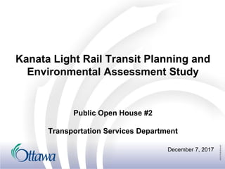
- 1. Kanata Light Rail Transit Planning and Environmental Assessment Study December 7, 2017 Public Open House #2 Transportation Services Department
- 2. 1 Agenda • Review study progress • Confirm the Preferred Corridor • Design Alternatives • Light Maintenance and Storage Facility • Preliminary Recommended Plan • Next Steps
- 3. 2 Context for the Study • Confederation Line nearing completion (2018) • Stage 2 Extension of Confederation Line West to Moodie and Baseline Stations is proceeding (2023) • Strategic opportunity to review possibility of Stage 3 to extend service further west
- 4. 3 Study Goals • Determine the Preferred Corridor; • Determine the Recommended Plan for LRT alignment and stations; and • Determine project staging and implementation based on future ridership and affordability.
- 5. 4 Study Schedule Spring 2017: Existing Conditions & Corridor Selection *Consultation Group Meetings* *Public Open House 1* Summer/Fall 2017: Evaluation of Designs *Meet with Stakeholders and Consultation Groups* Fall/Winter 2017: Recommended Plan *Consultation Group Meetings* *Public Open House 2* *Present to Committee and Council* Spring 2018: Commence Transit Project Assessment Process Pre-Planning Phase EA Phase
- 6. 5 Study Process • Environmental Assessment requirements addressed through Transit Project Assessment Process (TPAP) • Documented in Environmental Project Report (EPR)
- 7. 6 What We Heard • Expressed support for Corridor 8 • Do not support Corridor 13 • Consider how to provide a supporting transit network to better serve Kanata & Stittsville • Extend corridor 8 beyond Canadian Tire Centre, towards Hazeldean • How to cross Highway 417 • Connectivity to stations • Transit-Oriented Development potential • Future ridership numbers
- 8. 7 Confirm the Preferred Corridor
- 9. 8 Additional Corridor Evaluation • Further assessment of Corridors 1, 5, 8, 13 was undertaken – Terminus modified in each corridor • Evaluated new scenarios against same criteria used in initial evaluation • Used ridership projections from City Transportation model • All scenarios provide increased transit ridership versus the Transportation Master Plan Base Scenario (2031 Affordable Network)
- 10. 9 Preferred Corridor - 8A Ridership Potential & Network Connectivity TOD & City Building Opportunities Natural Environment Impacts Social Environment Impact Complexity Capital & Operational Costs ●+ ●+ ● ● ● ▲ • Provides rapid transit spine, supports approved transit corridors, development patterns • Good connection to Kanata North should be provided to enhance network • Extension to Hazeldean further increases ridership, improves network connectivity and provides additional transit-oriented development opportunities
- 12. 11 Alternative Designs • Generally, the LRT will follow the same alignment as previously approved Transitway EA’s • Alternative designs have been developed and evaluated for: – March/Eagleson Station – Terry Fox Station to Palladium segment
- 14. 13 March/Eagleson Station • LRT will follow previously studied and approved BRT alignment • Main considerations in developing a preferred design at this location include: • Station connectivity • Transit/traffic operations • Land use compatibility • Cost
- 15. 14 March/Eagleson Station– Alternative 1 • Limited impact to Ontario Provincial Police (OPP) facility • Bus terminal / Passenger pick-up and drop-off adjacent to station • Supports good station connectivity and access • Impact to BRT connection
- 16. 15 March/Eagleson Station– Alternative 2 • Maintains BRT connection • Requires relocation of OPP facility • Bus terminal is complex, and removed from LRT platforms
- 17. 16 March/Eagleson Station– Alternative 3 • Impact to BRT connection • Impacts OPP facility but may not require relocation • Bus terminal further away from LRT platforms
- 18. 17 March/Eagleson Station Preferred: Alternative 1 • Minimizes impact on the OPP facility, Watt’s Creek and adjacent lands • Provides for a bus • terminal immediately adjacent to the station • Supports good station connectivity and access
- 19. 18 March/Eagleson Station Preferred Alternative – Next Steps Additional work will be undertaken as part of station planning to consider: • Station connectivity • Traffic analysis / intersection design • The location and design of a new pedestrian/ cycling bridge over Highway 417 to the existing Park and Ride.
- 20. 19 Terry Fox to Palladium • 6 Alternatives identified based on stakeholder feedback • Considers changes to Campeau Road and Feedmill Creek • Opportunities to address impacts on land development / property • Integration with future road network
- 21. 20 Terry Fox to Palladium • Alternatives evaluated based on multiple criteria within the following categories – Transportation System Compatibility – Maximize Ridership Potential – Compatibility with Planned/Existing Communities – Social Environment – Natural Environment – Cost
- 22. 21 Terry Fox to Palladium – Alternative 1 Transportation System Compatibility Maximize Ridership Potential Compatibility with Planned/Existing Communities Social Environment Natural Environment Cost ● ● ▲ ▲ ▲ ▲ • Station location provides good coverage of existing/ proposed land uses • Best opportunity for city building and station integration with public realm • Good alignment geometry, with larger radius horizontal curves • Proximity to adjacent residential community across Campeau an issue due to elevated guideway and station • Blocks development frontage along Campeau
- 23. 22 Terry Fox to Palladium – Alternative 2 • Station location provides good coverage of existing/ proposed land uses • Good opportunity for city building and station integration with public realm • Good alignment geometry, with larger radius horizontal curves • Guideway further away from adjacent residential community • Allows for development frontage along Campeau Transportation System Compatibility Maximize Ridership Potential Compatibility with Planned/Existing Communities Social Environment Natural Environment Cost ● ● ● ● ▲ ▲
- 24. 23 Terry Fox to Palladium – Alternative 3 • Impact to development on adjacent lands as alignment bisects property • Station on east side of Canadian Tire Centre more difficult to integrate with existing and future development opportunities • Guideway further away from adjacent residential community • Alters previously identified and approved Carp River crossing Transportation System Compatibility Maximize Ridership Potential Compatibility with Planned/Existing Communities Social Environment Natural Environment Cost ▲ ▲ ▲ ● ▲ ▲
- 25. 24 Terry Fox to Palladium – Alternative 4 • Significant impact to development and access on adjacent lands • Station would be challenging to connect into future road network • Guideway further away from adjacent residential community • Alters previously identified and approved Carp River crossing Transportation System Compatibility Maximize Ridership Potential Compatibility with Planned/Existing Communities Social Environment Natural Environment Cost ▲ ▲ ▲ ● ▲ ▲
- 26. 25 Terry Fox to Palladium – Alternative 5 • Minimizes impact to development lands by placing alignment along south edge of property, adjacent to Highway 417 • Station would be challenging to connect into future road network • Reduced catchment area of station with Highway 417 barrier • Minimal natural environment impacts • Skewed crossing of Highway 417 will be challenging Transportation System Compatibility Maximize Ridership Potential Compatibility with Planned/Existing Communities Social Environment Natural Environment Cost ▲ ▲ ▲ ▲ ● ▲
- 27. 26 Terry Fox to Palladium – Alternative 6 • No station north of Highway 417 • Does not serve development lands or existing communities • Station on east side of Canadian Tire Centre more difficult to integrate with existing and future development opportunities. • Minimal natural environment impacts Transportation System Compatibility Maximize Ridership Potential Compatibility with Planned/Existing Communities Social Environment Natural Environment Cost ■ ■ ■ ▲ ● ●
- 28. 27 Terry Fox to Palladium – Summary Options 1 2 3 4 5 6 Transportation System Compatibility ● ● ▲ ▲ ▲ ■ Maximize Ridership Potential ● ● ▲ ▲ ▲ ■ Compatibility with Planned/Existing Communities ▲ ● ▲ ▲ ▲ ■ Social Environment ▲ ● ● ● ▲ ▲ Natural Environment ▲ ▲ ▲ ▲ ● ● Costs ▲ ▲ ▲ ▲ ▲ ● SUMMARY ▲ ● ▲ ▲ ▲ ■
- 29. 28 Terry Fox to Palladium Preferred: Alternative 2 • Makes best use of the previously approved rapid transit corridor and lands; • Places Campeau Station far enough north to serve the area effectively; • Provides for good access and visibility of rapid transit to the surrounding community; • Can be integrated along south edge of planned development; • Provides for a tangent/ 90 degree crossing of Highway 417.
- 30. 29 Light Maintenance and Storage Facility
- 31. 30 LMSF Activities • Heavy maintenance activities will be concentrated at Belfast MSF • LMSF activities include: – Interior/exterior cleaning – Minor repairs (seats, windows, doors) – Daily inspection and servicing – Operator hand-off/hand-over – Overnight storage of trains
- 32. 31 Light Maintenance and Storage Facility • Extension of LRT to Kanata requires additional analysis of LMSF options – Expansion of Moodie LMSF – Additional LMSF further west – Additional storage further west
- 33. 32 LMSF Site Evaluation • 9 potential sites identified • Potential sites must be: – Close to mainline (<500-750 m ideal) – Large (12-16 ha), regular-shaped site ideal – A continuous parcel (not assembled group of parcels) • Process similar to previous evaluation for Belfast, Woodroffe, Moodie
- 34. 33 Moodie LMSF
- 35. 34 Additional LMSF Potential Sites
- 36. 35 LMSF Site Evaluation Sites evaluated on a range of criteria: • Social Environment – Effects to local residents – Site safety – Transportation network – Land uses – Heritage / Culture • Biophysical Environment – Soil types – Contaminated materials – Key natural features – Greenbelt – Flood plains • Facility Operations – LMSF site servicing – LRT operations • Economics – Property
- 37. 36 LMSF Evaluation Results Site Moodie 1 2 3 4 5 6 7 8 Effects to local residents ● ■ ● ● ■ ■ ■ ■ ■ Site safety ● ▲ ● ● ▲ ● ▲ ▲ ▲ Transportation Network ● ▲ ▲ ■ ▲ ● ▲ ● ▲ Land uses ▲ ■ ● ■ ■ ● ■ ■ ■ Heritage / Culture ● ● ■ ● ● ● ● ● ▲ Soil types ● ▲ ▲ ▲ ▲ ▲ ▲ ● ● Contaminated Materials ● ● ● ● ● ■ ● ● ● Key Natural Features ▲ ▲ ● ● ● ● ● ● ● Greenbelt ■ ● ● ● ● ● ● ● ● Floodplains ● ▲ ▲ ● ● ● ● ● ● MSF site Servicing ● ● ▲ ● ● ● ● ● ● Property ● ● ● ▲ ● ● ● ● ● LRT Operations ● ▲ ▲ ■ ▲ ▲ ▲ ▲ ▲
- 38. 37 Preliminary Preferred LMSF Alternative • The preliminary preferred LMSF alternative is to expand the Moodie Drive site previously identified by Stage 2. Discussions with the NCC are ongoing. • Requires some NCC property • Requires realignment of Corkstown Road
- 40. 39 Preliminary Recommended Plan Ultimate Moodie LMSF Ultimate Moodie LMSF
- 41. 40 Elevated Guideway • Allows for flow of vehicles and traffic underneath • Provides visibility • Successful in other cities
- 42. 41 Concept Station Designs • Being developed for each station • Consistent with design vision along Confederation Line and fully accessible
- 44. 43 Next Steps • Based on feedback from consultation groups and public, project team will: – Confirm and refine the recommended plan – Confirm the preferred LMSF location – Undertake environmental impact assessment – Present recommendations to City Transportation Committee and Council (March/April, 2018) – Issue Notice of Commencement (TPAP)
- 45. 44 QUESTIONS? www.Ottawa.ca/KanataLRT Contact: Angela Taylor (613)580-2424 Ext. 15210 angela.taylor@ottawa.ca