Learning to use Local Studies software to create maps
•Download as PPT, PDF•
2 likes•818 views

Sue Kelly's Learning Journey
![Sharing a personal `Learning Journey’ ,[object Object],[object Object]](data:image/gif;base64,R0lGODlhAQABAIAAAAAAAP///yH5BAEAAAAALAAAAAABAAEAAAIBRAA7)
Recommended
More Related Content
Viewers also liked
Similar to Learning to use Local Studies software to create maps
Similar to Learning to use Local Studies software to create maps (20)
More from Geoprimary
More from Geoprimary (20)
Recently uploaded
Recently uploaded (20)
Learning to use Local Studies software to create maps
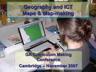
- 1. Geography and ICT Maps & Map-making GA Curriculum Making Conference Cambridge – November 2007
- 3. I investigated the various keys to draw a sketch map of South Wootton, so that I could ask the children to draw a map of a familiar place.
- 4. All 10 Hot Spots have photos and comments – but the children could personalise these comments, by stating how often their family visits the Retail Park, or whether it was a popular venue for SWJS families. I added hotspots to the map as place markers. These hotspots open up as text boxes that allow the inclusion of text, images, sound and video.
- 5. Knowing that I could scan sketch maps into this programme, I decided to scan one of the children’s completed graphs made in M. Excel into another Hot Spot, so a more able pupil could personalise the map in another way.
- 6. As an extension for myself, I also inserted a video clip to show that it could be done! Next task is to see if the children can be recorded, showing the results of their Retail Park Enquiry.